I Tested the Garmin inReach Mini 3 Plus for Two Months Across Five Activities — Here's the Honest Verdict
The most innovative handheld GPS device with unprecedented features

Home > Gear Reviews > Electronics
March 12th, 2026
Our verdict
The Garmin inReach Mini 3 Plus is the freshest, most innovative, feature-loaded, handheld GPS device available today. Want to send an SOS? Open a map? Check the weather? Send a voice message? Start tracking your trip? Just speak into the Mini 3 Plus’ mic and a voice command will make it so.
The Mini 3 Plus offers speedier, more reliable two-way communication and increased accuracy for location sharing and weather forecasts. The enhanced software, in combination with the Garmin Explore and Messenger apps, enables a user to easily send 30-second long voice messages,1,600-character text messages, and photos with a smartphone.
In addition, the touch or gentle swipe of a finger also opens applications on the 3 Plus’ color screen. (Of course, you can always use the push buttons on the device’s left and right sides to access functions. But what fun is that?)
Using the Explore and Messenger apps also opens additional levels of functionality for navigation, including a wider variety of highly detailed maps. The Mini 3 Plus can also pair with many Garmin hiking watches and be used remotely.
The Garmin inReach Mini 3 Plus’ advanced features can be useful for all manner of outdoor activities, but are not necessary unless a user has specific needs, like sending photos, long texts, or voice messages where cell service is spotty or unavailable. This device is best for outdoor adventurers, professionals, and guides who need better connectivity and location sharing in places like canyons and dense cover, and who want the advanced features.
Garmin inReach Mini 3 Plus
Learn more about our favorite GPS devices in our Best Satellite Messengers and Personal Locator Beacons guide.
We create reader-supported, objective gear reviews independently selected by our editors. This story may contain affiliate links, which help fund our website. When you click on the links to purchase gear, we may get a commission, without costing you an extra cent. Thank you for supporting our work and mission of outdoor coverage for every body! Learn more.
Garmin inReach Mini 3 specifications
Price: $500
Weight: 4.42 oz
Dimensions: 2.16” wide, 3.85” high, 1.05” deep
Display type: 1.9-inch color touchscreen display with technology that stays visible in bright sunlight and a backlight for low-light conditions (transflective color memory-in-pixel MIP)
Display size: 1.9-inch diagonal display with a 176 x 176 pixel resolution
Battery life (10-minute tracking): 350 hours in 10-minute tracking mode (default) and 95 hours in performance messaging mode. With High Detail Tracking: 120-170 hours, depending on settings.
Waterproof rating: IP67 designed to withstand immersion in water up to about 3.3 feet for 30 minutes. A special dive bundle case allows submersion up to 100 meters.
Satellite network: Iridium
Messaging: Two-way text messaging with texts up to 1,600 characters long and/or 30-second long voice messages.
Photo messages: Yes
SOS: 24/7 Garmin Response
Navigation features: A basic map, tracking at variable intervals, TracBack, Sight ‘N Go tracking, guidance to waypoints, course creation
App compatibility: Garmin Explore and Garmin Messenger
Subscription required: Yes
Current weather and weather forecasting is faster on Garmin's new inReach Mini 3 Plus because of an upgraded and enhanced antenna providing better connectivity with the satellite network. (Dean Krakel photo, Special to Treeline Review)
Best for
Outdoor adventurers, guides, and professionals who need better connectivity
Those who need location sharing in canyons and dense cover as well as high-speed, two-way texting messaging directly on the device
Those who want advanced features beyond basic button messaging, like a touchscreen, voice messaging, and the ability to send photos of an injury, details of a spicy route, and weather conditions
Comparison table
| DEVICE | MSRP* | WEIGHT | DIMENSIONS | WATERPROOF RATING | BATTERY LIFE |
|---|---|---|---|---|---|
| Garmin inReach Mini 3 Plus | $500 | 4.5 oz | 3.8 x 2.2 X 1 inches | IP67 | Up to 350 hours in 10-minute tracking mode |
| Garmin inReach Mini 2 | $350 | 3.5 oz | 3.9 x 2.0 x 1.0 inches | IPX7 | Up to 5 days in 10-minute tracking mode |
| Garmin inReach Messenger | $300 | 4 oz | 3.1 x 2.5 x 0.9 inches | IPX7 | Up to 28 days in 10-minute tracking mode |
| Garmin GPSMAP 67i | $600 | 8.1 oz | 6.4 x 2.5 x 1.4 inches | IPX7 | Up to 6.8 days in 10-minute tracking mode |
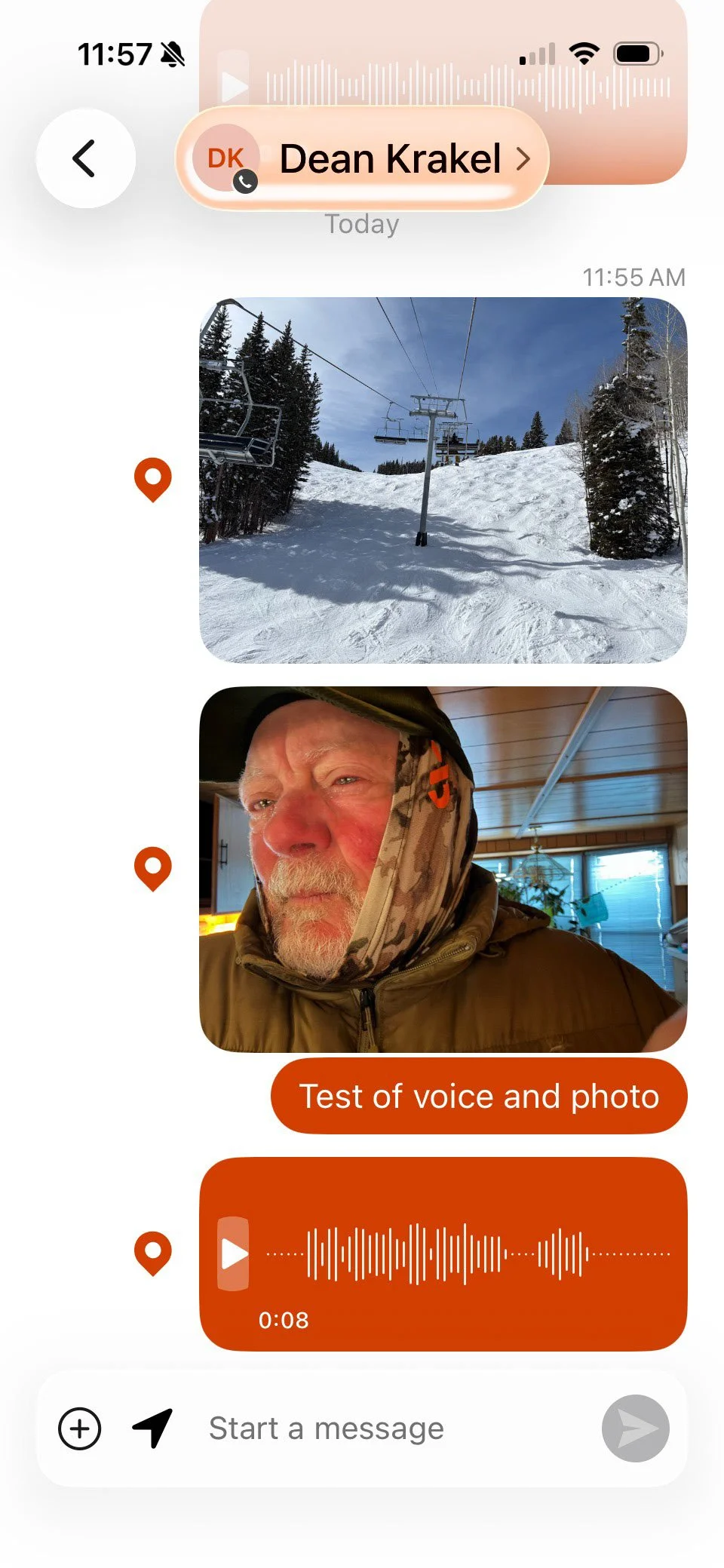
One of the features available on the Garmin inReach Mini 3 Plus is the ability to send voice messages, 1600-character texts, and photos. A test the author did, shown here, was to send photos, a voice message, and a text all in the same message. (Dean Krakel, special to Treeline Review)
What we liked
Faster everything
Speedy weather forecasts
Quick back-and-forth messaging
High-resolution color screen
Touchscreen
Voice commands to activate features
Sending 30-second voice messages and 1,600-character texts
Ability to transmit photos
Availability of more detailed maps for use with the Garmin Explore app
Wide variety of activities to choose from on the activity list
Included carabiner for attaching to packs and straps
Ease of use and intuitive nature for the buttons to open and navigate among applications
Hard plastic cover over the SOS button
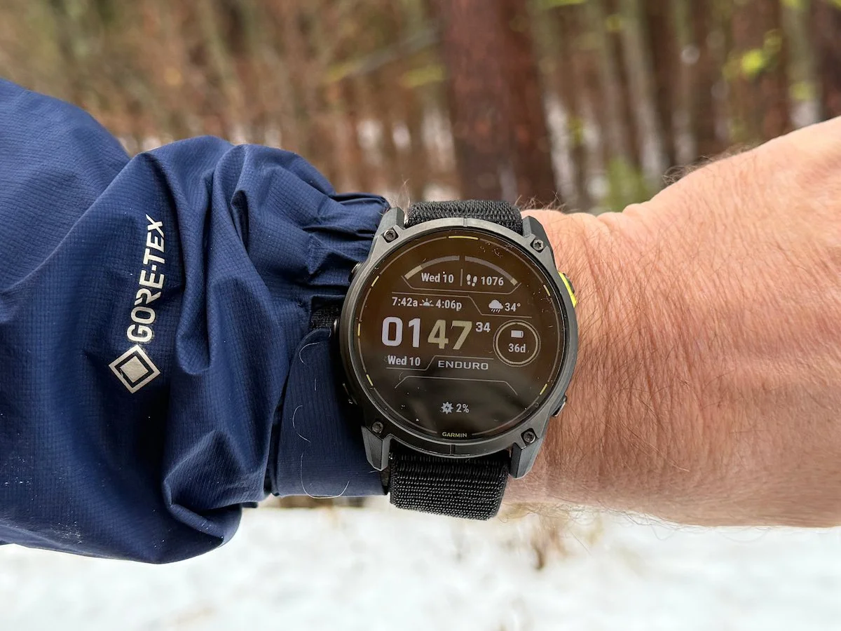
Ability to pair with a Garmin watch, such as the fenix 8
SOS siren
Navigation using waypoints can look like this on the basic map provided with the Garmin inReach Mini 3 Plus. Mapping, creating courses, and marking waypoints is much easier on the larger screen of a smartphone utilizing the Garmin Explore app. (Dean Krakel, Special to Treeline Review)
What could be better
Better maps and navigation on the device itself.
The cost. $500. Ugh.
$39.99 activation fee.
Monthly subscription plans are expensive.
How we tested
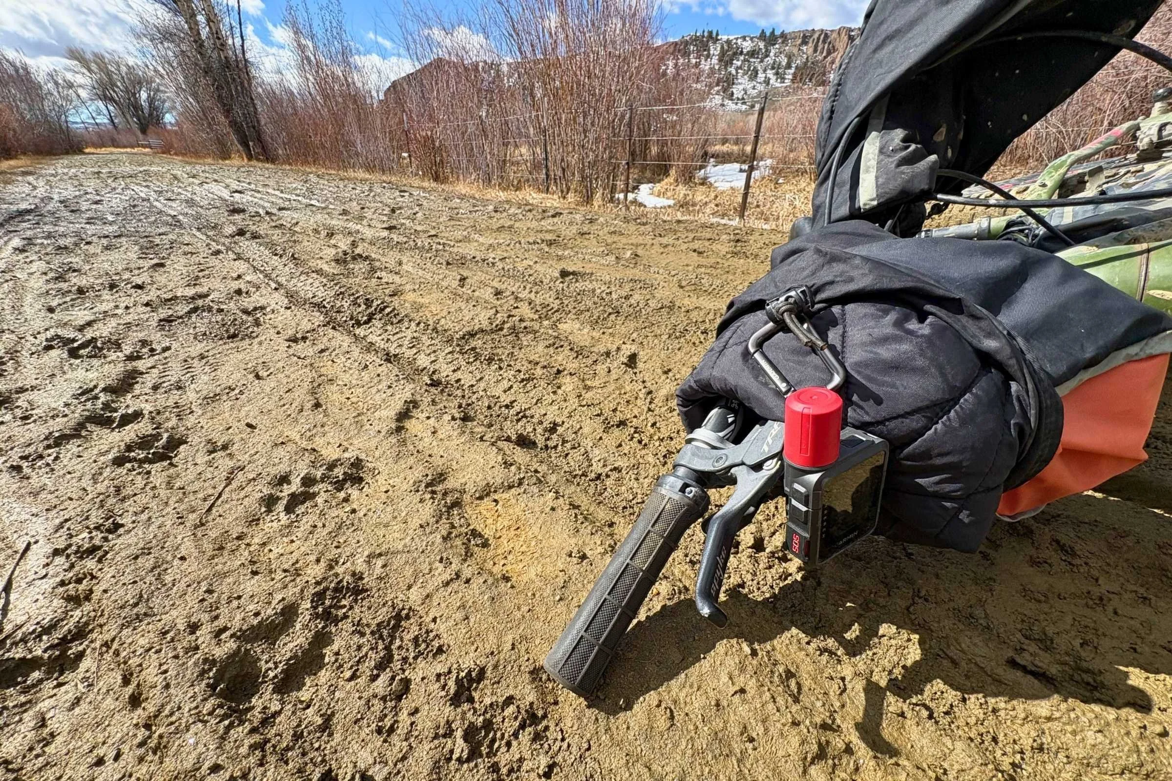
One way to test the new Garmin inReach Mini 3 Plus’ weatherproofing is to attach it to the front of a fat bike on a muddy ride and subject it to mud spatter, mud puddles, and vibration. The 3 Plus weathered the effects better than the rider. (Dean Krakel, Special to Treeline Review)
We tested the Garmin inReach Mini 3 Plus for two months, from January to March, with almost daily use alpine skiing, backcountry skiing and ski touring adventures, fatbiking, mountain biking, snowshoeing, and hiking. We used the device in a wide variety of terrain and temperatures from -15 to 60 degrees in all kinds of weather and cloud coverage.
The 3 Plus was attached to the outside of packs, on the frame bag of bikes, in jacket, coat and ski pants pockets, and bumped along on the dashboards of pickups.
We also directly compared the inReach Mini 3 Plus to similar devices from our Best Satellite Messengers and Personal Locator Beacons guide.
Performance in the field

On a cold, below-zero morning, the author tests the Garmin inReach Mini 3 Plus's cold tolerance by carrying the device on the outside of his ski pack. Cold did not slow down the unit's ability to function and battery drain was minimal. (Laine Walter, special to Treeline Review)
Satellite connectivity and reliability
All functions on the Garmin inReach Mini 3 Plus are fast and reliable. In testing, the weather forecasting and updates along with messaging were fast enough that it was a notable difference from previous Garmin satellite communication devices.
What makes all this possible is the Mini 3 Plus’ new antenna design and communication module that, utilizing a higher bandwidth, provides consistent messaging, tracking, and navigation in canyons, forests, open terrain, and dense snowfall no matter the cloud cover, and supports applications like voice commands, voice messaging, texts up to 1,600 characters in length, and the Garmin Explore app to send photos.
SOS confidence and emergency usability
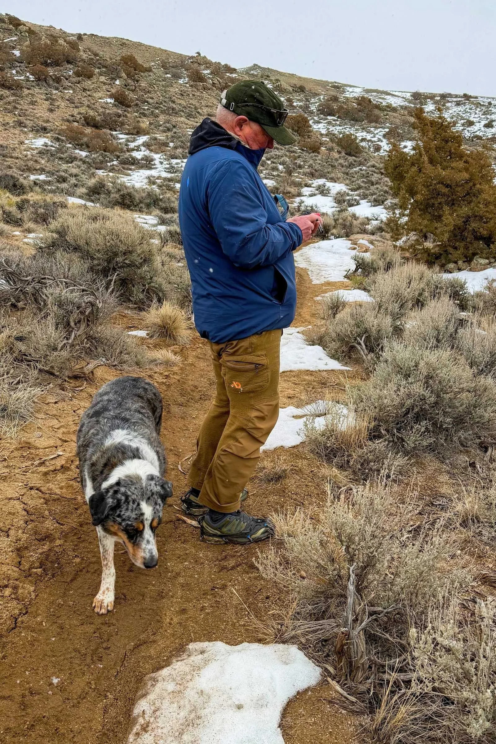
The author field-testing the new Garmin inReach Mini 3 Plus. (Laine Walter, special to Treeline Review)
While communication and navigation are notable features of the 3 Plus, the reason many users carry an inReach device is for safety, like being able to use the SOS feature for an emergency. The SOS “button” on the 3 Plus is well marked and easily accessible, located on the unit’s left side under a plastic cover that flips up and out of the way when needed, preventing an accidental push that triggers an alarm.
What’s new with the 3 Plus is the ability to send an SOS by voice command. Just press and hold the SOS button until there’s a tone. Then say “SOS.” Although either voice command or the touchscreen can be used to send an SOS, the most reliable method is by pressing the dedicated SOS button. After the SOS has been activated, the touchscreen can be used for interaction with Garmin SOS emergency response. Although the SOS button can be pressed for testing by lifting the cover and pushing the button and canceling the alert during a 20-second countdown, a more reliable way and one that doesn’t accidentally trigger a real SOS, is to schedule an emergency test with Garmin.
Users can do this by submitting a test request form (available on the Garmin website) 72 hours before you plan to do the test. Garmin Response will email a confirmation of the date and time. Then just follow the instructions in the email.
At the scheduled time, you will activate the SOS on your device. When Garmin receives the alert you’ll be notified to verify that all the registration is correct. Your emergency contacts will not be notified unless you want them to be. Once you are contacted by Garmin you can send a cancellation to complete the test.
The Mini 3 Plus also has a siren that can be activated for use to alert nearby hikers or rescuers or for any use you may have for a siren. This is not a very loud siren—it’s more of a chirp, audible at about 100-150 yards max.
The Garmin inReach Mini 3 Plus has features found on no other handheld GPS satellite communication device, such as voice command. (Dean Krakel Special to Treeline Review)
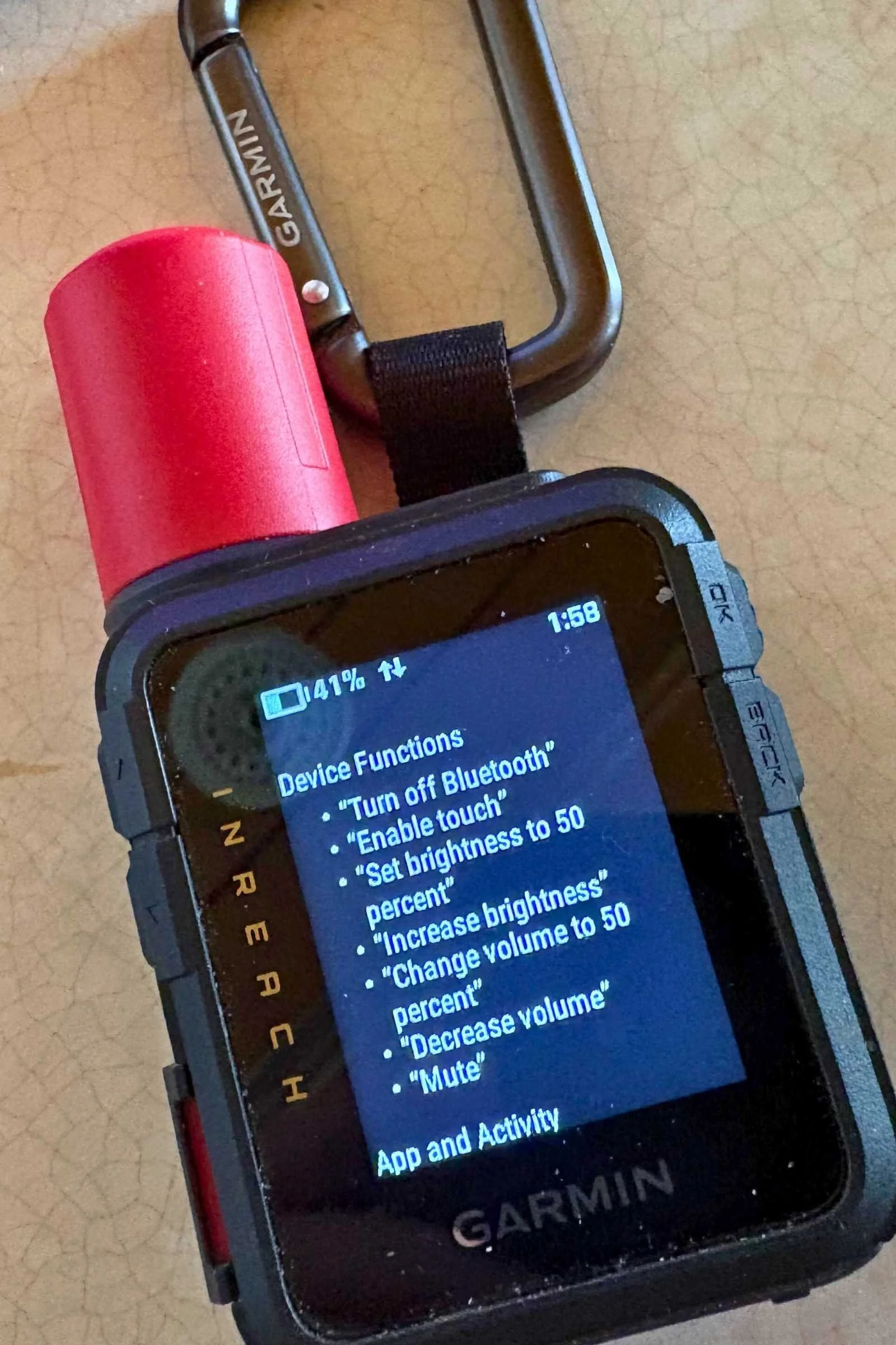
Voice command usability
Voice commands are started by holding down the “OK” button located on the device's right side. Once the mic image appears, another press of the OK button brings up a list of what phrases a user can say that the 3 Plus understands, like “show me the map,” “show me the weather forecast,” “start tracking,” or “make the screen brighter.”
There are 14 voice command options on the device’s menu and more available on the Garmin website. Voice messaging and transmitting photos are done with the Garmin Messenger app on a smartphone. (More about that in a bit.)
One of the great things about activating the voice command feature is that on cold winter days we didn’t have to remove mittens or gloves to touch buttons or use the touchscreen.
Battery life
Using these features contributes to a notable battery drain. While the Garmin website for the 3 Plus boasts a 350-hour battery capacity, in actual field testing leaving the device on 24/7 with 10-minute tracking intervals, voice messaging, voice command, touchscreen use, and weather forecasting, the average use from 100% to 1% was 70–80 hours.
Charging from 1% to 100% using a USB-C port of a laptop took three hours.
Unless you’re a heavy user or on a long trip between towns, the Mini 3 Plus will rarely need a recharge in the field. However, your phone (which it pairs with) absolutely will. See our battery strategy for thru-hikers for power bank sizing and a charging routine that keeps both alive.
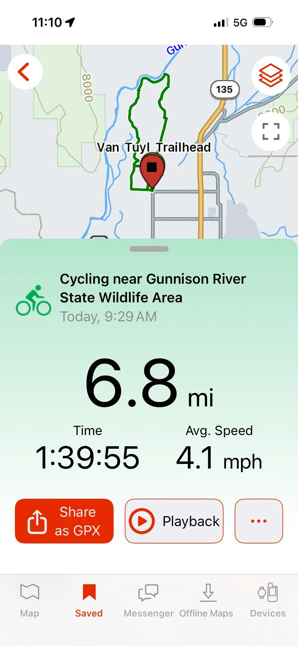
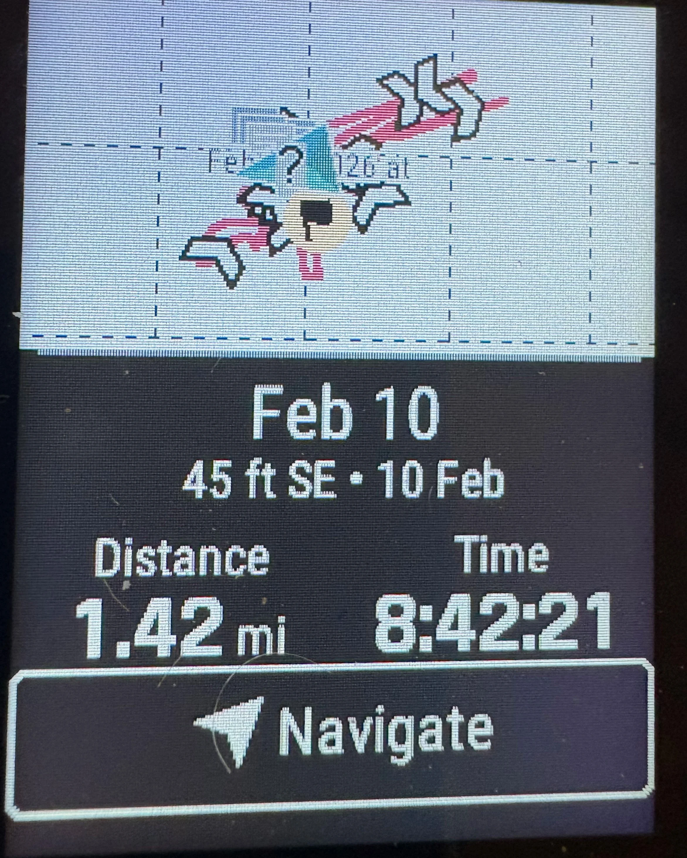
In the Garmin Explore app, a completed trip with a map of the route taken and trip data appears on your smartphone screen. Swiping down will hide the data and show a larger image of the route. (Dean Krakel, Special to Treeline Review)
Device pairing
While nearly every one of the 3 Plus’ functions, including voice messaging can be done with the device itself, things are much easier with a paired smartphone and the use of Garmin’s Explore and Messenger apps. Pairing the 3 Plus with a smartphone is easy and makes navigation, texting, voice memos, and messages much easier. Tapping out texts using the onboard QWERTY keyboard on the 3 Plus screen is for the most nimble-fingered and patient user.
Screen and interface
The Garmin inReach Mini 3 Plus color screen is a big improvement over the monochromatic screens of yesteryear. This screen adjusts in brightness so that viewing the applications in bright sunlight is easier. The screen is also backlit for viewing in low light. The screen also has a higher resolution than previous inReach devices. However, it's a disappointment that the unit’s base map is almost devoid of detail and doesn’t take advantage of the increased 3GBs of memory and the higher resolution screen to provide a better map.
Portability
Garmin includes a carabiner for attaching the 3 Plus to packs, bags, and straps. The device weighs 4.5 ounces and is 3.8 inches high,1 inch thick, and 2.6 inches wide and can be carried conveniently in pockets or attached to a pack.
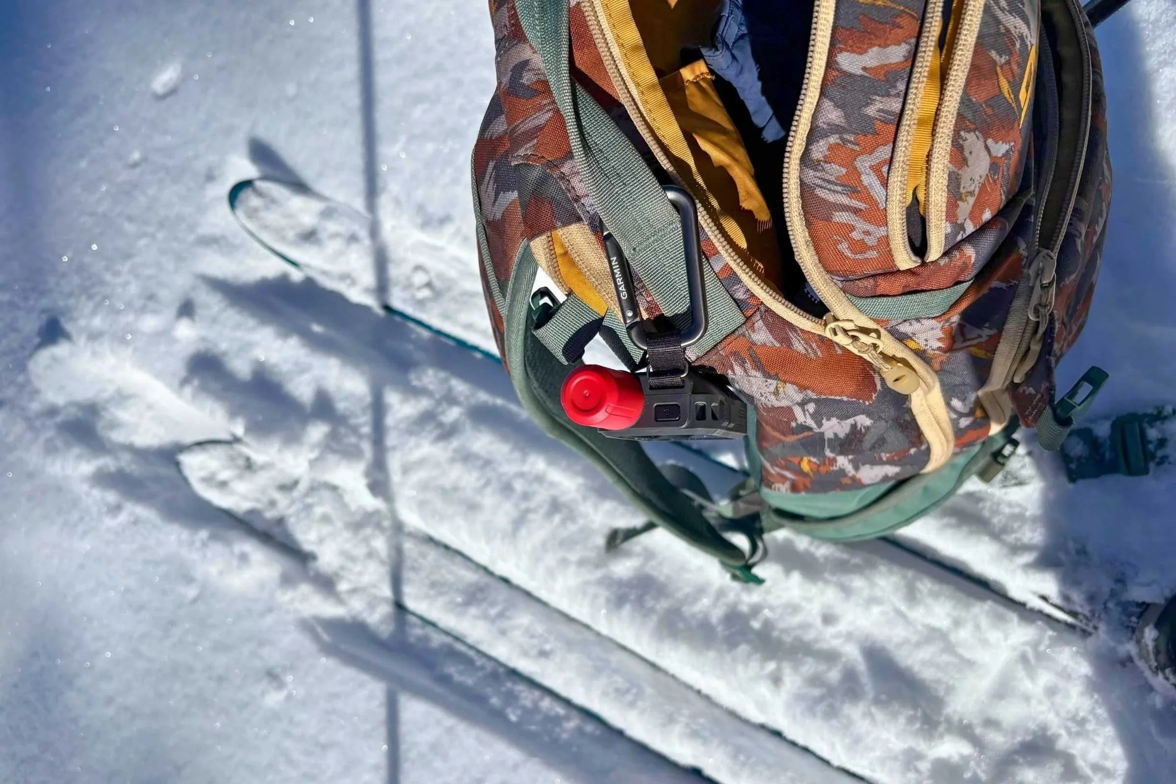
A Garmin inReach Mini 3 Plus carried outside a ski pack with the carabiner that comes with the device. The red antenna distinguishes the Plus 3 from all other Garmin GPS devices. (Dean Krakel photo, Special to Treeline Review)
Navigation capability

Detail of the Garmin inReach Mini 3 Plus screen on the right shows a map with waypoints marked. The images on the left (no waypoints marked) show what maps appear like on the Garmin Explore app when paired with a smartphone. Each of the Explore maps show a different map. (Dean Krakel, Special to Treeline Review)
The 3 Plus can perform basic navigation. The device can track your activity, set waypoints, navigate to a waypoint, create courses, use Sight ‘N Go, and has TracBack. We have found that doing them is much easier by utilizing the Garmin Explore app. The app, paired with a smartphone, just has a bigger screen and a plethora of more detailed maps than the 3 Plus does.
While the 3 Plus can do many things, and do them well, as a standalone navigational and mapping device, it falls short. Adventurers requiring more advanced navigation and mapping would be better off with the Garmin GPSMAP 67i.
Features
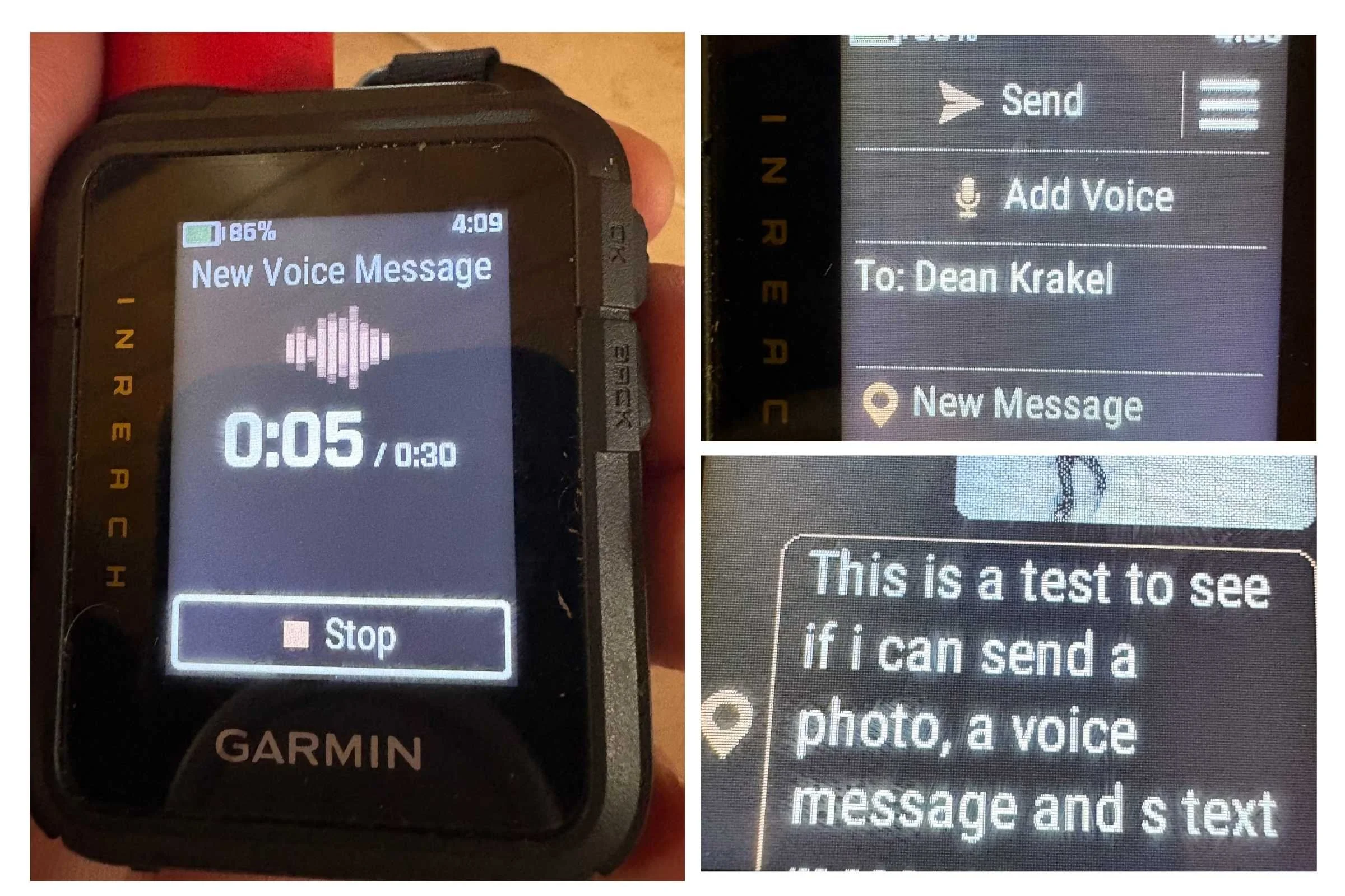
How the screen of the Garmin inReach Mini 3 Plus appears when receiving (left) and sending (right top) a voice message. Photos have to be sent using the Garmin Messenger app. (Dean Krakel, Special to Treeline Review)
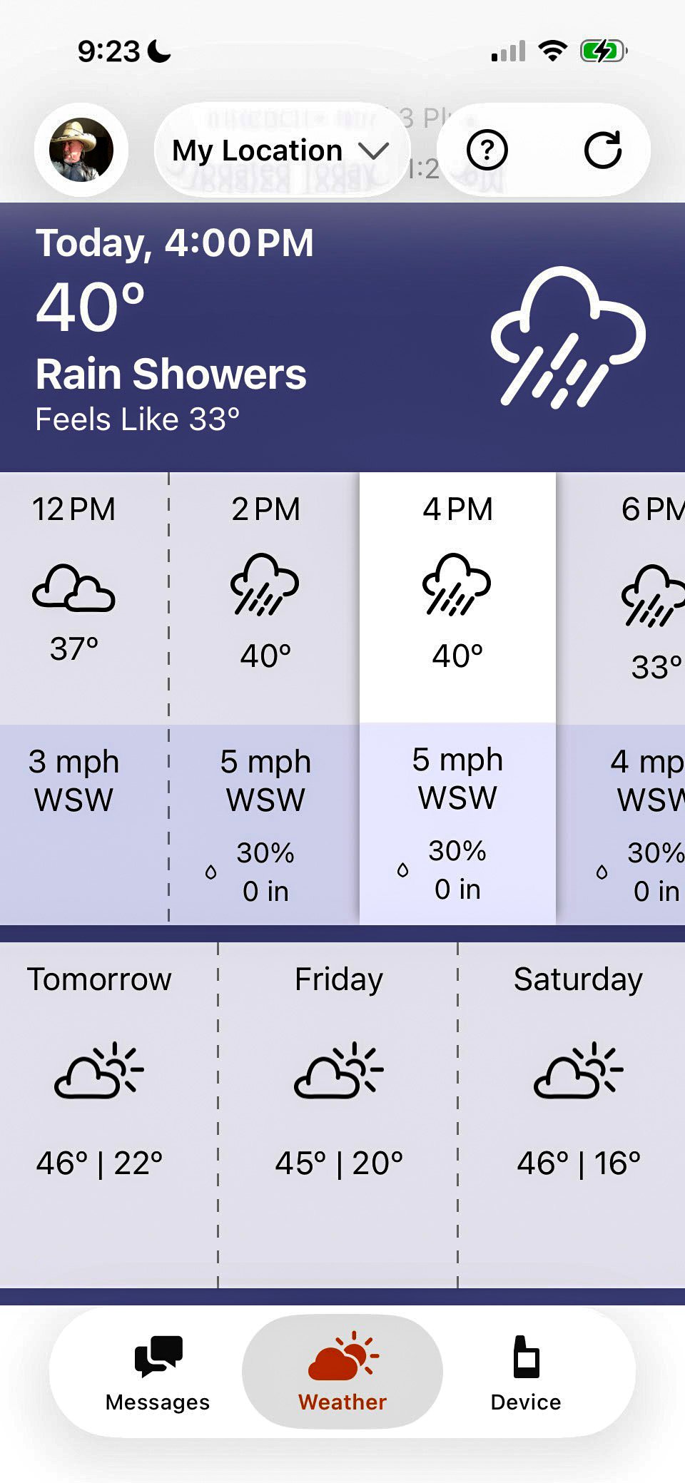
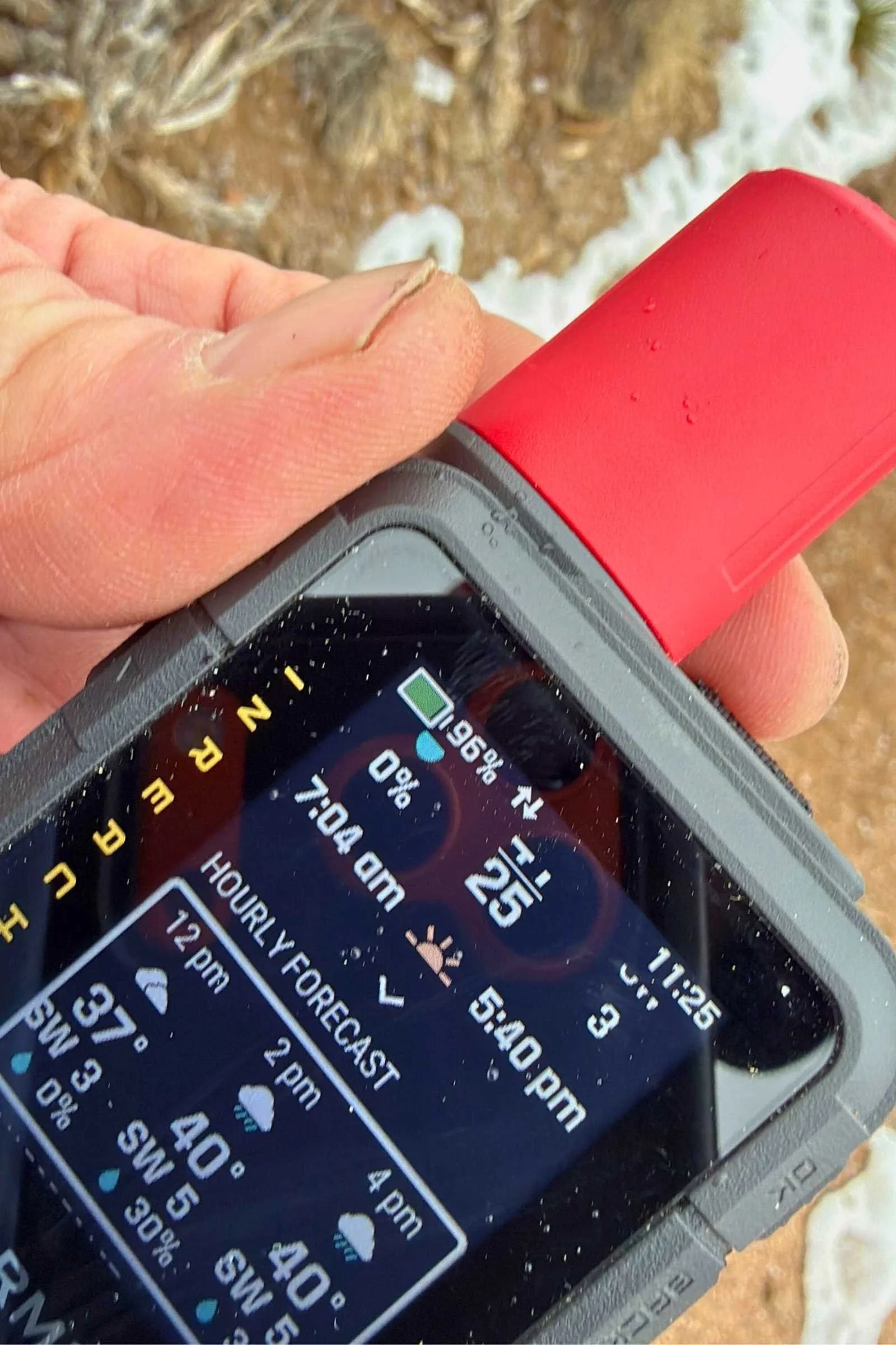
Forecast updates can be as often as 15-20 minutes, providing a 10 day forecast with the first 48 hours reported in 1 hour intervals then daily summaries for the following 8 days. (Dean Krakel photo, Special to Treeline Review)
Iridium satellite network connectivity: the Garmin inReach Mini 3 Plus connects to the Iridium satellite network by way of an enhanced antenna and communication module, offering faster connectivity.
Two-way text messaging: The Garmin inReach Mini 3 Plus has two-way text messaging using the built in QWERTY keyboard and voice-activated text messaging.
24/7 SOS access via Garmin Response
Color touchscreen: the Garmin inReach Mini 3 Plus has a high-resolution color touchscreen that can access applications by touch and swipe.
GPS tracking and breadcrumb navigation: the 3 Plus has tracking available in 10, 20, 30, 1 hour, and 2 hour intervals that can be seen on the devices screen, the explore app. It also has TracBack allowing a user to retrace their route.
Garmin Explore app integration: Garmin Explore app always uses the device on a much larger and easier to use smartphone screen. The Explore can be used for navigation, tracking, mapping, weather forecasts, and the Messenger app can be used for emailing, texting, sending voice messages and sending photos.
Weather forecasts: the 3 Plus offers rapid weather updates and daily forecasts for the area the device user is in or for other locations. With an internet connection, the forecasts are for 10 days with detailed hourly intervals for the first 48 hours and daily summaries for the remainder. With a satellite connection, the forecasts are for 8 days with the first 48 hours in 2-hour intervals and 6 days of summary. Marine forecasts are for up to 2 days with 1-hour intervals by satellite.
Check-in messages: the 3 Plus offers three predefined check-in messages: “I’m checking if everything is okay,” I’m starting my trip now,” and “I’m ending my trip now.”
Custom tracking intervals: tracking available in 10, 20, 30, 1 hour, and 2 hour intervals.
IP67 water resistance: the 3 Plus has an IP67 water rating. It can withstand exposure to water, such as rain and accidental immersion up to 3 feet for 30 minutes.
USB-C charging: the 3 Plus charges with a USB-C cord.
Garmin inReach Subscription Plans
In addition to a one-time activiation fee, all Garmin inReach devices require a monthly subscription in order to send text messages or SOS messages. When Garmin made changes to the subscription plan structures, we wrote an entire article about their plans.
Here’s a quick summary of the available plans:
| ENABLED PLAN | ESSENTIAL PLAN | STANDARD PLAN | PREMIUM PLAN | |
|---|---|---|---|---|
| No contract monthly cost | $7.99 | $15.00 | $29.99 | $49.99 |
| One-time activation fee | $39.99 | $39.99 | $39.99 | $39.99 |
| Annual fee | $0 | $0 | $0 | $0 |
| Emergency SOS messages | Unlimited | Unlimited | Unlimited | Unlimited |
| Check-in messages/reactions | $0.10 each | Unlimited | Unlimited | Unlimited |
| Custom text messages or weather requests per month | None | 50 | 150 | Unlimited |
| Custom text messages or weather requests above limit | $0.50 each | $0.50 each | $0.50 each | n/a |
| Photo and voice messages1 | None | 10 total | 25 total | 50 total |
| Photo or voice messages above limit1 | $1 each | $1 each | $1 each | $1 each |
| Satellite live tracking/ location requests | $0.10 each (10+ minute intervals) | $0.10 each (10+ minute intervals) | Unlimited (10 min+ interval) | Unlimited (2 min+ interval) |
1Available on inReach Plus-enabled devices only
Should you buy the Garmin inReach Mini 3 Plus?
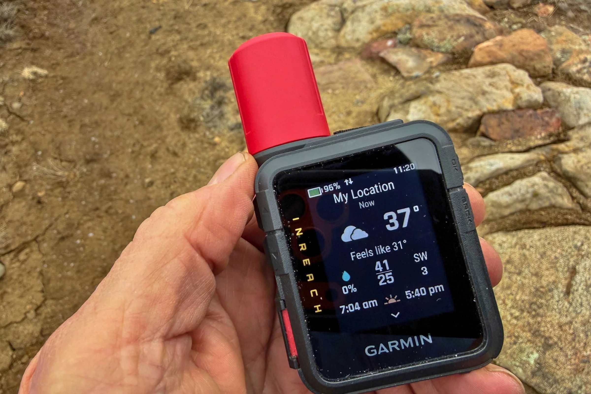
Current weather and weather forecasting is faster on Garmin's new inReach Mini 3 Plus because of an upgraded and enhanced antenna, providing better connectivity with the satellite network. (Dean Krakel photo, Special to Treeline Review)
Buy if:
You are a professional working outdoors in remote locations, a guide, or adventurer needing high-speed, two-way messaging and the ability to send voice messages, photos, and precision location sharing in challenging environments.
You need a GPS device that can be paired with a Garmin watch.
Skip if:
You don't need a color screen, or rapid transmission of long detailed texts, voice messages or photos
You don’t want to carry a cell phone or watch paired to your GPS device
You don’t want a recurring subscription
You need full, high-detailed topographic mapping capability and GPS navigation in a stand alone hand held device.
Where to buy the Garmin inReach Mini 3 Plus
The Garmin inReach Mini 3 Plus is a popular gear item, so you have options when it comes to retailers. Here are some of the pros of the retailers.
REI
Pros: 100% satisfaction policy for 1 year; 10% dividend for members.
Amazon
Pros: Free 2-day shipping with Amazon Prime membership
Backcountry
Pros: Frequent sales for Expedition Perks members (free to join), fast shipping, Gearhead chat customer service is excellent
Advice on where to buy
In general for gear, we recommend purchasing from a place with easy or free returns, like REI.
Garmin inReach Mini 3 vs Mini 3 Plus
The Garmin inReach Mini 3 Plus is a $50 upgrade over the Mini 3. Is it worth it? Here’s what you get with the Mini 3 Plus for that $50:
Voice messages via satellite
Photo sharing via satellite
Voice commands
Voice notes
Safety siren
Picture viewer
Bottom line: if you want to send photos or voice messages, get the Mini 3 Plus.
Similar satellite messengers
Garmin inReach Mini 2
Weight: 3.5 ounces
Dimensions: 3.9 x 2.0 x 1.0 inches
Coverage: Global
Waterproof rating: IPX7
Battery life: Up to 5 days in 10-minute tracking mode
The Garmin inReach Mini 2 remains a solid choice for those who need simplicity and function. With full satellite connectivity, the Mini 2 has two way messaging, receives text and emails, can send pre-loaded check in messages and 160-character custom texts. The Mini 2 can do basic navigation, set waypoints, has TracBack, and can send an SOS. Paired with a cell phone, the device can utilize the Garmin Explore and Messenger apps. The Mini 2 is an ounce lighter than the Mini 3 plus and costs around $350.
For more information, see our in-depth review of the Garmin inReach Mini 2.
Garmin inReach Mini 2
Weight: 4.0 ounces
Dimensions: 3.1 x 2.5 x 0.9 inches
Coverage: Global
Waterproof rating: IPX7
Battery life: Up to 28 days in 10-minute tracking mode
The compact and lightweight Garmin inReach Messenger can use either satellite or cell phone connectivity and switches seamlessly between the two. The Messenger has two-way messaging, interactive SOS, GPS location tracking and sharing, and weather forecasts.
The Messenger has a tiny screen, 1” x .43”, but by using the Garmin Messenger and Explore apps paired with a smartphone, the Messenger’s capabilities expand. Utilizing the apps, the new Messenger Plus can send 30-second voice messages, photos, and longer texts. The Messenger costs around $300 and weighs 4 ounces.
This device is our pick for best battery life in our Best Satellite Messengers and PLBs guide. To learn more, see our in-depth review of the Garmin inReach Messenger.
Garmin inReach Messenger

Weight: 8.1 ounces
Dimensions: 6.4 x 2.5 x 1.4 inches
Coverage: Global
Waterproof rating: IPX7
Battery life: Up to 6.8 days in 10-minute tracking mode
The GPSMAP 67i is a tactical grade handheld device intended for intricate navigation, mapping and safety in remote locations. The 67i is self contained, meaning that it can do anything any other Garmin handheld GPS can do, only better, without being paired to a cell phone or using apps. For instance, the GPSMAP 67i has preloaded, highly detailed maps, including satellite imagery.
Along with the iridium satellite network, Garmin GPS devices utilize the GPSMAP 67i and can access multiple global satellite systems. The GPSMAP 67i can be paired with the Garmin Messenger and Explore apps. This is the device you’d carry if you were searching for ancient lost cities in a remote jungle. The GPSMAP 67i weighs 8 ounces and costs around $700.
This device won best satellite device with GPS navigation in our Best Satellite Messengers and PLBs guide. To learn more, see our in-depth review of the Garmin GPSMAP 67i.
Garmin GPSMAP 67i
Why you should trust us / About the author

My interest in testing, reviewing, and writing about satellite communication devices for Treeline Review was triggered during a Continental Divide thru-hike in 2018. By accidently pushing the SOS button on my ancient Delorme GPS device and not being able to cancel the alert, I launched a lengthy and unnecessary SAR rescue in the Wind River Mountains of Wyoming. That incident made me curious about the satellite communication/GPS devices on the market, what they were capable of, how they were used and how many different kinds there are.
Over the years I’ve been able to test and review many devices from basic PLBs (personal locator beacons) to sophisticated handhelds like the Garmin inReach Mini 3 Plus. I am constantly amazed at how the technology keeps evolving.
Dean Krakel is also a three-time Pulitzer-prize-winning photojournalist, photographer, and photo editor whose work appears in National Geographic, Rolling Stone, Cowboys & Indians, High Country News, National Wildlife, Outside, Time, Yoga Journal, Newsweek, and Life magazines.
With over four decades of experience, his early dramatic documentary-style photographs of the Marlboro Man shot for the Leo Burnett Agency were seen worldwide.
Krakel is the author of three books: Season of the Elk, Downriver, and Krakel’s West. In 2015, Krakel left his newspaper career at the Denver Post to hike the 500-mile long Colorado Trail; a film about that hike—The Long Haul—won a Heartland Emmy Award.
Dean’s fine art prints are valued by collectors and have been exhibited in galleries in Jackson Hole, Wyoming, and Santa Fe, New Mexico. Large exhibition prints of his photographs are on permanent display in the Denver Justice Center. Dean is based in Crested Butte, Colorado.
Find more of Dean’s work on his Treeline Review author page.