Snowdonia Way Backpacking and Thru-hiking Guide
Hike through beaches, valleys, mountain ridges, and summits in the British Alps
August 3rd, 2023

The Snowdonia Way is a new 97- to 122-mile route (156 to 196 km) that connects the must-see sights of one of the UK’s most popular hiking and climbing destinations — Snowdonia National Park, known as the “British Alps.”
Distance: 97 miles (156 km) for the low route or 122-miles (196 km) for the high route. The two routes frequently intersect, so you can mix and match as the weather and your energy levels allow.
Days: 6 to 9 days
Elevation gain/loss: 17,745 feet gain (low route), 39,991 feet gain (high route)
Best season: Late Spring or Summer
Permits: None required
Difficulty: Moderate (low route) to Strenuous (high route)


We create reader-supported, objective, independently-selected gear reviews. This story may contain affiliate links, which help fund our website. When you click on the links to purchase gear, we may get a commission — without costing you an extra cent. Thank you for supporting our work and mission of outdoor coverage for every body! Learn more.

Quick Facts
The Snowdonia Way is a route in the North Wales and Mid Wales mountains that takes you through valleys, open moors, beaches, rivers, mountain ridges, and summits — including climbing the highest peak in the England and Wales, Mount Snowdon (called Yr Wyddfa in the Welsh language).
You’ll walk past millennia of Welsh history, including druid stone circles, Bronze age tombs, Roman roads and walls, Arthurian battlegrounds, and castles of Welsh princes who kept the area independent.
A highlight of the Snowdonia Way is meeting people who call this part of the world home. Many people in Snowdonia are bilingual in English and Cymraeg (the Welsh language). The Snowdonia Way goes through small towns with farms, cafes, and pubs that you would want to visit even if you weren’t hiking.

Highlights
Hits the highlights of Snowdonia National Park: The Snowdonia Way guidebook calls the Route “the best way to get to know this part of the world.” This includes Mount Snowdon (named Yr Wyddfa in Welsh), the highest mountain in the UK. It also includes famous sites such as the northern cliffs of Cadair Idris, the Aberglaslyn Pass, the Ogwen Valley, and Aber Falls.
History and Culture: Experiencing millennia of Welsh history and culture by foot — from stone circles to castles and Roman walls, to the Industrial Revolution, to modern-day life in Snowdonia. It’s more fun to learn about places while walking through them compared to a museum. Arguably, while hiking, we can be more open to making genuine connections with people who live there today.
Not Crowded or Touristy: Large sections of this long-distance trail are not crowded, despite having good-quality paths. Even the most touristy parts of the Snowdonia Way weren’t as crowded as other notable UK hiking areas, such as the Lake District or the West Highland Way.
High and Low Route Options: The guidebook has detailed information for a high route and low route. The high route sticks to above-treeline mountain terrain. If the weather is good, you can walk ridges and climb peak after peak. The low route visits historical sites and gives a taste of rural modern-day life in Wales while also protecting from the wet or windy weather found on the ridge tops of the high route. It’s easy to switch back and forth between the two routes as you see fit.

Challenges
Navigation
This is an unsigned route that is not part of the National Trail system. Navigation requires paying attention to all three of your route sources: maps, GPX, and guidebook. Please do not do this route without reading the guidebook beforehand and carrying it with you on the way (there’s a digital version for ultralighters). The GPX route is beneficial, but the descriptions in the guidebook by Alex Kendall are essential for making sense of where to go. The guidebook is available in both paperback and digital versions. I loaded the GPX route into Gaia GPS. There is not a lot of cellular coverage along the route so be sure to pre-downloaded the base maps before you leave home or Wi-Fi.
Weather and mud
While better than other places in the UK, the weather in the mountains can be wet and unpredictable. Some areas can be muddy or boggy, depending on the time of year you hike. You can get up-to-date weather information at the Mountain Weather Information Center for Snowdonia or the Met Office Mountain Weather for Snowdonia.
Overnight camping and lodging
Although the guidebook has excellent suggestions on where to camp or stay at hotels and hostels each night, many US-based hikers may find navigating the camping situation to be a challenge to some restrictions on wild camping (see rules below).

Best Season
The Snowdonia Way mountain route is best when done in summer unless you have some serious mountaineering skills and the equipment and experience to use them. The Low Route is best done in summer as well, but spring and fall can also be reasonably pleasant. Check the BBC weather for up-to-date information.

How to be respectful while hiking abroad
Hiking trails abroad can be a wonderful way to learn about a new culture, create relationships with people from other countries, and slow down to get to know a country and its people better.
However, you’ll want to spend extra time learning about the history and culture of Wales and the Snowdonia region before your hike. Your research and planning for the trip need to go beyond campsites and elevation gain to consider how your actions may impact others. Try to educate yourself with locals’ perspectives on history, not just the perspectives of travelers from your own country who have visited.
One perspective I’ve enjoyed is the work of the current Poet Laureate of Wales and television director and producer, Ifor ap Glyn. He writes on social history and language and the culture of Wales.
Western Wales, in particular, is and has historically been one of the poorest regions in Northern Europe, with more jobs lost here during the Thatcher years than in other parts of the UK. Today, it has a higher percentage of people living in poverty than the rest of the UK.

Hiker etiquette should be at the forefront of your mind on international trips. That means asking permission before camping, drying out gear, using wifi, or facilities like water and garbage. Always ask before taking photos of people or people’s homes or businesses. Show your appreciation to those who help you by tipping (10% is customary in the UK at restaurants, but buying the bartender a drink is more customary at pubs. Learn about tipping culture before you go!). While tourism is a sizable part of Wales’ economy, some trail towns along the Snowdonia Way will be less accustomed to travelers than tourism-focused cities elsewhere in Wales.
Be patient and keep an open mind — even when you’re cold, hungry, and your feet hurt from walking all day! You’re a representative not just for your home but hikers from around the world. The Snowdonia Way is a relatively new trail; it’s important to set a good impression so that hikers who come after you will continue to be able to enjoy this route.
When it comes to Wales in particular, a good portion of the population in communities along the Snowdonia Way will be fluent in English and Cymraeg, the Welsh language. Students must study Welsh in school until they are 16. Road signs are bilingual. Almost all the place names along the route are in Cymraeg.
It’s respectful to learn at least how to correctly say the names of the places you’ll be visiting. In addition, speaking other languages (or at least words in different languages) can help give us a deeper understanding of people, cultures, and places where we travel and walk. Plus, they’re fun to say. See this YouTube video on more on How to Pronounce Snowdonia Mountains.
There are lots of resources online about how to be a more respectful traveler.
To begin, see this guide on How to be a Good Traveler Abroad and this guide about being respectful while traveling in Wales.

What Trail Skills Do I Need to Hike Snowdonia Way?
Navigation
Snowdonia Way utilizes existing trails and roads but does not have signs that explicitly say “Snowdonia Way” at junctions or intersections. Therefore, please do not do this route without reading the guidebook beforehand and carrying it with you on the way (there’s a digital version for ultralighters). The GPX route is beneficial, but the descriptions in the guidebook are essential for making sense of where to go. In addition, the High Route sections include skills in off-trail navigation. I loaded the GPX route into Gaia GPS. There is not a lot of cellular coverage along the route so be sure to pre-downloaded the base maps before you leave home or Wi-Fi.
Rough Terrain/Scrambling/Rock Climbing/Technical Skills
There is some uneven trail. The High Route has some steep terrain and bushwhacking.
Elevation Gain/Elevation Loss
17,745 feet gain (low route), 39,991 feet gain (high route).

Permits
No permits are required to walk Snowdonia Way. However, learn more about wild camping restrictions and ethics in Wales here.

Route Summary
I started the Snowdonia Way at the northern terminus in Conwy. So I hiked it in the opposite direction of how the guidebook is written. As such, this route will describe the way that I walked it. However, most folks will find following the path as written to be more straightforward, and I think it would be more epic to end with the Carneddau mountains.

Carneddau
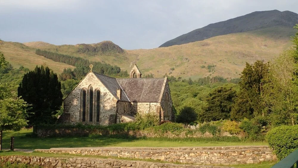
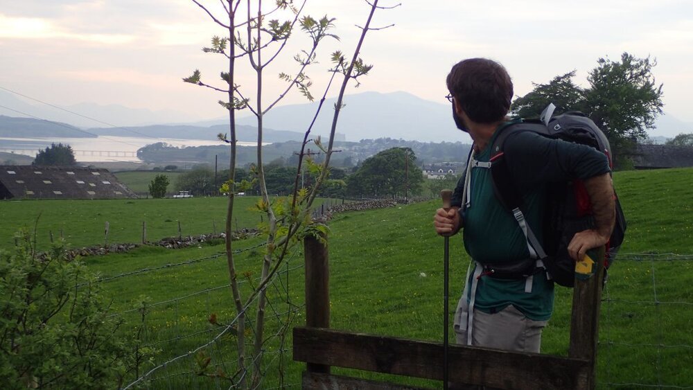
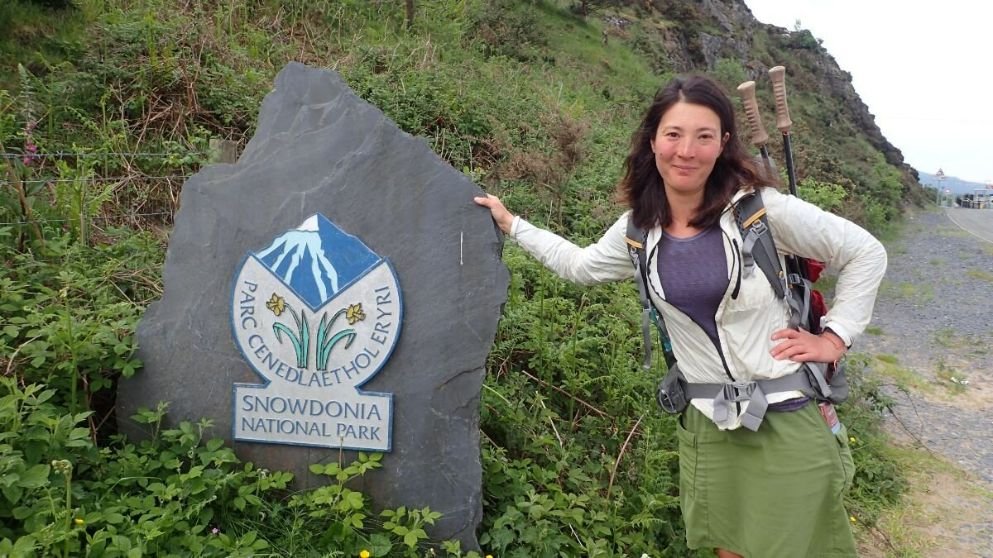
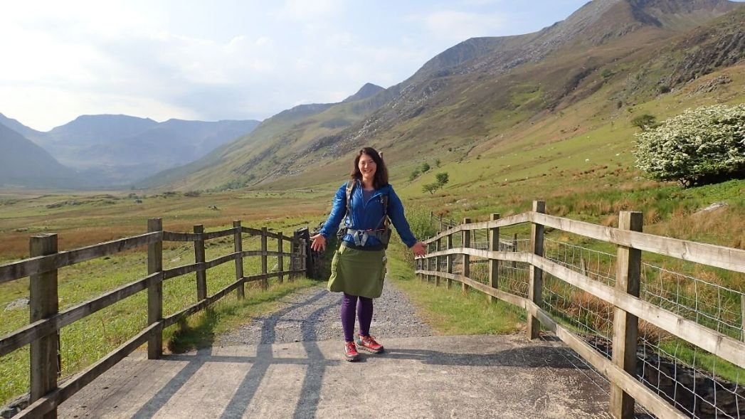
The northern terminus is Conwy, a tourist town on the sea, home to the 13th century Conwy Castle on the mouth of the Afon Conwy river. It’s also home to the UK’s smallest house. We walked the sandy beach and waterfront to an old Roman Road and Bwlch y Ddeufaen (“pass of the two stones”), where there are druid standing stones and stone circles next to the trail. I loved the views of the heathland to the open moor of Tal y Fan. This mix of travel, history, nature, and walking made quite an “I’m-Not-In-My-Home-Country” impression in the first few hours of the hike.
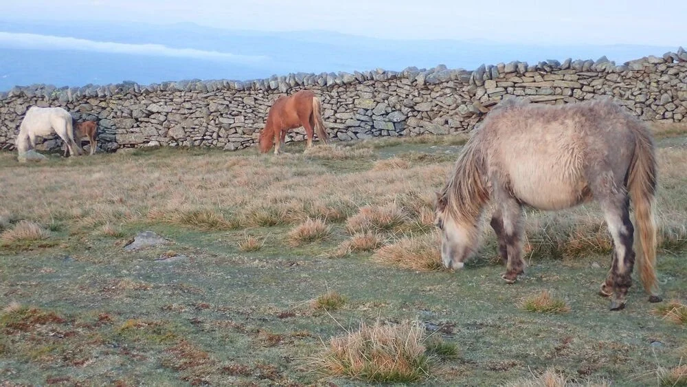
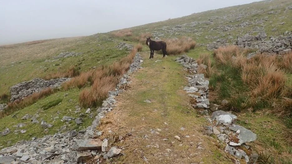
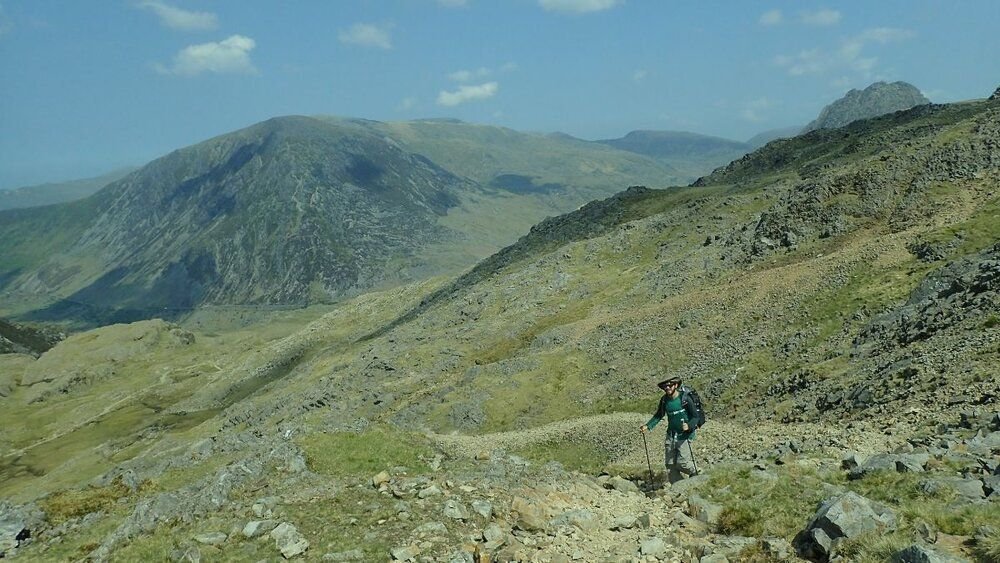
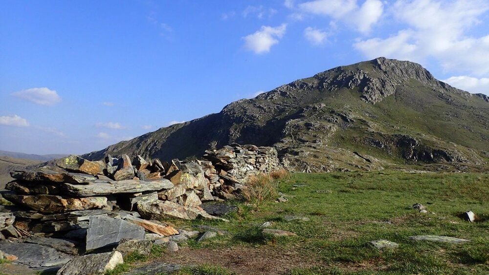
The Snowdonia Way climbs into the remote and wild Carneddau (‘the cairns’) mountains, the highest continuous land area in England and Wales. Many cairns here are Bronze Age burial chambers, often found on summits. We only saw one other hiker but numerous wild ponies who live in the high moorlands.
The Snowdonia Way stays on grassy ridges climbing several peaks, including Foel-fras, the northernmost 3,000-foot peak in Wales, and the massive Carnedd Llewelyn, which was recently renamed in 2009 to honor Princess Gwenllian, daughter of the last native Prince of Wales. The high route here is epic and remote, but we were sad to miss the famous Aber Falls, seen from the low route.
Glyderau ridge
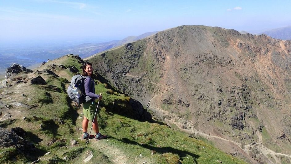
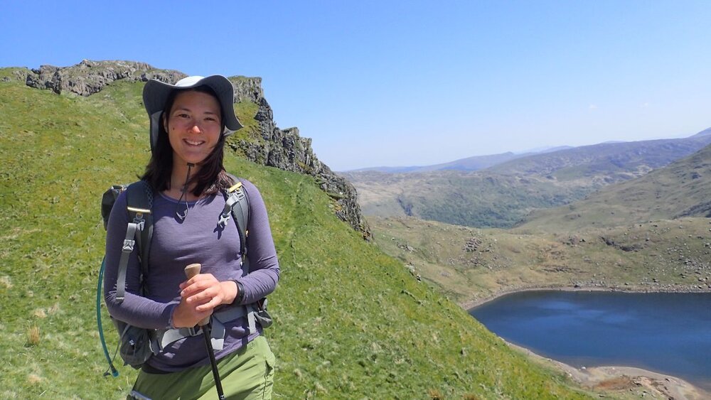
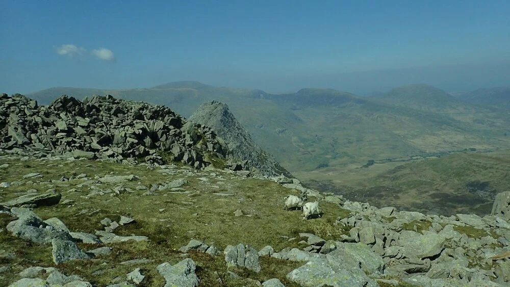
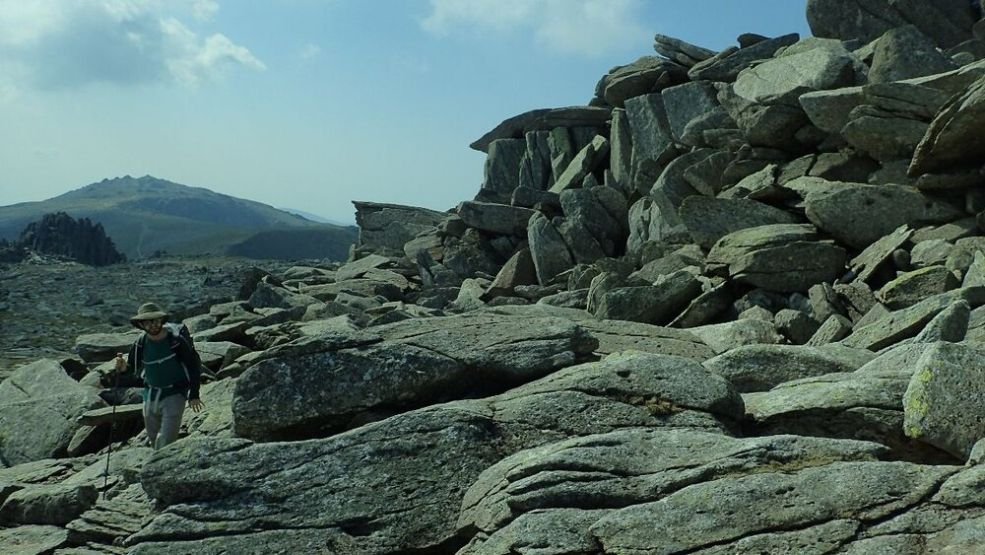
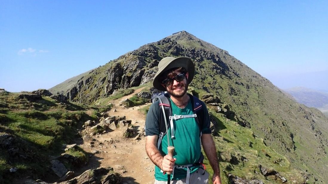
Next, the Snowdonia Way took us to Glyderau ridge, a popular hiking and climbing area known for its epic views and Instagram-worthy rock formations. Glyderau was one of the best ridge walks I’ve done anywhere, with incredible views of the Cwm Idwal, an impressive cirque.
The route traverses many peaks, including rocky Glyder Fach and Glyder Fawr. The Glyderau are anglicized to be called “The Glyders.” (The name Glyderau likely is derived from the Welsh word for “heap of stones”). There are also views of the pointy Tryfan peak, one of the UK’s most recognizable and beloved peaks. It is notable for being one of the only peaks in the British mainland that requires scrambling or technical skills to reach the summit.
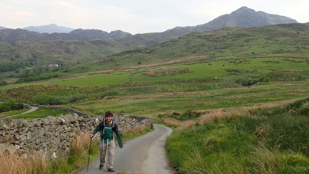
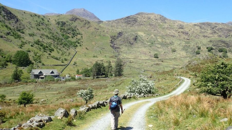
The path takes you right to the town of Capel Curig, home of the National Mountain Center and full of pubs, cafes, camping, hotels, hostels, and even a gear shop. We felt welcomed at the Siobhan Cafe, and a local farmer permitted us to camp in his field nearby. Even when you’re on a budget, staying with locals can be a way to be a more conscious traveler than always camping in the backcountry, far from people.
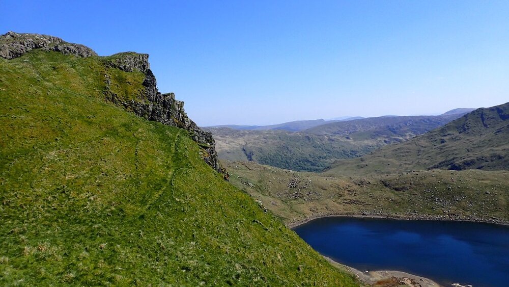
From here, the traverse along Moelwyn ridge had no other people but has incredible 360-degree views and the best view of Mount Snowdon framed from nearby mountain tarns. Woodland trails led to some less exciting but still pretty connector paths along rivers and streams to get across the valley to Mount Snowdon’s trailhead.
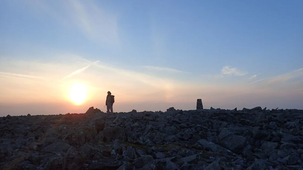
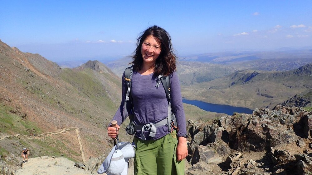
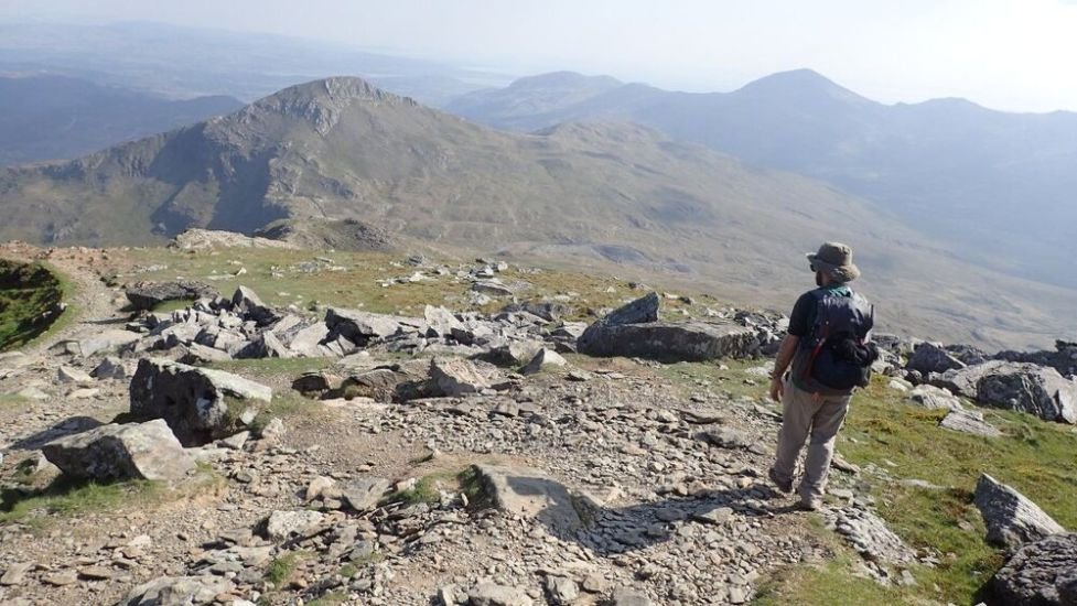
Mount Snowdon
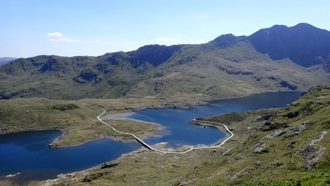
Pen-Y-Pass is the type of trailhead that has a cafe, hostel, and National Park Info Center. The Snowdonia Way takes the Pyg Track, a well-marked, classic route up Snowdon with views of Llyn Glaslyn (‘green lake’) and Llyn Llydaw (‘lakeside’). You’re likely to see lots of walkers, but it’s well worth it; and the Snowdon summit has a cafe!
The descent from Snowdon’s less popular side is steeper and includes minor scrambling. The views of the surrounding mountains are even more epic for being infused with the legend of King Arthur, who supposedly died in battle here. The descent was sometimes wet, but the trail gets a lot better as you pass old slate mining buildings (slate mining was a major industry in Wales from the 18th to 20th century.) Finally, we descended into the forest and wildflower-filled Yr Wyddfa National Nature Reserve.

Beddgelert and Llyn Trawsfynydd
From here, poor weather directed us towards the low route, along woodland paths that followed the peaceful Afon Glaslyn River. Next, we walked into Beddgelert, which the guidebook calls an “alpine village.”
Beddgelert is surrounded by steep mountains at the meeting point of two rivers, taking us to the famous Aberglaslyn Pass and the path by the narrow gorge in the pass.
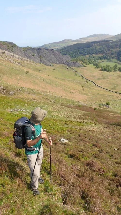
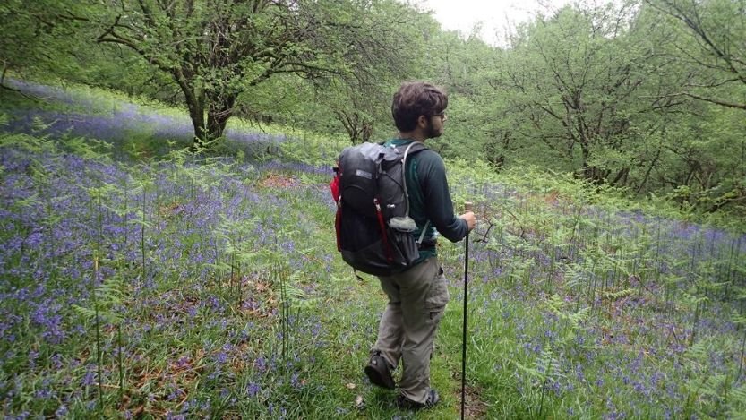
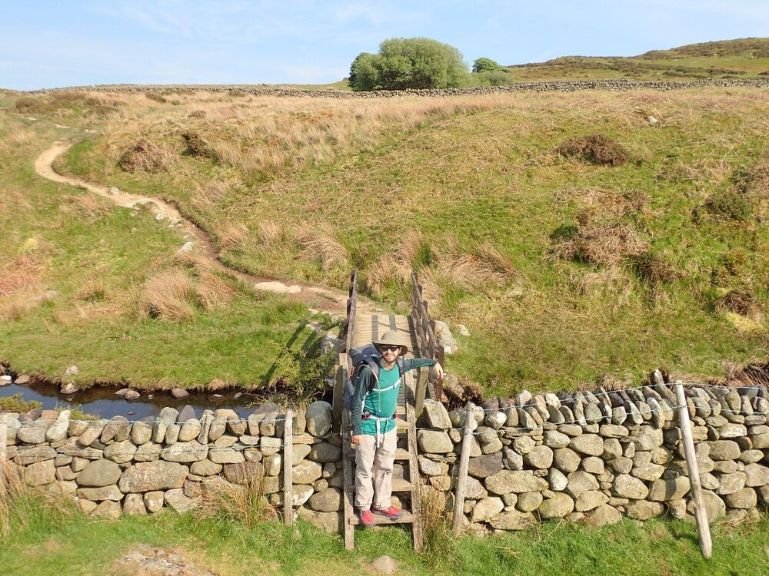
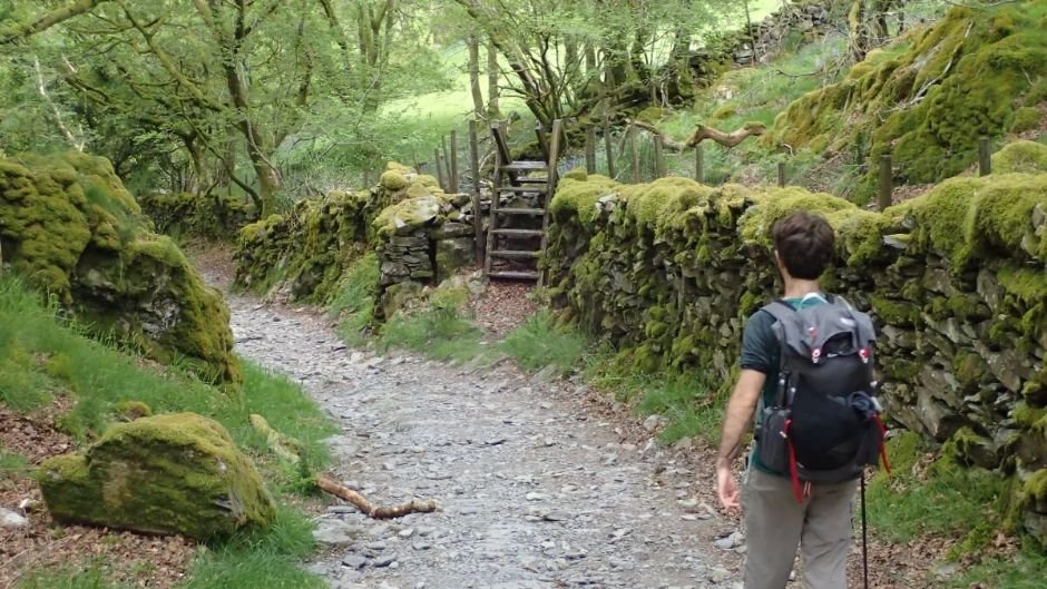
Woodland hikes and well-marked trails brought us over the impressively long footbridge over the dammed lake Llyn Trawsfynydd. From there, we walked active farmland — which is legal for hikers to do in Wales-to open moorland. The route enters the forest of Coed y Brenin, and you may even encounter some mountain bikers here. From here, the trail takes a good path through woodland to Dolgellau, a charming market town.
Cadair Idris to Machynlleth
The route ends on quiet roads and woodlands through paths that show the slate mining history of the area. The high route takes you through Cadair Idris, one of the most notable hiking areas in Snowdonia, known for its impressive cliffs and glacial lakes. The terminus of the Snowdonia Way is the remarkable clock tower in the Machynlleth town center. It’s a fitting end for a long-distance trail of culture and history: one of Wale’s most famous people, Owain Glyndŵr, was crowned native Prince of Wales in this town in 1404.

Maps and Guidebooks
Guidebook
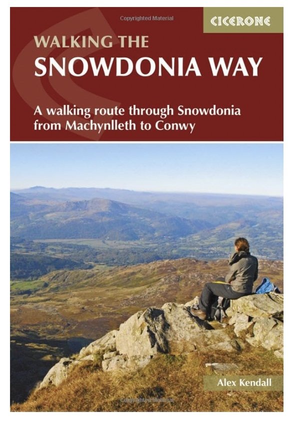
Walking The Snowdonia Way: A walking route through Snowdonia from Machynlleth to Conwy by Alex Kendall is an absolute must. If in the UK, you can purchase it locally at Stanfords.
Website
Read more about the route at the Snowdonia Way website, including updates to the book and route changes.
Gaia
The book includes a link for a GPX route. As the author Alex Kendall did a lot of work putting together the route, I won’t link directly to it here. We used the GPX route with the Gaia app and found it very useful.
Maps
OS Explorer OL 23 Cadair Idris & Llyn Tegid
OS Explorer OL18 Harlech, Porthmadog & Y Bala
OS Explorer OL17 Snowdon
OS Landaranger 135 Aberystwyth & Machynlleth
OS Landranger 124 Portmadog & Dolgellau
OS Landranger 115 Snowdon/Yr Wyddfa
Getting There
By Plane
We flew into Manchester, UK (MAN). From there, we took trains from via Chester to the trailhead. See below for more information on ground transportation. Liverpool airport is closer, but because MAN is the busiest airport in the UK (that doesn’t serve London), it was much more affordable.
The Anglesey (VLY) Airport is the closest airport to Snowdonia, but like Liverpool, it sees fewer flights per day than Manchester airport.
Bus and Shuttle Services
We took a train to Chester in Wales and then transferred on another train to Conwy. See Traveline Cymru for more information about reaching any of the trail towns. Each trail town for each route segment has a bus line, so it’s possible to section hike this trip.
The guidebook also has local taxi companies to get around each town.
Trailheads
Machynlleth is the southern trailhead located in mid-Wales. The route starts at its notable clock tower.
Conwy is the northern trailhead in northern Wales. The route starts at Rosemary Lane, near the smallest house in Britain, the Tourist Information Centre, and not too far from Conwy Castle.

Notable Pubs & Restaurants
The cafe at the Bryn Tyrch Inn in Betws-Y-Coed was a fancy treat after hiking through the Glyderaus. A small 12-room “country-chic” inn located right along the route, the locally sourced food at the restaurant was a culinary highlight of the hike. In addition, they operate the farm campsite behind the inn.
The Moel Siabod Cafe, located 0.2 miles down the road, caters to the outdoorsy crowd and runs guided trips and outdoor classes. Supporting local businesses along the way is not only a way your tourism dollars can do more good than harm but also open the door for memorable conversations and understanding.

Regulations
Follow Leave No Trace Ethics, including pack-it-in, pack-it-out for waste, and pooping far from water. While the UK uses different terms than the US, the general philosophy remains the same.
Wild camping has some restrictions in the UK. Read more about those rules here. Also, be sure to follow the Snowdonia Camping Code, which is similar to Leave No Trace.
You can learn more about wild camping restrictions and ethics in Wales here. Generally, plan to set up camp late in the day and leave early in the morning. In some places, you may require permission from the landowner to camp.

Resupply
The Walking the Snowdonia Way guidebook by Alex Kendall includes a databook with facilities including:
Overnight accommodations: hotels, hostels, B&Bs, campgrounds
Food: pubs, cafes restaurants, grocery stores, restaurants
Gear Stores
Transportation
For thru-hikers walking the entire trail, the route has grocery stores or cafes located no more than 10 miles apart on the low route and 18 miles apart on the high route.
You'll visit the towns of:
Abergynolwyn
Dolgellau
Trawsfynydd
Penrhyndeudraeth
Beddgelert
Dolwyddelan
Capel Curig
Bethesda
Llanfairfechan
The towns are right along the trail, so you shouldn't need to walk more than a mile from the route to reach the hotel, campsites, grocery, pubs, and restaurants.
Water Planning
Water is plentiful throughout almost the entire trail. As with food, you can get water in towns located no more than 10 miles or 18 miles apart (low and high route, respectively). Additionally, there are numerous mountain streams and lakes where you can find water. Keep in mind that the low route, in particular, has sheep grazing. You’ll also be passing some historic mining sites, so you’ll want to be prudent to avoid runoff from these areas. Finally, always filter water collected in the wild along this route. See our Best Backpacking Water Filters and Purifiers guide for our recommendations.

Side Trips and Peaks
The High Route visits many notable peaks, including the tallest mountain in Wales, Mount Snowdon. The High Route also has opportunities to hike the Snowdon Horseshoe, a loop from Pen-Y-Pass that visits all the highest mountains in the area. You’ll summit several peaks along the High Route, including a few of the taller mountains in the Carneddau and Glyderau.
Variations
Alex Kendall writes the guidebook directions from Machynlleth to Conwy, but it’s possible to walk in the opposite direction. Each section has a high route and low route described, and it’s easy to mix and match between different sections to create your own route. In addition, each section starts and ends at a town with public transportation, so it’s possible to section hike the route over many years.

Gear List for Snowdonia Way
BACKPACK
We used the Gossamer Gear Gorilla 50 and Gossamer Gear Kumo 36 backpacks on the Snowdonia Way. We liked that these lightweight technical packs were also sturdy enough to use as general travel packs while traveling around the UK. Since the trail has shorter resupplies and water carries, the Kumo 36 was a good amount of volume. The Gorilla 50 was great for using as a travel bag, though. The larger volume version of both of these packs, the Gossamer Gear Mariposa 60, is a winner in our Best Lightweight Backpacking Backpacks guide.
SLEEPING BAG
We used the Katabatic Gear Palisades quilt and the Montbell Down Hugger. Both have temperature ratings of 30-35 degrees, which worked for the cooler summer nights on the Snowdonia Way. Although we don’t have a quilt guide yet, the Montbell Down Hugger is a winner in our Best Backpacking Sleeping Bags guide.
TENT
We used the Z Packs Duplex on this trip. We liked that this tent was lightweight, easy to set up and that the DCF fabric dried quickly. It’s our winner for Best Ultralight Tent in our Best Backpacking Tents guide. See that post for more tent recommendations.
SLEEPING PAD
We used the Therm-a-Rest NeoAir XLite sleeping pad on this trip. Because we brought all our gear from the US, along with our “street clothes” for other sightseeing, we needed compact gear. The NeoAir XLite is a winner in our Best Backpacking Sleeping Pads guide due to its relative comfort given its light weight and packability.
STOVE
We used a Caldera Cone alcohol stove with purple denatured alcohol that we purchased locally (unlike in the US, it’s colored purple in the UK, so it isn’t mistaken for water). Although we didn’t include alcohol stove models in our Best Backpacking Stoves guide, the Caldera Cone is our favorite alcohol stove.
WATER PURIFIER
We used the Sawyer Squeeze filter on this trip. The Snowdonia Way has abundant water but passes through some farms and historic mining areas, so filtering is essential. The Squeeze doesn’t take up much room in luggage and is efficient and easy to clean, making it the winner in our Best Backpacking Water Filters guide.
TREKKING POLES
We carried the Gossamer Gear LT5 poles. The Gossamer Gear’s are incredibly light and telescope down enough that they fit into our international travel luggage. We used these poles to set up our tent. It’s a winner in our Best Trekking poles story.
POT AND SPOON
We also used our TOAKS 750 mL titanium pot and TOAKS long-handled spoon. This lightweight and affordable pot is our Overall Winner in our Best Backpacking Cooking pots story, and the spoon is in our Backpacking Essential Accessories story. We like both of them so much that they’re also in our gift guides. It’s amazing how such small things can make such a big difference on a backpacking trip!

What to Wear
SHOES OR BOOTS
We wore the men’s and women’s Altra Lone Peaks on this trip. They’re lightweight and comfortable, so we could easily travel with them internationally. In addition, they had enough traction to manage the steep and muddy sections. The Lone Peaks are winners in both our Best Women’s Trail Running Shoes and Best Men’s Trail Running Shoes guides.
We saw many hikers and backpackers in boots for those who were on portions of this trip, especially around the Glyderaus. If you’d feel more comfortable in boots, check out our Best Hiking Boots story or our Best Lightweight Hiking Boots story.
A nice footwear compromise for this trip would’ve been hiking shoes designed to feel like a trail runner but have stability similar to a boot. See our Best Hiking Shoes story for footwear that has more durability and stability than trail runners.
HIKING SHIRT
We wore the Patagonia men’s Capilene Merino shirt and women’s Smartwool merino 150 shirt. These base layers kept us warm enough when the weather turned but cool enough for the steep climbs. They’re both winners in our Best Base Layers guide.
If I were to hike the trail again, I’d probably wear something with a hood like a Sun Hoodie. Although we had some truly wet and cold days, we also had incredibly sunny weather though the Glyders and on Mount Snowdon—the two most exposed sections of the trail.
HIKING UNDERWEAR
We wore the Patagonia Active Briefs and Patagonia Essential Boxer Briefs featured in our Urban Hiking Packing List.
HIKING SOCKS
Each of us carried 2-3 pairs of the men’s and women’s Darn Tough Micro Crew socks. They are soft, durable, comfortable, and fit like a glove. See our Best Hiking Socks article for more about why we love these socks.
PANTS OR SKIRTS
We used Purple Rain Adventure Skirt and the REI Sahara Hiking Pants. Both excel at feeling comfortable, not too hot, and nice and stretchy for lots of mobility. See our Best Men’s Hiking Pants and Best Women’s Hiking Pants guide for more recommendations.
SUN HAT
Sunday Afternoons Ultra Adventure Hat and a trucker hat. Sun isn’t a big issue in Wales but it’s always a good idea to protect skin from the harsh rays of the sun.
RAIN JACKET
We carried Montbell Versalite and a NW Alpine DCF rain jacket. While this isn’t one of the jackets in our Best Rain Jackets article, it’s popular with thru-hikers because of its light weight.


