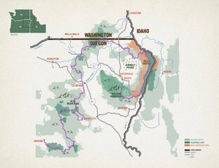
Blue Mountains Trail Backpacking & Thru-Hiking Guide
Find a true wilderness experience on Oregon’s newest long-distance trail
May 23rd, 2023
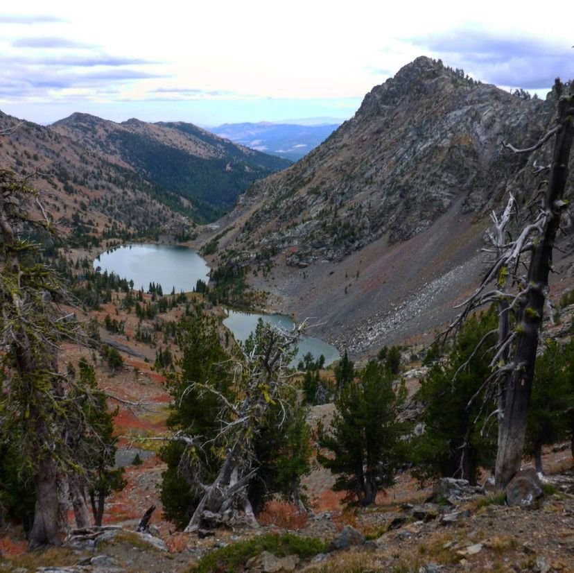
Frazier Lake in the Eagle Cap Wilderness is a gem of the Blue Mountains Trail thru-hike.
Distance: 520-565 miles (depending on alternate routes taken)
Time to hike the entire trail: 4-6 weeks
Elevation gain: 85,000’
Elevation loss: 87,000’
High Point: 8,400’ (Elkhorn Crest Trail)
Low Point: 1,000’ (Snake River)
Best season: August-September (some sections have longer hiking season)
Permits: None required
Difficulty: Strenuous
The Blue Mountains Trail is a remote ~550 mile long trail providing outstanding views and a true wilderness experience. The hiking trail avoids towns and heavily traveled roads, which can complicate resupply but results in a true sense of solitude.
The authors, Naomi Hudetz, Mike Unger, and Whitney LaRuffa were the first people to thru-hike the BMT. Renee Patrick hiked the entire route in two sections in August and October 2020. Our efforts were intended to “ground-truth” an initial route. Mike and Naomi (two of the authors of this story) have gone back and wrote the Town Guide to the Blue Mountains Trail.
Based on our feedback and the feedback from others involved in the route, the Greater Hells Canyon Council has updated the route. However, the route is not complete. However, since we first published this guide, other thru-hikers have walked the trail.
There will continue to be updates and alternative routes added in the future—and this guide has been updated to reflect improvements to the route since our initial hike. Check with the GHCC (and become a member) for the most current maps and databook.
Other trails you may like:


We create reader-supported, objective, independently-selected gear reviews. This story may contain affiliate links, which help fund our website. When you click on the links to purchase gear, we may get a commission — without costing you an extra cent. Thank you for supporting our work and mission of outdoor coverage for every body! Learn more.
Quick Facts
Originally conceived in 1960 and finally launched in November 2020, the 565-mile Blue Mountains Trail (BMT) is Oregon’s newest long trail. Leaving Wallowa Lake State Park near Joseph, it forms a spiral on its way to the finish in John Day, passing through the ancestral lands of the Nez Perce, Confederated Tribes of Umatilla, and Confederated Tribes of Warm Springs. It connects 7 wilderness areas, 1 national recreation area, and 3 national forests through incredibly diverse terrain and ecosystems.
The BMT is also a great trail for section hiking. The individual sections can be great 3-7 backpacking trips.
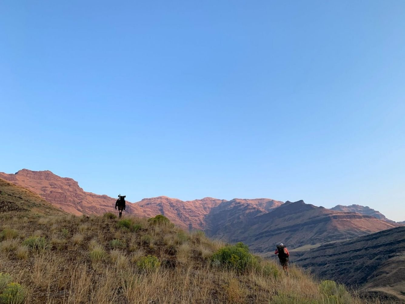
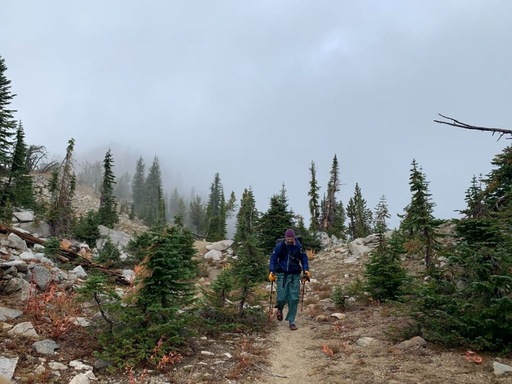
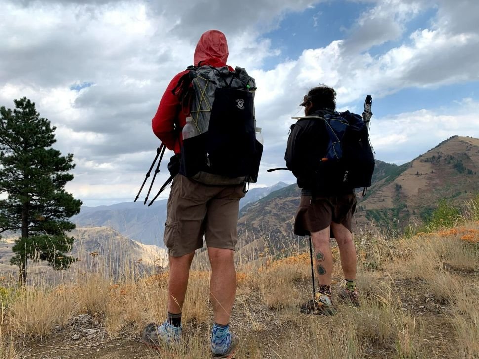
Climbing out of Hells Canyon on one of many off-trail sections of the Blue Mountains Trail.
Highlights
High alpine lakes and meadows in the Eagle Cap Wilderness
Hells Canyon, the deepest river gorge in North America
The Nez Perce (Nee-Me-Poo) National Historic Trail
River walking along the Wenaha and North Fork John Day Wild & Scenic Rivers
Alpine ridge walking on the Elkhorn Crest National Recreation Trail
Strawberry Mountain Wilderness
Solitude—we rarely saw any other hikers after Eagle Cap Wilderness
Challenges
A long section with no resupply
Long waterless stretches are possible
Rugged terrain with under-maintained trails
Navigation
Extreme temperatures
When to Hike
Snow in the high country near both terminuses makes timing difficult. Snow often lingers into July. August and September are the ideal times to hike the Blue Mountains Trail as a thru hike. Some sections of the BMT could be hiked earlier or later in the year.
Difficulty and Skills
Route finding
Ability to carry long resupply and water
Comfortable with fording creeks, and navigating steep, rugged terrain
Understanding the risk associated with hiking in burned areas
Ability to read the weather and deal with weather extremes
Start in Joseph or John Day?
Where to start really comes down to the potential weather you may encounter based on your start date. Personally starting in Joseph ensured that we could make it through the Wallowas before the snow set in. However, starting in Joseph also means you have some of the longest food carries and elevation changes at the beginning of your hike. The flip side is you get to end in John Day at 1188 Brewery which has one of the best Dutch Babies you will ever taste in life.

The market in Troy, Oregon, one of the resupply towns on the Blue Mountains Trail.
Resupply (starting in Joseph)
Troy (mile 182)
Troy has a very small convenience store and resort with laundry. It may be possible to send a resupply box to the resort. However, both the market and resort are only open Thursday through Sunday so timing will be challenging. Troy is right on the trail. There is no Post Office.
If you don’t want to carry the food for 182 miles, and you can convince a friend to resupply you, there are some options reachable by car:
Hells Canyon Overlook at mile 49.3 (USFS information)
Cow Creek Trailhead at mile 112.5 (USFS information)
Buckhorn Tower Viewpoint at mile 120.2 (USFS information)
Tollgate (mile 232)
Tollgate has a small convenience store and lodging at the Tamarack Three Bears Inn. It may be possible to send a box to the store. There is no Post Office.

A building in historic Sumpter, Oregon on the Blue Mountains Trail.
La Grande (mile 284)
La Grande is a full-service town, with motels, laundry facilities, Post Office, outfitter, and good grocery stores. The trail goes right through the middle of town. Side A Brewery is a must-visit.
Sumpter (mile 359)
Sumpter is a small historic mining town in northeast Oregon. There is a great PO to send yourself a box, two very small stores for a few resupply items (seriously send a box here), two restaurants, a hotel, a great CBD cafe, and Oregon’s highest dispensary—The Golden Nugget.
Austin Junction (mile 431)
More of a wayside than a town, the Austin Junction Store is a great spot for a meal or two. The owners are hiker friendly and will even let you mail a resupply box. The only lodging available is a mile down the road at Bates State Park.
Trail Resources
Guidebook, Maps, and GPX Data
Mike and Naomi wrote the Blue Mountains Trail Town Guide for the Greater Hells Canyon Council. It’s updated annually and free on the GHCC website.
Maps, GPS tracks, and a databook are also available from the GHCC.
A guidebook is currently under development.
Getting To The Trail
By Air
Wallowa Lake Terminus
Joseph, Oregon, is a 4-hour drive from the Boise Airport, a 5.5-hour drive from the Portland airport, and a 6-hour drive from the Redmond, Oregon airport. A combination of public and private transportation is available from these airports to the terminus (see below).
John Day Terminus
John Day, Oregon is:
a 2.7-hour drive from the regional Redmond, Oregon airport (near Bend, OR)
3.3-hour drive from the Boise airport
a 5-hour drive from the Portland, Oregon airport.
To the best of our knowledge, there are no shuttle services from the Boise or Portland airports to John Day. However, the Grant County People Mover offers a bus service connecting John Day with the Redmond Airport. See the schedule here.
Trail Shuttles
There are no trail shuttle services available at this time.
Hiking the Hells Canyon Rim on the Blue Mountains Trail thru-hike in Oregon.
Route Summary
The Blue Mountain Trail can be viewed as a series of distinct sections, each highlighting a different part of the Blue Mountains. Any of the sections would be a great 3-7 day backpacking trip, or the Blue Mountain Trail can be approached as a thru-hike; however, as we discuss below, there remain resupply challenges that will make thru-hiking difficult without some form of trail support. We will note that the Greater Hells Canyon Council is working to address the resupply issue.
The following is a brief description of each section:
1. Wallowa Lake to Hells Canyon Rim (jump to this section)
2. Hells Canyon Rim to Troy (jump to this section)
3. Troy to La Grande (jump to this section)
4. La Grande to Anthony Lakes (jump to this section)
5. Anthony Lakes to Sumpter (jump to this section)
6. Sumpter to Austin Junction (jump to this section)
7. Austin Junction to John Day (jump to this section)

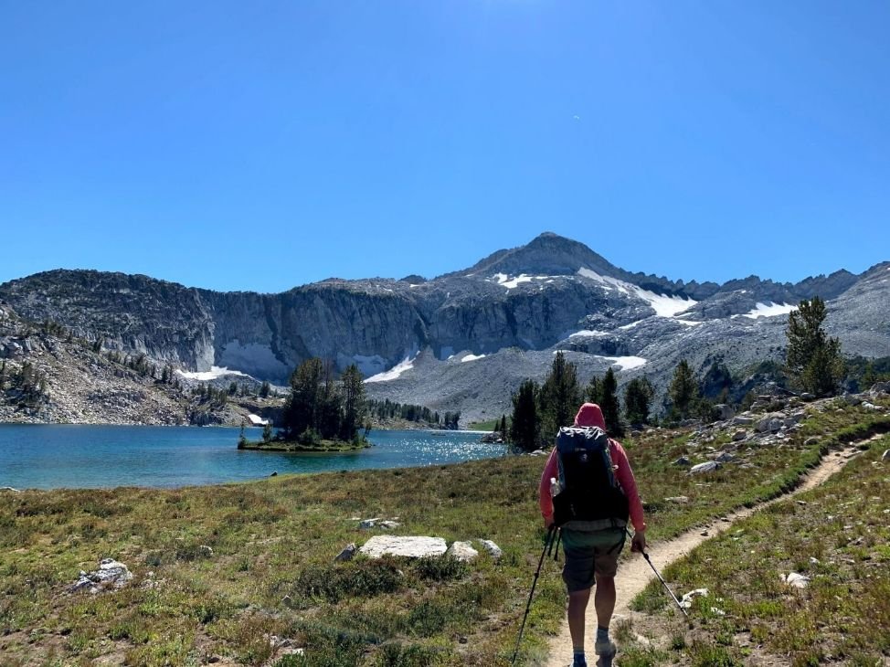
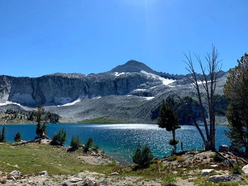
A highlight of the hike is Frazier Lake in Eagle Cap Wilderness on the Blue Mountains Trail thru-hike in Oregon.
Section 1: Wallowa Lake to Hells Canyon Rim
Distance: 59.7 miles
Elevation gain: 10,212’
Elevation loss: 8,951’
High Point: 8,357’ (Hawkins Pass)
Low Point: 4,639’ (Wallowa Lake)
The BMT starts out in one of the most scenic areas of Oregon—the Eagle Cap Wilderness. It leaves the Wallowa Lake Trailhead on the West Fork Trail and climbs 3,500’ to Hawkins Pass on well-maintained trails. The trail goes past beautiful alpine lakes—Frazier Lake and Little Frazer Lake—through fields of granite. Note that Hawkins Pass is at 8,357’, so snow often lingers there until July. After leaving Hawkins Pass, the trail crosses the headwaters of the South Fork Imnaha River—and later crosses the Imnaha River when it’s much bigger!
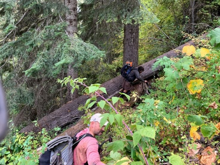
The trail connects to Summit Ridge in the Hells Canyon National Recreation Area using lesser-used trails and Forest Service dirt or gravel roads, most of which are low-traffic. Some of the trails have suffered fire and are littered with deadfall and overgrown with brush. There are also some long dry stretches. There is also an alternate route that drops down to the Imnaha River and walks past numerous car-camping campgrounds.
There is no resupply opportunity in this section of the BMT. The GHCC is working on resupply options; however, the first resupply opportunity is in the town of Troy (mile 182). As we note in the resupply section, Troy can be a challenging resupply. If you can convince a friend to meet and resupply you, there are some places accessible by car:
Hells Canyon Overlook at mile 49.3 (USFS information)
Cow Creek Trailhead at mile 112.5 (USFS information)
Buckhorn Tower Viewpoint at mile 120.2 (USFS information)

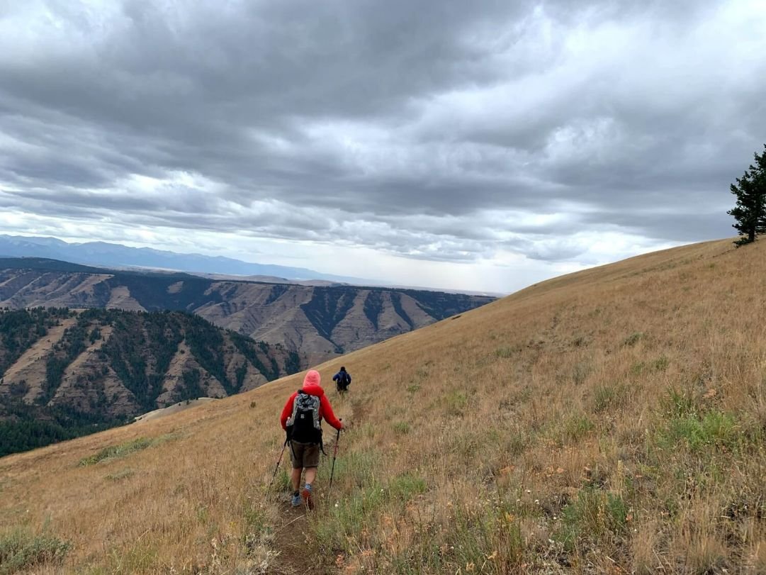
Hiking up out of Hells Canyon is a challenge of the Blue Mountains Trail thru-hike in Oregon.
Section 2: Hells Canyon Rim to Troy
Distance: 122 miles
Elevation gain: 17,377’
Elevation loss: 21,663’
High Point: 6,903’ (Hells Canyon rim)
Low Point: 1,183’ (Imnaha River)
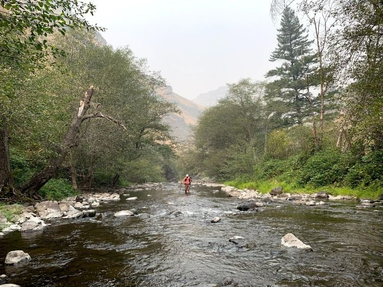
The trail continues along Summit Ridge on the Hells Canyon Rim for miles, with outstanding views of the canyon, using the Western Rim National Recreation Trail for part of the journey. At Fingerboard Saddle, there is an option to follow Cow Creek down to the Imnaha River, or stay on Summit Ridge to Dug Creek and eventually drop down to the Snake River at Dug Bar. Dug Bar is where the Nez Perce crossed the Snake River in 1877 as they were forced off their homeland in the Wallowa Valley. Both options cross the Imnaha River at the Cow Creek Bridge. A word of caution—the Dug Creek trail hasn’t been maintained in a while, and poison ivy and prickly plants make for slow going. Pants are a good choice for this section.
The Hells Canyon Rim is one of our favorite sections of the BMT; however, water can be scarce on the long rim walk. Carefully plan your water access points and be prepared for large water carries. The GHCC identifies known water sources in their databook.
The BMT climbs out of Hells Canyon on the Nez Perce Nee-Me-Poo National Historic Trail, with beautiful, vast views. We were lucky to see a herd of bighorn sheep taking turns drinking water from a spring. The Nez Perce Trail is fairly well marked to the top of Cemetary Ridge but can be difficult to follow at times.
There are several alternate routes to choose from once you leave Cemetery Ridge. One option heads southwest to the Zumwalt Prairie—part of which was designated a National Natural Landmark. Much of the route through here is on Forest Service gravel roads.
The trail then drops down into Joseph Canyon, the birthplace of Chief Joseph, briefly follows Joseph Creek, and then climbs back out of the canyon (note that this is cross-country). It’s all roads to cross the Grande Ronde River and reach Troy, the first town stop on the BMT.
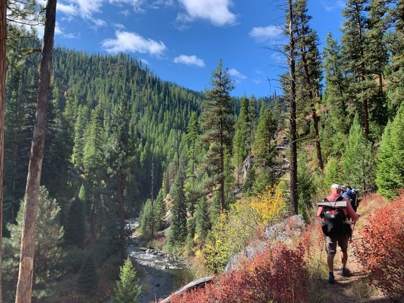
Hiking along Wenaha River Canyon on the Blue Mountains Trail thru-hike in Oregon.
Section 3: Troy to La Grande
Distance: 102.3 miles
Elevation gain: 15,967’
Elevation loss: 14,793’
High Point: 5,942’ (Mt. Emily Road)
Low Point: 1,619’ (Troy)
From Troy, the BMT enters another fantastic section along the Wenaha River—a Wild & Scenic River. The Wenaha River Trail suffered significant damage in the Grizzly Bear Fire of 2015, however, and a partial re-route is in place until trail crews can restore the trail.
The BMT then drops down a ridge and follows the South Fork Walla Walla River. It climbs back out of the canyon via Burnt Cabin Gulch and uses roads to head south into Tollgate, a resupply town (send a box).
From Tollgate, the BMT enters the North Fork Umatilla Wilderness and follows the North Fork Umatilla River, another outstanding section. After leaving the wilderness, the trail briefly follows a Forest Service road, eventually reaching the Shimmiehorn via a short cross-country route. Note that the road had significant flood damage and is no longer passable via car, but is still accessible on foot.
The final stretch into La Grande is through the Mount Emily Recreation Area, on top of a ridge through beautiful forest and views down to the valley below. The Mount Emily area is popular with mountain bikes so stay aware through here. The BMT goes right through La Grande—don’t miss Side A Brewing!

Cairns as a form of navigation are few and far between on the Blue Mountains Trail thru-hike in Oregon.
Section 4: La Grande to Anthony Lakes
Distance: 40.7 miles
Elevation gain: 7,963’
Elevation loss: 3,650’
High Point: 7,244’ (near entrance to Grande Ronde Lake)
Low Point: 2,769’ (La Grande)
The short section between La Grande and Anthony Lakes is entirely on gravel and dirt roads. However, we rarely saw cars so the roads just felt like a nice wide trail. Some of the road is on a ridge, which makes for beautiful views.
The Anthony Lakes Campground has potable water and vault toilets. However, the water might be turned off if you hike through after the campground has closed for the season—usually in late September

Backpacking along the well-established Elkhorn Crest Trail portion of the Blue Mountains Trail.
Section 5: Anthony Lakes to Sumpter
Distance: 34.1 miles
Elevation gain: 3,948’
Elevation loss: 6,602’
High Point: 8,466’ (Elkhorn Crest Trail near Rock Creek Butte)
Low Point: 4,364’ (near Deer Creek Campground)
Most of this section is on the Elkhorn Crest Trail — another gem of the BMT. Leaving Anthony Lakes Campground the trail enters the North Fork John Day Wilderness and gains the Elkhorn Crest. It’s a high ridge walk with some of the most outstanding scenery in the country. As is usual with ridge walks, water is scarce. You may need to drop down to one of the lakes just below the trail to pick up water and/or stock up beforehand. Lost Lake, Meadow Lake, and Summit Lake can all be accessed on good trail, and are worth a side trip! We found a flowing spring right on the trail in late September, but it’s best not to count on it.
Rock Creek Butte is a short side-scramble from the Elkhorn Crest — it’s the highest point in the Elkhorns at 9,100’. From the summit of Rock Creek Butte you can see the Wallowas to the east and the Strawberries to the west — meaning you could see both the start- and end-points of the BMT. This is pretty remarkable for a 520-mile trail — and is a function of the fact that it’s a spiral-shaped trail. Fun fact: Rock Creek Butte is also #5 on the list of Oregon peaks with 2,000’ of prominence — behind Mt. Hood, Sacagawea Peak (also on the BMT in the Eagle Cap Wilderness), Mt. Jefferson, and South Sister.
The BMT drops down off the Elkhorn Crest Trail at Twin Lakes, just a few miles from the Marble Pass Trailhead and the southern end of the Elkhorn Crest Trail, and heads down into Sumpter from there. The remaining miles into Sumpter are a combination of trail and dirt roads.
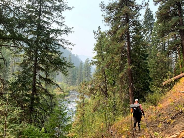
Hiking along the North Fork John Day River Trail on the Blue Mountains Trail thru-hike in Oregon.
Section 6: Sumpter to Austin Junction
Distance: 72.1 miles
Elevation gain: 12,577’
Elevation loss: 12,786’
High Point: 7,996’ (Crown Point)
Low Point: 3,759’ (Middle Fork John Day River)
The section between Sumpter and Austin Junction highlights the gold mining history of the region. Be sure to visit the Sumpter Gold Dredge before you leave town. On the forest road out of town, you will see huge gravel piles, remains of an old dredge, and even a small active mine. A new active mine has closed the road connecting to a unit of the North Fork of the John Day Wilderness. Instead, you are diverted over Crown Peak via a bushwack and old trail.
From the Crane Creek Trailhead, the route follows Crane Creek then the North Fork of the John Day, a designated Wild and Scenic River. This well-maintained trail is one of the highlights of the route as it follows the river for miles past old abandoned mining cabins. The trail fords the river several times, so be careful in the early season when the river runs high from snowmelt. This section is also reportedly very tick-invested in the early summer.
The route briefly leaves the North Fork of the John Day Wilderness near Olive Lake, before entering the Greenhorn Unit of the Wilderness in the Vinegar HIll-Indian Rock Recreation Area. There was a trail crew clearing out this section of the route in the fall of 2021 providing well-needed maintenance to this beautiful section.

Sunrise over Strawberry Lake in Strawberry Mountain Wilderness, Oregon on the Blue Mountains Trail thru-hike in Oregon.
Section 7: Austin Junction to John Day
Distance: 98.0 miles
Elevation gain: 16,962’
Elevation loss: 18,099’
High Point: 8,315’ (Junction to Strawberry Mountain)
Low Point: 3,085’ (John Day)
After you enjoy a great meal at the Austin House Cafe and Country Store, the trail follows low-traffic forest roads up the Clear Creek drainage, eventually descending to Last Chance Creek and the Eldorado Ditch, a 130-mile long ditch hand-dug by Chinese laborers in the 1860s and 1870s. Be sure to check out the book Ditch Walkers and Water Wars: The Life and Times of the Eldorado Ditch in the Gold Fields of Eastern Oregon co-written by Mike Higgins, who has been one of the founders and inspirations of the Blue Mountains Trail.
The route then climbs to the Table Rock Lookout for outstanding views of the region. After a long descent down to Sheep Creek followed by a long climb through the recently burned, but well-maintained trail to a ridgeline near Lookout Mountain, the route enters the Strawberry Mountain Wilderness. Although much of the Strawberry Mountain Wilderness has suffered devastating burns, the route offers beautiful and dramatic ridge walks.
Every great route needs a great terminus. The Blue Mountain Trail ends at 1188 Brewing in John Day. We strongly recommend hikers celebrate the journey with great food and cool, well-deserved refreshments.
Overall Impression of the Blue Mountains Trail
We started our thru hike on September 2 and finished October 2 with one zero day in La Grande. Since the days were short, we had days where we started hiking in the dark to make our miles.
Mike Unger's Impressions
The Blue Mountain Trail includes all the elements I love in a hike: outstanding scenic beauty, isolated wilderness, abundant wildlife, and great little towns and history. But, the Blue Mountain Trail also highlights the importance of maintaining and protecting our existing trail network. Many of the trails through the region are disappearing because of fire and lack of maintenance. I fear that we will lose many of these trails if we do not take steps to bring back many of the trails.
Whitney La Ruffa's Impressions
The Blue Mountains Trail was one of the more challenging hikes I have undertaken in life, given we were the first people to thru-hike, our ground-truthing efforts were a learn-as-we-go experience. Going into the hike, I expected it to be similar to the Oregon Desert Trail which I had hiked in 2018; long waterless stretches, no shade, little town resources for resupply, and an endless expanse of sagebrush for as far as I could see. The reality was 180 degrees different than this: there were old-growth forests, deep canyons, water aplenty, and a landscape rich in flora and fauna diversity.
The hiking itself was slow going, partly this was due to the efforts to find the trail on the ground versus what had been mapped, and past forest fires and seasonal flooding left some of the areas littered with obstacles like endless blowdown and thick understory brush. While the miles came slower than expected, the rewards were high, with views of Hells Canyon, old-growth forest to wander through, and best of all, little to no people encountered along the way.
I often find myself reflecting on this hike over the past few months and I believe in time this can be one of the best sub-1000 mile thru-hikes in the country. Its wild feel and remote setting in Oregon give it a constant feeling of adventure. The highlights for me would have to be the Wallowas, Hells Canyon, the Elkhorn Crest, and the Strawberry Wilderness. I really enjoyed the small towns we traveled through, and while resupply is challenging, the people we met were friendly and more than willing to help us along the way. If you are new to long-distance hiking, this trail might not be the first thru-hike you want to tackle; however, if you do, make sure you have good route-finding skills, can carry up to 7 days of food, and 3-4 liters of water, and be ready to have gear for varying weather conditions.
In closing, I think having the opportunity to walk through the ancestral lands of the Nez Perce was an honor and walk-through history. I highly recommend reading about the Nez Perce War prior to going on this trail. My knowledge of this tragic event in US history made this hike much more relevant in my understanding of their hardships and also gave me a deep respect for the land I was traveling through.
Read more at Whitney’s BMT trail journal, The Dago Diaries.
Naomi Hudetz's Impressions
I absolutely loved this trail. It has everything I look for in a long hike: scenery, solitude, diverse ecosystems, challenging terrain, adventure, and multiple route options. I would hike it again in a heartbeat.
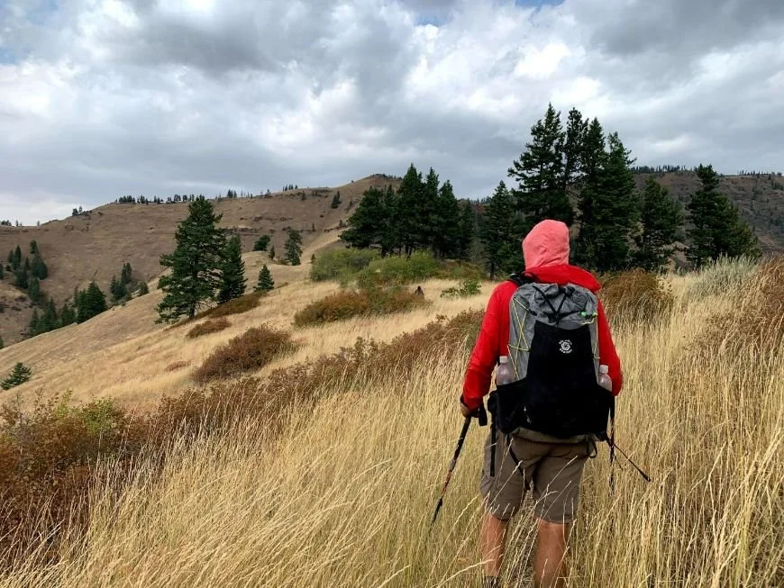
Trail conditions were challenging at times on the Blue Mountains Trail thru-hike in Oregon.
Challenges of the BMT
The Blue Mountains Trail is a very challenging hike. The trail climbs to high alpine, descends to hot desert canyons, and goes through fire-damaged sections with poor trail conditions. There are long dry sections and areas where resupply is difficult. The hiking season is short. Many of the alpine sections in Eagle Cap and the Elkhorn Crest can be snow-covered well into July and can be subject to severe weather and snow any time of year, while the Hells Canyon section along the Snake River is often too hot to hike in mid-summer.
Rugged and Physically Demanding Trail
The Blue Mountain Trail is physically demanding. We recorded nearly 180,000’ of elevation gain and loss on the Blue Mountain Trail. Our biggest single-day climbs were on our very first day on the trail (over 5,000’ in 15 miles in the Eagle Cap Wilderness). Our second biggest climbing day was on our second to last day in the Strawberry Mountains.
Each section has big climbs. However, the most difficult sections are those in bad trail conditions. Many of the areas that have suffered fire damage or not been maintained are littered with blowdowns or overgrown. Unfortunately, every section had areas with unmaintained trails.
You should plan to complete fewer miles than you might on other long trails such as the Pacific Crest Trail or Continental Divide Trail.

Poison ivy along the Blue Mountains Trail in Hells Canyon.
Navigation
The Blue Mountain Trail can be difficult to navigate. It is not uniformly blazed. There are unsigned junctions, overgrown trails, and sometimes the maps do not match the actual trail location. It’s important to maintain a good trail awareness. Plan ahead. Keep an eye out for junctions, landmarks, and water sources. The GHCC has produced excellent maps, GPS tracks, and a databook to assist with navigation.
Resupply
Resupply is currently a major problem for the first half of the BMT. There is currently no real reapply opportunity from the start (at Wallowa Lake) and Troy (mile 182). As we discuss in the resupply section, Troy is a challenging resupply point. The GHCC is working to solve the resupply challenges. Please refer to the GHCC website for resupply updates.
Short Hiking Season and Extreme, Unpredictable Weather
The BMT has a very short hiking season. The Eagle Cap Wilderness, Elkhorn Crest, and Strawberry Mountains may remain snow-covered well into July. These areas can receive snow and wintery weather any time of year. These high alpine areas may only be hikable in August and September.
Alternatively, the Hells Canyon section along the Snake and Imnaha Rivers can be extremely hot during the summer.
POISON IVY AND BLACKBERRY BUSHES
Poison ivy and blackberry bushes are prevalent in lower elevation areas in Hells Canyon, in Joseph Canyon, and along the Wenaha River. Know how to identify poison ivy. We recommend you consider long pants and knee-high gaiters to protect yourself. We also recommend you carry Technu to wash parts of your body that may have come in contact with poison oak.
Six Moon Designs Swift X backpack on Blue Mountains Trail
Gear List
Our gear list was affected by our September 1st starting date—we weren’t planning to finish until early October. We had to plan for warm temperatures at the beginning of the trip, but also colder and wetter weather towards the end of our trip.
Backpack
We both tested out a new pack on this hike—the Six Moon Designs Swift X with flight vest yoke from Six Moon Designs. Mike used the Lite Skin fabric and Naomi used the X-Pac. Neither had used a vest yoke before and were sold on its comfort and versatility. The vest system was designed to take the weight off your shoulders and transfer it to your core. Naomi can attest to this—her core muscles were slightly sore after the first few days but adjusted quickly. She also liked the additional stability provided by the vest yoke. She has always struggled with the change in her center of gravity that comes with wearing a backpack and found that she felt much more stable with the vest yoke—even with heavy loads. We both used the 50L pack liners from Six Moon Designs to protect our gear from rain. See our full in-depth long-term review of the Swift X or our shorter review in the Best Backpacking Backpacks guide.

Six Moon Designs Haven Ultralight Tent on the Blue Mountains Trail
TENT/TARP
We were also excited to test out the DCF version of our favorite two-person shelter—the Six Moon Designs Haven Ultralight Tent. It provides excellent rain protection, holds up great in the wind, and is easy to pitch—and the DCF version is only 28 ounces for a 2-person, double-walled shelter. They have stopped making the DCF version; however, we also have the SilNylon version, and love it just as much as the DCF version. See our Best Backpacking Tents guide for more recommendations.
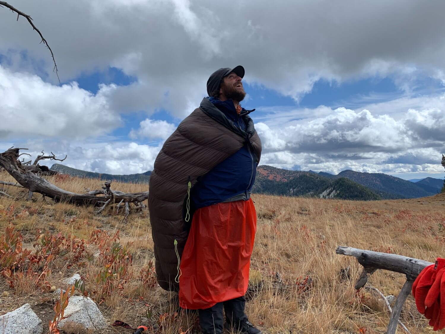
Hiker wearing rain skirt and Katabatic quilt over shoulders as a cape on the Blue Mountains Trail.
Sleeping Quilt
We both chose to carry our 15-degree Katabatic Sawatch quilts. This was a good decision for the few nights when temperatures dropped into the teens since we find Katabatic quilts to be true to their temperature rating; however, we were too warm at the beginning of the trip. We’re working on a best sleeping quilts guide, but for now, check out our Best Sleeping Bags story, which has some ultralight options.
Sleeping Pad
Naomi got to test out the Therm-a-Rest NeoAir XTherm on this trip. At 15 ounces, it’s the same weight as her favorite Sea to Summit Ultralight Sleeping Pad but with an astonishing 6.9 R-Value, nearly double the Sea to Summit R-Value of 3.5. Therm-a-Rest claims the NeoAir XTherm has the most warmth per ounce of ultralight mattresses, and combined with the 15-degree quilt, Naomi had no problem staying warm on this trail.
Mike prefers a two-pad system with a short Nemo Switchback closed-cell foam pad and a Therm-a-Rest ProLite self-inflating pad in a size small. The two pads provide great warmth, and he finds this system more durable and reliable than inflatable pads. Plus, he likes to sit on the foam pad during breaks. All three pads are reviewed in our Best Backpacking Sleeping Pads story.
TREKKING POLES
Naomi tested the Gossamer Gear LT5 trekking poles on this hike, the ultralight pick in our Trekking Poles story. Ultimately, Naomi found the LT5 to be too ultralight for this trail. Mike carried the Black Diamond Trail Ergo Cork poles, which are the best, most durable poles he’s used. Mike is notoriously tough on his poles (and all his gear) and has yet to break these poles over 7,000 miles of use. He’s replaced the tips five times, and he typically replaces the tips every 1,500 miles or so. The Black Diamond Trail Ergo Cork are the overall winners in our Best Trekking poles story.

Backpacking cooking in camp on the Blue Mountains Trail thru-hike in Oregon.
COOK SYSTEM
We carried a Soto Windmaster stove. It’s fast, light, and fuel-efficient. We each carried a 550ml Toaks pot and a long-handle Toaks spoon . Mike also carried a Talenti gelato container to cold soak meals throughout the day.
The Soto is the Upgrade Winner in the Best Backpacking Stoves story. The TOAKS 550 ml is reviewed in our Best Backpacking Cooking Pots story and the TOAKS spoon is in our Backpacking Essential Accessories story.
WATER STORAGE AND TREATMENT
We each carried a Sawyer Squeeze filter. We use 2-liter Cnoc Vecto water containers, which we think are the best, most durable water containers available. Adding in a Sawyer coupler lets us create a great gravity treatment system. The Squeeze is the overall winner in our Best Backpacking Water Filters story.
TOILET KIT
We always carry a Deuce of Spades trowel for digging a proper cathole for solid waste. We also carry dog waste bags for packing out our toilet paper.
Headlamp
A good headlamp is especially important for shoulder season hikes, as the days are short. We often found ourselves packing up or setting up camp in the dark, and occasionally we even hiked in the dark. We both carried the BioLite 325 headlamp. It is USB-charged, lightweight, comfortable, and has three modes: highly adjustable directed beam, floodlight, and red light. It’s a winner in our Best Headlamps story.
Satellite Communicator
Mike & Naomi carried a Garmin inReach Mini. In addition to providing emergency rescue notifications, it can be used to send text messages. It also has great battery life, as long as you keep it in extended tracking mode. It’s the overall winner in our Best Satellite Messengers and Personal Locator Beacons guide.
Headphones
Both Mike & Naomi occasionally like to listen to audiobooks and podcasts on trail. Naomi carried the Shokz Open Run Connect bone-conducting headphones, which are perfect for hiking and other outdoor activities. They provide great sound, but because they do not cover ears, you can maintain situational awareness—which is especially handy for hearing rattlesnakes. They are the overall winner in our Best Wireless Headphones and Earbuds for the Outdoors.
Hiking Watch
Mike wore an older version of what is now the Garmin fenix 7X Pro Solar. It has great battery life and provides ABC-altimeter, barometric pressure, and compass functions. Plus, you can track your daily steps and calorie burn, which are fun metrics to track on a thru-hike. Read more about the Garmin fenix editions in our hiking watch guide or in our long-term review of the Garmin fenix.
Naomi wore an older version of the Garmin Instinct Solar, the overall winner in our Hiking Watches guide. Read our long-term review of the older Garmin Instinct or our long-term of the newer Garmin Instinct 2.
BACK-UP BATTERY
To power their electronics, including headlamp, satellite communicator, headphones, and watch, both Mike and Naomi carried power banks. Mike carried a 20000 mAh Anker back-up battery and Naomi carried a 10000 mAh Anker.
Between so many devices, we found a 3-in-1 charging cable helps reduce the number of cables carried.
What to wear
Below is a list of the clothes Mike & Naomi wore:
| WORN CLOTHING | WOMEN'S | MEN'S |
|---|---|---|
| Hiking Shirt | Montbell Wickron Light Long Sleeve Hiking Shirt | Patagonia Tropic Comfort Hoody |
| Hiking Bottom | Purple Rain Adventure Skirt | praNa Stretch Zion shorts |
| Belt | n/a | Arcade |
| Underwear | Smartwool Merino Bikini | ExOfficio Boxer Briefs |
| Socks | Darn Tough Hiker Micro Crew | Darn Tough Micro Crew |

Treeline Review editor Naomi Hudetz wearing the Patagonia Torrentshell 3L jacket in rain at Anthony Lakes on Blue Mountains Trail
Rain Gear
We had to be prepared for cold and wet conditions. Our strategy is to layer with lightweight fleece under our rain gear. Rain gear will always “wet out” eventually, meaning the amount of moisture on the surface of the jacket won’t allow any more sweat evaporation from the inside, and you start to feel wet. The key is to avoid hypothermia even when wet. This is best accomplished by insulating under your rain gear with a synthetic jacket.
Mike carried the Torrent Flier rain jacket from Mont Bell and the Frogg Toggs rain pants. The Frogg Toggs tear very easily, though, so they must be used with care in sections with bushwhacking. Mike wouldn’t recommend Frogg Togg rain pants on the BMT. They tear too easily when bushwacking or navigating overgrown trails. Instead, he would recommend a rain kilt or rain skirt. The rain skirt is perfect for walking through wet, brushy trails.
Naomi carried the Torrentshell 3-layer rain jacket from Patagonia. Overall, she was impressed with the improvements made since the prior version of the Torrentshell. We review this jacket in our Best Rain Jackets article.
INSULATED PUFFY JACKET
We both carried the Patagonia Micro Puff (men’s and women’s) synthetic insulated jacket. With a windbreaker and synthetic insulation, it will keep you warm even when wet. See our Best Synthetic Jackets article for a more detailed discussion of the Micro Puff.
Windbreaker
Both Mike and Naomi also carried a Patagonia Houdini wind shirt (men’s and women’s), which is Mike’s favorite piece of gear. It’s the overall winner in our Best Men’s Windbreaker guide and is featured in our Favorite PCT Gear list. Since the Blue Mountains Trail has the potential for bad weather at any time, you’ll want some skills to stay warm and dry. See our Shoulder Season Backpacking Gear article for ideas.
MITTENS AND HATS
We also carried mittens, rain over-mittens for our hands, and buffs. The buff is an incredibly versatile piece of gear—it keeps your head warm when at night, keeps your neck warm, supplements your fleece hat on cold days, and looks quite stylish.
UMBRELLA
Finally, both Mike and Naomi carried a Silver Shadow Carbon trekking umbrella from Six Moon Designs. They used it both as a supplement for their rain gear and as sun protection in Hells Canyon. Using an umbrella when hiking through long hours of rain is invaluable. This umbrella also proved helpful on other thru-hikes and is in our PCT Gear List & Strategy and Arizona Trail Gear List.

Cooking in camp on the Blue Mountains Trail.
RECOMMENDATIONS FOR FUTURE HIKERS
PREPARE FOR POISON OAK
We had not expected so much poison oak on the route. The most popular areas of the route (Eagle Cap, the Elkhorn Crest, and Strawberry Mountains) are alpine stretches without poison oak; however, there are several low elevation stretches (Hells Canyon, Wenaha River, and Joseph Canyon) where poison oak is prevalent and difficult to avoid. Know how to identify poison oak. We strongly recommend long pants and poison oak ointment such as Technu to wash exposed skin.
PREPARE FOR BUSHWACKING THROUGH PRICKLY STRETCHES
There are stretches, especially in areas that have burned recently, where you will be bushing through blackberry bushes and other thorny brush. We recommend long pants and knee-high gaiters to protect yourself. We also recommend Neosporin to treat the occasional scrape or punctuation and a sewing kit to repair clothes and gear.
Carry a Satellite Communicator
The Blue Mountain Trail is remote and much of the route does not have cell phone coverage. Other than the occasional hunter we saw no one on the route after we left the popular Eagle Cap Wilderness section. We recommend carrying a satellite communicator in the event that one of us was severely injured on the route. We carried the Garmin inReach Mini. It’s the overall winner in our Best Satellite Messengers and Personal Locator Beacons guide. The inReach is also great for getting weather forecasts and texting family.
Prepare for Weather Extremes
The BMT is a tough route to prepare for. You are over 8,000’ in Eagle Cap, the Elkhorn Crest, and the Strawberry Mountains, where snow and freezing temperatures can occur any time of year. However, you could also have 100+ degree temperatures in Hells Canyon, around Troy, and a few other of the low-elevation areas. You could easily encounter such extremes in a single section. Carry clothes that can be layered or removed depending on conditions.
Below are a few of our favorite items we carried:
Patagonia Micro Puff (men’s and women’s): Unlike down jackets, the synthetic Micro Puff retains its warmth when wet. Therefore, it can be worn under your rain jacket in cold and wet conditions. We recommend carrying a synthetic insulated jacket over a down jacket for this trail.
Hiking Umbrella. An hiking umbrella has long been one of our favorite items for its versatility. It can be quickly deployed during an afternoon shower without the hassle of putting on a rain jacket. But, equally important, it is great for providing shade in hot conditions.
Rain Skirt. A rain skirt is a great option on a route like the BMT where you are likely to be walking through wet brush that crowds the trail. The rain skirt can be quickly put on over your hiking pants and it is excellent protection against the ”car wash” effect of walking through wet brush.

Much of the trail through Joseph Canyon was overgrown with blackberry bushes and poison ivy, forcing us to walk up Joseph Creek for miles.
Guidebook and Maps
Below are the resources we used for our thru-hike:
Guidebook
The Greater Hells Canyon Council now has a town guide, written by Mike and Naomi.
MAPS
Contact the Greater Hells Canyon Council for BMT maps (GHCC)
Gaia GPS phone app
Wallowa Mountains Eagle Cap Wilderness Map (by Green Trails)
Wallowa-Whitman National Forest Map (by USFS)

The Blue Mountains Trail follows parts of the Nee-Me-Poo National Historic Trail. This sign and marker show where the route is located.
resources
Forest Service Information
Dug Bar Historic Nez Perce Crossing of Snake River
Hells Canyon National Recreation Area
Nez Perce Nee-Me-Poo National Historic Trail
Zumwalt Prairie National Natural Landmark
history of the trail
A brief history of the Blue Mountains Trail by Renee Patrick
Chief Joseph & the Flight of the Nez Perce by Kent Nerburn
Ditch Walkers and Water Wars: The Life and Times of the Eldorado Ditch in the Gold Fields of Eastern Oregon by Mike Higgins and Les Tipton
Sumpter Valley Dredge State Heritage Area
Trail Journals
Whitney “Allgood” La Ruffa’s The Dago Diaries
Renee “She-ra” Patrick’s She-ra Hikes
Transportation
Grant County People Mover bus service connecting John Day and the Redmond Airport
Presentations
Oregon Wild Webcast, featuring Jared Kennedy, Renee Patrick, Mike Unger, Whitney La Ruffa, and Naomi Hudetz

Why you should trust us
This article was written by the first three people to have thru-hiked the Blue Mountains Trail: Naomi Hudetz (Treeline Review co-founder), Mike Unger, and Whitney LaRuffa. Naomi and Mike went back to the Blue Mountains Trail and are the authors of the Blue Mountains Trail Town guide.
Mike Unger was part of the team to first thru-hike the BMT. He is a double Triple Crowner, having completed the PCT, Appalachian Trail, and Continental Divide Trail each twice. You can see all articles by Mike Unger on his Treeline Review author page.
Naomi Hudetz was part of the team to first thru-hike the BMT. She has thru-hiked the PCT, CDT, and AT and is a Triple Crowner. She’s co-founder and online editor at Treeline Review. She’s thru-hiked numerous other distance routes including the Great Divide Trail across the Canadian Rockies (twice), Grand Enchantment Trail, Pacific Northwest Trail, the Arizona Trail, (most of) the Idaho Centennial Trail, the first known thru-hike of the Blue Mountains Trail, and the Oregon Desert Trail. You can read all her articles on her Treeline Review author page.


