Ouachita Trail Backpacking Thru-Hiking Guide
Find Solitude in the Ouachita Mountains in Arkansas
May 16th, 2023
Distance: 223 miles (375km) from Talimena State Park, Oklahoma to Pinnacle Mountain State Park, Arkansas
Time to hike the entire trail: 2-3 weeks
Elevation gain/loss: 34,300’ (10,455m) ascent; 34,900’ (10,648m) descent
High Point: 2,610’ (795m) at Rich Mountain near the Oklahoma/Arkansas border.
Low Point: 300' (90m) near Lake Maumelle close to the eastern terminus.
Best season: Fall or spring.
Permits: No permits are required.
Difficulty: Moderate


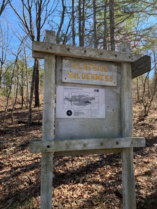
The 223-mile Ouachita (pronounced “Wash-i-tah”) Trail is a National Recreation Trail that runs through the Ouachita Mountains from Talimena State Park in eastern Oklahoma to Pinnacle Mountain State Park near Little Rock, Arkansas. All but the eastern 30 miles travel through the Ouachita National Forest, the oldest and largest National Forest in the Southern United States.
Much of the route follows the ridges and crest lines of the Ouachita Mountains, providing outstanding views and a wilderness experience. The hiking trail avoids towns and heavily traveled roads, which can complicate resupply but results in a true sense of solitude. The FarOut App offers an Ouachita Trail guide including maps, water, campsites and more. This write-up focuses on gear, tips and what we’d do differently, resupply, and transportation and logistics to get you on the trail.
We create reader-supported, objective, independently-selected gear reviews. This story may contain affiliate links, which help fund our website. When you click on the links to purchase gear, we may get a commission — without costing you an extra cent. Thank you for supporting our work and mission of outdoor coverage for every body! Learn more.

Highlights
Beautiful terrain and great views.
Solitude. The trail is lightly used and avoids towns and major roads.
Abundant wildlife including bears, turkeys, deer, and eagles. There are also rattlesnakes and cottonmouths.
Well-maintained trail with relatively new, meticulously clean shelters.
Challenges
Rugged, rocky trail conditions, especially the eastern third of the trail.
Long dry stretches. Caching water may be necessary. Friends of the Ouachita Trail provides a list of water sources. In addition, the Atlas Guides Ouachita Trail app identifies water sources.
Buggy. Ticks, mosquitoes, and chiggers can be an issue.
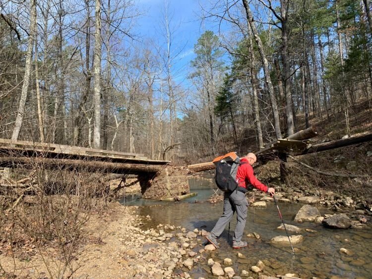
Potentially dangerous river fords, especially after storms.
The easternmost 30 miles are outside the Ouachita National Forest. Because that section is not on national forest land, the only legal camping spot is the Penney Campsite, approximately 15 miles from the eastern terminus at Pinnacle Mountain State Park. The Penney Campsite is 0.9 miles off-trail and accessed by a spur trail.
When to Hike the Ouachita TRail
The Ouachita Trail is a shoulder season hike, meaning it’s best to hike in the spring or fall. Summers in Arkansas are too hot, muggy, and buggy. The trail in winter can be subject to harsh storms and frigid temperatures. Freezing rain is a particular concern in the winter.
Difficulty and Skills
The trail is well-blazed and well-maintained. Junctions are generally signed and easy to identify. There are even mileage markers along the entire route. If you carry a good map and have decent trail awareness, you shouldn’t have a problem staying on the right path.
The Ouachita Trail is physically challenging. Like the Appalachian Trail, the route can feel like an endless series of 500’ to 1,000’ (150-300m) ascents and descents. The eastern third of the trail is extremely rocky and can be slow and sometimes treacherous-especially when wet. Expect a lower-than-average daily mileage over much of the route.
With some planning and advanced route-planning, some hikers have connected the Ouachita Trail with the ~170-mile long Ozark Highlands Trail to create a longer thru-hike.
Eastbound vs Westbound
The Ouachita Trail is traditionally a west-to-east hike, though it can be hiked in either direction. The Ouachita Trail Guidebook and trail mileage markers are oriented for a start at the western terminus in Talimena State Park in Oklahoma and a finish at the eastern terminus in Pinnacle Mountain State Park near Little Rock, Arkansas.

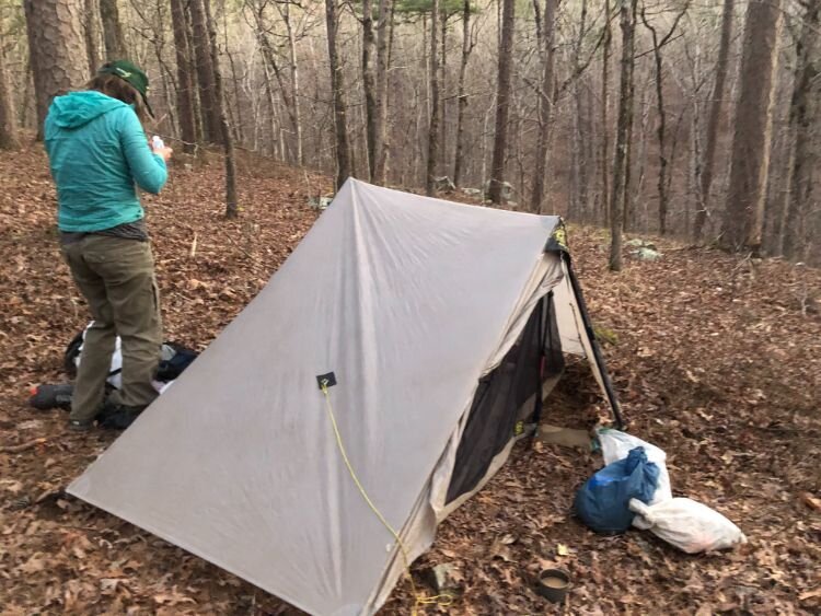
Naomi demonstrating how to stay well-fed on the trail. Photo by Mike Unger.
Resupply
Resupply along the Ouachita Trail can be tricky. The trail avoids towns and major roads. The Bluebell Cafe in Story, Arkansas—near the trail’s halfway point—is the traditional resupply point for Ouachita Trail thru-hikers. Below are other resupply options, with mileage assuming west-to-east travel:
Queen Wilhelmina Lodge at Mile 51
The lodge, located on Rich Mountain at the high point of the Ouachita Trail (2,610’), accepts hiker resupply boxes. (As this may change from year to year, you’ll want to call to confirm and get details.) Queen Wilhelmina Lodge also has beautiful rooms and a restaurant serving breakfast, lunch, and dinner. There is a small gift shop where candy bars and sodas are available, but it’s not adequate for resupplying.
Mena, Arkansas at Mile 68
Mena, located 12 miles south of the trail on Highway 71, is a full-service town with motels, restaurants, and a Walmart.
Bluebell Cafe in Story, Arkansas at Mile 122
The Bluebell Cafe is a highlight of the Ouachita Trail. Lori, the Bluebell’s proprietor, will shuttle hikers to and from the trail for a delicious meal. The Bluebell Cafe also has a small market, which is well-stocked with hiker-oriented foods. Lori will also accept hiker resupply boxes. Please do yourself a favor and visit the Bluebell when hiking the Ouachita and eat heartily. Important note: there is no cell phone service at this Highway 2771 trailhead, nor is there Verizon service in Story. Lori recommends hikers call from the Suck Mountain Shelter (mile 109) to pre-arrange rides.
Trail Resources
Guidebook
The Ouachita Trail Guide by Tim Ernest provides a nice overview of the trail and a detailed description of trail sections.
Trail Maps and GPX Data
Ouachita trail maps and GPX data are available for free. You can download both from Ouachitamaps.com. The maps are formatted to be printed at scale (1:24,000) on 11” x 17” paper.
FAROUT Guides (Guthook)
The FarOut App offers an Ouachita Trail guide with detailed maps, elevation profiles, water reports, and campsites and shelters, as well as campground and trailhead locations. It can also be purchased as part of the Arkansas Hiker package, which highlights other longer backpacking trails in the Arkansas trail system.
Water Report
Friends of the Ouachita Trail (FOOT) has compiled a list of navigation points including water sources along the entire trail. Please note that specific water sources may not be reliable.
Friends of the Ouachita Trail
FOOT is a non-profit organization supporting, maintaining, and providing resources for the Ouachita Trail. FOOT provides a detailed trail overview, a listing of trail shuttle services, current trail conditions, and information on how to support the Ouachita Trail. Please consider joining and supporting FOOT.
Getting To The Trail
By Air
Western Terminus
Fort Smith, Arkansas, approximately 1 hour from Talimena State Park, has commercial air service. Shuttles are available from Fort Smith to Talimena State Park (see below for information on shuttles).
Eastern Terminus
Pinnacle Mountain State Park is a 30-minute drive from Little Rock, Arkansas. Uber and Lyft serve the Little Rock metropolitan area.
Trail Shuttles
There are several shuttle services serving the entire trail. FOOT provides a list of trail shuttles.
Trip Report
I thru-hiked the Ouachita Trail with Treeline Review co-founder and Chief Operations Officer Naomi Hudetz in February. We are always on the lookout for new shoulder season hikes, and this was a relatively new part of the country for us.
Start Date and Duration
We started at Talimena State Park on February 26 and finished at Pinnacle Mountain State Park on March 8 for a total of 12 days on trail. We took one day off in Mt. Ida, thanks to a shuttle from Lori at the Bluebell Cafe.
While most spring starts are in late March and early April, Naomi and I chose an early start date because we wanted to hike before ticks emerged, temperatures warmed, and seasonal water sources dried out. There was plenty of water, and we had the trail to ourselves-mostly. While there were no people out that early, the ticks and chiggers came out early this year.

Naomi and Mike at the end of their Ouachita Trail hike—the eastern terminus at Pinnacle Mt. State Park near Little Rock, Arkansas.
Resupply Strategy
Naomi and I sent resupply boxes to the Bluebell Cafe in Story at mile 122. It was one of the most pleasant town stops we’ve had over 25,000 miles of thru-hiking. We called Lori from the Suck Mountain Shelter the afternoon before we arrived at the Highway 71 trailhead (there is no cell phone coverage from the trailhead). Lori arranged to have a friend pick us up at 8 am, and we stayed at the Bluebell for breakfast and lunch. In the mid-afternoon, Lori offered to drive us to Mt. Ida to do laundry and get a room for the night. She then drove us back to the Bluebell the next morning for breakfast, and then took us-clean, rested, and very well-fed-back to the trail. (Please note: Lori is very generous, but hikers need to considerate and do not assume that Lori will be able to provide town shuttles, especially during busy hiking seasons.)

The Bluebell Cafe and Market in Story, Arkansas.
Overall Impression of the Ouachita Trail
The Ouachita Trail is a great long trail, worthy of its National Recreation Trail status. Naomi and I would thru-hike it again, perhaps linking it via shuttles with the Ozark Mountain Trail. Below are several of its standout features:
Beauty and Solitude
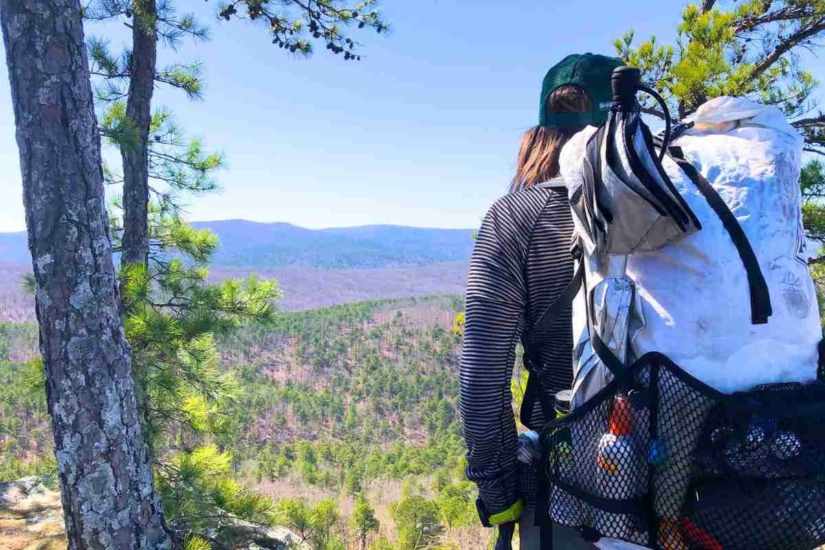
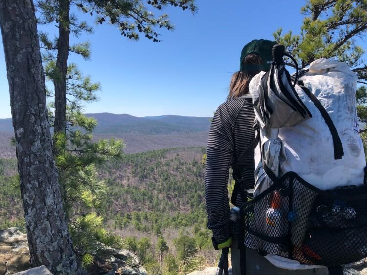
The Ouachita Mountains felt remote and wild. There are big views of the surrounding area. Civilization rarely encroached on the trail. We had the solitude that is increasingly rare on long trails. We only saw six other backpackers and very few day hikers until Pinnacle Mountain State Park. Only two were thru-hikers-one eastbound and one westbound.
The Ouachita Trail offers many open views of the surrounding forest and mountains. Photo by Mike Unger.
Well Maintained
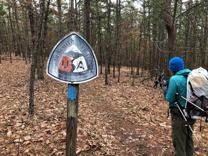
The Ouachita Trail is well-maintained and blazed. I’d argue it’s over blazed. Blue blazes are painted on trees and every mile is marked both on a tree and on the ground with a survey marker.

A line of blue blazes lead Naomi down the trail. Photo by Mike Unger.
Clean, Relatively New Shelters
The Ouachita Trail has shelters nearly every 8-10 miles. Without exception, these shelters were meticulously clean and uncrowded.

The Ouachita Trail has clean, well maintained shelters. The Suck Mountain Shelter has built-in chairs. Photo by Mike Unger.
Challenges
While navigation is not difficult, the Ouachita Trail is not an easy thru-hike. Below are some of the biggest challenges we faced:
Rugged and Physically Demanding Trail
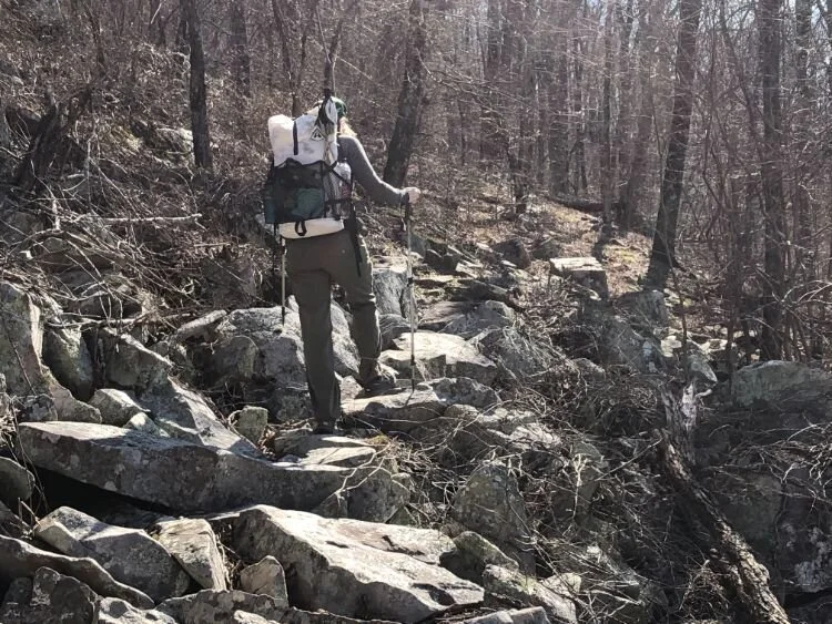
Like the Appalachian National Scenic Trail, the Ouachita Trail can feel like an endless series of 500’-1,000’ ascents and descents. The Ouachita Mountain range has a similar steepness and rugged feeling as the Appalachian Mountain range. Fortunately, one difference is that the Ouachita Mountain forest is fairly open and often offers nice views along the high ridges.

The first 70-odd eastbound miles are the most challenging. The trail is very rocky, and stepping safely requires focus. We were fortunate to have dry conditions, as this section could be treacherous when wet or icy. If hiking in colder months, you may consider winter traction devices.
Extreme, Unpredictable Weather
The Ouachita Trail is subject to weather extremes: strong thunderstorms, sub-freezing temperatures, ice- and snowstorms, and hot and muggy conditions. The temperatures dropped into the teens on our first night on trail, but we were sweating in our shelter a few nights later.
Rain and thunderstorms are a consistent threat on the trail, but Naomi and I got lucky. We expected and planned for rain, but it missed us. A thru-hiker on trail a week after us had to quit early after a week of strong storms. We recommend carrying a lightweight rain jacket for this trip, even if there is no rain in the forecast.

Lingering snow on the Ouachita Trail. Photo by Mike Unger
Ticks and Chiggers
We purposely started early to avoid ticks and mosquitoes. We did miss the mosquitoes, but a mild winter brought ticks out early. I found a tick on my pant leg on our 4th day on trail. After that, we wisely decided to do daily tick checks. We would recommend treating your gear and outdoor apparel with Permethrin before heading on your trip.

I discovered a tick on my leg during a break. Photo by Mike Unger.
I also learned about chiggers, creatures I’d heard of, but never personally experienced. What I initially thought were spider bites turned out to be chiggers, and they turned out to be a red, scratchy, unpleasant experience.
We didn’t think to pack bug spray at the start of the trip. Fortunately, we were able to buy some from the Bluebell Cafe in Story.
We also recommend carrying a tick removal tool with you. This is one we like in our Backpacking Accessories Gear List.

Applying bug spray to my socks in an effort to thwart ticks and chiggers. Photo by Naomi Hudetz.
Gear List
Our gear list was complicated by our early start. Our first two days on the trail had highs in the 30s and lows in the teens. However, temperatures rose by around 30 degrees within a few days. We needed to be prepared for both frigid cold, snow, and rain, as well as warm, muggy conditions.
BACKPACK
Naomi carried the Hyperlite 2400 Junction and I carried the Katabatic Onni V40 65 (which is no longer in production). Naomi added the Gossamer Gear feedbag for easy access to snacks, while I added the Gossamer Gear shoulder strap pocket to hold my camera.
We used trash compactor bags as pack liners to protect our gear from the expected rain.
Read a complete review of backpacks in our story Best Backpacking Backpacks.

TENT/TARP
Our favorite two-person tent since 2019 has been the Six Moon Designs Haven Ultralight Tent. It provides excellent rain protection, holds up great in the wind, and is easy to pitch.
For more, read our Best Backpacking Tents story.
The Six Moon Designs Haven Tarp with inner NetTent is a lightweight, 2-person shelter. Photo by Mike Unger.
Sleep System
Sleeping Quilt
Naomi and I chose to carry our 15-degree Katabatic Sawatch quilts. This was a good decision for the few nights when temperatures dropped into the teens since we find Katabatic quilts to be true to their temperature rating; however, we were too warm as temperatures rose above freezing. We’re big fans of quilts, but there can be a learning curve. First time thru-hikers may want to consider a sleeping bag. Check out our Best Sleeping Bags story, which has some ultralight options.
Sleeping Pad
Naomi loves her Sea to Summit Ultralight Sleeping Pad. I prefer a two-pad system with a short Nemo Switchback closed-cell foam pad and a Therm-a-Rest ProLite self-inflating pad in a size small. The two pads provide great warmth, and I find this system more durable and reliable than inflatable pads. Plus, I like to sit on the foam pad during breaks. All three pads are reviewed in our Best Backpacking Sleeping Pads story.
Trekking Poles
Naomi carried the Leki Jannu poles, which are no longer in production. I carried the Black Diamond Trail Ergo Cork poles, which are the best, most durable poles I’ve used. I am notoriously tough on my poles (and all my gear) and I have yet to break these poles over 6,000 miles of use. I have replaced the tips five times, and I typically replace my tips every 1,500 miles or so. The Black Diamond Trail Ergo Cork are the overall winners in our Best Trekking poles story.
COOK SYSTEM
Naomi and I carried a Soto Windmaster stove. It’s fast, light, and fuel-efficient. We each carried a 550ml Toaks pot and long-handled Toaks spoon. I also carry a Talenti gelato container to cold soak meals throughout the day.
The Soto is the Windproof Winner in the Best Backpacking Stoves story. The TOAKS 550 ml is reviewed in our Best Backpacking Cooking pots story and the TOAKS spoon is in our Backpacking Essential Accessories story.
WATER STORAGE AND TREATMENT
We each carried a Sawyer Squeeze filter. We use 2-liter Cnoc water containers, which I think are the best, most durable water containers available. Adding in a Sawyer coupler let us create a great gravity treatment system. The Squeeze is the overall winner in our Best Backpacking Filters story
TOILET KIT
Naomi and I always carry a Deuce of Spades trowel for digging a proper cathole for solid waste. We also carry dog waste bags for packing out our toilet paper. These are both items we recommend in our Best Backpacking Essentials gear checklist.
Headlamp
A good headlamp is especially important for shoulder season hikes, as the days are short. We often found ourselves packing up or setting up camp in the dark, and occasionally we even hiked in the dark. We both carried the BioLite 325 headlamp. It is USB-charged, lightweight, comfortable, and has three modes: highly adjustable directed beam, floodlight, and red light. It’s a winner in our Best Headlamps story.
Electronics
Satellite Communicator
I carry a Garmin inReach Mini 2. In addition to providing emergency rescue notifications, I like that I can use it to send text messages. It also has great battery life — as long as you keep it in extended tracking mode. It’s the overall winner in our Best Satellite Messengers and Personal Locator Beacons guide.
Headphones
I occasionally like to listen to audiobooks and podcasts on trail. I think the Shokz Aeropex bone-conducting headphones are perfect for hiking and other outdoor activities. They provide great sound, but because they do not cover ears, you can maintain situational awareness-which is especially handy for hearing rattlesnakes later in the season. They’re our overall winner in our Best Wireless Earbuds for Hiking, Running, and the Outdoors.
Hiking Watch
I carried the Garmin Instinct, which is an older model of the new Garmin Instinct 2 watch. It has great battery life and provides ABC-altimeter, barometric pressure, and compass functions. Plus, it allows me to track my daily steps and calorie burn, which I find to be fun metrics to track on a thru-hike. For more information on these watches, see our in-depth long-term reviews of the Garmin Instinct 1 and the newer Garmin Instinct 2 watch or see how it stacks up against other Hiking and Backpacking GPS watches.
Back-Up Battery
To power my headlamp, satellite communicator, headphones, and watch, I’ve started carrying a 20000mAh Anker back-up battery. A 3-in-1 charging cable helps me reduce the number of cables I need to carry.
WHAT TO WEAR
Worn Clothes TABLE
Below is a list of the clothes Naomi and I wore:
| WORN CLOTHING | WOMEN'S | MEN'S |
|---|---|---|
| Hiking Shirt | Ibex Merino Long Sleeve | Rab 120 Merino Long Sleeve |
| Hiking Pants | Prana Halle | Patagonia Quandary |
| Belt | n/a | Arcade |
| Underwear | Smartwool Merino Bikini | ExOfficio Boxer Briefs |
| Socks | Darn Tough Hiker Micro Crew | Darn Tough Micro Crew |
Fleece jacket
We had to be prepared for cold and wet conditions. Our strategy is to layer with lightweight fleece and tights under our rain gear. Rain gear will always “wet out” eventually, meaning the amount of moisture on the surface of the jacket won’t allow any more sweat evaporation from the inside, and you start to feel wet. The key is to avoid hypothermia even when wet. this happens by insulating under your rain gear. We carried Patagonia R1 fleece tops and capilene tights as an insulating layer. See our in-depth review of the Patagonia R1 Air fleece or see how it stacks up against other jackets in our Best Fleece jackets guide.
Wind Breaker
We also carried Patagonia Houdini wind shirts, which are my favorite piece of gear. It’s in our Favorite PCT Gear Items guide, and is a winner in both our Best Men’s Windbreakers and Best Women’s Windbreakers guides.
Rain Gear
Since the Ouachita Trail is best experienced as an early spring or late fall hike, you’ll want some skills to stay warm and dry, especially in wet conditions. See our Shoulder Season Backpacking Gear article for ideas.
I carried Frogg Toggs rain jackets and pants, as I have found them to be as good as other lightweight rain gear. They do tear very easily, though, so I only use them on trails that are well-maintained and will not require any bushwacking.
Naomi carried the Westcomb Shift LT men’s jacket. Though she couldn’t find a women’s version, it’s lightweight and made with Polartec Neoshell. Naomi used this jacket for the extreme conditions of the Great Divide Trail and carries it on all trips where heavy rain/snow and cold temperatures are a possibility. We discuss the jackets in our Best Rain Jackets article.
DOWN JACKET OR SYNTHETIC JACKET
We carried insulated jackets for use in the tent at night, as it’s essential to have something warm and dry after hiking in cold rain all day. I used a Montbell Plasma Down jacket and Naomi used the Patagonia Micro Puff. Both are winners in our Best Down Jackets guide and Best Synthetic Jackets article.
GLOVES AND WARM HAT
We also carried mittens, rain over-mittens for our hands, and buffs. My buff is one of my favorite pieces of gear. It keeps my bald head warm when I sleep, keeps my neck warm or supplements my fleece cap on cold days, and looks quite stylish.
Finally, we carried Six Moon Designs Silver Shadow Carbon trekking umbrellas. Naomi and I use an umbrella to supplement our rain gear. I prefer an umbrella to a wearing drenched jacket hood when hiking through long hours of rain. This umbrella also proved helpful on other thru-hikes and is in our PCT Gear List & Strategy and Arizona Trail Gear List.
BASELAYERS
We wore our base layers for the entire hike because it was relatively cool hiking weather in February. Naomi wore the Ibex Journey and I wore the Rab 120 weight. Both are lightweight layers made of merino, which stays warm when wet and has natural anti-odor properties. See our guide to The Best Baselayers for more recommendations.
HIKING SOCKS
Both Naomi and I wore the Darn Tough Hiker Crew (men’s and women’s). These soft and durable socks fit like a glove and are our favorites for thru-hikes. See our guide to The Best Hiking Socks
What I Would Do Differently
Send a Resupply Box to Queen Wilhelmina Lodge
We should have sent a resupply box to the Queen Wilhelmina Lodge at mile 51 in addition to the Bluebell Cafe in Story. Naomi and I ended up staying the night at the lodge. The rooms were beautiful and the restaurant was good-there’s a hiker-friendly breakfast buffet. Unfortunately, the gift shop only had light snacks and sodas. We did order a pizza from the restaurant for the hike out.
Prepare for Bugs
We should have carried bug spray and a tick key. A tick key is a fast effective way to remove embedded ticks.
Other Resources
Below are the resources we used for our thru-hike:
Guidebook
We purchased the Ouachita Trail Guide to get an overview of the trail and trail descriptions.
Maps
We printed out color, 11 x 17” maps that are available for free from ouachitamaps.com.
FAROUT GUIDES
We purchased the app for the Ouachita Trail. The app provided very good information regarding water sources.
Forest Service Resources


