Oregon Coast Trail Backpacking and Thru-hiking Guide
Explore the Iconic Oregon Coast from Washington to California
June 5th, 2023
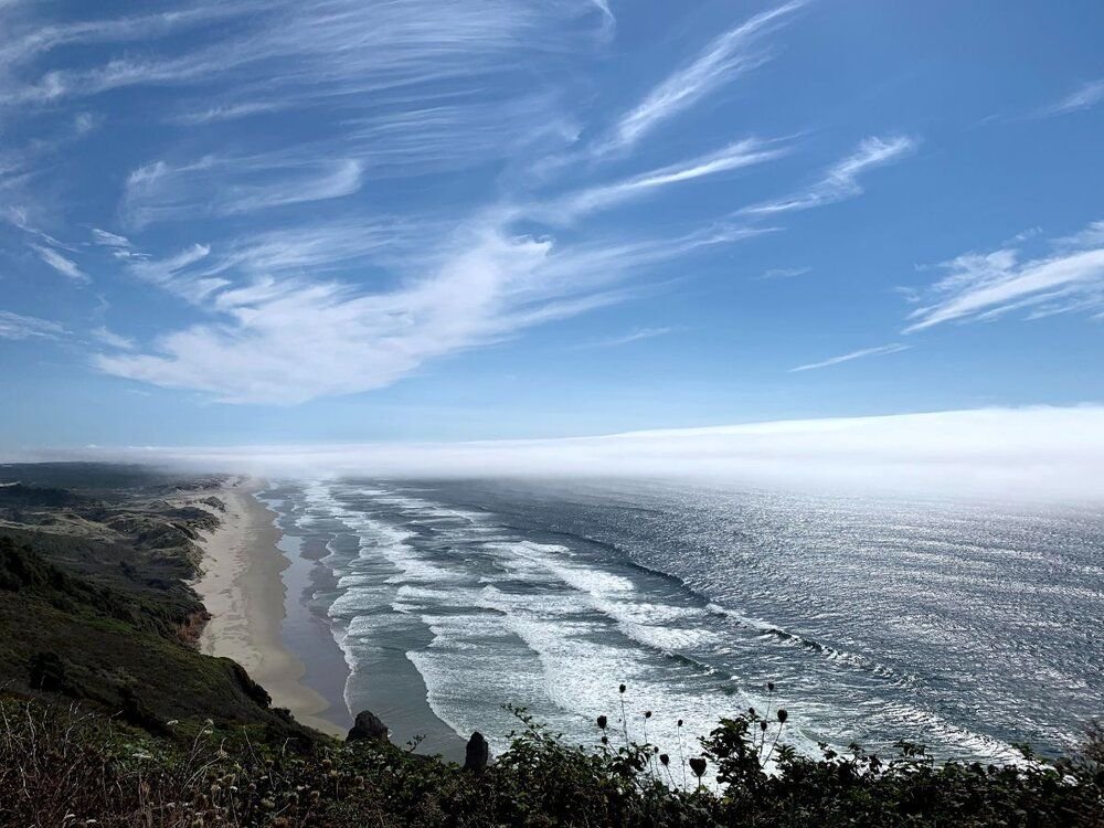
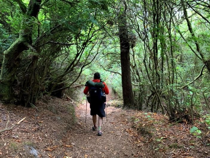
Cascade Head Recreation area is a highlight along the Oregon Coast Trail. Photo by Kate Hoch.
Enjoy this ~400-mile thru-hike along sea cliffs, forested headlands, and wide-open sandy beaches with numerous restaurant and inn-to-inn options along this border-to-border hike of Oregon. Hikers will visit many of Oregon’s iconic beaches, boardwalks, and tourist towns, as well as remote coastal destinations.
Distance: ~400 miles
Days: 30
Elevation gain/loss: 25,740 feet/ 25,765 feet (depending on route)
Best season: June to September
Permits: None required for hiking
Difficulty: Moderate
Related: Corvallis to Sea Trail (C2C) Backpacking Guide
Read More: Oregon Desert Trail Thru-hiking and Backpacking Guide


We create reader-supported, objective, independently-selected gear reviews. This story may contain affiliate links, which help fund our website. When you click on the links to purchase gear, we may get a commission — without costing you an extra cent. Thank you for supporting our work and mission of outdoor coverage for every body! Learn more.

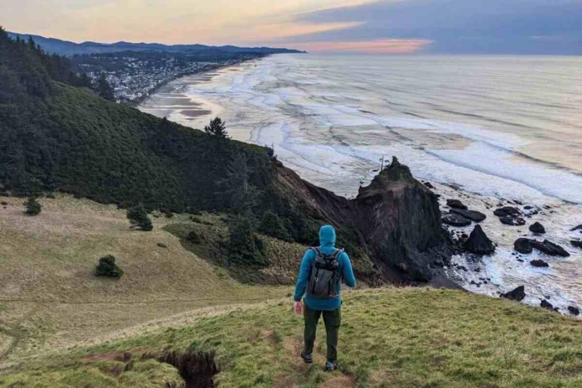
One of the perks of the Oregon Coast Trail are the ocean views from hiking the headlands. Photo by Whitney LaRuffa.
Quick Facts
The Oregon Coast Trail (OCT) is a 400-mile long distance trail that spans across Oregon from its border with Washington to California.
With frequent access to amenities like showers, hotels, WiFi, this thru-hike feels at times more like a European inn-to-inn wander than a typical US thru-hike. Still, there are days when your trails may be so remote that you may not see other people.
Keeping with the spirit of adventure, wayfinding, trail makers, and trail maintenance are not always guaranteed on the OCT. Rivers, estuaries, and sand volume change yearly and with each season; thus, maps may not be completely accurate, making each hiker’s experience unique. Some walking along paved roads is required.
Hikers will walk beaches and forested headlands, and enjoy the novelty of hitching boat rides from crabbers and anglers around big bays. Hikers will navigate tides with wildlife viewing of elk, marine mammals, and tide pools.
The OCT is a mix of wild adventure and peaceful saunter, giving thru-hikers a way to experience all of Oregon’s 262 miles of publicly-owned beaches and 64 miles of publicly-owned headlands.
The Oregon Coast land is the land of the Clatsop, Tillamook, Yaquina, Alsi, Siuslaw, Kuitsh, Coos, Coquille, Tututni, Chetco, and Tolowa people. Support indigenous-owned businesses along the trail and learn about causes in Oregon that are indigenous-led like the Oregon Native American Chamber.
Related: Appalachian Trail Gear List & Strategy
Read More: Pacific Crest Trail Gear List & Strategy

The OCT has numerous sea stacks, islands, and other formations that can only be accessed from the beach at low tide. Many sea stacks are protected for wildlife habitat and are closed to the public if they are in the Oregon Coast National Wildlife Refuge. See the Oregon Department of Fish and Wildlife for more information. Photo by Whitney LaRuffa.
Highlights
Dramatic changes in topography from sandy beach, to sand dune, to rainforest to coast range mountain, to headland cliff — often with an ocean view.
Wildlife sightings of elk, bears, mountain lions, seals, sea lions, and grey whales as well as crabs, anemones, starfish, and other sea creatures in tide pools.
Birdwatching from bald eagles to tufted puffins as well as coastal birds and songbirds in the forested sections of the trail.
Wide access to high-quality restaurants-especially fresh seafood. Expect fresh salmon, rockfish, Dungeness crab, and razor clams; in late summer, there’s albacore tuna. Many opportunities for fresh clam chowder, fish and chips, and fish tacos.
Plentiful hotels, hot showers, flush toilets, and clean tap drinking water.
Nearly every trail town has a coffee shop and brewery. Most towns also have weekly farmer’s markets with fresh produce.
Resupply is never an issue! Food carries are minimal — meaning that your backpack never needs to be heavy.
The novelty of flagging down boats to hitch rides across major bays.
Navigation changes from year-to-year as rivers and creeks change, which adds a spirit of adventure and the satisfaction of exploration to the trip; it requires hikers to be creative and flexible.

The Oregon Coast Trail isn’t just beach walking! You’ll hike through fern-filled forest, headlands, and sand dunes. Photo by Naomi Hudetz
challenges
Cost: More expensive per mile than other thru-hikes, as there are much more food and lodging options than the usual backpacking trip. Free beach camping is not always legal and staying at hotels or fee-based hiker-biker camps are essential to completing the route. Boat shuttles around bays also add up.
Logistics: Compared to other thru-hikes, more planning is required to figure out where it is legal to camp, get potable drinking water, or go to the toilet. The Hiking the Oregon Coast Trail guidebook (Amazon, Bookshop) breaks up the trail into suggested itineraries for thru-hikers or inn-to-inn backpackers, making day-to-day planning significantly easier.
Wind: Winds can be an issue, often reaching 20+ miles per hour. They come from the north to northwest, so the guidebook and experienced OCT thru-hikers strongly suggest heading southbound. Most OCT thru-hikers prefer hiking southbound to minimize wind exposure; northbounders may have a less enjoyable experience.
Perpetual dampness: Even if it’s not raining, any Oregon coast hike is usually extremely humid. Expect heavy condensation in your tent at night and limited opportunities to dry out your gear.
Road walking along US 101: Although the newest guidebook describes a route where road walking makes up 10% of the route — mostly at stretches less than a mile — hikers will still have to road walk to get around some private property.
Navigation skills required: Navigation can be tricky as maps are never totally accurate because river and tidal patterns change from year-to-year and season-to-season. In addition, rivers and creeks change yearly, and headland landslides can take out steep seaside cliffs.
Patience and Flexibility with Boat Rides: Boat rides around bay mouths rely on finding boaters — who are not always available and working with your schedule. When boat rides aren’t available, you’ll have to be patient, creative, and flexible and may even need to hitchhike, taxi, or road walk.
River fords: Hikers will have to cross some rivers. During June to September, they are usually passable, but may be too high to ford during high tide. The guidebook (Amazon, Bookshop) describes which rivers must be crossed at low tide only and how to get to the nearest bridge in the event that a river is too high to cross.

Another Oregon Coast highlight are the beach sunsets, as seen here on the OCT in Manzanita, OR. Photo by Liz Thomas.

Signage in some parts of the OCT can be quite good. In other parts, it is a choose your own adventure. Photo by Whitney LaRuffa.
Difficulty and Skills
Navigation
Bonnie Henderson’s Hiking the Oregon Coast Trail guidebook (Amazon, Bookshop) is essential to finding secret connector trails, tidal planning, and searching for boat rides across major bays to reduce road walking time along US 101.
While hiking the coast is possible without the book and associated maps, the guidebook will make it significantly easier and more enjoyable. Additionally, Henderson’s website www.hikingtheoct.com has up-to-date information to supplement the guidebook.
Road Walking
To get around private property, steep sea cliffs, and/or to access bridges across some risky rivers, hikers may need to walk short stretches along the shoulder of US 101. This highway has a narrow shoulder and can be unsafe for pedestrians because cars drive so fast. Visibility to drivers can be an issue when the highway makes is windy or steep or weather is poor. The most up-to-date route in the guidebook states that almost all of the stretches along US 101 are less than a mile. However, without proper maps and directions, some hikers have spent up to 40% of the route along US 101.
We recommend consulting the guidebook and doing extensive mapping and research to minimize road walking. One way you can do this is by taking boat shuttles across bays, calling local taxis, or hitching the sections.
If you must road walk, walk facing traffic, wear highly visible clothing, and aim to walk in the morning when traffic is lighter. You may also consider hiking the trail in September, when much of the summer RV traffic is gone for the season. See the guidebook for pros and cons of hiking the trail for each month.
See our section below on How to Avoid Road Walking on the OCT for more information.
Navigating the Tides
Hikers must have the skills to navigate around each headland and to ford rivers and creeks that are impassable during high tide. Know the tide cycle and time your hiking each day accordingly. The guidebook is an excellent source to determine which sections will require knowledge and navigation of the tides. Henderson’s guidebook recommends the free app Tide Alert NOAA USA.
Coastal Hazards
Read up on the hazards of coastal walking — from incoming waves and riptides to getting trapped on the headlands. Ocean water can be hypothermia-inducing. Sneaker waves (unusually high waves) are always a possibility. Although highly unlikely, it’s worth being aware of what to do should a tsunami occur. This primer details what to know about hiking Oregon's coastline.
Campsite Planning Required
Unlike some other thru-hikes, free dispersed camping on public land is not possible every night of this hike. Oregon state laws make free beach camping impossible to do every night. Hikers don’t need reservations for every night of their trip, but you will need to be flexible. Those who want to hike sections 1 to 3 from inn-to-inn will definitely need reservations.
While there is some free beach camping, it’s not possible every night. You’ll have to plan the length of your days around where camping is legal or where hotels are available. Hikers should be able to hike 10 to 15 miles per day, which is the minimum distance to hike between legal campsites.

Time your OCT hike for a season where the river and creek fords are passable. Photo by Whitney LaRuffa.
Best Season
June to September are the best months, though in some years, it may be possible to hike earlier or later depending on the weather.
River levels in the spring can be too high to ford across. In some years, it may be possible to start as early as April or May, although it’s not recommended. In those months, rain is much more likely and boat ferry services may not be operational. To get around the large bay mouths, you’ll need rides from boaters, who are more likely to be out from July to September. Expect temperatures averaging in the 60s, and some days with rain, fog, and/or wind.
Permits and Fees
Hikers don’t need a permit. However, if you park a car at Oregon State Park or a US Forest Service trailheads, you may need to make reservations to get a permit. Call beforehand to find out local permit requirements for parking. You will also have to pay campsite fees for walk-in campsites.

Bonnie Henderson’s new guide to the Oregon Coast Trail is the best resource for distance hikers and backpackers.
Maps and Guidebooks
Guidebooks
Bonnie Henderson’s Hiking the Oregon Coast Trail (Amazon, Bookshop) is the best resource for navigating the OCT, figuring out campsites and lodging, and researching where you need to be aware of the tides. The OCT is a logistics-heavy long distance trail. Henderson has hiked the OCT more times than anyone (literally!) and knows hidden connector trails and insider scoops to reduce roadwalking and maximize safety and enjoyment of the hik.
Gaia
Navigation is made easier with a GPX route and our favorite app for mapping is the Gaia App.
Before we left for the trail, we downloaded the surrounding background maps using Gaia GPS.
Henderson’s website www.hikingtheoct.com has an up-to-date GPX track that you can download. However, be aware that the route is constantly changing with the seasons and from year-to-year as rivers move, sand levels change, or landslides close hiking trails. Do not rely on the GPX track alone.
Maps
Green Trails Maps recently released 3 maps that cover the entire OCT — Astoria to Newport (North Coast map), Waldport to Cape Arago (Central Coast map), and Bandon to Brookings (South Coast map). We’re big fans of Green Trails maps, and the OCT maps are waterproof, tear resistant, and ultralight!

The view from Neahkahnie Mountain near the town of Manzanita in Section 1.
Route Summary
The following is a bird’s eye view of some of the highlights of the 5 sections of the trail. Bonnie Henderson’s Hiking the Oregon Coast Trail breaks each section down into what you’ll see each day, intersections, water, toilet, and camping availability as well as resupply, lodging, and alternates. See the guidebook for on-the-ground level details.
Section 1
The Oregon Coast Trail has an epic start — at the mouth of the Columbia River, the border between Washington and Oregon. You’ll begin at Fort Stevens State Park — Oregon’s longest, widest beach. Then you'll traverse majestic headlands and iconic Oregon landmarks of: Tillamook Head, Haystack Rock, Cape Falcon, Arch Cape, Oswald West State Park, and Neahkahnie Mountain.
You’ll also visit fun, popular coastal beach towns like Cannon Beach and Manzanita, with many options for cafes and restaurants. You’ll pass landmarks such as the remains of the ship The Peter Iredale, Tillamook Rock Lighthouse, and wildlife viewing opportunities. This section passes through the ancestral land of the Clatsop and Tillamook people.
Section 2
From Garibaldi to Siletz Bay, you’ll walk the remote Tillamook Coast to ascend Cape Meares, Cape Lookout State Park, Cape Kiwanda, and Cascade Head. This scenic section goes from wide beaches to temperate rain forests through the ancestral land of the Tillamook people.
Hikers can visit the world-famous Tillamook Creamery, which could be directly on the route for those who walk around Tillamook Bay, or otherwise not far from the main route. Tillamook is also home to one of our favorite breweries on any long trail, de Garde Brewing. De Garde uses wild fermentation in their beer production, rather than cultured yeast. (In fact, de Garde chose Tillamook for their brewery because of the abundance of microflora in the air from the surrounding dairy farms.)
Cape Mears State Scenic Point and National Wildlife Refuge is home to a lighthouse, the strange octopus tree, and numerous birds, including peregrine falcons. Both Cape Mears and Cape Lookout are made of basalt. Sandstone Cascade Head is considered arguably Oregon Coast’s most iconic hike and the only United Nations Biosphere Reserve in the state. Good trails take you deep into Sitka Spruce Siuslaw National Forest. Finally, you’ll end at the popular tourist town of Lincoln City, after passing through beaches famous for kite flying.
Section 3
Siletz Bay at Lincoln City to Florence takes hikers over Otter Crest, Yaquina Head, Cape Perpetua Scenic Area, Heceta Head, and Sea Lion Point, with many opportunities to visit towns, eat at quality restaurants, and resupply at grocery stores. It’s considered one of the best sections for inn-to-inn hiking but also has many hiker-biker campsites and surfer showers.
This section is the ancestral home to the Tillamook, Yaquina, Alsi, and Siuslaw people. You’ll pass the tallest lighthouse in Oregon. There are numerous opportunities for whale watching as well as tidepools at the Spouting Horn, a rock formation that looks like a fountain at high tide. It’s also home to one of the few remaining old growth forests on the Oregon Coast with 600 year old trees.

The OCT has opportunities to find starfish and explore tidal pools. Photo by Whitney LaRuffa.
Section 4
Florence to Port Orford is the most remote section of the OCT, passing through the Oregon Dunes National Recreation Area. There’s many opportunities for free dispersed camping; almost no need for road walking; and long, remote, undeveloped sections of beach to walk.
This section visits the ancestral lands of the Siuslaw, Kuitsch, Coos, and Coquille people. You’ll visit Shallow Sunset Bay State Park, one of the warmest sections of water along the OCT, which is one of the few places where there are swimmers. You’ll also walk to the westernmost point in Oregon at Cape Blanco State Park. This and the following section are where you should plan to carry more food and water than other parts of the trail.
Section 5
Port Orford Heads State Park to the California border is a scenic stretch with some logistical challenges. It passes Sisters Rock, Crook Point, and some rocky trail far above the beach at Boardman State Scenic Corridor. Again, plan to carry more food and water for this more-remote part of the OCT. It’s the traditional lands of the Coquille, Tutuni, Chetco, and Tolowa people.
Getting There
By Plane
Portland International Airport (PDX) is the closest major airport to the northern terminus. This flight tracker can find flights to PDX from anywhere in the world.
Rogue Valley International-Medford Airport (MFR) is the closest major airport to the southern terminus. MFR is a much smaller regional airport. This flight tracker shows flights to MFR.
By Train
Amtrak stops at Portland Union Station, where you can get a bus to Astoria. The Point offers daily service from Union Station to Astoria. NW Connector also offers bus service, but requires a transfer.
Bus and Shuttle Services
From Portland, take the MAX light rail to downtown Portland where you can catch a bus from Union Station to Astoria. The Point offers daily service from Union Station to Astoria. NW Connector also offers bus service, but requires a transfer.
From there, you can get a local taxi to the northern terminus or take NW Connector transit to Fort Stevens State Park where the hiking trail starts.
To connect between coastal towns, check the NW Connector bus for schedules in the northern part of the hike.
From the Southern Terminus, take a taxi, hitch hike, or walk about 3 miles to the nearest town. You’ll likely have to spend a night in Brookings, Smith River, or Crescent City before catching a 3 to 5 hour bus ride to the Medford airport. The Point transit offers service from Brookings, Oregon to the Medford airport. Brookings also may offer non-stop bus service from Brookings to Portland Union Station.
Visit this website for a comprehensive list of all transportation options on the entire Oregon coast!
Trailheads
Northern Terminus
The northern terminus of the Oregon Coast Trail is in Fort Stevens State Park. This trailhead has full-service facilities and it’s one of the nation’s largest public campgrounds. Much of the fort is preserved and can be toured — there’s even an historic shipwreck!
You can take NW Connector transit from Astoria to Fort Stevens State Park.
Southern Terminus
The southern terminus of the Oregon Coast Trail is the California border, near Crissey Field State Recreation Site. The closest town to the trailhead is Brookings, Oregon. The Point transit offers service from Brookings to Medford airport.
Alternate Trailhead
For section hikers, there are many options for alternate trailheads. You may need a trailhead overnight parking permit. See the guidebook for more information on where to park and related fees.

Aside from the northern and southern termini, numerous trailheads to access the OCT exist all along the route. The guidebook outlines where they are and how to backpack or day hike along the OCT. Photo by Whitney LaRuffa.
Post-Trip Favorite Restaurant
The OCT has some of our favorite restaurants and breweries of any long distance hike. On trail, we highly recommend de Gaarde Brewing. Here are two of our favorite places at the termini.
Astoria
Astoria is the oldest city in Oregon, and the first European settlement west of the Rockies. It sits at the mouth of the Columbia River where the river flows into the Pacific Ocean. The classic movie, The Goonies, was filmed here. Today it’s home to numerous restaurants and breweries — our favorite is Fort George Brewery for both food and beer.
However, we’d also recommend turning the trip into a full brew-thru in Astoria by also visiting Buoy Beer Company and Reach Break Brewing. Nekst Event offers fantastic globally-inspired street food. For breakfast and lunch we highly recommend Astoria Coffee House & Bistro. For fish and chips, you won’t want to miss Bowpicker.
For dessert, the best carrot cake we’ve ever had is from The Naked Lemon Bakery. Do. Not. Miss it.
Brookings
Brookings is the southernmost town on the Oregon coast, with excellent dining options. If you’re not tired of the fantastic Oregon seafood by this point, we highly recommend Catalyst Seafood. Brookings is also home to two excellent breweries — Chetco Brewing and Misty Mountain Brewing.
Forested sections of the OCT can be home to wildlife including bears and raccoons, which can be persistent in trying to access your food. Be considerate of wildlife throughout your trip. Photo by Naomi Hudetz.
How to Avoid Road Walking Highway 101 on the OCT
Unfortunately, there are still sections on the Oregon Coast Trail where road walking on Highway 101 is the only option. Highway 101 is unsafe for pedestrians. If you would like to avoid these road walks, we recommend hitchhiking or using one of the various transit options along the Oregon Coast. All of the transit options along the coast are listed here.
Regulations
Follow Leave No Trace Ethics, including camping and pooping far from water. For almost all of the trip, you'll be camping at hiker-biker campgrounds, many run by Oregon parks. These are good opportunities to get fresh water and use a flushing toilet, too.
Toilet Rules: There are numerous flush and pit toilets along the route and they are mapped and noted in the guidebook. Additionally, there are numerous port-o-potties near the OCT. For emergencies, carry a trowel and dig a cathole far from the hiking trail, private property, or intertidal zone. Catholes must be at least 6 inches deep for solid waste and pack out used toilet paper.
Follow Snowy Plover signs and fencing when you are on a beach trail. The snowy plover is a shorebird that nests on sandy beaches and is endangered. There is no camping, beach fires, or dogs allowed in these areas. You also must walk only on wet sand through these sections (because the birds nest in the dry sand).
Camping is not legal on some beaches. There is no legal camping on beaches adjacent to many towns. Additionally, there is no camping adjacent to Oregon parks (stay at the state park hiker-biker campsites instead). There is no camping allowed in snowy plover protected areas. The guidebook explains which beaches are and are not legal for camping.
Beach fires are not legal on some beaches. Beach fires are only allowed on open sand inland of the vegetation line. Do not build beach fires next to drift logs or driftwood, as these are difficult to extinguish.
Dogs are not allowed on some beaches that have restrictions to protect the endangered snowy plover. As a result, having a dog on a backpacking multi-day trip on the OCT can be logistically difficult.
Resupply
Resupply is very easy on the Oregon Coast Trail. You’ll pass through many towns along the way — too many to list in this guide. Some towns have very good grocery stores, and some are more limited.
The guidebook lists resupply options for each day you are on the trail, so there are plenty to choose from. You will rarely need to carry more than 2 days worth of food. If you’re super picky, then you may want to do more detailed resupply planning.
Note that the southern two sections of the OCT, Section 4 and Section 5, are more remote. You’ll have to camp without options for inn-to-inn meals. See our What to Bring section on suggestions for backpacking stoves and meals.
Water Planning
Unlike other thru-hikes, the naturally flowing water sources along this hiking trail are highly contaminated by salt, highway, and urban agricultural runoff. Experienced hikers recommend that you do not drink water from streams and rivers. Instead, the guidebook lays out water planning for this route. The maps list out potable water sources. In general, hikers will not need to carry a full day’s worth of water (10 to 15 miles between campsites). The exception is the remote Sections 4 and 5.
Bears and Food Storage
There are bears along this route, although raccoons and jays may be a bigger threat to your food. Many hiker-biker camps have lockers where you can store your food away from critters. See REI’s Food Storage story or REI’s Bear Canister story for more recommendations on keeping animals away from your food.

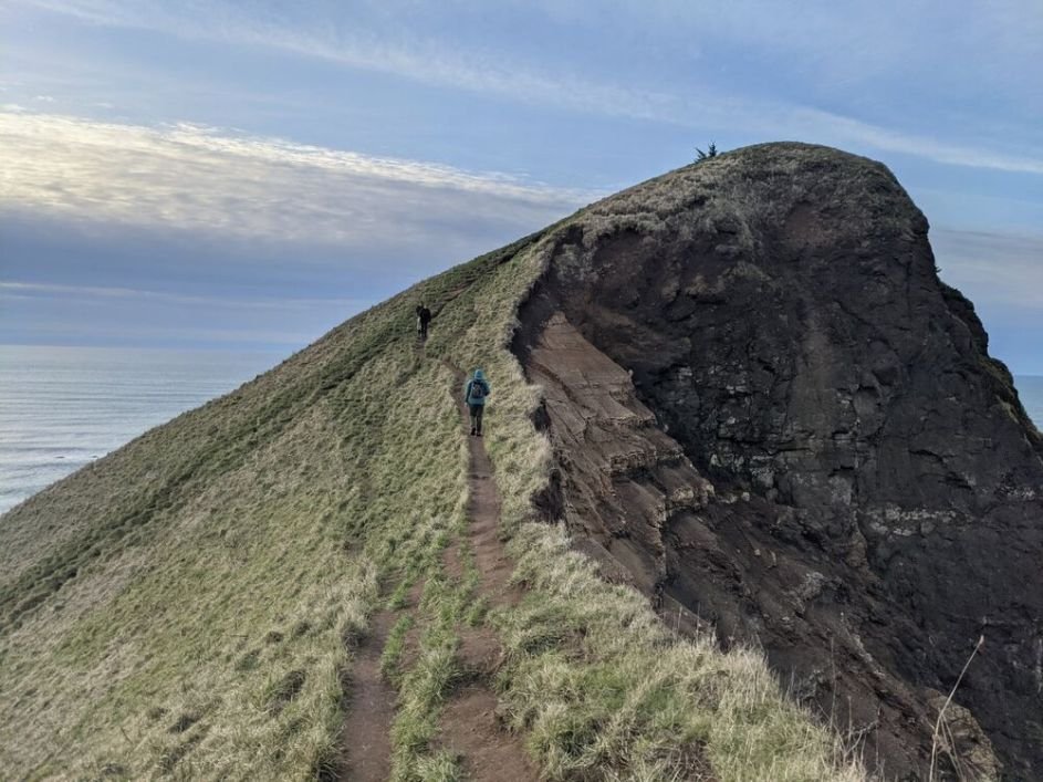
God’s Thumb is a notable side trip not far from the official route of the OCT. Photo by Kate Hoch.
Side Trips and Variations
Side Trips
There are many opportunities for side trips to peaks or natural or historic landmarks on the Oregon Coast Trail. Some of the top choices include:
Cascade Head
God’s Thumb
Hugbug Mountain
Minus tide beach walking — only possible a few times a year, these are sections where the low tide is below 0 in height
Variations
There are many variations on this route; they’re dictated by the tides, your ability to get a boat ride across bays, changes in rivers and sand levels, private property changes, whether the military is training on the beach, sandy plover endangered species beach closures, landslides, and more. The guidebook outlines many alternates depending on the conditions you may face in any given section.
Continue the OCT on the California Coastal Trail
Some hikers continue hiking the California coast for another ~100 miles on the California Coastal Trail. You'll travel through the redwood forests to Arcata. Read about the California Coastal Trail here from the California Coastal Trail Association and here from the California Coastal Conservancy.

Treeline editor Naomi Hudetz’s backpacking gear set up for for hiking on the Oregon Coast Trail. Photo by Whitney LaRuffa
Gear List
TREKKING POLES
Sections of this coastal hike, especially in the headlands, are rocky. Trekking Poles can also help with fords. We carry the Black Diamond Trail Ergo Cork poles along the coast, which are the most durable poles we’ve used. See our Best Trekking poles story for more detailed recommendations.
TENT
State Park hiker-biker campgrounds have a lot of people and lack privacy. Condensation is difficult to manage on the OCT, so we recommend a double-walled ultralight tent with a bathtub bottom.
Our tent for the OCT was the Six Moon Designs Haven Tarp with the inner NetTent — a double-walled, 2-person shelter that only weighs 34 ounces. Check out our Best Backpacking Tents story for more recommendations!
BACKPACK
A pack made of some material with waterproof properties is a plus on this coastal hike. The top winner from our Best Lightweight Backpacking Backpack guide is perfect for the OCT: the Six Moon Designs Swift X. We also have a long-term review of the Swift X.
You can buy the Swift X in either Liteskin or X-Pac material — both of which are waterproof. However, since the seams are not sealed, the pack itself isn’t waterproof. Therefore, we recommend a good pack liner too.
SLEEPING BAG
You’ll likely not need a sleeping bag below 40°F degrees for this trip. We carried our beloved Katabatic Palisade 30°F down quilt and we were perfectly warm.
Condensation was frustrating on this trip, so you may want to consider a quilt with synthetic fill rather than down fill. Enlightened Equipment has great options for synthetic quilts. In addition, check out our Best Backpacking Sleeping Bags guide for sleeping bag recommendations.
SLEEPING PAD
A compact lightweight pad is nice for comfort because the state park campgrounds often had compacted, hard ground. The Therm-a-Rest NeoAir XLite was the perfect choice for the OCT. See our Best Backpacking Sleeping Pads guide for more suggestions.

Dinner in a hiker campsite.
CAmp KITCHEN GEAR
The OCT is known for Portland-quality restaurants in the many seaside trail towns. That’s what makes this trail one of the best opportunities for an inn-to-inn thru-hike in the US. Still, Section 4 and Section 5 in the southern part of the trail are remote. You’ll likely have a night here or there camping on the beach, so you’ll need to bring your own dinner for at least a handful of nights.
GOOD BACKPACKING FOOD
For an OCT backpacker accustomed to fine dining cuisine almost everyday of the trip, the few nights of the typical freeze-dried camp food can be a stark contrast. The closest dehydrated backpacking food we’ve found to fine dining are the Good-to-Go meals. They’re actually made by a French Culinary Institute in Manhattan graduate chef who has worked alongside top chefs in New York Times rated 4-star restaurants.
Another unexpected benefit of the Good to Go Meals is that they offer flavor-rich dishes that can be tricky to find on the coast, like Bibimbap and my favorite, Thai Curry. So if you’re in town and are tired of your 14th bowl of clam chowder, you can still get some variety.
STOVE
It’s quite easy to go stoveless on most of the OCT with the abundance of restaurant meals and coffee shops along the way. However, if you like hot coffee in camp or hot meals after a day of walking in the rain, we recommend carrying a stove. Additionally, if you thru-hike or backpack the remote southern portion of the trail (Section 4 and 5), you won’t have access to restaurant meals every day. Since wind is a constant presence on the OCT, we carried the Soto WindMaster backpacking stove and highly recommend it. See our Best Backpacking Stoves guide for more recommendations.
COOKING POT
We carried the Toaks Titanium 750mL pot on the OCT. It’s the perfect size for one — it will fit an entire box of mac & cheese. See our Best Backpacking Cooking pots story for more recommendations.
SPOON
Regardless of whether you go stoveless or not on the OCT, we highly recommend carrying a long handle spoon for beachside ice cream or clam chowder. We carried the TOAKS long handle spoon — we like it so much that it’s in our Backpacking Essential Accessories story and our gift guides.
WATER PURIFIER
Unlike most backpacking trips, we did not carry a water purifier. The naturally occurring water on the OCT is highly contaminated from urban and agricultural run-off. We, along with other experienced OCT hikers, recommend getting tap water in town. With that being said, if you absolutely must carry a purifier, you are going to be safer with some of our heavier water purifiers recommended for international travel from our Best Backpacking Water Filters guide.
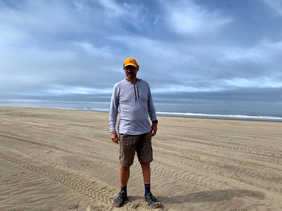
Treeline writer Mike Unger chose to wear merino wool on the OCT. Good footwear and a shirt and hat with good sun protection are a must. Additionally, have good rain gear. Photo by Naomi Hudetz.
What to Wear on the Oregon Coast Trail
In short, good footwear that can handle uneven beach walking, along with good rain gear, are must-haves on this hike. Additionally, we highly recommend that you choose clothing that is brightly colored with reflective material (maybe even a safety vest) for the sections of hike where you’ll need to roadwalk.
SHOES OR BOOTS
We wore the men’s and women’s Altra Lone Peaks while hiking on the OCT. They’re lightweight, comfortable, and dry quickly after fords. In addition, they had enough traction to manage the steep and muddy sections. The Altra Lone Peak 5s are our Long Distance Winners in our Best Women’s Trail Running Shoes story and Best Zero Drop shoe in our Best Men’s Trail Running Shoes guide.
If you’d feel more comfortable in boots, check out our Best Hiking Boots story or our Best Lightweight Hiking Boots story.
A nice footwear compromise for this trip would’ve been hiking shoes designed to feel like a trail runner but have stability similar to a boot. See our Best Hiking Shoes story for footwear that has more durability and stability than trail runners.
Additionally, if you are day hiking sections of the OCT, you may be more comfortable in hiking sandals. Many people feel more comfortable on beach hikes wearing sturdy sandals. See our Best Hiking Sandals guide for our recommendations.
HIKING SHIRT
There were days with full, all day long sun exposure on the OCT. At the same time, the humidity can make your clothes damp, even if you’re not sweating. Therefore, we recommend a merino wool sun hoody.
We wore the Minus 33 Woolverino ¼ zip hoody and can’t say enough good things about it. It’s 84% merino, 12% nylon, and 4% spandex — the spandex gives it the perfect amount of stretch. The ¼ zip is great to vent excess body heat, and it also has a functional chest pocket. See our Best Sun Shirts guide or Best Base Layers guide for more recommendations.
HEADLAMP
Not only are headlamps handy to have when trying to navigate hiker-biker camps on the OCT, but they’re one of the Ten Essentials for general safety. We carried the BioLite Headlamp 330 rechargeable headlamp. The more we use this headlamp, the more we love it. See our Best Headlamps guide for other recommendations.
RAIN JACKET
Good rain gear is essential on the OCT any time of year. We carried the the Patagonia Torrentshell 3-layer rain jacket (women’s and men’s). We’re glad we had the extra protection of a 3-layer rain jacket, as rain on the Oregon coast was heavy. See our Best Lightweight Rain Jackets article for more recommendations.
RAIN PANTS / SKIRT
We carried the ULA Equipment rain kilt and the Zpacks DCF rain kilt on the OCT and we were very happy with our choice. The soaking rain on the OCT lends itself to a rain skirt rather than rain pants.
SYNTHETIC INSULATED JACKET
We both carried the Patagonia Micro Puff jacket (women’s and men’s). It’s a synthetic-fill insulated jacket, rather than a down jacket. With synthetic fill, we didn’t have to worry about it getting damp or wet. Patagonia claims that it has the best warmth for the weight of any of their jackets. It’s the overall winner in our Best Synthetics Jacket guide. See our Best Synthetic Insulated Jackets guide for more recommendations.
PANTS
For sun protection, we wore pants on the OCT. The Ferossi pant from Outdoor Research (women’s and men’s) worked well — they’re lightweight, but functional. They’re winners in our Best Men’s Hiking Pants guide and Best Women’s Hiking Pants guide. The Ferrosi softshell fabric is the same as in the Outdoor Research Ferrosi softshell, the winner in our Best Softshells guide.
MISCELLANEOUS GEAR
MAP AND COMPASS
One of the ten essentials! We always carry our favorite Suunto M-3 D Leader compass.
FIRST AID KIT
We carried our homemade first aid kit. If you’d rather buy a pre-made first aid kit, Adventure Medical Kits has a great ultralight option.
UMBRELLA
Although the wind sometimes made using an umbrella challenging, we still carried the Six Moon Designs Silver Shadow with the hands-free attachment kit and we were glad to have it at times.
Other Resources
Transportation options on the entire Oregon coast
The Point transit system
NW Connector transit system
Green Trails Maps (North Coast, Central Coast, and South Coast)


