Oregon Desert Trail Backpacking and Thru-Hiking Guide
750 Miles of Remote and Rugged Solitude in Eastern Oregon

February 19th, 2026
Home > Trip Reports > Thru Hikes
Distance: 750 miles (mileage varies depending on route alternatives)
Time to hike the entire trail: 5 - 7 weeks
Elevation gain: 72,000’
Elevation loss: 73,500’
High Point: 9,570’ (Steens Mountain)
Low Point: 2,664’ (Owyhee Reservoir)
Best season: Spring or Fall
Permits: A backcountry camping permit for the Hart Mountain Antelope Refuge is required if you camp outside an established camping area.
Difficulty: Strenuous


We create reader-supported, objective, independently-selected gear reviews. This story may contain affiliate links, which help fund our website. When you click on the links to purchase gear, we may get a commission, without costing you an extra cent. Thank you for supporting our work and mission of outdoor coverage for every body! Learn more.

Quick Facts
The Oregon Desert Trail (ODT) is a 750-mile route extending through the high desert of Eastern Oregon from the Oregon Badlands, east of Bend, to the Owyhee State Park near the Idaho border. It is a remote, rugged, challenging trek through central and southeastern Oregon’s high desert natural and cultural highlights.
The Oregon Natural Desert Association (ONDA) established the ODT within the last fifteen years to highlight the Oregon High Desert. Only a few dozen people a year attempt to thru-hike the ODT. The ODT also provides great section hiking and multi-sport (biking, horseback riding, and winter sport) opportunities.
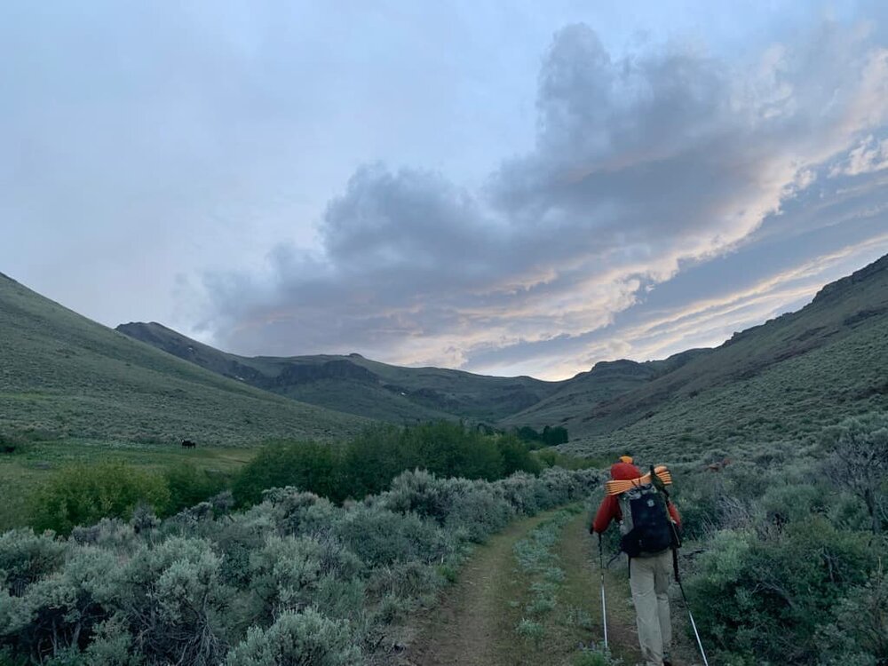
The Oregon Desert Trail is more of a route through the high desert than a trail in the traditional sense; it combines existing trails, old two-track roads, and cross-country travel into a route. The ODT is not a federally-recognized trail. It does not have blazes or markers like those found on a national scenic trail like the Pacific Crest Trail or Appalachian Trail. Junctions are not marked. Good navigation skills are a must. Hikers can choose between alternative routes to find the best way through large cross-country stretches. Below is approximate mileage by surface type:
Trail: 66 miles (10%)
Cross County: 262 miles (35%)
Primitive Road: 319 miles (41%)
Maintained Road: 66 miles (9%)
Paved Road: 38 miles (5%)
Related: Pacific Crest Trail Gear List & Strategy and Appalachian Trail Gear List & Strategy
Related: Guide to Backpacking and Thru-hiking the Blue Mountains Trail

Highlights
Diverse terrain, from grasslands to subalpine, to low and high desert to river canyons highlighting some of the most scenic parts of eastern Oregon.
Abundant wildlife, including mule deer, pronghorn, and wild horses.
Solitude: many days, you will not see another person-hiker or otherwise.
Multiple alternative routes, allowing thru-hikers to “choose their own adventure.”
challenges
Extreme temperatures
Long, waterless stretches
Lots of slow, cross country travel
Navigation challenges
Resupply

GEAR LIST
Here is a quick list of the gear we used on the ODT. For more detail on why we chose these items, skip below.
| OREGON DESERT TRAIL GEAR | OUR PICK(S) | MORE OPTIONS |
|---|---|---|
| Gear | ||
| Hiking umbrella | Six Moon Designs Rain Walker Hiking Umbrella (Naomi) Six Moon Designs Silver Shadow Trekking Umbrella (Mike) |
|
| Water filter/ coupler | Sawyer Squeeze Water Filter Sawyer Coupler |
Best Backpacking Water Filters & Purifiers |
| Water bottle | Cnoc Vecto 2L Water Bladder | Best Water Bottles for Hiking |
| Clothing |
When to Hike the Oregon Desert Trail
The ODT is a spring or fall long-distance trail since summers are too hot for most of the ODT. Snow and cold temperatures preclude winter or early spring/late fall thru-hikes.
Spring Start
Most spring thru-hikers start in mid-May. It is tempting to start earlier to avoid hot temperatures in the desert; however, early-season hikers will likely encounter lingering snow and even spring snowstorms in the high county. For example, a spring 2021 thru-hiker was rescued in the Fremont National Forest after a mid-May snowstorm.
Pros: More abundant water, long days, and wildflowers.
Cons: Snow in the high country, mosquitoes in marshy areas, and ticks are more common.
Westbound hikers may experience high water levels in the Owyhee Reservoir and Owyhee Canyon, potentially requiring hikers to swim around rocky outcroppings.
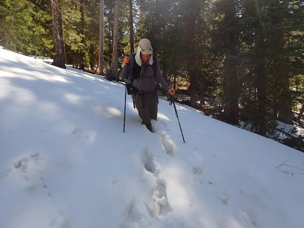
We hiked through deep snow patches in May on the Oregon Desert Trail.
Fall Start
Most fall thru-hikers start in mid-September, after the summer heat, and (hopefully) before the onset of winter storms.
Pros: Mosquitoes and ticks are less of an issue.
Cons: Increased water scarcity, high fire danger, shorter days, hunting season.
Where to start: Bend or Lake Owyhee State Park?
Most spring thru-hikers start in the Badlands, outside Bend. Most fall thru-hikers start at Lake Owyhee State Park and head westbound. The ODT databook, guidebook, and town guide are written assuming eastbound travel (and it’s always easier to hike in the direction that the guidebook is written). However, either direction works (although spring westbound hikers could experience higher water levels in the Owyhee Reservoir and Canyon). The following are some considerations for either option:
Eastbound (Oregon BadlandS Start)
The Badlands are only 14 miles east of Bend. Access is easy, and ONDA even provides a route to walk from Bend, if you desire.
ONDA recommends caching water at two locations in the Badlands region. The water caches are easier to coordinate if starting outside of Bend (since the caches are close to Bend).
The western section of the trail is less physically demanding, allowing thru-hikers to develop their “trail legs” before the most challenging sections (such as the Owyhee Canyonlands).
Westbound (Lake Owyhee State Park Start)
The starting point at Lake Owyhee State Park is very remote and does not have cell service. It is over an hour’s drive from Ontario or Vale, full-service towns with transit options. Hitching to reach the trailhead is difficult. Friends of Owyhee have expressed interest in helping hikers with shuttles. Contact them for more info: 541-212-1907, owyheefriends@gmail.com, www.facebook.com/ FriendsoftheOwyhee.
The Owyhee Canyonlands are the most physically demanding section of the hike. Plan for lower than average daily miles. There are long cross-country stretches. Shade is practically non-existent, and water is scarce when not in the Owyhee Canyon. This can make a particularly difficult start for your thru-hike.
Cell Phone Service
Cell phone service is extremely limited on the Oregon Desert Trail. If wireless coverage is important to you, we highly recommend using Verizon Wireless.
If you do not already hike with a satellite messenger, this is the trail where many thru-hikers break down and buy one. These messengers can work without cell service and allow two-way texting with cell phones. See our article on The Best Satellite Messengers and Personal Locator Beacons for our recommendations.

Oregon Desert Trail Route Summary by Region
ONDA has broken the ODT into four large regions. Each region is further broken into 20 - 40 mile sections. The ODT Guidebook provides detailed descriptions of the sections, including vehicle access information, making section hiking easier.
The following links from ONDA are useful including:
The following is a brief description of each region, written for eastbound hikers:

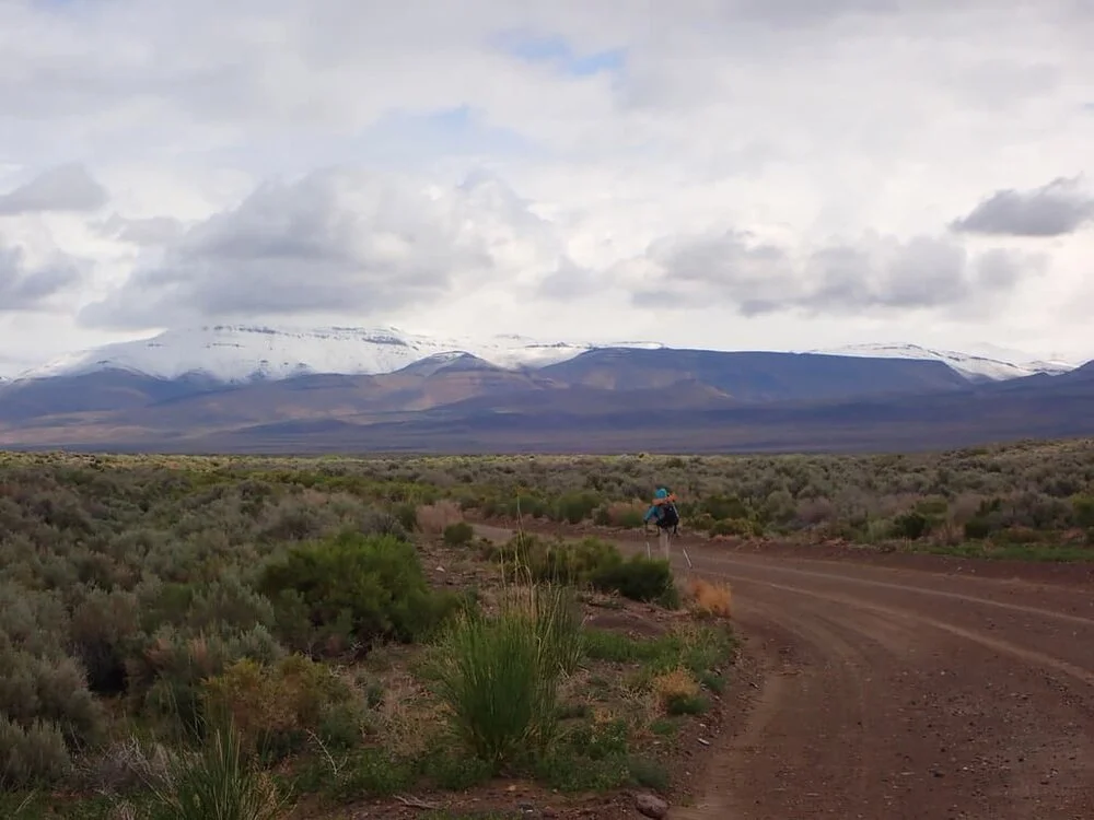
A good example of a well-maintained dirt road in the Oregon Badlands.
Region 1: Oregon Badlands to Paisley
Distance: 161 miles (the Christmas Valley alternative reduces the region’s length to 133 miles)
Elevation gain: 11,100’
Elevation loss: 10,200’
High Point: 6,175’ (Pine Mountain Campground)
Low Point: 3,406’ (Badlands Trailhead)
The Oregon Badlands is a federally designated wilderness area and a popular day hiking area. After a pleasant 9 mile hike on a good hiking trail, the route crosses Hwy 20, and the real ODT adventures begin. You will climb over a barbed-wire fence and start hiking cross-country to a primitive road. Like most of the ODT, much of the region continues the pattern of primitive roads (not recommended for cars) and cross country, with an occasional walk on a maintained road (gravel and paved).
There are beautiful views of the Cascade Mountains and Newberry volcanic formations, Ponderosa Pine forests, and cool rim walks.
This region is the driest of the ODT. After leaving the western terminus, there are no reliable water sources for 36 miles. ONDA provides recommended water cache locations. Plus, trail angels maintain two additional water caches. (Note: Email the Oregon Desert Trail coordinator at odt@onda.org for information on the water cache locations before you start your hike.)
REGION 1 RESUPPLY
BEND — MILE 0
Bend is a full-service town 14 miles from the western terminus.
CHRISTMAS VALLEY — MILE 100 (OR MILE 84 ON THE CHRISTMAS VALLEY ALTERNATIVE)
Christmas Valley is a full-service town with lodging, restaurants, and a grocery that should be sufficient for most thru-hikers to resupply. The alternative route goes right through town, avoiding a 19-mile hitch.
PAISLEY — MILE 161
The trail goes right through Paisley- which has a small motel, historic saloon, and market. You could resupply from the market if you’re not picky. Otherwise, we recommend sending a resupply package to the Post Office.

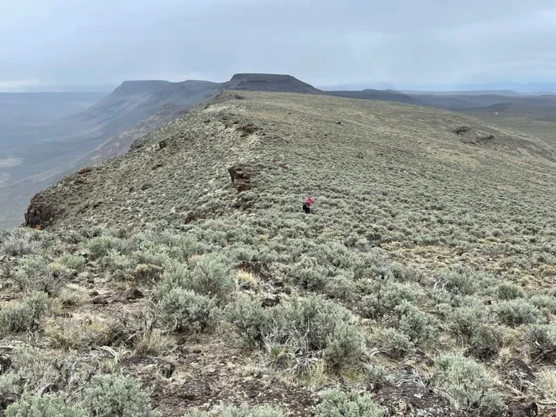
The Oregon Desert Trail shares tread with a portion of the Fremont National Recreation Trail, shown here.
Region 2: Paisley to Frenchglen
Distance: 214 miles
Elevation gain: 20,700’
Elevation loss: 21,000’
High Point: 7,608’ (Abert Rim South)
Low Point: 4,196’ (Frenchglen)
Out of Paisley, the route joins the Fremont National Recreation Trail (for 47 miles of the 135-mile FNRT) — the longest stretch of well-maintained and signed existing trail on the ODT. While it was closed in 2021 due to the Bootleg fire in 2021, it reopened as of Fall 2022. The Cougar Peak Fire in 2022 also closed a section of the Fremont-Winema National Forest, but it has since re-opened.
You will climb through Lodge Pine forests and traverse some high elevation subalpine areas. Spring hikers may encounter snow. Next, the route follows the Abert Rim, one of the most prominent continuous fault scarps in North America.
After the town of Plush, the ODT travels through the southern portion of the Hart Mountain National Antelope Refuge. The trail passes near hot springs at the Hot Springs Campground.
Note: Backcountry camping permits are required to camp outside established campsites in the Refuge. The permits are self-issued and can be obtained from the Hart Mountain Headquarters (on trail) or online. Backcountry camping is not allowed within ½ of a road. The ODT Guidebook states that backcountry camping is limited to areas between waypoints 191-193, 203-207, and 215-218. Check the Hart Mountain National Antelope Refuge website for the latest information regarding permits.
**As of February 2026, the ODT website states that the trail is closed through the Hart Mountain Refuge due to a fire in 2024. There is a closure map with a re-route. However, the anticipated end date was listed as June 2025. Contact ONDA for more info.
REGION 2 RESUPPLY
LAKEVIEW — MILE 208
Lakeview is a full-service town. It is a nine-mile hitch to Lakeview from the official route, or an alternative route allows one to walk directly to the town.
PLUSH — MILE 266
The trail passes within one mile of Plush. Plush has limited services; however, the Mercantile accepts resupply packages, sells snack items, and has a delicious grill.
FRENCHGLEN — MILE 374
The trail passes through Frenchglen. A small mercantile sells snack items; however, we recommend that thru-hikers send a package to the Frenchglen Hotel or the Steens Mountain Resort. The Frenchglen Hotel serves breakfast and lunches to go. Dinner is by reservation only.
Snow on Steens Mountain often doesn’t melt out until mid-July, keeping the road closed. We had the mountain to ourselves.
Region 3: Frenchglen to McDermitt (Hwy 95)
Distance: 165 miles
Elevation gain: 24,000’
Elevation loss: 23,600’
High Point: 9,570’ (Steens Mountain)
Low Point: 4,026’ (Alvord Desert)
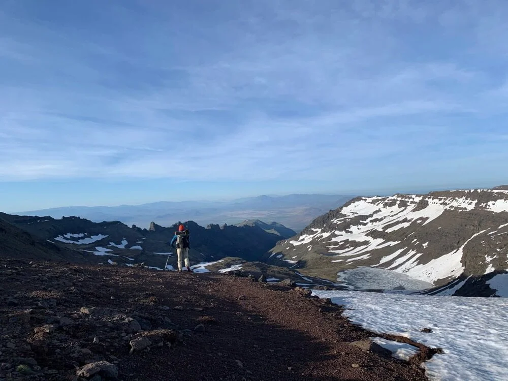
Leaving Frenchglen, you climb up to near the top of Steens Mountain. Spring thru-hikers will likely encounter snow near the higher sections in the Steens Mountain wilderness. On the official route, the descent to Wild Horse Lake can be hazardous when snow-covered (which is common into July). When snow-covered, ONDA recommends hikers seek a snow-free descent from near the communication towers.
The route from the Steens summit to the Alvord desert is perhaps the starkest contrast to the ODT. In a day, you will experience snowy subalpine to hot, flat open playa. Be sure to stop at Fields Station for a milkshake!
Next, you climb to the rugged Pueblo Mountains, where the cross-country route follows a series of cairns. It's a slow but beautiful journey highlighting the scenery of Oregon's high desert. Plan your daily miles accordingly.
REGION 3 RESUPPLY
FIELDS — MILE 439
The trail passes through Fields. Stop at Fields Station for a great burger and milkshake; however, aside from a meal, keep in mind that resupply is not possible in Fields. Fields Station no longer accepts resupply packages, and their market selection is little more than candy bars and chips. The staff said that they would be increasing their food options in the future. Instead, we recommend that thru-hikers send a resupply box to the Post Office to the next town along the route, Denio, Nevada.
DENIO — MILE 457
Denio, Nevada, is about a mile off-trail. A tavern (the Diamond Inn) serves food and has a very limited selection of grocery items. We recommend sending a resupply box to the Post Office, which is one mile south of the trail on a paved road. Lodging is available at Denio Junction, two miles south of Denio on a paved road.
MCDERMITT — MILE 539
It is a nine-mile hitch to McDermitt; however, an alternative route goes directly through town. McDermitt has lodging and a grocery store that should provide a full resupply for most hikers. There is even a casino with a restaurant.

There’s no trail through the West Little Owyhee River, requiring frequent river crossings and slow miles.
Region 4: McDermitt (Hwy 95) to Owyhee State Park
Distance: 212 miles
Elevation gain: 18,400’
Elevation loss: 20,000’
High Point: 6,470’ (Alcorta Rim)
Low Point: 2,664’ (Owyhee Reservoir)
The final region through southeast Oregon near the Idaho border is the most challenging and wild of the entire ODT. There is significant cross-country travel through the Owyhee Canyonlands. It is hot, dry, and shadeless (except when along the Owyhee River. The area is extremely remote; there is no cell phone coverage, and you will likely see no other people, except for near boat launches along the Owyhee Reservoir.
Despite its difficulties, the Owyhee Canyonlands are a highlight of the ODT. Much of the route is in the Owyhee Canyon, which is lush and beautiful; however, it requires scrambling over boulders, bushwhacking through willows, frequent river crossings (potentially requiring swimming), and a constant lookout for rattlesnakes. There is an alternative route that avoids much of the cross country through the canyon. It is also possible to packraft much of the region.
The two areas where you might experience a drop in your mileage are:
West Owhyee River canyon
Leslie Gulch to the eastern terminus
Note: There is little to no cell phone service for the rest of the ODT (going eastbound). There is wifi available at Rome Station, but no cell phone service. There is also no cell phone service at Owyhee State Park, the eastern terminus.
Getting to town from the eastern terminus can be tricky. The gravel road dead-ends at Indian Creek Campground (adjacent to the terminus) and hitching is difficult. Friends of the Owyhee may be able to help with logistics (please donate!). Contact information for Friends of the Owyhee: owyheefriends@gmail.com, 541-212-1907, www.facebook.com/FriendsoftheOwyhee
REGION 4 RESUPPLY
ROME — MILE 661
The trail passes very near Rome. Rome is not a town, but Rome Station accepts resupply packages, serves excellent food, sells limited snack items, and rents several small cabins. Rome Station is a welcome break about halfway through the hottest, the least shaded, and most challenging stretch of the ODT. Rome Station has WiFi but does not have cell phone service.
LAKE OWYHEE STATE PARK — MILE 750
The State Park has campgrounds, potable water, and pit toilets; however, there are no services, cell phone coverage, WiFi, or payphones. The nearest town is Adrian, 27 miles away. Vale (39 miles) or Ontario (45 miles) are the nearest towns with transit options.
ONTARIO — MILE 750
Ontario is a full-service city 45 miles north of Lake Owyhee State Park.

The Borax Lake area on the Oregon Desert Trail has open landscapes in interesting geological formations.
Oregon Desert Trail Resupply
The ODT is routed to allow for resupply every 3-6 days or so. The distance between resupply will depend on which alternative routes you select. Alternative routes into Christmas Valley, Lakeview, and McDermitt eliminate the need to hitchhike. Unfortunately, many towns in eastern Oregon lack a full-service market, requiring hikers to send resupply boxes.
The Oregon Natural Desert Association (ONDA) provides a comprehensive town guide. Below is our recommended resupply method for each town:
| Town | Trail Mile (Eastbound) | Trail Mile (Westbound) | Distance From Trail | Recommended Resupply | Notes |
|---|---|---|---|---|---|
| Bend | 0 | 750 | 14 W | Buy | Large, full-service city. |
| Christmas Valley | 84 or 100* | 650 | 19 W or 0* | Buy | Mid-size grocery in town. |
| Paisley | 161 | 591 | 0 | Buy or Mail | Small market; possible resupply if not picky. |
| Lakeview | 208 | 544 | 9 S or 0** | Buy | Full-service city. |
| Plush | 266 | 484 | 1 S | The small market has snacks, grill, and accepts resupply boxes. | |
| Hart Mountain HQ | 311 | 439 | 0 | Local trail angel will deliver resupply packages to Hart Mt. HQ. | |
| Frenchglen | 374 | 376 | 0 | A small market has snacks, but very difficult to resupply. | |
| Fields | 439 | 313 | 0 | No Resupply | Enjoy a burger and milkshake, but only snacks are available. Packages not accepted. |
| Denio | 467 | 284 | 1 S*** | No market. Snacks are available at Denio Jct. and the Diamond Inn. | |
| McDermitt | 539 | 213 | 9 S or 0** | Buy | Mid-size grocery in town. |
| Rome | 661 | 91 | .6 W | Rome Station has snacks available. |
*Christmas Valley Alternative is 16 miles shorter than the official route.
**There is an alternative route directly through town.
***Denio Junction is 3.5 miles south of the trail.
Resupply Notes
Always call to confirm that a business or Post Office will accept a resupply address. And, if so, be sure to ask how long they will hold the package.
Confirm business and Post Office hours.
Maps and Guidebooks
Guidebook, Maps, and GPX Data
The Oregon Natural Desert Association (ONDA) provides a guidebook, maps, and GPX data after potential users review and agree to a liability waiver.
Databook and Water Report
ONDA maintains a detailed databook and water report for the ODT. In addition, the shared Google spreadsheet allows hikers to document current water conditions. Contact ONDA at odt@onda.org for recommended water cache location and caching guidelines.
Town Guide
ONDA has prepared a town guide and recommended resupply strategy.

The Owyhee Reservoir is the eastern terminus of the Oregon Desert Trail.
Getting To The Trail
Western Terminus — Oregon Badlands
The western terminus is the Tumulus Trailhead at the north end of the Oregon Badlands wilderness, about 14 miles east of Bend. The Bend/Redmond Airport is approximately 20 miles north of Bend. There is also a daily shuttle bus between Bend and Portland.
Eastern Terminus — Lake Owyhee State Park
Lake Owyhee State Park is remote. It’s nearly a two-hour drive from Boise, Idaho, the nearest commercial airport. The closest transit connection from Bend, Oregon, is from Vale or Ontario, over an hour’s drive from Lake Owyhee State Park. Ontario is also served by Greyhound Bus from Boise or Portland.
Friends of Owyhee have expressed interest in helping hikers with shuttles. Contact for more info: 541-212-1907, owyheefriends@gmail.com, www.facebook.com/FriendsoftheOwyhee.
The Pueblo Mountains were a highlight of the Oregon Desert Trail and on our “must go back in the future” list.
Physical Training for the ODT
We recommend starting any thru hike with a good base fitness level. Ideally, you’d spend some time building your thru-hiking-specific fitness.
Trip Report
Naomi Hudetz, Treeline Review co-founder, and Mike Unger thru-hiked the Oregon Desert Trail in Spring 2021.
Start Date and Duration
We started our eastbound thru-hike on May 16, 2021, in the Oregon Badlands and finished at Lake Owyhee State Park on June 23, 2021. We took four zero-days, including an on-trail zero at the Hot Springs Campground in the Hart Lake Antelope Refuge.
Overall Impression of the Oregon Desert Trail
Naomi’s thoughts: I was born and raised in Oregon, and I’m embarrassed to admit that I had never visited most of the places on the ODT. On the other hand, to see them all for the first time, strung together in one fantastic route, was a wonderful experience. I loved seeing the wild extremes in weather, in ecosystems, in landscapes. I loved feeling challenged by these extremes and putting my hiking skills to the test. And I love knowing that these remote and isolated places still exist.
Mike’s thoughts: The ODT is among the most remote and wild routes I’ve hiked. We only encountered two other thru-hikers, and most days, we saw no one. Although the ODT is perhaps the “flattest” long-distance hike I’ve completed, it was among the most physically challenging. There are many long, dry, shadeless stretches; cross-country travel is slow and tedious, and navigation requires a consistent focus. Despite the challenges, I loved the wide-open vistas, isolation, landscape diversity, and wildlife (especially the pronghorn antelope and wild horses).

We had multiple instances of fresh snow along the Oregon Desert Trail in May.
Trip Advice & Recommendations
Prepare for Temperature Extremes
We knew to expect heat. Daily temperatures were in the mid-80s when we started in mid-May; however, on the third day, temperatures dropped to near freezing, and we had light snow and sleet. Thus, this was the beginning of three weeks of cooler weather with occasional rain, snow, and sleet. Higher elevations got several inches of snow, and one thru-hiker was rescued in the Fremont National Forest mountains.
The heat returned in the final two weeks. Daytime highs were in the mid- to upper-90s, and there were many long shadeless stretches and long water carries.

We had to backflush our Sawyer Squeeze water filter on trail (on other hikes we would only do this in town).
Remain Water Vigilant
Water is a big challenge on the ODT. You will need to cache water in the Badlands area (region 1). ONDA’s recommended cache locations are near Bend and easily accessible by a passenger vehicle. We cached in two locations the day before starting our thru-hike.
Many water sources are not reliable. Be sure to track the updates in the water report and provide your updates for others. We had several 25 - 30 mile carries and occasionally had to hike more than a mile off trail to get to a water source. We each carried up to seven liters of water for some of these long, dry stretches.

Snakes were a common sight on the Oregon Desert Trail.
Maintain Situational Awareness
The ODT is not a trail where one can put in headphones and trek away on autopilot. There are no trail markers, long cross-country sections, many unmarked junctions, and a two-track that fades into oblivion. Plus, there are a lot of rattlesnakes; Naomi and I encountered nearly a dozen. It was nice hiking with a partner to help stay on track (and assist with daily tick checks).
ONDA rates each water source as reliable, questionable, or unreliable. In general, we found the ratings to be accurate, although we had one reliable source that was almost dry.

Steep and rocky cross-country sections can make for slow miles.
Expect Lower than Normal Daily Miles
Cross-country travel is slow, even over level terrain. There are rocks, shrubs to trip on, and it can be tricky to stay pointed in the right direction with few visual landmarks. You can make good time traveling on some dirt/gravel roads, but these gains are easily lost when you miss a junction with a faint two-track (see Maintain Situational Awareness section).
Send Resupply Boxes
I hate sending resupply boxes, especially to Post Offices, because they are usually closed on weekends; however, resupply boxes are a must on the ODT (Naomi calls the ODT the “food desert trail”). Most towns have limited grocery options. We sent boxes to Paisley, Plush, Hart Mountain Refuge Headquarters, Denio, McDermitt, and Rome. Of these, McDermitt was the only place where we could have avoided sending a box.
Manage your power
The ODT is where I learned my battery strategy the hard way. On my second night out, my phone dropped to 8% because I'd assumed it would hold — and my power bank was buried at the bottom of my dry bag. That trip taught me that on a route with long resupply gaps and big temperature swings, a charging plan matters as much as a food plan. Everything I figured out from the ODT and trips since went into our complete outdoor battery strategy guide, including power bank sizing, a nightly charging routine, and how to manage batteries in both heat and cold.
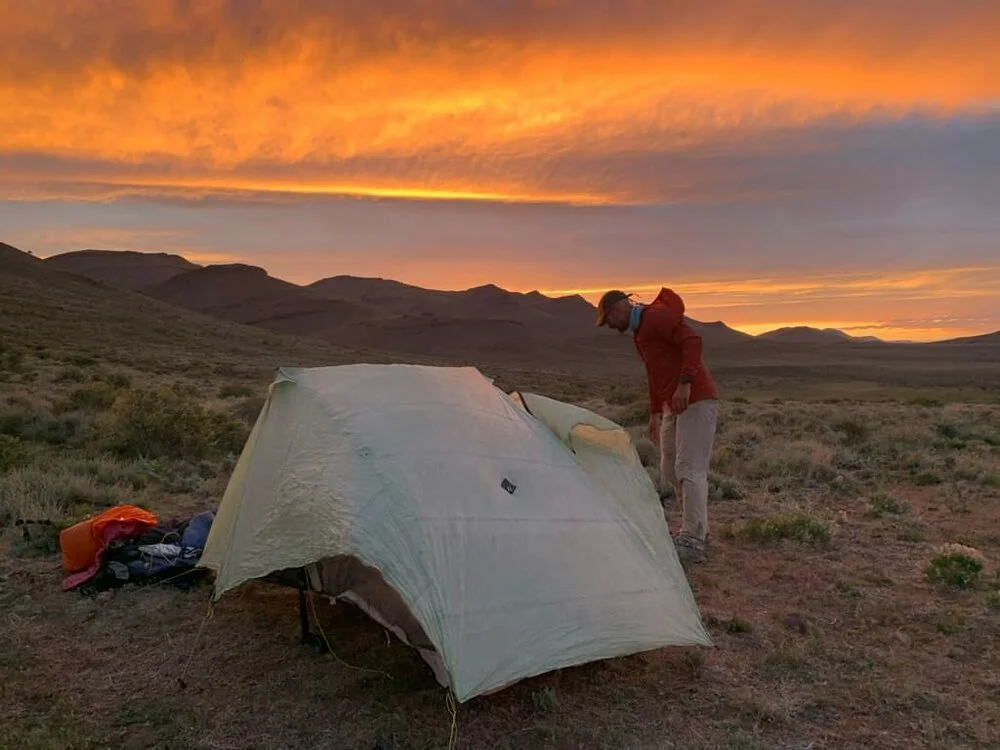
Wind sometimes made setting up the tent difficult.
Oregon Desert Trail gear STRATEGY
The ODT gear list is tricky. There are long, hot, shadeless stretches, potentially cold and snow-covered high elevation areas, and significant cross-country and bushwacking. The following are some of the key gear choices we liked.
Gear for Sun Protection/Heat Management
Much of the ODT is utterly shadeless, so it’s hard to overstate the importance of protecting yourself from the sun on the ODT. The following are some strategies we employed for dealing with the heat and sun:
UMBRELLA
We both carried umbrellas. Naomi brought an Six Moon Designs Carbon Silver Shadow, and I had the Six Moon Designs Rain Walker. They were invaluable for creating our own “shade” on the long shadeless stretches. We would also recommend a hands-free umbrella attachment kit, so you don’t have to hold the umbrella while hiking. For more recommendations, see our guide to the Best Hiking Umbrellas.
SUN CLOTHING
I love the Patagonia Capilene Cool Daily Hoody sun shirt. It is light, breathes well, and doesn’t smell as much as other synthetic shirts I’ve used. I was initially concerned about wearing a hood in the heat, but it is very comfortable and provides excellent neck protection. See our Best Sun Shirts guide for our recommendations.
I prefer wearing the hood of a sun shirt with a light brim cap rather than a large floppy hat like the Sunday Afternoons sun hats. See our Best Sun Hats guide for recommendations for sun hats. Or if you prefer a brimmed hat like me, you may find a better option for sun protection in our Best Running Hats guide.
BASE LAYERS
Naomi wore a baselayer top with a scoop neck. As a result, she got sunburned on the back of her neck and shoulders despite wearing a neck cape. This was her one big gear mistake; she would highly recommend a sun hoody instead. Or, see our Best Base Layers guide for other recommendations of light shirts to wear for cooler temperatures on the ODT.

We had to use our rain gear more than we expected on the Oregon Desert Trail.
what to wear
Gear for Rain and Cold Temperatures
The ODT can be cold and wet. We experienced several weeks of unsettled conditions with rain, sleet, snow, and subfreezing temperatures. We welcomed the cooler conditions, but we were glad that we had rain gear and insulating layers.
RAIN GEAR
I carried my lightest weight rain gear, not expecting to need it...an OR Helium (6.4 oz) and ULA rain kilt (3.5 oz). We ended up needing our rain gear more than we expected. The OR Helium was perfect for the cold, windy, and light rain/sleet/snow we encountered; it blocked the wind effectively and kept me dry.
Naomi carried the previous version of the OR Helium and a DCF rain skirt from Zpacks. In addition to rain protection, she also wore the rain skirt over her pants for warmth on the frigid days. With her umbrella, she found this rain gear to be sufficient.
See our guide to Best Lightweight Rain Jackets for more recommendations.
INSULATING LAYERS
We both carried the synthetic Patagonia Micro Puff Jacket. It’s lightweight, warm, water-resistant, and compressible. On cold and wet days, I layered it with my rain jacket to stay warm, without concerns that it would “wet out” as a down jacket might. It’s the overall winner in our Best Synthetic Insulated Jackets guide. We like it so much, we wrote an in-depth, long-term review on just the Patagonia Micro Puff.
WINDBREAKER
I also carried the Patagonia Houdini wind shirt (my favorite piece of gear). It’s perfect on cool mornings, can be used as an insulating layer, and provides excellent bug protection. It’s a favorite in our Best Men’s Windbreakers guide and also in our Best Women’s Windbreakers guide.

Tall gaiters were essential for both bushwhacking and the thick, sticky mud after rain storms.
Gear for Bushwacking and Cross Country Travel
Over one-third of the ODT is cross-country travel. Much of this is across open, rocky, and prickly brushlands. It’s easy to trip or get scraped up. Rattlesnakes and ticks are also a constant concern. We made some specific gear choices to address these conditions:
LONG PANTS
I prefer to hike in hiking shorts, and Naomi likes to hike in a skirt; however, we strongly recommend long pants on the ODT. Long pants will also help with sun protection.
I wore Patagonia Quandary pants (my favorite hiking pants). They are light, slightly stretch, and dry very fast. Naomi wore the Outdoor Research Zendo pants. She liked the yoga pants waistband and UPF protection but found the pockets to be lacking (a common problem with women’s hiking pants).
You can read more recommendations for hiking pants in our Best Women’s Hiking Pants and Best Men’s Hiking Pants guides.
HEAVIER DUTY GAITERS
Naomi and I wore lightweight trail running gaiters to keep grit out of my shoes, but we wore heavier duty gaiters for long cross-country stretches. We appreciated the extra protection they gave us when bushwacking.
Foot Protection
Foot issues are one of the biggest reasons for folks to abandon a thru-hike. We knew that the hot, dry, and gritty conditions would be a challenge for our feet. For tips and details, see our article on How to Take Care of Your Feet While Hiking and Backpacking.
SHOES
The ODT wreaked havoc on our trail running shoes. I can usually get 500 miles out of a pair of Altra Lone Peak shoes and Naomi gets over 700 miles out of hers. It’s a long-distance and thru-hiking winner in our Best Men’s Trail Running Shoes and Best Women’s Trail Running Shoes guide.
However, the ODT is a trail that requires a more rugged shoe. Naomi and I had to take an extra day off in Frenchglen (mile 360), so we could each get a new pair of shoes. We’ve heard similar stories from other ODT thru-hikers, so plan your shoes accordingly. Hiking shoes with a more rugged sole, such as a Vibram sole, could be a better choice. See our guide to Best Hiking Shoes for more recommendations.
Pro Tip: Zappos VIP program (free to join) has overnight shoe and sock delivery. We had new shoes in Frenchglen (far from any decent size city) in under 24 hours.
SOCKS
I usually carry one extra pair of hiking socks with the hope to rinse out a pair of socks every day. However, I know that it was going to be hard to rinse socks daily on the ODT due to the lack of water. I didn’t want to rinse in cow ponds or water troughs, so I decided to carry two extra pairs of hiking socks.
I rotated Darn Tough Number 2 Micro Crew Midweight Hiker (my usual), Swiftwick Pursuit 4, and a now discontinued pair of Smartwool socks. The Smartwool socks are stylish, but not as durable as the other two pairs. I really liked the Swiftwick’s feel. The Darn Tough socks were great as usual. Plus, you can’t beat Darn Tough’s lifetime guarantee. Darn Tough remains my favorite hiking sock. You can read why in our guide to The Best Hiking Socks.
TRAIL TOES ANTI-FRICTION FOOT AND BODY CREAM
I carry Trail Toes on every long-distance hike. For a hike (like the ODT) that I know will be especially hard on my feet, I will start using Trail Toes a week or two before the hike. I also use Trail Toes for any chafing that develops during the hike. That’s why you’ll see it as a key item in our Essential Hiking and Backpacking Accessories.

This was the worst water source on the ODT. It clogged our filter, even with a pre-filter. We had to continue on to the next source.
Gear for Water Management
We carried our usual water set up: Sawyer Squeeze filter and Cnoc water containers, plus Smart Water and Vitamin water bottles. We use the Sawyer coupler to create a gravity filter system. The coupler also allows you to easily flush the filter in the field with a Smart Water bottle. We also carried a paint filter to pre-filter particularly silty sources.
The Sawyer is a winner in our guide to The Best Water Filters and Purifiers and has come with us on countless thru-hikes, including other hikes in the desert.
We each carried a water filter and 8 liters of capacity. We recommend carrying a little extra capacity in the event that a water container punctures. Cnoc containers are very durable, but we had one develop a small hole that was easily repaired with Tenacious Tape.
Pro Tip: Thoroughly backflush your filter regularly. We carry the Sawyer syringe to flush the filter in town and use a Smart Water bottle and the coupler to flush in the field. After one extremely bad water source, we had to flush the filter immediately afterward. Otherwise, backflushing the filter in town was sufficient.

We tested the Garmin inReach and Somewear Global Hotspot side-by-side on the Oregon Desert Trail.
Communications and Navigation
SATELLITE COMMUNICATOR
The Oregon Desert Trail is very remote. We only met two other ODT hikers, and many days we saw no one. In addition, most of the trail does not have cell phone reception. Therefore, we strongly recommend a satellite communicator with texting capabilities.
I carried a Garmin InReach Mini. We sent out tracking points for our friends and family to follow or progress, get daily weather reports, and send text messages. Plus, we could request a rescue, should it become necessary (fortunately, it has never been necessary).
Naomi was testing the Somewear Global Hotspot. She was impressed with the fast texting and weather reports compared with the Garmin inReach. However, she had issues with the battery life and indicator. A full review is forthcoming. You can read about other Personal Locator Beacons as recommend in our guide to The Best Satellite Messengers and Personal Locator Beacons.

The Oregon Desert Trail maps were pre-loaded on the Garmin fenix6X Pro Solar GPS watch.
GAIA GPS
We always carry trail maps, but the ODT is difficult to navigate. There are no blazes or trail markings. here are long cross-country stretches. Even when on sections of trail or road, junctions are easy to miss.
We downloaded the ODT’s tracks and waypoints into our Gaia GPS app (contact ONDA for the GPX tracks). We find the Gaia app easier to use than handheld GPS devices, like the Garmin Etrex Touch.
Gaia allows you to download multiple map sources such as USGS Topo, satellite, and public lands maps. There are even map overlays showing cell phone coverage.
We found the public lands overlay especially helpful in avoiding trespassing on cross country sections or when improvising new routes.

Mike Unger and Naomi Hudetz under sun umbrellas on the Oregon Desert Trail.
ABOUT THE AUTHORS / WHY YOU SHOULD TRUST US
Naomi Hudetz thru-hiked the Oregon Desert Trail in May 2021. She has thru-hiked the Pacific Crest Trail, Appalachian Trail, and Continental Divide Trail and is a Triple Crowner. She’s co-founder and online editor at Treeline Review. She’s thru-hiked numerous other distance routes including the Great Divide Trail across the Canadian Rockies (twice), Grand Enchantment Trail, Pacific Northwest Trail, the Arizona Trail, the Idaho Centennial Trail. She is also part of the team who completed the first known thru-hike of the Blue Mountains Trail. You can read all her articles on her Treeline Review author page.
Mike Unger thru-hiked the Oregon Desert Trail in May 2021. He is one of few people in the world to have thru-hiked the PCT end-to-end both as a northbounder and southbounder. He’s a double Triple Crowner, having completed the Pacific Crest Trail, Appalachian Trail, and Continental Divide Trail each twice. He’s also part of the team who completed the first known thru-hike of the Blue Mountains Trail. He’s can see all articles by Mike Unger on his Treeline Review author page.


