Corvallis-to-the-Sea Trail (C2C) Thru-Hiking Guide
One of the first of its kind, the C2C Trail connects the Willamette Valley and the Pacific Ocean
January 4th, 2026
Home > Trip Guides > Thru Hikes For Working People
Update as of January 2026: Due to a land ownership change, the C2C is closed 5 miles inland (between mile markers 54.1 and 55.8). For the most current info, check the Corvallis to Sea Trail Organization’s Trail Advisories page.
Distance: 64 miles (103 kilometers)
Days: 3 to 5
Elevation gain/loss: 8,855' gain / 9,044' loss (2,699 meters gain / 2,757 meters loss)
Best season: May to October
Permits: Required (see below)
Difficulty: Moderate
We've been waiting for this for decades in the Pacific Northwest, and it's finally here! One of the first of its kind, the Corvallis-to-the-Sea Trail has finally accomplished what many have tried to do—connect the Willamette Valley to the Pacific Ocean via a footpath.
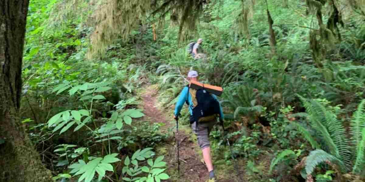
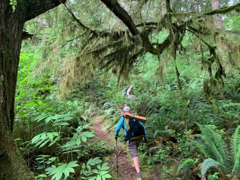
You'll pass through beautiful thick and lush Oregon coastal forests, open vistas, wildflowers (and some unfortunate clear cuts). If you time your trip right, you can feast on native berries such as huckleberries, blackberries, thimbleberries, and salmonberries. Wildlife, from newts to elk to owls, is common. Solitude and silence round out this hiking experience.
The C2C Trail is located within the traditional homelands of the Ampinefu band of Kalapuya, Wusi’n, and Yaqo’n People.
A true labor of love, the C2C Trail is the result of 50 years of volunteer effort. If you’d like to support it, you can visit the Corvallis-to-the-Sea Trail Partnership page. The C2C route uses existing trails, rural roads, and Forest Service roads in its journey across the Oregon Coast Range. It's a great way to do a gear shakedown before a longer thru hike, such as the Pacific Crest Trail.


We create reader-supported, objective, independently-selected gear reviews. This story may contain affiliate links, which help fund our website. When you click on the links to purchase gear, we may get a commission, without costing you an extra cent. Thank you for supporting our work and mission of outdoor coverage for every body! Learn more.
Lush thick forests, the ocean, wildflowers, and edible berries are highlights of the C2C Trail. Photo by Naomi Hudetz.
Highlights
Lush, thick Douglas Fir forest with occasional old-growth trees
Abundant wildflowers
A feast of edible berries (huckleberries, thimbleberries, blackberries, salmonberries)
Beautiful open vistas
Side trip to Marys Peak (the highest point in the Oregon Coast Range)
Well-marked and maintained trail
Solitude (we only saw 2 other hikers about 0.1 miles from the end)

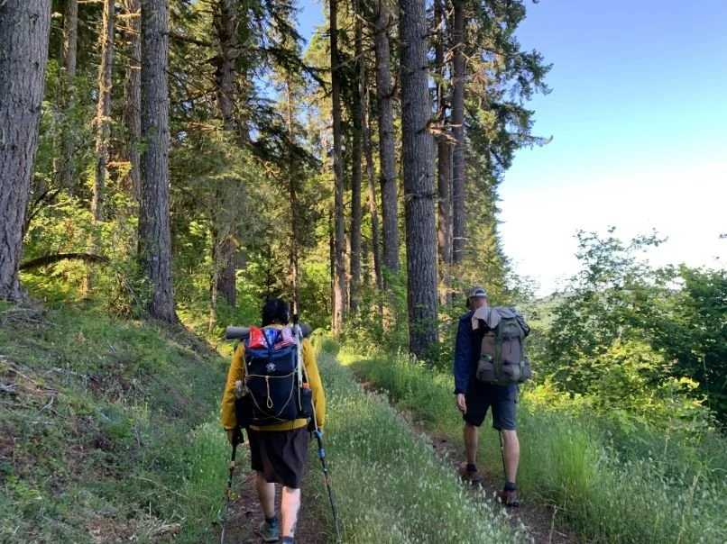
The Corvallis to Sea Trail has some sections routed onto roads. Photo by Naomi Hudetz.
Challenges
Finding legal places to camp is challenging and requires some pre-planning.
There are no legal places to camp in the first 19 miles (Marys River Grange Hall allows camping but must be arranged in advance)
Detours due to active logging operations are possible
A significant portion of the trail is on roads (mostly low-traffic gravel and dirt, but some paved roads as well)
Legal long-term parking is not available near the Corvallis terminus
Here is a summary of the gear we used or recommend for hiking the C2C. For a discussion about our gear choices, see the section below.
GEAR LIST
| C2C GEAR | OUR PICK | WOMEN (oz.) | MEN (oz.) | OTHER OPTIONS |
|---|---|---|---|---|
| Pack, Shelter Sleeping | ||||
| Tent | Six Moon Designs Haven Ultralight Tent | 34.0 | 34.0 | Best Ultralight Tents |
| Tent stakes | MSR Groundhog Stakes x 6 | 3.0 | 3.0 | |
| Backpack | Six Moon Designs Swift X | 36.0 | 36.0 | Best Lightweight Backpacks |
| Pack liner | Six Moon Designs Pack Liner | 3.0 | 3.0 |

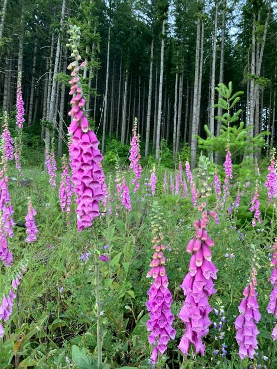
An abundance of fox gloves in bloom on the Corvallis to Sea Trail. Photo by Naomi Hudetz.
Best Season to hike the C2C
We're partial to hiking the C2C in the spring after the snow has melted, the trees have leafed out, and the wildflowers are blooming. Water is usually more plentiful in the spring as well.
Summer also has its advantages—wild, edible berries being at the top of that list. Look for huckleberries, blackberries, thimbleberries, and salmonberries. Your daily mileage may suffer!
Fall is one of our favorite times to hike—but hunting is popular in the Oregon Coast Range. See our section on hunting below.
Winter is possible—we know people who've done it in winter—but you should be prepared for a cold, wet hike through areas of snow. The closer you get to the ocean, the more likely you will encounter Coastal fog, which will obscure views and soak your bones. We recommend carrying a good 4-season tent and dress in many layers. If hiking this trail in the winter appeals to do, we recommend reading our detailed article on what to wear hiking in the winter.

Crossing a good bridge over a large river on the Corvallis to Sea Trail. Photo by Naomi Hudetz.
Difficulty and Skills
Navigation
We were all pleasantly surprised by how well the trail was marked (it may even have better signage than the Appalachian Trail!). Every junction was clearly marked with a "Corvallis to the Sea" post, and certain posts were angled to point in the direction of travel. There were even trail markers with mileage! Nevertheless, we always recommend carrying a map, compass, and GPS tracks on your phone or GPS device. Trail signpost vandalism is common, so unmarked junctions may occasionally happen.
Rough Terrain/Scrambling/Rock Climbing
There is no scrambling or rock climbing required on the C2C Trail. The entire trail is on good roads or trails.
Elevation Gain and Loss
When hiking from east to west, the total elevation gain is 8,855' over 64 miles (or 2,699 meters over 103 kilometers). Most of the climbs are not steep and are well graded. There are many stretches of relatively flat terrain, which makes for easy hiking.
Permits
A free permit is required to access private land owned by Staker Forests. Obtain a permit by calling their office at 541-929-2477, Monday through Friday, from 7:30 am to 4:30 pm Pacific. The office manager was friendly and helpful to us. However, remember that Starker Forests is NOT a source of information about the C2C Trail—they only issue permits. You can find more information about Starker Forests here.

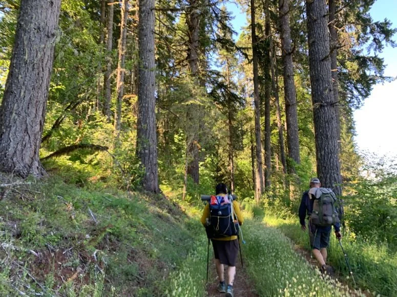
A journey through lush forest on the C2C Trail. Photo by Naomi Hudetz
Route Summary (described westbound)
Downtown Corvallis to Philomath
The C2C Trail begins in Shawala Point Park in downtown Corvallis, at the confluence of the Marys River and the Willamette River. The trail leaves downtown on a paved bike path, where it stays for 5.3 miles.
The trail then enters the City of Philomath but stays off the main highway on a parallel street through a neighborhood. If you want to stop for lunch in Philomath, the main street is only a block away with many restaurant options.
Philomath to North Ridge Trail
Leaving Philomath, the trail briefly joins Highway 34 for about a mile and then turns on Old Peak Road. The junction is beyond Old Peak Road if you plan to camp at Marys River Grange Hall. Old Peak Road is paved for 2 miles, then turns to gravel. The road is gated about 4 miles up. You'll need your Starker Forests permit here.
North Ridge Trail to Marys Peak Alternate or grange hall
The C2C hits the first single-track trail around mile 16.8 at the North Ridge Trail. It continues for 2.2 miles on public land to the junction of the Marys Peak alternate. However, camping is not allowed along this trail because it is in the Corvallis Watershed restricted area.

The C2C is one of the best marked and best signed trails we’ve hiked. Photo by Whitney LaRuffa
At mile 19, the trail joins a road on Forest Service land for 0.5 miles, where camping is allowed.
This Forest Service land is the first place that camping is allowed on the C2C Trail.
If you don't want to do 19 miles on the first day, you'll need to make arrangements to camp at Marys River Grange Hall or have someone drop you off at Old Peak Road to avoid the pavement walking and shorten your first day. See our description on avoiding pavement below.
At mile 19.5, the trail again goes through private land where camping is not allowed. Over the next 7 miles, the trail goes in and out of Forest Service land, so watch the signs for legal camping areas (it's clearly marked on the trail signs).
Harlan and Big Elk Campground to Palmer Mountain
The next 4 miles are on a gravel road through Harlan, an old mill town. There are no services in Harlan.
The junction to Big Elk Campground is at mile 32.9 (the campground is 0.8 miles off trail one way). The campground has water, pit toilets, picnic tables, fire pits, and a designated hiker/biker campsite.
The trail turns on Grant Creek Road for a mile, onto a Forest Service road to the right. The following 22 miles of trail are on Forest Service land (camping is legal, but there are few flat and open camping areas). The trail climbs and descends and climbs again to Palmer Mountain on a combination of roads and trails.

Ona Beach is the western terminus of the C2C Trail. Photo by Whitney LaRuffa
Palmer Mountain to Ona Beach
The last reliable water source is the Wright Creek headwaters at mile 51.5. It's slightly off trail and well marked.
The trail leaves Forest Service land around 6.5 miles from Ona Beach. The final 1.8 miles are paved and pass the Beaver Creek State Natural Area (see our section below). Cross Highway 101 to reach Ona Beach and the Pacific Ocean!
If you want to avoid the pavement out of Corvallis
We get it—you may want to skip the pavement from Corvallis to Philomath. If so, we recommend joining the C2C on Old Peak Road. You can have someone drop you off about 2 miles up, where it turns to gravel. Alternatively, they could drop you 4 miles up Old Peak Road, where the road is gated.
Any miles hiked on pavement can be notoriously painful on hiker’s feet, especially with a backpack. We recommend reading our popular article on How to Take Care of Your Feet While Hiking and Backpacking before starting this trail. While there are many exit points on the C2C should you have foot issues, it is far easier (and more fun) to be able to hike all the way through without foot issues.
Detours
The trail may experience detours from time to time due to active logging operations on private land. Check the C2C website for current information.

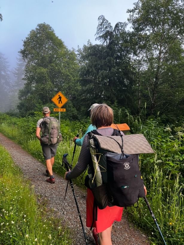
You may find you will need to hike farther than you want on Day 1 to make it to the first legal camping site on the C2C Trail, which is 19 miles from the eastern terminus. Photo by Naomi Hudetz
Camping
Finding places to camp on the C2C Trail was challenging. The trail is only partially on public land, and camping is not allowed on the private property that the trail crosses through. In fact, as part of your permit from Starker Forests, you agree not to leave the trail on their property. Camping is only permitted on Forest Service property.
In addition, when you are on Forest Service lands, the forest is usually thick and lush, with very few flat, clear places to pitch a tent. On our second night, we camped on a road pull-out. It was a challenge to get our tent stakes in the compacted ground.
Areas with no camping are designated on trail markers. Pay attention and plan your mileage, so you don't get stuck in an area with no camping at nightfall. On our first night, we had to hike further than we wanted when we were tired and ready to stop for the night because we were not on public land.
There are two established places to camp on the C2C Trail:
1. Mary's River Grange Hall
The junction to Mary's River Grange Hall is at mile 7.8 westbound and mile 56.3 eastbound. It's 0.2 miles off trail one way. They allow hikers to camp on their property for free, although we encourage you to donate to their donation jar. If you plan on camping here, please follow their rules:
Arrange your stay in advance. Check their online calendar to see if any events are scheduled for the night you plan on staying. Summer weekends are frequently booked.
They will leave the door unlocked so hikers can use the restroom and access water.
Don't disturb anything in the hall.
Leave the grounds as you found them.
Campfires are not allowed.
Close the gate with the bungee cords when you leave.
You can find more information on the Grange Hall website.
2. Big Elk Campground
The junction to Big Elk Campground is at mile 32.9 westbound and mile 31.2 eastbound. It's 0.6 miles off trail one way. The campground has water spigots, pit toilets, picnic tables, and fire pits—no trash service. Campsites cost $10 per person per night and there’s a hiker/biker campsite that has sometimes had a discount for $5, but check with the camp host. There's no advance booking. You can find more information on the Siuslaw National Forest website.
Campfires are not allowed anywhere on the C2C Trail except at the Big Elk Campground.

The C2C Trail has signs and kiosks with maps at many intersections with roads and trailheads. Photo by Naomi Hudetz
Maps and Guidebook
The Corvallis-to-the-Sea Trail Partnership publishes a map and guide. It's sold for $10 in Corvallis, Philomath, Newport, and Salem. Their website has an up-to-date list of locations where you can buy the map.
Alternatively, you can email corvallistothesea@gmail.com and request a map by mail.
A 50-page guidebook, covering natural and human history, is also available on their website.
We loaded the GPX tracks for the entire trail into the Gaia GPS phone app. The C2C Partnership provides the GPX tracks for the entire trail. We also downloaded the maps for the tracks onto our phone before we left (so we can still use the app while in airplane mode).
The C2C Partnership also loaded the GPX file to CalTopo here.

The C2C trail is well marked at intersections with roads. If biking, you may be able to go faster than hikers on some sections. Photo by Naomi Hudetz
Biking the C2C Trail
There is also a bike route for the Corvallis-to-the-Sea Trail. However, much of the bike route is different than the hiking route (the Forest Service has not approved all of the sections for bicycles).
Be aware that as a hiker, you may get passed by bicycles, but usually on roads where it won't be an issue. You can read about the bike route here.
If you decide to bike the C2C route, use a bikepacking bicycle designed for a mix of trail and road and carrying all your gear. Read more about how to get started bikepacking as well as bikepacking-specific gear including bikepacking tents, bicycle frame bags, bicycle seat and saddle bags, and bike handlebar bags.
Because the bikepacking route is shared with vehicles, be aware of your visibility.

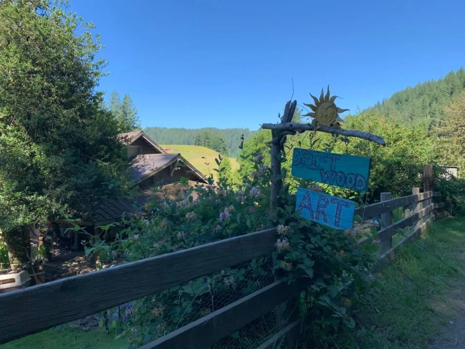
The Corvallis to Sea Trail passes an art studio, farms, and wineries, making for an interesting cultural and scenic hike.
Getting There – Corvallis (eastern terminus)
By Plane
The closest major airport is Portland PDX International Airport. Groome Transportation offers 15 daily shuttles from PDX to downtown Corvallis.
They'll drop you off at the Corvallis Marriott Courtyard (400 SW 1st Street)—3 blocks from the start of the trail (Shawala Point Park).
Eugene, Oregon, also has an airport (EUG) with non-stop service from 15 major cities through 6 airlines operating out of EUG. From Eugene, FlixBus has daily service to Oregon State University, 1 mile from Shawala Point Park (the eastern terminus of the C2C Trail).
By Train
Amtrak Cascades has 3 daily trains to Albany, Oregon (11 miles from Corvallis). The Coast to Valley Express has daily service from the Albany Amtrak station to the Corvallis Downtown Transit Center, 10 blocks from Shawala Point Park (the eastern terminus of the C2C Trail).
By Car
Corvallis is easily accessible via Interstate 5. Overnight parking, however, is challenging. Corvallis is a university town (go Beavs!), so parking is heavily restricted. The City of Corvallis prohibits parking on any City street for more than 48 hours.
Once you finish the trail, you can return to your car in Corvallis from Newport via the Coast to Valley Express. They operate 3 buses a day, 7 days a week, and will drop you off at the Downtown Corvallis Transit Center. You can catch the bus at Newport City Hall or the Hatfield Marine Science Center—both of which will require a hitch from Ona Beach (the western terminus).
Bus and Shuttle Services
Groome Transportation offers 15 daily shuttles between Corvallis and Portland International Airport (they stop at the Corvallis Marriott Courtyard—3 blocks from the trail terminus).
Greyhound has a stop in Corvallis at 100 SW 5th Ave—9 blocks from the trail terminus.
Benton Area Transit (ride the BAT!) operates the Coast to Valley Express, with service between Corvallis and Newport, including stops in Philomath.
FlixBus has service to Corvallis from Seattle, Tacoma, Portland, Salem, and Eugene.
Car Sharing Services
Oregon State University keeps a list of taxi cab companies
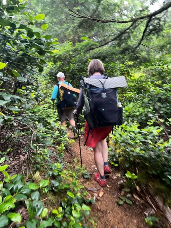
The author hiking through lush forest on the Corvallis to Sea Trail. Photo by Whitney LaRuffa
Getting There – Newport (western terminus)
By Plane
Portland International Airport (PDX) is the closest major airport to Newport, Oregon.
Caravan Shuttle offers daily service between Newport and PDX. Reservations are required.
By Train
Amtrak Cascades has stops in both Albany and Eugene, Oregon. You'll have to shuttle from both of these cities to Corvallis and then to Newport, as there is no direct service to Newport.
By Car
Newport and Brian Booth State Park (formerly Ona Beach State Park) are easily accessible via Highway 101. We weren't able to locate any overnight parking opportunities.
Bus and Shuttle Services
Benton Area Transit (ride the BAT!) has 3 daily buses between Newport and Corvallis via the Coast to Valley Express.
Caravan Shuttle has daily service between Newport and the Portland airport.
NW Connector has 4 daily buses 6 days a week to and from Newport. If you're catching the bus from Brian Booth State Park to Newport, you'll need to call ahead and arrange a pickup since it is not a regular stop. They'll pick you up at NW Estate Drive (the entrance to the Makai subdivision), a short walk north from N Beaver Creek Road (the only place for the bus to pull over safely). If you're taking the bus from Newport to Ona Beach, just let the driver know you need to get off at Brian Booth State Park.
Car Sharing Services
Hiking on trail surrounded by wildflowers on the Corvallis to Sea Trail. Photo by Whitney LaRuffa
Trailheads (from east to west)
The C2C Trail Partnership has driving directions and maps to all trailheads on their website.
Shawala Point Park – Eastern Terminus
The eastern terminus of the Corvallis to the Sea Trail is Shawala Point Park in downtown Corvallis, at the confluence of Mary's River and the Willamette River. The City of Corvallis prohibits parking for more than 48 hours on all City streets.
Overnight parking is available at Benton County Fairgrounds near the corner of SW 53rd Street and SW Reservoir Avenue in a gravel parking lot. Put a note on your dashboard with your hike and return date (or contact the Sheriff at 541-766-6858). From the parking lot, walk 0.7 miles to the corner of SW 53rd and SW West Hills Road and catch the free Corvallis Transit System (Route 8) to the Corvallis Downtown Transit Center (no service on Sundays).
You can also park in a paved and fenced parking lot at the fairgrounds for $10 per night. You must arrange this in advance with the fairgrounds.
Overnight parking is available on most Philomath streets—for up to 5 days. There is a free Corvallis Transit System bus from Philomath to Corvallis (no service on Sundays).
Lower North Ridge Trailhead
Parking is available for the Lower North Ridge Trailhead, approximately 6 miles up Woods Creek Road.
Alternatively, you can continue 2 more miles up Woods Creek Road to access Lower North Ridge Trail and North Ridge Trail (which climbs to Mary's Peak).
Sugar Bowl Creek Trail
You can access the Sugar Bowl Creek Trail from Shot Pouch Trail Road and Harlan/Marys Peak Road. The Corvallis-to-the-Sea Trail Partnership has driving directions and maps on their website.
Grant Creek Trailhead
You can access the Grant Creek Trail on Grant Creek Road, 1 mile west of Harlan.
Ona Beach Trailhead—Western Terminus
The western terminus of the C2C Trail is Ona Beach in Brian Booth State Park, about 8 miles south of Newport. There is no camping at the Park. Cell service is limited—we had better signal closer to the ocean.
Other Trailheads
The C2C Trail has many other access points on Forest Service roads. Check the Corvallis-to-the-Sea Trail Partnership website for detailed information.
The Corvallis to Sea Trail has great restaurants options every day, including some of the best fish and chips. Photo by Whitney LaRuffa
Where to Eat
So. Many. Choices!! I can't decide on just one, so I'll list all of my favorites:
Corvallis
Block 15 Brewing is arguably one of the top breweries in Oregon. If you like artisan beer, don't miss Block 15. We may have a 4-pack of Sticky Hands IPA in our fridge right now!
When I dream about pizza, I dream about Woodstock's Pizza. It's one of the only pizzerias I've found that offers whole wheat crust as an option—and it's fantastic. Bonus—if you finish the C2C in Corvallis, you can do your laundry at Suds & Suds, the laundromat right next door. Drink beer, eat pizza, and do your laundry all at the same time!
A close second to Woodstock's is American Dream Pizza (ok, I like them both equally). Their crust is like a twisted soft pretzel—be sure to get the garlic butter on it. (How can a small town support 2 of the best pizzerias, you ask? It's a college town!)
For breakfast, WiseCracks Cafe is the best spot in Corvallis.
Philomath
If you're starting or finishing in Philomath, don't miss the fantastic breakfast and brunch at The Dizzy Hen. The menu rotates based on what's in season, but hopefully, they'll have some french toast on the menu.
Newport
For fish & chips, South Beach Fish Market is the best in town.
Wolf Tree Brewery is a hidden gem with unique and creative beers such as Spruce Tip Saison.
Rogue Brewer's on the Bay is located inside the world headquarters of Rogue Brewing, an Oregon institution. They have 40 Rogue beers on tap, including specialty beers found nowhere else.
Regulations
Follow Leave No Trace Ethics, including camping and pooping 200 feet from the water.
Carry out your toilet paper. I highly recommend single-use dog waste bags.
Do not leave the trail on private lands.
Do not camp on private lands (which are clearly marked).
No campfires allowed, except at Big Elk Campground.
Sign in at one trail register.
Carry a printed version of your Starker Forests permit (or leave it on your dashboard if you're parked at a Starker Forest trailhead).

A hiker refilling from a drinking fountain at a water spigot on the Corvallis to Sea Trail. Photo by Whitney LaRuffa
Water Sources
You'd expect water to be easy to find in the Oregon Coast Range. Unfortunately, there are not many perennial streams along the C2C Trail. Those existing perennial streams can be challenging to access because they flow beneath the road in culverts. Early in the season, you will likely have better water availability than later in the season.
Overall, these three sources are reliable. However, be prepared to adapt if it's a dry year. I thru-hiked the C2C in late June during a heat wave, and I had 4 liters of capacity.
Mile 5.2: water spigot at a playground on the bike path (usually turned off during the late fall and winter)
Mile 19.5: a path leading to a creek
Mile 23.9: Shotpouch Creek
Mile 26.8: creek
Mile 32.9: Big Elk Campground (0.8 miles off trail one way)
Mile 33.0: Big Elk Creek (accessible near road junction)
Mile 34.4: Grant Creek
Mile 40.1: Gopher Creek
Mile 45.8: creek
Mile 51.5: Wright Creek (off trail)
For all naturally occuring water sources, we highly recommend using a water filter or purifier. The C2C trail goes through agricultural areas and should not be consumed unfiltered.
Bears and Food Storage
There are black bears in the Coast Range, but bear canisters are not required. Properly hang your food or carry an Ursack.
Hunting Season
The Coast Range is a popular hunting area. Hunting is on private land as well—Starker Forests also issues permits to hunters. If you're planning on hiking the C2C in the fall, you may want to time your hike to avoid hunting season. Check here for current information.
Side Trips
Marys Peak
Marys Peak is the highest point in the Oregon Coast Range at 4,097' (1,248 meters). The native Kalapuya people called it "tcha Timanwi" or "place of spiritual power." On a clear day, you can see the Pacific Ocean to the west and the Cascade Mountains to the east across the Willamette Valley—a unique and spectacular experience. The 5-mile hiking trail to the summit (one way) from the C2C takes you through beautiful forests with red cedar, western hemlock, and even some old-growth noble fir and Douglas fir – making the hike even more magical.
Marys Peak has also been designated a Scenic Botanical Special Interest Area, with open meadows, wildflowers, xeric rock gardens, and noble firs. You can read more about the Marys Peak plant communities here.
The junction to the North Ridge Trail and summit of Marys Peak is at C2C mile 19. The North Ridge Trail climbs 1,900' over 4 miles to the parking area, which is 330' below the summit. Continue to the summit trailhead for the final 0.6 miles. I highly recommend it!
If you want to make a day of it, camping is permitted at Marys Peak Campground, with access via the Meadow Edge Trail or Marys Peak Road (NF-3010). There are only 6 sites and no reservations, so plan to hit it mid-week to increase your odds of getting a spot.
Beaver Creek State Natural Area
Beaver Creek State Natural Area was added to the Oregon State Parks system in 2010. There are miles of trails to explore the marsh and surrounding forest. It's critical habitat for fish and migratory birds. Otters and, yes, beavers live there too.
The Beaver Creek Loop hike is only 4.6 miles and well worth the effort. It's only 1.2 miles from the western terminus of the C2C Trail at Ona Beach, so you could also do this hike after you finish. Who doesn't like bonus miles?
Oregon Coast Trail
The C2C Trail intersects the Oregon Coast Trail at Ona Beach (we ran into 2 OCT hikers at Ona Beach!). If you're not ready to stop hiking, jump on the Oregon Coast Trail – either north or south – and explore the fantastic coastline of Oregon. Read our guide to the Oregon Coast Trail for more information.
Westbound or Eastbound?
We hiked the C2C Trail westbound, ending at the Pacific Ocean and Ona Beach. We think ending at the ocean is pretty memorable and exciting—not to mention celebrating with some of the best fish and chips on the Oregon coast. We all soaked our tired and dirty feet in the Pacific, which was another bonus.
Ending in downtown Corvallis, while it is a great town, just doesn't have the same level of excitement. However, we could be persuaded to hike the C2C again, but eastbound so we can compare.

A hiker camping inside of a bug net tent on the Corvallis to Sea Trail. Photo by Naomi Hudetz.
Gear DISCUSSION
Your gear will depend significantly on the time of year and weather conditions. Some general gear notes specific to this hike:
The weather can vary significantly between the Willamette Valley and the coast. We left Corvallis during a heat wave, and by the time we got to Ona Beach 3 days later, it was cool and foggy. We all had to put on our insulating layers when we got there.
In general, the Coast Range is damp and humid. Therefore, we recommend carrying a synthetic insulating layer rather than a down jacket. See our discussion of down vs synthetic.
Mosquitoes and ticks can be an issue for much of the summer. We recommend having a bug net or fully enclosed tent (rather than a tarp). See our guide to the Best Backpacking Tents for more recommendations.
A mosquito headnet might save you a lot of grief in spring and summer. It's worth the weight penalty.
Here's what we carried on our thru-hike of the Corvallis-to-the-Sea Trail in late June during a heat wave.
Why you should trust us/About the author
Naomi Hudetz thru-hiked the Corvallis to Sea trail in June with her two friends Brian and Whitney and her husband Mike.
Naomi left her corporate career to pursue her passion for the outdoors. She received the Triple Crown award for hiking for completing the Appalachian Trail, Pacific Crest, and Continental Divide Trail and has hiked numerous other distance routes including the Great Divide Trail across the Canadian Rockies (twice), Grand Enchantment Trail, Pacific Northwest Trail, the Arizona Trail, (most of) the Idaho Centennial Trail, the first known thru-hike of the Blue Mountains Trail, and the Oregon Desert Trail. She served as an executive board member of the American Long Distance Hiking Association-West and is based in White Salmon, Washington.
Resources
Big Elk Campground, Siuslaw National Forest
Brian Booth State Park (Ona Beach)
North Ridge Trail (Forest Service)
Marys Peak North Ridge Hike (Oregon Hikers)


