Centennial Trail of South Dakota: A Guide to Thru-Hiking and Backpacking
Hiking 125 miles of the Black Hills from Wind Cave National Park to Bear Cave State Park
May 9th, 2023

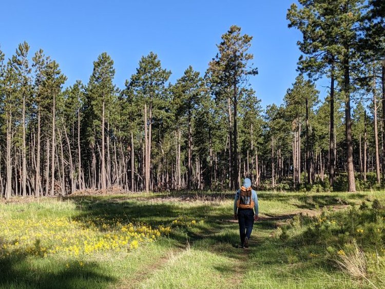
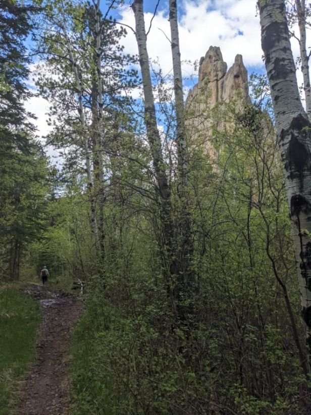
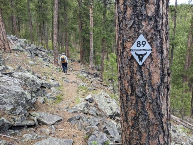
The South Dakota Centennial Trail goes through the Black Elk wilderness in Black Hills National Forest, named after a Lakota chief.
We create reader-supported, objective, independently-selected gear reviews. This story may contain affiliate links, which help fund our website. When you click on the links to purchase gear, we may get a commission — without costing you an extra cent. Thank you for supporting our work and mission of outdoor coverage for every body! Learn more.
The South Dakota Centennial Trail is a 125-mile long hiking and backpacking trail through the Black Hills National Forest of western South Dakota. It offers solitude, abundant wildlife, and a satisfying thru-hike experience that can be completed in just one week.
Distance: 125 miles
Days: 5-8
Elevation gain/loss: +24,500’
Best season: Spring through Fall
Permits: Only a few permits are potentially necessary, and all can be easily avoided with planning.
Difficulty: Moderate. The trail is fairly easy to follow, but the near-constant elevation gains and losses can be tiring.
Related: Thru-hiking the Pacific Crest Trail
Read More: Thru-hiking Guide to the Appalachian Trail
Background
The South Dakota Centennial Trail packs a lot into 125 miles. The southern end of the trail begins in Wind Cave National Park, then travels through Custer State Park and the Black Hills, and finally ends at Bear Butte State Park in the north. The trail is primarily a singletrack trail with some quiet dirt road travel.
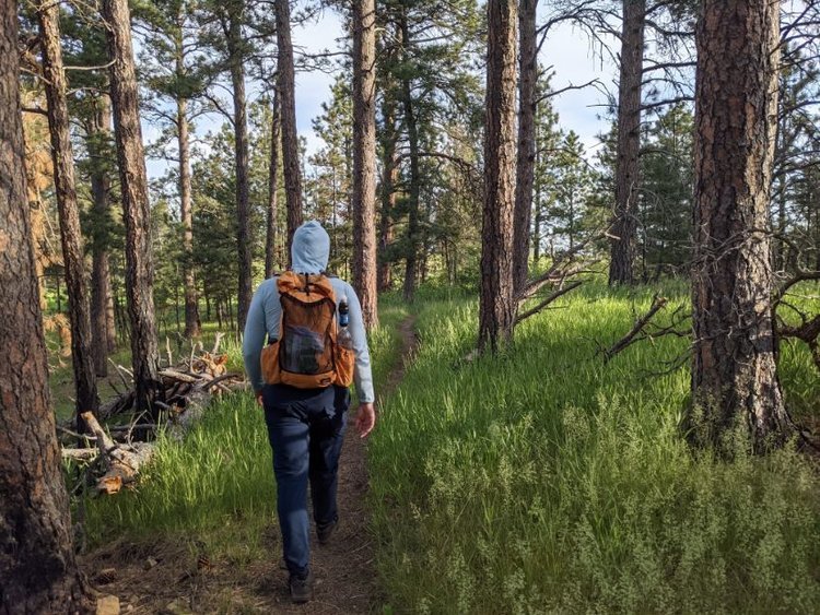
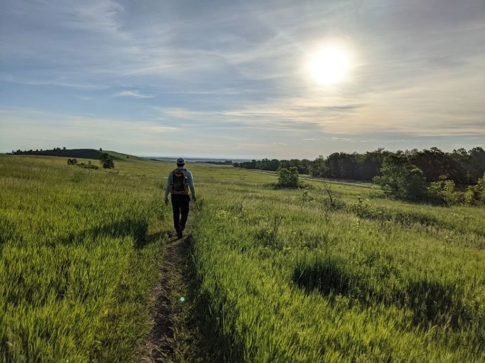
The terrain varies from flat, wide-open prairie, to rolling ponderosa forest, to a steep rocky trail in woods dotted with granite towers. With lots of wildlife and few people, this trail offers a great opportunity for a short thru-hike.

Gear List for the South Dakota Centennial Trail
| ITEM TYPE | GEAR MODEL | COMMENTS |
|---|---|---|
| SHELTER/ SLEEPING | ||
| 2-person tent (shared) | Z Packs Duplex | We like this tent when hiking together |
| Stakes | Titanium shepherd hook 6x, V-stakes 2x, bag | Shepherd hooks are enough to hold down the shelter with the V-stakes for the front and back |
| Sleeping Pad | Neoair X-Lite women's with stuff sack | I like the comfort and warmth of the Neoair |
| Sleeping Bag | Enlightened Equipment Revelation 40deg quilt | I knew the forecast going into this hike was quite warm and that this very lightweight 40deg quilt would be sufficient |

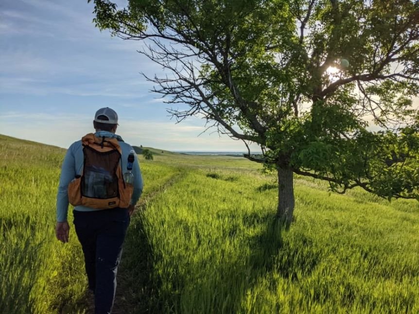
The South Dakota Centennial Trail is a hiking trail with mountains, meadows, prairie, forest, and interesting rock spires, packing in a lot in a one-week thru-hike.
Highlights
Abundant Wildlife
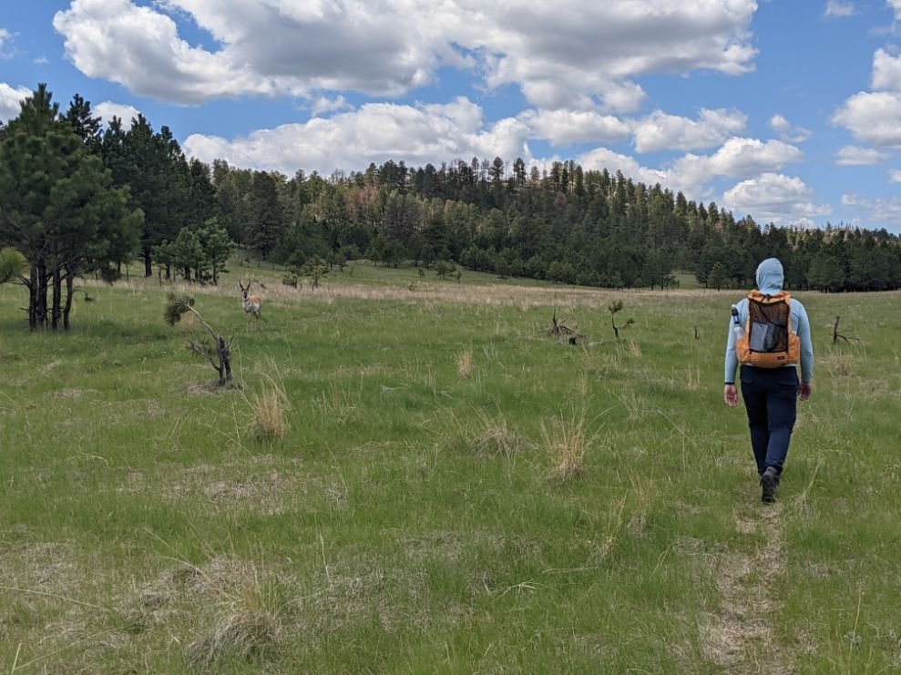
We saw bison, antelope, deer, prairie dogs, marmot, and lots of birds that we couldn’t identify. There is also the possibility of seeing turkeys, bighorn sheep, and mountain goats. The animals in Custer State Park are very accustomed to seeing people and do not scare off easily. Be sure to give any bison you may encounter a wide berth and do not approach!
Diverse Terrain
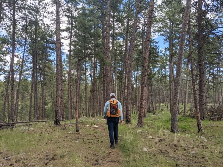
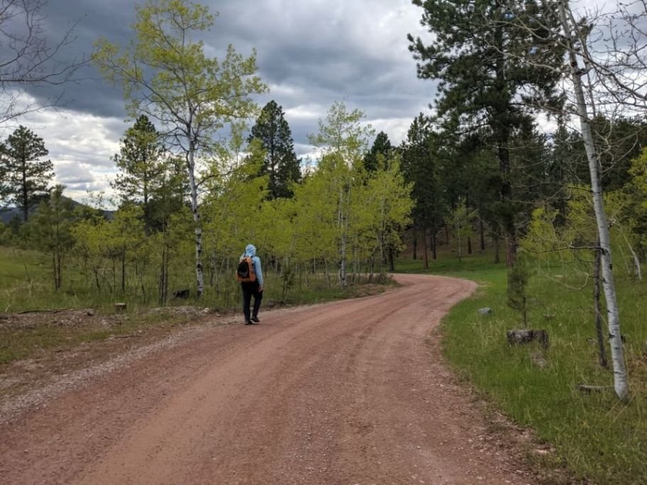
The Centennial Trail travels through wide-open prairie alternating with ponderosa forest, as well as more densely wooded and rugged terrain in the Black Hill country. The trail is, for the most part, a nicely groomed singletrack with some quiet dirt road portions.
Solitude
On my hike in early June 2021, I only saw 2 other backpackers, a handful of day hikers, and about a dozen ATVs outside of developed trailhead/campground areas.

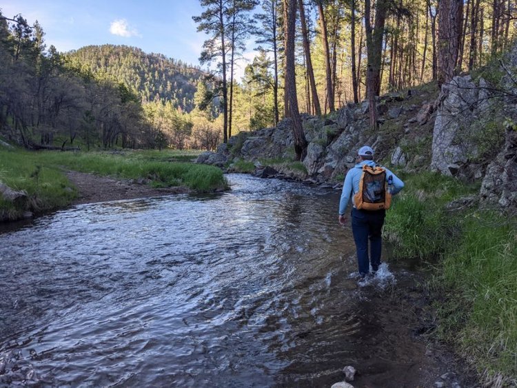
Water planning is generally not an issue along the South Dakota Centennial Trail and resupply is also relatively easy on this longer backpacking trail.
Challenges
Poison Ivy
There is abundant poison ivy in the French Creek Natural Area of Custer State Park, as well as some in the Black Hills through the section along Elk Creek. With a watchful eye when going off-trail for bathroom breaks or camping, it can be avoided.
Ticks
Prior to this trail, I’d backpacked more than 8000 miles and never once gotten a tick. I got multiple on this trail. Be sure to check yourself for ticks frequently.
Water availability/information
Water is mostly not a problem with the exception of in the northern section in dry years. However, because it’s a less popular trail, information on current conditions can be difficult to find. See our Water Planning section below for more on this.
ATVs
The section between Merritt/Pilot Knob TH and Dalton Lake is largely on ATV trails. My hike was around Memorial Day, the very beginning of ATV season, so it wasn’t too busy yet; However, high ATV traffic and sharing the trail can be very unpleasant.

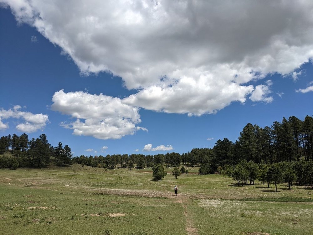
Spring hikers on the Centennial Trail may see wildflowers as well as wildlife like antelope.
Best Season
The Centennial Trail can be hiked spring through fall.
Temperatures can get very hot, so if you’re hiking in summer, try to leave flexibility in your schedule to avoid hiking during a heatwave. I hiked the first week of June and had 2 uncomfortable 95°F+ days at the end of my hike.
Spring and very early summer before ATV season is ideal for a more pleasant and quiet hike.
Although it isn't a national scenic trail, one benefit of this trail is it can be hiked earlier in the season than some trails. Its somewhat similar climate to sections of the Continental Divide Trail also make it a potential option to train for sections of the CDT.

Navigation is generally straightforward on the Centennial Trail, though you may have to walk through some grass.
Difficulty and required Skills
Navigation
Navigation is mostly straightforward with very frequent signage. There are some areas with a lot of ATV roads or junctions, so paying attention in order to not miss turns is important. If you haven’t seen a blaze in a while, it’s a good idea to check in with your map!
Technical Skills
The Centennial Trail is a well-maintained hiking trail. Some sections are perfectly smooth while others are rockier underfoot, but no technical skills are required for any part of the trail.
Elevation Gain/Elevation Loss
The total elevation gain and loss for the trail is +/-24,500 feet.
There are never any massive sustained climbs. The overall elevation stays between 3100’ and 5900 feet. However, there are a lot of constant ups and downs, particularly concentrated in the middle of the trail.
Permits are required for backcountry camping in some sections of the South Dakota Centennial Trail, though the sections are short and can be avoided with good campsite planning.
Permits
A free backcountry permit is required if camping in Wind Cave National Park. However, this is the first or last 6 miles of the trail depending on which direction you’re going, so it can easily be avoided if you are not camping in the park.
No permit is required to hike through Custer State Park, but backcountry camping is limited to the French Creek Natural Area.
There are many developed campgrounds along the route. If you choose to stay in these campgrounds, you’ll need to pay a fee. Some popular camping areas may require advanced reservations to secure a site.

A hiker walks near a pronghorn on the South Dakota Centennial Trail.
Route Summary and Map
Map for informational use only: https://caltopo.com/m/GP17D
For the Northbound hiker, the trail begins at the Norbeck Trailhead in Wind Cave National Park. It's just 2 miles from the Wind Cave Visitor Center, where the National Park Service offers a guided tour of the cave. The trail is gentle and crosses open prairie and straight through some prairie dog towns, as it heads north into the boundaries of Custer State Park. Bison are very common in this area.
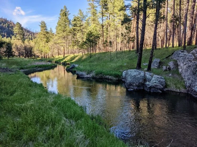
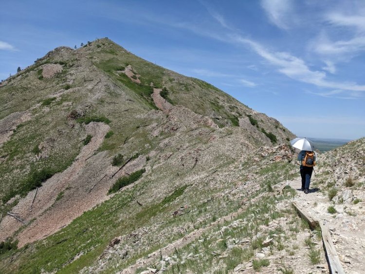
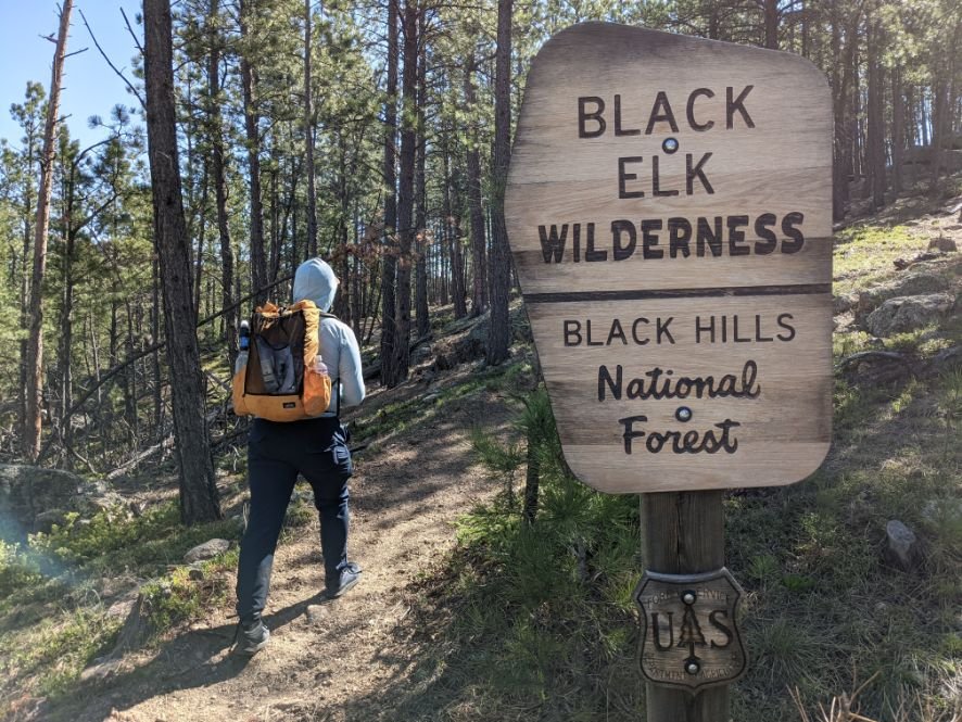
The trail then follows French Creek, a lush, wooded area with plenty of water and shade. A climb out of French Creek leads to Legion Lake, popular with summer tourists visiting the State Park. Pleasant forested walking leads to the rugged Black Elk Wilderness, a sacred area to many Native Americans. This wilderness and nearby Black Elk Peak are named after the Lakota spiritual leader, Black Elk. This beautiful section is filled with short but steep climbs and descents and dotted with granite spires.
The ups and downs continue to the highest point of the trail at 5889’ before dropping down to pleasant Sheridan Lake. With several major highway crossings, this section can feel a bit too close to civilization, but a return to more isolated walking follows. Ridge walks and open high country offer nice views past Pactola Reservoir.
From Merritt, the trail follows a network of ATV trails to the town of Nemo. Past here, the route returns to a more pleasant single-track hiking trail through the forest before a long descent drops down to Alkali Creek and I-90.
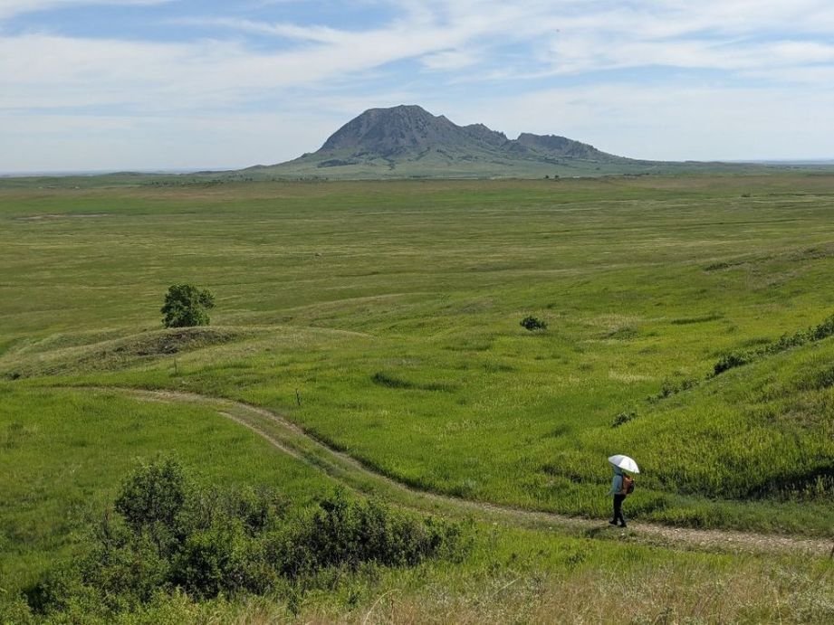
The final stretch of trail winds through a few hills, but is mostly wide open grassland with a commanding view of the northern terminus, Bear Butte.

Mato Paha, or Bear Butte, is an important spiritual and prayer site. Read about the importance of this area. You may consider whether climbing this mountain is for you.
Native American Cultural and Spiritual Significance
The entire area along the South Dakota Centennial Trail is rich with Native American cultural and spiritual significance. For instance, Wind Cave is central to the origin story of the Lakota and many other local indigenous people because it is believed the first bison and humans emerged from the small hole that is the cave’s natural entrance. You can learn more about the Lakota emergence story as it was passed down by Wilmer Mesteth, a tribal historian, and spiritual leader. The NPS consults with an extensive list of associated tribes in the South Dakota Centennial Trail Area.
The entire Black Hills country has always been important to native people, such as Cheyenne and Lakota Sioux.
Jumpstart your learning about the significance of the area to native people, their removal from the land when gold was found in the Black Hills, and the stolen land used to celebrate colonialists.
Lastly, the trail’s northern terminus, Mato Paha, or Bear Butte, is an important spiritual and prayer site for many native people. The site was turned into a State Park in 1961, putting Native religious use at odds with recreational use. Presently, hikers are required to stay on a designated trail and not enter or disturb certain sacred areas. Development in the area today continues to be a source of conflict with preserving the sacredness of the site. Consider this information and decide if you feel appropriate to complete the climb to the top of Bear Butte.
In general, educating yourself before your hike will help you be more mindful and respectful of the lands of the native people you are visiting. The guides Indian Country Etiquette and Things You can Do to be more respectful of Native American cultures are a good starting point for what to think about and how to behave when visiting native sites.

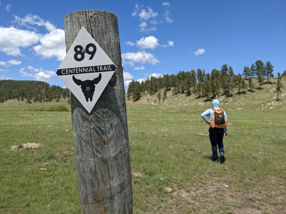
The South Dakota Centennial Trail is generally well-marked and signed with posts labeling Trail #89.
Maps and Guidebooks
Guidebooks
For a basic overview map and list of Trailheads and services, see the Centennial Trail brochure.
There is one Guidebook available, Hiking Centennial Trail: A Guide to Hiking South Dakota’s Centennial Trail. However, it can be tricky to find if Amazon is out of stock.
The writers do not have a website, but they do have a Facebook page where you can find links to purchase the guidebook. They also have Avenza maps with GPS coordinates that you can download for your phone (geolinked PDFs) and large wall-sized maps of the trail.
Gaia
I used the GPS phone mapping app Gaia GPS. Be sure to preload the base maps for offline use in Gaia before you leave home.
Other Maps
The National Geographic Trails Illustrated Black Hills South (#238) and Black Hills North (#751) cover the entire length of the trail.
Note there is one difference between the base map printed SDCT and the current (2021) signed trailhead sections between French Creek Natural Area and Legion Lake in Custer State Park.

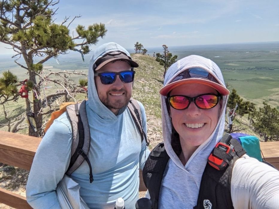
The author and her hiking partner at the terminus of the South Dakota Centennial Trail, which has a sign about the trail.
Getting There
By Plane
The closest airport is Rapid City, South Dakota (RAP). Both terminuses are within 60 miles by car. From the airport, you can rent a car from several companies.
By Car
Both the Southern and Northern termini are easily accessible via paved roads. The drive between the two ends takes just under 2 hours.
Overnight parking is allowed at the southern terminus at either Norbeck Trailhead or Wind Cave Visitor Center, and also at the northern end at the Bear Butte Education Center. Calling ahead to let rangers know you’ll be leaving a car is highly recommended.
Bus and Shuttle Services
No public transportation is available to the trail.
However, several private shuttle services catering to this heavily tourist-ed region are available. The paralleling Mickelson Trail (a bike trail) is very popular and outfitters offering shuttles for this trail may also be able to provide Centennial Trail shuttles. Here are a couple of possible options:
Trailheads
Norbeck Trailhead
The Southern End of the South Dakota Centennial Trail is Wind Cave National Park: Norbeck Trailhead.
Bear Butte Visitor Center
The Northern End of the South Dakota Centennial Trail is Bear Butte State Park: Bear Butte Visitor Center
See other access trailheads in the Centennial Trail brochure:
https://gfp.sd.gov/userdocs/centennial-trail-brochure.pdf
Post Trip Favorite Restaurant
While you’re hiking, take a 1-mile detour off the trail to grab a burger and ice cream at the Sugar Shack, where you can relax under a large covered deck and enjoy delicious (and large!) burgers to fill your hungry hiker belly :
Regulations
Follow Leave No Trace Ethics including camping and pooping far from water.
Dogs are not allowed in the backcountry in Wind Cave National Park. While your dog should always be on a leash or under strict voice control when hiking, it is especially important along this trail as there is much wildlife, which may tempt some dogs.
Leave any artifacts you may find.
Many of the lands you’ll be walking through are considered sacred by multiple groups of people for many thousands of years. Treat the land with respect as you travel.
Resupply
While there are no full resupply options along the trail, there are quite a few restaurants and small stores with snacks either directly on the route or a very short detour away. Possible options include:
Legion Lake Lodge in Custer State Park, which has a restaurant and cabins.
Whispering Pines Campground is a ½ mi detour from the trail, just north of Pactola Reservoir. It has a general store, pay showers, cabins, and tent camping, and may be able to hold a resupply box (call ahead for current information).
Merritt is one-mile off-trail and has a burger joint, the Sugar Shack
Nemo has a store, Nemo Mercantile, with typical convenience store snacks and beverages. This is <1 mi from the official trail, or you can pass it directly if you shortcut through town.

A water pipe on the South Dakota Centennial Trail. Always treat water sources before drinking.
Water Planning
There are many small creeks along the route, and generally, water is available at least every 10 miles, often more frequently. There are also a few water spigots at campgrounds along the trail (check campground opening dates to be sure these will be turned on).
However, there is the potential for a long, 24-mile waterless stretch between Dalton Lake and Alkali Creek if Elk Creek is dry, which is possible after early summer if there has not been much recent rain. Being a less traveled trail, there is not always recent water information available.
You can check out the Facebook Page Centennial Trail, which may have information from recent hikers to share.
If Elk Creek is dry and a long water carry is not feasible for you, there is trailhead access (Elk Creek TH) in the middle of this potential dry section, so caching or having someone meet you with water is possible.
When I hiked in early June 2021, Elk Creek was not flowing but had large pools of good water still available.
Bears and Food Storage
Black bears do live in the Black Hills but have not historically been in conflict with hikers. There are no requirements for bear canisters or other special precautions. Standard precautions such as keeping a clean camp and not leaving food unattended should always be followed.

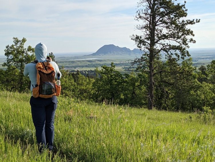
The terminus of the South Dakota Centennial Trail is Bear Butte, the highest peak in the area.
Side Trips or Peaks
Any popular side trips like peaks, lakes, swimming holes, historic monuments, etc.
Take a tour of Wind Cave, a vast cave network known for its boxwork formations, just 2 miles from the southern terminus
You can catch a glimpse of Mount Rushmore from the trail. However, you can also take a side trail to visit the monument up close. If you have transportation, also be sure to check out the nearby Crazy Horse Memorial before or after your hike. It depicts the Oglala Lakota Warrior riding a horse towards his tribal lands.
The northern terminus of the trail is in Bear Butte State Park. A visit to the education center for information about the significance of the area for local native people is highly recommended.
Sheridan Lake and Pactola Reservoir along the trail are popular summer destinations for boating, fishing, swimming, and camping. They can serve as a great place to meet up with family or friends while you’re hiking the trail.
Variations
The trail lends itself equally well to Northbound or Southbound travel. I went Northbound and liked ending atop Bear Butte.
The area’s many nearby attractions make this hike a great opportunity to have your family or friends shuttle you to trailheads or slackpack you through sections.
While you are hiking, your support team can check out the sights in the area including Wind Cave National Park, Mount Rushmore National Memorial, Crazy Horse Memorial, the Black Hills, and Custer State Park. There are many easily accessible trailheads along the route, making it possible to do the entire trail as a series of day hikes.
Gear Rentals
I did not use any gear rentals for this trip. There are no specialty requirements like bear cans, so if you already have backpacking gear or are able to rent it locally, gear rentals for bulkier items are probably not needed for this trip. If you enjoy ATVs, you could rent one for a ride on a portion of the SDCT and the network of surrounding trails from numerous businesses along Highway 385.

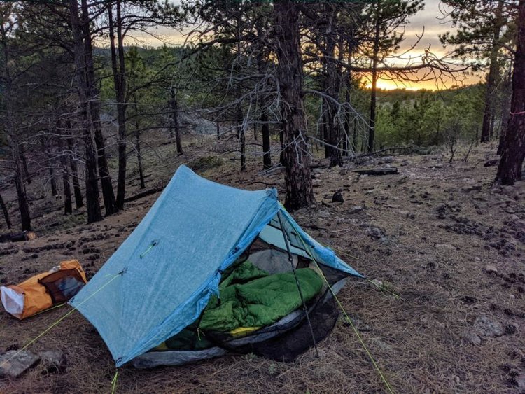
One of our campsites on the South Dakota Centennial Trail. We were able to set up our tent and sleeping bags right in the pine forest.
Gear List
TENT
We carried the ZPacks Duplex and split it between the two of us. It’s a lightweight option for two people that could fit out stuff. See our Best Backpacking Tents guide for more recommendations.
BACKPACK
My hiking partner carried the ZPacks Nero. I carried a Make Your Own Gear Backpack that is most similar to a Six Moon Designs Swift X, the Overall winner in Treeline’s Best Lightweight Backpacking Backpacks guide.
We never had more than 3 days of food. We also had minimal water carries, and warm temps, so didn’t need high-volume packs.
SLEEPING BAG
My hiking partner carried a ZPacks 20deg sleeping bag, which is no longer anywhere close to being a 20deg bag. I carried the Enlightened Equipment 40deg Revelation quilt. See our Best Backpacking Sleeping Bags guide for our recommendations.
SLEEPING PAD
My hiking partner carried the Thermarest NeoAir Uberlite short. I carried the Thermarest NeoAir Xlite. The NeoAir was the Overall winner in our Best Sleeping Pads for Backpacking Guide.
BACKPACKING STOVE
We shared the Jetboil Sol Ti, a discontinued lightweight Jetboil stove. The closest model available is the Jetboil Stash, which is actually 1.4 oz lighter. For more recommandations, see our Best Backpacking Stoves guide.
WATER PURIFIER
We both carried the Sawyer Squeeze. We both love these filters and use them on Smartwater bottles for filtering as we sip, keeping us on the move and not having to take time to stop and filter. It’s the Overall winner in our Best Water Filters and Purifiers for Backpacking.
Satellite Messenger
We carried the Garmin Mini 2 in case of emergency and also to keep in touch with our resupply people through two-way text messaging. It’s the the overall winner in our Personal Locator Beacon and Satellite Messenger Guide.
Map and Compass
I printed a custom set of paper maps created with CalTopo and used the Gaia GPS app on my phone. I also used the Avenza Map purchased through Hiking Centennial Trail, primarily for water source information.
First Aid Kit
My first aid kit is very minimal: Leukotape, safety pin, mini super glue, single-use packet triple antibiotic cream, one sheet of steri-strips, ibuprofen, and duct tape.
Sun Protection
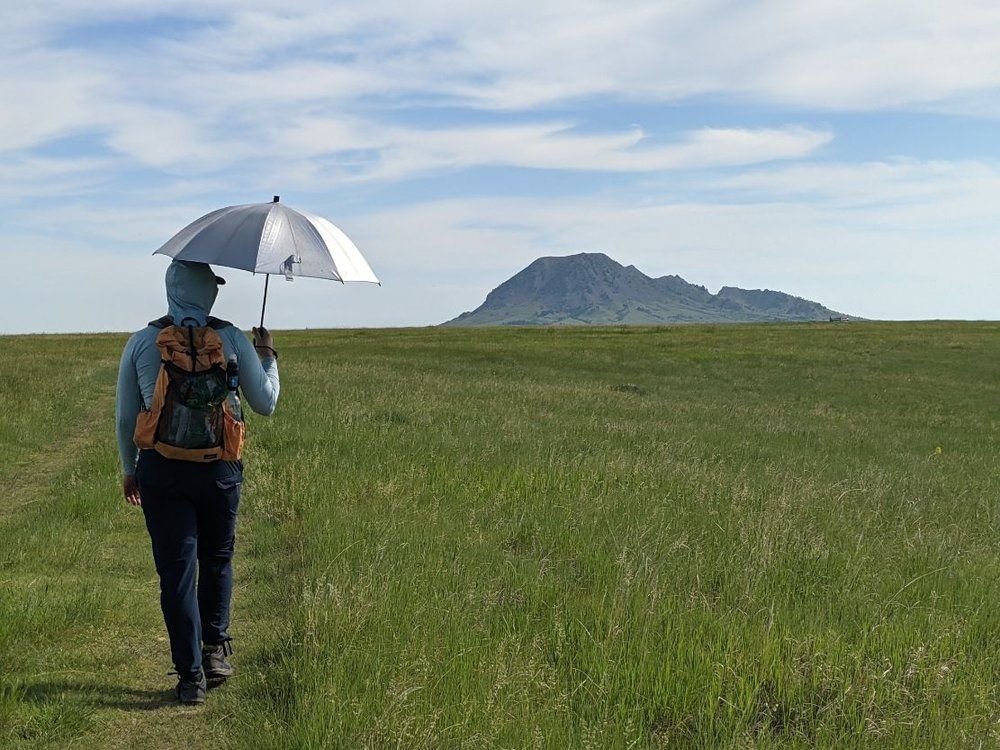
We both carried the Six Moon Designs Silver Shadow Umbrellas for sun protection.
The umbrellas were critical for hot sunny days through the exposed prairie sections and also doubled nicely as rain protection during a few thunderstorms.
Pocket Knife
I carried the Swiss Army Classic, mainly for opening food packages and cutting tape for blisters
Gear Repair
Our gear repair kit was minimal: Tenacious tape, sewing needle, and dental floss that doubles as a thread.
Hygiene
I carried a pee rag by Wander Woman wipes and we shared a potty trowel. We each carried our own hygiene kits with TP and bags to carry out used toilet paper.

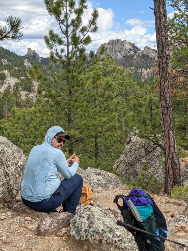
A dinner break on the South Dakota Centennial Trail. We carried a Jetboil stove to split the weight among two backpackers.
What to Wear
SHOES OR BOOTS
We both wore trail running shoes. I wore the Brooks Cascadia and my hiking partner wore the Astral Rassler. For more recommendations, see our Best Women’s Trail Running Shoes story and Best Men’s Trail Running Shoes guide.
Many backpackers prefer to wear boots for this kind of trip. If you’d feel more comfortable in boots, check out our Best Hiking Boots story or our Best Lightweight Hiking Boots story.
A nice footwear compromise for this trip would’ve been hiking shoes, which are designed to feel like a trail runner but have stability more like a boot. See our Best Hiking Shoes story for footwear that has more durability and stability than trail runners.
SOCKS
During warmer days, feet can get sweaty, so a good hiking sock and wick away moisture and helps prevent blisters. Check our Best Hiking Socks guide for more recommendations.
HEADLAMP
My hiking partner used the Nitecore NU25, an upcoming winner in the update of our Best Headlamps guide. I wore the newly updated version of the classic Petzl Bindi.
SUN SHIRTS
My hiking partner wore the Patagonia Capilene Cool Daily hoody, one of our favorite hoodies in The Best Sun Shirts guide.
I wore the North Face Reactor hoodie, which is a sun shirt that has been discontinued.
I like to wear a sun hoodie for full coverage from the sun, and there are many sunny, exposed sections on this trail.
SUN HAT
The sun exposure is intense on the open plains. There is almost no shade. Check out our Best Sun Hats guide for recommendations.
RAIN JACKET
I carried the Montbell Versalite rain jacket and my partner carried the Columbia Outdry Ultralight rain jacket. The Columbia jacket has since been updated to the Outdry Ex NanLite. See our Best Lightweight Rain Jackets guide for our recommendations.
RAIN PANTS
Neither of us brought rain pants on this trip, knowing we wouldn’t need them with the very warm forecast.
DOWN JACKET
I didn’t bring a down jacket due to warm forecast. That being said, if you were to hike this trail earlier in the year or in the fall, an insulating jacket would be nice. See our Best Down Jackets or Best Synthetic Jackets guides for our recommendations.
FLEECE JACKET
Because the forecast showed warm temperatures, we opted to carry a fleece jacket for insulation. We both wore the Senchi Alpha Direct Hoodie. See our Best Fleece Jackets guide for more reccomendations.
PANTS
I wore the Patagonia RPS Rock Pants, which have been discontinued in the women’s version. The closest model is the Patagonia Chambeau Rock Pants. I like wearing pants for sun and bug protection. These particular pants fit me well, are durable, and don’t stretch out after days of wearing. See our Best Women’s Hiking Pants and Best Men’s Hiking Pants article for more recommendations.
My hiking partner wore the Coalatree Trailhead pants, which are unisex pants that is a favorite among many hikers.
SHORTS
I always hike in pants for sun protection. However, my hiking partner carried the Asics D1 shorts, which have been discontinued but are similar to the Asics Split. If you’re thinking about hiking in shorts, see our Best Thru-hiking Shorts guide or Best Women’s Running Shorts and Best Men’s Hiking Shorts guide for our recommendations.
MISCELLANEOUS GEAR ITEMS
Map and Compass
First Aid Kit
Sun Protection: don't forget lip balm and sunscreen. See our guide to The Best Face Sunscreen and The Best Body Sunscreen for recommendations.
Sunglasses are essential. See our Best Running Sunglasses guide for sunglasses we like for staying on the face while moving that don't fog up from exertion.
Pocket Knife
Other Resources
There is one Guidebook available, but it can be hard to find. The writers do not have a website but do have a Facebook page, where you can find links to purchase the guidebook, as well as Avenza maps for your phone (geolinked PDFs) and large wall-sized maps of the trail.


