Thru-hiking the Via Dinarica White Trail in the Balkans
A 783-mile scenic, Remote trek through the Western Balkans

December 3rd, 2025
Home → Trip Guides → Thru-Hiking
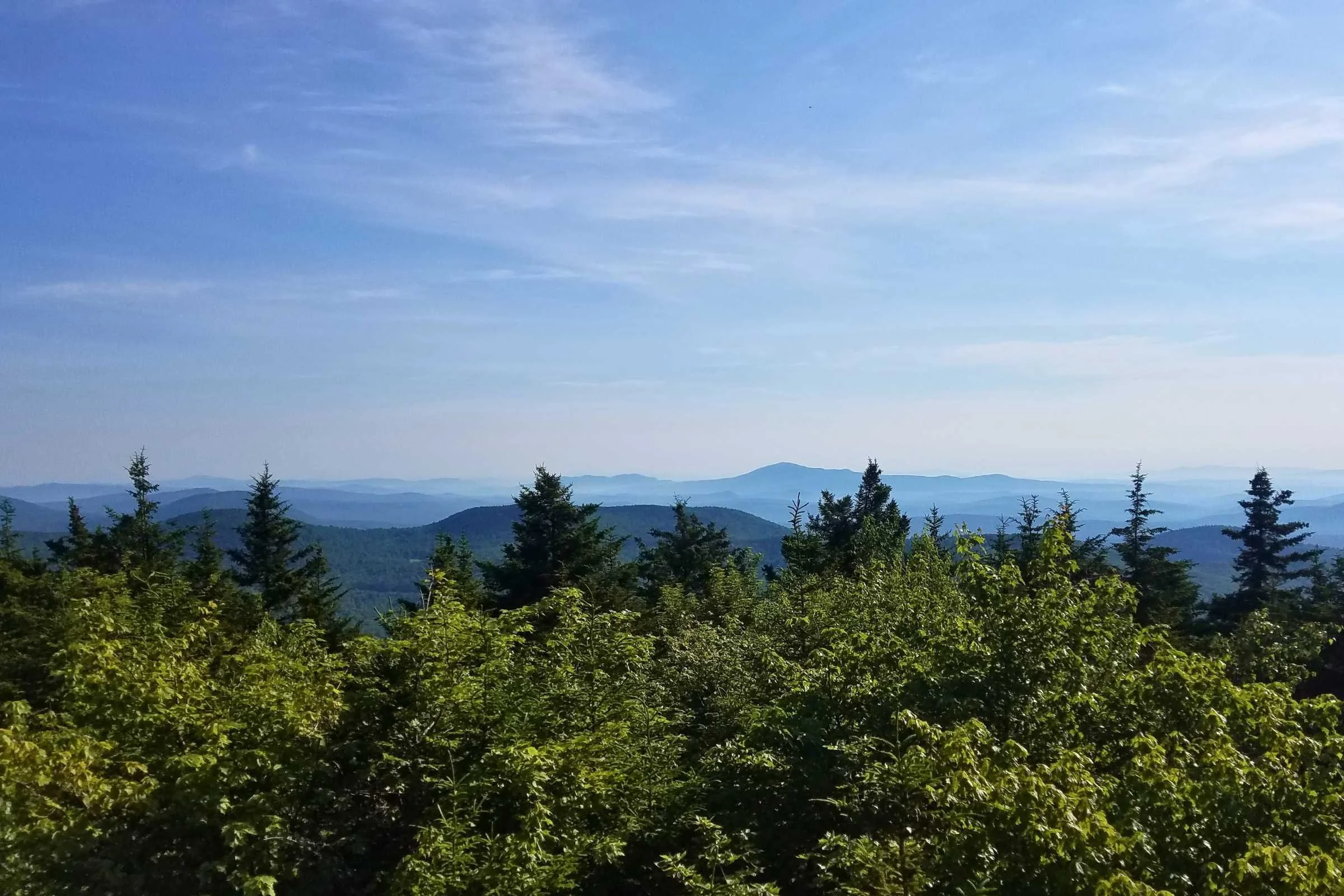
Stretching 1,200 kilometers (745.6 miles) through the spine of the Western Balkans, the Via Dinarica White Trail links trails through Slovenia, Croatia, Bosnia and Herzegovina, Montenegro, and Albania.
I hiked this route southbound in early summer, tracing lonely ridgelines and karst plateaus, and visiting small mountain villages. Remote, rugged, and still under development, it rewards confident navigators and solitude-seekers with wild landscapes few hikers ever see.
Distance: 1,261 km (783 mi)
Days: 45–60
Elevation gain/loss: +49,579m / –49,377m
Best season: May–October (ideal May–July, or later in the fall for lower temperatures)
Permits: None required for most sections, some national parks have small entry fees (country-specific park fees may apply)
Difficulty: Difficult
We create reader-supported, objective, independently-selected gear reviews. This story may contain affiliate links, which help fund our website. When you click on the links to purchase gear, we may get a commission — without costing you an extra cent. Thank you for supporting our work and mission of outdoor coverage for every body! Learn more.
Background

The Via Dinarica White Trail follows the Dinaric Alps, a limestone mountain chain that runs diagonally across the western Balkans. It passes through vast karst plateaus, ancient beech forests, and alpine peaks that form one of Europe’s last truly wild corridors.
The route crosses traditional pastoral lands, small villages, and national parks while offering cultural immersion alongside natural beauty. Although the trail network has existed for generations, the “Via Dinarica” project unites these older paths under one trans-Balkan vision of sustainable adventure tourism. The White Trail is the main and most complete of its three routes, following the highest ridgelines; the Blue and Green Trails remain in development.
This trail traverses Slovenia, Croatia, Bosnia and Herzegovina, Montenegro, and Albania, and passes through mountain communities that have shaped life in the Dinaric Alps for centuries.
Highlights
Beautiful, well-maintained section along Croatia’s Premužić Trail
Durmitor National Park, with dramatic limestone peaks and wide alpine views
Abundant solitude—I met fewer than a dozen other hikers during my month on trail and only two other thru-hikers
Opportunities to explore Mostar and Sarajevo in Bosnia and Herzegovina; rich in history, food, and architecture
A chance to experience one of Europe’s most remote and culturally diverse mountain regions
Challenges

Limited signage and unreliable GPX data; navigation skills essential
Sections of heavy overgrowth, unmaintained paths, and long road walksComplex or illegal border crossings between Croatia and Bosnia; requirement to plan alternate routes
Extreme summer heat and limited water sources, especially in Croatia
Snakes are prevalent along this route. The horned viper or Poskok is the most venomous snake in the Balkans and I ran into several of them along the trail. They often hide in the overgrowth, so be aware while you’re walking.
Ticks, language barriers, and inconsistent wild-camping regulations
Certain areas in Bosnia and Herzegovina and Croatia still contain unexploded ordnance (UXO) from past conflicts. Always remain on marked paths and obey posted warnings—detours off-trail can be dangerous.
Best Season
Late spring through early summer (May-June) offers the best balance of cooler weather, flowing springs, and slightly more manageable vegetation. July and August can bring intense heat and dry conditions in Croatia’s lower sections, while autumn may see early snow at higher elevations in Montenegro.
Difficulty and Skills

This route is best suited for experienced long-distance hikers comfortable with off-trail navigation, limited resources, and logistical self-reliance. Expect to spend time cross-referencing GPS tracks, reading terrain, and making on-the-fly route decisions. The solitude is rewarding, but it also means few other hikers to consult or follow.
Navigation
The official GPX track from the Via Dinarica website provides a baseline but is often inaccurate or incomplete. I supplemented it with GPX files shared by previous hikers. I began using OutdoorActive but switched to Gaia GPS for clearer mapping and offline functionality. Reliable navigation and an understanding of topography are must-have skills.
The trail often overlaps with the Croatian Long Distance Trail and the Via Adriatica in Croatia. There are sections of trail where you may want to follow one of those more popular routes for a while if you get tired of bushwhacking, although they are not always better.
Elevation Gain / Loss
Nearly 50,000 meters (164,042 feet) of climbing make this trail a sustained physical challenge. Elevation profiles vary sharply between countries—steep alpine ascents in Slovenia and Montenegro, rolling karst plateaus through Bosnia, and exposed ridgelines in Croatia.
Permits and Borders
No unified permit system exists. Each national park (e.g., Paklenica, Durmitor) may charge separate entry fees. Border crossings can be problematic–several sections of the official GPX line cross at non-official points. To avoid fines, arrange a ride or bus through legal checkpoints, and always carry your passport.
Security was especially strict at the Croatia and Bosnia and Herzegovina border. This is likely because Croatia is now an EU member, so the border is more strictly enforced, including with drone surveillance.
While National Parks typically charge a small fee, I was allowed to pass through freely as I was only a single hiker. This may not be the case for everyone, so be prepared to pay, but many of the park staff seem to have a soft spot for Via Dinarica hikers.
Route Summary

Starting in Slovenia’s limestone caves near Postojna, the White Trail winds south through Croatia’s Velebit Mountains, connecting the Premužić Trail and Paklenica National Park. It continues through remote karst plateaus of Bosnia and Herzegovina, crossing Sutjeska National Park and skirting high ridges toward Montenegro.
I hiked southbound from Slovenia to the Montenegrin border over five weeks. Each country brought a distinct rhythm — well-built huts and infrastructure early on, fading into rougher, less-maintained terrain farther south. For many hikers, Bosnia’s section is the most rewarding blend of culture, views, and accessibility.
Northbound travel can make logistical sense, giving you the best conditions up front and flexibility to decide whether to continue into rougher, more overgrown terrain.
Here’s a southbound route summary:
Slovenia
The trail doesn’t spend much time in Slovenia—especially if you begin in Postojna—so if you want to experience more of the country’s iconic landscapes, consider choosing your own alternate starting point or visiting a few classic Slovenian hiking areas or peaks before beginning the route.
Along the way, you’ll find several paid mountain huts, which are particularly useful since wild camping is illegal in Slovenia. That said, an “emergency bivouac” is generally tolerated–i.e., pitching a small tent at dusk and leaving at sunrise, in an inconspicuous spot that isn’t within a national park or on private property.
The caves near the trail in Notranjski Park are absolutely worth the detour.
If you start from Razdrto, about 13 kilometers into the first day you’ll come across a sign for Tatanka, a small rest stop for hikers. It’s definitely worth a visit—Nina may even be able to host you for a small donation if she’s around. It’s a lovely place to spend your first night on trail.
Croatia

Croatia’s free hut system is incredibly helpful for hikers. Many of the huts—especially those in Velebit National Park—are beautiful and well maintained. However, Croatia is also where trail maintenance largely drops off. The path quickly becomes heavily overgrown, navigation grows more complicated, and both ticks and thick nettle become constant companions.
That said, the Premužić Trail is a standout highlight. Built nearly a century ago by local stonemasons, it remains one of the most stunning and well-crafted sections of the entire route.
Water is harder to come by in Croatia, and temperatures can climb extremely high. While there is good tree cover through much of this stretch, keep a close eye on your water supply and plan accordingly.
Bosnia and Herzegovina
The trail improves slightly through this section, with long stretches following jeep tracks broken up by occasional pieces of true singletrack. You’ll pass several beautiful, well-maintained huts along the way. As you move farther south, the mountains grow larger, wilder, and even more breathtaking.
If you have the time, I highly recommend exploring a few cities in Bosnia and Herzegovina—I found them incredibly interesting, with excellent food and coffee.
Be aware that in several parts of Bosnia and Herzegovina, the “trail” simply doesn’t exist. You’ll spend a significant amount of time route-finding and traversing rolling hills without a clear path, so plan accordingly.
Montenegro

Durmitor National Park is stunning—and surprisingly quiet. The mountain trails here are generally well maintained, with dramatic limestone peaks, alpine lakes, and the occasional mountain dog companion that make this one of the highlights of the entire route. The park feels wild without being overly crowded, offering some of the most memorable views on the trail.
Once you leave the boundaries of Durmitor, the character of the hike changes. Much of the Montenegro section involves long stretches of road walking as the route winds through small villages and farmland. While it’s less remote than the national park, this part of the trail gives you a glimpse into everyday Montenegrin rural life. Water sources can be scattered, so planning ahead becomes important.
Overall, Montenegro is a beautiful mix of rugged alpine terrain and quieter cultural landscapes, offering a different but equally meaningful part of the Via Dinarica experience.
Albania
I ended my trail at the Albanian border, so I did not cross into Albania. It was another unclear border crossing, legally speaking, and the trail only continues for a few more kilometres on the other side. If you’d like to explore more of this area, consider looking into the Peaks of the Balkans Trail.
Getting There
By Plane
Ljubljana (LJU) and Zagreb (ZAG) are the most common international gateways for the northern start.
By Car/Bus
Public transport connects most major towns; local buses serve trailheads near Paklenica and Durmitor National Parks. There is a bus from Ljubljana, Slovenia to Razdrto, Slovenia that leaves from the main bus station in the center of town. This is where I started the trail.
Trailheads
Northern starts typically begin near Postojna, Slovenia or an alternate start is from Razdrto. The official starting point is actually a bit unclear. Southern finishes end at the Montenegro–Albania border near Plav or Gusinje, or hikers can continue for a couple more days into Albania, however this requires another questionable border crossing and limited resources at the current finishing point. Parking and public transit are limited in rural areas.
Post-trip Favorites

Take a few extra days in Bosnia and Herzegovina to wander the Old Town of Sarajevo and cross the iconic Mostar Bridge, where Red Bull hosts its annual diving competition. Don’t miss Bosnian coffee and punjene paprike (stuffed peppers)—simple but unforgettable.
There are also several beautiful beach towns to explore in Albania or Montenegro.
Regulations
Follow Leave No Trace ethics at all times.
Wild camping is generally prohibited but tolerated if kept discreet–set up near dark, leave early, and skip fires.
Respect private farmland and active grazing areas.
Carry identification and printed park tickets or permits where required.
Sections of the trail in Bosnia and Herzegovina and Croatia pass through regions where unexploded ordnance (UXO) may remain from the 1990s conflicts. While main routes and maintained trails are considered safe, venturing off trail is not recommended. Follow all official signage, stay on visible paths, and consult local guides or authorities if uncertain about specific areas.
Camping and Water
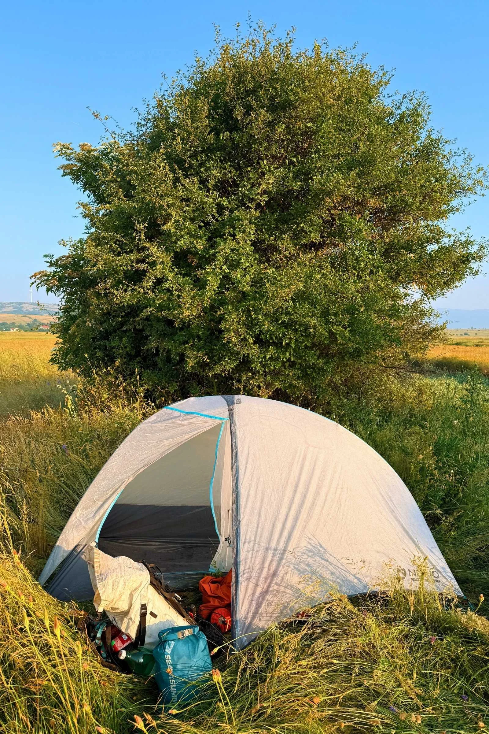
I alternated between mountain huts, wild camping, and occasional guesthouses. Most nights were spent camping or staying in simple backcountry huts. Water quality was generally good; I filtered everything and carried at least two liters between sources, often more, especially across dry Croatian landscapes.
Many of the mountain huts, especially in the less popular areas, are free and in various states of upkeep. There are a few serviced huts in the northern part of the route that are typically 10–15 euros for a bunk. These are often full on the weekends, so plan accordingly. The hosts are often accommodating and may let you sleep on the floor in the dining area, for example.
Camping is illegal in the national parks, so you’ll need to stay in huts or plan to be out of the national parks before nightfall.
Gear List
I used my standard thru-hiking kit—lightweight tent, inflatable sleeping pad, 30-degree sleeping bag, backpacking stove, and trekking poles. Protection against ticks, sun, and heat is essential. I experienced mostly dry, windy conditions with only a few days of rain.
A long-sleeved sun shirt and possibly long pants might be good ideas for this trail. There are long sections of bushwhacking and the trail is often completely overgrown with nettle, which can cause itchy reactions on skin.
Tent
I used the Nemo Hornet Elite OSMO 1P tent, which is the Best Lightweight winner in our Best Backpacking Tents guide.
Sleeping Pad
I recommend the Therm-a-Rest NeoAir Xlite NXT sleeping pad, which won Best Overall in our Best Sleeping Pads guide.
Sleeping Bag
Rather than a sleeping bag, I opted for the Neve Gear Waratah Quilt 0°C. For more of our favorites, check out our Best Backpacking Quilts and Best Backpacking Sleeping Bags guides.
Cookware
For cookware, I used the BRS 3000T Titanium Stove and the Toaks 750ml pot. Find more of our favorites in our Best Backpacking Stoves and Best Cookware Pots guides.
Trekking Poles
While I backpacked with old second-hand trekking poles, you can find our top picks in our Best Trekking Poles guide.
Water filter
I used the Platypus QuickDraw to filter water, which is the Best Overall winner in our Best Backpacking Water Filters and Purifiers guide.
Sun shirt
I packed the Town Shirt Sun Hoodie. Find more of our favorites in our Best Sun Shirts guide.
Hiking Pants
My favorites are the Outdoor Active zip-off pants. Check out our Best Men’s Hiking Pants and Best Women’s Hiking Pants guides for more options.
Jackets and Shells
I packed the Montbell Down Jacket and a REI waterproof shell. Find our favorite puffy jackets in our Best Down Jackets and Best Synthetic Jackets guides. For waterproof shells, check out our Best Lightweight Rain Jackets guides.
Base Layers
For base layers, I opted for a pair of REI wool leggings and a UNIQLO heat tech long-sleeved base layer shirt.
Footwear
I wore the Astral Designs Nosobo trail running shoes. Look for something rugged that can handle bushwhacking and sharp rocks, but is also comfortable enough for long road walking sections.
For our top picks, check out our Best Men’s Trail Running Shoes, Best Women's Trail Running Shoes, Best Men’s Hiking Shoes, Best Women’s Hiking Shoes, Best Men’s Hiking Boots, and Best Women's Hiking Boots guides.
Not sure if trail runners or hiking shoes are right for you? Learn more in our guide to Trail Running Shoes vs. Hiking Shoes.
Hiking Socks
I wore Darn Tough Merino Hiking Socks. Learn more in our Best Hiking Socks guide.
Bears and Wildlife

Brown bears, wolves, and wild boar inhabit the region but are rarely seen. Store food securely and avoid leaving scraps near huts or campsites. I saw one bear along the way in northern Croatia, but it was not aggressive and quickly ran away. I kept my food in my tent in a dry bag for the duration of this trail and had no problems, but also didn't typically camp in the deep forest and avoided camping in areas that looked like there was bear activity.
Ticks were a serious problem on this trail, especially in Slovenia and Croatia. They can carry multiple diseases and should be managed carefully. I would recommend treating your gear, shoes, and socks with permethrin before starting.
Snakes are prevalent along this route. The horned viper or Poskok is the most venomous snake in the Balkans and I ran into several of them along the trail. They often hide in the overgrowth, so be aware while you’re walking.
Side Trips and Variations
Explore Mostar and Sarajevo between Bosnia stages. Buses or trains are easy to navigate to these two towns and hostels are cheap and easy to book.
Durmitor National Park offers multiple side peaks accessible from the main route.
Some hikers choose to walk northbound, starting in Montenegro or Albania to tackle the most scenic areas first.
Other Resources
National park pages for Velebit, Paklenica, Sutjeska, and Durmitor
Local tourism boards: Visit Croatia, Visit Bosnia & Herzegovina, Montenegro Travel
EVA Dinarica: blogged and published maps for parts of her trail from 2018. Some info is out of date now, but was useful for cross referencing: https://www.outdooractive.com/mobile/en/route/mountain-hike/bosnia-and-herzegovina/croatia-my-via-dinarica-white-trail/21280684/
Why you should trust us / About the Author

Lauren Roerick (trail name Longway) is a long-distance backpacker and content creator who has hiked over 12,000 km across North America, Europe, and Oceania—including the Pacific Crest Trail, Te Araroa, HexaTrek, and Via Dinarica. She is a certified Wilderness First Responder and shares stories and advice to inspire more women into the backcountry. Find her work at www.laurenroerick.com and on Instagram, YouTube, and TikTok @laurenroerick.