Superior Hiking Trail Backpacking Guide
~300-mile hiking trail on the north shore of lake superior in minnesota

Updated September 3rd, 2024
Home > Trip Guides > Thru Hikes For Working People
Distance: 300 miles
Days: 2 weeks to 1 month
Elevation gain/loss: 37,821 feet (not including the Duluth section)
Best season(s): Fall
Permits: None required
Difficulty: Moderate
Pets: Leashed dogs are allowed on the SHT
The Superior Hiking Trail (SHT) is a 310-mile-long hiking trail in Northern Minnesota from the Wisconsin border near Jay Cooke State Park to the 270 Overlook near the Pigeon River north of Grand Marais near the United States-Canada border. Hikers, backpackers, and thru-hikers will experience the northern boreal forest, waterfalls, deep gorges, serene lakes, and bogs, with chances to swim and see moose, wolves, and the Northern Lights.
The SHT is a good trail for first-time thru-hikers as it's a well-marked footpath with 94 established campsites with no reservations, permits, or fees. It also has numerous opportunities to resupply and recuperate in towns along the north shore of Lake Superior.
The trail traverses Lake Superior, including 7 state parks and Superior National Forest, generally high on the bluffs and the Sawtooth Mountains, with daily grand views of the lake. This peaceful thru-hike is only open to foot traffic and is one of the most dog-friendly trails I've hiked. Its many easy-to-access trailheads (3 to 11 miles apart) make it ideal for day hiking, trail running, overnight backpacking, and section hiking, especially for people who live in Minnesota, Wisconsin, or Chicago.
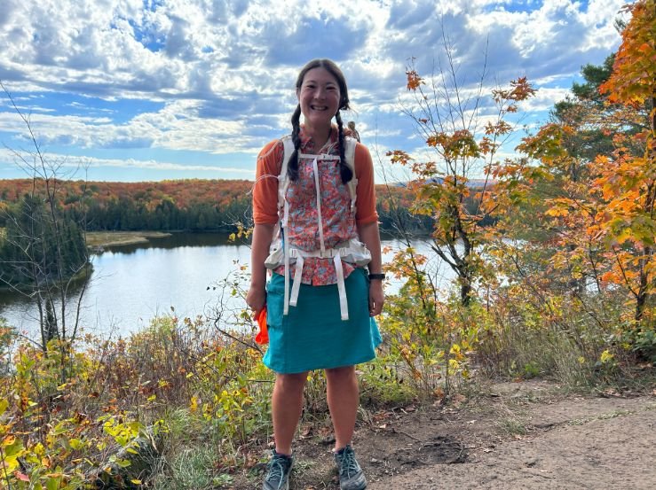
I southbound thru-hiked the SHT in the Fall of 2022 and absolutely loved this trail. Though it's a great first-time thru-hike, even as a Triple Crowner, I had a blast on this thru-hike. While many people will pay good money for a weekend trip to Up North Minnesota during leaf-peeping season, I feel fortunate to have spent weeks camping and hiking for free, immersed in the changing fall colors. Here are tips and advice I have for future hikers--from overnight backpackers to section hikers to thru-hikers.
These are the ancestral and current homelands of the Anishinabewaki and Očhéthi Šakówiŋ (Dakota/Lakota), who are still very much an active part of the community. Learn about issues important to today's indigenous people of Minnesota, including the wild rice harvest along bogs, the renaming of landmarks, and initiatives to return land. Learn about Minnesota's history of indigenous people and the many people who have called this home. Support local indigenous-owned businesses in trail towns and cities as you transit to and from the trail.
We create reader-supported, objective gear reviews independently selected by our editors. This story may contain affiliate links, which help fund our website. When you click on the links to purchase gear, we may get a commission — without costing you an extra cent. Thank you for supporting our work and mission of outdoor coverage for every body! Learn more.


Liz Thomas starting at the northern terminus 270 overlook of the SHT.
Highs
Fall colors, crisp air, sections of solitude
Waterfall after waterfall
Walking along Lake Superior's shore
Meeting amazing and fun people around the campfire at various campsites. As a thru-hiker, I could easily score extra food from overnighters, too!
Learning and partaking in Nordic culture at the Clair Nelson Community Center. I happened to resupply there during their Fall Booyah Festival and ate my fill of stews, freshly pressed apple cider, locally harvested mushrooms, fry bread, and wild rice porridge with berries—all while listening to a one-person polka band.
Impeccably maintained trail and campsites—each with outhouses
Well-signed junctions with campsite mileages
Great trail towns that are super walkable with friendly people
Many easy-to-access trailheads make it ideal for section hiking
Crossing impeccably built bog bridges across lakes
Challenges
Ticks and mosquitoes can be vicious if hiking in the spring or summer. It wasn't a problem for me in the fall.
Logistics around camping in the Duluth area. There are 50 miles with only a few legal camping areas close to the trail.
Logistics of getting to and from the trailheads
State park campgrounds require reservations, which can be hard to get and book while on the trail with limited cell reception. Most hikers figure out logistics so they do not camp in any state park campgrounds.
Mud and flooding. Be prepared to get your feet wet.
I didn't mind this, but want to be clear the trail is not along Lake Superior the whole route. In fact, you may only see it once a day through the trees.
Hotels can be expensive or impossible to get during leaf-peeping season
The trail goes past some popular hiking areas that can be crowded, like Bear and Bean Lake, Devil's Hole, and the swinging bridge at Jay Cooke State Park. I had half days of solitude and even some campsites to myself but be prepared to see crowds in certain sections, too.

Fall is the ideal season to hike the SHT, though you will want to wear bright orange as hunters may be about.
Best season
Fall is the best season to hike this trail. Ticks and mosquitoes can be an issue in the spring and summer in Northeastern Minnesota. After a good freeze, they die off. The fall colors on the SHT are the most extraordinary I have seen anywhere. Nights were chilly, but I brought a 15F sleeping pad and was happy at night. Consider treating clothes and gear with Permethrin before you go, even in the fall. I saw one tick even though I had many below-freezing nights.

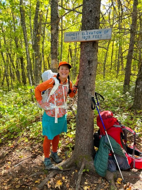
Liz Thomas at the high point of the SHT on her first day of thru-hiking.
Difficulty and required skills
The SHT is similar to the Appalachian Trail because it has a fair amount of up and down, and the trail can be rocky, muddy, and rooty. It's a good option for anyone preparing for the Appalachian Trail. Here are some other similarities:
Navigation
Navigation along the SHT is generally well-marked with blue blazes (6-inch paint markings) on trees at trail junctions. Like other long-distance hiking trails, the most confusing junctions were near busy state park areas and campgrounds, which tend to have many trail junctions. Luckily, state parks generally have large maps at kiosks, so you can orient yourself back to the SHT (plus, you likely will want to stray off the SHT in these areas to see some of the park's highlights).
Rough Terrain/Scrambling/Rock Climbing
Certain sections of the trail can be steep, rocky, and muddy. Still, no rock climbing skills are required, and nothing is exposed.
Elevation Gain/Elevation Loss
The SHT's high point is at 1829 feet, but it still has a fair amount of up and down each day. While you don't need to be an expert hiker, you should be in good walking shape, especially for hills and uneven ground.
Permits
No permits are required to hike the SHT. However, you will need campsite reservations if you intend to camp in any state park campgrounds or backcountry sites. However, it is easy enough for thru-hikers to plan their hike to end each day at a camping area outside of the state parks.
Camping
The trail has 94 designated camping areas. Each campsite has tent spots, benches, a fire ring, an open-air latrine, and a water source. Although I usually prefer to stay in non-designated camping areas, I was impressed by how nice these camping areas were and how often I had the campsites to myself.
If you're hammock camping, you must still stay in the camping area.
The camping areas were also great for meeting friendly new people. In a few instances, I shared campsites with overnight backpackers, they often shared food and beverage with me, which I much appreciated as a thru-hiker.

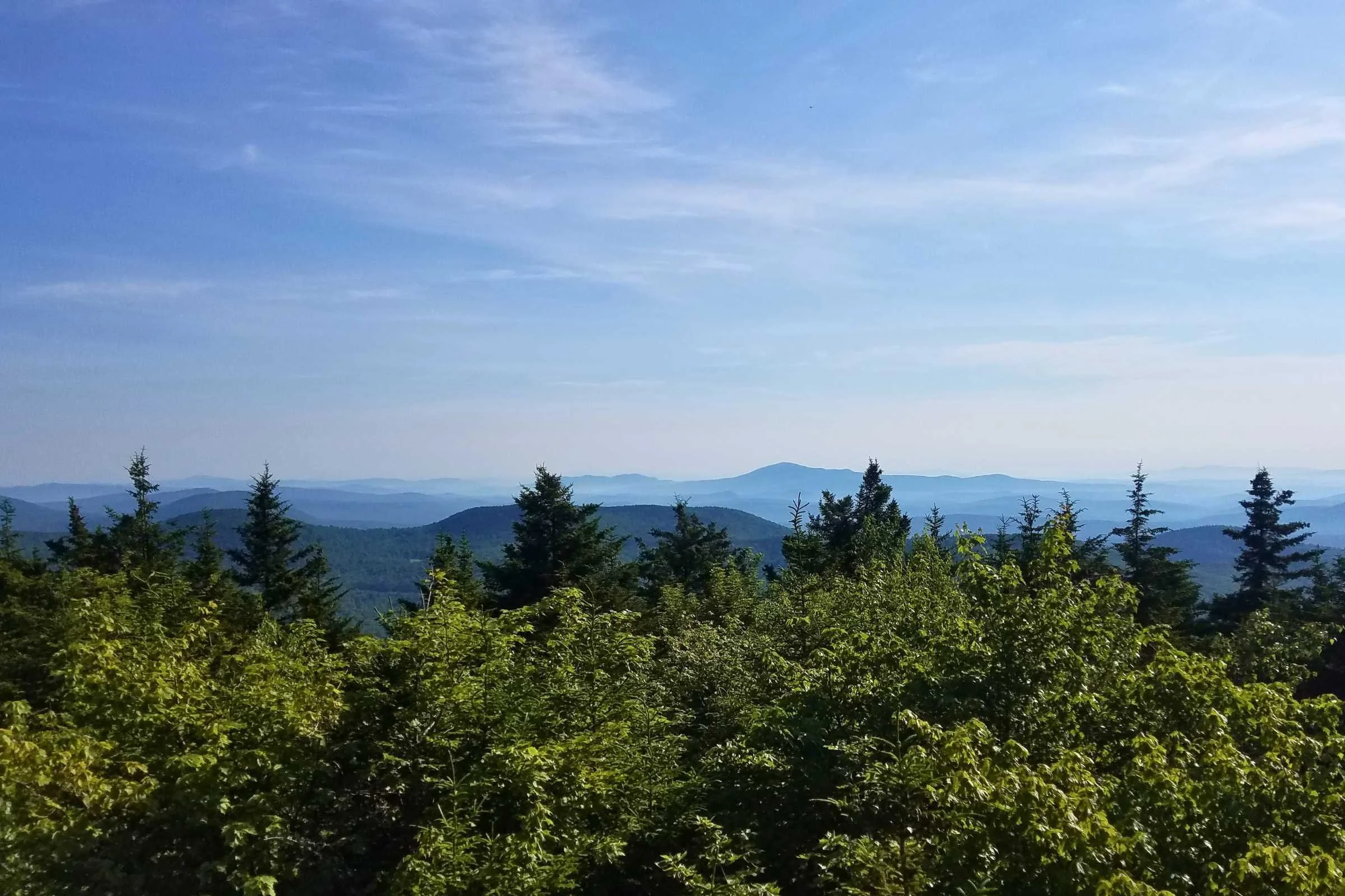
A view of Lake Superior from a grassy knoll on a beautiful crisp morning on the Superior Hiking Trail.
Northbound or southbound?
Southbound
As a late-season southbounder, I wanted to do the part of the trail that was likely to be the coldest first. I started the trail in good shape, having just hiked the High Sierra Trail, and was ready to start with the more rugged terrain. I also wanted to start a trail by completely disconnecting, so the remote northern boundary was a good wake-up call to my brain that the trail was about to begin. Logistically, the northern boundary is the hardest to reach and has no cell reception. So it's easiest to arrange a shuttle or ride to this terminus and finish in the south, where cell reception is more reliable.
Northbound
Many hikers find the logistics of hiking northbound to be easier. Because the 49 miles of the Duluth section has limited camping areas, making overnight arrangements can be easiest at the beginning. Your itinerary is unlikely to deviate much from your original plan during the first few days of your hike, so you can make your reservations for pay-for-fee campsites or hotels (or arrange where to stay with trail angels).
Additionally, the southernmost 100 miles are less rugged and have lots of opportunities to bail should you decide your gear isn't right or the hike isn't for you. The further north you get, the trail gets more difficult and remote. Luckily, as a northbounder, you'll have your trail legs by then and will be prepared for the more difficult route ahead.
Route Summary
I thru-hiked the SHT southbound and found the logistics around southbounding easier, so I will describe my path. The trail is usually broken into 6 sections.

270 Degree Overlook to Pincushion Mountain Trailhead (hitch to Grand Marais)
The SHT starts off the dirt Otter Lake Road a few miles from the Canadian border and Pigeon River near Hovland. If you turn left at the northern terminus, you can take the Border Route Trail (65 miles) and then later to the Kekekabic Trail (41 miles) and into the Boundary Waters Canoe Area Wilderness. These trails are also part of the 5000-mile-long North Country Trail. I camped and hiked with a couple who connected the Border Route with the Kekekabic Trail and SHT. However, like most SHT hikers, I turned right to the incredible view at the 270-degree overlook. Then, I retraced my steps back to the parking lot to head southbound.
The trail is surprisingly flat until it reaches its high point at 1829 feet. Then, I descended to Jackson Lake, with views of the birch forest (but alas, no sightings of a moose…yet!) You'll get your first almost view of the lake at the humorously named Hellacious Overlook, perhaps so named for the climb to get to the top. There's not much of a view through the trees, but this was still exciting to me as a southbounder eyeing the lake for the first time from the trail.
The area is popular with dog sledders and the sight of a famous photo along the trail. From there, I crossed the Flute Reed River into Judge C.R. Magney State Park, the first of many state parks the SHT visits. I followed the Brule River to the two main attractions of Magney State Park: the Devil's Kettle and Upper Falls. There are lots of wooden stairways here to get through the steep stuff. Then you'll walk through a day hiker's parking lot with a privy, water faucets, trash cans, and picnic area, ideal for a lunch break.
A major highlight of this section is dropping down to Lake Superior's smooth rock and sandy shore—the only time the SHT walks right on the shoreline. There's one kayaker's campsite along the shore. It was windy and slow walking on the shoreline rocks, but as it was only a few miles, I was grateful to have had the experience before climbing to a forest of rare red pine and overlooks of the lake below.
White blazes are used for overlooks or spur trails, and I went to a great one near Pincushion Mountain. The trail had a rare large rocky slab with an impeccable panoramic view of Lake Superior. Watch for mountain bikers in this area. While the SHT is for hikers only, there are many intersecting trails. Many hikers will hitchhike into Grand Marais from the large Pincushion Mountain trailhead parking lot (with an outhouse and garbage can!). Grand Marais is an artsy town that is a great place to resupply.

Liz Thomas on the SHT at a viewpoint above Lutsen looking out at the changing color in the maple forest below.
Grand Marais to Lutsen
The section from Grand Marais to Lutsen is the highest elevation of the whole trip. As a result, it gets colder here earlier than other parts of the trail, so leaves will change here before other parts of the trail. The red fall colors on the maple ridgelines in this section knocked my socks off.
There are some nice bog boards over Sundling Creek (that's actually more of a pond) that were pretty exciting. As a hiker from southern California, nothing makes me feel more like I'm in the boreal forest than these bog boards and beaver ponds.
I follow the Devil Track River Gorge (there are a lot of devil-named waterways) along private property until you reach Cascade River State Park. There's a trail on both sides of Devil Track River to form a loop, but when I thru-hiked, the "official" SHT was closed for repairs, so I hiked the alternate. There are some cool cedar trees along these waterways that were a surprising break from the pine and birch I'd seen so far. I camped with a group on a low-key bachelor party, and they gave me an entire stick of butter that I used for the next week!
The Cascades are popular waterfalls that are viewable from a well-positioned high bridge. Here, the river has dug out a deep gorge that is quite notable.
It's a steady climb up to the panoramic view from Lookout Mountain (where I met a hunter who gave me even more food!). I kept hiking up towards Jerry Evjen's Overlook and into great views of fall colors out towards Lutsen and Eagle Mountain, the highest point in Minnesota.
One of the highlights of my SHT thru-hike was a leisurely lunch break along Agnes Lake near Lutsen. There are several campsites along the lake, but I took the chance to soak my feet in the cold water and look out at the red and orange forests surrounding the lake.
The area around the Lutsen Mountain Ski Resort and Moose Mountain were some of the most stunning fall colors for me, and I had it all to myself for several hours in the late afternoon. Had I timed it better, I could've grabbed a meal of fried cheese curds at the Lutsen Mountains Ski resort at the bottom of the Lutsen Mountains gondola, or supposedly, there is a restaurant at the top of the gondola that I failed to find. There's a lodge that accepts resupply packages that some hikers I met stayed at and had a great time.

SHT thru-hikers may not always go to the top of the many peaks and high points near the trail, but some are worth it. Carlton Peak was one of them.
Lutsen to Caribou Falls State Wayside
The fall colors at Moose Mountain and Mystery Mountains were some of the most memorable sustained climbs of the trip, but they also had some of the best views and fall colors. It was getting to be the end of the day, and I still had a few miles to my campsite, but if I had more time, I would've hiked up the Oberg Loop on Oberg Mountain. The trail skirts the edge, and just as it started getting interesting along a moraine, it stayed low. It took a lot of willpower to keep pushing on.
I had a similar opportunity for a fun detour on the Leveaux Loop up to Leveaux Mountain for a panoramic view of the fall color. I skipped the short spur trail to Britton Peak that morning in favor of a bigger mountain: Carlton Peak (1526 feet and 924 feet above Lake Superior). I got exceptional views of the lake and surrounding forests of old-growth maple. I also got cell reception to check in back home.
From there, I traveled down the Temperance River to Temperance River State Park to cross a cool high bridge close to where the river dumps into Lake Superior. Then, I followed the river back up. That happens a lot on the SHT, and I couldn't help but think how much easier it would be to cut off some miles by fording the river. But given how deep and fast-moving it was even at the end of October, that seems like a Bad Idea. Plus, the gorges through this section were pretty incredible, and there wasn't much elevation gain, so I didn't mind too much.
Much of the day was pleasant walking next to a river and through beautiful forests with many camping options. It was cold and raining that day, so I missed the view from Tower Overlook.
I descended to Caribou River Gorge (see a theme of climbing up and down waterways?)
For thru-hikers, a highlight of this section is the Covered Bridge near Crystal Creek. The section ends at a spur trail that connects to the Caribou Falls State Wayside, 0.7 miles away. While this is a popular access point to the SHT for section and day hikers, most thru-hikers don't make the side trip to the base of the falls (I didn't).

The fall colors and view from Mt Trundy was perfect for Liz Thomas during her SHT thru-hike.
Caribou Falls State Wayside to Silver Bay
I climbed to Horseshoe Ridge, where I had a campsite to myself. The trail spends a very short period in Crosby Manitou State Park, passing by some reservation-only campsites. Since it was raining, I was stoked to grab a snack in the day-use shelter, but it burnt down since my guidebook was written. Still, I made use of the toilet and tried and failed to use the water pump at the Crosby Manitou State Park trailhead.
It's a short dirt road walk to connect to a cool trail following the East Branch of the Baptism River, where I saw many toads. The fall color was magical through here. I passed Sonju Lake campsite, where there's a side trail that goes to Lilly's Island. I was on a mission to make it to the Recreational Center to get a resupply package, so I took some photos and headed on my way.
If I'd had more time, I might have camped at North Egge Lake or South Egge Lake, two beautiful campsites that friends had told me about before I started my trip. I made it to the Rec Center during the Booyah Festival, a fall festival with live music, press-your-own apple cider, local farmers selling food, and endless bowls of affordable booyah stew, frybread, and wild rice porridge. I topped off my electronics, warmed up, used their WiFi, left a donation to the center, and finally dragged myself away feeling restored.

A house-sized glacial erratic boulder on the SHT.
The rest of the afternoon was relatively flat hiking through intense fall color, including past a giant glacial erratic (boulder) that feels totally out of place here. Perhaps a highlight of the SHT was the Sawmill Creek Pond Boardwalk—a boardwalk over a pond surrounded by red, yellow, and orange forest. I camped at Section 13 campsite—one of the most popular on the whole SHT. I had been warned it was overcrowded and frequented by bears, but the next camp was 4 miles away, and it was getting dark and starting to rain.
I called it a day and instead hung out at the vista along with photographers with tripods and had a fun evening with overnighters around the campfire. I woke early for a short but steep climb to Picnic Rock and Sawmill Dome Vista. The trail narrowed at the Lime Squeezer, and I was disappointed as I expected it to be similar to the Lemon Squeezer on the Appalachian Trail.

The view looking at towards the Wolf Ridge Environmental Learning Center. The SHT crosses their private property through an easement offering this amazing view.
The trail crosses through the Wolf Ridge Environmental Learning Center's private property through an easement. The view into Raven Lake and Wolf Lake from the SHT was jaw-droppingly incredible. I spent many miles fantasizing about how I could weasel a stay at their modern buildings (visible across the lake). There's a spur trail to the Fantasia Overlook just outside of Wolf Ridge's land, but I skipped the additional climb.
My mind was actually on the upcoming scary ford in Tettegouche State Park.

High Falls Lower Vista on the Baptism River. Many day hikers gather here for the view but the SHT stays high. Liz Thomas took a detour thinking the ford of the river was below the falls. The swinging bridge that is out is actually above the falls.
Before starting the SHT, I was warned that the swinging high bridge across the Baptism River was out. Signs throughout the park warned it was impassable. The trail to the base of High Falls Lower Vista was great, and I made the mistake of fording below the falls. After poking through the bushes to find the trail, I had to backtrack. I forded well above the falls in a dicier crossing before continuing onto another landmark—the Drainpipe.
In the early days of the SHT, the Drainpipe was a notoriously steep rock chute that hikers had to hand-over-hand. Now, there are steep wooden stairs over the chute, making what was once an SHT hiker rite of passage less notable. The climb up to Raven Rock was stout, and it was an unseasonably warm day. Near the vista on the ridge of Mount Trundee, I took a photo of a couple replicating a photo they'd taken there together 20 years before.
I skipped the Round Mountain Mini Loop and headed onto Bear Lake Vista. Bear Lake and Bean Lake are two of the most highly trafficked spots of the SHT. Even on a weekday (admittedly, fall is peak season here), there were day hikers. Still, the view of these bright blue hanging lakes cradled by steep rocky rhyolite slopes is unlike anything on the SHT—it felt like being in Colorado. The surrounding red maple forests contrasting with the lake's blue made it even more spectacular. Connector trails lead to Silver Bay here.
The trail follows a cool rocky cliff line with great views for a mile before descending into the forest. The trailhead leads to an easy hitch to Silver Bay.

Silver Bay and Gooseberry State Park
The trail reaches a junction with the paved Gitchi Gami bike trail through an underpass before entering a newly re-routed section of the trail through private property owned by the mining company. It felt a little exposed being so close to "civilization," but the campsites were super nice, and signs prohibit anyone but SHT hikers from using it (including ATVers).
I could've had a campsite to myself at East Beaver River campsite but opted to go to West Beaver River campsite, where I had a great night around the campfire with some overnighters and another thru-hiker (one of only 3 camps I shared with other thru-hikers!)
The views at Fault Line Valley Vista towards the lake are great. I had toyed with the idea of taking the spur trail to Cove Point Lodge (which also accepts packages) but decided to keep going. Christmas Tree Ridge was one of those quiet, memorable parts of the SHT for me—the trail is flatter rock slabs covered in moss and lichen and tiny plants I don't remember seeing anywhere else. It felt very boreal, and I constantly stopped to take photos of the smallest plants.
After nearly 7 years of planning and construction, the new Gooseberry (pronounced G-ooze-berry) re-route was finished just a week before I started. Hikers used to detour to the Gitchi Gami trail to connect with Gooseberry State Park, but now it stays high through beautiful forest. The trail no longer goes by Fifth Falls Bridge, and the section of Gooseberry State Park has no falls. It has plenty of three campsites along the Gooseberry River, though.
After all the climbing, the 1-mile section of trail shared with the Merrill Grade Historic Logging Railroad was not long enough. The trail enters Split Rock Lighthouse State Park but doesn't get anywhere close to the famous eponymous lighthouse—supposedly the most photographed landmark on the North Shore.
Instead, the trail goes close to Split Rock, with many waterfront views. I took a lunch break right under the falls with a view right across to the Split Rock formation. The Split Rock Loop, a 5-mile day hike that uses much of the SHT on either side of Split Rock River, was one of the more popular hikes on the North Shore.
The bridge is out and now requires a ford, though, in low water, I found it pretty easy. If necessary, I was prepared to detour to the Gitchi Gami Trail (which has a bridge). The trail was muddy but with great on-the-edge-of-the-cliff views of the waterfalls below. The Strand Creek Waterfall is right by the trail—one of the last falls for a while.
The following day, I crossed the Encampment River, an easy rock jump through a ravine with lots of warnings of poison oak. Then, I hitched into Two Harbors for the rest of the day off to resupply, catch up with a friend, and take my first shower of the trip.

The section of the SHT to Martinville Road is generally flatter but through interesting forest. Though it may not look like much, thru-hikers share the photo of going under the train bridge to signal the are entering (what will be for many southbounders) the last section of their hike.
Two Harbors to Martinville Road
The trail moves onto a road walk to avoid an easement through private property that was recently revoked. It follows a muddy trail along Reeves Road to a Railroad Underpass, a landmark for SHT thru-hikers. I was lucky to catch up with my thru-hiker friend and hike this section of the trail together on a cold day. The fall colors were popping, and I stopped to take some slo-mo videos at the Epic Tree Stand and marvel at what we were walking through.
We saw a bear cross Rossini Road before climbing to 12 Mile View, which wasn't the best view on the SHT.
This flatter section, with mixed pine and maple, was still fun during the fall season. Much of the trail goes through the experimental forest, with signs telling you what trees were planted and when. If you're a tree-nerd like me, this can be fun to walk through.
The next morning, it snowed on me at Fox Farm Pond, and I met some northbound thru-hikers who had just come off the Continental Divide Trail. I sat out the heaviest snowfall in a snowmobile shelter, taking time to layer up. Slowly, the trail feels less wild as it follows the North Shore State Trail snowmobile trail and even has a bit of a road walk through the countryside.
The last bit to Martinville Road goes on several grassy snowmobile routes. Several section hikers I talked with said these can be full of ticks during spring and summer, but I didn't see a single tick here in the fall.
The miles went quickly, and I reached Martin Road Trailhead faster than expected. Many thru-hikers end here to avoid the section through Duluth.

The viewing deck at Bagley Nature Center on the University Campus was incredible! I couldn’t believe it was on a campus trail.
Martin Road Trailhead to Spirit Mountain
The "Duluth" section of the trail far exceeded expectations–and that's not just because I'm an urban thru-hiker! Martinville Road trailhead had great fall color, and the Hartley Nature Center and Hartley Pond were so beautiful that I saw people getting married there! Bagley Nature Center on the university campus was convenient to camp off the trail and in the city (and rideshare into restaurants). The view out to Lake Superior that morning from the viewing platform was one of the highlights of the whole SHT. From there, the trails through Chester Park were surprisingly secluded-feeling.
I walked through the Historic Old Town area for a short road walk past the Farmer's Market and supermarket to Canal Park and the Lakewalk path. A half marathon was going on, and a runner even yelled to me, "Are you thru-hiking? That's hardcore!" The walk along the lake was world-class, and while there were tourists, I had a great time walking by the brewery, watching the tower bridge rise for ships, and getting a smoked fish sandwich at Northern Waters Fish. This is one of the better spots to get food as (to my shock) much of the rest of the "Duluth section" is through forest.
The area around Bayfront Park to Interstate 35 Footbridge wasn't my favorite, but then it's back to the dirt trail up to the American-Japanese Peace Bell in the Japanese garden in Enger Park. This was special to me as I can't think of another trail where my heritage is a landmark spot on the trail.
The SHT winds through Lincoln Park, Lyman Park, Brewer Park, and Oneota Park. While nothing is notable, it's still incredible that there's this much connected and wild feeling trail all within the city. Some friends joined me for the Duluth section, and we talked so much that we missed the junction for the Lake Superior Zoo.
I loved the trail builders’ sense of humor, choosing names like 'Overpass Overlook.' I didn't think the views were bad through Duluth and appreciated the chance to forage apples off the trees growing near the trail.
The night ended at the impressive Spirit Mountain, where we got beers at the pub right at the Grand Avenue Chalet trailhead. Spirit Mountain operates a fee campground, but as it was closed, this was a good spot to call it a night and return to civilization.

The southern terminus of the Superior Hiking Trail along the Minnesota-Wisconsin border.
Spirit Mountain to Jay Cooke State Park and southern terminus
The next morning, the walk over the Gogebic Creek stone bridge and Steward Creek Stone Bridge with sunrise views over the lake was fantastic. The trail goes into Magney/Snively Park and Natural Area, which sometimes have confusing intersections. The view from Ely's Peak was also a lovely surprise, considering its proximity to civilization. For hikers who don't like the Duluth section, the wilds begin again at the surprisingly remote and unvisited Frederick Rodney Paine Forest Preserve. Soon, the trail officially crosses into Jay Cooke State Park, and it begins to feel like the end is near.
The Grand Portage Trailhead on the St. Louis River Fond du Lac is a rare chance to be close to the river. Friends met me on their bikes here, and we hiked high onto a ridge before crossing the Willard Munger State Trail (a bike trail) a few times. It descends to the dam and then is on wide cross country ski trails until reaching the fee-campsite by the Swinging Bridge.
We warmed up by the fire in the WPA-era Stone Visitor Center (the gift shop sometimes has ice cream for sale, but they were out). The Swinging Bridge and the Mars-like rocks underneath are a cool spot, though it was crowded. But 100 yards up the trail, the crowds were gone, and we had the trail to ourselves for miles. The Railroad Bridge Vista is a nice place for train spotting before the second to last road crossing. Connector trail leads to Wild Valley Road, the closest road to the Southern Terminus.
The last 2 miles of the SHT pass a final campsite, the Red River Valley. The southern terminus is on the Minnesota-Wisconsin state border, and a good trail continues to the east on the North Country Trail. But I returned to Wild Valley trailhead after celebrating the end of my SHT hike.

A grassy section of the SHT on an early crisp fall morning.
Maps and guidebooks
Gaia
Before I left for the trail, I downloaded the surrounding background maps using Gaia GPS. Remember, many sections of the trail do not have cell reception, so it's important to download these maps before you go.
Farout Guides
Farout guides, a phone app for long distance trails, released a guide for the North Country Trail. It’s great for planning your distance to the next intersection, road crossing, water source, or town while you are on trail.
Maps
I purchased paper maps of the trail from the Superior Hiking Trail Association. Somewhat frustratingly, the maps do not label the distance between landmarks (or campsites). However, I also purchased the databook from their store, which does list the distance between landmarks. To get all the info I needed, I had to purchase both items.
Additionally, the SHTA sells a digital map through the Avenza app. Avenza puts a blue dot of your current location and superimposes it onto your location on a topo map.
Guidebooks
I purchased the databook from the SHTA because the mapset does not label distances between points; that information is only available in the guidebook. Then, I hand-drew the distances between locations onto my maps and developed a spreadsheet based on those numbers for my itinerary.
Lastly, the data book does not list which road crossings lead into town for resupply. So I had to cross-reference with my maps to figure out which roads would be the easiest place to hitchhike to get to towns. Then, using the data book, I could then figure out the mileage between resupply points. The SHTA also sells a thicker guidebook with more natural history information, but I opted not to purchase that.

An overview point near Pincushion Mountain gave an incredible view of the lake and a good place to dry out wet gear from the night before.
Getting there
By Plane
I flew from LA to Duluth, MN, a regional airport with service from Minneapolis-St Paul airport. You can get a taxi or rideshare service from the Duluth airport to take you close to the "southern" terminus.
Alternatively, you can fly to Minneapolis Airport, which has international service. You can rent a car or take a shuttle to Duluth from there. Given how long my layover was at the Minneapolis airport, I may have been better off taking a shuttle to Duluth instead of taking the short flight there from Minneapolis.
By Car
From Minneapolis, the southern terminus is about 2 hours drive. The northern terminus adds another 2 hours. If you're traveling on the weekend during fall, be prepared for slower traffic along the north shore highway as there are many leaf peepers.
The northern terminus is closest to a very remote trailhead off a smooth dirt road (Otter Road). I was dropped off by a friend in a Tesla, and we had no problems getting there. Still, this isn't the type of place you'll likely be able to hitchhike to, and there certainly are no buses to this trailhead.
From this trailhead, the northern terminus is a 2-mile hike in. Whether you're a northbounder or southbounder, you'll have to backtrack those miles.
The southern terminus is less remote, but still off a short dirt road. As with the northern terminus, you'll have to hike about 2 miles to reach the state boundary line with Wisconsin. Whether you are northbound or southbound, you'll have to backtrack those miles.
Bus and Shuttle Services
Two shuttle services provide service to trailheads along the SHT. You can read more on the SHTA's shuttle service page.
Superior Hiking Shuttle–Make reservations online or by calling (218) 834-5511. Shuttle service can take you to any trailhead with drivers based in Castle Danger, Duluth, and Grand Marais to help keep the cost and miles down of any given shuttle.
Harriet Quarles Trans–Local ride service is available from May to November with service to all hiking trails from the Cook County Airport in Duluth or the Twin Cities. Reservations are accepted year round. As of 2022, shuttles from the Duluth airport to the northern border cost $300 one-way. Call 218-370-9164 for a quote.
Arrowhead Transit buses–these affordable buses go as far north as Grand Portage, for those section hiking. They start as far south as Duluth and service trail towns in Lake County: Two Harbors, Beaver Bay, Silver Bay, Tofte, Grand Marais, and Grand Portage. Some hikers will take the bus as close to the trail as they can get and then will use one of the paid shuttle services to get to the trailheads, which are sometimes are dirt roads that are hard to get to. Others will rely on local trail angels to travel the last few miles to the trailhead. Depending on the trail town, you may be able to hike connector spur trails to the SHT.
Trail angels: there's an active trail angel community on the Superior Hiking Trail Facebook page. You may be able to find a local willing to give you a ride. Remember to always, at minimum, cover gas costs for trail angels.

The southern border of the SHT is at the Wisconsin border.
Trailheads
Wild Valley Road Trailhead
The 310-mile route takes you through the city of Duluth to Jay Cobb State Park to the Wisconsin state border. This is the route I hiked, and I was very happy about it. I was surprised by how wild the Duluth section was—almost no road walking, and the forested trail along this route was secluded, quiet, and beautiful. You wouldn't know you were in the city—and in fact, you aren't for most of it.
Duluth Martin Road Trailhead
This 260-mile route starts at the northern part of Duluth and skips the town section. This is considered the "historic" southern terminus of the trail. Still, I found it to be not as scenic as the other termini and a rather anticlimactic place to end the hike.
Otter Road trailhead to northern terminus
This remote trailhead is the northern most road that can access the 270 Degree Overlook northern terminus of the trail. It's a dirt road, but a friend driving a Tesla was able to drop me off with no problem. It's about another 2 miles of hiking until you reach the actual northern terminus.
Start in Duluth and Flip-flop from the Grand Marais trailhead:
The northern trailhead at Otter Road is remote. Many people choose to northbound from Duluth to Grand Marais to cut down on logistical challenges. Then, they take a shuttle to the northern trailhead and southbound back to Grand Marais. Although they still have to pay a shuttle fee, this way of hiking the trail cuts down on the cost of the shuttle fee.

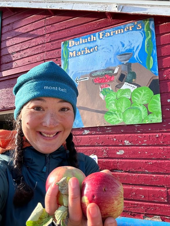
Resupplying on the SHT at the Duluth Farmer’s Market.
Trail Town Favorites
Castle Danger Brewing in Two Harbors has great local beers and food trucks. Plus, they are major supporters of the Superior Hiking Trail Association and are hiker-friendly.
Although they didn't serve anything special, the Spirit Mountain ski resort at Duluth is right on the trail and has a bar with pub food. There aren't too many trailheads on any trail that come with a pub.
Physical Training
We recommend starting any thru hike with a good base fitness level. Ideally, you’d spend some time building your thru-hiking-specific fitness.
Regulations
Practice Leave No Trace outdoor ethics.
It's imperative on this trail to only camp at the 94 designated camp areas. This trail crosses many private lands—and landowners only permit that to happen with the understanding that hikers will stay at the designated campsites. By camping at the designated areas, you ensure the trail stays open to hikers. Sections have been closed in the past resulting in long road walking re-routes and the need for costly new trails to be built. Be respectful to private landowners.
Campsites are limited, so sharing campsites is expected. Each camping area has room for about 9 people, so plan accordingly.
Keep pets on a leash.
Caching of food or camping supplies in the woods is prohibited.
No camping is permitted at parking lots.
No bikes or motor vehicles on the trail. Foot traffic only.
Do not stay at a state park campsite unless you have reserved and paid for it.

Pressing apple cider at Clair Nelson Community Center during the Booyah Festival.
Resupply
The Superior Hiking Trail has many small towns along the way where you can resupply—either at local grocery stores or by sending yourself a package of food.
The Superior Hiking Trail Association maintains a list of Post Offices that accept packages for General Delivery, a way to send yourself a package for free. Show your ID, and the postal clerk will give you your package.
This list also has services available in each town including grocery stores, laundry, hotels, camping, meals, and gear outfitters.
The Superior Hiking Trail Association also maintains a list of businesses that will accept packages along the trail. The benefit of sending a package to a business instead of a Post Office is that businesses are often open on weekends or for longer hours during the day.
You'll have to walk into trail towns or arrange for a ride. Quite a few spur trails connect the SHT to nearby towns.
The trail towns of the SHT are:
Hovland
Grand Marais–I didn't go into Grand Marais, but a fellow Triple Crowner I thru-hiked with on the SHT resupplied here and said it is one of the great trail towns of any trail.
Lutsen
Tofte
Shroeder
Finland–I sent a package to the Clair Nelson Community Center 0.3 miles from the trail via spur trail.
Silver Bay
Beaver Bay
Castle Danger
Two Harbors–I loved this trail town and zeroed here, finding everything quite walkable with good restaurants and an excellent supermarket.
Duluth–the trail goes right past the Farmer's Market, burrito shops, and near a brewery. However, the "town" part of the SHT in Duluth is only 6 of the 50 miles, so be sure to take advantage of your food options while you can!
Additionally, there are several hostels, resorts, and even a community center near the trail where you can send boxes or at least get a bite to eat. This list of businesses and spur trails to take to get there includes some of them. Here are two that I used or hung out with hikers that used:
Eagle Ridge Resort (call to see if they accept resupply boxes)
Clair Nelson Finland Community Center–A 0.3-mile walk from the trail, you can get your package 24 hours a day, and it even has a bathroom with running water. During weekdays, there's free Wi-Fi. I arrived during a festival on a Sunday (when they're usually closed) and got hot stew and porridge, fresh apple cider, and live music.
Water planning
Water is abundant on this trail. Each of the 94 campsites has a water source nearby. The data book tells you which campsites don't have water (there's a handful) and the distance between water sources when that happens. It also mentions which are intermittent streams.
Of note: the water on the SHT is rich in natural tannins from the boreal forest. Even when filtered, water appears brown (it gets the nickname "root beer float" water). Unless there are leaves in the water, it won't clog your filter.
Bears and food storage
The Superior Hiking Trail is home to black bears. The Superior Hiking Trail Association recommends that smellables, food, and garbage stay in a bear canister or bear bag. Bears are usually not a problem, though there have been reports of close encounters with bears at some of the more popular campsites near trailheads like Section 13 (I camped there and didn't have any issues). I stored my food in an Odor Proof sack and hung my food at a few sites, like Campsite 13. See REI’s Food Storage story or REI’s Bear Canister story for other bear canister recommendations.
Variations
The Border Route Trail essentially starts at the northern terminus of the SHT and heads west along the border for 50 miles. You could easily connect the two trails for a longer hike if you wanted to get more miles in.
Gear List
| GEAR | PRODUCT |
|---|---|
| Tent | Zpacks Duplex |
| Backpack | Granite Gear Crown3 60 (men's) Granite Gear Crown3 60 (women's) |
| Sleeping bag | Katabatic Gear Sawatch 15F Quilt |
| Sleeping pad | Therm-a-Rest XTherm Sleeping Pad |
| Stove | TOAKS Titanium Siphon Alcohol Stove Trail Designs Wind Screen/ Pot Stand |
| Cooking pot | TOAKS Titanium 750ml Pot |

The lake walk section along Lake Superior through the Duluth part of the trail.
TENT
I used a now-discontinued lightweight DCF tent similar to the Zpacks Duplex. I loved its low weight and spaciousness, which proved useful on below-freezing nights with rain and snow. That's why it's one of our top picks on our Best Backpacking Tents guide. For ideas for lighter shelters, see our story on Best Ultralight Tents.
BACKPACK
I used the Granite Gear Crown3 60 L backpack on this trek. This was a perfect pack to carry my shoulder season gear—including my "heavier" 15F Katabatic Quilt (which is bulkier than my usual summer quilt, the Katabatic Palisade). It carried my 7-day food carry like a charm.
I removed the brain on my Crown3 60 and still found plenty of room. The Crown3 60 rides comfortably and weighs less than 2 lbs, which is why it is the Best Budget winner in our Best Backpacking Backpacks guide.
Related: Granite Gear Crown3 60 Backpack In-Depth Review
SLEEPING BAG
I used the 15F Katabatic Quilt on this SHT on my October trip. I sleep cold and was worried about the snow storms predicted during my trip. The 15F bag was the perfect temperature for this trip, and I was delighted I carried it. I have a lot of experience backpacking with quilts, but I still think a sleeping bag is a better option for folks on their first thru-hike. See our Best Sleeping Bags story for more recommendations.
SLEEPING PAD
I used the Therm-a-Rest NeoAir XTherm sleeping pad on this trip. This insulated pad is rated down to -40F. As a cold sleeper, I was very happy to have this pad on this trip. It's our Best Cold Weather sleeping pad winner in our Best Backpacking Sleeping Pads guide because it only weighs 3 oz more than our overall winner but keeps you much warmer.
COOKING STOVE
I used the TOAKS alcohol stove. The TOAKS alcohol stove is incredibly lightweight and easy to use. Alcohol stoves have a learning curve and require extra care, which is one reason they aren't in our Best Backpacking Stoves guide. They're not a good choice for use in drier climates due to fire danger, but I felt pretty confident the cold, snowy, and rainy SHT in the fall would be ok. Alcohol stoves excel in colder temperatures, like what I experienced on my late-season SHT hike. I also carried a windscreen/pot stand by Trail Designs.
COOKING POT
The TOAKS 750 mL cooking pot is our overall winner in our Best Backpacking Cooking Pot guide and is sturdy, lightweight, and affordable.
I also used my trusty TOAKS long spoon, which is a favorite in our Backpacking Essential Accessories gear list.
WATER TREATMENT
I used the Sawyer Squeeze filter as my primary purification method on this trip. It's lightweight, works fast, and requires no pumping or chemicals. I use it inline with my Platypus Hoser for on-demand clean water. Note that water on the SHT is high in tannins, so it will stay tea-colored, even after being filtered. Since it got below 32F most nights, I wrapped my filter in a zip plastic bag and put it in my sleeping bag each night to prevent the filter from freezing (which damages the integrity). Check out our Best Backpacking Water Filters and Purifiers guide for more recommendations.

A sunset view from an overlook near Section 13 camp on the SHT.
What to wear
SHOES OR BOOTS
I wore the Altra Lone Peaks on the trail, which provided enough stability and traction for my feet. It's a winner in our Best Trail Running Shoes story.
We saw many backpackers in boots for this trip because sections can be rocky, rooty, and muddy. If you’d feel more comfortable in boots, check out our Best Hiking Boots guide. I highly recommend quick-drying, non-waterproof Lightweight Hiking Boots that will dry more quickly. This trail is wet and waterproof boots will not keep your feet dry.
A nice footwear compromise for this trip would’ve been hiking shoes, designed to feel like a trail runner but have stability more like a boot. See our Best Hiking Shoes story for footwear that is more durable and stable than trail runners.
SUN SHIRT
The SHT is a low-elevation hike in the woods. You could probably get away with a t-shirt in summer (if bugs aren't an issue) or baselayer for cooler conditions. I always thru-hike in sun shirts and used our winner for hiking, the Jolly Gear Triple Crown Button Down in bright orange (to be visible to hunters). See our guide to The Best Sun Shirts for our recommendations.
HEADLAMP
I carried the BioLite 425 on the SHT, a winner in our Best Headlamps guide. It's lightweight and bright enough for night hiking. This was important for me as I thru-hiked the SHT during October, which doesn't have much daylight, especially that far north.
DOWN OR SYNTHETIC JACKET
Since I knew I'd get wet, I opted for a warm-when-wet synthetic jacket. See our recommendations in our Best Synthetic Jackets article. If you prefer down for its better warmth-to-weight ratio, check out our Best Down Jackets guide, which should be a good option under most weather conditions.
HIKING PANTS
It was cool and downright cold during some parts of this hike. Pants offer extra protection compared to shorts, especially against ticks or mosquitoes. I wore my Purple Rain Hiking Skirt with tights because I find the pockets useful. See our guides to the Best Women's Hiking Pants and Best Men's Hiking Pants for more recommendations.
SOCKS
A good hiking sock can wick away moisture and help prevent blisters. Check our Best Hiking Socks guide for more recommendations.
SUN HAT AND SUNGLASSES
I make sun protection a practice, even on forested trails like the SHT. Check out our Best Sun Hats guide for recommendations. Be sure to pack a pair of secure sport sunglasses or running sunglasses that will stay on your head during scrambling.
GLOVES OR MITTENS
I backpacked this trail during late fall; some days, it was cold all day. I was happy to have gloves and mittens. See our Best Winter Gloves guide for recommendations.
MISCELLANEOUS GEAR ITEMS
Map and Compass
First Aid Kit
Sun Protection: Don't forget lip balm and sunscreen. See our guide to The Best Face Sunscreen and The Best Body Sunscreen for recommendations.
Pocket Knife
| GEAR | PRODUCT |
|---|---|
| Tent | Zpacks Duplex |
| Backpack | Granite Gear Crown3 60 (men's) Granite Gear Crown3 60 (women's) |
| Sleeping bag | Katabatic Gear Sawatch 15F Quilt |
| Sleeping pad | Therm-a-Rest XTherm Sleeping Pad |
| Stove | TOAKS Titanium Siphon Alcohol Stove Trail Designs Wind Screen/ Pot Stand |
| Cooking pot | TOAKS Titanium 750ml Pot |