San Diego Trans County Trail: A Guide to Thru-hiking and Backpacking
winter-friendly 155-mile thru-hike from the salton sea to torrey pines beach
Updated December 12th, 2024
Home > Trip Reports > Thru Hikes for Working People
Distance: ~155 miles
Days: 7 to 12 days
Elevation gain: ~20,000 feet
Best season: Late Fall, Winter
Low Point/High Point: -226 feet (Salton Sea) and ~4,900 feet (Lake Cuyamaca area)
Permits: None required. Pre-arranged permission may be required for some routes and camping sites.
Difficulty: Physically strenuous
Navigation: Difficult
Disclaimer: This guide is not enough for a hiker to safely travel this trail. Learn the risks, invest in education, gain skills and experience prior to your trip, learn about public and private land and off-trail travel, and take courses prior to partaking in risky activities.

The author, Liz Thomas, hiking a desert wash road in Anza Borrego Desert Park. Photo by Kate Hoch.
What is the San Diego Trans County Trail?
The San Diego Trans County Trail, aka the Sea to Sea Trail or the TCT, is an ~155-mile hiking and backpacking route from the eastern boundary of San Diego County near the Salton Sea to the western edge of the county at the Pacific Ocean. The route connects Anza Borrego Desert State Park and Wilderness in the Colorado Desert to the world-famous Torrey Pines Natural Preserve. I’ve thru-hiked this trail twice, and this guide is based on my experience on both trips.
San Diego County is the most biologically rich county in the continental US. This east-to-west hike goes through at least 10 different ecosystems, including sandy desert washes, slot canyons, oak canyons, open meadows, pine-covered mountains, chaparral and riparian forest, urban canyons, estuary lagoons, coastal scrub, and sandy beaches.
“You’d be hard-pressed to find 150 miles of trail anywhere else in the United States that packs in so many different trail experiences in one. ”
Similarly, the San Diego Trans County Trail thru-hike also gives you a taste of many types of hiking trails–from well-marked singletrack trails to bushwhacking to road walking to well-marked urban paths.
The eastern part of the San Diego Trans County Trail visits areas that are ancestral homes to bands of the Cahuilla people, also known as ʔívil̃uqaletem or Ivilyuqaletem. The western part of the trail is the ancestral home to groups of the Kumeyaay people. Descendants and members of both groups are still active in San Diego and surrounding counties. The trail crosses Native American Reservations of the Iñaja and Cosmit and near reservations of other groups. It’s essential to be respectful of private property while traveling in this areas.
Today, many current Cahuilla and Kumeyaay tribes and groups continue to value, visit, and practice ceremonies and traditions along the route. Many groups have hundreds or even thousands of years of relationships with the land you’ll be walking. This article from Outside explains why hikers should pay attention to this history and how to be better land stewards. You can learn more about the Kumeyaay from this website operated by the Viejas Band of the Kumeyaay.
We create reader-supported, objective, independently-selected gear reviews. This story may contain affiliate links, which help fund our website. When you click on the links to purchase gear, we may get a commission — without costing you an extra cent. Thank you for supporting our work and mission of outdoor coverage for every body! Learn more.
GEAR LIST
Highlights

The author, Liz Thomas, in Los Penasquitos Lagoon trail near Torrey Pines State Beach at sunset. Photo by Kate Hoch.
Ability to backpack or thru-hike during the winter
Experience at least 10 distinct ecosystems in a shorter thru-hike: desert washes, sand dunes, and mud caves of the Colorado Desert; montane chaparral, pine, and cedar forests of the Peninsular range; oak forests, riparian corridors, urban trails, estuary, coastal scrublands, and beach
The trail ends at the Pacific Ocean at Torrey Pines State Reserve, a world-class hiking destination
Anza Borrego State Park and Wilderness is the second largest state park in the country and a certified International Dark Sky destination notable for star watching
The trail connects some of the most popular day hiking destinations in San Diego County, including El Cajon Peak, Los Peñasquitos Canyon, and Torrey Pines
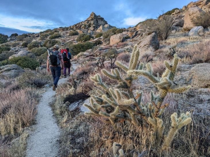
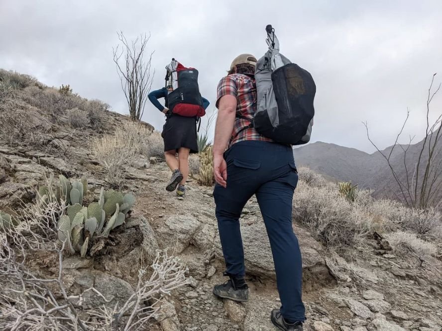
One of the biggest challenges of the trail is several miles of off-trail hiking through bushes to the summit of El Cajon Peak. Photo by Kate Hoch.
Challenges
An advanced skill set is required to navigate and stay safe in the diverse number of ecosystems on this hike, including off-trail hiking (however, you can easily opt to use a rideshare or shuttle around the most challenging bushwhacking parts of the trail).
You should feel comfortable hiking at least 20 miles between water sources before attempting this hike. You should also feel comfortable carrying at least a gallon of water.
As a winter hike, days are short, so you won’t be able to cover as many miles as you would during the summer. While San Diego County weather can be mild in winter, snow and high winds are still possible at higher elevations.
The trail requires significant logistics to complete. You must cache water ahead of time through the desert section. The urban sections do not have many legal camping areas, so you should plan to have a friend, rideshare app, or trail angel meet you to take you to legal places to camp overnight. Additionally, finding places to go to the bathroom may be difficult along road walks and urban areas.
Sections of the route either border private property or are on roads that border private property, such as the Iñaja and Cosmit Reservations. Be sure to use maps and navigate correctly to respect private property while on your journey. Stay only on the road through areas where there is a road right of way. We recommend using the Gaia GPS app with private property boundary maps or a GPS device preloaded with boundary lines.
Sun protection and preparation against dehydration and water imbalance are necessary. If possible, acclimate to the dry climate and warmer temperatures for a few days before starting your trip. Bring plenty of electrolytes. See our guide to The Best Electrolytes for what we carried.
Given the heat, spiky desert plants, bushwhacking, extended periods of road walking, and little water on this route, this is one of the worst thru-hikes imaginable for a dog. Additionally, many of the parks and open space regional trail systems are open to mountain biking and do not allow dogs. However, doggie hotels or kennels should be available near either terminus.

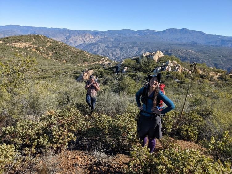
Even in January, some sections of the trail can be quite warm. Sun umbrellas are definitely recommended. Photo by Kate Hoch.
Best Season
Winter. Anza Borrego State Desert Park is one of the hottest places in the country during the summer. Many San Diego Trans County Trail areas can be scorching and sunny for many parts of the year. Most thru-hikers and backpackers attempt this route between November and February. Expect to be hot during certain of the sections of the trail, even in December or January.

The Trans County Trail has very few trail markers. This route must be navigated by map and you cannot rely on signs to show you which trails are the way to go. Photo by Kate Hoch.
What Skills Do I Need?
Navigation
The San Diego Trans-County Trail is a route, not a trail. Because it isn’t a trail, you will not see many trail markers or mentions at signed intersections (in fact, there aren’t many signed intersections at all). Additionally, there are challenging sections of off-trail travel after Ramona and to ascend El Cajon Mountain. Unlike the Appalachian Trail or John Muir Trail, which are generally easy to navigate and have signs and trail the entire length, this thru-hike doesn’t have an app, map, or guidebook. You’ll largely be responsible for your navigation and your navigational skills. There are sections where you will walking through 15 feet high pushing your way through.
If this doesn’t sound fun or within your comfort zone, you can have similar (but better marked) winter-friendly backpacking experiences on the Trans-Catalina Trail or the California Riding and Hiking Trail in Joshua Tree National Park.
Water and Heat Management
There is little natural flowing water on this route-hikers cache water in several places before hiking. Heat management is an essential skill as overheating is a serious danger, even in the winter. Additionally, weather can change in the mountains during the winter; snow and below-freezing temperatures are also possible. The Trans San Diego County Trail incorporates parts of the Cedar Creek Falls Trail, where rescues for overheating have happened nearly daily and deaths have occured. We highly recommend bringing electrolytes and familiarizing yourself with how to stay hydrated and the warning signs.

The brush can be thick and spiky during the several miles of bushwhacking off-trail on the route. Hopefully, one day, trail will be built in this areas. Until now, a good alternative is to shuttle around the bushwhack section. Photo by Kate Hoch.
Rough Terrain/ Scrambling/ Technical Skills
Expect to spend at least a full day, if not more, on sections without any trail or road at all. Hikers should be familiar with navigating through tall, thick, and sometimes spiky plants.
Most hikers will want durable, long pants for this section. Allow plenty of time to complete the bushwhacking section as there are few places to camp and no water. See our guides to men’s hiking pants or women’s hiking pants for recommendations.
Some of the terrain on this route is steep–up to 43% in grade while descending the trail from El Cajon Peak.
Additionally, the route has several long walks on paved roads. While no skills are required for these walks, some hikers may want specialized walking shoes or more cushioned trail running shoes for walking on pavement for extended periods.
Elevation Gain/Elevation Loss
The entire journey is about 20,000 feet in elevation gain. However, the starting and ending location are at sea level.
Permits
There is no permit required to hike the entire route. However, you may want a permit to visit Cedar Creek Falls, which is only 1/2 mile off the trail. There are some alternate routes where permission from landowners or managers may be required beforehand.
The San Diego Trans County Trail starts at the Salton Sea to go ~155 miles to Pacific Ocean. Photo by Kate Hoch.
Route Summary
This description is written east to west, the direction almost all people hike the SDTCT.
The San Diego Trans County Route starts at the Salton Sea, a large saline lake in a desert basin on the San Andreas Fault at 236 feet.
The TCT uses a combo of the California Riding and Hiking Trail, Pacific Crest Trail, Cedar Creek Falls Trail, Los Peñasquitos Trail, and other trails. Along the way, you’ll walk through parts of Anza Borrego Desert Park, including the Ocotillo Wells area and Blair Valley. From there, you’ll climb to Cuyamaca Meadow Natural Preserve, Cuyamaca Rancho State Park, and Wilderness, Cleveland National Forest. The route then descends to the San Diego River Canyon near Cedar Creek Falls in the town of Ramona.
From there, the TCT stays in Cleveland National Forest and ascends off-trail to El Cajon Mountain’s summit with views of snow-covered Mt Baldy, San Bernardino, and San Jacinto mountains to the north and east and San Vicente reservoir.
Good trail and quiet roads lead into the more urban part of the trip through the cities of Lakeside and Poway. Good urban trails connect regional open spaces, including the local’s favorite Los Peñasquitos Waterfall and the Los Peñasquitos Estuary trails in the Sorrento Valley neighborhood.

The author and her hiking partners on the Cedar Creek Falls Trail near the San Diego River Trail. Photo by Kate Hoch.
Maps and Guidebooks
Community
In the 2000s, the Sea to Sea Trail Foundation worked with the US Forest Service, City of Poway, County of San Diego Recreation Department, and City of San Diego Recreation Department to build and connect the San Diego Trans County Trail.
Since then, the organization folded. Now, much of the enthusiasm and energy around the trail continues among its many users. The San Diego Trans County Trail Facebook group is the best resource for up-to-date information on camping, water sources, maps, and caching locations. It’s also an excellent place to find potential shuttling services to get to and from the airport and trailheads.
The Facebook group says: “All tracks and maps are subject to change. The status of water sources and passages are not confirmed from year to year; therefore, each individual is responsible for their own thorough planning. The maps and tracks shared are essentially artistic and promote ideal walkability and mobility within the urban and rural regions that the route traverses. Following the trail in its entirety in practice puts you at risk of violating property rights.”
Gaia
We navigated mostly by Gaia GPS app on our phone. Because the route comes close to private property and is not always marked, we opted for the Public and Private Land layers to better inform our navigational decisions. The Public and Private land layer is a Premium feature. Having thru-hiked the trail once in 2018, I knew that if I ever did it again, I’d use a GPS line with the private property lines. I don’t usually use the premium features on Gaia for thru-hiking or backpacking trips, but this is one trip where I was really happy to have it.
Maps
After loading our route into Gaia app and Cal Topo, we printed paper maps as a backup in case we could not navigate from our phone. However, there is not a map set trailhead for the entire route.
The Trans County Trail has a short roadwalk section into the town of Borrego Springs. Photo by Kate Hoch.
Getting There
By Plane
Although the route is called the San Diego Trans County route, the closest major airport to the eastern terminus is Palm Springs International Airport (PSP), as it is closer to the starting terminus at the Salton Sea.
You should plan to arrive at least a day early so that you have time to rent a car to set up your water caches. Once you return your car from the airport, it’s about 1 hour and 10 minutes via rideshare to the eastern terminus.
The best option for your return flight is the San Diego Airport (SAN), about a 20-minute drive from the western terminus. There’s also a bus stop at the western terminus that you can easily take into San Diego and get to the San Diego Airport. There's also a bike trail that can take you to the town of Del Mar.
Alternately, if you can arrange a shuttle service or a local trail angel to take you to the Salton Sea, you may be able to fly into the San Diego airport. Otherwise, it is more than a 2-hour drive to the eastern terminus.
By Car
The Palm Springs Airport has numerous car rental options.
From Los Angeles, take I-10 for about 2 hours (120 miles) to the town of Indio. From there, take CA-86 for about 36 miles to Salton City.
From San Francisco and the Bay Area, take your preferred method of getting to I-5. From there, drive about 285 miles south to the I-210 East to Pasadena for about 80 miles. Then take I-10 east to Indio. From Indio, take CA-86, about 36 miles to the Salton Sea.
Bus and Shuttle Services
Although some bus and transit options are available for the western third of the trail, there is no public transportation to the Salton Sea.
Plan to take a Rideshare service to the Salton Sea. Alternately, trail angels can often give rides to and from each trailhead. The best place to find a trail angel is on the San Diego Trans County Trail Facebook page.

Our thru-hiking group at the starting point and eastern terminus of the San Diego Trans County Trail at the edge of the Salton Sea. Photo by Kate Hoch.
Trailheads
There's a reason this was once called the San Diego Sea to Sea Route--you'll walk from the Salton Sea to the ocean.
Eastern Terminus: Iberia Wash is at -226 feet on the Salton Sea. Reach this by traveling to the end of Crystal Avenue in Salton City.
Western Terminus: Torrey Pines State Beach on the Pacific Ocean. It is accessible on N. Torrey Pines Road at the South Beach Parking Lot. There is also a bus stop at N. Torrey Pines Rd and State Park Preserve.
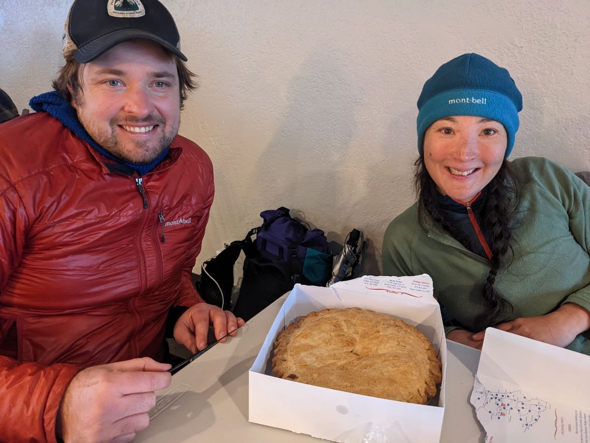
The author and hiking partner eating a world famous Julian apple pie at the Lake Cuyamaca store, a resupply point on the Trans County Trail. Photo by Kate Hoch.
Resupply
The following resupply documents the food, potable water, hotel, trash service, and electronic charging options directly on the route you will walk. On the ~155-mile route, you rarely have to hike more than 40 miles without resupply. If you’re willing and comfortable hitchhiking, it’s also possible to catch rides to the nearby towns of Ranchita and Stagecoach to shorten that distance.
Borrego Springs
The trail is routed directly through this small town. You’ll walk past two grocery stores, several restaurants, a post office, and hotels. The trail is routed through Christmas Circle, a park with potable water, trash service, electricity to charge devices, and flushing toilets, as well as shade.
Lake Cuyamaca Store
This is a resort located right on the water of Lake Cuyamaca that has a restaurant that offers breakfast, lunch, and dinner. It has water, restrooms, trash, and cell reception. It also has a small supply of relatively expensive camp food such as s’mores, ramen, and chips.
Ramona
This town is about 4 miles from the Cedar Creek Falls Trailhead, but it’s possible to have pizza delivered to this trailhead. Additionally, the trailhead has water, a pit toilet, and trash service. You’ll have cell reception to take a Rideshare service into town.
Poway
Once you reach the open space regional trail system in Poway, it’s easy to take a Rideshare or shuttle service to get into the more developed parts of the city. There are few camping areas in the urban western part of the trail. From the Scripps Poway parkway area, you’ll likely need to take one of the numerous side trails to a road and catch a ride to a hotel or a trail angel’s house for the night. From the Scripps Poway Parkway, it’s possible to take a side trail to Costco, In N Out, and other restaurants. Depending on your route, you may also pass Starbucks, Chevron, and other restaurants depending on your route.
San Diego
Several miles from the end of the hike, the trail takes you past Zumbar Coffee and Tea, Elena’s Mexican Restaurant, as well as a pizza place.

San Diego Trans County Trail thru-hikers walking the Mason Truck Trail to join with the Pacific Crest Trail at the top of the ridge. Photo by Dan Slattery.
Regulations
Follow Leave No Trace Ethics, including camping and pooping far from water sources.
Water cache ethics: When using water caches, keep them out of sight from trails and roads. Take the empty bottles with you by crushing and strapping them to your pack until you can dispose of them properly. Do not leave water jugs behind for other hikers. If you have excess water, dump it and take the bottle with you.
Be respectful of archeological sites. The trail visits Grapevine Canyon, Kumeyaay Soapstone Cultural Preserve, Ah-ha' Kwe-ah-mac/Stonewall Mine Cultural Preserve, and many other unsigned sites of cultural significance. Leave what you find; respect the land and the people who have passed through here before you.
No dogs. Given the heat, spiky desert plants, bushwhacking, extended periods of road walking, and little water on this route, this is one of the worst thru-hikes imaginable for a dog. Additionally, many of the parks and open spaces on this hike do not allow dogs.
Be respectful of private property. Respect “private” and “no trespassing” signs. The route comes near several ranches and residences. Carry a GPS device or use the private property mapping feature on the Gaia App that will help you navigate. As this is a route where each hiker has some choices to make about how to get through certain areas, make sure that the route you hike and camp on is one that is on public land. Remember shuttling or hitch hiking around is always an option.

Water planning for the San Diego Trans County Trail relies mostly on water caches that you must set up before you start. However, there are a few ephemeral springs that may be running, as seen here. Photo by Kate Hoch.
Water Planning
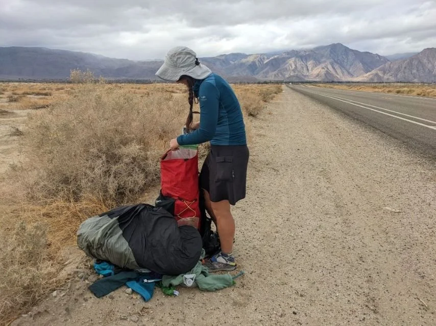
You should plan to cache water in several spots along the route. Most hikers will cache their water a day before they start their hike. The most accessible places to cache water are where the route crosses or comes close to the road.
Early in the season or after a good rain or snowstorm, you may find water flowing in springs in Anza Borrego Desert Park. However, pay close attention to water conditions and be prepared to go into town if water sources are not running.
You should feel comfortable hiking at least 20 miles between water sources before attempting this hike. You should also feel comfortable carrying at least a gallon of water. Because of the large amount of water you’ll need to carry, consider bringing at least two of the 2L Cnoc collapsible water bags. Alternately, you can bring larger volume versions of the Platypus hydration bottle that won Best Collapsible Water Bottle in our article on the Best Water Bottles for Hiking. They are far easier to compress and carry when they are empty than traditional bottles.
Bears and Food Storage
The Trans San Diego County Trail ecosystems are not historically black bear habitats. However, critters like kit foxes may frequent camping areas, as happened to me in Anza Borrego Park. I used an odor-proof bag to store my food for this trip. See REI’s Food Storage story for ideas on keeping food safe from animals.

The last 40 miles of the route go through more urban areas and have alternatives and side-trails you can take that will lead to the same place. Photo by Kate Hoch.
Variations
As the San Diego Trans County Trail is a route, you have many options for variations, especially in the urban areas where you can opt to take roads instead of trails. Areas with a trail network system like Cuyamaca State Park and Sycamore Canyon Open Space have options to make your route longer or visit attractions like visitor centers, drinking fountains, restrooms, or cultural sites.
Additionally, some hikers have experimented with routes that take trails up and over Cuyamaca Mountain and alternates along Inspiration Point in Anza Borrego State Desert Park. Be aware that these off-trail alternates require more planning, mapping, and additional water.
Torrey Pines State Park Alternate
Many hikers choose to walk from the Pacific Ocean up the bluff to Torrey Pines State Preserve on good, well-marked, and maintained trails. This world-class hiking destination is one of the wildest stretches of coast in Southern California and is a National Natural Landmark. It’s home to the Torrey Pine, the rarest pine tree in North America. Its trails have ravines, badlands, and sandy cliffs while offering magnificent ocean views. The bluffs in Torrey Pines Reserve are also a destination for whale watching.
Cedar Creek Falls
Cedar Creek Falls is one of the most popular hiking destinations in San Diego County and requires a permit for day hiking. You’ll pass within ¾ of a mile of the waterfall on the TCT route but cannot hike the last bit of trail to the waterfall without a permit. If you wish to see the waterfall, get a permit from Cleveland National Forest at recreation.gov before your trip and make sure to time your backpacking trip so that you arrive in the area on the day of your permit.
El Capitan Summit
The summit of El Capitan is a short side trail on your descent from El Cajon Mountain. El Capitan is a noted mountain that is slightly shorter than El Cajon Mountain but with similarly beautiful views. El Capitan and El Cajon Mountain are listed on a local peaks challenge. If you're a peak bagger, the TCT takes you so close to the summit of both mountains that it is worth making the side trip.
The San Diego Trans County Trail packing list requires gear that can manage sun and heat, but also gear that can keep you warm on cooler winter nights. Photo by Kate Hoch.
recommended gear for this hike
TENT
I used a one-person Six Moon Designs Tarp on the San Diego Trans County Route. I liked this shelter because it is lightweight and has a bug net skirt. We spotted a tarantula while setting up camp on our second night, so I was happy about the extra protection.
My two hiking partners shared the Six Moon Designs Haven Tent, a two-person shelter.
When I thru-hiked this trip in 2018, we had better weather, and I cowboy-camped every night (camped without setting up a tent). However, I carried the Mountain Laurel Designs Solomid in the case of rain.
BACKPACK
I used the Six Moon Designs Swift X backpack on this trip. I appreciated its ability to carry extra water capacity comfortably, especially with the vest harness. It’s the overall winner in our Best Lightweight Backpacking Backpacks guide.
When I thru-hiked this trip, I carried the Gossamer Gear Kumo 36. I would carry this pack again if the weather forecast for the week looked promising. However, given this hike’s cold and rainy forecast, I wanted a pack with the volume to carry more cold-weather gear.
SLEEPING BAG
For my most recent trip, I checked the weather forecast for the week I’d be on trail, and it looked like it would dip below 30 degrees, so I used the Katabatic Designs Sawatch 15-degree quilt and enjoyed having the extra warmth.
On my 2018 hike, the weather forecast was warmer, so I was fine with a 30-degree quilt. (Check out more quilts here.)
My hiking partners used the Feathered Friends Swallow, a 20F bag that is the Overall winner in our Best Sleeping Bags guide.
SLEEPING PAD
We all used Therm-a-rest NeoAir X Lites as our sleeping pad on this trip. In addition, I used a Gossamer Gear Thinlight Foam ⅛” inch foam insulation pad under my NeoAir to protect my inflatable sleeping pad against spiky desert plants. The NeoAir is the Overall winner in our Best Sleeping Pads guide because it is lightweight and has a high r-value for insulation.
STOVE
We used the MSR PocketRocket Backpacking stove on this trip. We enjoyed having a canister stove on this trip because it boils quick enough to heat a hot mid-day lunch or pick-me-up hot drink during cold days. The MSR Pocket Rocket is the Overall winner in our Best Backpacking Stoves guide.
WATER PURIFIER
We all used the Sawyer Squeeze water filter on this trip. We like that it’s lightweight and gives clean water immediately. It’s the Overall winner in our Best Water Filters and Purification for Backpacking guide. Almost all of the water we had on this trip was from water caches or faucets, so we didn’t need to filter water much. However, we drank from several springs and puddles and were grateful for our filters.
TREKKING POLES
I used the Gossamer Gear LT5 foldable trekking poles for this thru-hike. They’re the Ultralight winner in our Best Trekking Poles guide. I liked having folding poles for this trip because I wanted to put my poles securely away in my pack during the bushwhacking section and road walking sections.

Although the San Diego Trans County Trail requires adequate sun protection, weather can change quickly in the mountains, so having good rain and wind gear is also important. Photo by Kate Hoch.
What to wear
RAIN JACKET
Two in our hiking party wore the Montbell Versalite. It’s one we like a lot for being so ultralight in our Best Lightweight Rain Jackets guide.
Hiking Socks
I wore Darn Tough micro crew socks for this hike. Because the route is so sandy, especially the first few days, I thanked myself for carrying 3 pairs. I used one pair as sleep socks and then wore them on my last day into town. The Darn Tough socks are our favorite in our Best Hiking socks guide.
RAIN PANTS
Two of us wore rain skirts and were happy to have the extra warmth.
DOWN JACKET
I wore the Montbell Thermawrap, a synthetic jacket winner in our Best Synthetic Jackets guide.
BASELAYER
I wore the Icebreaker Oasis 200 base layer. This is my favorite base layer due to its fit, durability, breathability, and warmth even when wet. See our Best Base Layers guide for more recommendations.
FLEECE JACKET
I wore the Patagonia Micro D ¼ zip fleece pullover. The weather looked cold and wet enough to want an extra layer to stay warm. The Micro D is one of the jackets we will be testing in our upcoming Best Fleece guide.
BOTTOMS
I wore a pair of Montbell Light Trail Tights on this hike under a Purple Rain Skirt. I prefer hiking in a skirt, mainly due to the pockets. I also find the tights are easy to wear with a skirt for extra warmth. For this hike, I knew that the bushwhacking section could damage whatever lightweight bottoms I wore, so I chose to wear an older skirt and tights.
My hiking partners chose a more straightforward approach and wore hiking pants that could survive the bushwacking section and protect their legs from branches and the sun. One wore an older version of the Patagonia Chambeau Rock Pants, found in our Best Women’s Hiking Pants guide. The other hiker in our group wore the Coalatree Trailhead Pants.
Hiking shoes
I wore the Altra Lone Peak trail running shoes on this trail. It’s the winner for Best Long Distance shoe in our Best Women’s Trail Running Shoes and Best Men’s Trail Running Shoes guides.
My hiking partners wore the Merrell Nova (women’s is called the Antora) trail running shoes. They have a Vibram sole, which my hiking partner enjoyed having on a shoe, especially during steep descents and on rocky climbs during the bushwhack.
HAT and GLOVES
The desert in the winter can get below freezing, even if it’s in the 70s or 80s during the day. I brought a fleece hat and gloves for this hike and was very happy to have them. See our Best Winter Gloves guide for recommendations for lightweight gloves for hiking, cycling, and snowshoeing that aren’t as bulky as traditional ski gloves.

Adequate sun protection including sun glasses, a sun hat, and sun umbrella are all essential gear for the San Diego Trans County Trail. Photo by Kate Hoch.
MISCELLANEOUS GEAR
MAP AND COMPASS
Although we used the Gaia App on our phones for navigation, we also carried paper maps and a compass.
FIRST AID KIT
Because the trail is in the desert and is sandy and can sometimes get hot, blisters are a very real possibility. All of us carried Leukotape in our med kit to cover up blisters.
Since this short thru-hike is best backpacked during the winter, we all admitted starting the trail a little out of shape. As a result, we each had some pain in our hips, shins, feet, or knees. Be sure to bring painkillers and anti-inflammatories of your choice on this trip.
ELECTROLYTES
The TCT is a desert hike, and even on cold days, the dry air and extreme sun can get your body out of balance. My hiking partners carried the Ultima Replenish Electrolytes, which are the overall winners in our Best Electrolytes guide for more information. I tested out the Liquid IV Electrolyte to write about for an update on our electrolytes guide. It later became one of the winners in that guide. We all carried at least two electrolyte drink mixes a day and salt pills.
SUN shirt
Despite the cold weather, San Diego County is very sunny. I wore the Voormi River Run Sun Hoodie, the overall winner in our Best Sun Shirts guide. See our in-depth review of the Voormi River Run hoodie for more info.
SUNGLASSES and sunscreen
Be sure also to bring sunglasses and sunscreen. If you like having a separate face sunscreen we recommend that as well. You’ll be in places without shade and at altitude. Even though most people hike this trail in the winter, you’ll get a lot of sun exposure.
SUN HAT
You’ll want a hat of some type for sun protection on this trail. Because it can get windy and because of the intensity of the sun on this trip, it’s worth carrying a hiking sun hat with a wide brim over a baseball cap.
SUN UMBRELLA
I’m not kidding about the sun being strong on this trail. The Anza Borrego section of the trail can look and feel similar to Death Valley National Park. We all carried sun umbrellas and used them for road walks, desert canyons, and urban trails. We used them as rain umbrellas when the weather turned wet. You will especially want an umbrella if live in a cooler climate and traveled to hike the TCT. For more recommendations, see our guide to the Best Hiking Umbrellas.
HEADLAMP
A good headlamp is essential on this trip. Because winter is the best (and arguably only season) that you can comfortably thru-hike this trail, you will likely be night hiking to get in your miles because the days are short. I used the Biolite 330, the overall winner in our Best (and Brightest) Headlamps guide. One of our hiking partners used the Nitecore NU25 headlamp, an upcoming winner for the best ultralight headlamp.
FOOD STORAGE
We used an LOKSAK Odor Proof Sack to store our food for this trip.


