Northville-Placid Trail Backpacking and Thru-Hiking Guide
Experience the Adirondack Mountain lowlands on this century-old backpacking trail

Published March 10th, 2024
Home → Trip Guides → Backpacking
The Northville-Placid Trail (NPT) is an approximately 135-mile (218 km) route highlighting a less-traveled region of New York’s Adirondack Park. This north-south footpath links rivers, valleys, and remote lakes through the valleys and high plateaus of the Adirondack Wilderness.
Distance: Estimated between 133 and 138 miles (214 to 222 km). Re-routes, changing wilderness, and two northern terminus locations lead this trail to be reported as 133, 135, and 138 miles in distance.
Days: 8 to 14 days
Elevation gain/loss: Approximately 15,000 feet gain
Best season: Late Summer to Early Fall
Permits: None required
Difficulty: Moderate
Start/End Points: Northville, NY (south) and Lake Placid, NY (north)
Trail Stewardship: New York State Department of Environmental Conservation and NPT Chapter of the Adirondack Mountain Club


Treeline Review objective statement: We create reader-supported, objective, independently-selected gear reviews. This story may contain affiliate links, which help fund our website. When you click on the links to purchase gear, we may get a commission — without costing you an extra cent. Thank you for supporting our work and mission of outdoor coverage for every body! Learn more.
QUICK FACTS

The author at Silver Lake Lean-to. Photo by Tom Williams

Starting at the NPT Arch in Northville. Photo by Kate Riley

Hikers can expect remote lake views through the Adirondack lowlands. Photo by Kate Riley
The Northville-Placid Trail, Northville to Lake Placid Trail, or N-P Trail, is a long-distance route for those who enjoy the adventure of unpredictable conditions. Cut between 1922 and 1924—a time before the popularity of cars–by the Adirondack Mountain Club as their first major project, this recreational footpath was originally designed to connect two community train stations within the Adirondack Mountains.
At a century in age, the NPT is almost as old as another well-known East Coast trail, the Long Trail of Vermont built from 1910 to 1930. Both the Long Trail and NPT initially even shared the same name.
Today, the NPT is a mix of single and double-track connecting old and second-growth forests in an area heavily logged in the 19th century. From the echoes of loons across gentle lakes, black bears, mud, and green marshes, to secluded settlements and spanning bridges, this is sure to be an adventure.
The rumored “flat yet technical” terrain of the NPT, nearby in my home state, drew me to this hike. In August of 2023 my partner, Tom, and I took nine days to backpack this shorter thru-hike. You’ll see that we hiked in the rainy season - conditions are rarely perfect in the Adirondacks. I look back upon our NPT favorably, recognizing the historical significance of this trail system, the welcoming local spirit, and the great memories along the way. Hiking with a friend or a small group elevates the NPT experience!
The Northville Placid Trail is located on the traditional land of the Mohawk and Haudenosaunee Native People.
HIGHLIGHTS

Crossing a footbridge in the Shaker Mountain Wild Forest. Photo by Kate Riley
Traverse designated Wilderness Areas: The trail mostly traverses public protected land. You’ll occasionally encounter other thru-hikers, section hikers, and day hikers near trailheads. The majority of campsites were not crowded.
Daily Surprises: Unexpected joys or landmarks replace summit views on the NPT. My favorite memories include a lunchtime canoe trip at Mud Lake Lean-to, the angular South Lake Bridge, a hot meal in Long Lake, and the Noah Rondeau Hermitage.
Local Communities: You’ll pass through or near a few small communities on the NPT. We experienced a warm welcome as hikers that, for being a shorter trail, I was not expecting. This kindness elevated the experience.
Lake Durant Campground: This State Campground is located around mile 86 northbound. For the $2 cost of a day pass as of 2023, our moods were boosted with the indulgence of hot showers, a place to rinse gear, clean restrooms, and lunch under a dry canopy. I cannot thank the park employees enough who encouraged us to dry out in the sunshine.
CHALLENGES

Large stretches of mud were present during our hike. Photo by Kate Riley
Weather: Weather in the Adirondacks can be unpredictable. In late August, temperatures ranged from 40 to 78 degrees Fahrenheit. We experienced sunshine, one cold front, and five days of rain.
Bugs: The worst of the Adirondack bug season is May-June; however, mosquitoes, no-see-ums, and biting flies can be present through the fall. Layers, a bug net, and bug spray are a must!
Challenging Terrain: While the trail is not flat, the total elevation gain per day is low. Sections can be intense with stretches of mud, beaver bogs, bog boards, spiderwebs, blowdowns, and brushy vegetation. We encountered one intense section of flooded trail in the West Canada Lakes Wilderness (read more below).
Shelters: Lean-to shelters in the Adirondacks are public spaces on a first-come, first-served basis. It was surprising to see lean-tos occupied by tents or hammocks or used as storage for larger groups. While this can lead to a few ruffled feathers for thru-hikers, my impression was that this might be common for some ADK campers. In these instances, we found tent sites or continued to a nearby lean-to.
BEST SEASON

August is a great time to hike the NPT for warm temperatures, swimming, and fewer bugs. Photo by Kate Riley
Most folks will hike the NPT in late summer to early fall to enjoy warmer temperatures and avoid the early summer Adirondack bug season. Always pack the bug spray and head net as mosquitoes and flies can be present into September.
A winter thru-hike is possible. Folks attempting the NPT on snowshoes or cross-country skis should expect deep snow, unbroken pathways, and inaccessible seasonal roads by vehicular traffic. Check the NYSDEC Adirondack Backcountry page for up-to-date information.
DIFFICULTY AND SKILLS FOR THE NORTHVILLE-PLACID TRAIL

The NPT is blazed with blue “Foot Trail” disks. Photo by Kate Riley
NAVIGATION
Blue Adirondack “Foot Trail” markers designate the NPT as a north-south regional trail. There were some areas or junctions where signage was limited, requiring us to check maps before heading on. There is always a chance for markers to be removed or obstructed from view. While the path was generally easy to follow, please do not attempt this route without the guidebook or map (see details below). The route I saved on Gaia GPS was useful for verifying our location in conjunction with the paper National Geographic Map.
ROUGH TERRAIN / TECHNICAL SKILLS
This lowland trail is more challenging in terrain than elevation. The wilderness experience is what makes the NPT special.
We hiked the NPT in August of 2023. It was a rainy summer with record-level precipitation across the northeast. While our conditions were not the norm, NPT hikers in spring, summer, or fall should be prepared for rain, mud, short steep climbs, shallow river/creek fords, rock hops, bog boards, and brushy vegetation.
Simply, it can be hard to catch a pace. Going into the hike we planned for these challenges by giving ourselves buffer time to finish and adjusting daily mileage to enjoy scenic campsites.
RIVER AND CREEK CROSSINGS

The author fording 80’ wide West Stony Creek. Photo by Tom Williams
There are multiple shallow river or creek fords. The biggest is an 80’ ford across West Stony Creek in the Shaker Mountain Wild Forest. The rocky creek is fordable most times of the year, and online reports show that a footbridge across West Stony Creek is in the planning phase. For us, the depth of West Stony Creek was less than knee-high.
REROUTES

This re-route sign is located northbound of a particularly intense area of flooding near West Lake. Photo by Kate Riley
Hikers will see evidence of re-routes related to blowdowns, erosion, and beaver activity. The NPT Chapter of the Adirondack Mountain Club maintains the trail to protect, preserve, and promote a safe wilderness experience for wildlife and recreationists. These re-routes were also completed in 2013 and 2015 to eliminate 7 miles of road walk out of Northville.
ROAD WALKS

At mile 40 northbound, the road walk to Piseco is something to look forward to! Photo by Tom Williams
You’ll encounter several short sections of road walk of less than four miles. These are easy to navigate and, in my opinion, elevate the experience.
ELEVATION GAIN / ELEVATION LOSS
The NPT has an estimated 15,000 feet gain in total, with the highest point reaching 3,008’ in the Blue Mountain Wild Forest, south of Long Lake. The southern terminus is approximately 1,000 feet lower in elevation than the northern terminus.
The provided elevation estimate is based on a range of reported GPS tracks from recent northbound hikers. My research showed there is not an official gain/loss at this time. The NPT is flat-ish, but not flat.
PERMITS
No permits are required to walk the Northville-Placid Trail. Learn more about New York State Land Camping Rules here.

No permits are needed to enjoy this dense greenery of an ADK summer. Photo by Kate Riley
FISHING PERMITS
The landlocked lakes and waterways make the NPT a fishing destination for many backpackers. Information on New York Fishing Licenses can be found here. For more on fishing, see our article on Beginner Fly Fishing Skills and guide to Beginner Fly Fishing Combos.
DISTANCE
A hiker can generally expect to thru-hike the NPT in 8 to 14 days based on the desired level of difficulty. The reported length of this backpacking trail varies at 133, 135, and 138 miles.
ROUTE SUMMARY
Most thru-hikers head northbound, starting in Northville, NY. Photo by Kate Riley
Most folks complete the NPT northbound, following its namesake. Southbound is a great option if aligning with public transportation. The trail is divided into sections less than 40 miles, making it possible to section hike over several trips. I found the route to lend very well to hiking northbound as the terrain allowed us to ease back into the hiking groove. I also enjoyed ending in the touristy mountain town of Lake Placid, signing the last registration book, and exploring the walkable town center.
NORTHVILLE AND SHAKER MOUNTAIN WILD FOREST

Tom signs the first trail register at Waterfront Park, Northville. Photo by Kate Riley

While West Stony Creek Lean-to wasn’t marked on our maps, we took a quick break here to dry feet and visit the privy. Photo by Kate Riley
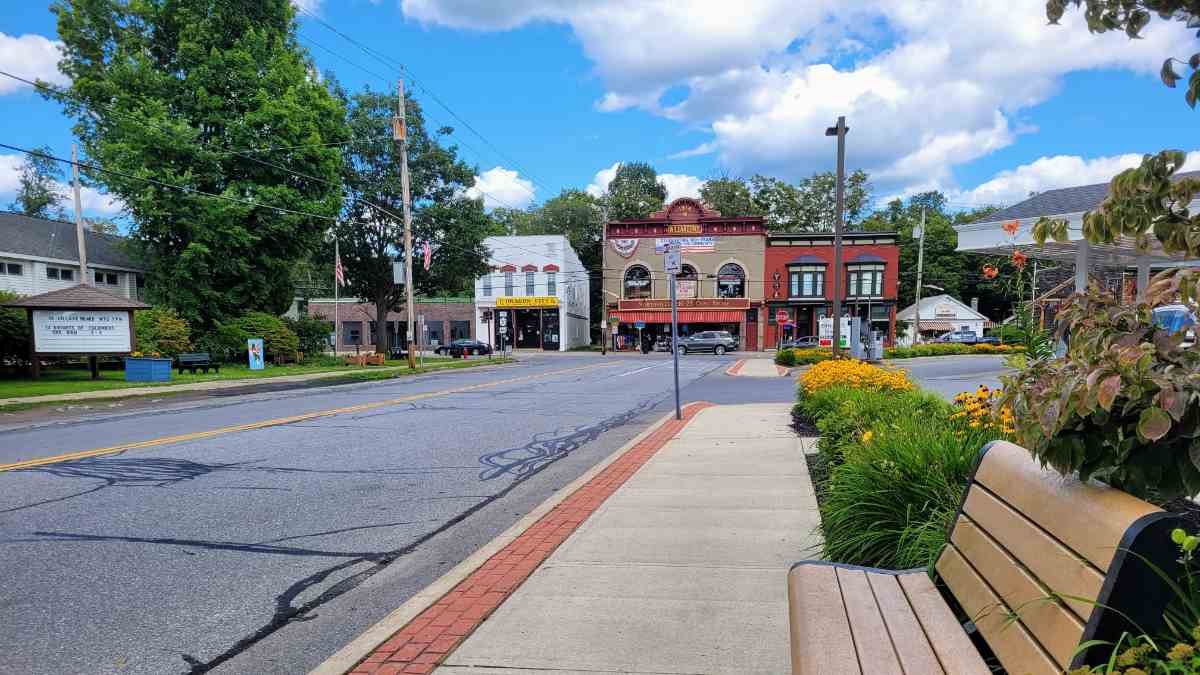
We started the hike on a sunny day in Northville, a historic logging boomtown near the southern boundary of the Adirondack Park. In the village center stands a wooden arch noting the NPT’s southernmost point. After signing the first log book, we started the 3.5-mile road walk northbound. Hikers cross a road bridge across the Sacandaga River, skirt around the cottage community of Sacandaga Park, before entering the Shaker Mountain Wild Forest on Collins-Gifford Valley Rd. This was a poetic start, knowing that in over 135 miles we’d be road walking into Lake Placid.
The Northville road walk of today is more welcoming than the 10-mile roadwalk of the past. Two major re-routes were finalized in 2013 and 2015 to cut 7 miles of road and bring the route into the woods.
Past the Collins-Gifford Valley Rd. trailhead we found the single track to be well-blazed and maintained, and not at all “flat.” The miles were fast with wooden footbridges and calm lakes, including our first black bear sighting, before setting up tents on the south side of West Stoney Creek.
To the north of the 80’ river ford stands the first lean-to/designated camping area, West Stony Creek Lean-to, located east of the main trail. This newer lean-to wasn’t marked on our Nat Geo map or Gaia GPS. However, I’m almost certain it was noted on the kiosk in Northville–where we mistakenly didn’t take a picture of the posted information–and would be included in the updated guidebook.
SILVER LAKE WILDERNESS

A lunchtime paddle around Mud Lake is a top NPT memory. Photo by Kate Riley
After Benson Rd., the campsites and lean-tos became more frequent. We spotted another black bear who scampered away. At Silver Lake Lean-to surrounded by hemlock trees, we shared the space with one other thru-hiker and a tenting section hiker. Telling hiking stories just past hiker midnight, the trail felt like home.
The footpath through the Silver Lake Wilderness had short climbs and sawed lumber walkways across lush marsh. Lucky hikers might find a metal canoe to paddle around at Mud Lake Lean-to before crossing the West Branch Sacandaga River suspension bridge. The Whitehouse stone fireplace stands at the northern base of the bridge, the remains of a former camp.
PISECO AND JESSUP RIVER WILD FOREST

Breakfast at the Post Office as we waited to pick up our mail drop. Photo by Kate Riley
At State Highway 8 we stepped out of the wilderness and started the two-mile roadwalk to the Piseco Post Office, where we picked up our resupply maildrop. You’ll pass by an NPT picnic area, the Riley House Piseco Lake Historical Society, and Riley Tavern circa 1880 before entering the small settlement of Piseco.
Located slightly northbound of the post office is the residence of Piseco NPT Bob. NPT Bob is a well-known trail angel whom we didn’t get the chance to meet but he is legendary for offering shuttle services and holding resupply boxes.
The NPT re-enters the woods at the end of Haskell Rd. with a limited parking area.
WEST CANADA LAKE WILDERNESS

The author crosses the angular wooden walkway of South Lake Bridge. Photo by Tom Williams
The trail continued between bog boards, dry single track, and large stretches of mud. The three lean-tos of Spruce Lake are a popular weekend backpacking spot. On a Monday evening it was calm as we settled in at lakefront Spruce Lake Lean-to #3, the only other inhabitants being several loons wailing and hooting across the water.
The next morning came rain as we continued north, soon stopping in awe at one of the top-photographed spots along the NPT. The South Lake Bridge is a spectacular sight, the angular wooden walkway standing strong against the foggy marsh.
Our smiles from the bridge turned into a teeny bit of cursing when we encountered the trail underwater just after the West Lake Trail junction. Using precarious logs to cross one intense section, my right leg ended hip-deep in water, and Tom, upon trying to help, was launched backward into the brush. Unfortunately, there isn’t a great detour around this section. Look for posted trail updates and continue with caution during times of high rain.
MOOSE RIVER PLAINS CAMPING AREA AND WILD FOREST
NPT hikers eventually enter the State Cedar River Campsites at Wakely Dam. It's an open roadside campground tucked in along the dam. There's a caretaker house, a handful of marked no-fee primitive tent sites, and privies set back into the woods. This is a popular first-come, first-served spot for vehicle access and paddlers. When we were there mid-week, only one other campsite was occupied by car campers–offering beers and conversation about NPT adventures.
BLUE RIDGE WILDERNESS

A hiker yardsale drying gear at Lake Durant State Campground. Photo by Kate Riley
The trail weaved between single track and roadbeds, getting us to Lake Durant State Campground by early afternoon. This is a reservation-based state campground with improved sites. For a $2 day pass per person we took a few hours to enjoy hot showers, dry gear in the sunshine, and eat lunch under the canopy of the bathhouse. Oh, the joys of plumbing! As you exit the campground, NY Rtes 28 & 30 head west into Blue Mountain Lake.
BLUE MOUNTAIN WILD FOREST

Heading out after tenting near Tirrell Pond Lean-to. Photo by Kate Riley

This mountain meadow was a surprise heading toward the highest point on the NPT. Photo by Kate Riley
A sand beach for swimming and flat tent sites makes Tirrell Pond Lean-to popular for weekenders. We set up tents and enjoyed a campfire to ward off biting flies, shared with a family staying in the lean-to for two nights.
Past Tirrell Pond is the spur trail to Blue Mountain Lake as you start the 1,000-foot ascent to the highest point of the NPT at 3,008 feet. Following a logging road, then singletrack, we entered a lush mountain meadow followed by several uphill rocky slides. The descent off the saddle was fun and steep through dense forest.
Heading into the Town of Long Lake we opted to go against our purist ways and take the NPT shortcut trail directly into town to avoid the need to hitchhike. This yellow-blazed cross-country ski path had many blowdowns, the blazes ultimately guiding us in a loop. Storm damage likely led us to miss a critical marker. With our shortcut attempt unsuccessful, the main NPT turned out to be much easier to follow as we reached the NY-28N trailhead and obtained a mid-day hitch to Long Lake.
LONG LAKE AND HIGH PEAKS WILDERNESS

A metal bridge crosses the Cold River. Photo by Kate Riley

Remnants of the Noah Rondeau Hermitage near Cold River. Photo by Kate Riley

The historic Duck Hole Dam was partially breached in August of 2011. Photo by Kate Riley
The Town of Long Lake is the biggest settlement along the NPT interior. With pub sandwiches and fries for lunch and a light resupply of snacks at Stewart’s Shops convenience store, we gladly accepted the offering of a free ride back to the NY-28N/Newcomb Rd. trailhead. Hitching in New York State along major highways is illegal as it causes a distraction to drivers. However, based on our experience, folks in this area are used to hiker practices. Always use caution along busy roadways.
The NPT along Long Lake is heavily used by motorized boaters, paddlers, hikers, and groups as campsites pepper the eastern lakefront. We shared the Kelly Point Lean-to campsite with a group of 12 camping for a family reunion. We had one of the two lakefront shelters to ourselves as a nighttime cold front blew in across the lake.
Going into the Cold River section, several metal and suspension bridges carry hikers across the scenic landscape. Lean-tos and campsites are frequent as trails connect peaks to the west and east. The trail was dry but brushy, making us wish for the comfort of hiking pants.
The Hermitage of Noah John Rondeau (1883-1967) is a noteworthy landmark, as thru-hikers reminisce on a man who stepped away from society for 21 years to live year-round in the High Peaks Wilderness. A plaque and artifacts mark the location of his camp, Population 1. We imagined following in the same footsteps as Mr. Rondeau as we headed north, thanking him for a few miles of easy-to-walk path.
Our last night was spent tenting overlooking the picturesque remnants of Duck Hole Dam, a wooden and stone dam originally built in 1915. The trail south of Lake Placid was muddy from multiple days of rain and brushy, with many blowdowns. We took the time for a short side trip up to the cascading Wanika Falls lookout, the presence of pure wilderness until the last trailhead.
LAKE PLACID

All smiles as the author approaches Lake Placid Station. Photo by Tom Williams
At the Averyville Road Trailhead stands a large weather-worn sign with details on the NPT heading south. We cheered our victory in light rain, with only the 1.8-mile road walk left to finish our journey at the historic Lake Placid Station.
MAPS AND GUIDEBOOKS

Silver Lake Wilderness Marshland on the Northville-Placid Trail.
WEBSITE
Read about this footpath on the Northville-Placid Trail Website, including a history of the trail, suggested re-supply locations, and trail updates.
GAIA
Gaia GPS was extremely helpful for pre-trip mileage planning. I used saved routes for navigation during the hike and to view the elevation profile without cell reception.
MAPS
We carried the National Geographic 736 Adirondack Park, Northville-Placid Trail paper map. The map is printed on waterproof paper and includes noteworthy features, such as campsites, footbridges, and potential areas of flooding. I’d highly recommend carrying the Nat Geo map in addition to a digital navigation app. Copies of the Nat Geo map can be found at outfitters in New York, including EMS in Lake Placid.
GUIDEBOOKS

Guidebook and Map Pack from ADK Mountain Club.
The Adirondack Mountain Club Northville-Placid Trail Essential Guide, 5th Edition edited by Jeff and Donna Case describes the NPT in detail and includes a page map at the start of each section. We did not purchase the guidebook, but the guidebook would have been useful in addition to our map. The guidebook and National Geographic map can also be purchased as a bundle.
NYSDEC ADIRONDACK TRAIL INFORMATION
The NYSDEC Adirondack Backcountry page maintains updated seasonal notices on trail and weather conditions, as well as rules and regulations for visiting the Forest Preserve lands.
GETTING THERE

The peaceful Northville-Placid Trail is accessible from major cities.
BY CAR
NPT hikers will commonly use two cars or shuttles. We drove from Buffalo, NY to Lake Placid, parking a car at the Lake Placid Station/Lake Placid-North Elba Historical Society. This being our northern terminus of choice, we confirmed our parking spot with staff inside. From there, Tom’s mother (thank you Carol!)–who happened to be visiting the area–shuttled us by car two hours south to the Northville Waterfront Park.
BY PLANE
Albany International Airport (ALB) is the closest major airport to the Adirondack Region. John F. Kennedy International Airport (JFK) in New York City and Boston Logan International Airport (BOS) are several hours away by transit but offer more flight options.
BY TRAIN
Unfortunately, passenger train service stopped to Northville in 1930 upon intentional flooding of the Sacandaga Valley, and to Lake Placid in 1965 due to increased highway use.
Amtrak trains connect New York City and Boston to Albany. Amtrak stations are also located in communities near the NPT termini including Westport, NY to the north and Amsterdam, NY to the south. More on New York State Amtrak routes can be found here.
BUS AND SHUTTLE SERVICES
The Trailways bus has routes around the Adirondack Region, including service in/out of Lake Placid. For the southern terminus, the Trailways Bus gets close, but not quite to Northville. I found this Trailways Map to be helpful; however, current stations may not be accurately represented on this map.
Local guides, outfitters, and trail angels offer fee-based shuttles to and from trailheads. The Northville Placid Trail Facebook group is a great resource for trip planning. The guidebook also has helpful transportation logistics. With shuttle options it is possible to section hike this trail.
TRAILHEADS

A weathered NPT sign at the Averyville Rd. Trailhead. Photo by Kate Riley
Waterfront Park in Northville, NY is the southern terminus. The park has a small parking area as well as a trailhead information kiosk with the first register book. Some folks opt to skip the 3.5-mile road walk, instead starting at the Collins Gifford Road Trailhead where the route heads into the woods. This trailhead contains a small parking area on a seasonal gravel road.
Lake Placid, NY is the northern end of the route. There are two accepted terminus locations in Lake Placid.
The last trailhead is located on Averyville Road. There is a small parking area.
The Lake Placid Station is located 1.8 miles north by road, which currently houses the Lake Placid-North Elba Historical Society History Museum. Hikers are encouraged to park in the museum’s rear lot and sign the NPT Finisher’s Register on the west side of the building.
Caution that while we found it important to walk to the Lake Placid Station, the roadwalk between Averyville Rd. and the station had limited shoulder space and fast traffic.
Major trailheads for parking, section-hiking, or bail-out are located near Benson Road, Piseco, Wakely Dam/Cedar River Campsites, Lake Durant State Campground, and Long Lake.
NOTABLE RESTAURANTS & LODGING

The author celebrates with hot chocolate at Lisa G’s in Lake Placid. Photo by Tom Williams
Lake Placid: Give yourself some time to walk the stylish streets of Lake Placid, home of the 1980 Winter Olympics where many Olympic facilities are still in use. I’ve been to Lisa G’s American Restaurant a few times with outdoor seating, greek-style chicken wings, and gluten-free options. If staying the night, TMax-n-Topo’s Hostel just outside Lake Placid has bunks and private rooms.
Long Lake: If you make the 1.5-mile side-trip into Long Lake, the Long Lake Diner & Pub was a lunchtime highlight as we sat on the patio enjoying sandwiches—GF buns!!—and cold soda. They even offered space for safe pack storage while we ate.
Piseco: The Oxbow Inn/Pizzeria and Oxbow Lake Motel along NY-8 are popular places for hikers to enjoy a meal or night indoors.
REGULATIONS

Tom at Kelly Point #2 Lean-to. Photo by Kate Riley
Follow Leave No Trace Ethics, including packing out all trash, pooping far from water, and walking through puddles/mud instead of widening the path. Read more about Adirondack Mountain Club Leave No Trace Guidelines here.
Camp at designated sites, or in clear areas at least 150 feet away from water, trail, or road. Small groups minimize impact. Read more on New York State backcountry camping and campfire rules here.
Dogs are welcome on the Northville-Placid Trail; however, rugged, slippery, and muddy/flooded conditions can be tough. Read more about the NPT and dogs here, including guidelines that pets should be restrained on a leash when approaching others, kept away from drinking water sources, and waste properly buried.
RESUPPLY
Resupply locations are limited along the Northville-Placid Trail. Hikers should be prepared to carry multiple days of food.
Heading northbound, the following resupply options are available:
Northville (mile 0): Post office, Stewart’s Shops Convenience Store, Tops grocery store, and True Value hardware store.
Piseco (mile 42): Post office and trail angel NPT Bob. Confirm mail drops before sending to Piseco NPT Bob.
Blue Mountain Lake (mile 86): 3.1 miles off-trail. Convenience store.
Long Lake (mile 100): 1.5 miles off-trail. Post office, Stewart’s Shops Convenience Store, and Hoss’s Country Corner (general store with some camping foods). The Adirondack Trading Post grocery store and laundromat are an additional 2.2 miles outside of town.
Lake Placid (mile 137): Post office, Stewart’s Shops Convenience Store, and Eastern Mountain Sports (outfitter). A Hannaford grocery store and Family Dollar are located 2.3 miles north of the Lake Placid Station.
Mileage estimates are approximate. Call ahead to confirm hours, mail drops, and availability of camp fuel.
CAMPING
Backcountry campsites and lean-tos can be expected every 10 miles along the NPT. We found it helpful to have a few stopping points in mind. Some marked tent sites were small or rarely used. Most, but not all, lean-tos had nearby tent sites. Privies were in good to fair condition; I’d still pack a trowel for proper cat-holing.
A surprise was the lack of dispersed or “stealth” campsites along the route’s dense wilderness. Flat dispersed sites were remarkably infrequent.
WATER PLANNING

The author crosses one of the many streams along the NPT. Photo by Tom Williams
Water is plentiful throughout most of the trail. Except for seasons of drought, you’ll pass by multiple streams, rivers, and lakes each day. Keep in mind this is a lowland trail with beaver, human, and other animal activity. You’ll want to be cautious of downstream sources, beaver pond outflow, and areas with motorized boat activity. Always filter water collected in the wild along this trail. See our Best Backpacking Water Filters and Purifiers guide for recommendations.
BEARS AND FOOD STORAGE

Photo by Kate Riley
We carried a UDAP No-Fed-Bear canister and an Ursak Major Bear Bag for the entire trail.
The use of bear cans is heavily enforced in the highly used Eastern High Peaks Wilderness, and is recommended (but not required) for the rest of the Adirondack Park. NPT hikers aren’t currently required to carry bear cans as the trail does not cross an area where bears have been successful in getting food from hikers. Specific guidelines for the NPT can be found here.
Black bears are present along the NPT. We saw one bear in the Shaker Mountain Wild Forest, one in the Silver Lake Wilderness, and bear prints in the Blue Mountain Wild Forest.
It’s good practice to use a bear-proof container, hang food and toiletries, and eat away from camp to reduce the number of negative bear-human interactions. Most people, ourselves included, either stored food outside of tents/shelters in bear-proof containers or hung bear bags.
More on Bear Resistant Canisters can be read here. Adirondack canister requirements and rental information for backcountry camping in the Eastern/Central High Peaks Wilderness can be found here.
SIDE TRIPS
In the High Peaks Wilderness, junctions connect the NPT to the Seward Range to the west and the Central High Peaks to the east.
GEAR LIST FOR NORTHVILLE-PLACID TRAIL

Be prepared for rain along the NPT. Photo by Tom Williams
| GEAR | PRODUCT |
|---|---|
| Tent | ZPacks Altaplex Classic Tent |
| Backpack | ULA Ohm Backpack |
| Sleeping bag | Hammock Gear Burrow 30F Quilt |
| Sleeping pad | Therm-a-Rest NeoAir XLite Sleeping Pad |
| Cooking pot | TOAKS Light Titanium 650ml Pot |
TENT
I (Kate) used the Zpacks Altaplex one-person Tent on this trip. The tent was lightweight, fit into tight spaces, and the DCF fabric dried quickly. This is the tent I carried on my 2022 southbound Appalachian Trail thru-hike. See our Best Backpacking Tents guide for more recommendations.
BACKPACK
I used the ULA OHM on this trip. It’s a lightweight pack that handles rugged terrain. I was surprised to see my bear canister fit horizontally with the extra weight carried well, even frameless. The ULA 400 Robic fabric isn’t waterproof so I’d recommend adding a pack liner. See our Best Backpacking Backpacks guide for more recommendations.
SLEEPING BAG/QUILT
I used a Hammock Gear Burrow Quilt with a 30-degree temperature rating. This worked well for cooler nights, occasionally being almost too warm for nights bundled up to keep out mosquitoes. See our Best Sleeping Bags story for more recommendations.
SLEEPING PAD
I used the Therm-a-Rest NeoAir XLite Women’s Sleeping Pad. I love this pad because it’s lightweight, warm, and the perfect length. It’s comfortable on the ground and wooden shelter floors. The current model offers an improved construction for less noise and four size options. See our Best Backpacking Sleeping Pads story for more recommendations.
TREKKING POLES
I used my Leki Legacy Lite Cor-Tec Trekking Poles, which are now discontinued. Trekking poles were extremely helpful while fording creeks and rivers, for grip on slippery boarding, and while rockhopping patches of mud. I use one trekking pole to set up my tent. For more recommendations, see our Best Trekking poles story.
COOKING SYSTEM, POT, AND SPOON
I used an ultralight titanium canister stove, my TOAKS 650ml Titanium Pot, and TOAKS Long Handle Spoon. I like to use the pot lid as a cutting board and the spoon edge for slicing blocks of cheese. Every night I enjoyed hot herbal tea with vanilla protein powder. An alcohol stove would have also worked well. See our Best Cooking Pot and Best Backpacking Stoves for more recommendations.
HEADLAMP
I carried the Nitecore NU25 360LM headlamp. While we didn’t do much night hiking on this trip, I like that this rechargeable headlamp is super packable with easy red and white light settings. This lamp has always performed well for me in the rain and snow. Version 2 of this headlamp, Nitecore NU25 400LM, is USB-C rechargeable, offers more light settings, and a longer runtime. See our recommendations in our Best Headlamps story.
SATELLITE MESSENGER
Cell reception is not always guaranteed on this trail. I carried my Garmin inReach Mini to communicate with folks at home. See our Best Personal Locator Beacon and Satellite Messenger guide.
WATER PURIFIER
I carried a Sawyer Squeeze water filter and two plastic bottles for a 1.75L capacity. Tom used his Platypus QuickDraw and CNOC 2L Vecto with two plastic bottles (1.75L in capacity) as a gravity system. We never needed to carry more than 1.75L capacity in water; however, it was convenient to have a CNOC bag at camp. Check out our guide to the Best Water Filters and Purifiers for Backpacking.
UMBRELLA
It’s a luxury item, but I carried my Snow Peak Ultralight Umbrella for this trip. This collapsible umbrella allowed me to ditch the rain jacket in humid light to heavy rain. It also provides rain coverage to my pack. For East Coast hiking, an umbrella like this works best on wide paths, but is small enough in diameter to weave in between trees. It is not UPF rated.
WHAT TO WEAR FOR THE NORTHVILLE-PLACID TRAIL

Hiking pants are better than shorts for sections with dense undergrowth. Photo by Tom Williams
SHOES OR BOOTS
I wore Topo Athletic Terraventure trail runners. I like that these trail running shoes have traction to grip on rock and can handle muddy and steep conditions. Many water crossings on the NPT required full submersion of our feet. The non-waterproof upper material allowed for water to drain out easily.
For more recommendations, see our Best Women's Trail Running Shoes story and Best Men's Trail Running Shoes story. Alternately, see our Best Hiking Shoes stories (men’s and women’s) for footwear that has more durability and stability than trail runners. Unsure whether trail running shoes or hiking shoes are right for you? Check out our Trail Running Shoes vs Hiking Shoes guide.
We saw a few hikers wearing boots, and given the muddy conditions and unsteady terrain, there may be an argument for boots or waterproof shoes on the NPT. It depends on what you are most comfortable with! If you’d feel more comfortable in boots, check out our Best Hiking Boots story or our Best Lightweight Hiking Boots story.
RAIN JACKET
For this trip I tested my Frogg Toggs Ultra-Lite2 Waterproof Rain Jacket. I liked that it was lightweight with a surprising amount of rain coverage. It fought well against overgrowth, only accumulating one puncture hole from a tree branch. For more recommendations, see our Best Rain Jackets article.
DOWN OR SYNTHETIC JACKET
I used my Montbell Superior Down Parka, a recent gear add-on for me. I love the lightweight packability. It didn’t get too hot or too cold. See our Best Synthetic Jacket recommendations, or If you prefer down for its warmth-to-weight ratio, check out our Best Down Jackets guide.
SUN SHIRT
I used my Jolly Gear Triple Crown Button Down sunshirt for this trip. The long sleeves and hood provided needed bug protection. The shirt kept me insulated but can be vented in the front for warm days. And it has pockets! See our Best Sunshirts guide for more recommendations.
HIKING PANTS AND SHORTS
I used my Body Wrappers Ripstop Pants in camp for bug protection and extra warmth. I enjoyed hiking in these pants on the final day to combat rainy weather and wet vegetation. I will often pack these wind pants instead of rain pants.
I primarily hiked in my Chicknlegs running shorts, a carryover from the AT. I prefer to hike in shorts for temperature regulation, leg mobility, and to avoid heat rash. If I were to hike the trail again I’d probably wear something with longer coverage from brushy vegetation or I would pack separate hiking pants.
See our guides to the Best Women's Hiking Pants and Best Men's Hiking Pants for more recommendations. For more recommendations on shorts, see our Best Men's Trail Running Shorts guide, Best Women's Trail Running Shorts guide, Best Men's Hiking Shorts guide, or Best Thru-hiking Shorts guide.
BASE LAYER
In addition to an insulating layer, I’d recommend carrying a dry shirt with sleeves. In colder wet weather, I threw on my lightweight base layer and puffy anytime we stopped. Feelings of chill and hypothermia can come on fast hiking in the rain. For recommendations, see our Best Baselayers guide.
SOCKS
I carried two pairs of Darn Tough Micro Crew Lightweight Hiking Socks and two pairs of Injinji Liner Crew Socks for hiking. It was great to have a couple pairs as we tried to keep one set dryish. Take those damp socks off during lunch!
I also carried one pair of Hiker Micro Crew Midweight Socks for sleeping. Check our Best Hiking Socks guide for more recommendations.
HIKING GAITERS
Lightweight leg gaiters were key to protecting feet and socks from trail debris on the NPT. For this trail we preferred gaiters that could be taken on/off while leaving hiking shoes on, such as the Topo Athletic Performance Gaiter.
HIKING UNDERWEAR
I love my durable Tera Kaia Low Cut Basewear Top as a hiking bra and my Woolly Clothing Co. merino briefs for sleeping.
See our Best Sports Bras for AA-D cup or D Cup and Up guides for more recommendations.
For underwear bottoms, see our Best Men's Hiking Underwear and Best Women's Hiking Underwear guide for more recommendations.
SUN HAT
I used my Topo Designs Global Hat for this trail. While sun exposure isn’t a huge concern on the NPT, hats are great to layer under a bug net while hiking or at night, or for protection against spiderwebs draped across the trailway. Check out our Best Sun Hats guide for more recommendations.
CAMP SHOES
Another luxury item, on this hike I used my Xero Z-Trail EV sandal. These are lightweight and packable, I found it worth the weight to have something dry to wear around camp or on breaks while allowing our shoes to air out. Camp shoes also work great for river/creek fords. See our Best Hiking Sandals or Best Camp Shoes guide for more recommendations.
ABOUT THE AUTHOR / WHY YOU SHOULD TRUST US

Kate Riley “Big Catt” is a thru-hiker, runner, and writer from Upstate New York. She comes from a technical background in Environmental Geology before pivoting to focus on outdoor recreation. Most recently, she’s been living out gear enthusiast dreams as Assistant Manager at a locally-owned run specialty store in the Buffalo region.
Kate thru-hiked the Appalachian Trail southbound in 2022. She has also hiked the Foothills Trail and Northville-Placid Trail, as well as sections of the Fingerlakes Trail System. You can (hopefully) catch her on the Continental Divide Trail during the 2024 hiking season.


