Arizona Trail Gear List and Strategy
TREELINE REVIEW STAFF HIKED 800-MILES ACROSS THE ARIZONA TRAIL TESTING GEAR—HERE ARE OUR TOP GEAR AND STRATEGIES

February 5th, 2026
Where to Go > Thru-hiking
Distance: 800 miles (1,287 kilometers)
Time: 4 to 6 weeks
Elevation gain/loss: 109,500' (33,300 meters)
Best season: Spring, Fall
Permits: Required for Saguaro National Park and Grand Canyon National Park (if camping)
Difficulty: Strenuous
The Arizona Trail (AZT) is an 800-mile National Scenic Trail open to hikers, equestrians, and mountain bikes that runs from Mexico to Utah, traveling through Saguaro National Park and Grand Canyon National Park, Sky Islands, high desert, and ponderosa and aspen-covered plateaus. This spring or fall hike offers beauty and solitude and is excellent for viewing wildlife, wildflowers, and even fall colors.
Our writers for this guide have hiked the Arizona Trail four times in total, both northbound and southbound. We offer our thoughts on the trail in different seasons. Our three gear testers bring over 50,000 miles of gear testing experience including three completions of the Triple Crown of Thru-Hiking (Appalachian Trail, Pacific Crest Trail, Continental Divide Trail).
The highpoint of the Arizona Trail is 9,600 feet in the Santa Catalina Mountains and low point is 1,700 feet at the Gila River. Temperature lows are in the 30s with highs in the 100s. The extreme ends of these conditions means your Arizona Trail gear must be versatile, lightweight, durable, and able to protect us from the sun.
The Arizona Trail is cared for with a partnership between the National Park Service, Forest Service, local agencies, and the Arizona Trail Association. It is located on the ancestral land of people who have inhabited Arizona for more than 10,000 years. You can learn more about the original stewards of this land here.
***Note: As of February 2026, 25.5 miles of the AZT are closed, including the North Rim of the Grand Canyon, and there ares no detours or workarounds. For the most current information, visit the Arizona Trail Association’s Passage Updates page or the Grand Canyon Closures/Updates page.
We create reader-supported, objective gear reviews independently selected by our editors. This story may contain affiliate links, which help fund our website. When you click on the links to purchase gear, we may get a commission — without costing you an extra cent. Thank you for supporting our work and mission of outdoor coverage for every body! Learn more.
ARIZONA TRAIL GEAR LIST
Here is a list of the items we used or recommend on the AZT. For the reasoning behind our gear selection, read below.
| ARIZONA TRAIL GEAR | OUR PICK | OTHER OPTIONS |
|---|---|---|
| Packing & Sleep | ||
| Tent | Six Moon Designs Haven Ultralight Tent Zpacks Duplex Classic Tent |
Best Backpacking Tents Best Ultralight Tents |
| Tent stakes | MSR Groundhog Stakes MSR Mini Groundhog Stakes |
|
| Backpack | Zpacks Arc Haul 50L Backpack | Best Lightweight Backpacks |
| Sleeping bag/ quilt | Katabatic Gear Palisade 30F Quilt | Best Backpacking Sleeping Bags Best Backpacking Quilts |

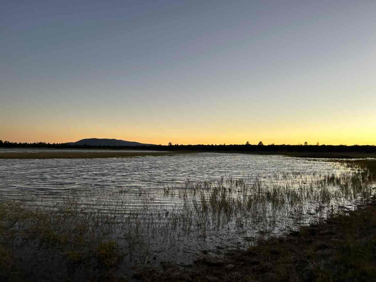
The wildflowers on the Arizona Trail during a very wet spring can be spectacular. Photo courtesy Naomi Hudetz.
HIGHS
Walking through the many different ecosystems of Arizona, which is surprisingly diverse, from the Sonoran desert to Sky Island peaks above 9,000 feet, red rock canyons, aspen, and pine-covered plateaus.
One of the best long trails for wildlife viewing with animals you'll not find on other trails, including Gila Monsters, javelina, coatimundi, and the Sonoran Desert tortoise. There are also elk, antelope, and bear. This land is even home to the jaguar and ocelot, though sightings are very rare.
Excellent system of Gateway Communities, Trail Angels, and trail-focused services that make the journey easier logistically.
Clear signage and navigation apps are better than you'll find on many long trails.
Treeline Review Mike Unger near a wet area in Saguaro National Park. Photo courtesy Naomi Hudetz.
CHALLENGES
Long distances between water and few ways to safely leave the trail should you run out.
In some sections, the water is brown or green, often due to cow activity. You will need a good water filter and frequent backflushing to maintain it.
Heat and the sun can sap your energy, contribute to sunburns, and lead to dehydration.
For northbounders, climbing Miller Peak (over 9,000 feet) on the first day is physically challenging.
Northbounders are likely to encounter snow on the Sky Islands.
Sections of the trail are steep, rocky, and loose, requiring good footwear selection and a daily foot care routine.
Prickly plants abound in the desert! Watch your shoes and gear. Parts of the trail can get overgrown with thorny bushes, so prepare to get scratched up.

AZT Northbounders will likely encounter snow north of the Grand Canyon.
BEST SEASON
Spring and fall are the best season for the Arizona Trail. Spring in Arizona can start as early as late February in low snow years or as late as April in high snow years. Spring hikers will want to northbound, starting at the Mexico border. Southbound hikers will start as early as mid-September and as late as mid-October.

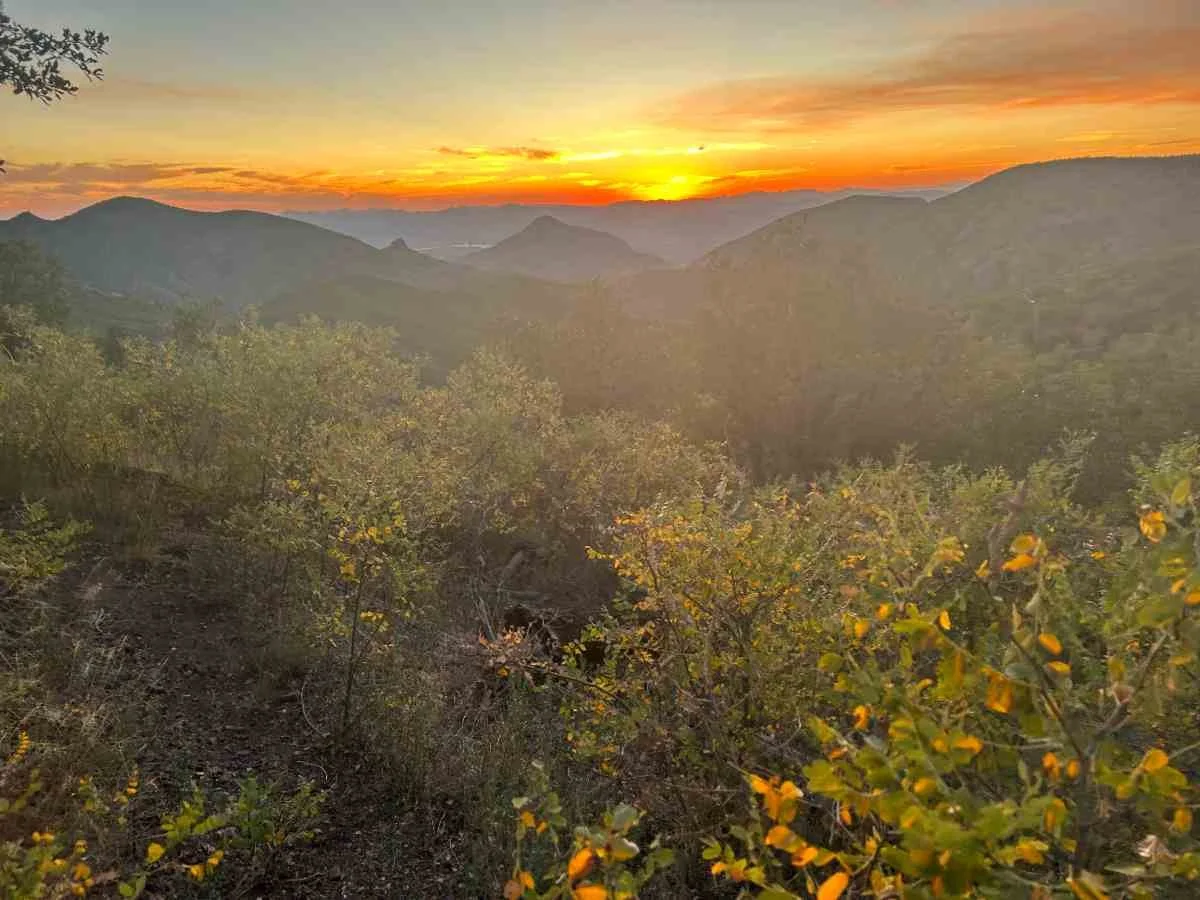
Fall color on the Kaibab plateau on the AZT.
SHOULD I NORTHBOUND OR SOUTHBOUND THE AZT?
Northbound (spring) hikers will generally have more water options, but also may encounter more cow activity, which can impact water sources. There are more northbound hikers and it is a social trail.
While we wouldn't necessarily recommend the AZT as a first thru-hike, if it will be your first long hike, do it northbound. You'll encounter folks who can teach you along the way.
Northbounders often have more challenging climbs, like on the first 1-2 days up to the snow-covered Miller Peak. Weather can be more unpredictable, but generally is cooler. Wildflowers for northbounders can be astoundingly beautiful.
Southbounder (fall) AZT hikers have fewer water options, especially if it has been a dry monsoon year. There are fewer southbound hikers and there is more solitude. Southbounders may not have as much access to services or trail angels. Southbound AZT hikers will see fall colors and must also make themselves visible to hunters. Southbounders are unlikely to see snow.

Naomi hiking at sunset on the AZT.
DIFFICULTY AND REQUIRED SKILLS
NAVIGATION
The FarOut app is pretty much essential for an AZT thru-hike, even for those who carry paper maps. The ability to have others comment on whether water is still flowing or has dried up provides an extra level of security in the desert. Commenters also can leave up-to-date info on water caches, changing hours of services in town, or contact info for trail angels.
The Arizona Trail Association offers paper maps. The paper maps can be loaded to a phone with the Avenza App, which will show your location relative to the topo map via GPS (see the Maps and Guidebooks section for more on these resources).
ROUGH TERRAIN/SCRAMBLING/ ROCK CLIMBING
There is no rock climbing on the AZT, but there are a few sections where you may need to do some minor scrambling, notably on Mt Lemmon. Nothing is technical or as difficult as you'd find on the Appalachian Trail.
The terrain on the Arizona Trail can be very steep, rocky, and loose. Wear well-cushioned, durable trail running shoes or hiking shoes with good tread. This is not the trail to skimp on your shoes. You also may want hiking insoles for your shoes.
ELEVATION GAIN/ELEVATION LOSS

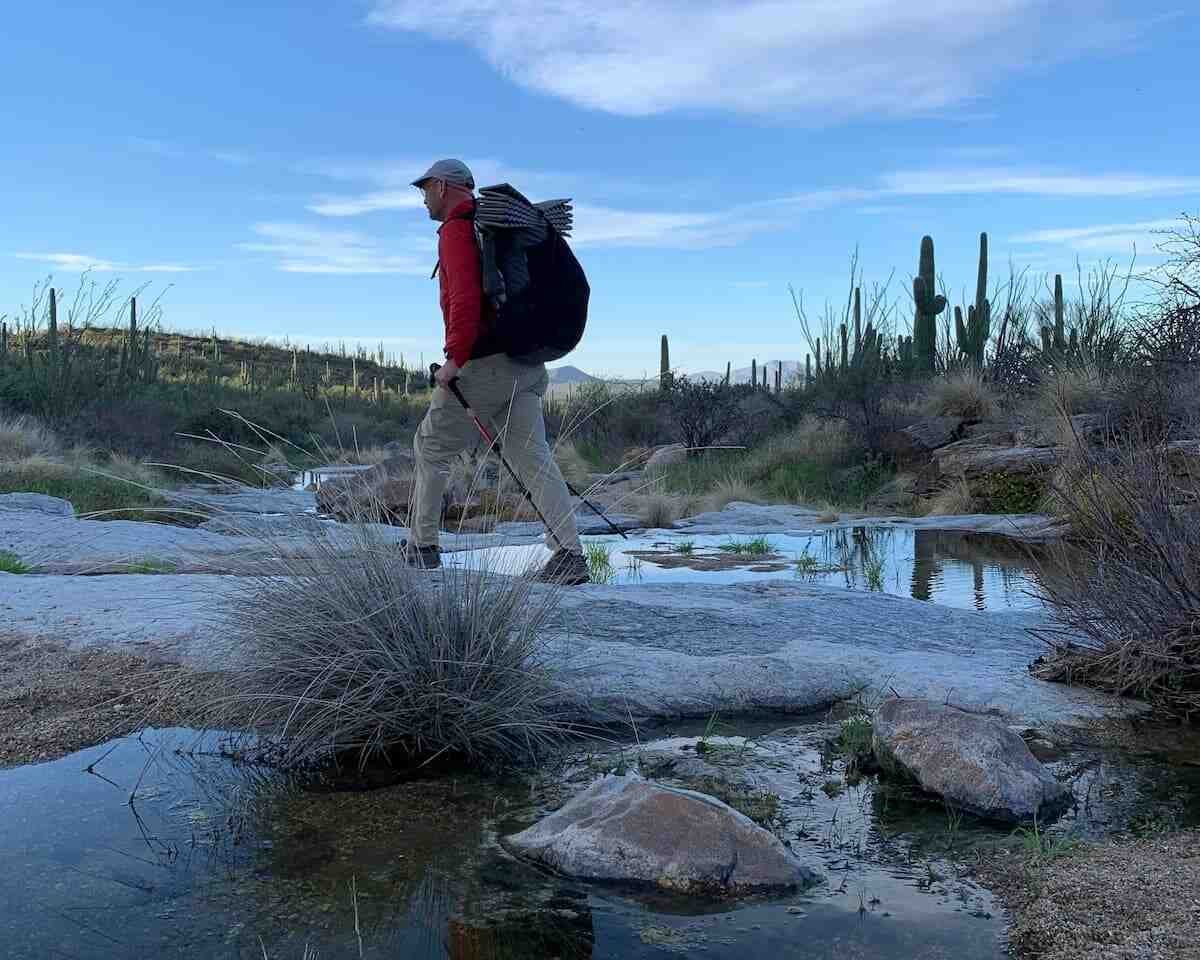
Crossing the Colorado River in the Grand Canyon on the Arizona Trail.
The Arizona Trail has certain sections that have 3,000+ feet of elevation gain over a few miles and other sections that are practically flat. The Sky Islands section in the southern 300 miles tends to be the most challenging. The Grand Canyon also requires 5,000 feet of elevation loss and then gain to get across.
Aside from the sky islands, many hikers find the elevation gain to be challenging in the Mazatzal Wilderness, Four Peaks Wilderness, and Superstition Wilderness. Some sections of the Arizona Trail mimic the Pacific Crest Trail in that it utilizes switchbacks and other trail design engineering to keep a relatively low grade. Sections open to bikes generally have good switchbacks. Be prepared for all grades of trail. This is one trail where we recommend trekking poles.

The Grand Canyon is a highlight of the AZT.
PERMITS
There are two sections of the AZT that require permits: Grand Canyon National Park and Saguaro National Park. Both national parks recognize that thru-hikers need a different system for choosing permits because it's hard to predict the exact dates they may reach a park.
SAGUARO NATIONAL PARK PERMITS
Saguaro permits are the easiest of almost any national park we've hiked through. A special link on recreation.gov will take you to the AZT thru-hiker permit. The AZT thru-hiker permit is good for camping at Grass Shack and Manning Campground (the two designated campsites along the AZT). It lasts 14 days, so you don't need to know exactly when you'll get to the park. There are even helpful reminder signs 30 miles south and 40 miles north of the Saguaro entrance (with a QR code), so you're sure to get your permit while you still have coverage on your phone.
You'll also need a park entrance fee (good for 7 days) or to carry your America the Beautiful Interagency Annual Pass (aka National Park Pass). I had an Annual Pass and didn't realize I needed it for Saguaro—so be sure to carry yours or send it to yourself before entering the park. At Grass Shack and Manning campground, thru-hiker sites are signed and set aside during thru-hiking season (they're the group campsite).
GRAND CANYON NATIONAL PARK PERMITS
As of 2025, much of the Grand Canyon is not accessible along the AZT. Please see the Arizona Trail Association’s closure page for the most current info.
For Grand Canyon National Park, hikers and bikers can stay at the hiker-biker sites at Mather Campground on the South Rim and the hiker-biker sites at the North Rim Campground. It's $6, and it is on a first-come first-serve basis.
If you want to camp anywhere else in the Grand Canyon, you need a backcountry permit. Walk into the backcountry office on the south rim, and they can get you set up for some backcountry camping permits set aside for thru hikers. There's a backcountry office on the north rim, too.
It may be a challenge to get a same-day permit, but most AZT hikers find that okay because the rim campgrounds are popular places to resupply, shower, and do laundry. If you know your exact dates 5 months in advance, you can apply for the lottery through Rec.gov.
Hikers obtaining their permit at the South Rim will have priority for sites at the Havasupai Gardens Campground and hikers getting permits at the North Rim have priority at the Cottonwood Campground. Some years, the Bright Angel stock group site at the bottom of the canyon may be available for thru-hikers. If you are flexible (and courteous), the Backcountry Office will do their best to help you figure something out.

A bikepacker we met on the Arizona Trail in the Grand Canyon section.
BIKES ON THE ARIZONA TRAIL
The Arizona Trail is open to mountain bikes and is considered an extremely difficult bikepacking route. In our experience, interactions between hikers and bikers are very positive, especially compared to other trails like the Colorado Trail or Tahoe Rim Trail.
Yielding
The Arizona Trail Association has made it clear and easy to know who yields to whom on the trail and all our interactions were friendly and courteous as we encouraged each other forward on this challenging journey. The Arizona Trail Association has a very detailed description of who yields to whom in nearly every situation.
Bikes yield to hikers.
Bikes and hikers yield to equestrians.
Bikes are not allowed in the Wilderness sections of the AZT (Mazatzal Wilderness, Four Peaks Wilderness, Superstition Wilderness, Rincon Wilderness, Pusch Wilderness, Miller Peak Wilderness). Each section has a bike route that avoids the wilderness, often via services. Bikepackers are required to break down their bikes and carry them across the Grand Canyon. The FarOut app has a separate Bikepacking the Arizona Trail guide and also includes the bike alternates on the hiking app.
ROUTE SUMMARY BY SECTION
The Arizona Trail is separated into 43 passages, which are sections that are somewhat easily day-hiked. Here, Liz writes about the trail based on how a thru-hiker may think about the distance between resupply points or obvious changes in terrain or landmarks.
Sections are listed from south to north.
HUACHUCA MOUNTAINS

Liz Thomas at the southern terminus of the AZT.
The Arizona Trail starts at the US-Mexico border in Coronado National Monument (no entrance fee required) near Sierra Vista, AZ. Most hikers start at the trailhead Montezuma Pass along a gravel road, southbound two miles to the border monument, and then retrace their steps back to the Pass. From there, they head north into the Miller Peak Wilderness, part of the Huachuca Mountains and an elevation of nearly 9,000 feet. They'll often encounter snow at higher elevations and the first of the sky island mountains on the AZT. As of November, 2025, US Customs and Border Patrol has installed concertina wire around the border monument and the Arizona Trail Association asks you not to attempt to cross it to reach the monument for a picture.
CANELO HILLS AND SANTA RITA FOOTHILLS

Red Bank Well, a solar and windmill water pump, has reliable water.
The trail drops to the gentler Canelo Hills, which are well-graded and open to bikes. Many AZT travelers stop in Patagonia, AZ for food and resupply before heading into the Casa Blanca Canyons and Santa Rita mountains below Mount Wrightson.

Sunset view from the new section of the AZT open in the Santa Rita mountains.
As of Fall 2023, the new route open to bikes is outside of the Mount Wrightson wilderness. Kentucky Camp is a popular stop for hikers, bikers, and equestrians as it has water, electricity, and even a cabin to rent.
The AZT continues to the well-graded foothills of the Santa Rita mountains through oak forest and grasslands.
CIENEGAS

The trail crosses under I-10 at a culvert with the fun rattlesnake painting.
The gentle Las Cienegas passage has great views of Mount Wrightson, the Empire Mountains to the east, and the Rincon mountains to the north. Because of its relative ease and proximity to Tucson and easiest to access, it's popular with day hikers and day riders and I saw a few even on a weekday. The main trailhead along this section is the Gabe Zimmerman Trailhead, which commemorates a major advocate of the establishment of the Arizona Trail who was killed during the 2022 Tucson shooting.
The trail drops to La Cienega and Davidson Canyon, which are a riparian ecosystem filled with cottonwood trees, plants, and wildlife that are relatively rare in Arizona. The trail crosses under Interstate 10 at the rattlesnake mural, a must-stop photo opportunity. Gentle trail over hills leads to Colossal Cave Mountain Park, where there is water, camping, a restaurant, and a chance to get your resupply box before climbing the Rincon Mountains.
SAGUARO NATIONAL PARK AND THE RINCON MOUNTAINS
The trail enters Saguaro National Park through a forest of dense saguaro before climbing to grasslands, granite slabs, pines, and even snow near Manning Camp (elevation: 8,000 feet) and Mount Mica. It descends over the less traveled back side of the Rincon's to Redington Pass via Italian Spring. Contrary to popular belief, not all of Saguaro National Park has saguaros and once you get above 4,000 feet or so, it turns to oaks and then pines. While it's possible to hike through the trail in one push, I'm grateful to have spent the night at the thru-hiker group camp at Manning Camp. Watching the full moon from a Sky Island among the pines is one of my favorite memories of the trip.
REDINGTON PASS
For this passage, it's gentle walking through grasslands with views of the Rincon Mountains and Catalinas ahead.
After a beautiful short rocky pass, you'll drop to Molino Basin and gently climb to Gordon Hirayabashi trailhead and campground, honoring the civil rights leader who fought the curfew and Japanese American concentration camps. He was imprisoned in the area in the 1940s.
SANTA CATALINA MOUNTAINS AND MT. LEMMON

A full moon setting in the Santa Catalina mountains as viewed from Sabino Canyon.
It's a long ascent through the Santa Catalina Mountains through the Pusch Ridge wilderness and Sabino Canyon to Mt Lemmon and the mountain town of Summerhaven towards the top. Hutch's Pool is a popular swimming hole (and water source) before the climb to Romero Pass, and then up to the Wilderness of Rock. Here, things can get scrambly with big boulders and large granite rock formations reminiscent of Idyllwild on the Pacific Crest Trail or lower elevations of the John Muir Trail.
This section is physically challenging but a highlight of the whole AZT. It's unlike any other section. Temperatures can be 20F cooler up in the pines. Descend along a creek to lush Marshall Gulch and walk the road through Summerhaven for resupply.

American Flag trailhead on the Arizona Trail.
Oracle Ridge is a 3,000-foot steep descent to the American Flag Trailhead and has great views in either direction. I loved breaking it up by doing half at sunset and half at sunrise. Towards the end, you'll pass High Jinx Ranch, which was once owned by Buffalo Bill Cody and allows hikers and bikers to stop by for water. It ends at American Flag Ranch, which is the oldest territorial post office in Arizona and is open to visitors during certain hours.
Oracle State Park is a short but pleasant section through grasslands with views of Mt Lemmon. Afterward, stop at the Oracle Patio Cafe in Oracle, AZ for amazing pastries and resupply before heading into the next remote section.
SONORAN DESERT AND THE COPPER CORRIDOR
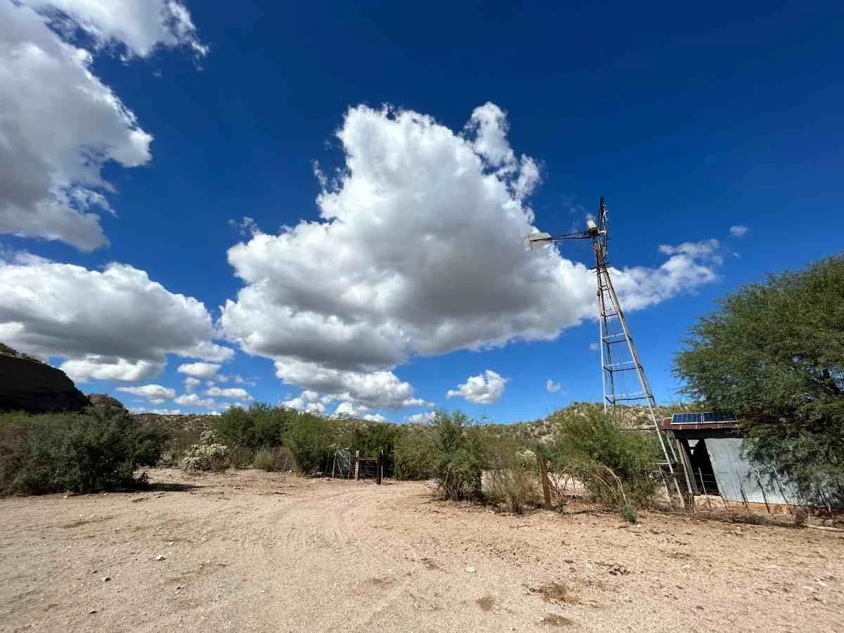
Beehive well is solar and windmill powered and a welcome break spot on the AZT.
The Black Hills are the southernmost passage in the Central Arizona region of the AZT. These rolling grasslands have saguaros and switchbacked trail. This section has limited shade, far apart water sources, and the area can get over 100F in spring and fall. This is why you're unlikely to see day hikers or many cyclists in this section.
Northbounders will see Antelope Peak ahead. The green San Pedro River watershed is to the east. The few water sources in this section are Mountainview Tank, Cowhead Well and Beehive Well, which private landowners provisionally allowed hikers, bikers, and equestrians to use–as long as there is good stewardship.

Sunset near the Freeman Road trailhead close to the Tortilla mountains.
The trail enters the Tortilla Mountains. There's some cool rock formations and some relatively high up but flat terrain. You've got views of the Superstitions ahead and a climb up to the Big Hill with views of the Gila River before dropping to the Gila River and access point to Kearney, AZ, the trail town home of Gary the Trail Angel from Old Time Pizza.
GILA RIVER

The Gila River is one of few rivers you'll see on the AZT. Hikers, bikers, and equestrians cross it on a bridge.
The Gila River is a lush section of trail where the AZT was completed. There are numerous river canyons along the Gila before climbing to one of my favorite sections of the entire trail, the most dramatic gorge on the AZT outside of the Grand Canyon.

The Picketpost to Gila River section has some of the best scenery of the whole AZT.
To add to the scenery, there are saguaro and wildflowers here, plus rocky tall cliffs unlike anywhere else on the trail. This section is where I saw a desert tortoise. The trail continues through awesome saguaro on switchbacked trail through Alamo Canyon to Picketpost Trailhead.
SUPERSTITION WILDERNESS
North of Picketpost Trailhead is the Superstition Wilderness, with notable jagged volcanic peaks as you ascend the lush Reavis Canyon, where you'll even find apple trees. This section has some steep climbs and big elevation, but also some nice ridgewalks set high above the wilderness for 360-degree views of Apache Lake before descending to Roosevelt Lake Marina, a popular resupply spot. For northbounders, this is one of the most challenging sections since Oracle Ridge. For southbounders, it's hard but gentler than what you've come through.
FOUR PEAKS WILDERNESS

Fall color and cactus in the steep and exposed Four Peaks wilderness traverse
You'll cross the Roosevelt Bridge over the Salt River. It's one of the few paved spots on the whole AZT, but isn't busy and is an architectural beauty that is worthy of the landscape. From here, it's a steep and rocky loose climb from the Vineyard Trailhead to a saguaro forest. For northbounders, these are the last you'll see the whole trip and are the first for southbounders.
From the Mills Trailhead, you enter the Four Peaks Wilderness. What we call "the Four Peaks" is actually one mountain with four distinct peaks. Despite a recent burn, the area is lush. As a southbounder, each gully was filled with red maples. The traverse along the peaks has some of the best views of the lake below and mountain above, but has very steep drops and is quite rocky. I found this to be one of the most challenging sections of the whole trail. From Pigeon Spring, it's a hot, steep, and high-up dirt road walk before descending into Boulder Canyon down to Sycamore Creek.
MAZATZAL WILDERNESS
Sunset in the Mazatzal wilderness.
For many thru-hikers, myself included, the Mazatzal Wilderness is the most difficult part of the entire trail. It's the longest section of designated wilderness and is the most remote. It has little water, is extremely rocky, and has long sections without shade. I could write more, but am still processing how freaking hard this part was.

Sunset descending from White Rock mesa in the Mazatzal wilderness.
The wilderness proper descends the Red Hills and ends near the East Verde River, only a few rivers along the AZT. It is one of only two Wild and Scenic Rivers within the entire state.

Triceratop skeleton-looking rock formations on the White Rock Mesa.
From here, you climb to Whiterock Mesa, which has an entire plateau filled with rocks that look like triceratops skulls. The trail to Pine, AZ, is rocky and exposed, but soon changes as you cross Highway AZ 87 and start the Highline Trail.
HIGHLINE TRAIL

Highline Trail red rock north of Pine.
The Highline National Recreation Trail is one of the jewels of the AZT, a fairly newly reconstructed 17-mile section below the Mogollon Rim, which is a red rock escarpment of the Colorado Plateau. Numerous creeks along the way mean there's lots of water and shade. Smooth, well-graded trails make for easy hiking, even as you climb. Red rock formations along the way are reminiscent of hiking in Sedona. The AZT leaves the Highline at Washington Park trailhead and climbs through creeks and springs to the pine-covered Mogollon Rim.
Note: In the summer/ fall of 2024 there was the lightning-started fire along most of the Highline Trail. Though the trail is now re-opened in this section, use the same caution you would use traveling through any recently-burned environments.
MOGOLLON RIM AND BLUE RIDGE

General Springs cabin is a beautiful spot on the Mogollon Rim.
From the Mogollon Rim and Blue Ridge, the trail is pine, aspen, and shade as you walk along part of the General Springs cabin loop trail. The Happy Jack Passage north of it continues along the Mogollon Plateau through ponderosa forest, flat walking, and cow ponds for water. From Gooseberry Springs trailhead, it's more soft, meadow and pine-needle walking to the side trail to Mormon Lake. I saw elk and antelope in this section. Watch for hunters here in the fall.
ANDERSON MESA
Horse Lake at sunset was one of my favorite spots on the AZT.
Anderson Mesa was one of my favorite sections of the AZT, with flat walking through ponderosa, good views of the San Francisco Peaks, and excellent wildlife viewing. This plateau has numerous natural lakes formed 5-10 million years ago. Watching elk swim and bugle in Horse Lake at sunset is something I will never forget.
FLAGSTAFF AREA
The trail descends to cool red rock cliffs in Walnut Canyon before splitting into the Flagstaff Urban Route or Flagstaff Equestrian Route. The Urban route was surprisingly pleasant, through ponderosa pine forest before crossing into town, where I resupplied before going to Buffalo Park and the Dry Lake Hills Trail System.
SAN FRANCISCO PEAKS
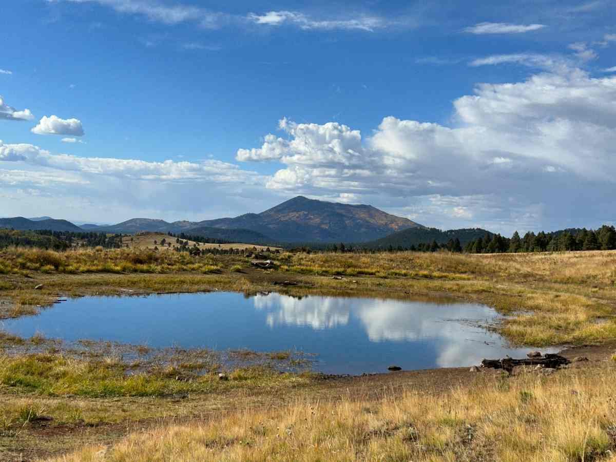
Reflection of the San Francisco peaks in a tank.
The San Francisco Peaks passage is another highlight of the AZT. The fall color was incredible, and the trail is well-graded. Mt. Humphreys makes its own weather system and big boulders covered in moss along this trail reminded me more of the Appalachian Trail than the Arizona Trail!
BABBITT RANCH AREA
The trail descends to the flat and sometimes double-track or dirt road Babbitt Ranch CO Bar section. This is one of a few private property sections of the trail, so be sure to be a respectful steward here. As a southbounder who experienced this trail during a rainstorm, this section was cool and windy, with incredible views of Mt. Humphreys. It's also where I met the most thru-hikers in one spot of the entire trip–ten of us at a wildlife guzzler watering hole. For northbounders who don't have a mountain view and often get hot weather here, it can be more challenging.
COCONINO RIM
The Coconino Rim and Coconino Plateau are cool passages of the AZT that surprisingly don't require a lot of physical effort for such a view. It's part of the newly designated Baaj Nwaavjo I’tah Kukveni Ancestral Footprints of the Grand Canyon National Monument (as of August 2023). It has the Grandview Lookout Tower and pleasant ponderosa pine forest walking.
GRAND CANYON

The Grand Canyon on the AZT is a highlight of the whole AZT.
The Grand Canyon passage is a clear highlight of the Arizona Trail. The AZT uses the South Kaibab Trail to access Bright Angel. You can get food at Phantom Ranch before ascending the North Kaibab Trail to the North Rim. Thru-hikers can resupply, take a shower, or do laundry based at south rim or north rim campgrounds. Nothing I write here can do justice to the many layers and grandeur of the canyon. As a thru-hiker, it's an honor to travel through this landscape.
In 2025, the Dragon Bravo fire, starting at the North Rim of the Grand Canyon, burned over 145,000 acres and destroyed structures including the North Rim Lodge, which is an important resupply for AZT hikers. As of February, 2026, there is a 25.5 mile closure between Phantom Ranch in the Grand Canyon, and the Kaibab Plateau Trailhead, with no reroutes available. This closure means thru hikers will have to deal with incredibly complicated logistics for getting around this area, as the drive from the South Rim around to the North Rim is over 200 miles. Please check the Arizona Trail Association, National Park Service, FarOut app, or the current year Arizona Trail 2026 Facebook page for updates.
KAIBAB PLATEAU AND THE ARIZONA STRIP

Liz Thomas at the viewpoint for the East Rim of the Grand Canyon.
The Kaibab Plateau north of the Grand Canyon can be overlooked by finish-happy northbounders, but is a magical place for southbounders. The AZT has an awesome view into the East Rim of the Grand Canyon. From the East Rim viewpoint, you can see the Saddle Mountain Wilderness, Marble Canyon, Vermillion Cliffs, and Navajo Mountain in the distance.

Fall color on the Kaibab plateau is amazing.
The fall color in Tater Canyon was one of the coolest things on the AZT for me, reminding me of Colorado. The burnt section of the middle Kaibab Plateau has tons of aspen that were turning yellow, making the area surprisingly beautiful. In the north Kaibab Plateau, it starts feeling more like Utah. The soil turns red, there's a big sagebrush, and the ponderosa pines turn to the Great Basin Conifer Woodland.

Liz Thomas at the northern terminus of the AZT.
The trail ends in the red rock and pink high desert ecosystem with views of Buckskin Mountain, the Coyote Hills and the Vermillion Cliffs National Monument. You'll finish at the State Line Trailhead at the monument not far from Wire Pass. You're where Buckskin Gulch and the Paria Canyon start, so if you feel inclined to keep walking, even more great adventures await!

Fall at the Grandview fire tower on the north rim of the Grand Canyon.
MAPS AND GUIDEBOOKS
FAROUT
The FarOut app for the Arizona Trail is a near essential for navigation. It includes details on water, including what is still flowing or what has dried up. It also includes important intersections, some campsites, trailheads, a town guide, and more.
GAIA
The Gaia app is useful for downloading broader map sets around the Arizona Trail. This is helpful if you want to do side trips or peak bag. It also gives you options if you need to leave the AZT in case of wildfire, high snow, or injury. I like to download maps so that I can identify surrounding peaks and canyons. You can download the GPX line of the trail for free from the Arizona Trail website (download each passage separately).
PAPER MAPS
The Arizona Trail Association sells a color paper map set. I always carry paper maps to be a responsible hiker and be safe in case my phone runs out of battery or stops working. I also enjoy looking at the maps as they often have levels of detail of the surrounding area not available in the app.
GUIDEBOOKS
Arizona Trail Association members can have access to a pdf of the databook. They also sell a paper version of the guidebook.
The Best Day Hikes on the Arizona Trail by Sirena Rana is a great resource for folks looking to section or day hike along the Arizona Trail.

Getting to remote locations on the AZT is easier than you may think.
GETTING THERE
BY PLANE
NORTHBOUNDERS
Fly into Tucson International Airport, AZ (TUS). From there, you can hire a shuttle service or find a trail angel who can give you a ride to the trailhead. If you want to save a little, you can fly into Phoenix International Airport and take the Flix bus to Tucson, but that adds more time and logistics. From Tucson, many hikers spend the night before heading to the Montezuma Pass trailhead. It is pretty far from Tucson to the border, so budget at least 4 hours to get to the trailhead. For details, see the Arizona Trail Association's list of trail angels. This is their list of shuttle services.
SOUTHBOUNDERS
Fly into Page Municipal Airport (PGA). Page, AZ is a very small airport accessible from Phoenix. From there, you can hire a shuttle service or find a trail angel to drive you to the northern terminus. Budget at least 3 hours to get from the airport to the terminus. For details, see the Arizona Trail Association's list of trail angels. This is their list of shuttle services.
Cedar City Regional Airport, Utah (CDC) is another option. It has very limited service, mostly with connections in Salt Lake City. A few trail angels or shuttle services will drive you from this airport. It's about 2.5 hours and expensive. This is a list of shuttle services.
BY CAR
SOUTHERN TERMINUS
Drive to Montezuma Pass Trailhead in Coronado National Monument near the town of Sierra Vista, AZ. The last few miles are on a steep, gravel road that sees lots of side-by-sides, so may not be suitable for all cars and all drivers. Take care, especially after a rain. For long-term parking, please contact Sierra Vista Self Storage (520-458-4400) for secure parking not far from the AZT’s southern terminus for a monthly charge.
NORTHERN TERMINUS
From Highway 89, turn south on House Rock Valley Road for 4.6 miles and park on your left. House Rock Road is a hard-packed dirt road that is generally well-maintained but can sometimes get flooded. We don't recommend parking here for an extended period, especially since there is a fee.
BUS AND SHUTTLE SERVICES
The Arizona Trail Association keeps this list of shuttle services.
REGULATIONS
Follow Leave No Trace Ethics, especially to keep the limited water sources clean.
Mountain bikes are not allowed in wilderness areas.
Camp at least ¼ mile from certain water sources that are important for wildlife. Animals will avoid humans and this can lead to dehydration.
Don't store food or other supplies in water cache boxes. Read more about water cache etiquette here.
Watch for campfire bans and refrain from campfires where prohibited.
Watch for prescribed burns or wildfires and use alternate routes when the trail is closed for fire.
Permits are required for the Grand Canyon and Saguaro National Park.

RESUPPLY
The Arizona Trail has among the most robust trail gateway community programs of any long distance trail. Trail towns are excited about trail users and you'll find resources and services for hikers and bikers. Here are towns that are right on the trail or available by easy hitchhike. See our guide on how to hitchhike as a thru-hiker for more tips. Some trail angels in these communities offer rides as well.
Patagonia (short hitch from trail via the new route): hotels, hostel, camping, grocery stores, post office
Colossal Cave (via 1 mile side-trail): accepts packages, restaurant
Summerhaven (on trail): post office, hotels, market, restaurants
Oracle (short hitch): post office, market, restaurants, casitas to rent, camping
Kearney (short hitch): restaurants, post office, laundry
Superior (short hitch): restaurants, post office, hotel, grocery
Lake Roosevelt (via 0.25 mile side-trail): accepts packages, restaurant, small market, laundry and camping 1 mile away
Payson (longer hitch): city with everything you could want
Pine / Strawberry (short walk or hitch into town): post office, restaurants, trail angels, laundry, small markets
Mormon Lake (1 mile side trail): accepts packages, market, showers, laundry, restaurants, camping, can rent cabins
Flagstaff (right on the urban route): city with everything you could want, including gear stores and medical care
Tusayan (0.25 mile side trail): hotels, restaurants, laundry, market, Starbucks
Grand Canyon South Rim (hiker biker site 0.5 mile from trail): camping, hotels, restaurants, laundry, shower, grocery, post office, gear store
Grand Canyon North Rim (hiker biker site 0.5 miles from trail): camping, hotels, restaurants, laundry, shower, grocery, post office, laundry, gear store (note: services are generally open in the North Rim during thru-hiker season, but closed in the fall)
Jacob Lake (short hitch): restaurant, hotel, small market, laundry, shower

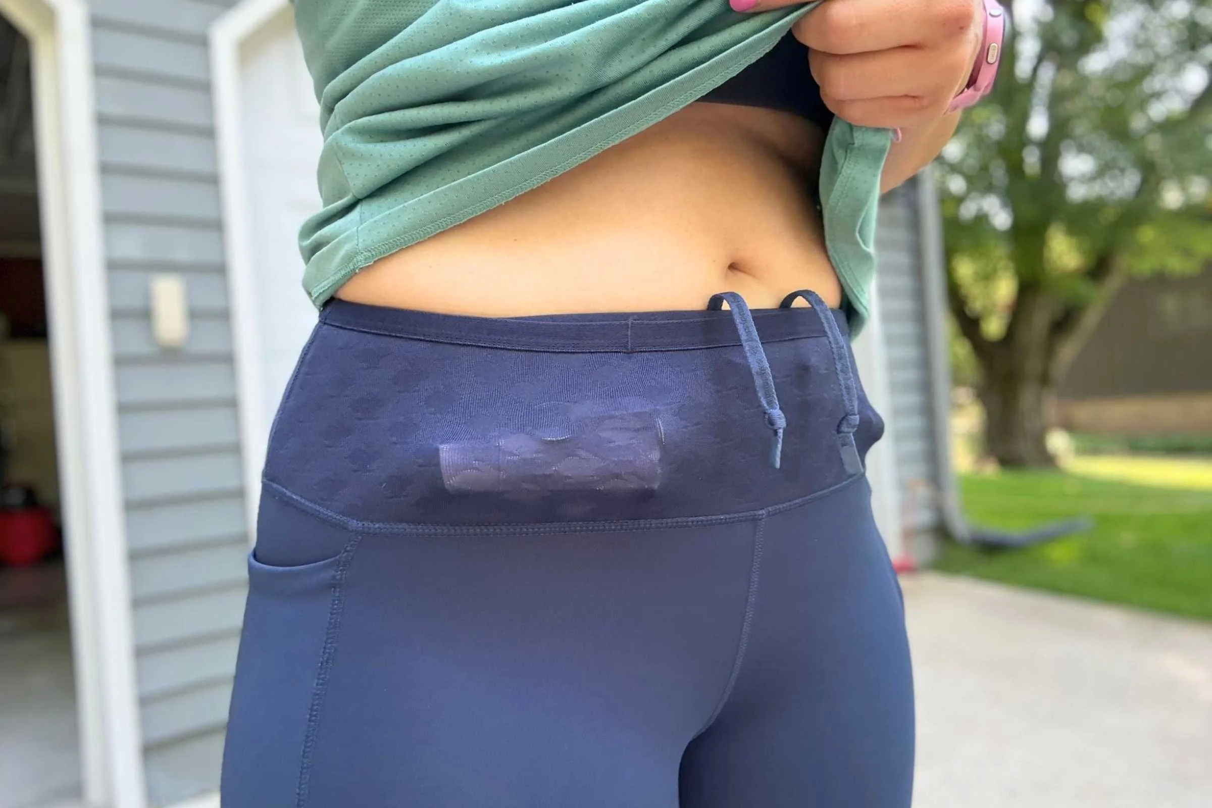
The Six Moon Designs Haven Tarp generously fits two people. Here it is set-up at a primitive campsite on the Arizona Trail. Photo courtesy Naomi Hudetz.
CAMPING
The FarOut app lists some campsites, but with a few exceptions, you can camp where you want along the AZT. Camping permits and exact locations are required within the national parks. There's no camping in Coronado National Monument.

Retrieving water from a tank on the AZT.
WATER PLANNING
The FarOut App lists water sources, predicts whether they are running based on conditions, and also allows real-time user input from other hikers and bikers. The Arizona Trail Association also runs a water sources page that is free and run by FarOut.
Many AZT trailheads also have bear boxes called Resupply Boxes that operate as water caches.
You should plan to use a water filter or purifier on every source on the AZT.
BEARS AND FOOD STORAGE
The National Park requires that you store smellables, food, and garbage in hard-sided canisters. In the Grand Canyon, each campsite has its own bear box. For other sections, we carried an odor proof food bag. For other bear canister recommendations, see REI’s Food Storage story or REI’s Bear Canister story.
SIDE TRIPS
Mt. Humphreys
The highest peak in Arizona, Mt. Humphreys, is a short side trail away. At 12,633', it's also the highest point in the San Francisco Peaks. It's a 10-mile round trip from the AZT.
Mt. Lemmon
Mount Lemmon (9,171 feet) is the highest peak in the Santa Catalina range. It is the highest point in the Santa Catalinas. This would add 6.8 miles one-way, so not a lot of thru-hikers do it.
Mica Mountain
Mica Mountain (8,668 feet) adds 0.4 miles round trip. It's the highest point in Saguaro National Park and the Rincon Mountains.
Miller Peak
Miller Peak (9,470 feet) adds 1 mile round trip and 400 feet of gain. The highest point in the Huachuca mountain range.

A coiled rattlesnake that Mike and Naomi saw on the AZT.
STRATEGY AND TIPS
HIKE DURING THE COOL PARTS OF THE DAY
Whether northbound or southbound, you're bound to have hot days on the AZT. Consider adopting a siesta schedule during really hot stretches. Early afternoons can be uncomfortably hot. Instead of fighting the heat, find a shady spot for an extended rest.
On Mike and Naomi’s PCT northbound hike, they cooked “dinner” during their afternoon siesta. Sometimes it’s best to hike before sunrise or after sunset when temperatures are cooler.
Bring a good headlamp if you plan to do any night hiking. See our Best Headlamps guide for more suggestions.
Pro tip: Situational awareness is especially important when night hiking. For northbound hikers, snakes and other creatures are more active at night. Also, keep an eye out to not trip on other hikers sleeping on or near the trail.
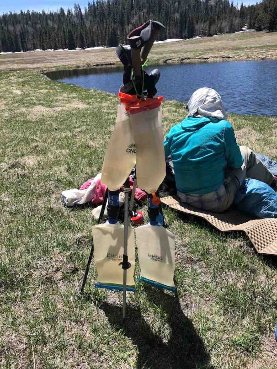
CARRY EXTRA WATER CAPACITY
AZT hikers should plan to carry at least 6 liters worth of water capacity. It may be more than 30 miles between water sources. While water caches are generally reliable on the AZT, we've walked into many empty caches. Check the FarOut app for recent comments as to whether water sources are flowing.
We recommend using reliable, compact water bags in the desert. Mike and Naomi started using the Cnoc Outdoors water containers on the Grand Enchantment Trail–a rough desert and mountain route between Phoenix and Albuquerque that shares some miles with the Arizona Trail. They find the Cnoc bags to be more durable than Platypus bladders or Sawyer water bags. Their 2-liter Cnoc bags have been dropped, squeezed, and carried through thorny brush. They’ve never had one fail. They can’t say the same for Platypus or Sawyer bags.
USE ELECTROLYTES
Electrolytes are essential for the AZT. Water alone is not enough when exerting yourself in hot and exposed conditions.
During Mike and Naomi’s NOBO hike they came upon a hiker sitting in the shade with his head in his hands, unable to continue hiking. He didn’t understand what was wrong because he was drinking lots of water. They asked if he used electrolytes and he wasn’t. He was possibly headed toward hyponatremia. So they gave him a packet of electrolytes and it was like a light switch was turned on. He immediately came back to life and was able to continue hiking. Lesson learned: electrolytes matter.
Read our in-depth review of electrolytes written by a nutritionist-turned-thru-hiker, where we discuss the pros and cons of each type of electrolyte, when to take them, and more.
WATCH FOR SPIKY PLANTS
We include the cactus in the list of potentially dangerous creatures of the desert. Those of us who have been attacked by the jumping cholla will swear the cactus launched itself into our calf. Removing a cholla is tricky. We strongly recommend you keep a simple hair comb within reach at all times in the desert. This is the most effective method for removing a cholla. Many folks will opt for long pants on this trail for this reason.
BUILD A DIY GRAVITY FILTER
"Squeezing water to filter is the worst part of my hiking day," another AZT thru-hiker told Liz. There's a quick fix: gravity filtering.
Mike and Naomi like to use the Cnoc bags as a gravity system with the Sawyer Squeeze filter.
You use a Sawyer coupler to attach two Cnoc Vecto bags to a filter. Using this system, you can filter two liters in less than five minutes–all hands-free without any squeezing. They strongly recommend using Nite Ize gear ties to hang the Cnoc/Sawyer gravity system.
Treeline editor Liz Thomas likes to use her Sawyer Squeeze as an inline filter. Using a drinking water bladder, she cuts the hose and inserts the Sawyer Squeeze using the Fast Fill Adapter. She fills the Platypus with dirty water, sucks on the bite valve of the Hoser, it travels through the filter, and voila! Clean water.
SUN PROTECTION
Most folks expect hot weather on the AZT, but you also need to be prepared for the lack of shade and intensity of the sun.
A good sun hat is essential, but also consider a long-sleeve sun shirt and sun gloves to protect your skin and limit the amount of sunscreen needed. Long pants, despite the heat, can protect you from painful sunburns and on your legs (though plenty of AZT hikers wear running shorts or skirts). Pants will also help protect you from the ever-present cacti.
Wear sunscreen and use sunglasses, too. Consider bringing a sun umbrella for road walks and long-exposed sections. You should plan to hold the umbrella when in use (or use a hands-free umbrella attachment system. For more recommendations, see our guide to the Best Hiking Umbrellas.
RETHINK YOUR FOOTWEAR
Every hiker we met on the AZT complained of foot pain and fatigue. This is a rocky and loose trail.
After 460 miles, the midsoles in Mike and Naomi's Altra Lone Peak shoes were like pancakes. They'd used the Altra Lone Peaks on countless other thru-hikes. Mike and Naomi both had enough and got new shoes.
Unfortunately the pain didn’t get any better with the new shoes. So, 100 miles later they both bought Superfeet Trailblazer Comfort Orthotics out of desperation, which made a huge difference. We get into the how and why of insoles in our Should I get insoles for my hiking shoes? article (Long story short: for the AZT, the answer may be “yes”). The trail also got better (think soft pine needles rather than rocks and compacted soil).=
Knowing Mike and Naomi's experience, Liz switched from her go-to Altra Lone Peaks to the Altra Olympus, which are a higher stack and more cushioned shoe. Treeline Review writer Sam Schild, who hiked the AZT southbound, opted for the HOKA Speedgoat 5. You can read his full review of the HOKA Speedgoat here.
And, given how feet can swell in heat, you may want to size up for the AZT.
PREPARE FOR REMOTENESS
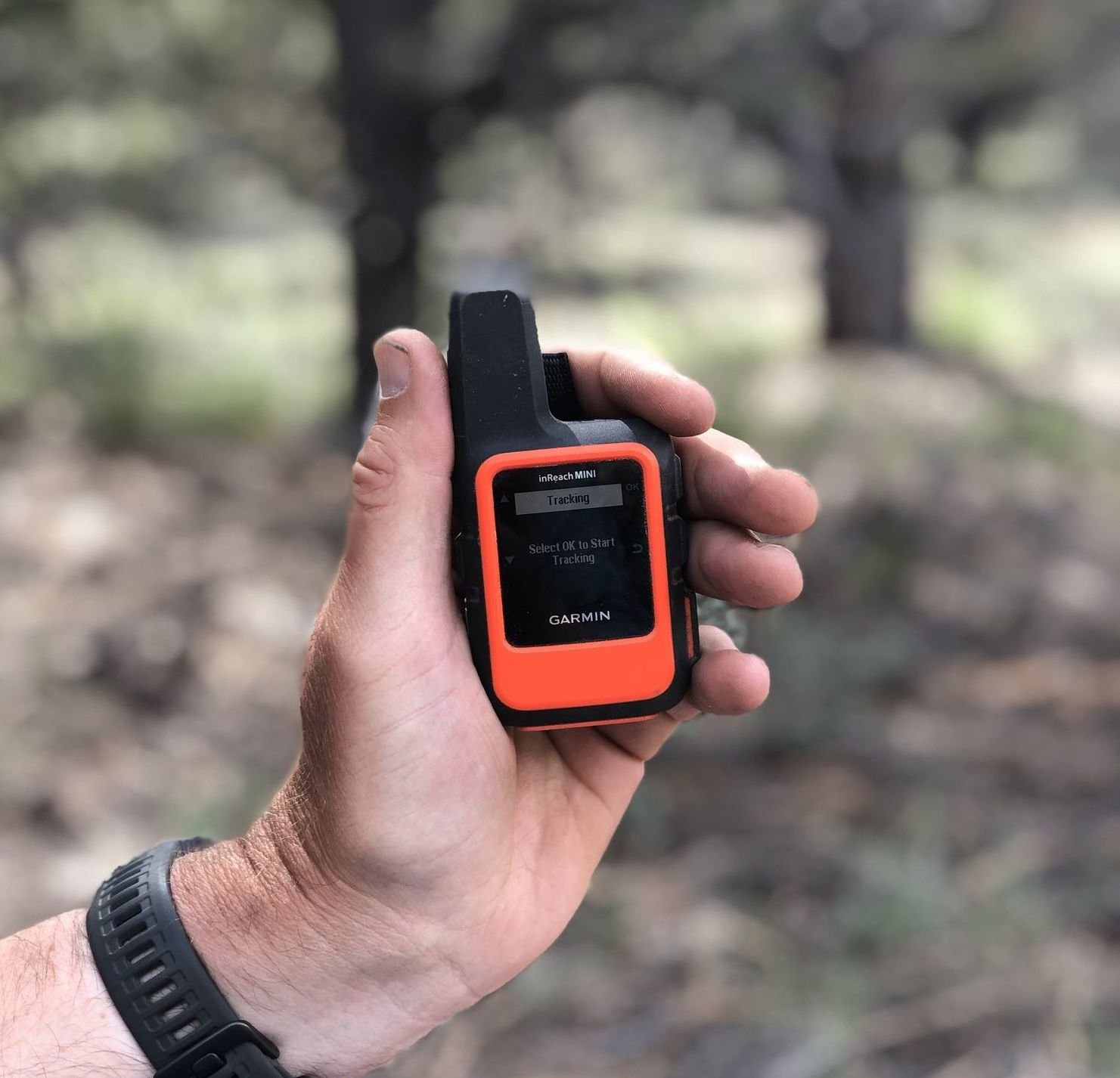
Towns are few and often distant on the AZT and there are many sections where you won't have reliable cell reception. We recommend carrying a personal locator device like our favorite, the Garmin Mini, iDevices like the 3.5 oz Garmin inReach Mini 2 or Garmin Messenger allow you to two-way text with the folks back at home during the sections of the AZT that don’t have cell reception. A two-way PLB could help you in a tough situation, whether that means calling in a rescue team or just getting some morale encouragement from back home in the form of a text.
PREPARE FOR COLD NIGHTS
Desert nights can be more than 40 degrees cooler than day temperatures. Be prepared for subfreezing nights.
See our Best Sleeping Bags or Best Ultralight Quilts stories for our suggestions for 20-degree sleeping solutions for folks of different sizes and sleeping styles.
Remember that sleeping warm isn't just a function of not having a warm enough sleeping pad. Your sleeping pad contributes to how well you sleep, too. By far the most popular pad is the NeoAir XLite, which has good insulation to weight ratio. Liz carried the winter version, called the NeoAir Xtherm, on her southbound hike. Take care of it in the desert, though. Inflatable pads are more subject to popping in the desert. See our Best Sleeping Pads guide for other recommendations.
Because it doesn't rain often on the AZT, many folks choose to go to cowboy camp (sleep under the stars without putting up a tent). Remember your tent or tarp can add up to 10F degrees of warmth, so if it's cold, it is worth sleeping inside, even if it won't rain.
PROTECT YOUR WATER FILTER AND ELECTRONICS
Protect your water filter from freezing at night by sleeping with them in your sleeping bag or quilt. Filters that use a ceramic filtering system will crack at below-freezing temperatures. Sleeping with your electronics in your sleeping bag will also save battery life.
If you expect below-freezing temperatures, bring your shoes into your tent and unlace them so they are loose enough to get your foot in if they freeze overnight. Tip water bottles on their side. That way, if they partially freeze, you can still get water out.
HAVE SOME COLD WEATHER GEAR
For cooking on cold nights and breaks on chilly or windy days, we carry an insulating puffy jacket and a warm hat throughout the entire hike. See our Best Down Jackets and Best Synthetic Jackets guides, which both have lightweight suggestions for thru-hikers. We're partial to the Patagonia Micro Puff synthetic, which is warm when wet and has a similar warmth-to-weight ratio as down. In a pinch, you can wear your rain jacket and rain pants for extra warmth.
BOUNCE YOUR COLD WEATHER GEAR
You'll want cold weather gear for the southernmost and northernmost parts of the AZT. However, many hikers start getting hot in Central Arizona. Instead of sending your cold weather gear home, we recommend bouncing them. Send yourself a package for General Delivery to Pine, AZ (for northbounders) or Oracle, AZ (for southbounders). Some hikers choose to bounce their puffy jackets or stoves. We recommend holding onto your rain gear, though.
CARRY HEAVY DUTY TENT STAKES
There are lots of lighter stakes available, but the MSR Groundhogs are great for staying secure in rocky conditions. We have never had a Groundhog break when we unintentionally pound it into a rock.
Pro tip: If the ground is too sandy to securely hold a stake, place the stake flat on the ground and secure it with rocks. We have also used trekking poles in lieu of stakes in extreme conditions.
Liz, who has hiked the PCT, CDT, AT, and more with shepherd hook stakes, says that the AZT is one trail where she wished she had better stakes. Halfway through her trip, she bought the MSR Mini Groundhogs and was much happier.
selecting gear for the ARIZONA TRAIL
Here, we will discuss which gear worked for Mike, Naomi, and Liz on their various thru-hikes of the AZT and special considerations for this desert route. Some of the items are the same for all three and there's some variation.
SHELTER/TENT
The Six Moon Designs Haven Ultralight Tent is a spacious and affordable ultralight shelter that Mike and Naomi used on their northbound Arizona Trail hike. It has a fully-enclosed design that is an extra defense against scorpions, snakes, tarantulas, and whatever else the desert wants to throw at us. The internal netting makes it a double-walled tent, but at a fraction of the weight of most traditional Backpacking Tents. The netting can be removed for use on other trails, when you want something more minimal.
Liz used the Zpacks Duplex for her southbound hike. You can read her in-depth review of the Zpacks Duplex here.
TENT STAKES
Because the ground on Arizona Trail is so rocky and sandy, tent stakes deserve mention. We carried eight of the MSR Groundhog tent stakes. The beefier (but still lightweight) tent stake can survive the rocks and have a lot of surface area to hold fast in the sand.
TREKKING POLES
Mike used the Black Diamond Pursuit trekking poles, which are our Overall Pick in our Best Hiking Poles story. These lightweight, reasonably priced poles are noted for their durability — something that survived the rugged Arizona Trail.
Liz used the Gossamer Gear LT5 trekking poles, the winner of best ultralight poles. She fully admits these are not the poles for most people on the extremely rocky and steep AZT. But as an ultralighter who sometimes goes pole-free, she was very happy to have had two poles on the Arizona Trail. The terrain is that rugged.
HIKING WATCH
On the Arizona Trail, we wore the Garmin Instinct 3 GPS watch, our top winner in our Best Hiking Watches guide. We have thousands of miles of testing on each of the recommended watches in our guide, including three thru-hikes across the Canadian Rockies on the Great Divide Trail, the 1,200-mile long Pacific Northwest Trail, the Grand Enchantment route from Phoenix to Santa Fe, and the rugged GR20 in Corsica, France.
The Garmin Instinct has GPS capability and tracks data like elevation gain and distance to give you a better idea of how you performed each day of your hike.
The Instinct pairs with your phone, music, can send messages, and even initiate an SOS. When we finished the Arizona Trail we mapped daily tracks over five weeks of backpacking across Arizona. The watch connects to a Garmin app, which can make fly-by visualizations to relive the epic days of your hike and share with your friends.
For more information, read our best hiking watches guide or our Long-term review of the Garmin Instinct 3.
PERSONAL LOCATOR BEACON AND SATELLITE MESSENGER
For the Arizona Trail, Naomi, Mike, and Liz all used the Garmin inReach Mini 2, our Overall Pick for in our Best Personal Locator Beacon and Emergency Satellite Device guide.
HEADPHONES

We recommend caution regarding the use of headphones on the Arizona Trail because it is a backpacking trip that really requires being situational aware. The trail is open to mountain bikes, so it’s important to be able to hear a bike coming in different directions.
Wildlife like rattlesnakes and even mountain lions call the Arizona Trail home, so we want to be able to hear when other animals are nearby. The Shokz wireless headphones work without blocking your ear drums, so you can still hear other sounds that are happening around you.
Naomi, Mike, and Liz agree that the Shokz headphones are a keeper–especially on the Arizona Trail. We all wore them while sweating profusely (it was Arizona, after all) and in the rain (yes it rains in Arizona). The rain and sweat had no effect on them.
The sound quality was shockingly good but I could still hear everything around me, even faint sounds like twigs snapping or footsteps behind me. In some ways I had to get used to this situational awareness feature because my brain was only used to hearing one set of sounds at a time. They are easy to control with buttons on the side and an easy way to skip to the next song. And they're discreet–other hikers probably weren't even aware that we had them on. You can stop and have a conversation without having to remove them.
Liz found that the battery life is better than advertised. It claims 8 hours, but she was often able to get closer to 12 hours.
Re-charging them takes very little power. We carried a battery power bank, and keeping the headphones fully charged barely had an effect on the power level. It can even do a fast charge of up to an hour's additional play off a ten minute charge.
Read our comparison of the 8 most popular wireless earbuds in our Best Wireless Earbuds story.
BACKPACK
More than other thru-hikes, the Arizona Trail is notorious for having rocks, spiky plants, and other items that can cause abrasion and punctures. Liz used the Zpacks Arc Haul 50L, which was a perfect size for her hiking style. Her longest food carry was for 4.5 days with a 5 L water carry. It generally carried the weight well. The Arc Haul was reviewed in our Best Lightweight Backpacking Packs story. Mike and Naomi hiked the AZT with two now-discontinued packs made by Katabatic Gear.
See our Best Backpacking Backpacks guide for more recommendations.
SLEEPING BAG
All three of us used our lightweight Katabatic Gear Palisade 30° F sleeping quilts on the AZT. The Palisade isn't new for us—Mike and Naomi have both had them since 2014 over thousands of miles and Liz has had the Palisade since 2015. They still have great loft and have lost no down. We wash them according to manufacturer instructions after every long hike with Nikwax Down Wash. They have no cold spots. The Palisade is rated to 30° F but we've had them down to 12° F in a freak storm. It was a long night, but we weren't shivering. In short, we are all huge fans of the Palisade.
See our Best Quilts or Best Sleeping Bags stories for more recommendations.
SLEEPING PAD
Mike has struggled with inflatable pads popping and was tired of waking up in the middle of the night on the cold hard ground. He was even more concerned that an inflatable pad would pop in the desert, what with the prickly desert cacti. So, he started out on the Arizona Trail with our former Best Foam Pad winner from our Best Sleeping Pads guide, the Therm-a-Rest ZLite SOL pad. Unfortunately, it wasn’t comfortable enough for him. So to add more comfort, part way through the hike, he bought a Therm-a-Rest ProLite Plus from Amazon (yes, they ship to General Delivery post office addresses now). He used this on top of the ZLite and the 36” length provided extra cushioning where he needed it—under the shoulders and hips. He slept like a baby after that. The total weight of his 2-pad system was 19 ounces with a total R-value of 5.0 (2.6 for the ZLite SOL plus 3.9 for the ProLite).
His two-pad system has other advantages besides great sleep. Using a foam pad underneath an inflatable pad drastically reduces the chances that your inflatable pad will pop (his ProLite never popped). Having a foam pad also gives you a sense of relief that you’ll still have something to use if your inflatable pops in the middle of the night. And finally, a full length foam pad is also great for breaks–much better than just a sit pad. You can completely sprawl and stretch out while gravity filters your water. I think he may be on to something with this 2-pad system.
Liz used the NeoAir XTherm for her southbound AZT hike. The X-Therm is the winner for best winter sleeping pad in our best sleeping pads guide. She worried it'd be too warm for this trail but loved having the warmth, especially since she carried a lighter-weight quilt. While other southbound hikers froze on the North Rim of the Grand Canyon, she was toasty.
See our Best Backpacking Sleeping Pads story for more recommendations.
COOKING STOVE

Naomi and Mike took the SOTO WindMaster stove for the AZT northbound and inspired Liz to do the same on her southbound. It's the overall winner in our Best Backpacking Stoves story.
The WindMaster stove is lightweight, efficient, and more windproof than any of the backpacking stoves we considered. It’s becoming harder to find as Soto promotes the WindMaster. We were impressed by how the WindMaster performed side-by-side against other stoves in high winds. The AZT has many sections with little tree protection from the wind and the Windmaster lived up to its name often. Additionally, the regulator allows consistent pressure even with big changes in temperature and elevation, both which happen on a near daily basis on the AZT.
See our Best Backpacking Stoves story for more recommendations.
COOKING POT

Liz carried a pot for 1-person, the TOAKS Titanium 750 Pot, which is our overall winner in our cookpot guide. It's lightweight, durable, and affordable.
Mike and Naomi shared an Evernew Titanium UL Pot. For two people, we preferred the 1.3 L size of the pot. The Evernew is a well-designed pot with thoughtfully placed insulating features and convenient handles.
To learn more about cooking pots for backpacking, check out our Best Cookpot Guide.
HEADLAMP
Mike and Naomi used the Biolite 330 rechargeable headlamp. Liz used the Black Diamond Spot rechargeable headlamp. See our recommendations in our Best Headlamps story.
WATER FILTER
Naomi and Mike carried the Sawyer Squeeze on their northbound hike and Liz carried it on her southbound AZT hike. It's the “Best for Thru Hiking” winner in our Best Water Filter guide. The Squeeze is lightweight, time-efficient, and easy to field clean. It doesn’t require manually pumping and is good for one million gallons (or until you accidentally leave it out in freezing temperatures–whichever comes first).
The Sawyer Squeeze has long been a top pick for water filters. But the desert water of the Arizona Trail is notoriously bad. Several of the water sources are frequented by cows.
WATER STORAGE
We paired the Sawyer Squeeze with several water storage bags. Mike and Naomi carried the Cnoc Outdoors Vecto 2L Water Container and Liz carried several Platypus containers. The Cnoc is made of a rugged silicone-like material that we believe may be able to handle the desert better than other plastic water bags. Like all water bags, their advantage compared to a bottle is compression. When empty, they squish down. Water bags are the least bulky option when you want to have the option of extra water capacity, but know you won’t always have to be carrying full water capacity.
WATER FILTER ACCESSORIES
Water is life on the Arizona Trail. That's why Mike and Naimi carried a few extra water filter accessories and Liz did the same on her southbound hike.
To connect the Sawyer filter to the Cnoc Vecto, we purchased a Sawyer coupler that allows us to screw our filter into bags to convert them into a gravity filter system. Liz didn't carry a coupler but wished she had as she borrowed the coupler from other hikers a couple times.
To tie it all together, we all used Nite Ize gear ties (12” length) to attach the entire system to just about anything: a tree branch, hiking poles, or a fence post. While gravity does its magic and filters the water, we can relax and eat a snack!

Compare the Altra Lone Peak 3.0 (left), Altra Lone Peak 3.5 (middle), and Altra Lone Peak 4.0 (right) after they’ve hiked the same miles, on the same trail, on the same days. Photo courtesy Naomi Hudetz.
WHAT TO WEAR
SHOES OR BOOTS
Mike and Naomi started the AZT with Altra Lone Peaks. They both suffered significant foot fatigue due to the extremely rocky terrain. Neither had experienced pain like this since their first thru-hike. Keeping this in mind, Liz hiked the AZT in the Altra Olympus, the burlier version of the Lone Peaks, and had no foot pain.

Still, Mike and Naomi were impressed with the tread on the Lone Peaks–even after 460 miles of tough terrain, there was still decent tread left. The soles were grippy and I felt stable on the rocky terrain. They had no stress points on the mesh uppers whatsoever. We recommend trying before you buy as sizing differs, especially when feet swell in the heat.
For more recommendations, see our Best Trail Running Shoes story. We also have a guide for our favorite trail running shoes for thru hiking.
If you’d feel more comfortable in boots, check out our Best Hiking Boots story or our Best Lightweight Hiking Boots story.
A nice footwear compromise for this trip for some folks may be hiking shoes, which are designed to feel like a trail runner but have stability and cacti-resistance more like a boot. See our Best Hiking Shoes story for footwear that has more durability and stability than trail runners.
RAIN GEAR
Naomi carried the Frog Toggs rain jacket for her northbound AZT hike. It's a favorite budget pick for rain gear. Mike carried the lightweight GORE-TEX three-layer Montbell Torrent Flier. For rain pants Mike brought the Montbell Versalite Pants and the Zpacks DCF Rain Kilt.
Liz carried the Montbell Torrent Flier and Zpacks DCF Rain Kilt for her southbound hike.
Even though it rained on us on the Arizona Trail, Naomi and Mike never actually put on our rain gear on their northbound. Their umbrella was sufficient to keep us dry. However, Naomi did use my rain kilt on one very cold morning to provide some warmth, which it did very well.
As a southbounder, Liz used her rain jacket and kilt during three afternoon storms. Two storms were so windy that using an umbrella was impossible. Still, if she were to do the AZT again, she'd use the lighter-weight Montbell Versatile jacket or the ZPacks Poncho Groundsheet as rain gear instead.
For more recommendations, see our Best Rain Jackets article.
DOWN OR SYNTHETIC PUFFY JACKET
Naomi used the Patagonia Micro Puff Insulated jacket and Mike tested the Montbell EX Light Down Anorak jacket on their spring northbound hike. It was surprisingly cold on the AZT and we used these jackets more than we thought we would. You can read our in-depth review of the Patagonia Micro Puff here.
According to Patagonia, the Micro Puff jacket has the highest warmth to weight ratio of any jacket they've ever made. No doubt, it kept me incredibly warm. What I liked:
Seamless shoulders allows for incredible freedom of movement
Hand warmer pockets
Interior pockets
Long torso length meant it did not bunch up under my hip belt
Quilted construction
Synthetic fill meant I didn't have to worry about getting it wet
Mike was equally impressed with the Montbell EX Light Down Anorak jacket. It also has an incredible warmth to weight ratio and enough fill to keep him warm.
For her southbound hike, Liz carried the Montbell Plasma 1000 Alpine Down jacket, which is similar to the Ex Light but is a full zip with pockets and made of a higher fill power down. She worried it'd be too much jacket for the AZT, but was so happy to have brought such a robust jacket for below freezing nights and mornings on the AZT.
See our recommendations in our Best Synthetic Jackets article. If you prefer down for its better warmth-to-weight ratio, check out our Best Down Jackets guide.
WARM HAT
To supplement the warmth of these jackets, Liz and Naomi carried the Montbell Chameece Cap with ear warmers.
Mike kept his beanie in place on really cold nights with a Buff over the top of the beanie. He needed the head protection because he sleeps in a quilt and doesn't have much hair to keep his head warm. Bonus: the Buff can double as sun and neck protection.
FLEECE OR MIDLAYER
Liz carried the Senchi Designs Alpha 60 Hoodie, the lightest fleece on the market. For its 3.4 oz (size small) it was shockingly warm and often all she needed while moving on chilly days. For other fleece jacket recommendations, see our Best Fleece Jackets guide.

Patagonia Quandary Pants, Houdini, and Sun Stretch Shirt all shown here at East Clear Creek on the Arizona Trail. Photo courtesy Naomi Hudetz
SUN SHIRT
For the Arizona Trail, we wanted something with long sleeves, that would dry quickly, had UPF protection, and had pockets. Mike and Naomi wore the Patagonia Sun Stretch shirt, a winner in our Best Sunshirts guide.
Liz wore the Ridge Merino Solstice Sun Lightweight Hoodie on her southbound thru-hike of the AZT. While she wouldn't consider a merino wool hoody for a northbound hike, she thought it would be cool enough to wear on a southbound hike. While she did find it warmer than other sun shirts, this was an advantage in the northern part of the trail. She was impressed by how well the merino kept odor down, even when her shirt soaked with sweat and salt during a record-breaking heat wave. She found herself not needing to do laundry as often because of it. Aside from that heatwave and at the lowest elevation point of the trail along the Gila River, she found the merino wasn't too hot for her southbound hike.
WINDSHIRT
We think a windshirt is one of the most important layers a backpacker can carry. Mike and Naomi used the Patagonia Houdini Windshirt on the Arizona Trail. Liz carried the Montbell Tachyon Windshirt. They're both winners in the Best Men's Wind Jacket and Best Women's Jacket guide.
HIKING PANTS
On the Arizona Trail, we wore the Patagonia Quandary Pants on our northbound hike. In thousands of miles of backpacking, it’s difficult to find hiking pants that are stretchy and lightweight while still feeling breathable.
These Quandary was good for desert travel offering breathable fabric and UPF sun protection. They’re both in Patagonia’s fishing line, not their hiking line. Fishing gear is designed for extended sun exposure while also being breathable, which led us to believe they would work well for our trek across the desert.
Liz wore her usual Purple Rain Adventure Skirt on the Arizona Trail southbound. While her legs were bleeding and torn up from the thorny brush, she says it'll take a lot more than cat's claw and mesquite bush to get her to change her ways.
See our guides to the Best Women's Hiking Pants, Best Men's Hiking Pants, and Best Hiking Skirts and Dresses for more recommendations.
SHORTS
Many thru-hikers wear shorts on the Arizona Trail. For more recommendations, see our Best Men's Trail Running Shorts guide, Best Women's Trail Running Shorts guide, Best Men's Hiking Shorts guide, or Best Thru-hiking Shorts guide.
HIKING SOCKS
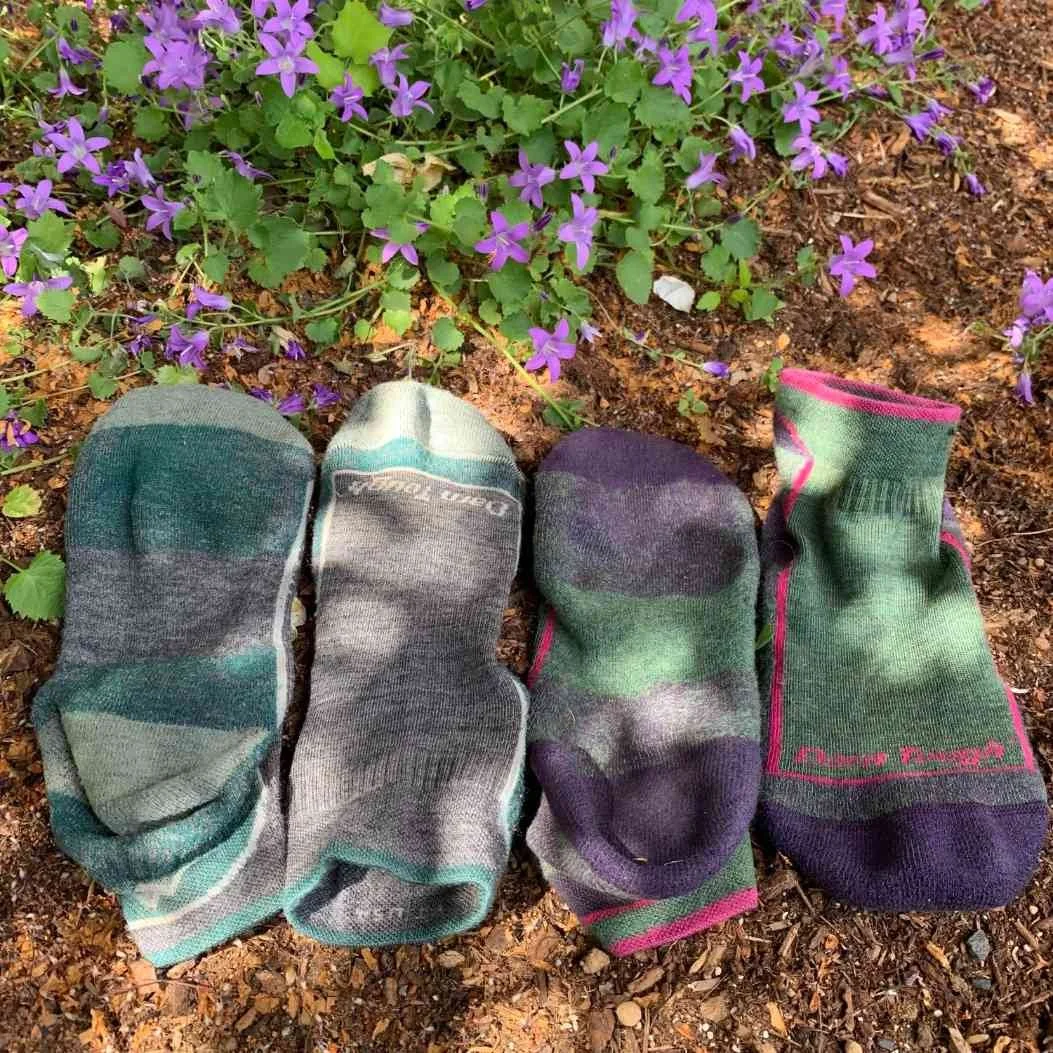
On the Arizona Trail, Mike wore the Darn Tough Hiker Quarter and I wore the Darn Tough Hiker Micro Crew. And I can honestly say, after 800 miles neither sock shows the slightest amount of wear. See the photo above. I'm impressed, especially considering how rocky and dusty the Arizona Trail is. There were very few opportunities to rinse the dust out of the socks because water sources were scarce and precious.
The Darn Tough socks breathe really well and dry keep my feet from getting too sweaty. At breaks I would take off my shoes and socks and the socks were always dry by the time it was time to start hiking again.
In addition, Mike and Naomi both wore Dirty Girl gaiters on the Arizona Trail to keep out tiny rocks and twigs. They also prolong the life of your socks by keeping dirt from the bottom of your socks. The only hard part is deciding on a pattern - they have so many fantastic options!
Check our Best Hiking Socks guide for more recommendations.
SUN HAT
When hiking across Arizona, we knew that sun protection would be especially important.
Mike started out using a simple running baseball cap with a bandana underneath for sun protection. He quickly realized the problems with this set up and switched. With a ballcap and bandana, it is hard for to get good coverage of the neck and sides of face. He spent a lot of time adjusting the bandana but still got random sunburn spots. A sun hat with a strap under the chin is very helpful in windy environments, such as hiking down the Grand Canyon where the wind is dusty and can easily pull your hat/bandana off with a single wind gust.
Naomi wore the Outdoor Research Sun Runner Cap. This convertible hat can be worn as a ballcap with an attachable sun skirt that goes around the outside to protect the neck and side of your face. I really like that I can wear it as a baseball cap in town without the sun skirt—it's really like two hats in one. Our only criticism is that it's not the best looking hat. Luckily, as Mike reminded us, we're not hiking to be fashion models!
Check out our Best Sun Hats guide for more recommendations.
SUN GLOVES
To protect her hands from the desert sun, Naomi wore the Outdoor Research Activeice Chroma Sun Gloves. They also protect the palms of my hands from getting blisters from my hiking poles. In fact, she wore through the palms completely on one hand. For Naomi , sun gloves are essential in the desert and these did not disappoint.
UMBRELLA

Our Six Moon Designs Silver Shadow Carbon sun umbrella has become one of our favorite pieces of desert hiking gear. Naomi struggles in the heat, and keeping the sun off makes a world of difference. When she's using the umbrella, she can also take off my hat which means I stay even cooler. We met several local Arizona hiking guides who had never seen a mylar chrome umbrella and were ready to buy one after talking with us. She also managed to attach my umbrella to my pack for a hands free experience. When it rained, she used it as a regular umbrella and didn't have to use her rain jacket.
We also like the Six Moon Designs Rain Walker SUL Umbrella, which is lighter in weight and slightly more expensive.
WARM GLOVES OR MITTENS
We all carried minimalist gloves for this trip. Liz carried the Possum Down gloves, which are incredibly warm for their weight. For more recommendations on lightweight but warm gloves, see our Best Winter Gloves guide.
MISCELLANEOUS GEAR ITEMS
FIRST AID AND SANITATION
We think every backpacker should carry a potty trowel.
Mike and Naomi used TheTentLab DirtSaw Deuce #2 UL Trowel. Aside from having a pun-filled name, the Deuce is the widest and easiest to use of the lightweight trowels we’ve seen.
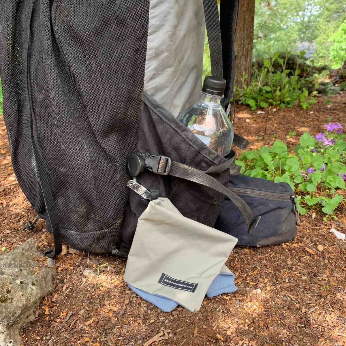
We used the Wander Woman Gear Pee Cloth on the Arizona Trail. A "pee rag" is a great way to practice Leave No Trace for women on the trail. We also think it makes bathroom breaks faster and cleaner.
First Aid Kit
Although we don’t intend to write a guide about it, it’s worth noting that we carry a home-made first-aid kit and hygiene kit.
We get more into what to carry in our Essential Backpacking Accessories article.
Here’s what that includes:
Blister Protection and Anti Chafe: Trail Toes Anti-Friction Cream
Blister Protection: Leukotape sports tape
Hand Sanitizer
Biodegradable Soap in Small Bottle: Dr. Bronner's Castile Liquid Soap
Toothbrush (cut off at handle)
Toilet Paper
Painkillers
Anti-Diarrhea
Allergy Meds
EXTERNAL BATTERY
Backcountry adventurers who use electronics must charge devices even when far from a power outlet. Both Naomi and Liz used the Nitecore NB 10000. We used it to charge our electronics, which included:
• Phone (for photos and GPS navigation)
• Emergency satellite communicator
• Hiking watch (for navigation, compass, altimeter, and barometer)
• Wireless earbuds (for listening to music and podcasts)
• Rechargeable Headlamp
That’s a lot of electronics to charge, especially since it has to hold enough charge for all those items for 5-7 days at a time in some cases during longer sections between resupply.
The AZT taught me that heat is as hard on lithium-ion batteries as cold. Power banks sitting in a sun-exposed pack pocket through a 95°F afternoon in the Sonoran Desert charge less efficiently and lose capacity over time. On both my AZT hikes, I started keeping the power bank insulated inside my pack, the same way I'd protect it from cold on the CDT. Our outdoor battery strategy guide covers heat protection, cold-weather tactics, and how to size a power bank for trips with the AZT's typical 3-5 day resupply gaps.

Navigating drains your phone battery. You’ll likely need to charge your phone multiple times between town stops.
SUNGLASSES
Be sure to pack a pair of secure sport sunglasses or running sunglasses that will stay on your head during scrambling.
SUN PROTECTION
The Arizona Trail is at high altitude and doesn’t have a lot of shade. Sunscreen is essential. See our guide to The Best Face Sunscreen and The Best Body Sunscreen for recommendations.
ABOUT THE AUTHORS / WHY YOU SHOULD TRUST US
Naomi Hudetz has thru-hiked the AZT as a northbounder. She's also thru-hiked the PCT, CDT, and AT and is a Triple Crowner. She’s co-founder and online editor at Treeline Review. She’s thru-hiked numerous other distance routes including the Great Divide Trail across the Canadian Rockies (twice), Grand Enchantment Trail, Pacific Northwest Trail, (most of) the Idaho Centennial Trail, the first known thru-hike of the Blue Mountains Trail, and the Oregon Desert Trail. You can read all her articles on her Treeline Review author page.
Mike Unger has thru-hiked the Arizona Trail twice. He is one of few people in the world to have thru-hiked the PCT end-to-end both as a northbounder and southbounder. He’s a double Triple Crowner, having completed the PCT, Appalachian Trail, and Continental Divide Trail each twice. You can see all articles by Mike Unger on his Treeline Review author page.
Liz Thomas has thru-hiked the Arizona Trail as a southbounder. A former Fastest Known Time (FKT) record holder on the Appalachian Trail, she has also hiked the PCT and CDT and is a Triple Crowner. She’s co-founder and editor in chief of Treeline Review. You can read all her gear articles here and on her personal website, as well as on Wikipedia.