Pinhoti Trail Thru-hiking and Section Hiking Guide
The Appalachian Foothills connect wilderness to community for 350-miles through Alabama and Georgia
April 9th, 2026
Home > Trip Guides > Thru Hikes For Working People
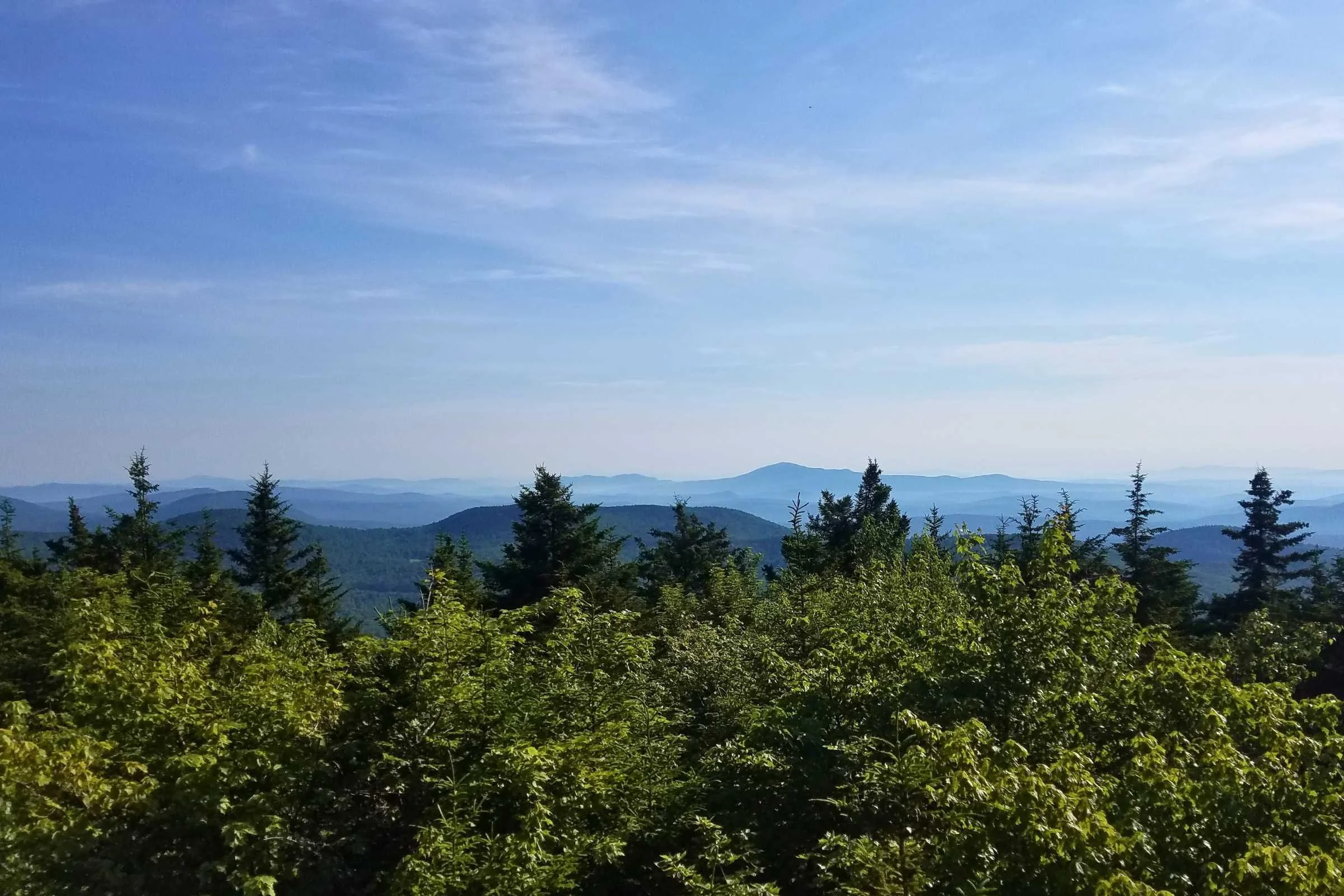
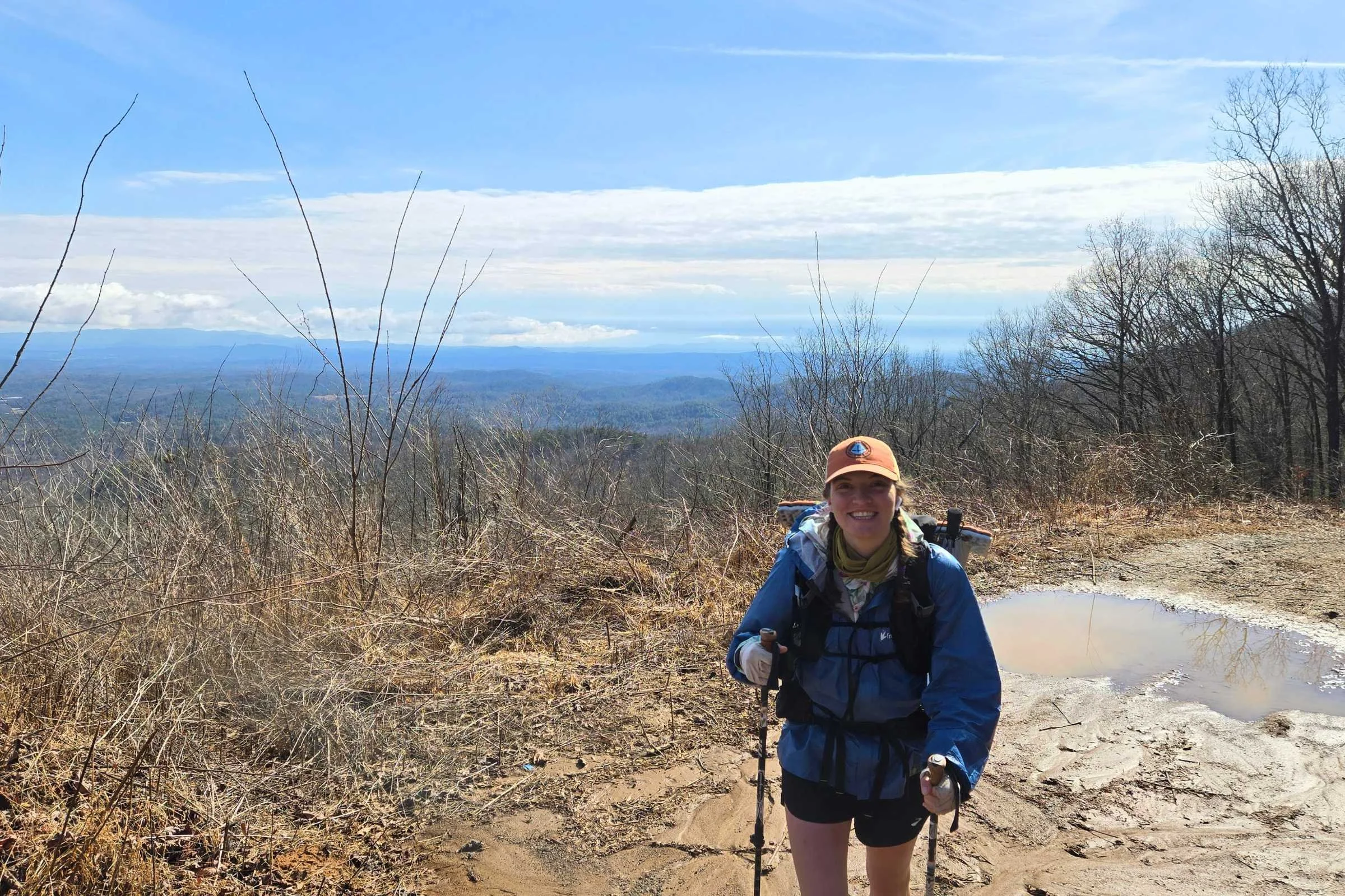
The Pinhoti National Recreation Trail is a 350-mile highlight of public lands through the southernmost foothills of the Appalachian Range. This route features a wonderful balance of remote beauty with closeness to civilization that keeps you excited to see what's next. From pine tree-laden ridgelines in Alabama to rhododendron rolling mountains of Georgia, this mid-length trail is bound to be a favorite for hikers in search of accessible wild solitude.
The Pinhoti is an adventure for novice and experienced backpackers alike. For a winter off-season hike, my partner Tom and I chose this southeastern US trail for the intermediate mileage, agreeable winter temperatures, and positive feedback from prior hikers.
Distance: 350 miles (563 km) from Flagg Mountain, Alabama to the Benton MacKaye Trail, Georgia
Days: 20-30 days (3-4 weeks)
Elevation gain/loss: 47,572’ (14,500 meters) gain; 46,211’ (14,085 meters) loss northbound
High Point: Buddy Cove Gap at 3,164’ (964 meters) in Cohutta Wildlife Management Area
Best season: Fall, winter, and spring
Permits: No permits required
Difficulty: Beginner to Intermediate
We write mission-driven gear reviews. To find the best gear, we combine expert reviews, everyday user opinions, and rigorous independent trail testing—never pop-up or display ads. We are reader-supported and may make a small commission from some qualifying affiliate links. Learn more.
Gallery of photos
What to Expect
With its extended connection to the Appalachian Trail, via a 70-mile section of the Benton MacKaye Trail, the Pinhoti is often highlighted as a well-maintained, beginner-friendly route. It’s a popular choice for southeastern US shakedown hikes, and as part of the longer “Bama to Baxter” and Eastern Continental Trail routes.
What we discovered was a blossoming backpacking trail full of community and love for the outdoors. Wild yet welcoming, a mix of cruisy tread with sections that make you absolutely work for it. “A hug from the wild” as one hiker stated given its rough cut, not overly groomed treadway. It’s fun and sometimes a rugged challenge—perhaps offering a lens into what the Appalachian Trail was decades prior. Special in its own category from the AT.
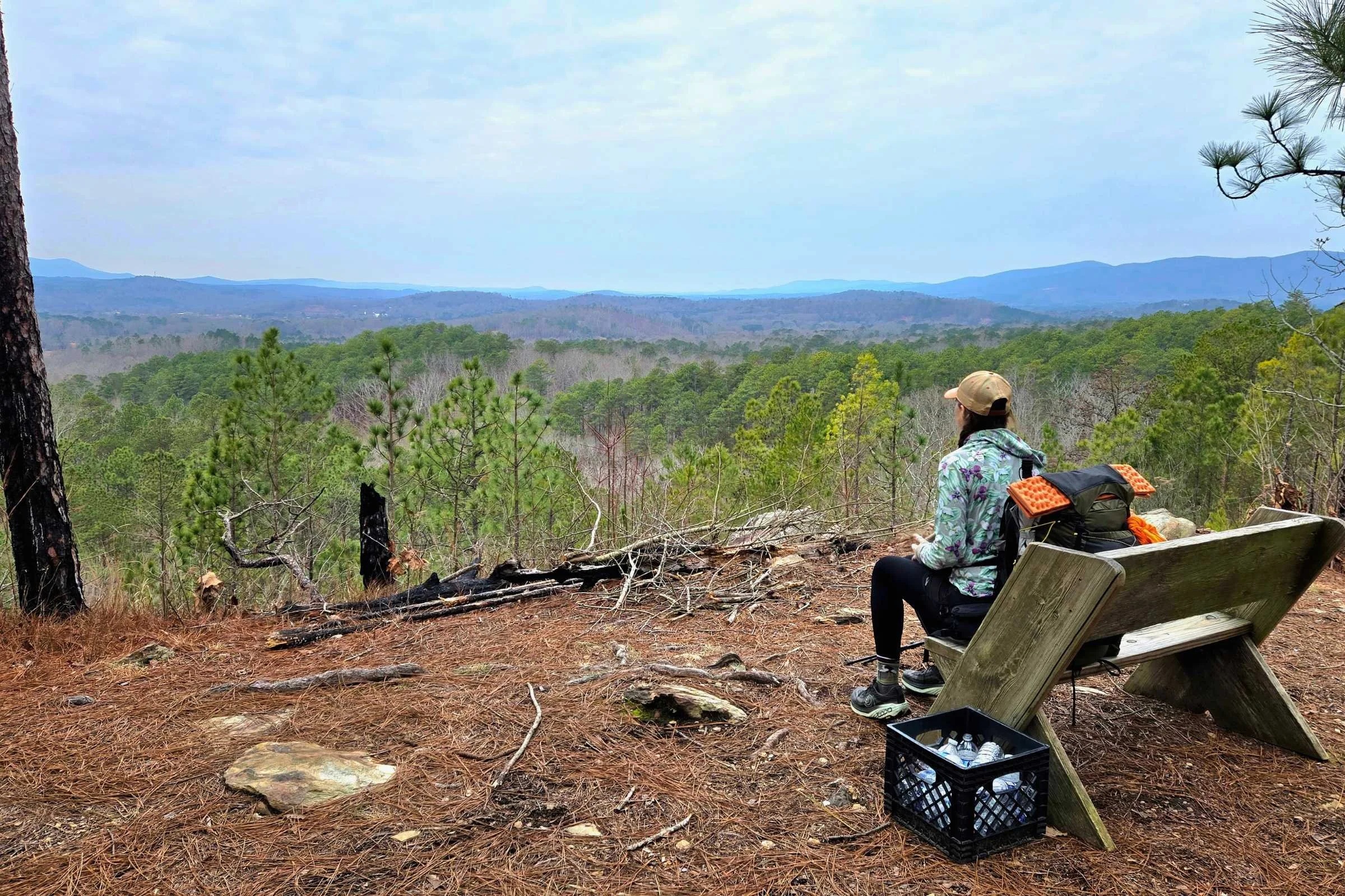
For shorter treks, the Pinhoti Trail is an exceptional option for section hiking. Accessible trailheads break long sections of National Forest, pulling hikers from nearby states to experience the longest trail system of Alabama and Georgia.
Pinhoti Trail History
The Pinhoti is a relatively young trail system spanning over ancient mountain ridges. The name “Pinhoti” is derived from the Creek (Muscogee) word for "turkey home" or “place of the turkey” to honor the ancestral territories of the Muscogee (Creek) Nation and natural surroundings in Alabama and Georgia. In the 1830s, the Creek and Cherokee nations were forcibly removed from the southeastern United States following the Indian Removal Act of 1830. The Trail of Tears passed directly through this region.
Roots of the Pinhoti Trail are linked back to a 1921 proposal by Forester Benton MacKaye for the designation of a national recreation footpath extending the length of the Appalachian Mountain Range. MacKaye’s vision spurred the development of the Appalachian Trail from Georgia to New England/Maine, as it currently exists from Springer Mountain to Mount Katahdin. However, it’s said that future expansions were proposed to eventually extend the trailway south to Birmingham, Alabama.
In the spirit of MacKaye’s ultimate vision, the U.S. Forest Service began development of the Pinhoti in 1970, starting in Talladega National Forest. Decades of trail work and land acquisition resulted in the finishing of Alabama in 2002, Georgia in 2008, and access work in Flagg Mountain from 2015 through 2025. Efforts are continued today to lead hikers off pavement and into the forest.
Oversight
Oversight of the Pinhoti Trail is completed as a cooperative effort between the Forest Service (USFS), non-profits, and volunteer organizations to develop and maintain the trail. The trail would not be possible to hike without the USFS, land donations, and community-driven groups such as Wild Alabama, Alabama Trails Foundation, Pinhoti Experience Foundation, Alabama Pinhoti Trail Association, and the Georgia Pinhoti Trail Association.
Highlights
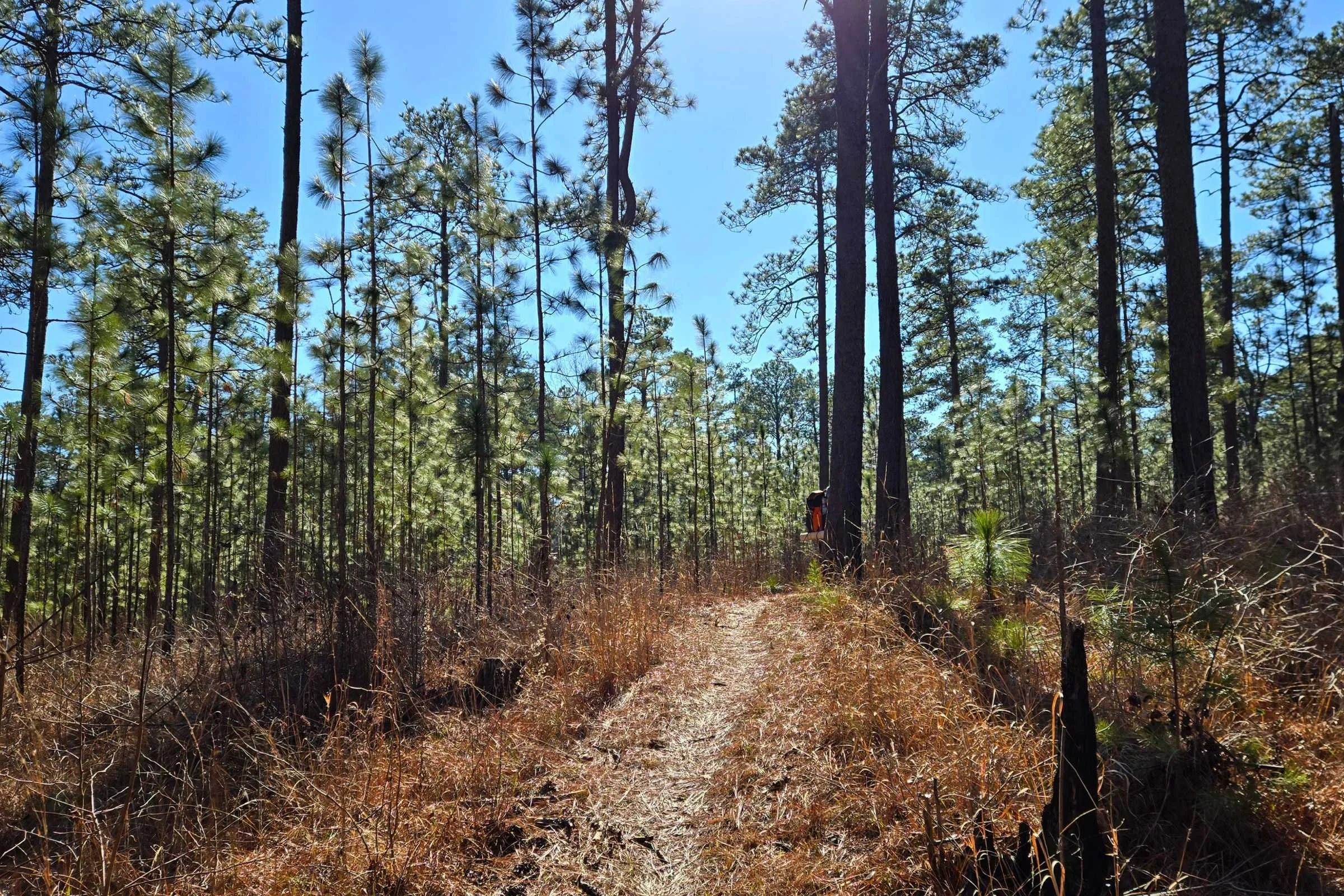
Dense longleaf pine forests
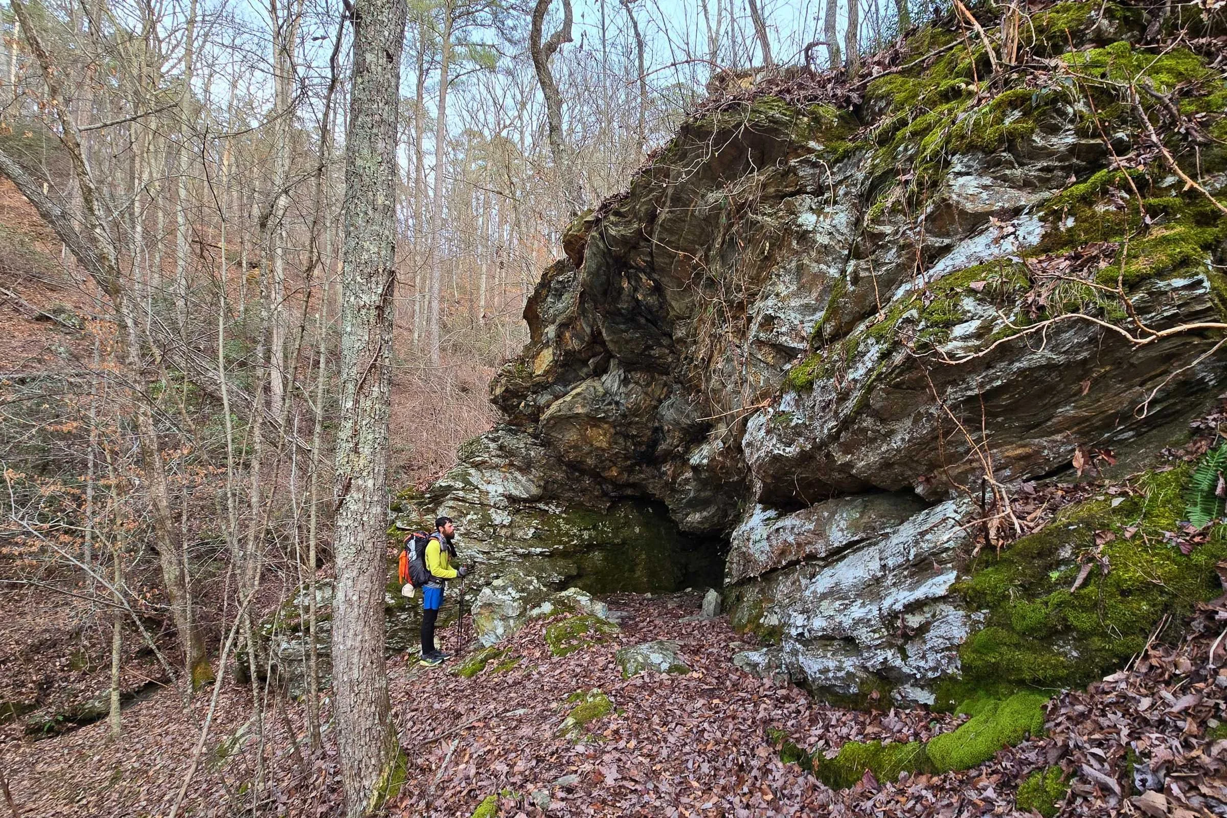
Waterfalls, swimming holes, and rocky caves
Several observation towers and overlooks
High Appalachian ridgelines
Welcoming gateway communities with hostels and shuttles to make logistics easy
Affordable pricing for meals and lodging
Frequent trailheads for section hiking
September Pinhoti Fest in Sylacauga, AL
No permits required and few camping restrictions
Challenges
Several road walks with limited shoulder space, especially in Georgia where road walks are twice around 20 miles or more in length
Sometimes narrow or rocky trail conditions
Dry ridgeline water carries of up to ten miles
Unleashed dogs on road walks that may seem aggressive
Small dispersed or unmarked campsites with limited sites for large groups
Many unbridged water crossings requiring rock-hops, log crossings, or wet feet
Prescribed forest fire burn scars may impede access and darken forest views
Cold winter weather and rain can be huge demoralizers
Gear list
| PINHOTI TRAIL GEAR | OUR PICK | OTHER OPTIONS |
|---|---|---|
| Gear | ||
| Shelter | Durston X-Mid 1 | Best Backpacking Tents Best Ultralight Tents |
| Backpack | Six Moon Designs Minimalist V2 Backpack | Best Lightweight Backpacks |
| Sleeping quilt | Enlightened Equipment Enigma Hammock Gear Burrow Quilt |
Best Backpacking Sleeping Bags Best Backpacking Quilts |
| Sleeping pad | Therm-a-Rest NeoAir NXT Sleeping Pad |
Best Sleeping Pads For Backpacking |
Best season
Winters are cold in Alabama and Georgia but mostly snow-free.
The Pinhoti Trail is a shoulder and winter season hike, meaning most hikers are on trail between September and April for cooler temperatures, lower humidity, and fewer insects.
The Sylacauga, Alabama-based Pinhoti Fest in late September kicks off the fall hiking season from the trail’s southern extent. Favorable fall temperatures, fewer insects, swimming holes to dip in, and vibrant tree foliage draw fall season hikers. Note that low summer rainfall can dry water sources.
Winters in Alabama and Georgia can be cold. We experienced a temperature range from 15 degrees to 75 degrees Fahrenheit. During our hike, two unseasonably cold winter storms came through, driving us indoors to take two zero days in total. We encountered several days of rain and were very happy to have packed sun umbrellas for additional coverage to stay dry in colder temperatures.
Snow is uncommon in Alabama and ice patches were limited to high elevation ranges in Cheaha State Park; ice patches of several feet were able to be avoided by stepping a few feet off trail with no ice spikes required. During the winter you can expect to encounter fewer hikers, wildlife such as snakes are less of a concern, and views are plentiful through bare tree branches. Just be prepared to hike in shorts and sleep in below freezing temperatures on the same day!
Spring brings budding trees, cool to warm temperatures, and blooming wildflowers. Winter rain fills waterfalls and water sources. March and April were reported by one hostel owner to be increasingly peak hiking months for the Pinhoti.
It is highly discouraged to hike during the summer as the months of May through August are too hot, humid, and buggy for backpacking. There is less trail maintenance during the summer. Ticks are of increased concern after April, as well as mosquitos and wasps. And if you can get past the muggy heat, spider webs will be a constant annoyance due to the lack of foot traffic.
Variations
Many long-distance hikers use the Pinhoti Trail. In addition to Pinhoti section and thru-hikers, folks completing “Bama to Baxter” and the Eastern Continental Trail (ECT) share the same pathway with different goals in mind.
For the 350-mile Pinhoti Trail, FarOut Guides App offers a few alternate routes along this hike. Most are four miles or less in length. These side trails usually consist of reroutes of old trail or past closures from storm impacts. We followed the main route on FarOut, with exception to a few side quests to view points, and were happy with that decision.
Difficulty and skills
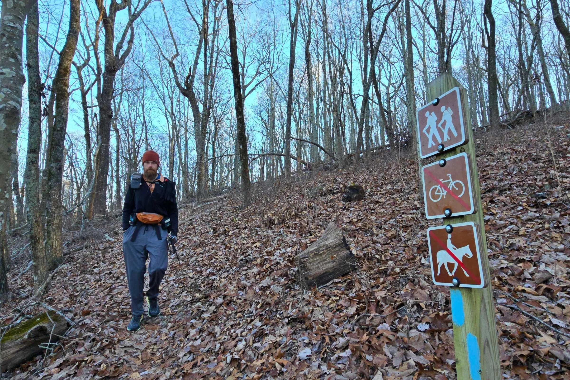
Navigation
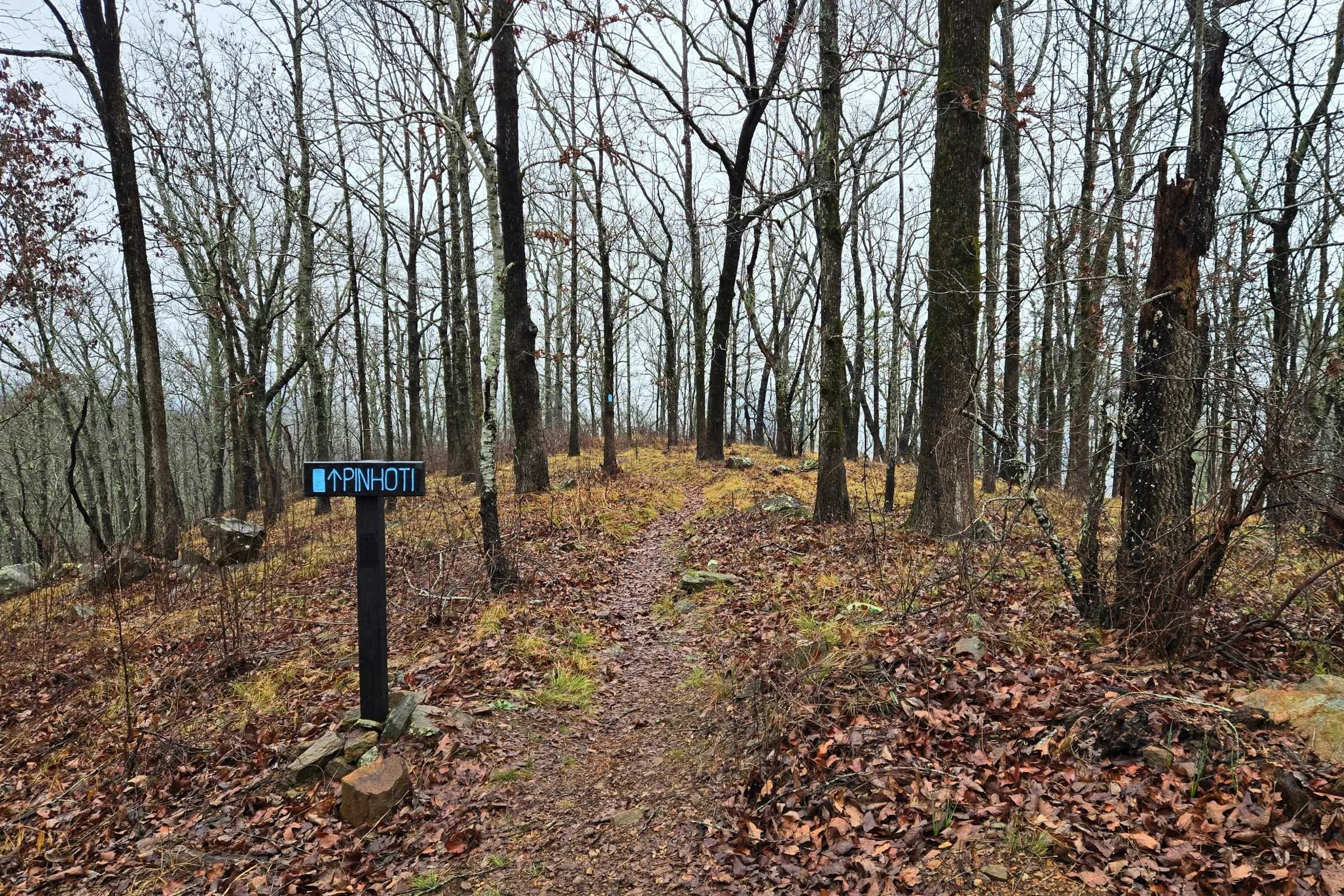
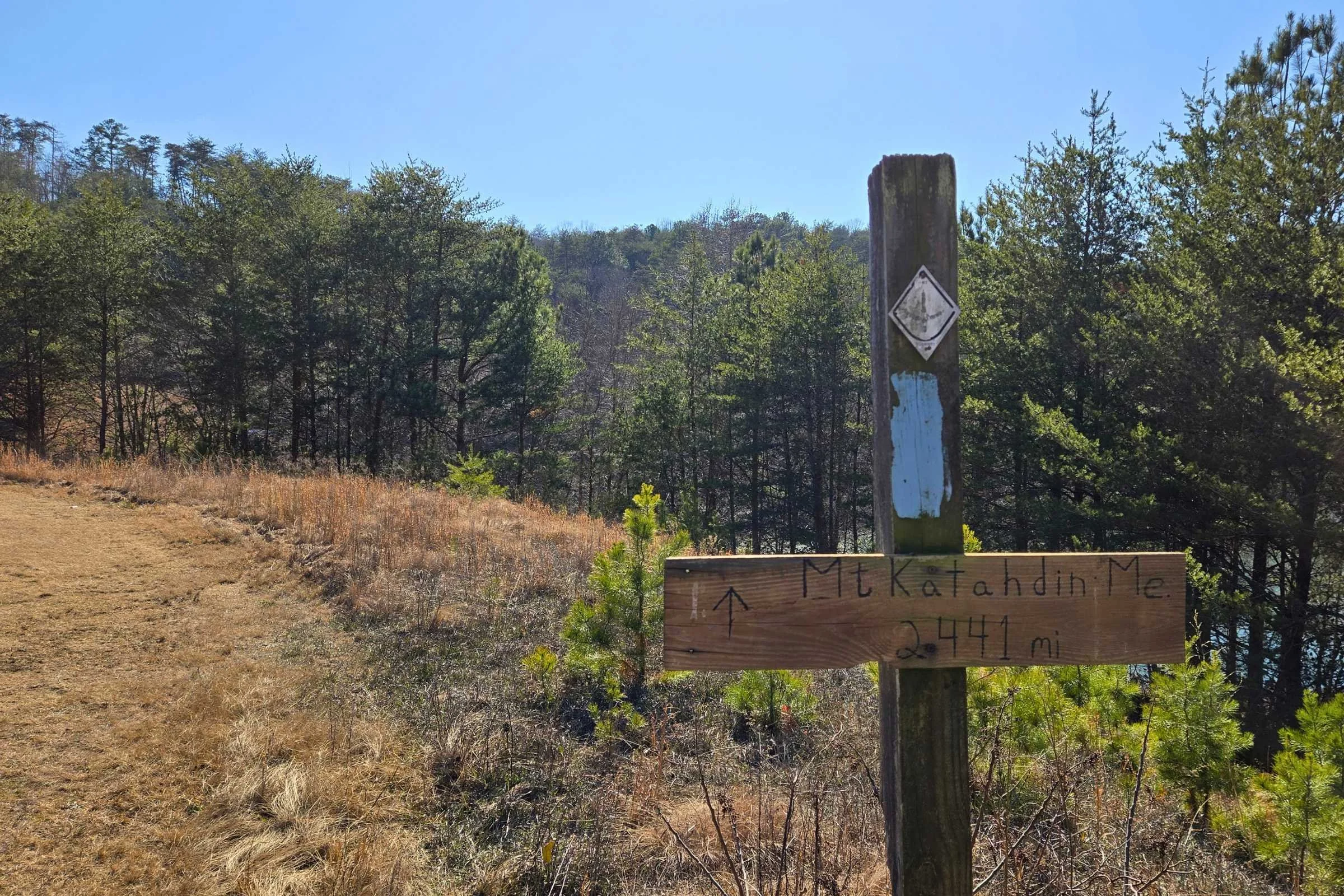
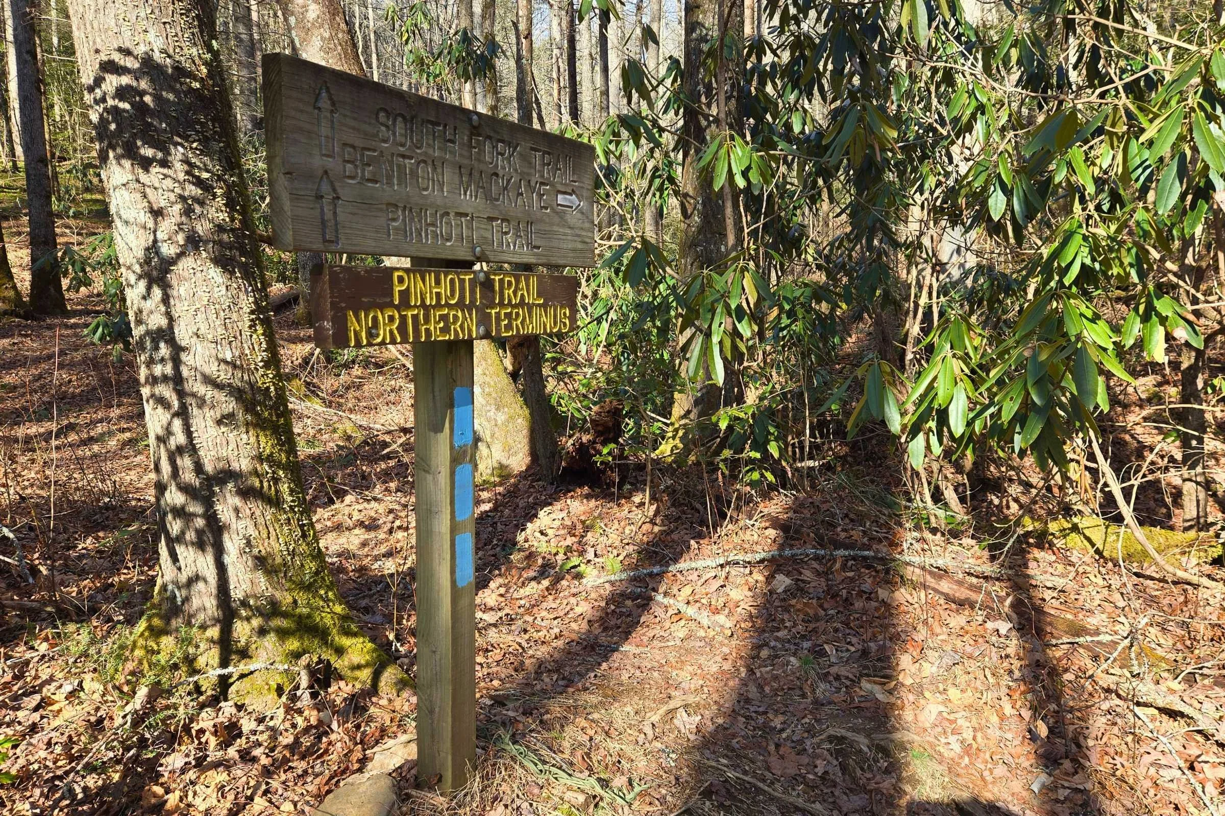
Painted light blue blazes note the Pinhoti Trail in both directions. In most locations, blazes are frequent and easy to follow.
Blazing is significantly reduced in the Cheaha Wilderness, Dugger Mountain Wilderness, and Cohutta Wildlife Management Area. Wilderness areas are managed with a focus on preserving natural character and therefore might feel different than the rest of the pathway. Blazes can also be infrequent along road walks, where junctions can sneak by unnoticed. Near the northern end of the trail in Georgia, we missed several turns and had to double back. Offline or backup sources of navigation are recommended to double check along the way.
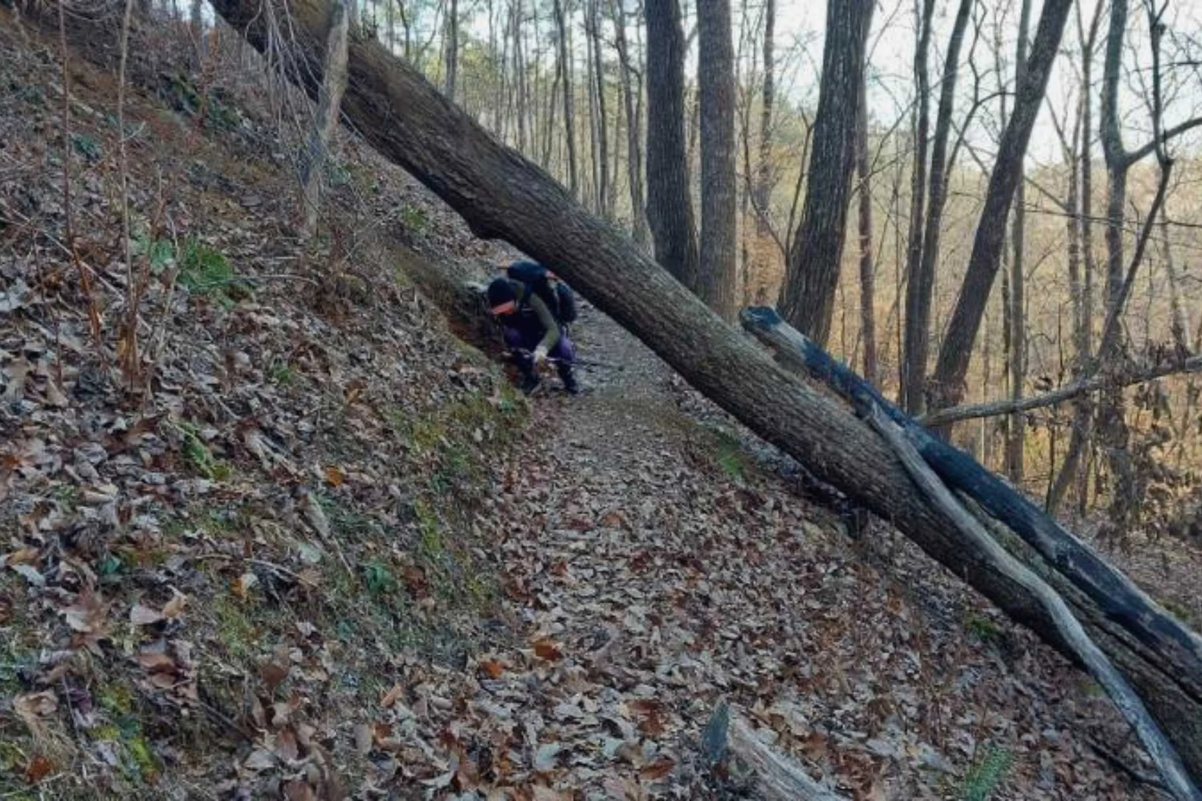
Terrain
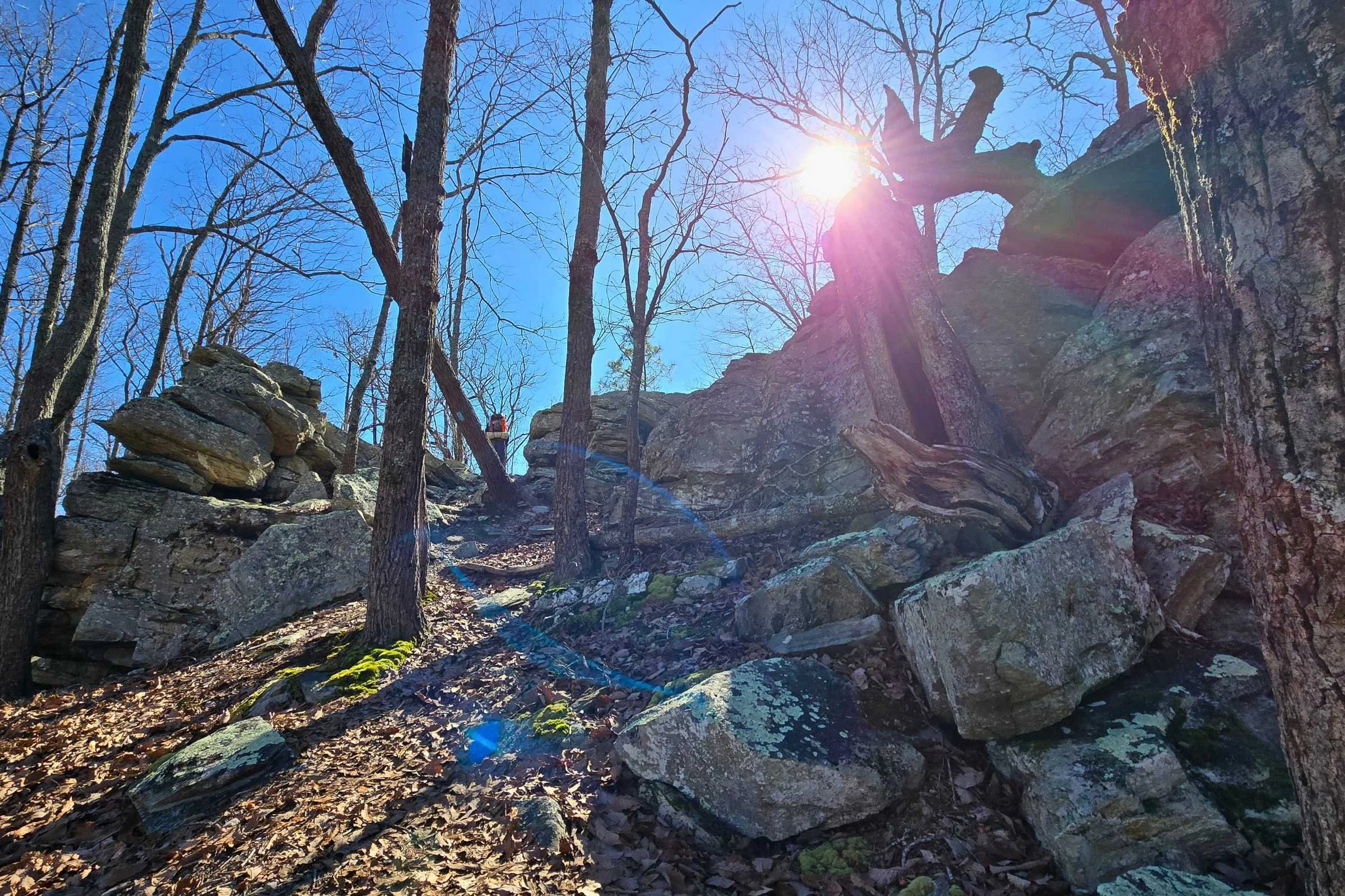
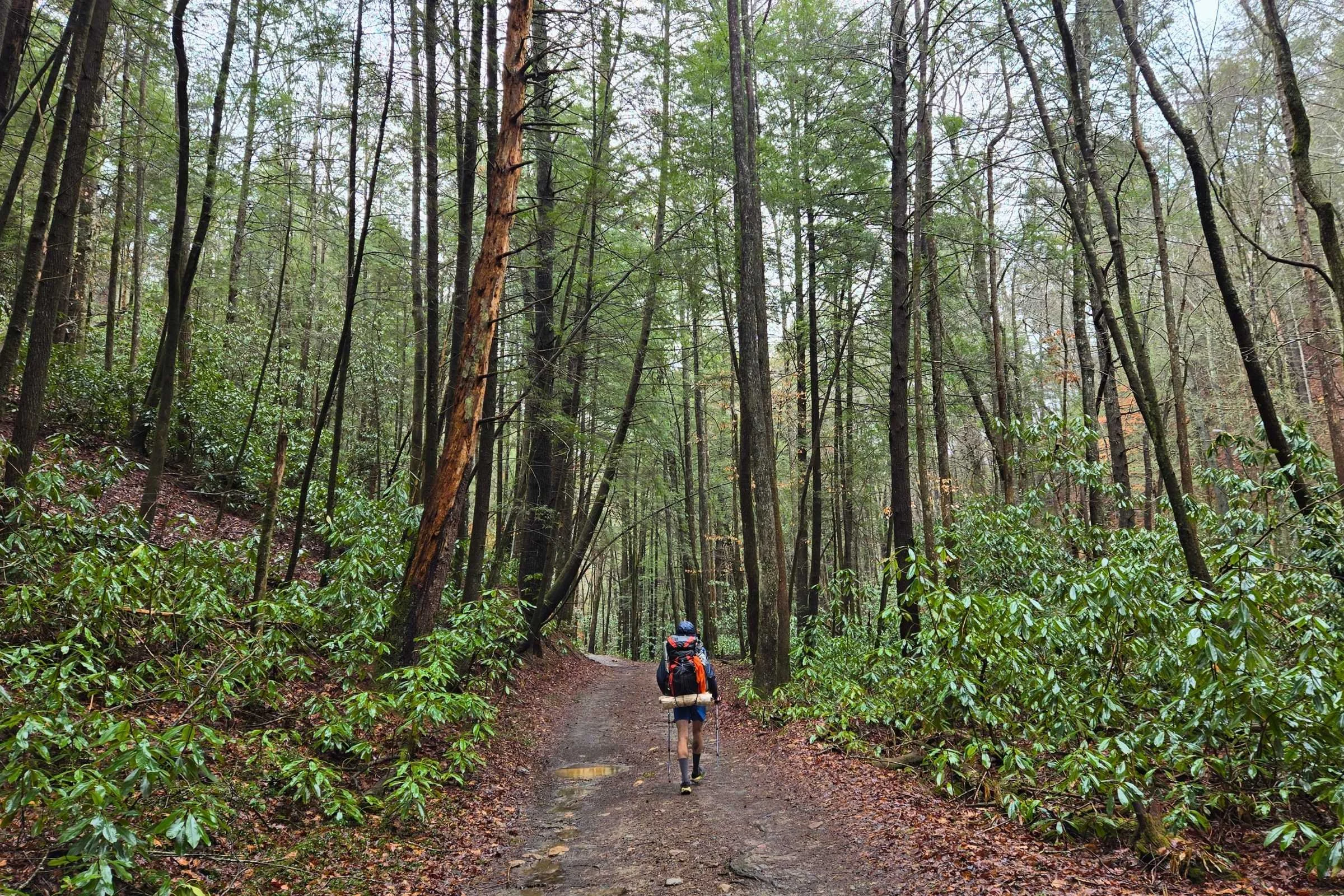
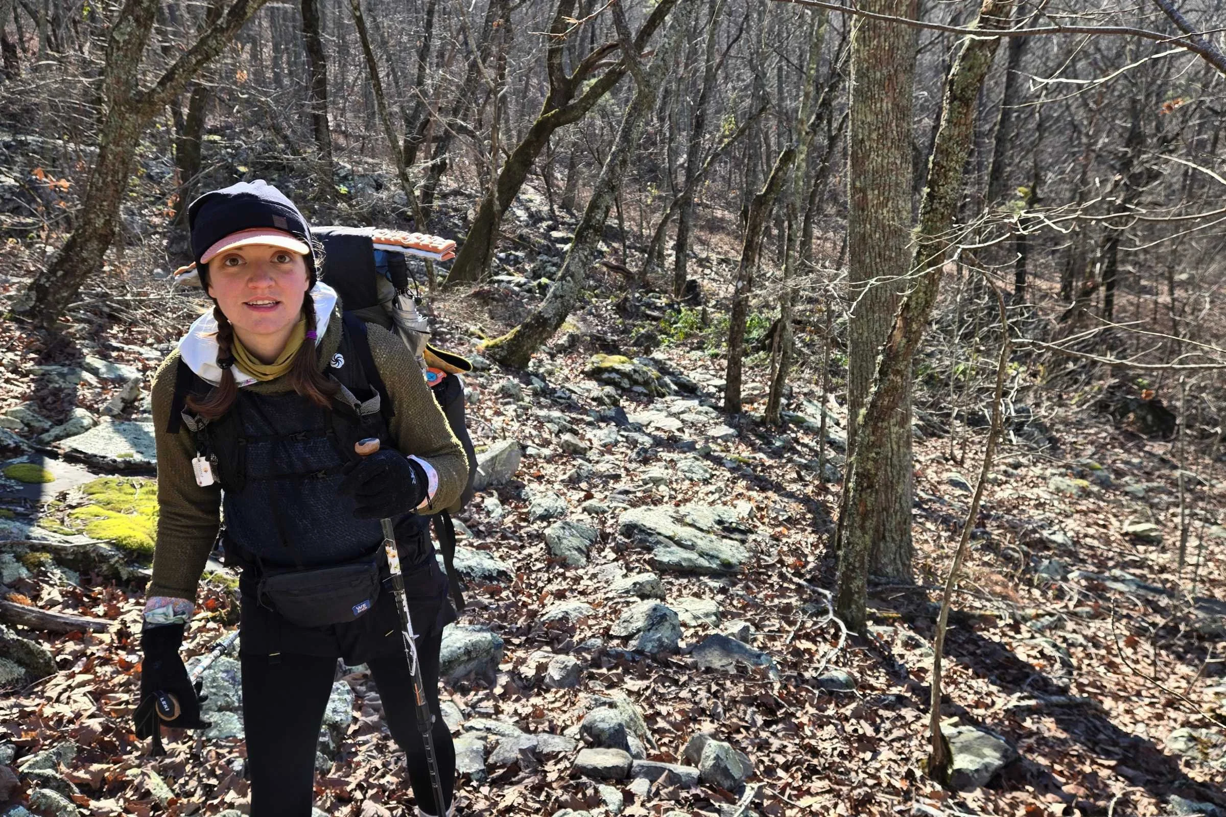
The trail primarily covers physically challenging rolling foothills and ridgelines. Hikers experience a rewarding mix of pine duff covered soil, rugged talus, gravel Forest Service roads, paved roadway, and narrow cut traverses covered with leaf debris. Occasional large rocks and boulders can make the treadway a bit more technical, especially near Cheaha State Park. The rolling terrain consisted mostly of 200 to 1,500-foot ascents and descents. These sections were short, steep, and sweet, especially as our legs got stronger.
From the beginning, we were able to complete higher mileage days than initially expected. The only “scrambling” could be considered an eight-rung ladder to descend a rock slab near Indian Mountain ATV Park in northern Alabama. The most ankle twisting sections were due to sections of narrow treadway covered with leaf debris. The last ten or so miles of the trail in the Cohutta Wildlife Management Area (past Mulberry Gap Adventure Basecamp) were the least maintained, with blow downs, thorny brambles, and wet water crossings slowing the pace.
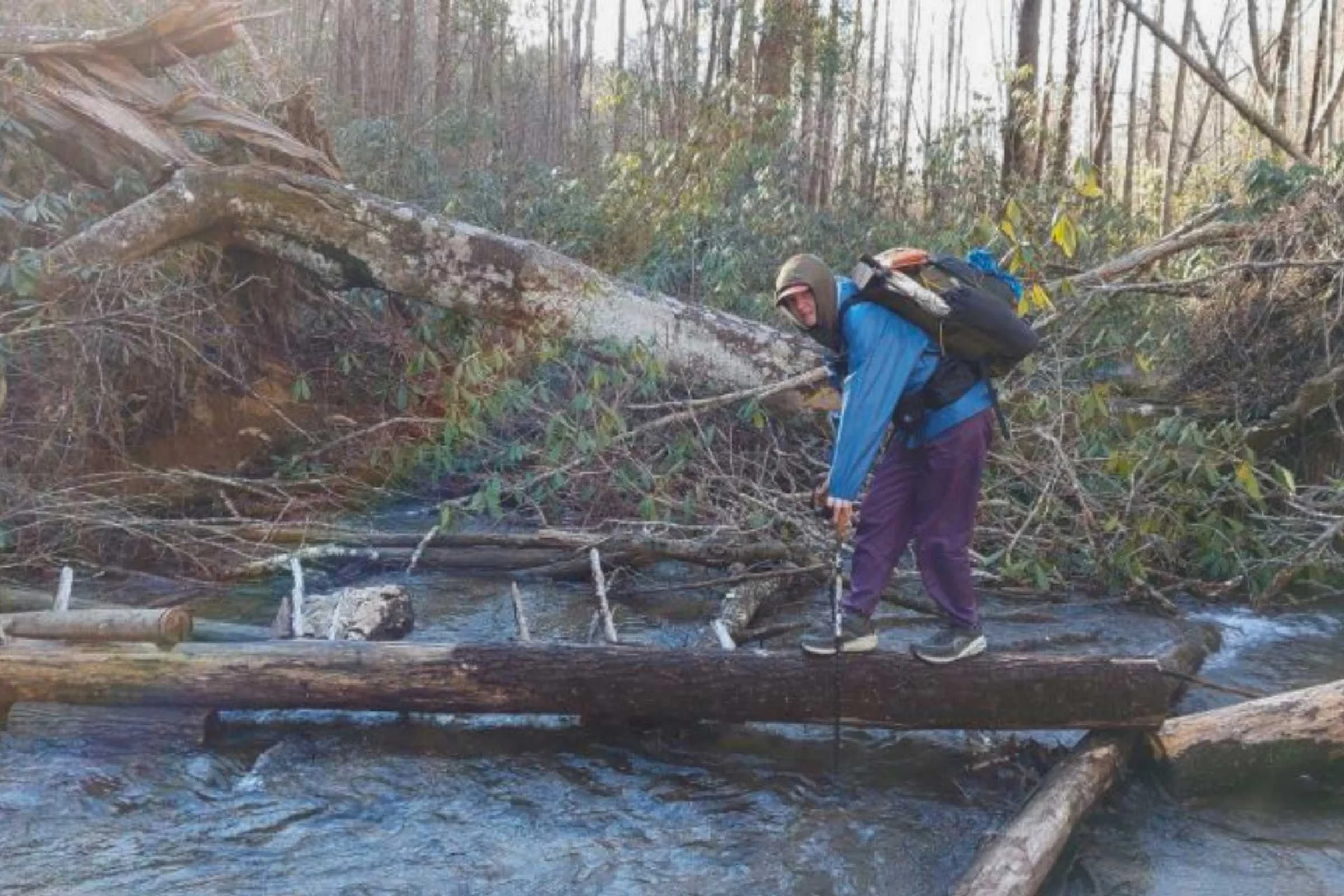
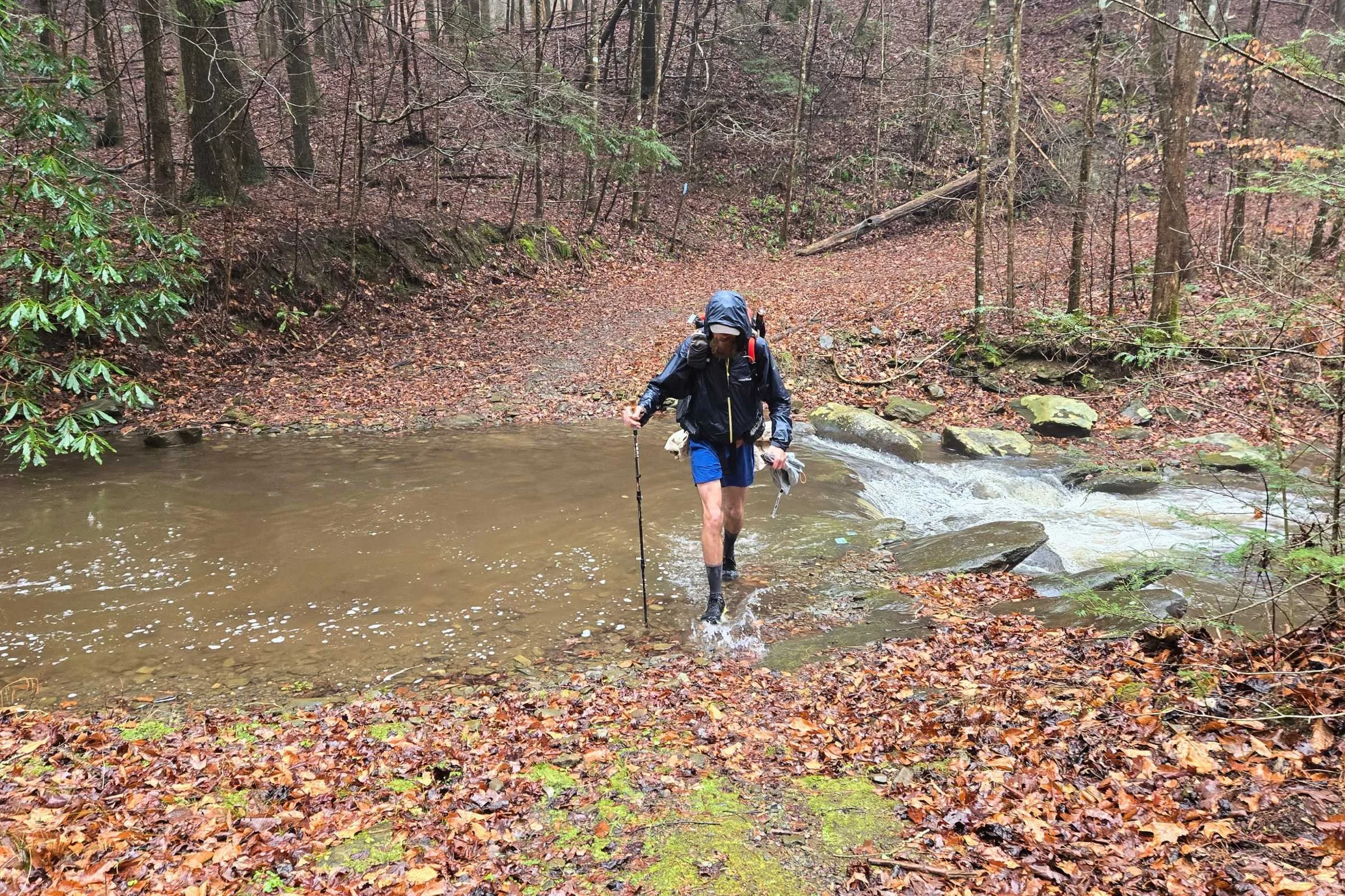
The trail crosses many streams and small rivers, adding to the scenic experience and adventure. Bridges were always present for water deeper than several feet. However, there were probably six unbridged rivers and tributaries. A hiker can cross with wet feet or try to find an alternate dry solution. Switching to camp shoes is fantastic for these wet crossing locations! Through Alabama and most of Georgia, we were able to find rock hops or well placed logs to avoid the water. We eventually got our feet wet in Georgia, with three rivers that did not have alternate dry options. These river fords were ankle to calf deep, numbingly cold in February hike but not swift. FarOut comments left by prior hikers are a great resource for crossing information.
Creeks were running well due to the winter rains before and during our hike, which seemed typical for that time of the year. Based on FarOut comments, the water crossings of note are consistent year to year.
Burn Zones
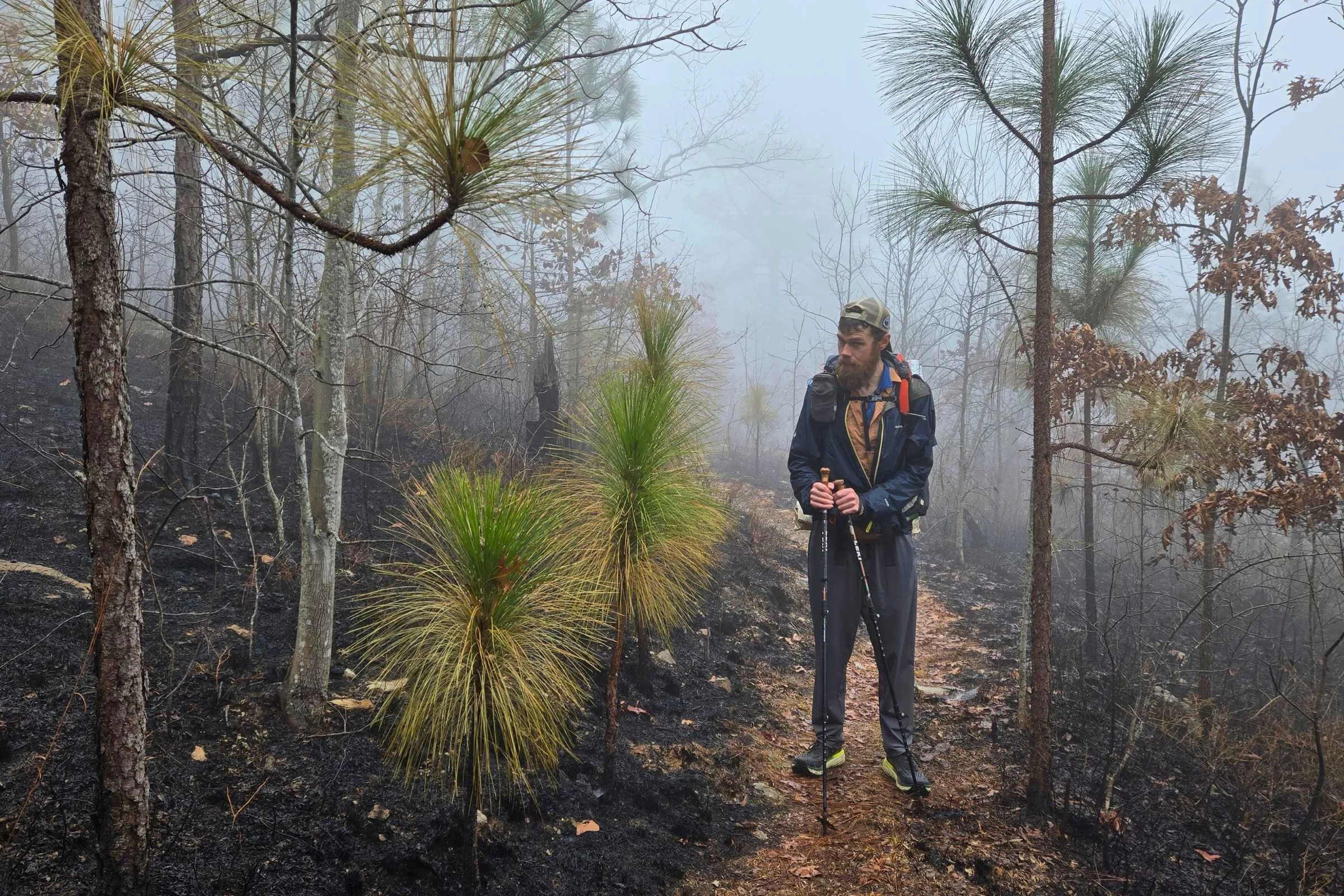
One element I was not expecting along this trail were the number of forest fire char from prior and recent burns. We walked through multiple burn scars along the ridgelines of Tallagega National Forest, recent enough that smoke remained smoldering in a few locations even after heavy rains. The Forest Service appears to manage these locations with intent. In the winter season, hikers may experience reroutes during prescribed burn events.
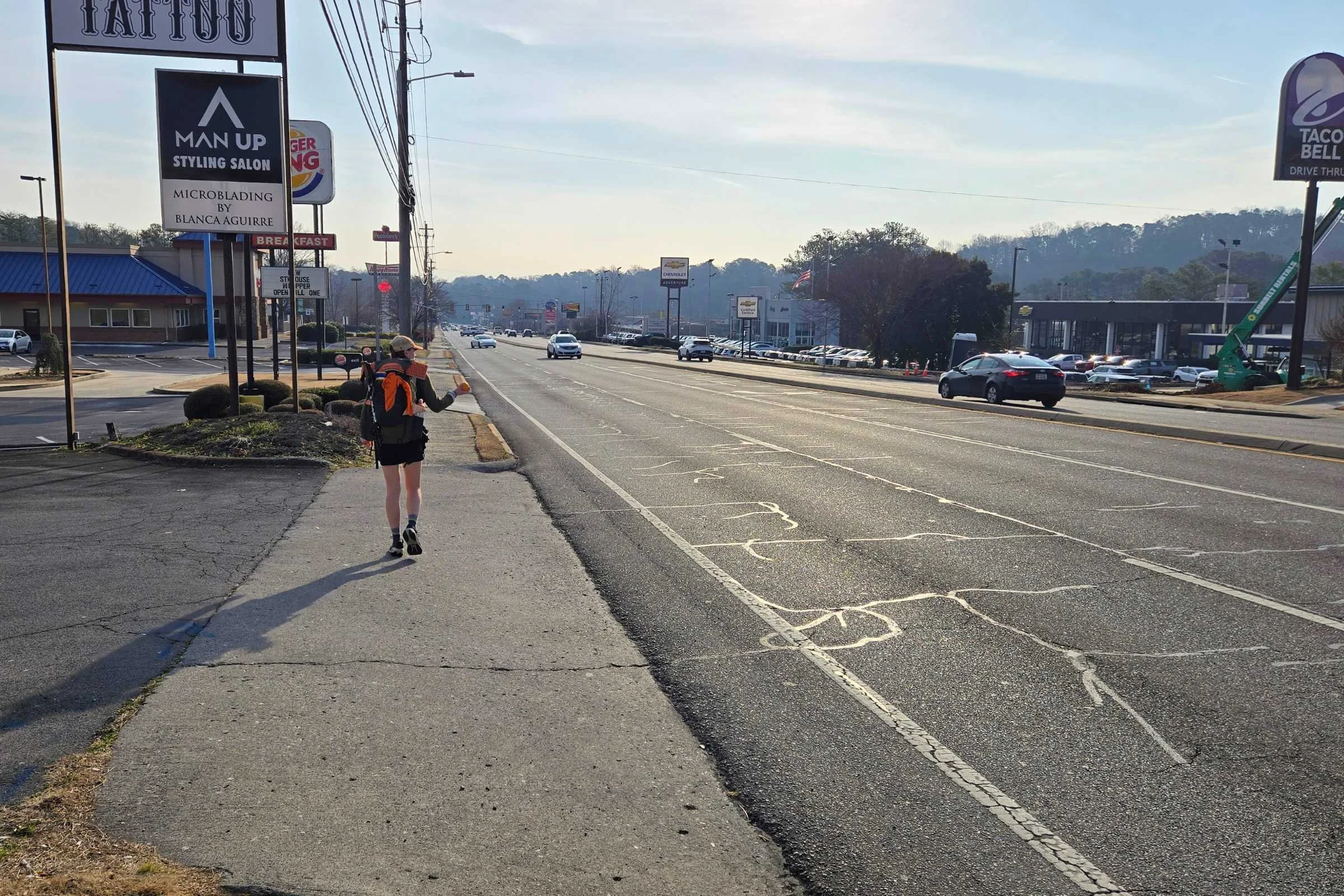
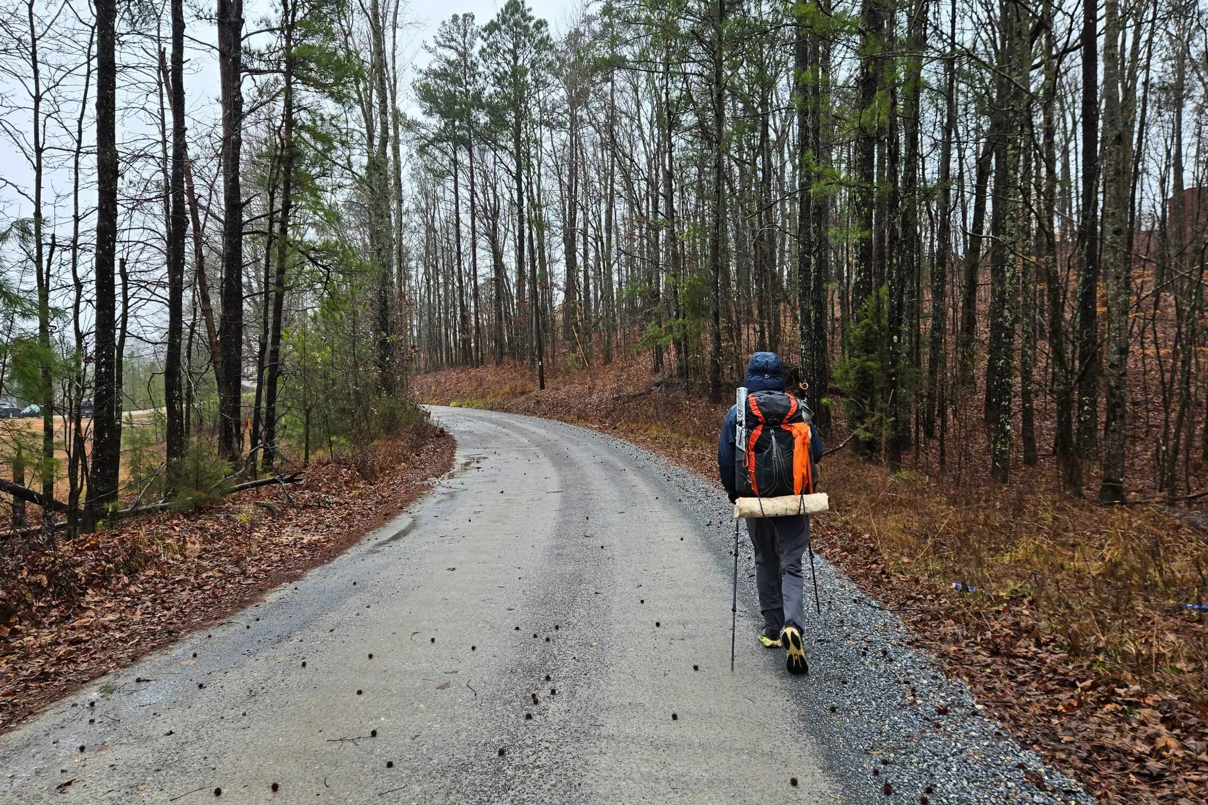
Road Walks
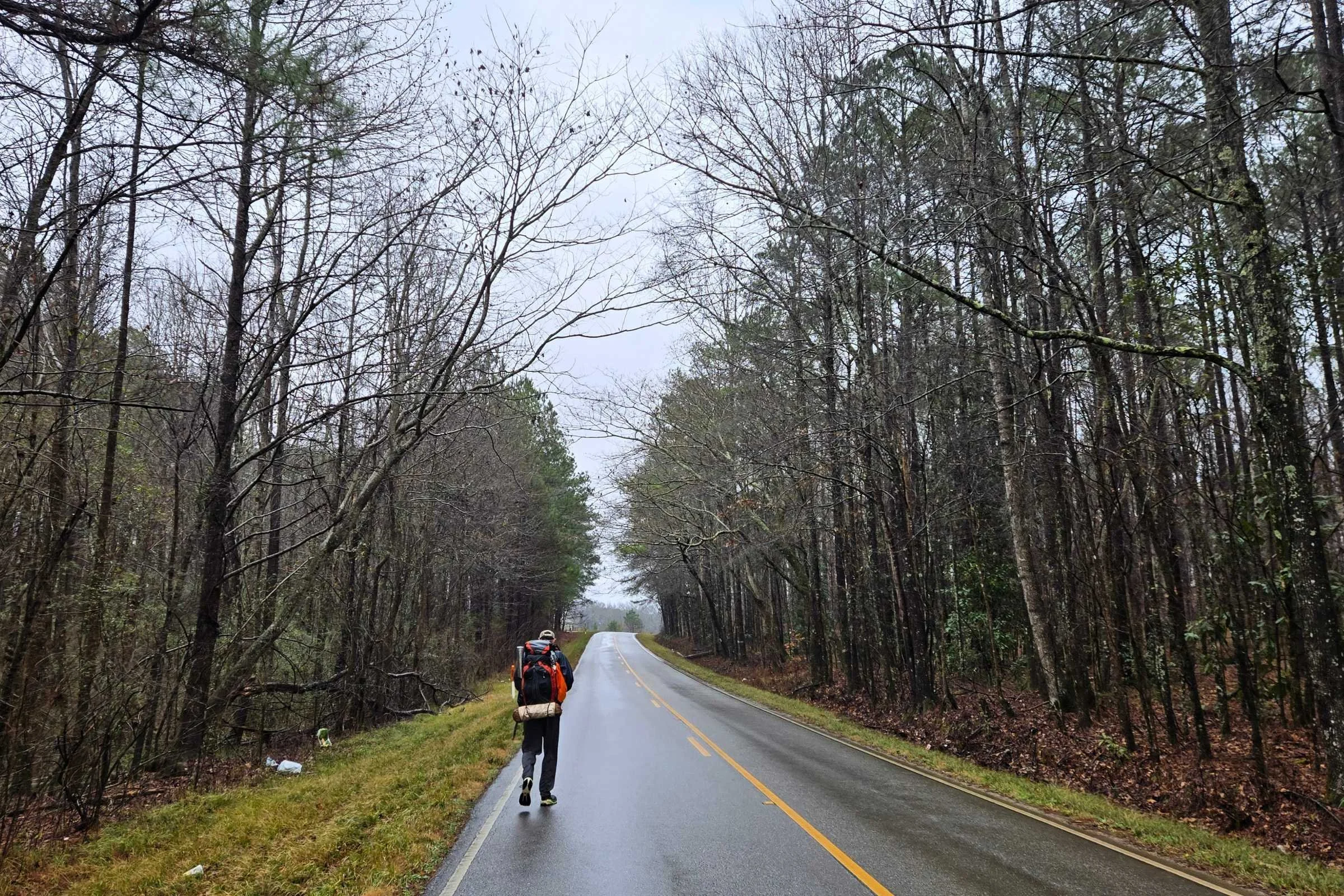
It would not be a proper discussion of the Pinhoti Trail without talking about road walks. Like many trail systems, sections of forested trailway are connected by paved asphalt and gravel Forest Service roadways.
A highly contested aspect of the Pinhoti are the long paved road walks ranging from less than a half-mile to 27-miles in length between trailheads. Alabama has an estimated 16 miles of paved road walk while Georgia contains around 60 miles. The longest two road walks are in Georgia near Cave Spring (around 22 miles) and Dalton (around 28 miles). Depending on a hiker’s comfort level, these can be hiked in a single day, split between multiple days by contacting shuttle drivers, or skipped completely. FarOut comments on trail town and trailhead waypoints, contacting Pinhoti Trail hostels, and inquiring on the Pinhoti Trail Alliance Facebook group are great resources for linking up with local shuttle drivers.
We walked the roads (taking two small shortcuts for more direct routes) and found them to be manageable but nothing too exciting. Efforts are ongoing in paved locations to route the trail into the woods.
Elevation Gain/Elevation Loss
Hiking northbound was great as we felt the rise of the Appalachians towards Springer Mountain underfoot. Having hiked the Appalachian Trail before, Chattahoochee National Forest in Georgia felt the most similar in environment to the AT.
Permits
Permits are not required to hike the Pinhoti Trail.
Hiker registration is encouraged with the Pinhoti Experience Foundation. Before starting the Pinhoti Trail—or shortly after via phone call—hikers can register their start date with the Sylacauga Chamber of Commerce to receive a free Pinhoti pack hangtag.
After finishing all 350 miles of the trail, thru-hikers and section hikers can apply for a certificate of completion provided by Heflin City Hall. You must register your hike with the Sylacauga Chamber of Commerce to receive a certificate of completion.
Helpful hints and regulations
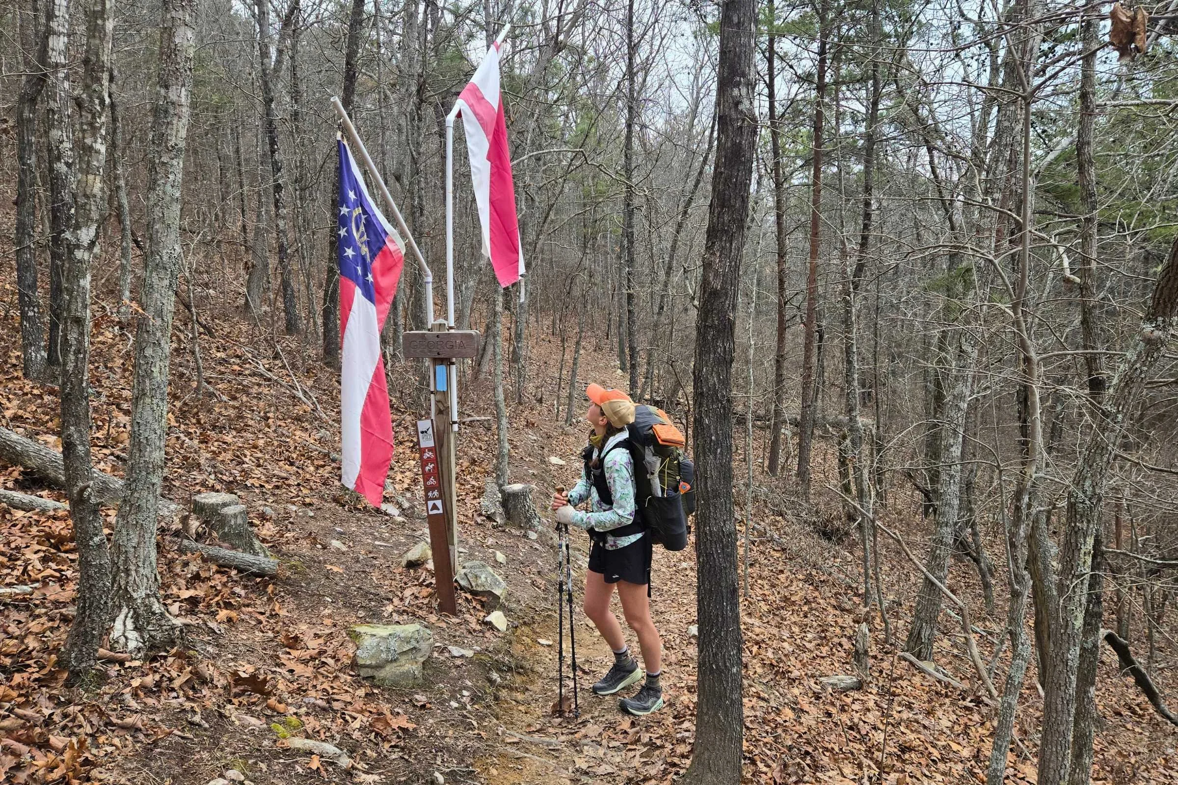
At the Alabama/Georgia border hikers cross into a new time zone.
Alabama and Georgia are in different time zones! Alabama follows Central Time and Georgia follows Eastern Time, meaning you jump ahead by one hour as you hike into Georgia. This is important to specify when arranging shuttles from one state to another.
Dogs are welcome on the Pinhoti Trail. It is recommended that dogs be kept leashed to keep humans and pets safe from steep drop-offs and wildlife encounters. You should also have a plan for your dog during the road walks where shoulder space is limited.
Follow Leave No Trace Ethics, including packing out all trash (along with trash found along the trail for good karma), going to the bathroom away from water, planning ahead, and being considerate of others. You can minimize your environmental impact by camping in small groups at designated sites or on cleared, durable surfaces at least 150 feet away from water, trail, or road. Fires should be contained to existing fire rings.
Northbound vs. southbound
Flagg Mountain is the southern terminus of the Pinhoti Trail.
Northbound is the traditional direction for Pinhoti Trail thru-hikers. Folks say that travelling northbound from Flagg Mountain offers a more scenic “ease” into the elevation, with long road walks pushed towards the end in Georgia. Access to the southern terminus of Flagg Mountain is also logistically easier.
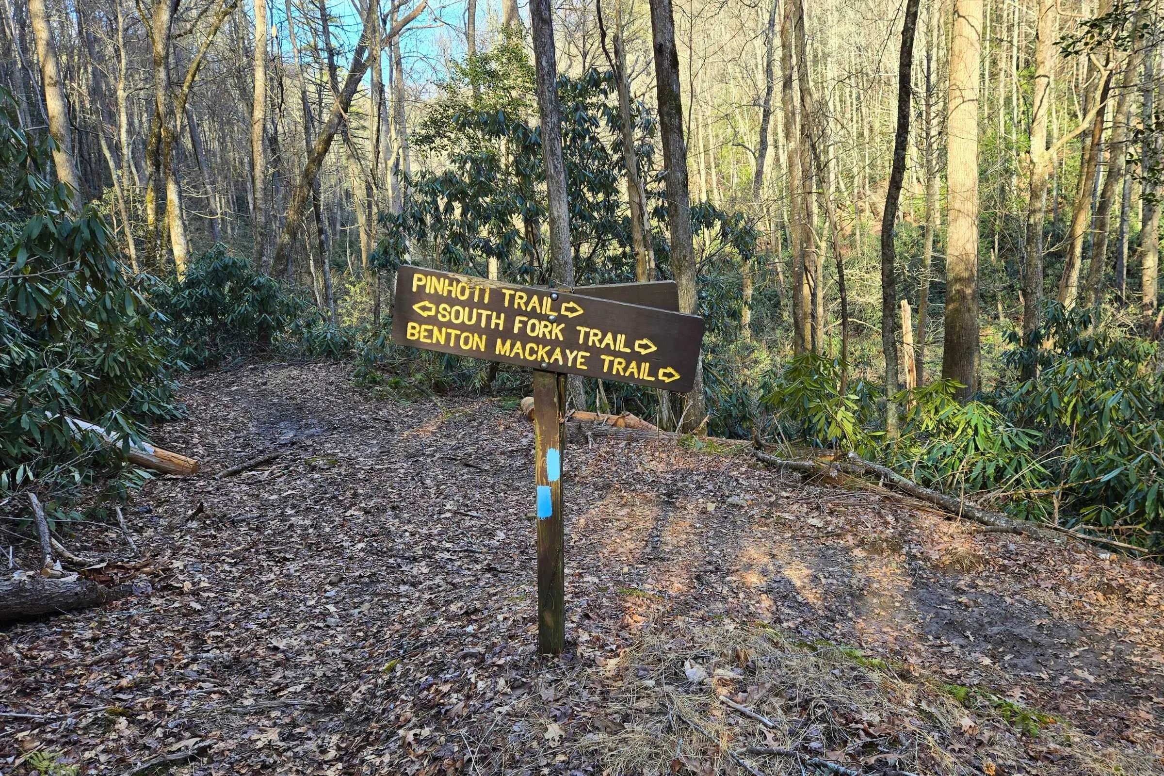
We ran into many southbound thru-hikers on the Pinhoti Trail who were having a blast. Logistically more complicated, southbound thru-hikers start their hike “at the junction of the Pinhoti Trail and Benton MacKaye Trail” in Chattahoochee National Forest.
Nearby markers to the northern terminus include Harkins Creek USFS Campsite, Jacks River Fields USFS Campground, and Watson Gap in Cohutta Wilderness. All shuttle drop-off points require a two-mile or less hike to the official northern terminus. Working with a shuttle driver familiar with these remote access points is highly recommended, and keep in mind that shuttle drivers can have a preferred dropoff/pickup spot.
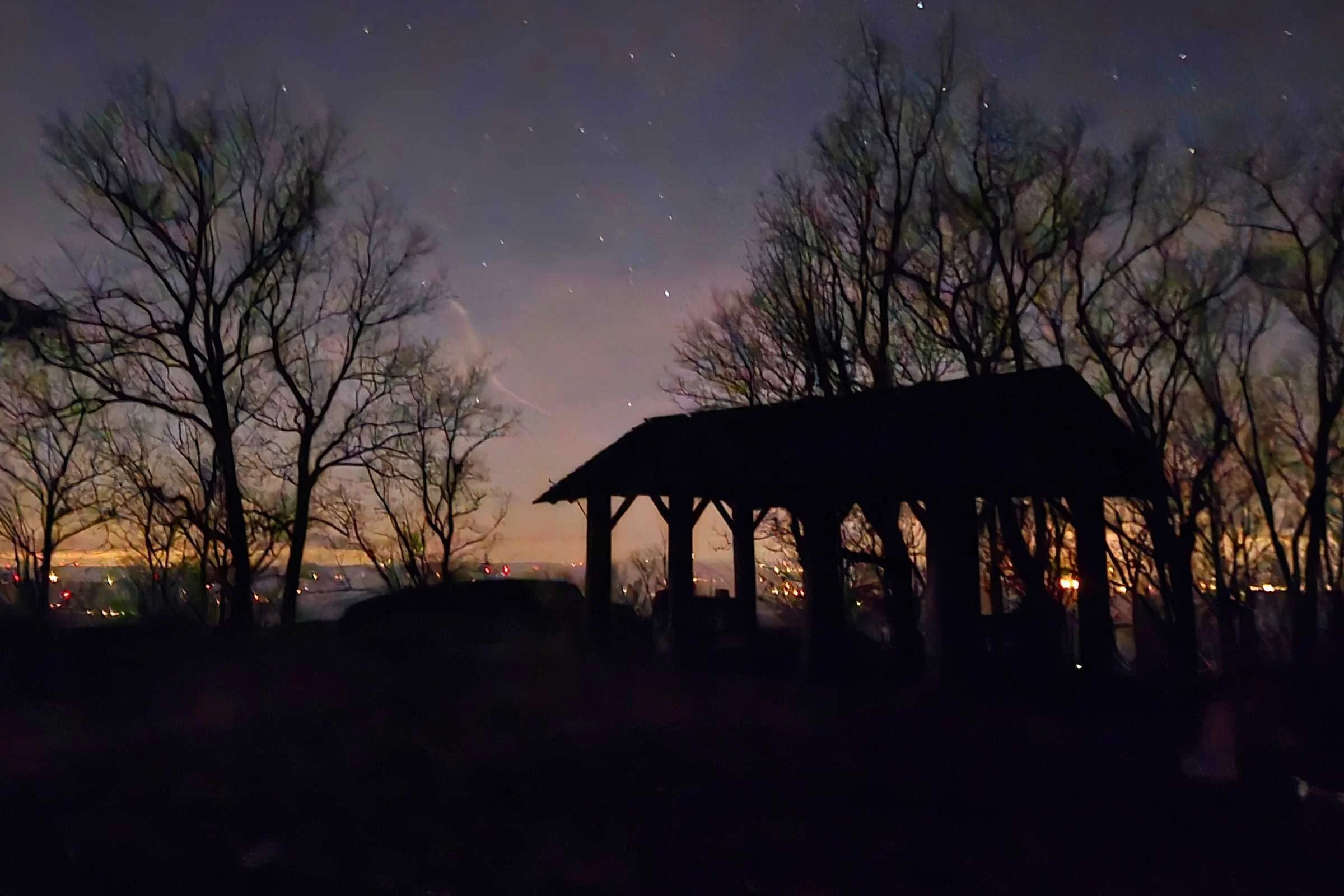
Camping
While the shelters were clean, we chose to tent 99% of nights spent outdoors due to frigid temperatures.
Tenting
A majority of the Pinhoti Trail is on public and National Forest land. In these areas, free primitive campsites are scattered along the trailway. Following Leave No Trace Principles, hikers should minimize environmental impact by setting up on durable (non-vegetated) surfaces, packing out all waste, and containing campfires to established fire rings.
The best resource for campsite planning is FarOut. Campsites ebbed on the smaller side, with cleared durable surfaces for one or two tents, or trees for hammock camping. Dry camping was common along our thru-hike, on old road beds or small pockets in the trees. With winter temperatures, camping in the stream valleys was damp and cold and we woke up to condensation-covered gear.
North of Heflin, AL there is the option to stay at two fee-based Forest Service car campgrounds. Pine Glen Campground has basic amenities including picnic tables and vault toilets (in poor condition). Coleman Lake Campground, open seasonally between March 15th - December 8th, is more luxurious with flush toilets and electric hookups for charging phones.
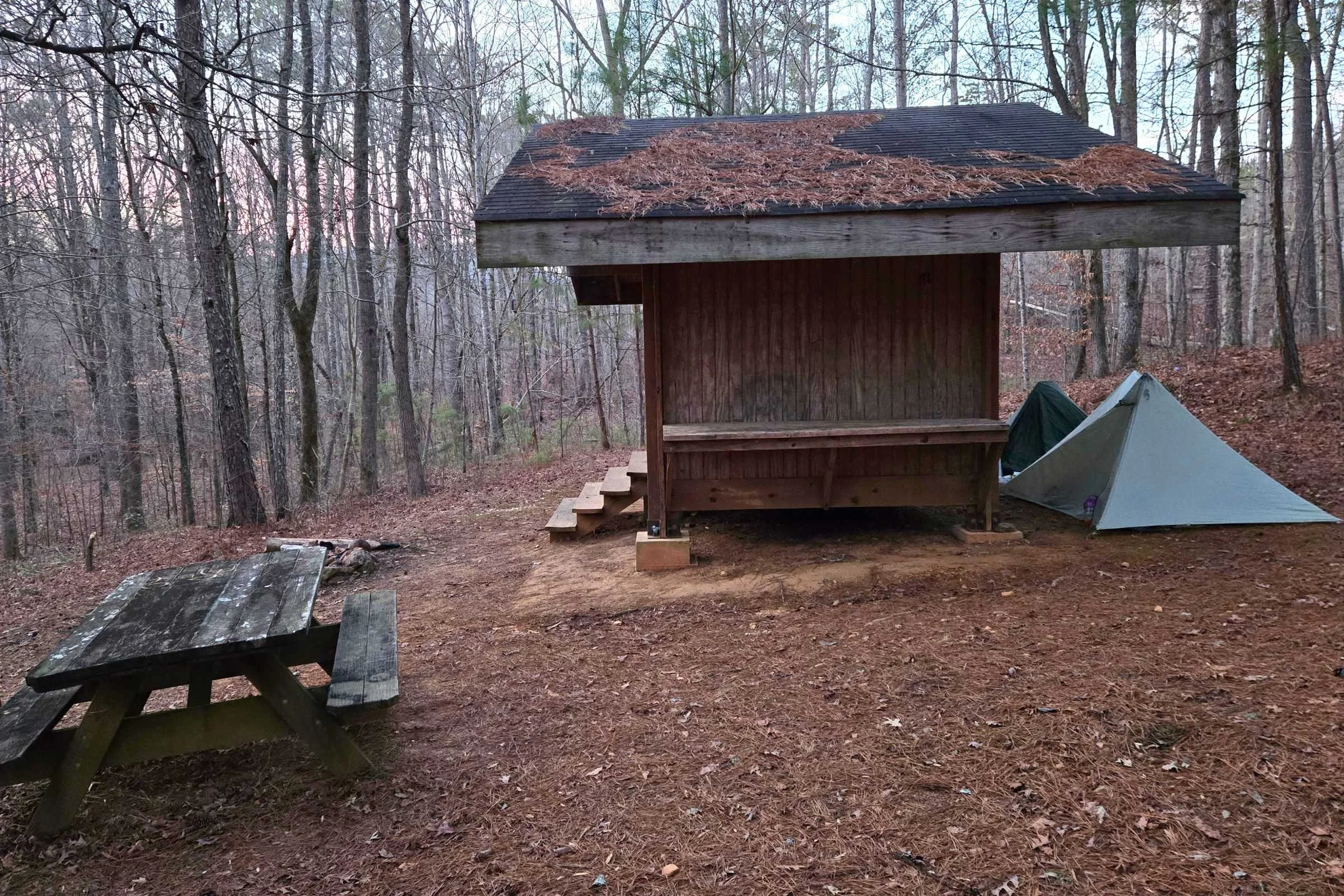
Shelters
Shelters are infrequent along the Pinhoti Trail. There is a small three-person shelter at mile 2 northbound. There isn't another shelter until Blue Mountain Shelter around mile 88 near Cheaha State Park. There are a handful of wooden shelters for the following 100 miles, ending with Spring Creek Shelter at mile 180 just after the Alabama-Georgia border. The shelters we saw were in good condition, spacious, and clean; usually with a few tent sites in the vicinity.
Private Lands
The Pinhoti Trail passes through Indian Mountain ATV park for approximately 8 miles from NOBO mile 169 to mile 177, right before the Alabama-Georgia border. In this stretch of private land, signs ask that hikers respect the private owner’s property by staying on the trail and only camping at shelters and camping platforms. These campsites appear to be shared with off-road vehicle users in the park.
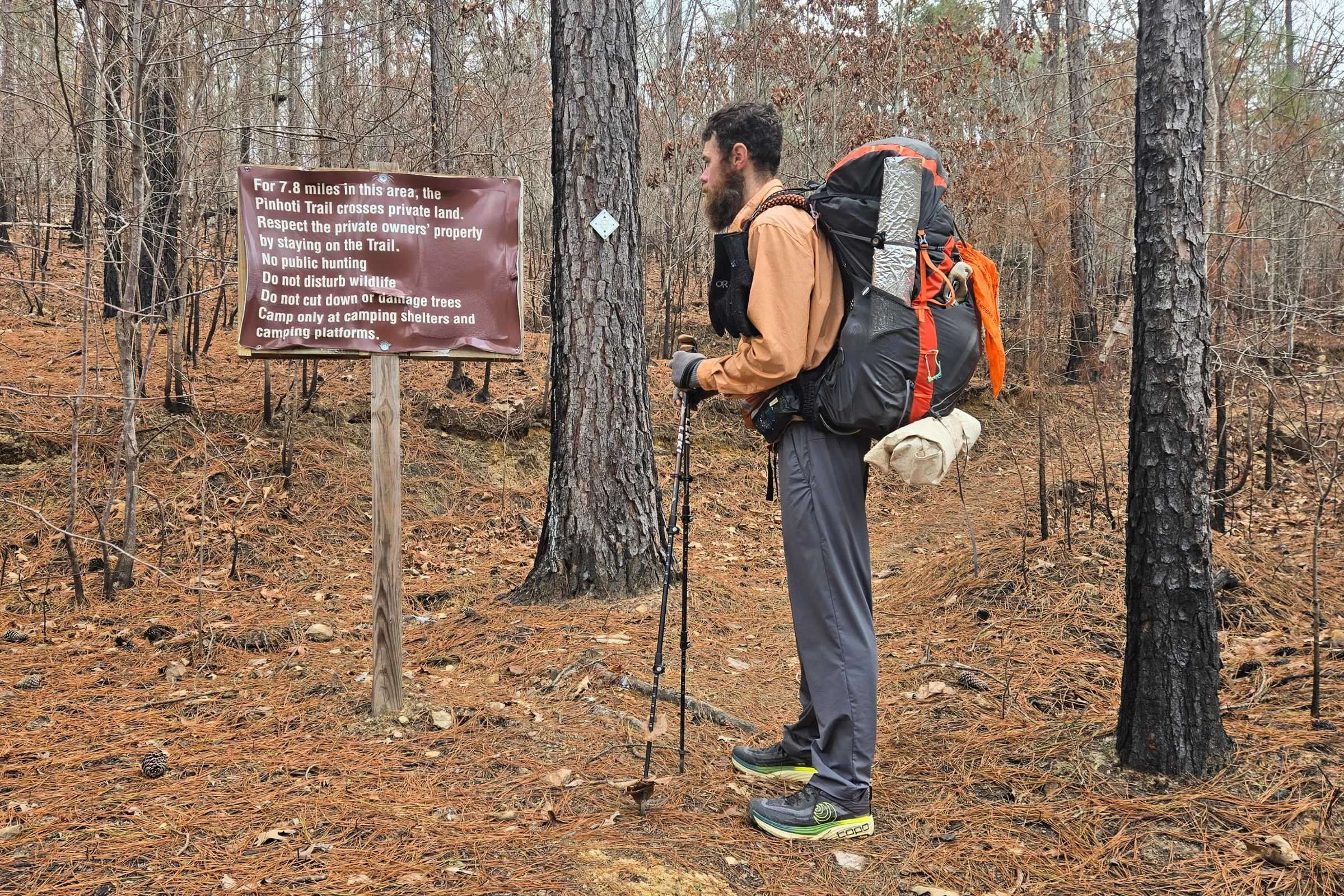
Signs note where camping is limited within the Indian Mountain ATV Park.
Another tricky camping stretch to note is the Simms Mountain Trail in Georgia (NOBO miles 209.8-221.4). Leaving Cave Spring northbound, there isn’t a great place to camp in the middle of this 10-mile stretch of rail trail tacked onto the end of the 20-mile Cave Spring road walk. Private houses, ATV use, and a few unleashed or loud barking dogs are present along this former railway. For hikers who are uncomfortable with stealth camping or hiking longer mile days, it might be best to complete this in two sections.
Water planning
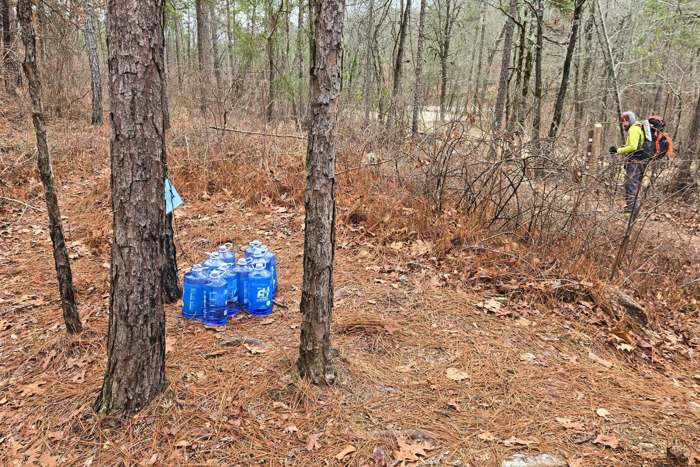
This water cache at Bull’s Gap is maintained by the POC. Trail angels often leave water caches at trailheads in Alabama.
Water can be plentiful along the Pinhoti Trail after winter and spring rains, and more scarce in the fall. Water caches are maintained by trail angels in several locations along the trail, notably before, during, or after high ridgeline sections. Having a carrying capacity of two liters helped us prepare for these sections and dry camping. Water carries were never longer than 15 miles max.
Wildlife and Food Storage
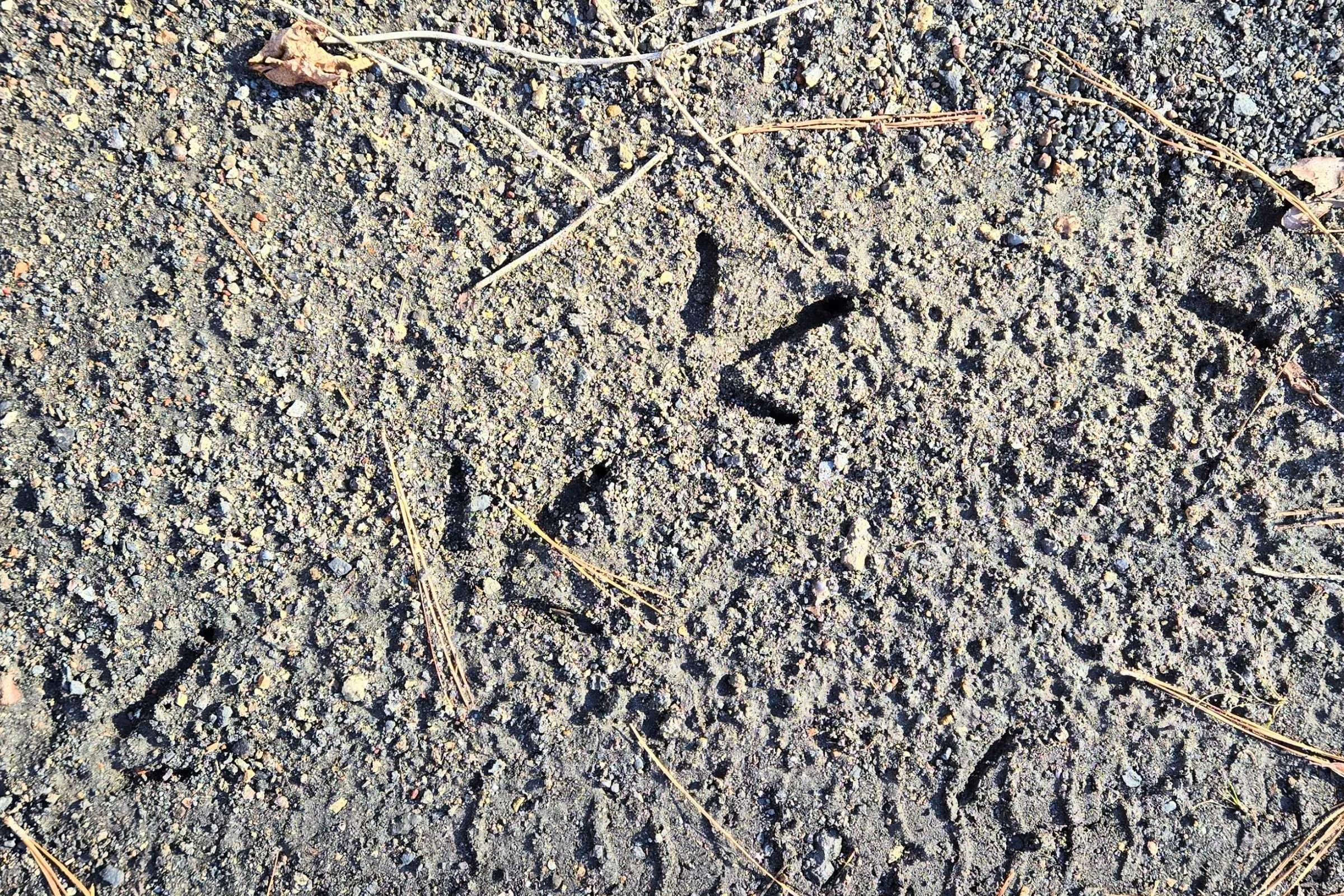
Black bears are rare to see along the Pinhoti Trail, but not an impossibility. A few FarOut comments have reported prior black bear sightings along the northernmost 40 miles of the trail in Chattahoochee National Forest. We spotted the tail end of a wild boar running away from us in one location. By far, the biggest threat to a hiker’s food are small to medium size rodents like mice or raccoons.
Bear canisters are not required in any section of the Pinhoti Trail. Most hikers carry bear hang bags or Ursack Puncture Resistant Food Storage bags. For bear canister recommendations, see our in-depth review of the BearVault BV ONE bear canister, or REI’s Food Storage story or REI’s Bear Canister story.
I enjoyed hiking during the winter season as the risk of running into large wildlife and snakes is significantly decreased during the cold months. We spotted deer, woodpeckers, and Great Blue Herons during our hike, and heard owls and coyotes on occasion in the distance.
Resupply
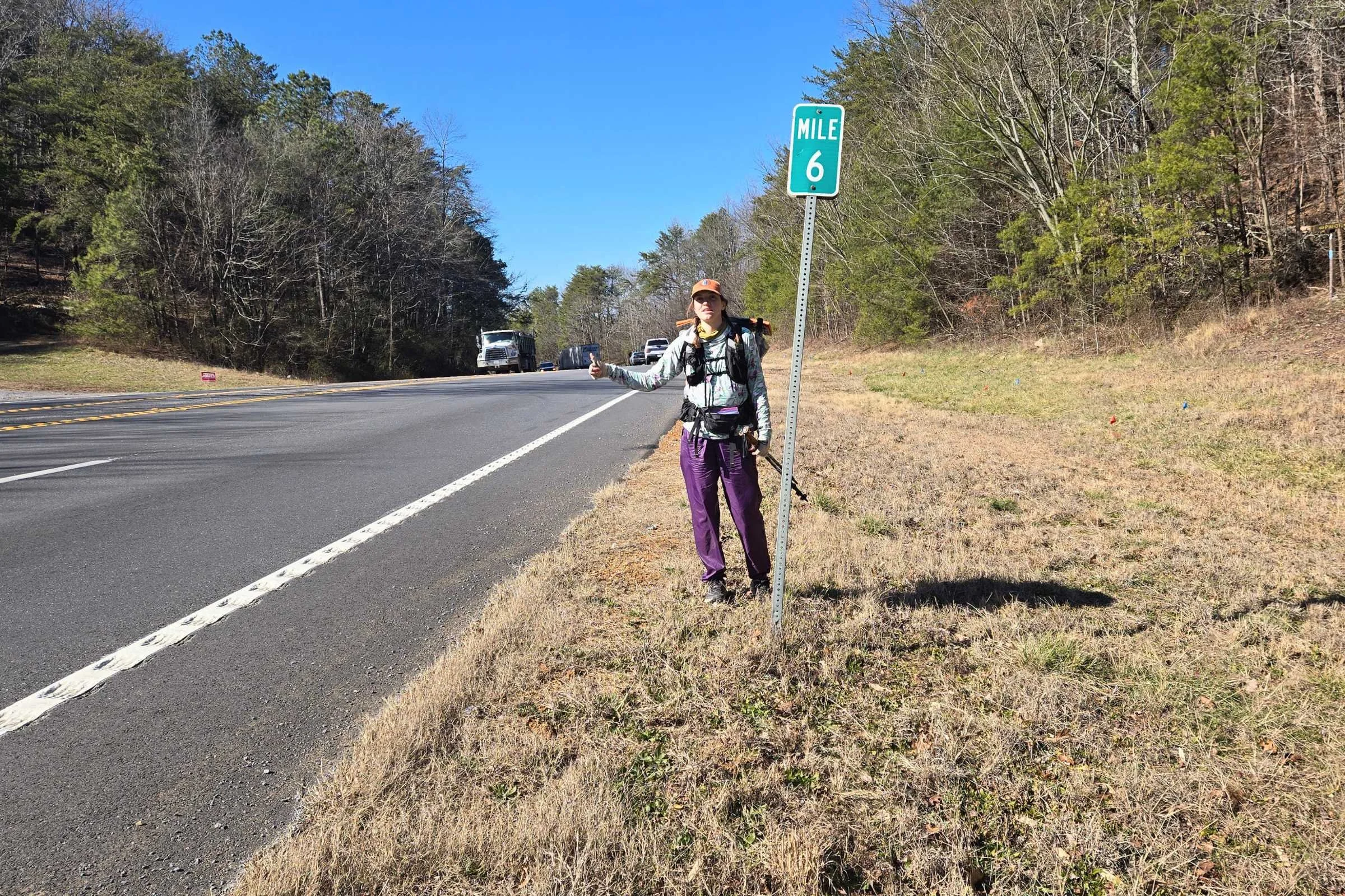
We successfully hitched in and out of Summerville, GA on the same day, an optional resupply point for Pinhoti hikers.
The Pinhoti Trail offers convenient resupply and town access options.
The cities of Sylacauga, Oxford, Summerville, and Dalton all have major grocery stores such as Publix, Ingles, or Walmart. Heflin and Cave Spring have Dollar General and local markets to shop at. Additionally, long road walks in Georgia pass hikers by Dollar General stores, delis, and convenience stores for a quick treat.
For northbound travel (south to north) there are multiple major resupply locations to choose from. The resupply locations we used are highlighted in bold. No resupply drop boxes were sent as part of our hike.
Mile 24.4: US Route 280 to Pinhoti Outdoor Center (POC) and Sylacauga, AL. The POC is located 1.6 miles off trail and offers bunks, limited resupply, mail drops, and shuttles.
Mile 60.0: Highway 77 to Talladega, AL. Requires a hitch or shuttle.
Mile 86.0: Cheaha State Park. Cheaha State Park camp store with limited resupply, snacks, coffee, a small hiker exchange box, and picnic benches accessed by a 0.2-mile spur trail or road walk. USPS does deliver to the park for resupply boxes; I recommend calling ahead to confirm seasonal delivery restrictions and hours of operation.
Mile 113: US Hwy 78 to Heflin, AL. Downtown Heflin can be accessed by a 3.7 mile spur trail, hitch, or shuttle. In this area, the commercial district of Oxford, AL can be accessed by shuttle with national grocery store and chain restaurant options. Mail drops are accepted by hostels in the area.
Mile 168.9: US Hwy 278: Piedmont, AL, requiring a hitch or shuttle.
Mile 190.3 Cave Spring, GA. The Pinhoti Trail passes through downtown. Multiple restaurants, small markets, and a Dollar General within a short walk.
Mile 232.1: US 27 to Summerville. Requires a hitch or shuttle. Multiple restaurants, an Ingles Market, and lodging options.
Miles 282.8-310.5: Dalton road walk. Hikers walk through the City of Dalton with an overwhelming number of lodging and restaurant options. An RAK Outfitter, Publix Market, and Walmart Supercenter are located right on trail. After leaving the city sidewalks (NOBO mile 289.8), there are several more opportunities to stop at convenience stores and Dollar General stores before reentering the woods at Dennis Mill Trailhead.
Mile 309.3: Toadshade Hill Hostel.
Mile 330.3: Mulberry Gap Adventure Basecamp (last paved road crossing).
Something helpful on the Pinhoti Trail is the presence of hostels within 25 to 40 trail miles of both the northern and southern ends. If you leave a car or mail a resupply box to these locations, your resupply carries can be reduced starting from either terminus.
Trail Resources
FarOut
The FarOut App Pinhoti Trail guide is the most up-to-date resource for maps, elevation profiles, water reports, campsites, and shelters. We found ourselves often scouting ahead on waypoints for information on unmarked campsites and streams.
Trail Maps and GPX Data
I used Gaia GPS as a backup navigation resource. The Pinhoti Trail can be viewed on Gaia GPS (including the free version); however, not all of the sections were accurate to the current route. CalTopo also offers a GPX file for the Pinhoti Trail.
Guidebooks
My Pinhoti Trail Hiking Journal by Kimm Wright is available through the Pinhoti Outdoor Center. The journal acts as a basic trail guide for documenting your journey and planning a hike.
Pinhoti Outdoor Center & Hostels
The Pinhoti Outdoor Center (POC) in Sylacauga, Alabama is geared to empower outdoor recreation in Alabama. A wealth of information on all things Pinhoti, POC owners Nathan and Kimm Wright, serve to make the trail a welcoming space for all hikers. The POC offers trail planning and educational opportunities, shuttles, a 6-bunk hostel with tent space, and a small Pinhoti store for resupply items and Pinhoti swag.
We stayed at two hostels and communicated with a couple more. All of the hostels were quick to respond and offered helpful planning assistance.
Facebook Pinhoti Trail Alliance
The Pinhoti Trail Alliance on Facebook is an extremely active group, open to those who want to share stories and ask questions. The Facebook group is also the most up to date resource on trail closure and prescribed burns.
Getting to the trail
By Plane
Folks flying in to hike on the Pinhoti trail have access to three major airports:
Hartsfield-Jackson Atlanta International Airport (ATL) in Atlanta, GA
2:30 drive to the Pinhoti northern terminus
2:50 drive to Flagg Mountain southern terminus.
Birmingham-Shuttlesworth International Airport (BHM) in Birmingham, AL.
1:35 drive Flagg Mountain southern terminus
4:00 drive Pinhoti northern terminus
Montgomery Regional Airport (MGM) in Montgomery, AL.
1:20 to Flagg Mountain southern terminus
4:25 to Pinhoti northern terminus
Most Pinhoti hikers use Atlanta and Birmingham airports. Shuttle drivers might have preference for pickup in a certain city or location; for example, Atlanta traffic discourages some shuttle drivers from direct airport pickups. It doesn’t hurt to check in prior to making arrangements.
By Car
The Pinhoti Trail is very accessible within all directions by car. For southern and northern terminal access, it is not recommended to leave your car parked at Flagg Mountain or Chattahoochee National Forest for extended periods of time. Most hikers park at a nearby hostel and arrange for a shuttle dropoff/pickup.
Hostels convenient to Flagg Mountain include the Pinhoti Outdoor Center (POC) and Southern Comfort Hostel. To the north Toadshade Hill and Mulberry Gap Adventure Basecamp are open to hikers. Throughout the trip, all the drivers we worked with were kind and very familiar with rural trailhead access points.
Bus and Shuttle Services
The Pinhoti Trail is accessible by bus in the south to nearby cities of Birmingham and Montgomery, as well as Sylacauga, AL. To the north, Greyhound appears to run to Ringgold, GA and Chattanooga, TN. This website is helpful for viewing Greyhound Bus Route Locations. Travel by bus requires also getting a shuttle to the trailhead. Most shuttles are arranged through trail hostels. Shuttle driver information can also be found in FarOut comments for trail towns and trailheads.
For airport transportation to/from nearby trail communities, check out Groome Transportation for shuttle service to major airport hubs. This was new to me, but one shuttle driver mentioned a hiker catching a Groome Shuttle from Oxford, AL near Heflin.
Trip report
After a season of hosting hikers and guiding on the Appalachian Trail, Tom and I were anxious to get some trail miles in ourselves. This was a new part of the country for me, and a redemption hike for Tom as he had attempted a thru-hike in July of 2024 and bailed after 21 miles due to the heat, thorny overgrowth, and incessant spider webs.
State Date and Duration
Tom and I came to the Pinhoti Trail with very few expectations. The aim was to complete a hike in our winter off-season, short enough to attempt in under a month. We also thought it would be similar enough to the Appalachian Trail. We started on Flagg Mountain on January 22 and finished at the Benton MacKaye Trail junction on February 12 for a total of 22 days on trail (3 weeks). We took two zero non-hiking days indoors to wait out winter storms.
Overall Impression
The Pinhoti was different in experience from the Appalachian Trail and I’m pleased to have completed it as a stand alone adventure.
While it’s often remarked to be a beginner-friendly trail, we used skills learned from prior thru-hikes almost every day. It was small things that we noted, like ridgeline water planning, dry camping, setting up camp in odd imperfect spaces, scouting out unmarked campsites in FarOut comments, and the ability to push bigger mileage days as needed—sometimes past sunset. Long road walks, sleeping below freezing for weeks, cold water crossings, and dry campsites can be huge demoralizers for hikers of all experience levels.
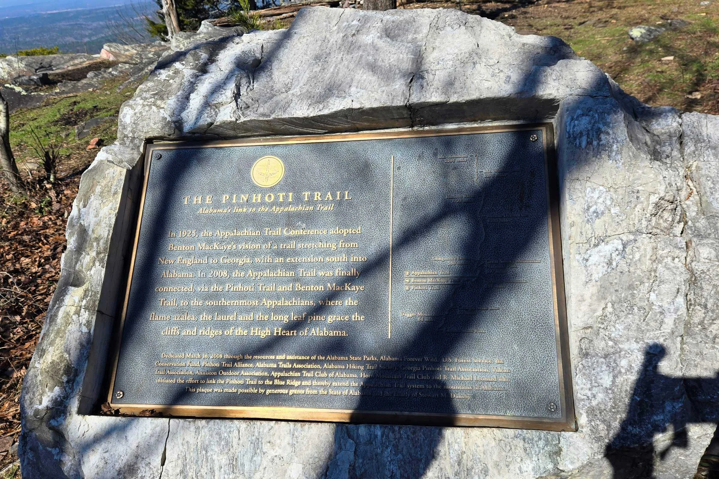
It's a trail system that has taken nearby communities by heart, as they learn about wild thru-hikers and trail culture. I loved seeing the trail placards high on ridgeline overlooks to express the pride families have in their donations for public land use. Locals asked us questions along the way. Historical markers highlighted Alabama’s Appalachian Heritage. And National Forest informational signage reflected a desire to protect remnant longleaf pine and American Chestnut forests.
Mileage & Elevation
Over 22 days, we hiked an average of 15.7 miles per day including two zero days taken for weather. Our hiking mileage ranged from a 9.0-mile nearo (near zero) to 27.1 miles along the Dalton Road Walk.
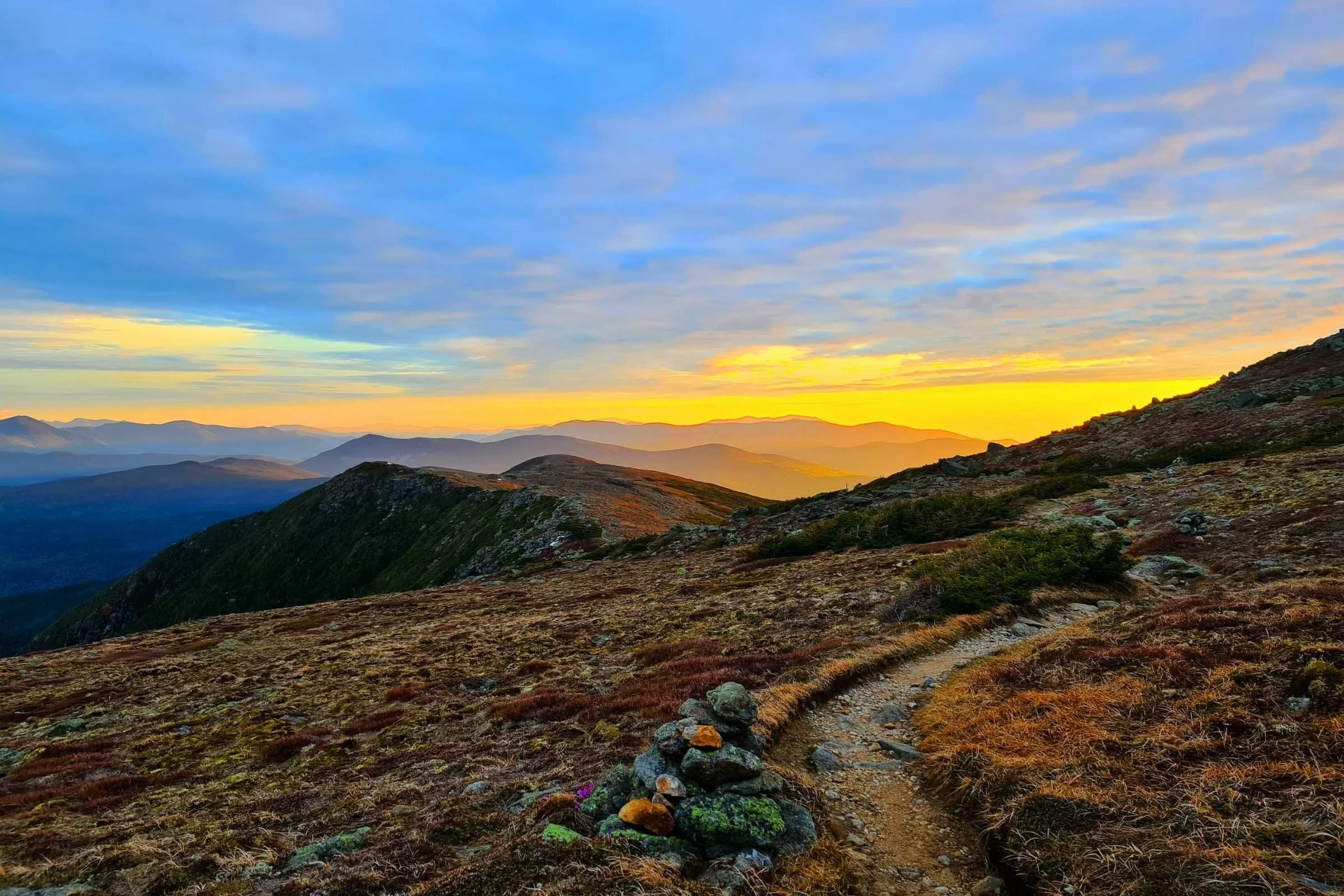
Elevation had a slight gradual increase northbound. Total elevation for our hike was 47,298 feet, with an average of 2,150 feet per day including zero days. Our highest elevation day was in the Chattahoochee National Forest at 4,226 feet of gain.
The numbers above are from the FarOut Guides App.
Vehicle Logistics
For both of us, not only was this a new trail location, but also a new logistics strategy: hiking with a car. We staged our vehicle at key locations—the POC to start and then Cave Spring City Hall for the remainder of the hike north of Porter’s Gap. Near the northern terminus, we arranged for a shuttle from Harkins Creek Campsite back to Cave Spring. This strategy allowed access to stored food and winter gear in key locations. It was a personal choice; however, we likely spent more money on shuttles overall.
Cave Spring City Hall has several parking spots reserved for Pinhoti hikers. This is around the trail’s halfway point and perfect for staging vehicles during section hikes. For end-to-end thru-hikes, hikers most commonly leave a vehicle parked at a southern or northern terminus hostel with plans for one long shuttle at the end of their hike back to the car.
Trip summary
Weogufka State Forest, Coosa Wildlife Management Area, and Pinhoti Outdoor Center
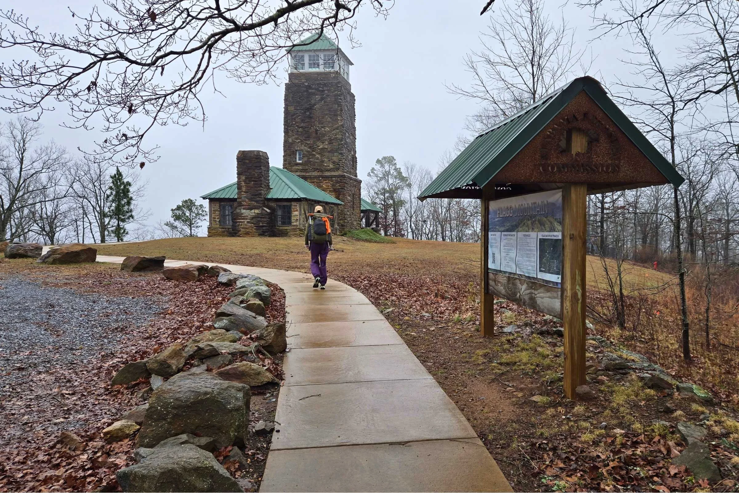
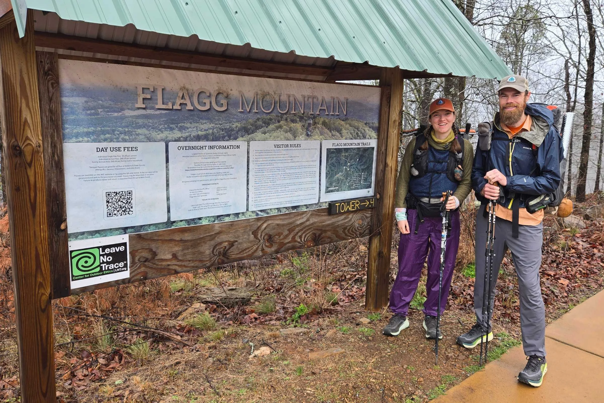
Flagg Mountain Observation Tower marks the southern end of the Pinhoti Trail.
Public excitement for this relatively new backpacking route can be felt from the very first steps up the switchbacked sidewalk to Flagg Mountain Observation Tower (elevation 1,156’) . The southern terminus was moved to Flagg Mountain in 2015, with a celebration in 2025 to commemorate work completed to open the tower to visitors, route the Pinhoti off roadways into the forest, and bring fresh drinking water to the site. You can read more on recent works to open Flagg Mountain to the public on the Alabama Forestry Commission website.
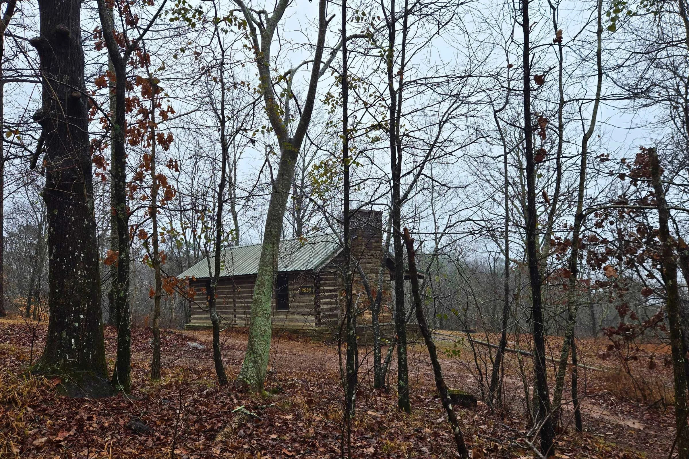
Highlights from Flagg Mountain to the POC included historic CCC cabins, deciduous forest scattered with mountain laurels and longleaf pine trees, blooming wild daffodils, passing our first Pinhoti shelter, and our first several-mile long road walks. We ended day 1 by ascending the recently installed Terrapin Hill “Top of the World” Observation Tower. These pockets of the Weogufka Mountains felt dense and well forested, even as close as we were to civilization.
For the extent of our trip, we encountered the highest number of unleashed, aggressive dogs on the roads between Flagg Mountain and the POC. The dogs seemed to be more curious and defensive than aggressive. I carried pepper spray as a backup defense. Luckily, I never needed the spray, as all the dogs we encountered on the Pinhoti would trudge away after a stern talking-to.
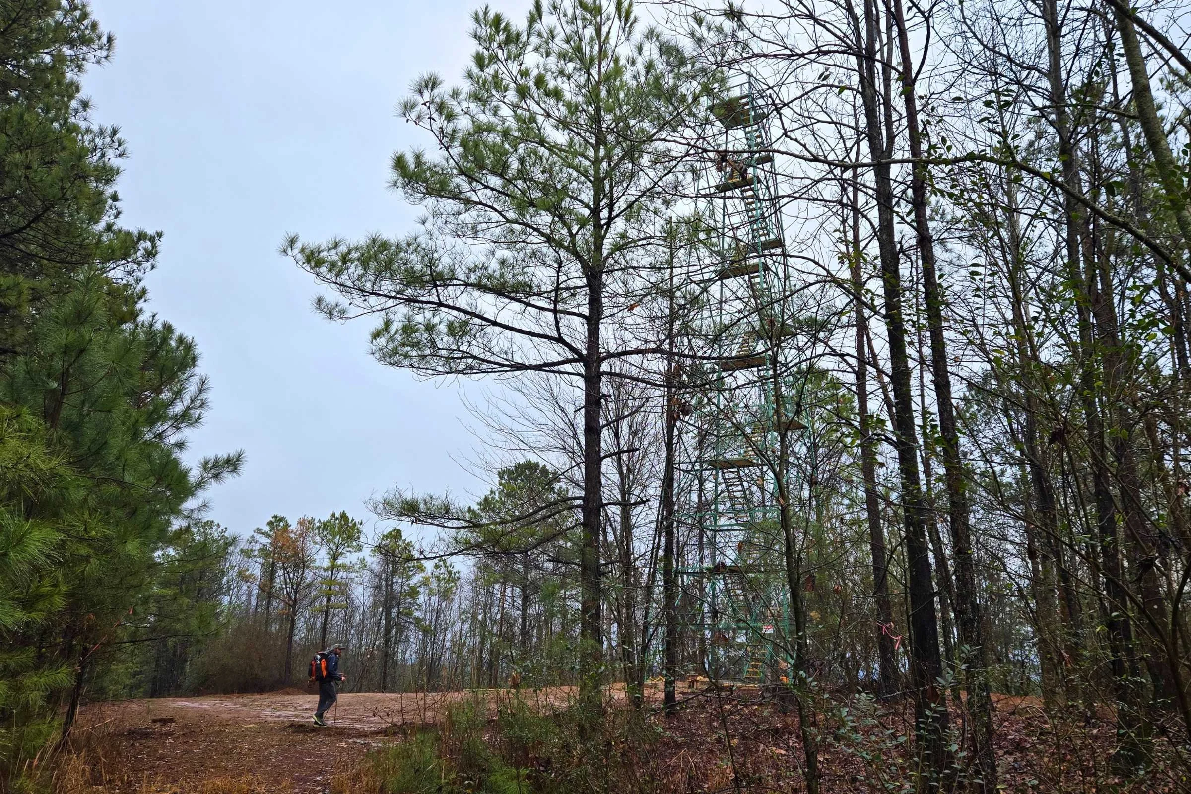
Terrapin Hill “Top of the World” Observation Tower was officially opened in Spring of 2026.
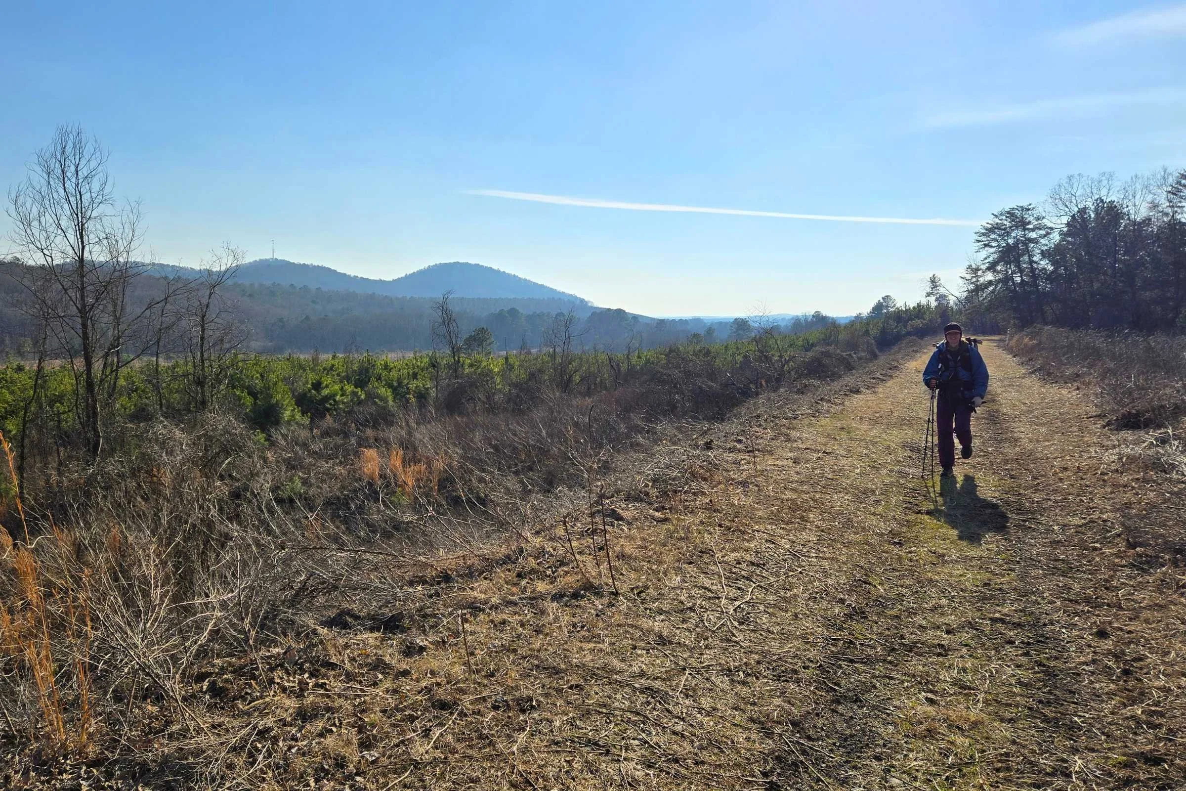
Talladega National Forest: Trammel to Porter’s Gap
The high elevation ridgelines of Trammel Trailhead to Bulls Gap, and then Bulls Gap to Porter’s Gap were unexpected this early into the hike. In these sections, you have to plan your water accordingly as ridgelines are dry. The trail parallels the Skyway Motorway overlanding road starting at Bulls Gap Trailhead.
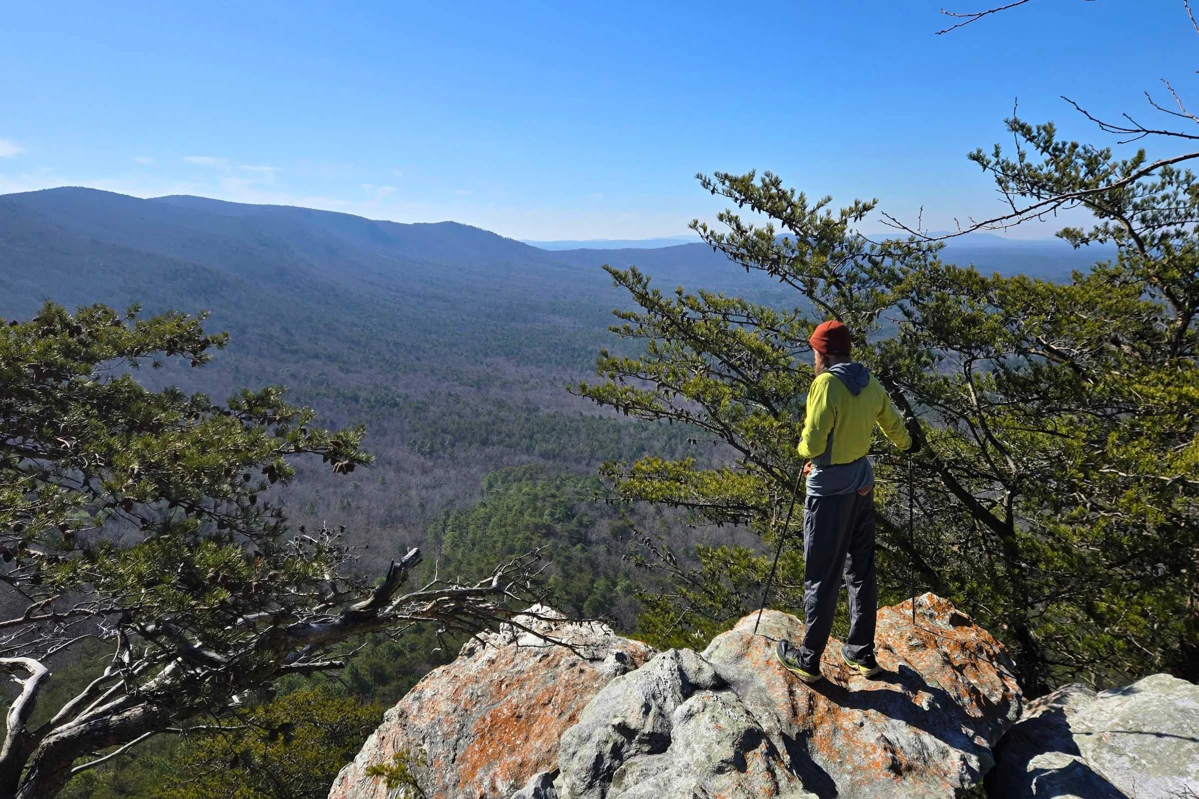
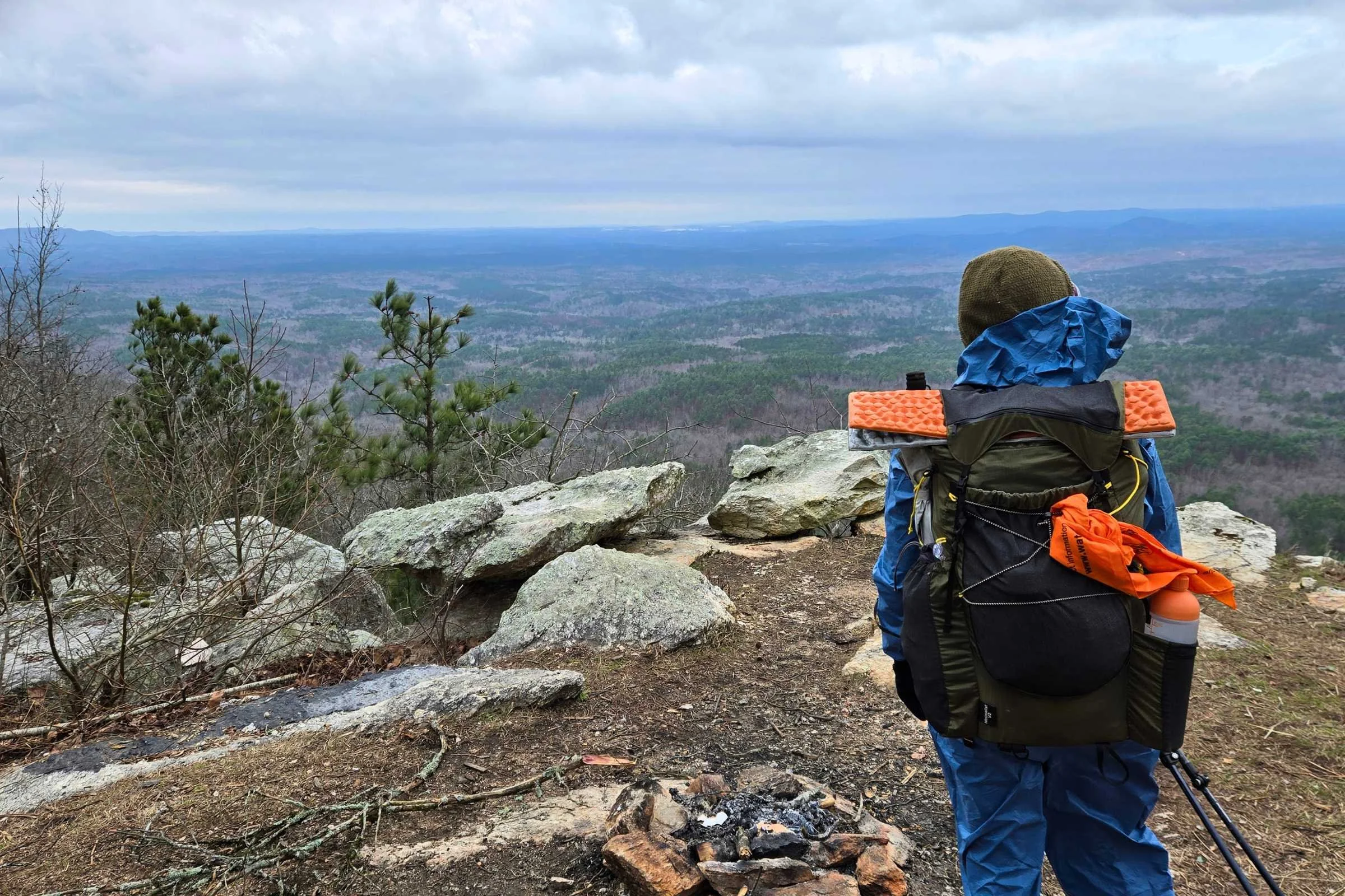
Highlights include camping at Horn Mountain Lookout Tower and stopping at multiple rocky ledge viewpoints. The ridgelines of Central Alabama are spaced far apart, offering long views of the forested rolling hills far below on a clear day.
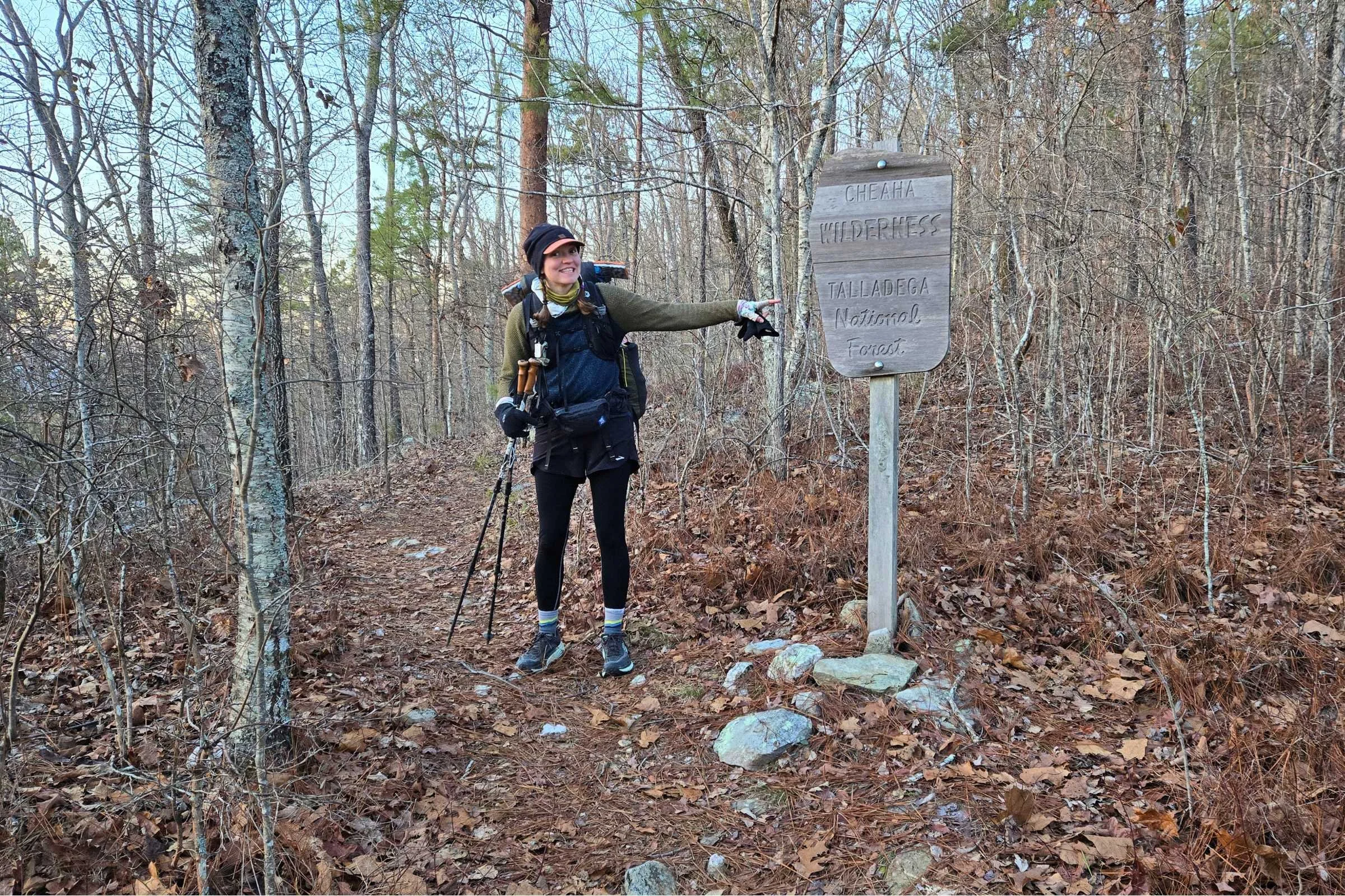
Talladega National Forest: Cheaha Wilderness
Cheaha Wilderness is jokingly called “Alabama’s Rocksylania”, or Rock-syl-bama one could say.
The dirt pathway from Porter’s Gap led up, over, and along the forested Talladega Mountains. The Skyway Motorway switches to the paved Talladega Scenic Highway (State Route 281) at Adams Gap Trailhead.
The section of Talladega National Forest to the south of Cheaha State Park is referred to as “Alabama’s Rocksylvania” by folks at the POC, a reference to the rocky state of Pennsylvania on the Appalachian Trail. The talus leading up to Odum Point (2,343-feet elevation) in the Cheaha Wilderness is slow going and infrequently blazed, making it easy to lose the trail if you aren’t paying attention.
McDill Point overlook is worth the side hike, and if you plan the mileage correctly, the camp sites from McDill to Hernandez Peak are flat and spacious. In this area, we encountered ice covered rhododendron thickets and ice patches several feet in width covering the trail.
McDill Point sidetrail offers sweeping views and large campsites.
Talladega National Forest: Cheaha State Park to Heflin
Cheaha State Park is home to Alabama’s High Point (2,407-feet elevation) with several amenities. Most important to thru-hikers, the general store sells various snacks and hiker foods, as well as complimentary coffee, water, and indoor restrooms. A picnic bench in the warm sun for lunch was a highlight.
Several waterfalls and rocky ascents lead the gradual descent towards Heflin, AL. As compared to the south side of Cheaha State Park, north of the high point feels cruisy. An added bonus, wide wooden sleeping shelters start to appear in this section.
Talladega National Forest: Choccolocco Wildlife Management Area
You can use the USFS Shoal Creek Ranger Station north of the US Route 78 overpass as a hitch or shuttle point into Heflin. Hikers can also take a 3.7- mile spur trail into town. We continued north on the Pinhoti Trail, opting to arrange a shuttle by 8Acorns Hostel with pickup at the USFS Pine Glen Campground. This allowed us to increase our northbound progress before taking a second zero to wait out another winter cold front.
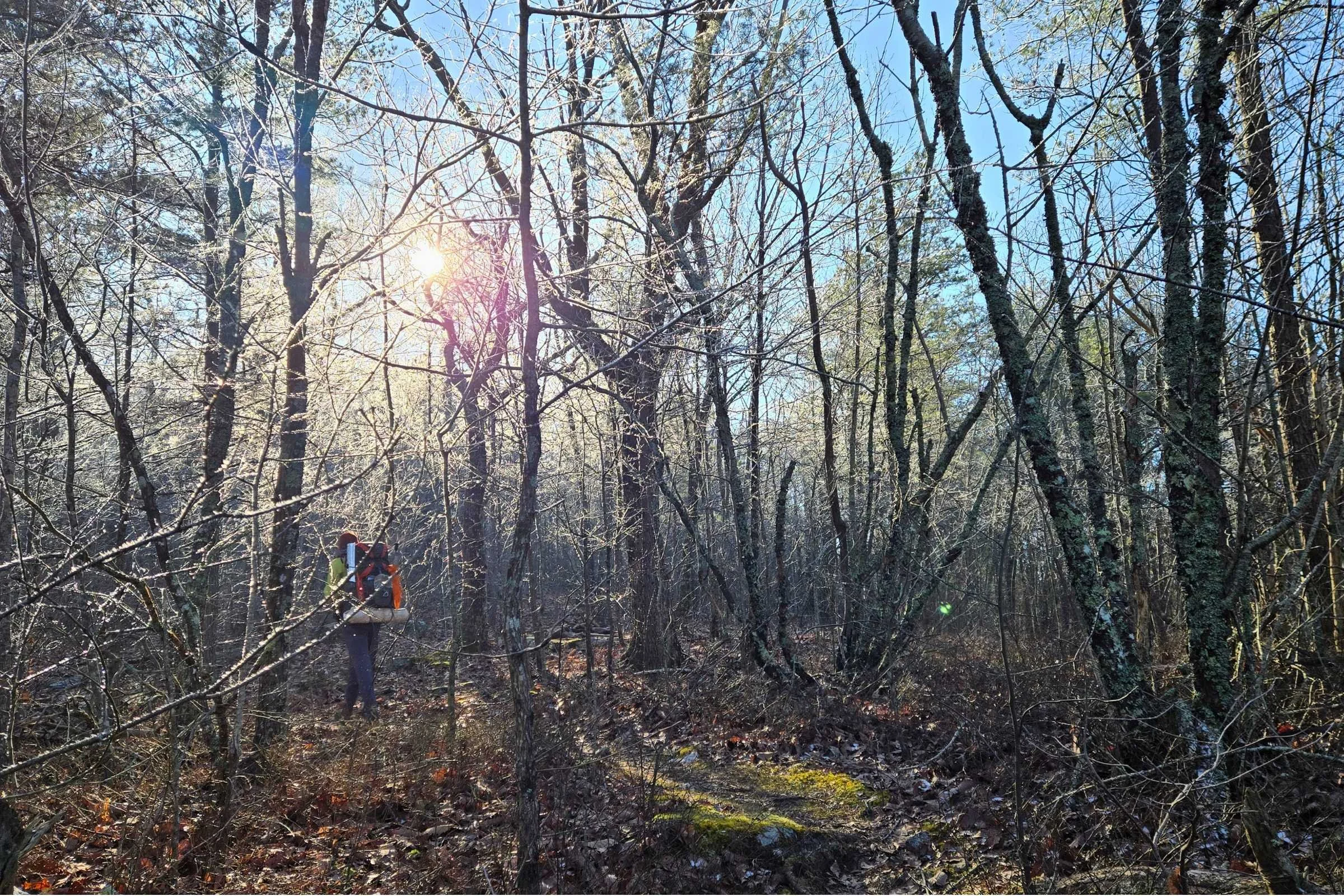
The forest leaving Shoal Creek Ranger Station felt warm and welcoming.
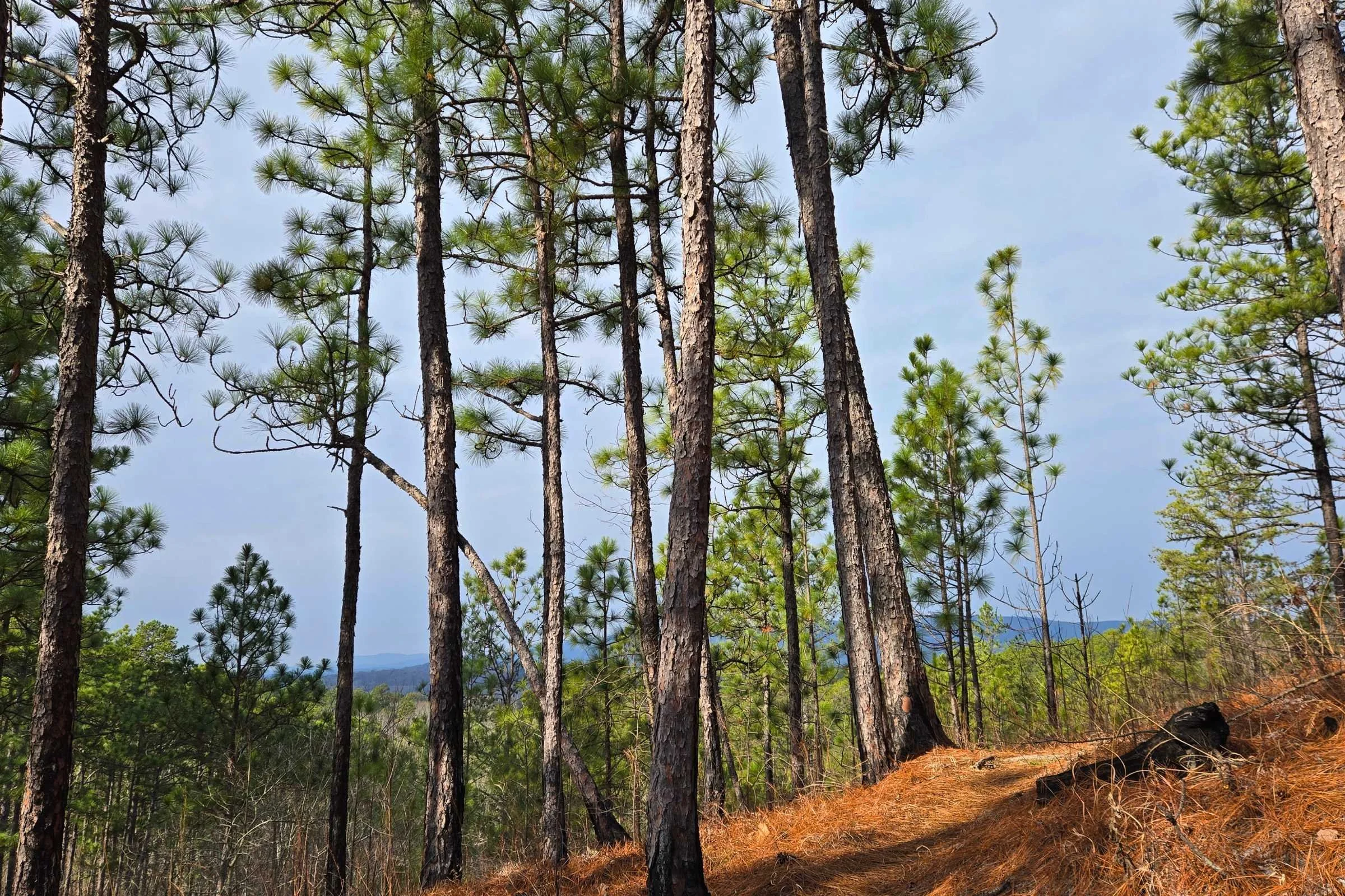
The portion of trail between the ranger station and Pine Glen Campground was possibly one of my favorites of the entire trail. Green long leaf pine forests offer westward views of the Piedmont. The trail edges along the mountain sides before dropping into the valley of Shoal Creek.
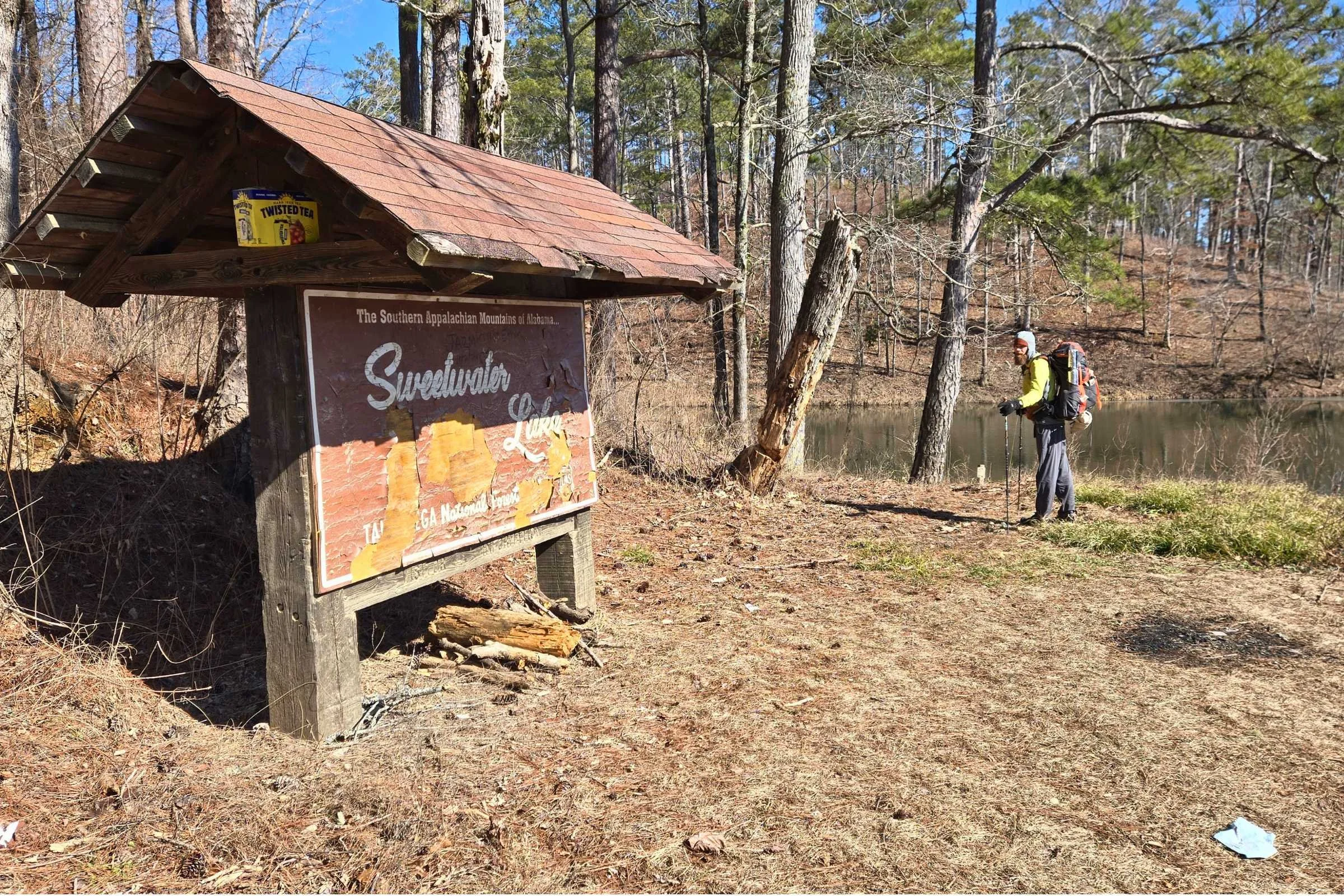
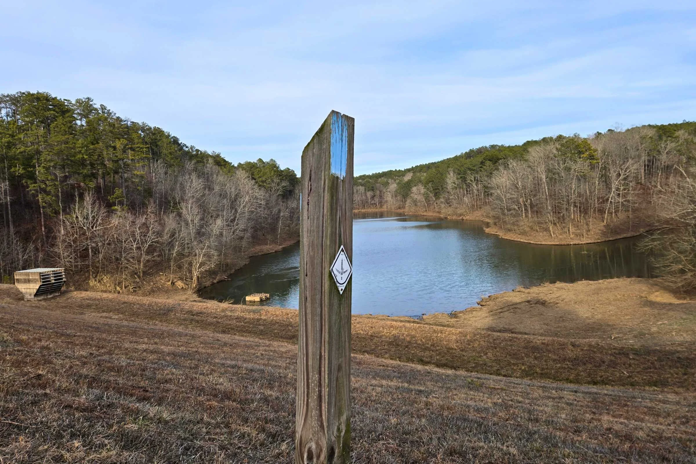
North of Pine Glen Campground, you continue to see the beauty of Talladega National Forest. The treadway stays graded along Shoal Creek before encountering the first of three dammed lakes along Shoal and Choccolocco Creeks. Tall golden grassed meadows interspersed with pine and deciduous forest in this “lake district” of the Pinhoti, it was hard to not smile the entire day with cold, clear blue skies.
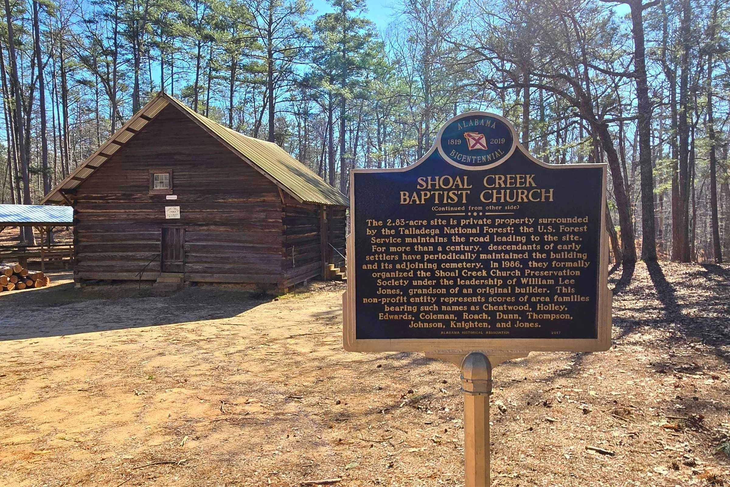
I’d imagine the area of Sweetwater Lake and Coleman Lake Campground are popular for day trips and car camping during the warmer months. Just south of Coleman Lake, I recommend popping over to check out the Shoal Creek Baptist Church (NOBO mile 134), a log hewn church built in 1895 by early settlers of the area. According to informational signs, the last regular church service was held at the church in September 1914.
It is important to note that the dam levees in this area have the potential to be accessible to off-road vehicles. We stayed the night at Choccoloocco Shelter, and at midnight were awoken to an SUV driving laps close to the shelter down along Choccolocco Creek.
From pine forest to lakes, the Pinhoti offers a bit of everything.
Talladega National Forest: Dugger Mountain Wilderness
Hikers talk about the steep ruggedness of Dugger Mountain Wilderness. The ascent I barely noticed, as I was too distracted by the dense bright evergreens lining the trail. I absolutely adored this section from Shoal Creek Ranger Station to High Point Trailhead.
Cheaha State Park to High Point Trailhead/US Route 278 (NOBO miles 87-170) would make an incredible section hike for a range of excellent terrain, ecosystems, and views. For a longer section, start at Bulls Gap or Trammel Trailhead further south.
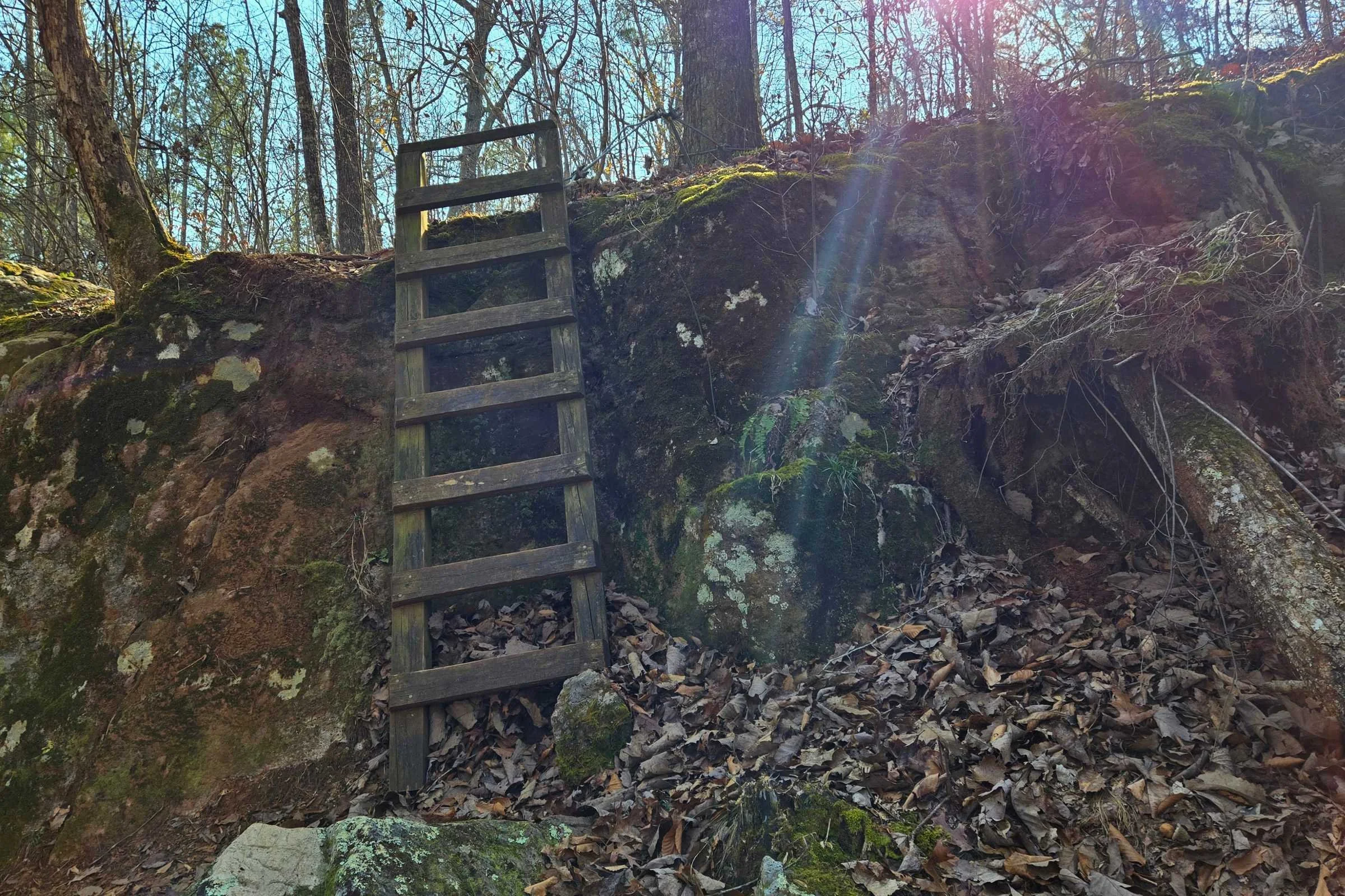
Indian Mountain ATV Park
Hiking through the Indian Mountain ATV Park is another example of the trails' surprising character. From the large High Point Trailhead parking area, hikers walk east along US Route 278 for a half mile before reentering the woods. The next 7.8 miles (Section 13) passes through the longest span of private land on the Pinhoti Trail. This land easement includes Davis and Indian Mountains. The good news is that this section of the trail is off the paved road, although camping here is limited to shelters and tent platforms.
Indian Mountain Park has a rough cut footpath that intersects with an ATV track of loose dirt and large rocks. It’s fun yet frustrating with a multitude of environments. The private park started with what appeared to be an old mine area. The next seven miles include rocky ascents, wooden bridge crossings, two shelter sites to camp at (Davis Mountain Shelter and Hawkins Hollow Shelter), and one short ladder descent; all culminating at a clearing near Indian Mountain with close to 360-degree views. Leaving this ATV playground, it’s a relief to see the Forever Wild Property boundary and the Alabama-Georgia border.
Cave Spring
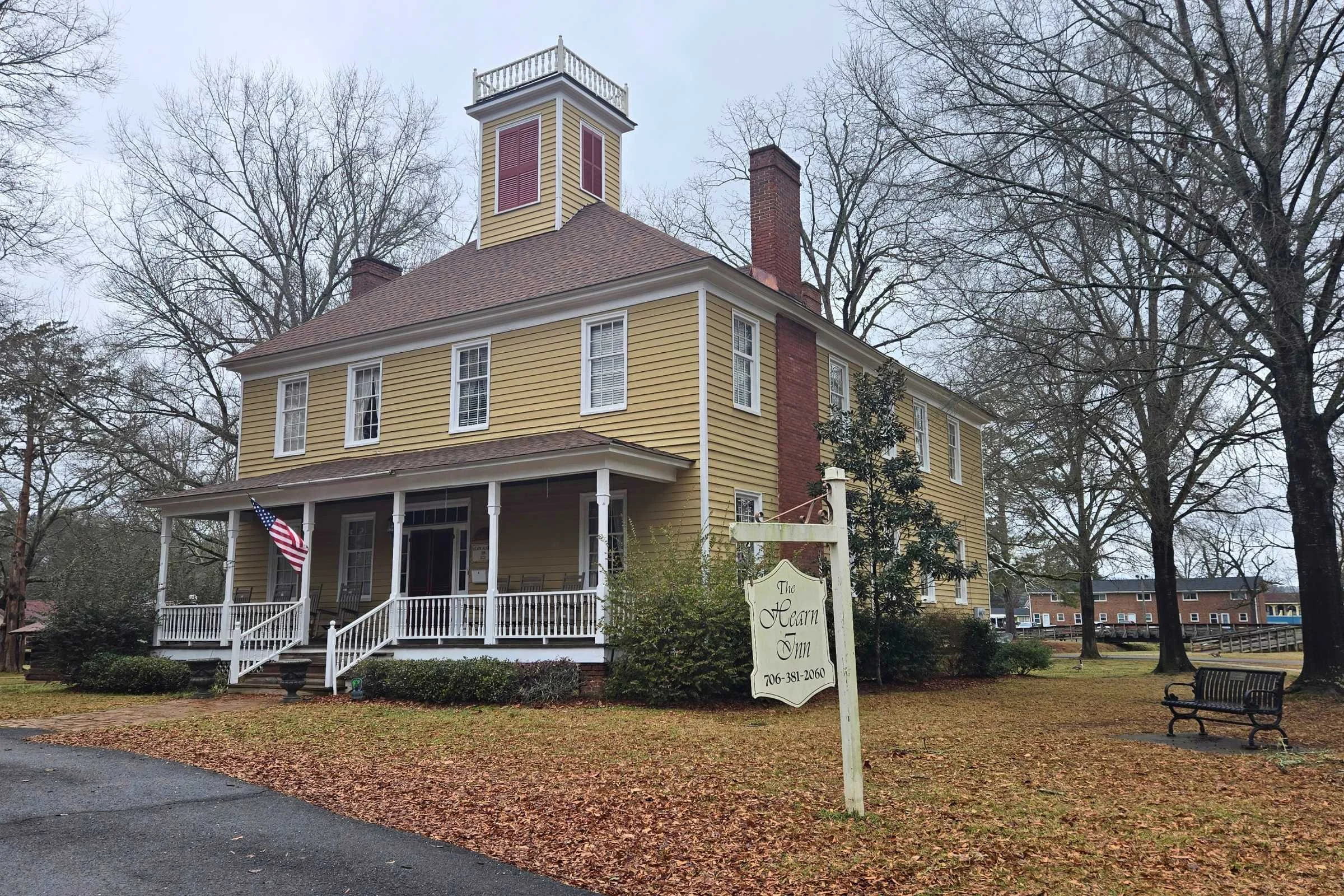
Cave Spring is the first of two cities that you walk directly through along the Pinhoti Trail. It’s the perfect “mental mid-way” stop for town food, resupply, and to prepare for the 20-mile Cave Spring road walk.
This small former resort town was originally settled around a large natural limestone spring that still flows from a gated limestone cave in Rolater Park. If possible, budget and call ahead for an overnight stay at the historic Hearn Inn in downtown Rolater Park. For overnight trail parking, several Pinhoti hiker parking spots are located near Cave Spring City Hall. It was confirmed that the spots are monitored by residents and local police.
Walking through town, you might feel a sense of layered history. The Trail of Tears National Historic Trail notes Cave Spring was one of the many places where native peoples were forcibly removed from their southeastern homelands in the 1830s. In 1832, the community of Cave Spring was established by European settlers surrounding the limestone spring, with later development including a health spa resort, occupancy during the Civil War, the Hearn Academy Manual Labor School, and the still-existing Georgia School for the Deaf.
From Cave Spring, Pinhoti Trail follows a series of sidewalk-free roadways with narrow (to no) shoulder space for 20 miles. It’s a long day, with two gas stations to aim for in Coosa as a break spot. The Simms Mountain Trail picks up north of Coosa, a grass covered former railway offering 10 miles of cruisy respite for the feet.
While the Simms trail is generally flat, camping can be tricky. It’s in close proximity to roadways and residences, with sections actively used as ATV and tractor track. We did find a small flat site to the side of the trail to camp at the end of a long day and woke up to black staining on our gear, likely related to former railway operations. Most hikers seem to stealth camp, like we did, or arrange shuttles to split this mileage past Cave Spring.
Simms Mountain Trail is a multi-use rail-to-trail that’s well graded but difficult to camp along.
From Highpoint Trailhead (note: the second so-called "Highpoint Trailhead" in 50 miles), the path heads up the single and double track of another ridgeline, this time in Chattahoochee-Oconee National Forest.
Chattahoochee National Forest to Dalton
At Mack White Gap, hikers have the option to head into the small city of Summerville, GA via US-27/GA-1. There’s an Ingles in Summerville, and opting to hitchhike into town allows for a smaller food carry from Cave Spring.
Summerville seemed to me to be the least hiker-friendly town, unfamiliar with our hiker antics as we stood roadside to catch a hitch. Altogether, the hitch in and out of Summerville was a success.
Highlights past White Mack Gap included many scenic miles of forested dirt and gravel roadway, a barefoot shin-deep water crossing West Armuchee Creek where the concrete roadway is intentionally submerged, chilly morning views from John’s Mountain Overlook, the trickling Keown Falls over the edge of a rocky cave, a beautiful and clean pit toilet at Keown Falls Trailhead, and more miles of rocky ridgeline and valley views.
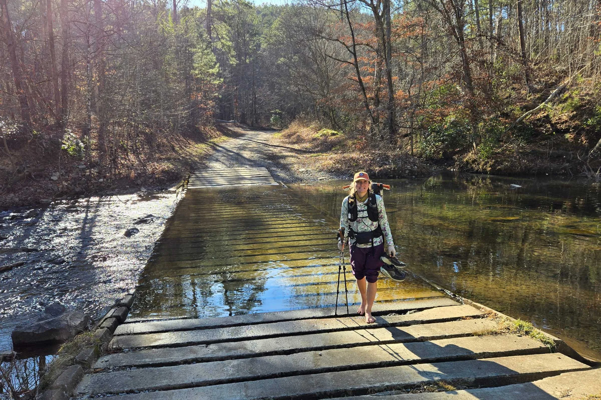
West Armuchee Creek flows over the concrete roadway, for a chilly, slippery, barefoot crossing. We kept our shoes dry for as long as possible!
I really enjoyed the 60 miles from Georgia’s Highpoint Trailhead to Dug Gap, experiencing the best scenic ridgeline views prior to Dalton. There is not a good parking location at Dug Gap. I think this would make a great section hike.
Similar to the miles preceding, the 2.5 miles of paved roadway into Dalton had narrow shoulders until the appearance of sidewalks near the Dalton Convention Center. The southbound ascent up this road walk to Dug Gap would be brutal.
Dalton Road Walk
Dalton is the second and last city that the Pinhoti Trail passes through. Some comments on FarOut note Dalton is a hikers paradise, with lodging, restaurants, fast food, and grocery stores all within walking distance. We opted for an overnight stay at the Days Inn. It was affordable with on-site laundry machines, and while the rooms were not high end, the shower had plenty of pressure. What else does a hiker need?
When you are well fed and rested, the sidewalk guides you for five miles through the city of Dalton, before another 20.6 miles of sidewalkless road. It’s not the best, it could be worse. Some hikers choose to skip the Pinhoti road walks. Another option is to arrange shuttles to slackpack in sections. We had lunch at the Dollar General in Spring Place and grabbed additional snacks at the Ramhurst Sunoco Station. A road walk isn’t too bad when you can grab cold drinks along the way!
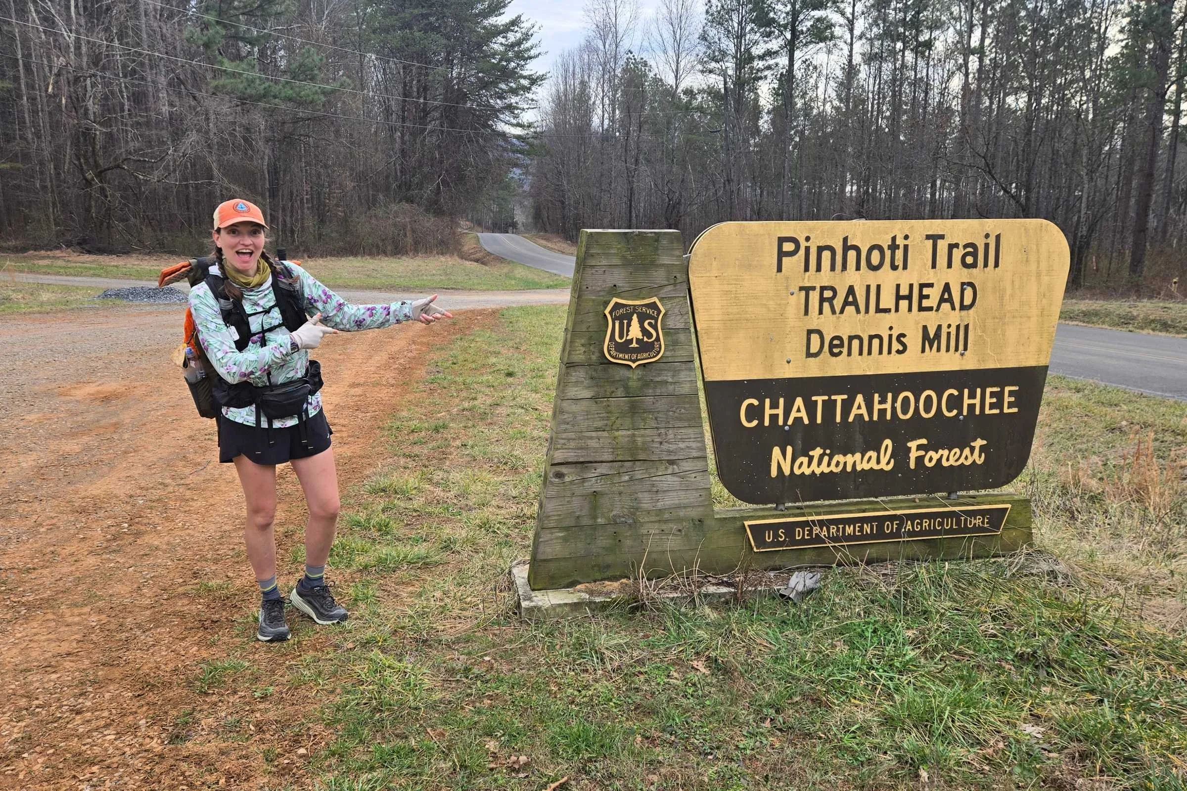
Chattahoochee National Forest and Cohutta Wildlife Management Area
Dennis Mill Trailhead was a beacon of hope as we reentered the pine forest after a long day of pavement. Rain came in overnight, and we had the first of a few wet feet creek crossings. The forest here over rolling terrain felt dense and green as compared to ridgelines of prior sections. Light green pine trees rose high above lower dark green rhododendrons. Creek crossings were frequent, though could be done mostly on logs and rocks.
From the dense valley of Baker Branch, the trail starts to rise again towards Tatum Mountain. Trees suddenly open up for views to the east before the sudden appearance of newly constructed million dollar tree-house inspired vacation homes. A quick turn to single track, a road walk to Cohutta Overlook (worth the side trip), and single track mountain bike trail near Mulberry Gap Adventure Basecamp places hikers into Cohutta Wildlife Management Area.
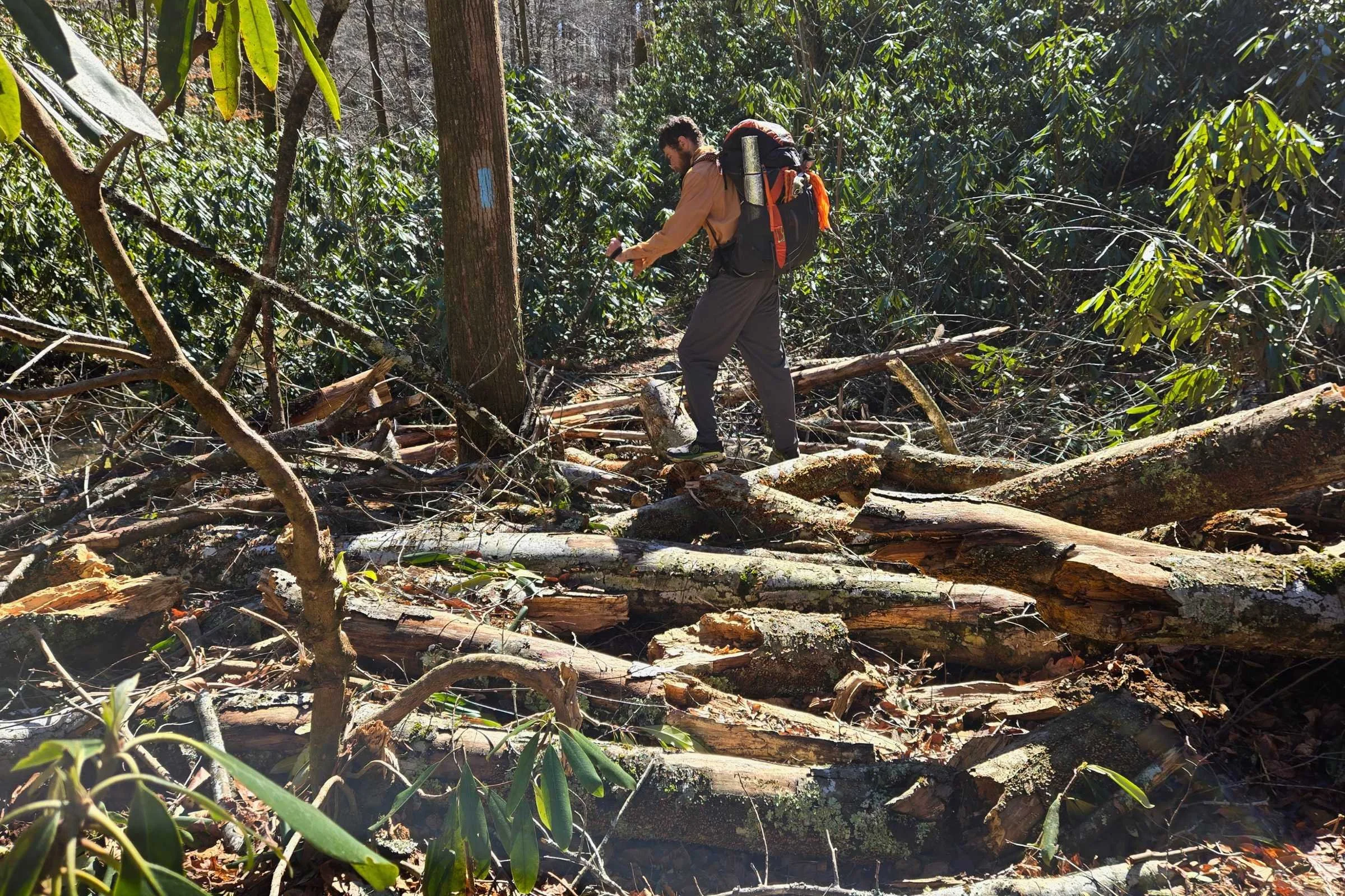
In Cohutta WMA, the trailway takes a turn for the wild. This last section feels like the least maintained of the entire trail, with downed trees, overgrown thorny brambles, and multiple wet water crossings. As rough as the last bit of trail was, I really enjoyed the last 40 miles of Pinhoti past Dalton.
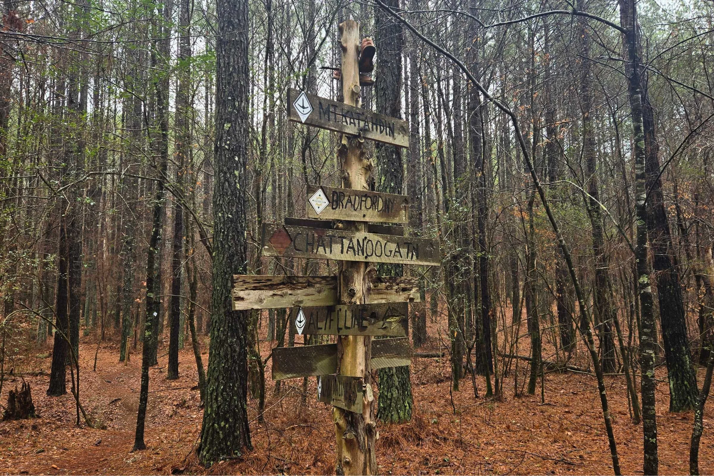
After 350 miles, the northern terminus sign stands humbly, slightly hidden in the knotted branches of rhododendron. For an additional 0.7 miles for the day, we backtracked to the South Fork Trail junction to access Harkins Creek, our last campsite of the Pinhoti Trail adventure. Our shoes froze overnight as a goodbye. Our shuttle driver, Richard, arrived early the next morning to cart ourselves and frosty tents 2.5 hours away to our car parked in Cave Spring.
Favorite places to eat
A stop at L’Acosta Mexican Restaurant in Sylacauga, AL is a thru-hiker's must. Amazing food, lovely people, with hiker-sized portions and prices. They are vegetarian and vegan friendly. L’Acosta is a favorite for locals and hikers.
In Cave Spring, GA, (NOBO mile 190) I have a few recommendations. During our trip we ate twice at Local Joe’s BBQ. Everything was fantastic at Local Joe’s, including the vinegar slaw, mac and cheese, smoked turkey with white sauce (white BBQ sauce being an Alabama specialty), and their heaping pulled pork sandwich. Stop by Spring Brew Coffee Company for to-go breakfast, chai latte, coffees, and ice cream flavors.
Additionally, there are two Cave Spring honorable mentions that we missed this trip but have great hiker reviews on FarOut. Southern Flavor is an All You Can Eat Catfish Restaurant with classic southern cooking. For those feeling classy in trail runners, Linde Marie’s Steakhouse comes highly recommended to celebrate the Pinhoti mental halfway point.
Dalton, GA, (NOBO mile 285) is home to a menagerie of chain and fast food establishments. This is a funny one, but I’ve got to shout out the LongHorn Steakhouse lunch specials. After a long day’s hike into Dalton, LongHorn was the perfect place to wait for our hotel check-in time and eat a burger and fries. The friendly staff said many Pinhoti hikers stop there for a celebratory end-of-trail steak.
Gear discussion
Tent
I used the Durston X-Mid 1 as a tarp only set-up. Tarping was colder than having a second layer inner, but worked well for space and weight reasons. It's a winner in our Best Ultralight Tents guide. See our Best Backpacking Tents guide for more recommendations.
Backpack
The Six Moons Designs Minimalist V2 with a vest harness was my pack of choice for this trip and it worked well. I loved its many pockets for organization. See our Best Backpacking Backpacks guide for more recommendations.
Sleeping Bag
I used an Enlightened Equipment Enigma 20 Degree Sleeping Quilt as my primary sleeping bag, and carried an additional Hammock Gear Burrow Top Quilt during the coldest first week of trail. This dual-quilt system helped me to adapt to below freezing temperatures using gear I already owned. See our Best Sleeping Bags story and Best Sleeping Quilts story for more recommendations.
Sleeping Pa
My Therm-a-Rest NeoAir XLite NXT Sleeping Pad, paired with a tyvek groundsheet, kept me warm and off the ground at night. See our Best Backpacking Sleeping Pads or our in-depth review of the NeoAir XLite NXT sleeping pad story for more recommendations.
Trekking Poles
I continue to use my Leki Legacy Lit Cor-Tec Trekking Poles. While this model is discontinued, I’m a fan of these aluminum Legacy Lite poles with cork grips and long lasting tips. I also use trekking poles to set up my tent. For more recommendations, see our Best Trekking poles story.
Cooking System
I used the OLicamp Titanium 750ml Space Saver Mug paired with an OLicamp Kinetic Ultra Titanium Stove. I’ve found the OLicamp titanium pot to be slightly thicker for the reduction of burned meals. The stove is lightweight, but appears to be not as fuel efficient in windy or cold environments as compared to other options. See our Best Backpacking Stoves story for more recommendations and our Best Cooking Pot section for our recommendations.
Headlamp
I carried the Nitecore NU25 360 headlamp. This light is lightweight, packable, and rechargeable. With early sunsets, we did a small amount of night hiking on the Pinhoti Trail. The Nitecore NU25 UL MCT 400 Lumen is Version 2 of this headlamp. See our recommendations in our Best Headlamps guide.
Satellite Messenger
Cell reception was strong on most ridgelines and often weak in mountain valleys. I did not carry my Garmin inReach Mini for this hike but strongly recommend the inReach Mini 2 or inReach Mini 3 Plus as a satellite messenger. See our Best Personal Locator Beacon and Satellite Messenger guide.
Food Storage
For this trip I used a LiteAF Dyneema Flat Bottom Bear Bag as black bears were not expected to be a concern. An Ursack Major Bear Sack or Ursack AllMitey Bear and Critter Sack would also work well to protect food from mice and small critters.
Water Filter
I used the Platypus QuickDraw water filter with a CNOC 2L Vecto, and carried a 1.75L liter capacity in waterbottles. We often dry camped on the Pinhoti, with water plentiful in mountain valleys and scarce on high ridgelines. Check out our guide to the Best Water Filters and Purifiers for Backpacking.
Umbrella
Given the winter rains in Alabama, I carried a Zpacks Lotus UL Umbrella. A luxury item, the umbrella provided shelter while on the move to keep myself and gear dry(er) in colder temperatures. See our Best Hiking Umbrellas guide for more recommendations.
What to wear
Shoes or Boots
Topo Athletic Vista trail runners (womens and mens) with high cushion were well suited for the longer road walks and rocky terrain. The lugs gripped well on fallen leaves, pine duff, and mud. For more recommendations, see our Best Trail Running Shoes guide.
If you’d feel more comfortable in boots, check out our Best Hiking Boots guide or our Best Lightweight Hiking Boots guide. With the uneven terrain, a nice footwear compromise for this trip could be hiking shoes, which are designed to feel like a trail runner but have stability more like a boot. See our Best Hiking Shoes guide for footwear that has more durability and stability than trail runners.
Rain Jacket and Rain Pants
I used the Frogg Toggs Ultra-Lite waterproof rain jacket and pants for warmth, wind, and rain protection. After the first week, the rain pants were left behind. For more recommendations, see our Best Lightweight Rain Jackets guide.
Down or Synthetic Insulating Jacket
My Montbell Superior Down Parka remains one of my favorite pieces of gear. This down jacket is lightweight, packable, and provides amazing breathable insulation during long breaks and in camp. See our recommendations in our Best Synthetic Jackets guide. If you prefer down for its better warmth-to-weight ratio, check out our Best Down Jackets guide.
Fleece or Midlayer
I wore an Alpha Direct 90 Fleece from Tumble On Outfitters daily as a breathable, lightweight, and packable midlayer. I like that I can hike longer in an Alpha Direct layer without overheating as compared to thicker grid fleece midlayers. Find more of our favorites in our Best Midlayers and Best Fleece Jackets guides.
Sun Shirt
A Town Shirt Trillium Print Sun Hoodie was the perfect balance for warmth in the cold, and breathability on warmer days. I really enjoy how well this shirt layers. See our Best Sunshirts guide for more recommendations.
Hiking Pants
Body Wrapper Ripstop Pants are my go-to layering pant for lightweight protection. They pack down small, dry fast, and weigh under 4.0 ounces. While these are more of a wind pant, see our guides to the Best Women's Hiking Pants and Best Men's Hiking Pants for more recommendations.
Hiking Shorts
Brooks Chaser 3” 2.0 Running Shorts are lightweight, flowy, and include a liner that stays in place. Most notably, the Chasers don’t have a waistband zipper pocket to rub against a pack hipbelt.
For more recommendations, see our Best Men's Trail Running Shorts guide, Best Women's Trail Running Shorts guide, Best Men's Hiking Shorts guide, or Best Thru-hiking Shorts guide.
Base Layer
The tasc Performance Merino Fusion Base Layer top and bottoms offered a good mix of stretch and warmth. It’s important to be able to layer base layers as needed for hiking and at camp. For more recommendations, see our Best Base Layers guide. For base layer bottoms, see our Best Men's Long Underwear or Best Women's Long Underwear guides.
Hiking Socks
Darn Tough Micro Crew Lightweight with Cushion Hiking Socks are my go-to for comfort and durability. I’ve also been really enjoying Feetures Merino 10 Max Cushion Mini Crew socks for their soft anatomical fit. Check our Best Hiking Socks guide for more recommendations.
Warm Hat
I used a combination of neck gaiters and fleece hats to keep my head warm. It was critical to pack multiple warm accessories for this winter thru-hike.
Sun Hat
I used a Pinhoti Trail Trucker hat purchased from the POC. Any comfortable hat will work to block the sun and rain. With bare winter trees and long road walks, the sun could be quite bright. I opted to leave the sunglasses at home. Check out our Best Sun Hats guide for more recommendations.
Gloves or Mittens
Outdoor Research Flurry Sensor Gloves kept my hands warm even in damp conditions. For more recommendations on lightweight but warm gloves, see our Best Winter Gloves guide.
Miscellaneous gear items
Maps
USGS Paper Map (updated 2014)
Conservation Fund Downloadable Map
Mapping Apps
Pocket Knife
This Derma-Safe Folding Knife is all I need to open boxes and food packaging.
Insect Repellent
In cold weather, biting insects including mosquitoes and ticks are not as much of a concern. I did not carry insect repellent on the Pinhoti. However, insect populations will continue to build through March and April. I prefer to hike with Sawyer Picaridin Insect Spray or Sawyer 20% Picaridin Insect Lotion, as well as treating hiking outfits with Sawyer Permethrin Fabric Treatment.
Why you should trust us / About the author
Kate Riley “Big Catt” is a thru-hiker and runner currently located in the Appalachian Mountains of Western North Carolina. She comes from a technical background in Environmental Geology before pivoting to outdoor recreation. She works with Blue Ridge Hiking Company as a hiking guide and AT hostel caretaker.
Kate thru-hiked the Appalachian Trail southbound in 2022 and the Continental Divide Trail northbound in 2024. She has also backpacked the Foothills Trail, Northville-Placid Trail, sections of the Fingerlakes Trail System, and the Pinhoti Trail.