Foothills Trail Backpacking and Thru-Hiking Guide
A 77-mile trail for hikers looking for an intermediate shake-down hike, yet demanding in elevation

January 8th, 2026
Home → Trip Guides → Backpacking
Distance: 77 miles (122.6 km)
Days: 5-10 days
Elevation gain/loss: 18,308 ft gain (Gaia GPS); 24,040.7 ft gain/23,444.6 ft loss (FarOut)
Best seasons: Spring and Fall
Permits: None required
Difficulty: Intermediate
Trail Stewardship: Foothills Trail Conservancy (FTC)
The Foothills Trail was my first solo backpacking trip of more than 20 miles and 3+ nights. Trail selection was a big deal. This 77-mile non-motorized footpath quickly became my top choice as a first thru-hike for a few reasons:
I could complete it within a week of vacation from work.
It’s known to be well-maintained and well-supported. AKA, it felt safe.
Multiple digital and paper navigation options (free and paid).
It can be hiked in one push with no re-supply needed.
Convenient trailhead shuttles.
It’s impressive that every consideration on that list proved true. If you are looking for a shorter point-to-point route that will hold a special place in your heart… consider the Foothills Trail.
We create reader-supported, objective, independently-selected gear reviews. This story may contain affiliate links, which help fund our website. When you click on the links to purchase gear, we may get a commission — without costing you an extra cent. Thank you for supporting our work and mission of outdoor coverage for every body! Learn more.

Views of Bad Creek Reservoir and Lake Jocassee from the north. Photo by Kate Riley.
What to Know
The Foothills National Recreation Trail (FT) skirts the southern extent of the Blue Ridge Mountain Range, following the western border of North and South Carolina. The escarpment is an area of geologic transition extending north-south from Georgia to Virginia, where the Appalachian Blue Ridge Mountains rise quickly from the rolling foothills of the lower Piedmont Plateau.

The FT is known for its many bridges and waterfalls. Photo by Kate Riley
The Foothills Trail Conservancy explains its history in greater detail here. I recommend giving the history a read. It explains how, in the early 1970s, the original Foothills Trail Conference was assembled to collaborate with Duke Energy/Crescent Land and Timber Company in developing a recreational trail for the purpose of protecting these beloved scenic mountains from further development. The FT was built in partnership from 1974 through 1981.
It’s a hike for backpackers looking for an intermediate shake-out (also called a shake-down), yet demanding in elevation for those seeking a quick challenge in section or thru.
It’s said that the Foothills Trail is great prep for the Appalachian Trail; as someone who has hiked both trails, I think that is an accurate assessment given the clear maintained pathway, rolling terrain, and iconic Blue Ridge vegetation. However, my mind refuses to box them together, each special in distinct ways.
Gear checklist
Here is a summary of the gear I used or recommend for the Foothills Trail. I discuss my selections in detail below.
| FOOTHILLS TRAIL GEAR | OUR PICK(S) | OTHER OPTIONS |
|---|---|---|
| Hardgoods | ||
| Tent | Zpacks Altaplex Classic Tent Durston Gear X-Mid 1 |
Best Backpacking Tents Best Ultralight Tents |
| Backpack | ULA Ohm Backpack Durston Gear Kakwa 40 |
Best Lightweight Backpacks |
| Sleeping bag/ quilt | Hammock Gear Burrow Quilt (10F) | Best Backpacking Sleeping Bags Best Backpacking Quilts |
| Sleeping pad | Therm-a-Rest NeoAir XLite NXT Sleeping Pad | Best Sleeping Pads For Backpacking |

From Oconee, eastbound hikers are pulled towards Sassafras Mountain. Photo by Kate Riley
Highlights
Remote and quiet trail that feels accessible.
Incredible views of the Chattooga River, Lake Jocassee, and the Blue Ridge Foothills.
Sassafras Mountain (3,547 feet), the highest point in South Carolina.
Spacious campsites that are tent and hammock-friendly.
Frequent footbridges allow feet to stay dry.

A backpacker overlooks the blue Carolina Foothills. Photo by Dan Hupp.
Challenges
Limited re-supply options. While access points are frequent, hitches to nearby towns would be long and inconvenient.
No lean-to shelters mean limited shelter options in bad weather.
The FT can be surprising in elevation gain/loss if you haven’t been training in similar topography. Every section presents a fun challenge in terrain.
Lots of stairs! While trail infrastructure reduces erosion for sustainable maintenance, stairs with a heavy pack don’t always make life easier.

Blooming wildflowers are a perk of hiking in the spring. Photo by Kate Riley
Best Season
It’s a hike that can be completed year-round since it is at a lower elevation than many other trails in a place that experiences moderate winters. The best seasons are spring and fall for cooler temperatures, fewer insects, and scenic views. I hiked from March 21-27 and enjoyed that time of year.
Winter: cooler temperatures with the chance of light snow into March. Low winter foliage provides clearer mountain views.
Spring: cool to warm temperatures with wildflowers blooming in April to May.
Summer: humid to hot temperatures with dense greenery. Rhododendrons bloom in May to June. Mosquitoes can be present in low-lying wet areas.
Fall: cool to warm temperatures with colorful fall foliage in November.

Painted white blazes mark the FT pathway. Photo by Kate Riley
Difficulty and Skills
Navigation
Painted white blazes note the FT in both directions. The blazes are frequent and easy to follow. Trail junctions and designated campsites are well-signed. Mobile service can be spotty so be sure to have offline maps or backup sources of navigation.

Cruisy terrain makes the FT great for trail running or fastpacking. Photo by Kate Riley
Terrain

The FT is known for its stairs, such as this descent to Horsepasture River. Photo by Kate Riley
The footpath is a rewarding balance of clear soil or rocky footpath mixed with a handful of good climbs.
Almost every stream crossing has a footbridge to avoid getting your feet wet. However, the wooden walkways can be slippery after rain. Mistaken confidence led me to lose my footing a few times.
Elevation Gain/Elevation Loss
The FTC does not have an official elevation gain/loss for this route. Most GPS tracks provide a slightly different estimate. According to the current route on Gaia GPS app, my mileage for the seven days spent hiking ranged from 7.6 miles to 15.5 miles going eastbound. Elevation per day was the lowest at the beginning of the hike at 1,360 feet of gain, and increased steadily to almost 4,000 feet in a day in sections towards the middle and end. Generally, the steep short climbs are terraced with stairs instead of switchbacks and long ascents/descents are well-graded.
As I had a full week of vacation and set drop-off/pick-up dates, I took my time to complete the Foothills Trail. Coming from flatter Upstate New York, the elevation was more challenging than I expected, while remaining navigable for arriving at camp at a decent time.
Headed westbound from Table Rock is a different story. The climb from Table Rock Trailhead (1,150 feet) to Pinnacle Mountain Spur (3,115 feet) over four miles, and then to Sassafras Mountain (3,553 feet) can be less forgiving. You’re golden after you get those out of the way!
Permits
No permits are required to walk the Foothills Trail.
The FTC does require day and overnight hikers to register at three trail access points. Registration kiosks are located at Oconee State Park, Frozen Creek at Gorges State Park, and Table Rock State Park.

The FarOut App notes neat features with waypoints like this section of the trail routed through giant boulders. Photo by Kate Riley
Route Summary
I walked the Foothills Trail eastbound, from Oconee State Park to Table Rock State Park. Hikers often complete this trail in both directions. I found the terrain heading eastbound enjoyable, allowing my body and mind to ease into the hike. The climbs and views steadily pick up eastbound for a sweet (almost) finale at Sassafras Mountain.

The author and her friend Kelsey at the Oconee terminus sign. Photo by Kate Riley
Oconee State Park
My friend Kelsey joined me for a one-night section for her first backpacking experience. We parked her car at Burrells Ford Access and met with Heyward Douglas, who at the time was a volunteer shuttle driver and FTC Board Member. On our drive to Oconee, Mr. Douglas pointed at FT cross points along SC Route 107 while providing helpful advice on what to expect for wildlife, camping, and scenery.
Oconee State Park in the northwestern corner of South Carolina has an improved campground and two lakes. Tent sites within walking distance to the trailhead may be available before or after the hike; however, I’d recommend contacting the park to make a reservation or confirm availability. Long-term parking is available for a per-day fee.
Most Foothills Trail hikers won't see much of the park as their focus is on a small paved parking area where a wooden sign notes the western terminus of the route. The FT stays in the Oconee State Park for just over a mile.
Sumter National Forest
The pathway remains smooth as it passes through rhododendrons and deciduous forest. We kept the first day easy with eight miles of cruisy trail after a mid-day start. Camp was set up at a site near Licklog Falls with plenty of time to enjoy dinner and play a few rounds of cards. This was the coldest night on the trail with temperatures lowering to 40° Fahrenheit.

The Chattooga River bank has sandbars and flat rocks to take a quick break. Photo by Kate Riley
The theme of this section is the Chattooga River as the trail zig-zags along the teal-blue water. The pathway started to get more technical compared to the day prior, often narrowing over rocks and roots. Near Burrells Ford we found King Creek Falls to be worth the 0.6 mile out & back side trip before parting ways at the Burrells Ford parking area—Kelsey to head home after another eight-mile day and myself to set up camp at Burrells Ford.
Burrells Ford Campground is a no-fee Forest Service campground open year-round to visitors along the Chattooga River. River access, elevated tent sites, picnic tables, and a clean vault toilet made this luxury camping. This is likely a popular spot for car campers in summer months.
From Burrells Ford, I started the first ridge climb up Medlin Mountain with scenic views to enjoy along the way. At Sloan Bridge Access Picnic Area there is a pit toilet before crossing SC Route 107.

The cascades of Upper Whitewater Falls can be seen in the distance. Photo by Kate Riley
Whitewater Falls
After SC107, the trail curves in and out of South and North Carolina, touching Sumter, Nantahala, and Pisgah National Forests. Charred trees, dense smokey air, and hot sun remained as evidence of a recent burn on the ridge between Sloan Bridge Access and Whitewater Falls Access.Along this ridge you can spot the first glimpses of the Bad Creek Reservoir and Lake Jocassee.
At the Whitewater Rd./Upper Whitewater Falls Access point, a small gravel parking area sits along SC281. The road or a spur trail can be used to reach the Whitewater Falls National Forest parking to the north. I continued directly along the FT where rocks and wooden steps lead down to the Whitewater River.
A footbridge sits in the river valley where hikers get a great view of North Carolina’s Upper Whitewater Falls cascading down 411 feet in the distance. Downstream, a one-mile spur trail provides access to view the 400-foot-high Lower Whitewater Falls of South Carolina. I did not venture to the Lower Whitewater Falls overlook. I stopped to solo camp at the Whitewater Campsite just before dark after a 15-mile day.
No camping is allowed in the Duke Energy Whitewater Falls corridor from SC281 to the Bad Creek/Lower Whitewater Falls Access trail. This 2.9-mile section of restricted camping is well-signed.

The Toxaway River Suspension Bridge in Gorges State Park, NC. Photo by Kate Riley.
Toxaway Gameland & Gorges State Park
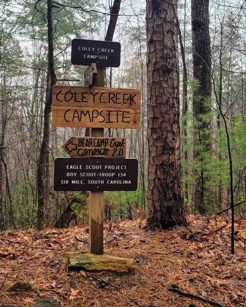
Footbridges become a common theme in this section. I crossed with ease over the Thompson River and Bearcamp Creek before hitting the mile 38.1 halfway point sign. At Horsepasture River, flights of wooden stairs head down to the river before the staired ascent up.
Power lines mark the Foothills Trail entrance into Gorges State Park. Expect a knee-busting 620-foot descent along a wide path shortly before Toxaway River.
The Toxaway River suspension bridge, originally built in 1981 and refurbished by Duke Energy in 2019, spans 225-feet. After a 15-mile day, the Toxaway Campsite along the river just past the bridge was one of my favorites. The amenities of individual campsites include elevated tent pads, picnic tables, and campfire rings. After a quick rinse in the water of Toxaway Creek, three other eastbound thru-hikers welcomed me to their campfire at a neighboring site.

Nearing the top of Heartbreak Ridge, going eastbound. Photo by Kate Riley.
The ever-dreaded Heartbreak Ridge at Mile 49 separates Toxaway Campsite and Rock Creek Campsite.This is an unavoidable climb of 300 steps up and then 300 steps down over one mile. With cooler morning weather, tiered sections, and a few “photo” breaks, I found the challenge of Heartbreak Ridge to be fun and somewhat over-hyped!

Backpackers head away from the shelter of this rock outcropping. Photo by Kate Riley.
Laurel Fork & Jocassee Gorges Management Area
Bearcamp Creek Campsite to Laurel Valley Access felt the most remote of any section, with no major road crossings or easy bail-out spur trails. At Laurel Fork Falls I spent a few hours under a dry rock outcropping—one of the few covered places on the FT—with the folks I’d camped next to the night before. Together we waited out the worst of a severe thunderstorm before slopping through the flooded trail to camp at Virginia Hawkins Falls—8 miles complete for the day. With almost 10 hours of thunderstorms from noon into the early morning, I was happy to be camping in a group. My Garmin inReach was invaluable for weather updates.
Slow to rise, I was surprised after such a chaotic night to see a few day hikers out on Forest Service Roads enjoying the bright morning sun.

The view from Sassafras Mountain at dawn. Photo by Kate Riley.
Chimney Top to Sassafras Mountain
The road crossing at US-178 offers a large parking area to the west down Horse Pasture Road. The trail to Chimney Top Gap and then Sassafras Mountain is not exceedingly steep, but it does feel endless. A few unique rock outcroppings guide the way.
Sassafras Mountain at FT Mile 66 is the highest point in South Carolina (3,553 feet). The observation tower, built in 2019 and split in half by the SC/NC border, provides a full-range view of the Appalachian Blue Ridge Mountains to the north and foothills to the south. In clear conditions you’ll see the regional bluish haze of the mountain range, linked to the release of isoprene into the atmosphere from forests dense with oak and poplar trees. The Sassafras Observation Tower is vehicle accessible and welcomes visitors from sunrise to sunset.
Near here, hikers can leave the FT and follow a blue-blaze trail to Caesars Head State Park in Upstate South Carolina. The FT shares access rights of the Caesars Head Spur Trail with the Palmetto Trail.
I stayed the night at Cantrell Campsite after a 10-mile day—the campsite busy with weekenders—and backtracked the mile to watch the sunrise from the summit of Sassafras Mountain for an unforgettable experience.

A calming view from Bald Knob. Photo by Kate Riley
Table Rock State Park
From Cantrell, the trail works its way along the rocky escarpment. Exposed bedrock and waterfalls pepper the trail to the left with a steep drop providing open views to the right. One shallow stream crossing has a cable to guide hikers over the slippery rock face. Lighthouse and Long Ridge Campsites are the last tent sites before the no-camping zone of Table Rock State Park.
Just past Pinnacle Mountain, the open rock of Bald Knob (2,849 feet), offers jaw-dropping views of rolling foothills to the south. Along a well-trodden trail I soon reached Table Rock State Park Nature Center to head home; with the urge to resupply, turn around, and do it all over again.

Maps and Guidebooks
FAROUT
The FarOut Foothills Far Out Trail Guide is the official navigation app for the Foothills Trail. FarOut has GPS-enabled offline maps, detailed waypoints, elevation profiles, and water source information.
In 2021, a FarOut map for the Foothills Trail had not yet been released. I enjoyed navigating with other sources discussed below. However, the FarOut map notes additional features, like remote cemeteries or fun rock features, that I walked right by without recognizing their significance. For these reasons, I’ll use FarOut for future hikes of the FT.
MAPS
The Official Map of the Foothills Trail was my primary source of navigation. The double-sided map includes an elevation profile, designated campsites, water sources, access points, and spur trails.

The official FT Guidebook and Trail Map can be purchased on the FTC Website.
GUIDEBOOKS
The Foothills Trail Guidebook, Golden Anniversary Edition, includes trail descriptions, fold-out maps, and historical information on the trail. Directions are provided in west-east and east-west orientations. Before I started the hike, I reviewed the guidebook and brought pages with me as a backup; however, I found myself navigating with the official paper map instead of guidebook pages while on the move.
For geology nerds like myself, a Geology Guide is also available through the FTC website for a geologic history of the trail from start to finish.
OTHER APPS
Gaia GPS and the onX Backountry also allow for offline GPS-enabled navigation. These maps do not include as much detail for campsites or water sources.

Getting There
By Plane
I flew from Buffalo, NY to Charlotte Douglas International Airport (CLT) in North Carolina. However, flying into Hartsfield-Jackson Atlanta International Airport (ATL) in Georgia will offer the most frequent and affordable flight options.
Getting to terminus trailheads from either airport will take 2 to 3 hours by car, meaning that you’ll have to find a friend, bus, or shuttle driver to connect the distance. I was lucky to have a friend in Charlotte host and then drive me to and from the trail.
Greenville-Spartanburg International Airport (GSP), SC and Asheville Regional Airport (AVL), NC are smaller airports that are closest to the trail and offer several airline options. Airline tickets are likely pricer but shuttles are easier to arrange. Getting to the terminus trailheads from GSP and AVL takes 50 to 90 minutes. Shuttle drivers may have preferred airports.
Time to trailhead from airports:
Charlotte Airport to Oconee: 2 hour and 45 minute drive
Charlotte Airport to Table Rock: 2 hour 5 minute
Atlanta Airport to Oconee: 2:22
Atlanta airport to TAble Rock: 2:40
Greenville Airport to Oconee: 1:24
Greenville to Table Rock: 0:50
AVL to Oconee: 1:25
AVL to Table Rock: 0:50
By Car
It takes about 50 minutes (40 miles) to drive from Oconee State Park to Table Rock State Park.
All trailheads and terminus locations are easily accessible by car. Parking areas are common and well-maintained. As discussed above, the trail is within a couple hour drive from several nearby cities, leading this to be a hike that is very easy to access for sections or a thru attempt.
Bus
FlixBus and Greyhound offer bus service from Charlotte and Atlanta to the nearby cities of Greenville, SC, and Clemson, SC.
Shuttle Services
Shuttle information can be found on the Foothills Trail Conservancy Facebook page, the Foothills Trail Hiking Facebook page, and the FarOut app, including contacts for volunteer shuttles and commercial shuttles. I arranged a shuttle about a month in advance for Burrells Ford Access to Oconee State Park. Volunteer drivers should always be reimbursed fairly for time and miles. Cash is recommended.

Table Rock State Park Visitor Center. Photo by Kate Riley
Parking
Day use and overnight parking fees are required for those leaving cars at Oconee State Park, Table Rock State Park, and the U.S. Forest Service parking area at Whitewater Falls. Valid parking permits must be visible. Cash and cards are accepted at the State Parks.
Oconee State Park: $5 per day for overnight parking. Permits can be obtained at the Park Entrance, or Visitor Center/Park Office during regular office hours.
Table Rock State Park: $6 per day for overnight parking. Permits can be obtained at the Table Rock State Park Visitor Center/Headquarters located south of SC Route 11.
U.S. Forest Service Parking at Whitewater Falls: $3 per day for overnight parking. Fee stations with permit envelopes are located in the parking area.
A small gift shop inside Table Rock State Park Visitor Center offers snacks, cold beverages, and Foothills Trail memorabilia.

The author at Table Rock State Park’s eastern terminus sign. Photo by Kelsey Magraw
Trailheads
Frequent access points allow the FT to be enjoyed in 14 individual sections. Major access points include:
Oconee State Park (mile 0): paved parking area. Bathhouse in the improved park campground.
Burrells Ford Access (mile 16.5): large gravel parking area and a pit toilet.
SC-107/Sloan Bridge Access (mile 24): paved parking lot, picnic area with tables, and a pit toilet.
NC-281/Upper Whitewater Falls Access (mile 28): large gravel parking area. Large Forest Service parking to the north with heated restrooms, flush toilets, and bear proof trash cans.
SC-130/Bad Creek & Lower Whitewater Falls Access (mile 31.4): 0.7-mile spur trail with a large parking area near the Duke Energy Bad Creek Hydroelectric Station.
US-178/Laurel Valley Access (mile 62): large gravel parking area.
Chimneytop Gap Access (mile 64): shoulder parking to the north.
Sassafras Mountain Observation Tower (mile 66): medium parking area with a pit toilet and trash cans.
Table Rock State Park (mile 76): large parking area, restrooms/showers, primitive walk-in tent sites, and reservation-based improved campsites.
Mileage estimates are from FarOut headed eastbound.

Exploring Pickens, SC with a chai tea latte is a post-hike highlight for the author. Photo by Kate Riley.
Post Trip Meal
On the way back to Charlotte, we stopped in Pickens, South Carolina for a meal and caffeinated drinks from local spots in this small city of southern charm. Pickens is about 13 miles south of Table Rock State Park by car. I’m always keen to support local after a backpacking trip!
Regulations
Follow Leave No Trace Ethics, including pack-it-in, pack-it-out for waste, and going bathroom far from paths and water.
Non-aggressive dogs are allowed on the FT. It’s best practice for pets to be on leash when approaching others, kept away from drinking water sources, and waste properly buried.
Respect land use agreements by not camping in restricted zones along the Whitewater Falls Corridor, Sassafras Mountain Summit, and Table Rock State Park Trail System.
Resupply
I reduced my food carry by two days, leaving a majority of my food in a car parked overnight at Burrells Ford, located about 1/3rd of the way through my hike.
There are few resupply options on this trail due to its mountain remoteness. Most hikers carry food for the entire length or arrange food caches. Shuttle drivers can often help set up cache locations.

The riverside Toxaway Campsite. Photo by Kate Riley
Camping
Primitive camping is allowed along a majority of the Foothills Trail. Camping is not allowed along the Whitewater Falls Corridor, Sassafras Mountain Summit (video-monitored), and the Table Rock State Park Trail System. These zones are well-posted.
I camped in designated group campsites and found them to be generally flat with good water, clear of debris, and working bear cables. A lovely surprise was that the trail in March was not as busy as I expected. Most nights were spent near one or two other hikers.
For those who prefer solitude, there are many dispersed or “stealth” campsites. Dispersed camping is allowed along the FT except in restricted zones. Dispersed sites are noted on the FarOut App.
This is a hard trail to get lost on as junctions are well-signed. Photo by Kate Riley
Water Planning
Water is plentiful along the Foothills Trail from streams, springs, and cisterns. Spur trails to reliable water sources are marked along the trail with blue reflectors on wooden posts.
I followed the water sources noted on the paper Official Foothills Trail Map or filtered from streams and carried two plastic bottles for a 1.70-liter capacity.
You may run into short dry stretches along ridges or in seasons of low rain. Always filter water collected in the wild along this trail. See our Best Backpacking Water Filters and Purifiers guide for recommendations.

The author spotted a few blooming Oconee Bells in Gorges State Park, NC. Photo by Kate Riley
Bears & Wildlife
Bear canisters are not required, but are recommended for the FT. Bears are present in the area and the FTC provides bear cables at many of the designated campsites for bear and hiker safety. I did not see active evidence of bears. Nights were calm except for a few lively armadillos at Burrells Ford. For bear canister recommendations, see REI’s Food Storage story or REI’s Bear Canister story.
A rare, early budding wildflower is the Oconee Bell which blooms from mid-March to April. The Oconee Bell is special to the southern Appalachian mountains, found only in specific locations in NC, SC, and GA. In addition to wildflowers, expect dense Appalachian greenery with rhododendron tunnels and towering hardwood trees.

King Creek Falls is a must-see in my book! Photo by Kate Riley
Side Trips & Variations
Several alternate routes and spur trails are located along the Foothills trail for access to waterfalls, gorges, and parking areas. If I were to hike the FT again, I could see myself exploring a few more spur trails for added adventure and views.
Mile 15.9: King Creek Falls is worth the short out & back near Burrells Ford.
Mile 17-23.6: Chattooga Spur Trail/Fork Mountain Trail is an 11.5-mile connector route with campsites along the Chattooga River.
Mile 36: Spur trail to Hilliard Falls, named after Glenn Hilliard in 1989, the FTC founding Chairman and FT Co-Founder. While I didn’t hike this, FarOut comments show reports of camping, swimming, and flat rocks.
Mile 66: The 14.2-mile Caesars Head Spur Trail connects to Caesars Head State Park and doubles as a passage for the Palmetto Trail, a mostly complete 500-mile passageway across South Carolina.

The charred trees from a prior fire closure in 2021. Photo by Kate Riley
Trail Updates
Trail closure and condition information is updated here on the FTC website. The page includes a form to report trail maintenance issues. The FTC is also on Facebook, Instagram, and has an active Facebook FTC Hiking Group.
Wildfire and controlled burn closures do affect the FT. Use the above online resources and posted trailhead information to travel safely. Backup options include an Art Loeb Trail thru, or sections of the Palmetto Trail, Mountains-to-Sea Trail, or Bartram Trail.
GEAR FOR THE FOOTHILLS TRAIL

Campers start to pack up after a stormy night at Virginia Hawkins Falls Campsite. Photo by Kate Riley
Tent
I used the Durston Gear X-Mid 1P trekking pole tent for this trip. I like that this tent is lightweight, can fit into small campsites, and doesn’t leak in heavy rain. I’ve since switched to a Zpacks Altaplex one-person tent for increased internal space. See our Best Backpacking Tents or Best Ultralight Tents guides for more recommendations.
BACKPACK
I used the Durston 40L Backpack for this trip. I enjoyed the waterproofing of X-pac material. I’ve since switched to a ULA OHM with S-Straps that is lightweight and equally handles rugged terrain. See our Best Lightweight Backpacks guide for more recommendations.
SLEEPING BAG/QUILT
I used a Hammock Gear Burrow Quilt with a 10-degree temperature rating. This temperature rating worked well for the cooler first night and was too warm for the remainder of the nights. See our Best Sleeping Bags or Best Backpacking Quilts stories for more recommendations.
SLEEPING PAD
I used the Therm-a-Rest NeoAir XLite Sleeping Pad in short. I love this pad because it’s lightweight, warm, and the perfect length for me being 5’9” tall. It’s comfortable on the ground and wooden shelter floors. The current model offers an improved construction for less noise and four size options. See our Best Backpacking Sleeping Pads story for more recommendations.
TREKKING POLES
I used my Leki Legacy Lite Cor-Tec Trekking Poles, which are now discontinued. Trekking poles were helpful for grip and going up/down the numerous stairs. I also use trekking poles to set up my tent. For more recommendations, see our Best Trekking Poles story.
COOKING SYSTEM
I used an ultralight titanium canister stove, a TOAKS 650ml Titanium Pot, and TOAKS Long Handle Spoon. I like to use the pot lid as a cutting board and the spoon edge for slicing blocks of cheese. An alcohol stove would have also worked well. See our Best Cooking Pot and Best Backpacking Stoves for more recommendations.
HEADLAMP
I carried the Nitecore NU25 360LM headlamp. While I didn’t do much night hiking on this trip, I like that this rechargeable headlamp is compact with easy red and white light settings. This lamp has always performed well for me in the rain and snow. Version 2 of this headlamp, Nitecore NU25 400LM, is USB-C rechargeable, offers more light settings, and a longer runtime. See our recommendations in our Best Headlamps story.
SATELLITE MESSENGER
Cell reception is spotty on this trail. I carried my Garmin inReach Mini to communicate with folks at home and receive weather updates. See our Best Personal Locator Beacon and Satellite Messenger guide to learn more about satellite messengers.
FOOD STORAGE
I brought my LiteAF Dyneema Flat Bottom Bear Bag with a carabiner for hanging on bear cables. It’s recommended that food and smelly items be stored in a bear canister or properly hung along the Foothills Trail.
WATER FILTER
I carried a Sawyer Squeeze water filter, a winner in our Best Water Filters and Purifiers guide. Water was easy to collect and filter on this trail.

The author wore shorts and a long sleeve shirt for a thru-hike of the Foothills Trail in March. Photo by Kelsey Magraw
What to wear
SHOES OR BOOTS
I used Altra Superior trail running shoes on the FT. I enjoyed the wide toebox and found the outsole tread to work well on the light to moderately technical pathways of the Foothills Trail. Most recently I’ve been wearing the Topo Athletic Terraventure and the Topo Athletic MT-5 trail running shoes. I like the wide toebox, stability, and grippy Vibram outsole tread on Topo Athletic trail running and hiking shoes. For more recommendations, see our Men’s and Women’s Best Trail Running Shoes guides.
If you’d feel more comfortable in boots, we also have Best Hiking Boots and Best Lightweight Hiking Boots guides.
Hiking shoes are a good choice since they are designed to feel like a trail runner but have stability like a boot. For more, see our Best Hiking Shoes stories (men’s and women’s). And if you’re unsure whether a trail runner or hiking shoe is best for you, we also have a Trail Running Shoes vs. Hiking Shoes guide to highlight the differences.
RAIN JACKET
A trusted rain jacket is important as this area of Upstate South Carolina can get over 75 inches of rain per year. I had two days of rain and used an inexpensive rain jacket/poncho that failed pretty quickly. Today, I’d bring a Frogg Toggs Ultra-Lite2 Waterproof Rain Jacket or something beefier. For more recommendations, see our Best Rain Jackets article.
DOWN OR SYNTHETIC JACKET
I’ve recently been loving my Montbell Superior Down Parka for lightweight packability and layering. However, I was thrilled to have a synthetic puffy jacket when my rain jacket failed. You probably don’t need to carry both a puffy and midlayer on the FT during the summer months. Check out our Best Down Jackets guide and Best Synthetic Jacket recommendations.
FLEECE OR MIDLAYER
I run cold and primarily used a grid-fleece midlayer for insulation on the FT. The Fayettechill Fleece Hoodie is my current go-to for hiking and camp comfort.
SUN/Hiking SHIRT
I enjoyed having a hooded sun shirt on the FT for insulation in cool weather and for sun protection. On this hike, I used the Truewerk B1 Sun Hoodie which showed no signs of wear after hundreds of miles.
Today, I prefer to wear a Jolly Gear Triple Crown Button Down, for ventilation and chest pockets. See our Best Hiking Shirts For Women or Best Hiking Shirts For Men guides for more recommendations.
HIKING PANTS
My Body Wrappers Ripstop Pants have remained in my pack for wind, rain, hiking, or sleeping since this trip. On the FT I only wore these pants at camp due to the moderate temperatures. See our guides to the Best Women's Hiking Pants and Best Men's Hiking Pants for more recommendations.
SHORTS
For this trip I hiked in running shorts, and continue to primarily hike in running shorts in three-season conditions because they are breathable, quick drying, and comfortable. For more recommendations, see our Best Men's Trail Running Shorts guide, Best Women's Trail Running Shorts guide, Best Men's Hiking Shorts guide, or Best Thru-hiking Shorts guide.
BASELAYER
In addition to an insulating layer, I’d recommend carrying a dry shirt as feelings of chill and hypothermia can come on fast hiking in the rain. The base layer I brought on the FT was too warm for the spring season in addition to the other carried insulation layers. For recommendations, see our Best Baselayers guide.
HIKING SOCKS
I carry lots of socks. My current go-to hiking combination is Darn Tough Micro Crew Lightweight Hiking Socks paired with Injinji Liner Crew Socks. Two sets of each — I like to keep one set clean(ish) for luxury.
I also carry one pair of Hiker Micro Crew Midweight Socks for sleeping. Check our Best Hiking Socks guide for more recommendations.
SUN HAT
I used a Sunday Afternoons Vantage Point Trucker Hat for this trip. Having a brimmed hat kept the sun and rain off my face. Check out our Best Sun Hats guide for more recommendations.
MISCELLANEOUS GEAR ITEMS
Body Glide Skin Glide: this being a trail where I was testing new items, I was glad to have a small bottle of Skin Glide lotion to apply to the bottoms of my feet where socks were rubbing hot spots. I’ve since dialed in my sock choices!
Sunscreen: I didn’t think I’d need it, but luckily I was convinced to bring a small tube of sunscreen. Hiking in the spring before leaves emerged, there were a few sections of increased sun exposure along the Chattooga River, ridgelines, and the west side of Sassafras Mountain. During the summer months, I’d expect most of this route to be protected by the tree canopy.
Gaiters: I used Dirty Girl Gaiters to keep debris out of my shoes; however, gaiters might not be necessary as the footpath is generally well-used.
Sit-pad: hikers are pretty spoiled on the FT with benches and stone chairs at campsites. A foam pad is a way to level up the experience while resting.
Bug repellant: While I experienced a low bug presence, mosquitoes and ticks can be present in this area. I like to carry a picaridin-based insect repellent for my skin, and I treat clothing, gear, and shoes with permethrin.
For ideas on how to build a first aid kit for the outdoors, we have a guide on Outdoor Items for an Emergency Preparedness Kit.
Other Resources
A huge thank you to Andrew Gleason, FTC Board Chairman, for providing additional information on this trail system!


