Hiking and Thru-hiking Guide to the New England Trail (NET)
a new 210-mile national scenic trail in Connecticut and Massachusetts

Profile view of the New England Trail's Holyoke Range, as seen from Massachusetts' Mt Sugarloaf. Photo by Aubri Drake.
Updated August 24th, 2025
Home → Trip Guides → Backpacking
The New England Trail is a curiosity—a National Scenic Trail winding its way through sleepy Connecticut and Massachusetts towns, with very little camping involved. It lends itself to an atypical thru-hike, one with many stays in towns close to the trail and few thru-hikers. But for those looking for a unique experience wandering through southern New England, accessible across three seasons, and enjoying town food, mossy glens, and rolling green hills, this may be the hike for you!
I started hiking on the NET in 2012; it’s where I cut my hiking teeth and I’ve returned countless times over the last 12 years. I’ve traversed the entire NET twice (including the +18mi NH segment), as a day hiker, trail runner, and backpacker. I’ve run the entire MA NET in long sections 3 times in the last 3 years, and do trail runs on my local NET sections multiple times a month. I have lived less than 10 minutes from the Massachusetts NET for the last 8 years, and lived less than 10 minutes from the Connecticut NET for the 4 years before that.
Distance: ~210 miles (105 miles in Connecticut, 105 miles in Massachusetts)
Days: 10-20 days
Elevation gain/loss: ~30,000’ (11,000’ in Connecticut, 19,000’ in Massachusetts)
Best season: May-October
Permits: None
Difficulty: Physically moderate, logistically difficult
Treeline Review objective statement: We create reader-supported, objective, independently-selected gear reviews. This story may contain affiliate links, which help fund our website. When you click on the links to purchase gear, we may get a commission — without costing you an extra cent. Thank you for supporting our work and mission of outdoor coverage for every body! Learn more.

View of the Pioneer Valley as seen from Mt Tom in central Massachusetts. Photo by Aubri Drake.
What to know
The NET is located in Quonecktacut and Massa-adchu-es-et, on the traditional lands of the Mashantucket Pequot, Schaghticoke, Golden Hill Paugussett, Mohegan, Eastern Pequot, and Nipmuc sovereign Tribal Nations. As we travel across these lands, let us be thankful for the gifts we have been granted by the land and embrace the responsibilities that come with it, as reflected in the Northeast-located Haudenosaunee’s Thanksgiving Address - Greetings to the Natural World.
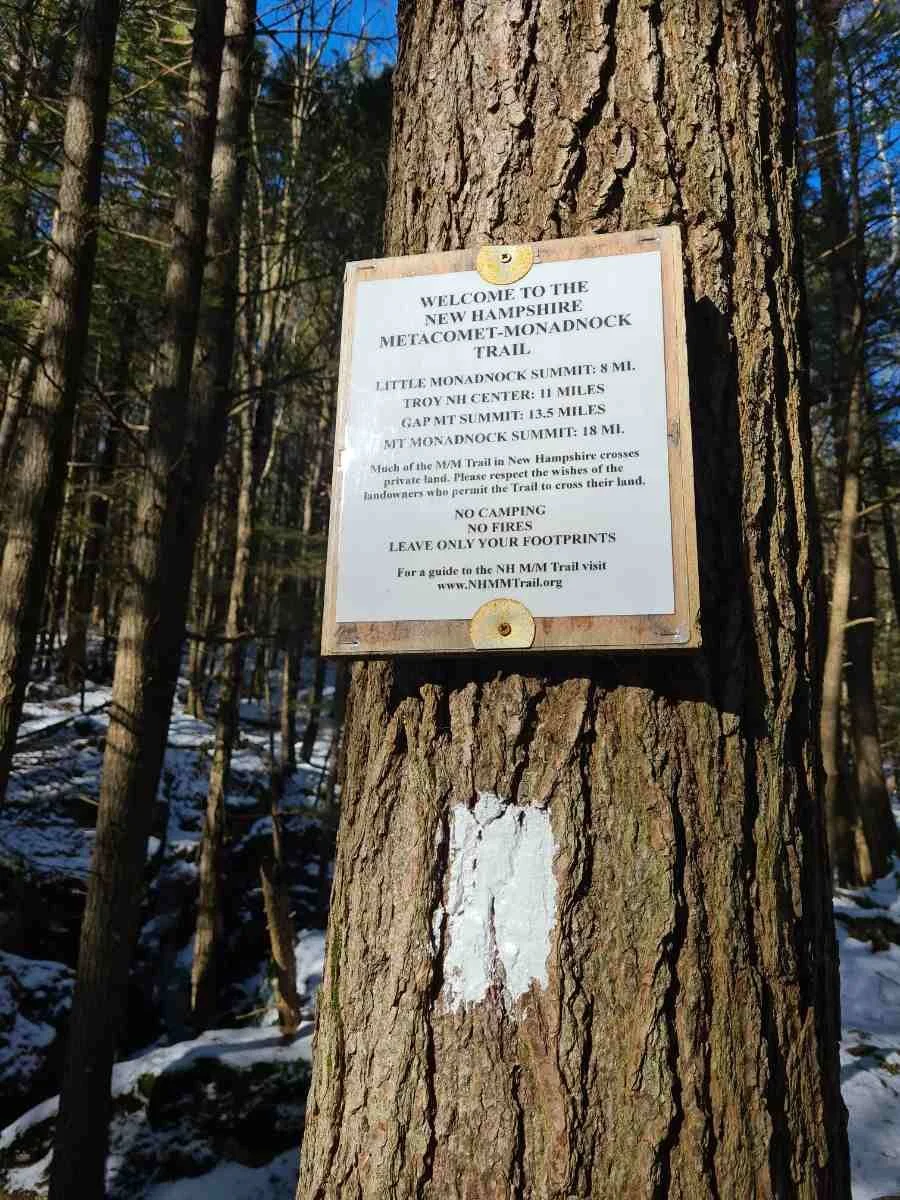
The New England Trail was created in 2009 when it was designated as a National Scenic Trail. Before this, it was a collection of interlocking trails, whose names are still used today to differentiate trail sections. The Connecticut (CT) portion is traversed by three separate, consecutive trails: Menunkatuck, Mattabesett, and Metacomet, and are all blazed blue. The northern portion from the Connecticut/Massachusetts (MA) border up to the summit of Mt. Monadnock was known as the Metacomet-Monadnock (M-M) Trail and is blazed white.

The Mt Holyoke Summit House on the Holyoke Range in central Massachusetts. Photo by Aubri Drake.
This trail is very young and underdeveloped, while also being in close proximity to densely populated areas. Local communities are unaware of thru-hikers and often don’t know they have a long trail in their backyard. Unlike more popular, developed long trails, this trail will require more planning and prep, but you’ll also have easier access to fresh food. There is a FarOut phone app for the trail, but we recommend pairing it with info from other sources including Gaia GPS and Google Maps will be very useful tools for the prospective thru-hiker. It’s a unique adventure—so many front-country amenities but so little trail infrastructure!


GEAR LISTS
Here is a summary of the gear I used or recommend for the New England Trail. I discuss my selections in more detail below.
Trail Running Essential Gear
| NET RUNNING GEAR | OUR PICK | OTHER OPTIONS |
|---|---|---|
| Running vest | Salomon Adv Skin 12 Hydration Vest Men's Women's |
Best Running Hydration Vests |
| Water bottle/ filter | Katadyn BeFree AC 1.0 Filter Bottle | Best Running Water Bottles |
| Headlamp | Black Diamond Storm Headlamp | Best Running Lights |
| Emergency communication | Garmin inReach Mini | Best Satellite Messengers |
| Rain jacket | Outdoor Research Helium UL Jacket Men's Women's |
Best Lightweight Rain Jackets |
When I backpacked the NET, here is the gear I brought with me:
Backpacking ESSENTIAL gear
| NET BACKPACKING GEAR | OUR PICK | OTHER OPTIONS |
|---|---|---|
| Gear | ||
| Tent | REI Co-op Half Dome 2 Tent Big Agnes Copper Spur UL2 Tent |
Best Backpacking Tents Best Ultralight Tents |
| Backpack | Gossamer Gear Mariposa 60 Backpack | Best Lightweight Backpacks |
| Sleeping bag | Enlightened Equipment Revelation 20F Quilt | Best Backpacking Sleeping Bags Best Backpacking Quilts |
| Sleeping pad | Therm-a-Rest NeoAir XLite Sleeping Pad | Best Sleeping Pads For Backpacking |
Highs
There are frequent leafy views of rolling hills and green valleys, with beautiful cliffside views scattered along the trail in each state
The trail travels through many small Connecticut and Massachusetts towns, with frequent access to larger towns and small cities
Smoother, less technical terrain than many New England trails, such as the AT or the Long Trail
Starting at the ocean (Long Island Sound) and ending at the impressive summit of Mt Monadnock (if you take the +18 mile addition into New Hampshire)
Lower elevation hiking closer to the ocean lends itself to a wider seasonal window and milder temperature ranges
Challenges
This trail was built for day hiking and does not have the infrastructure most people expect of a National Scenic Trail. Camping is only allowed at nine spots on the entire trail – stealth camping is not permitted. Thru-hikers are required to leave the trail most nights for lodging in town; trail stewards have created a list of nearby accommodations to support thru-hikers. Trail managers are actively working to expand the trail’s overnight site network, but this will take time and resources.
A large portion of the trail is located on private land and access has been granted at the discretion of the landowner. User behavior can and has caused landowners to revoke access to portions of the NET, requiring expensive reroutes that can increase road walking for the trail. On this trail more directly than others, our individual behavior can have a big impact on future hikers’ experiences.
There is limited and seasonal water in some sections, and some sections are swampy and have troublesome mosquitoes for large portions of the year.
There are very few thru-hikers each year, so local communities are not accustomed to seeing thru-hikers. Hitchhiking will be difficult, though rideshare services are available in some communities.
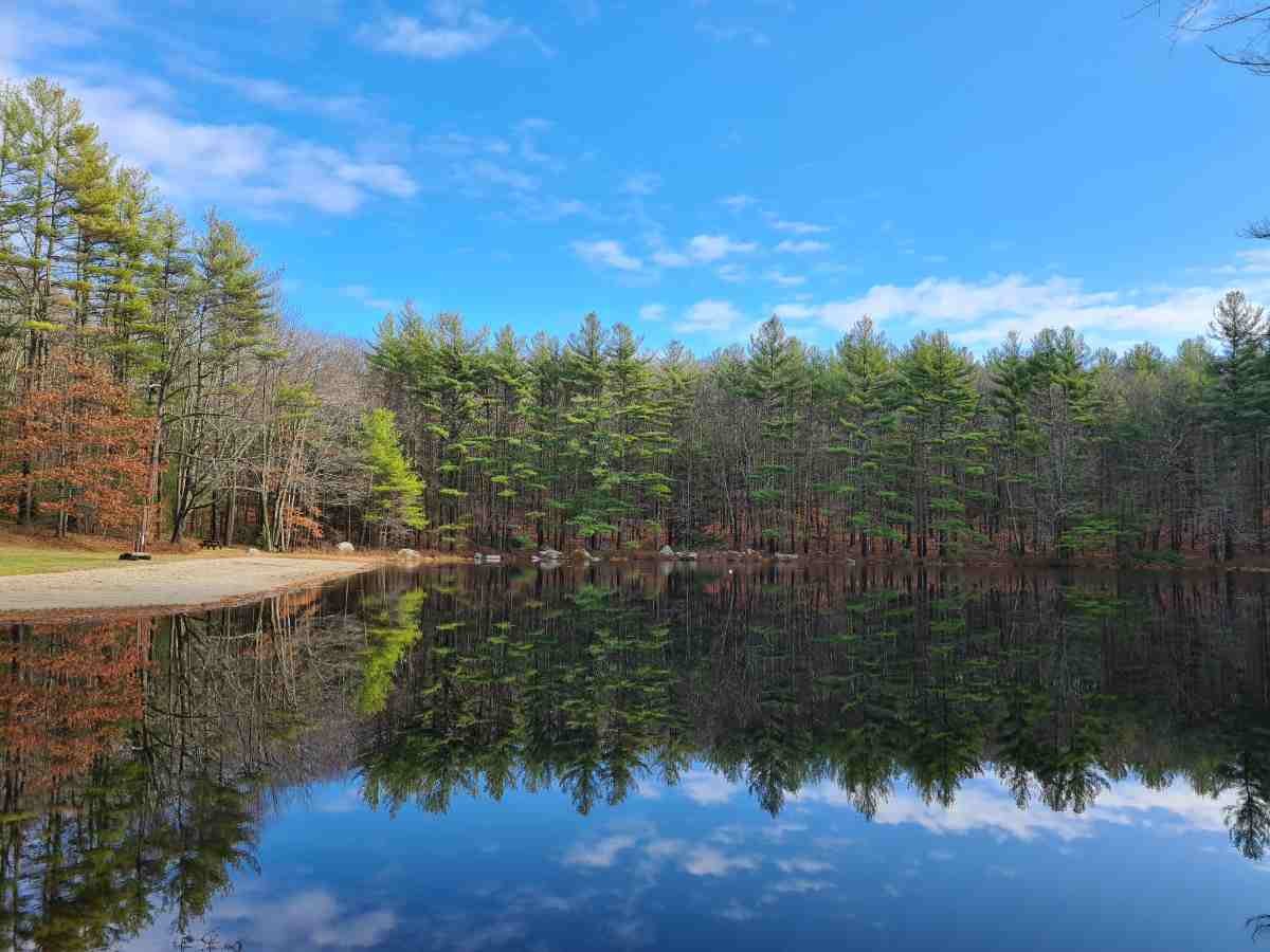
Perfect reflections on Ruggles Pond in northern Massachusetts. Photo by Aubri Drake.
Best Season
The New England Trail is best hiked May to October. While it is possible to hike the New England Trail in April or November, April tends to be rainy, muddy, and buggy, and November is often cold, damp, and rainy. Earlier in the hiking window, there will be more rain and mosquitoes, but water sources will be more plentiful and of better quality. Later in the hiking window, the weather will be better – more sunshine and less rain with lower humidity and less heat – but the remaining water sources will be of poorer quality.
The New England Trail is generally clear of snow April to November, with snow most often present between December through March and more likely the further north you go. I’ve hiked and run on the NET every month of the year. I’ve found the fall to be very pleasant weather while the water sources are scarce, and also enjoyed the cooler temperatures and generous water sources of May before all of the bugs emerge.

While some parts of the NET are smoother, it does have its fair share of steep, rocky terrain. Photos by Aubri Drake.
Difficulty and Skills
Navigation
The New England Trail is relatively easy to follow, though there are sections where the trail parallels or crosses many other use trails (either foot paths or ATV trails). However, it is easy to get off-trail on the NET. Most sections of the trail are blazed (blue in CT and white in MA) and signed as the NET, though there are areas where blazes are deteriorated, defaced, or infrequent.
It is important to have a GPS track as it’s easy to wander off trail if you follow the most traveled path. I only carried my cell phone and used downloaded GPS maps through Gaia GPS as well as the FarOut app.
Challenging Terrain
For this trail, the challenging terrain is often not the trail itself but managing the lack of infrastructure. Most of the NET is smooth trail by Northeast standards, with some rocks and roots to trip you but fairly smooth walking that looks somewhat similar to the Connecticut Appalachian Trail. Still, the NET can be remarkably steep at times (30%+ grade), with some sections having loose gravel or disintegrating leaves on the incline.
The NET is not maintained in the way one might expect given it is a National Scenic Trail. There are few water bars and less trail maintenance leading to areas of eroded or muddy trails and overgrown bushes. Some sections are washed out and steep. It’s not uncommon for ATV and dirt bike trails to intersect and overlap with the official trail.
Another challenge faced by thru-hikers is the two rivers that intersect with the trail in Massachusetts. The more southern Westfield River can be forded (most often knee-to-chest deep) depending on recent rainfall, or there is a very difficult 4-mile road walk around with fast and busy traffic and no shoulder.
The more northern Connecticut River cannot be forded and must be gone around by a 10-mile road walk, hitching a ride on a boat, or calling a rideshare. Some of the road walk could also be avoided by taking the PVTA 39E bus from Northampton to the Skinner Mountain stop. The longer road walk is much more comfortable than the first, with many services along the way and sidewalks for half of the 10 miles.

While some parts of the NET are smoother, it does have its fair share of steep, rocky terrain. Photos by Aubri Drake.
Elevation Gain/Elevation Loss
The NET climbs ~30,000’ over its ~210 miles, with ~11,000’ elevation gain over Connecticut’s 105 miles and ~19,000’ elevation gain over Massachusetts’ 105 miles. The NET starts at sea level on Long Island Sound in Connecticut, and its highest point is atop Mt. Grace (1,611’) in northern Massachusetts.
A unique feature of the NET is that most of its elevation gain (and loss) occurs in sharp, short bursts; there are no single climbs longer than 600’ in Connecticut or 1000’ in Massachusetts, though it is rarely flat. One of the tougher sections is the MA NET’s Holyoke Range, called the Seven Sisters, with 3,800’ gain and loss over just 10 miles while never getting above 1,100’. This is also in the middle of one of the trail’s longest water carries. This accumulation of elevation gain can be more exhausting than long climbs in many ways, feeling a bit like death by 10,000 papercuts.
Camping
This trail was built for day hiking and does not currently have the overnight infrastructure people expect of a National Scenic Trail. There are only nine legal overnight sites on the entire trail, and four of those are clustered in northern Massachusetts. Thru-hikers are required to leave the trail at night if they are not sleeping at one of the designated sites – stealth camping is not allowed anywhere on trail since most of the trail is located on private land. While trail stewards are actively working to expand the trail’s overnight sites, this takes time and resources; and if landowners withdraw their permission due to hiker behavior, those resources are then spent on rerouting the trail instead.
The NET organization does offer a custom Google Map with an overlay of the NET itself to help thru-hikers find lodging close to the trail. Once you’re on trail, it's relatively straightforward to locate lodging for upcoming town stays using sites like Google Maps, Airbnb, Booking.com, Hotels.com, Kayak, or other travel aggregators.

View of the Heublein Tower in the distance from a ledge within northern Connecticut's Penwood State Park. Photo by Aubri Drake.
Bugs
Like the northeast portion of the Appalachian Trail or the Long Trail, the NET is home to many mosquitoes and ticks. I’d recommend bringing your preferred bug spray (I like Sawyer picaridin spray and lotion), doing tick checks every night, and also treating your hiking clothes in advance with permethrin. I’ve sent my hiking clothes away to InsectShield for an industrial-strength infusion of permethrin that lasts the lifetime of the product and I’ve been delighted with the results.
Know the symptoms of Lyme disease, and if you start experiencing symptoms, be sure to get tested even if you never noticed a tick bite. Connecticut has the highest rates of Lyme disease of all 50 states. If you find a tick attached to your skin, taking a single dose of the antibiotic doxycycline can help prevent Lyme disease if taken within 3 days of the bite.

State line signs for MA/CT and NH/MA on the NET. Photo by Aubri Drake.

State line signs for MA/CT and NH/MA on the NET. Photo by Aubri Drake.
Route Summary
The NET boasts ponds, rivers, shallow bogs, vernal pools, meadows, mountain laurel, hardwood forests, endless traprock ridge walking, and cliffside views. The Connecticut portion of the New England Trail is composed of 3 separate, consecutive trails: Menunkatuck, Mattabesett, and Metacomet, and are all blazed blue.
The ~15-mile Menunkatuck trail goes from Long Island Sound to the Broomstick Ledges in Guilford. The ~30-mile Mattabesett trail goes from Guilford up to Berlin; there is also a ~28-mile spur out to Middletown typically unused by thru-hikers. The ~60-mile Metacomet trail goes from Berlin up to the CT/MA border in Suffield, CT/Southwick, MA.
The northern portion from the Connecticut/Massachusetts border up to the summit of Mt Monadnock is known as the Metacomet-Monadnock (M-M) Trail and is blazed white.

NET trail map, courtesy of the National Park Service's ArcGIS map of the NET.
MENUNKATUCK
The NET starts at a Long Island Sound beach in Guilford, CT. The NET then follows the Menunkatuck up to the Mattabesett intersection, still in Guilford.
MATTABESETT
The Mattabesett travels up to Berlin, passing through many towns, including Durham, Madison, Haddam, Middletown, Wallingford, Middlefield, and Meriden.
METACOMET
The Metacomet starts in Meriden, where the Mattabesett ends. It travels up to Suffield and the CT/MA state line, passing through towns such as Southington, New Britain, Farmington, West Hartford, Simsbury, and East Granby. It travels by Castle Craig in Hubbard Park, Hill-Stead Museum in Farmington, and the Heublein Tower in Talcott Mountain State Park in Simsbury.
METACOMET-MONADNOCK
At the CT/MA stateline, the NET begins to follow the Metacomet-Monadnock Trail. The M-M starts in Southwick and officially ends at the summit of Mt. Monadnock in Jaffrey, NH, though the NET ends at the MA/NH state line in Royalston, MA. It travels through dozens of Massachusetts towns, including Westfield, Holyoke, Easthampton, Northampton, Hadley, Amherst, Shutesbury, Wendell, Northfield, and Warwick. It travels over Mt. Tom in Easthampton, the Holyoke Range in South Hadley and Amherst, and Mt. Grace in Warwick.

View of Easthampton, MA from Mt Tom's ledges. Photo by Aubri Drake.
Maps and Guidebooks
Please note that the New England Trail is frequently being rerouted, sometimes multiple times per year. Know that what you see on apps and maps may very well be different than what you’ll see on the ground.
FarOut
FarOut offers the NET among their trails. However, as a newer trail, we’ve found that the route on the app doesn’t always match the route you’ll see on the ground, leaving you to choose between following the blazes or the app.
One thing to note is that many of the water sources on the app aren’t linked using the “jump ahead to the next water source” feature that FarOut is known for on other trails. We recommend checking by hand to see how far away the next water source is.
We also found some steady sources are missing and some of the sources marked as steady are seasonally dependent.
Utilize comments where you can, and use both FarOut and Gaia GPS topographic maps to identify water sources on trail that are not noted as waypoints in FarOut.
Gaia GPS
Gaia GPS is a mapping app and software with trail map layers that offer useful information for hiking the NET, though the NET trail is not always clearly marked within the layers. I would recommend making a GPX file in advance using the interactive NET map as a visual guide, or downloading one from the NET FKT page (though the route may have shifted in some ways since the GPX was last refreshed). Gaia GPS has a great interface for trip planning on your computer at home and while you’re hiking on your phone.
Maps
The NET trail organization offers a map of the entire NET. However, they do note that the trail has been rerouted in places since it was published, so users will need to utilize their interactive online map for the most up-to-date information regardless.

A beautiful forest ledge on the NET in northern Massachusetts. Photo by Aubri Drake.
Getting There
By Plane
While it would be possible to use Boston or New York airports, Bradley International Airport (BDL) in Windsor Locks, Connecticut (near Hartford) is the most centrally located, with the shortest transportation times to travel from the airport to one of the trail terminuses. See the trailhead information below for more details about getting to each terminus.
By Car
The NET terminuses are most easily arrived at by car, ideally with someone dropping you off. While it is possible to park a car at the Amtrak train station in Guilford near the southern terminus (one of the NET stewards’ suggestions), the trailhead near the northern terminus is small and isolated. The NET trail organization notes that leaving a car overnight at any trailhead is done at your own risk.
Bus and Shuttle Services
Neither the Connecticut Forest & Park Association (CT trail maintainers) nor the Appalachian Mountain Club (MA trail maintainers) offer a list of shuttle services or trail angels. The trail does not have this kind of infrastructure.
The NET website recommends using ride share services like Uber or Lyft; however, I would not expect ride share services to work in small towns, but they may work for small cities along the trail corridor. I live locally and utilized friends and family for rides. I have tried ride shares around larger towns like Northampton and they rarely work; there's typically 1-2 rideshare drivers per town and often only drive on weekend nights. Ride shares are most likely to work close to the cities of Hartford and Springfield, but not elsewhere. I would not recommend relying on rideshare apps for your transit plans along the NET.
The trail travels through many towns that have a local bus system, like Connecticut’s Meriden, Bristol, New Britain, and Hartford, and Massachusetts’ Westfield, Easthampton, Northampton, Hadley, Amherst, Belchertown, and Erving. Google Maps is aware of these bus lines and can be a very helpful tool for utilizing public transit along the trail. Consider downloading the Transit app in advance, as both Connecticut and Massachusetts’ transit lines use this app to show bus schedules and allow digital payment.

A freshly cut meadow on the NET in southern Massachusetts. Photo by Aubri Drake.
Trailheads
Southern Terminus: The southern terminus is located at Chittenden Park, with Long Island Sound access, on the beach in Guilford, CT, within 0.6mi of an Amtrak train station. It is possible to arrive there in 2-3 hours from the Bradley International Airport using public transit.
Northern Terminus: The northern terminus is located in Royalston, MA, on the MA/NH state line. It is a ~1-mile hike back to the small trailhead that has space for 5-6 cars. Unfortunately, it’s in a very rural area with little to no cell service and little chance of a ride unless arranged in advance. That trailhead is busiest on weekends, so if finishing on a Saturday or Sunday, you might have better odds of hitching a ride.
It is a 20-minute drive down Rt 32 to Athol, where there is a regional transit bus stop at the Hannaford grocery store. That bus allows connection to Greenfield, MA where there is access to Greyhound and Amtrak, which could be used to connect to Bradley International Airport. The Hannaford grocery store bus stop also connects to Boston by way of Gardner.
There does appear to be a Winchendon Taxi or Uber, which is just the next town over from Royalston. That might be a good shuttle option to get from the trailhead to one of those bus stops, but I have not used their services.

The bare summit of Mt Monadnock. Photo by Aubri Drake.
Variation - Mt. Monadnock: From the Visitor Center/Park Headquarters, it would be possible to hitch a ride to Keene, NH, which is 30 minutes away by car. In Keene, there is local transit and a Greyhound bus station. This allows connection to Boston, New York, and Bradley International Airport through a web of public transportation such as Greyhound, Amtrak, Peter Pan, and other local transit systems. See Variations below for further details.

A lovely view of the Connecticut River as seen from the summit of Mt Holyoke. Photo by Aubri Drake.
Regulations
Follow Leave No Trace Ethics
Respect private property. Please do not leave the trail, and camp only in designated areas. Property boundaries are often not obvious, so assume you are on private land.
The NET trail organization requires that hikers keep all dogs leashed while on trail, since leash laws vary between towns and the majority of landowners have requested this stipulation.

The NET walks around a number of reservoirs providing water to the city of Hartford in central Connecticut. Photo by Aubri Drake.
Resupply
There are endless resupply options on this trail, given its proximity to roads and towns. There are many resupply options within a few miles of the trail and/or easily accessible through public transit; I’ve noted below a few of the easiest resupplies, all easily walkable from the NET.
Connecticut
In Meriden, CT, there is a full mall with a Target only a 0.75-mile road walk from the NET. In Plainville, CT, there is a 20-screen movie theater, full grocery store, and restaurants within a 0.6-mile road walk.
Massachusetts
Thru-hikers will walk directly through the town of Northampton, MA on the 10-mile Connecticut River roadwalk, walk past the organic food outlet store Deals and Steals, and be within 0.75 miles of a full grocery store and 1.5 miles of a Walmart. From the Hadley, MA side of the Connecticut River roadwalk, there are Walmart, Whole Foods, Target, Trader Joe’s, and three outfitters within 4 miles of the route, all easily accessible using the local bus.
On-Trail Restaurants
There are restaurants available directly on trail in a number of places, such as:
Som Siam Thai in Guilford, CT
Guida’s in Middlefield, CT
Sliceworks in Berlin, CT;
Cracker Barrel Pub in Simsbury, CT
Little George’s in West Springfield, MA
Many restaurants in Northampton on the road walk
Creamy Delights ice cream in Hadley on the road walk
Thai Bamboo in Troy, NH on the 18-mile NH extension

View of Hampton Ponds State Park from Snake Peak on the Massachusetts NET. Photo by Aubri Drake.
Camping
As mentioned above, hikers are required to leave the trail at night if they are not sleeping at one of the below designated sites. Stealth camping is not allowed anywhere since most of it is located on private land. Our hiking access has been granted at the discretion of the landowner, under the specific stipulation that we don’t camp. If we as hikers stealth camp, it’s breaking the trust given to us by the landowners and it can impact many other people.
User behavior can and has caused landowners to revoke access to portions of the NET, requiring expensive reroutes that drain the few resources available for trail maintenance and can push us off of trails and onto roads instead. On this trail more directly than others, our individual behavior can have a big impact on future thru-hikers and local hikers. I know it’s very tempting to stealth camp, but on this trail especially, it only takes one bad experience for a landowner to consider withdrawing permission for everyone.
In Connecticut, the overnight sites are:
Cattails Shelter
Lamentation Mountain Primitive Tentsite
Windsor Locks Scouts Primitive Tentsite
In Massachusetts, the overnight sites are:
Harold Akey Tentsite
Wendell State Forest Lean-to
Richardson-Zlogar Cabin and Tent Platforms (reservation for cabin required)
Mount Grace Lean-to
Royalston Falls Lean-to
The NET website notes the Godman Group Campsite in Connecticut, but it is off-trail by 1.25 miles. They also note the Mt. Holyoke Outing Club Cabin in Massachusetts as an overnight site, but the cabin is only available by advance reservation (locked and inaccessible otherwise) and can only be used during the school year (September to April), and therefore is rarely an option for thru-hikers.

The Mt Holyoke Outing Club Cabin. Photo by Aubri Drake.
Water Planning
The NET is unusual for a long trail in the northeast, in that many sections do not have reliable, flowing water readily available. Please see the FarOut segment above for more information about using the app for locating water. I’d highly recommend using both FarOut and Gaia GPS topographic maps to identify water sources that are not noted as waypoints in FarOut.
Consider the recent precipitation, and check on Connecticut and Massachsuett’s drought status. For cleaner catches in the often shallow and muddy water of the NET, I always brought a light-weight scoop with me; this allowed me to make use of any water I found.
The most risky section for water will likely be the 19 miles from the last gas station on the MA road walk around the Connecticut River, over the Holyoke Range, to Hop Brook on Federal Street in Belchertown, MA. It’s a 19-mile water carry if you pass by the Mt. Holyoke Summit House when it’s closed; there are three seasonal sources along the way but they are typically gone or undrinkable later in the season or if it hasn’t rained lately. The hours of the Summit House vary widely by season; I would recommend calling them in advance to get updated operating hours.
Bears and Food Storage
Bears are not a substantial concern on this trail. The largest risk to food will be rodents. When camping, you may want to hang your food to prevent rodent issues.

The view from the Richardson-Zlogar Cabin and Tent Platforms of Mt Grace to the right (highest point on the NET) and Mt Monadnock in the distance. Photo by Aubri Drake.
Variations
The Metacomet-Monadnock (M-M) Trail originally started at the CT/MA border (where the Metacomet Trail ended and this trail began) and ended at the summit of Mount Monadnock in New Hampshire. The 18-mile section of the M-M in New Hampshire was not included when the New England Trail was created. However, it is still well-maintained and smoothly continues from the MA/NH border to the Mt. Monadnock summit. There are logistical advantages to this variation beyond the stunning view from the summit (and the Thai restaurant directly on trail in Troy, NH): Mt. Monadnock is extremely popular and only a 30-minute drive to Keene, NH, which has a Greyhound bus stop.
There is also a 28-mile spur of the New England Trail that is typically ignored by thru-hikers; it travels east to the end of one of the arms of the 3-armed Mattabesett Trail through Durham, Higganum, Haddam, and Middletown, ending at the Connecticut River. The other two arms of the Mattabesett Trail are traveled as part of a continuous north/south thru-hike.
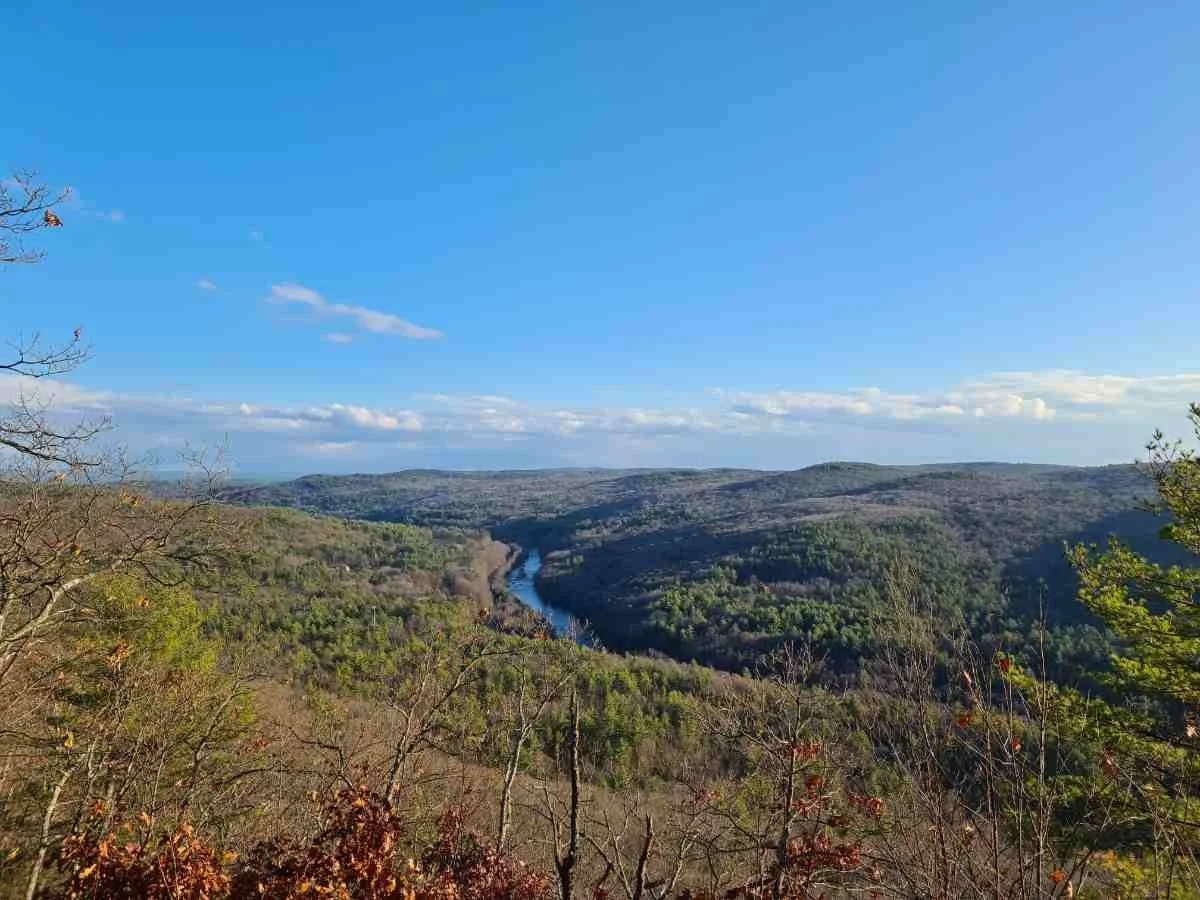
Millers River as seen from Farley Ledges on the northern Massachusetts NET. Photo by Aubri Drake.
GEAR DISCUSSION
I have thru-hiked, section hiked, and trail run the New England Trail. I’ve been hiking on its various trails since 2010. This gear list shows what I've carried on various versions of this trip, from long trail runs to a backpacking trip. I live nearby, so when I backpacked the NET, I made use of their campsites for camping and tapped friends and family to pick me up for overnights away from established campsites. I’ve hiked and run on the NET every month of the year, with the majority taking place between April and October. Weather in New England can change quickly, so I carry 3-season gear whenever I’m on trail.
TENT
I used the REI Co-op Half Dome 2 on my camping trips because the tent sites’ raised wooden platforms make it difficult to pitch a non-freestanding trekking pole tent, and the weather and humidity in the Northeast typically require a double-walled tent. I already owned this ~5 lb model for quick and light car camping, so I withstood the weight to ensure a dry, freestanding tent.
A better choice would have been the Big Agnes Copper Spur UL2, since it is fully freestanding, spacious, double-walled, and only weighs 3 lbs.
See our Best Backpacking Tents guide for more recommendations.
BACKPACK
I used the Gossamer Gear Mariposa (Treeline’s Best Backpack for Transitioning to Ultralight) pack on this trip for its comfortable waist belt and excellent ability to carry weight well.
SLEEPING BAG
I packed the 20 degree Enlightened Equipment Revelation Quilt for this trip since it’s my favorite 3-season quit, customized to allow room for my broad shoulders. See our Best Sleeping Bags story for more recommendations. If you are curious about my quilt—and others—check out our review of Best Backpacking Quilts.
SLEEPING PAD
I used the Therm-A-Rest NeoAir XLite wide pad (the winner of Treeline Review’s Best Overall Sleeping Pad) for the excellent cushion on top of tent platforms and warmth against nighttime temperatures.
TREKKING POLES
For trekking poles, I brought the Black Diamond Trail Cork trekking poles. They’re light, mold to my hands, and don’t grow slick when I sweat. I’m very hard on my poles, and these aluminum poles are light but also hold up well despite everything I ask of them. Black Diamond has also gracefully replaced my poles many times when they’ve broken within the warranty period. Check out our Best Trekking Poles guide for other recommendations.
COOKING SYSTEM
I used the MSR PocketRocket stove because it’s simple, inexpensive, and hard to break. I also brought my beloved TOAKS titanium long handle spoon. See our Best Backpacking Stoves story for more ideas.
COOKING POT
I cooked with a small GSI cookset. Take a look at our Best Backpacking Cooking Pots guide for more of our recommendations.
HEADLAMP
I carried the Black Diamond Storm, which is affordable, bright, and lightweight. I recommend checking out our Best Headlamps guide for our other favorite headlamps.
SATELLITE MESSENGER
Cell reception is not always guaranteed on this trail, though you’ll have service for most of the trail in Connecticut and the bottom half of Massachusetts. There is typically strong cell service on the ridgelines but weaker service below those high points.
I carried a Garmin InReach Mini to be sure I could contact Search and Rescue if needed. Learn more in our Best Personal Locator Beacon and Satellite Messengers guide.
WATER FILTER
I filtered water with my Sawyer Squeeze, winner of Best Affordable Water Filter in our Best Water Filters and Purifiers guide. I wanted something I could easily backwash in the field since the NET water tends to be muddy and carry leaf sediment.

A beaver lodge in Ruggles Pond seen from the Massachusetts NET. Photo by Aubri Drake.
WHAT TO WEAR
SHOES OR BOOTS
I typically wear Brooks Cascadias or Saucony Peregrines on a route like this because they are available in 2E/men’s wide sizes and provide excellent traction. On smoother trails, I’ll wear HOKA Speedgoats, (read our full review of the Speedgoats), but these trails favor a smaller footprint and more lugs for the loose, steep descents. For trail shoe recommendations, see our men’s and women’s Best Trail Running Shoes guides.
If you’d feel more comfortable in boots, we also have Best Hiking Boots and Best Lightweight Hiking Boots guides.
Hiking shoes could be a good compromise for this hike, since they are designed to feel like a trail runner but have stability more like a boot. For more, see our Best Hiking Shoes stories (men’s and women’s). And if you’re unsure whether a trail runner or hiking shoe is best for you, we also have a Trail Running Shoes vs. Hiking Shoes guide to highlight the differences.
RAIN JACKET
I wore the Outdoor Research Foray (the women’s version is the Aspire) on this trip because it offers a robust 3L shell that can withstand tree branches dragging and catching, since some parts of this trail can be narrow and in need of brushing. While I prefer to bring my lighter-weight Outdoor Research Helium Jacket on fair weather trail running trips, I knew I’d need a more robust rain jacket for this trail given the often-rainy weather.
For more recommendations, see our Best Rain Jackets guide.
FLEECE OR MIDLAYER
I run warm so I used the SmartWool Classic Thermal long sleeve shirt—winner of Best Heavyweight in our Best Base Layer guide—as my midlayer for sleeping.
HIKING PANTS
For 3-season conditions on this trail, I used Janji Transit Tech pants because they’re lightweight, flexible, and dry quickly. See our guides to the Best Women's Hiking Pants and Best Men's Hiking Pants for more recommendations.
SHORTS
I wear Mier men’s running shorts for warmer weather because they’re affordable, quick-dry, and do not have a liner. For more recommendations, see our Best Men's Trail Running Shorts guide, Best Women's Trail Running Shorts guide, Best Men's Hiking Shorts guide, or Best Thru-hiking Shorts guide.
BASE LAYER
The SmartWool Classic All-Season base layer T-shirt is my go-to hiking shirt because it fully covers my upper arms, dries quickly, doesn’t smell, and provides great temperature control. For more of our favorites, see our Best Base Layers guide.
HIKING SOCKS
Darn Tough Hiker Cushion socks are great for a thru-hike because they dry quickly, provide good temperature control, and hold their shape. Check our Best Hiking Socks guide for more recommendations.
WARM HAT
The Turtle Fur fleece hat was my choice on this trip because it’s lightweight, comfortable, and keeps my ears warm.
GLOVES OR MITTENS
I used the Minus33 Merino Wool Glove Liner on this trail when the temperatures would be cool, particularly on spring or fall mornings. They were lightweight and kept my fingers warm without losing dexterity. For more recommendations on lightweight but warm gloves, see our Best Winter Gloves guide.
MISCELLANEOUS GEAR ITEMS
FIRST AID KIT
Leukotape
Ibuprofen
Adhesive bandages
Safety pins
Gold Bond Friction Defense Stick
For ideas on how to build a first aid kit for the outdoors, we have a guide on Outdoor Items for an Emergency Preparedness Kit.
SUN PROTECTION
I didn’t bring sunscreen on this route during the summer months; this trail is well protected by the tree canopy. I did bring sunscreen for my face, ears, and neck in the spring and fall before the leaves emerged. This route is under tree cover so even when it’s a very sunny day, you won’t need more sun protection than that.
See our guide for Best Face Sunscreen and Best Body Sunscreen for more recommendations.
GAITERS
I used Dirty Girl Gaiters to keep rocks and dirt out of my socks and shoes.


