Monadnock Sunapee Greenway Backpacking Guide
A beautiful, beginner-friendly, 52-mile thru-hike in southern New Hampshire
June 12th, 2026
Home → Trip Guides → Backpacking
Distance: 52 miles
Days: 2-4 days
Elevation gain/loss: 12,500’
Best season: Summer and Fall
Permits: None
Difficulty: Moderate
We create reader-supported, objective gear reviews independently selected by our editors. This story may contain affiliate links, which help fund our website. When you click on the links to purchase gear, we may get a commission — without costing you an extra cent. Thank you for supporting our work and mission of outdoor coverage for every body! Learn more.
Background
The Monadnock Sunapee Greenway (more commonly called “The Greenway”) is a rare gem of a Northeastern hike. It’s 52 miles long, with 12,500’ of gain, and has excellent backpacking infrastructure with six established overnight campsites. When done southbound, hikers end on the epic bald summit of Mt. Monadnock, which offers 360-degree views of three states on a clear day.
The trail is a mix of singletrack, wooded roads, and dirt roads. The single-track trails have some rocks and roots but aren’t nearly as rocky as many other New England trails, resulting in a trail that has a moderate level of technicality. This trail is a great shakedown hike in the Northeast before a long thru-hike.
The Greenway goes through a small town around mile 17 southbound (or mile 35 northbound), with a little general store that is friendly to hikers. The trail also has a FarOut route with information about campsites, shelters, water, road crossings, and more. Most people will be able to comfortably complete the trail in four days or less. Completing this in one day is possible and this trail does have an FKT route.
I have completed the Greenway twice, once as a 2.5-day shakedown backpacking trip and once as a faster ultra effort.
Land Acknowledgement
We would also like to begin by acknowledging that the land on which this hike is located is the unceded territory of the Wabanaki (Dawnland Confederacy), which is the ancestral homeland of the Abenaki, Pennacook, and Wabanaki Peoples, past and present. We acknowledge and honor with gratitude the land and waterways and the Indigenous peoples who have stewarded these places throughout the generations.
You are welcome to take material steps in recognizing our access to stolen Indigenous land, such as through a voluntary land use tax through donation to one of the regional Indigenous tribes, such as the Cowasuck Band of the Pennacook-Abenaki People or the Sovereign Koasek W8banaki Band.
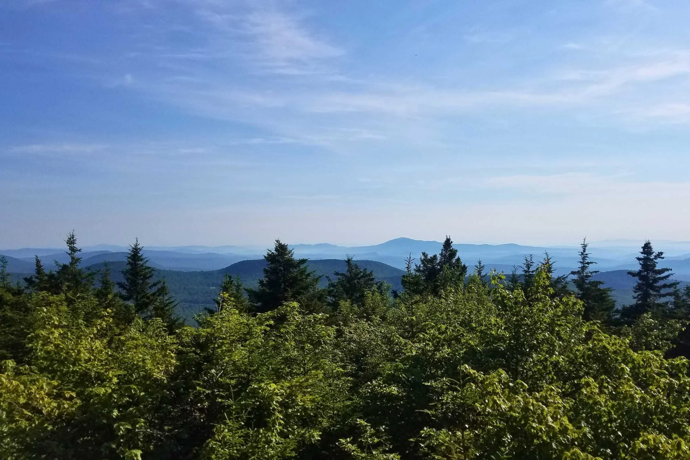
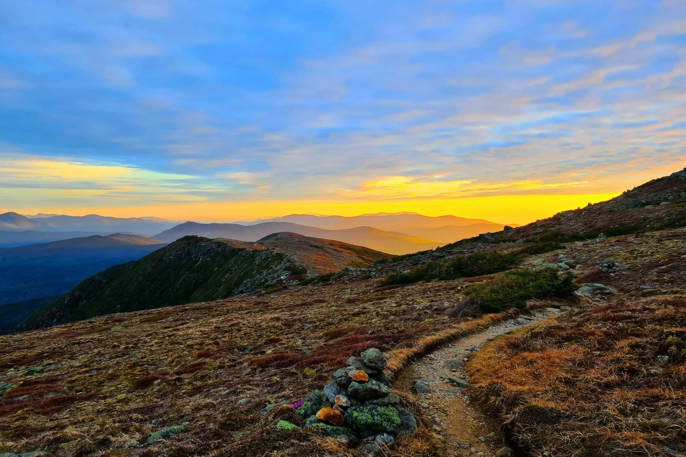
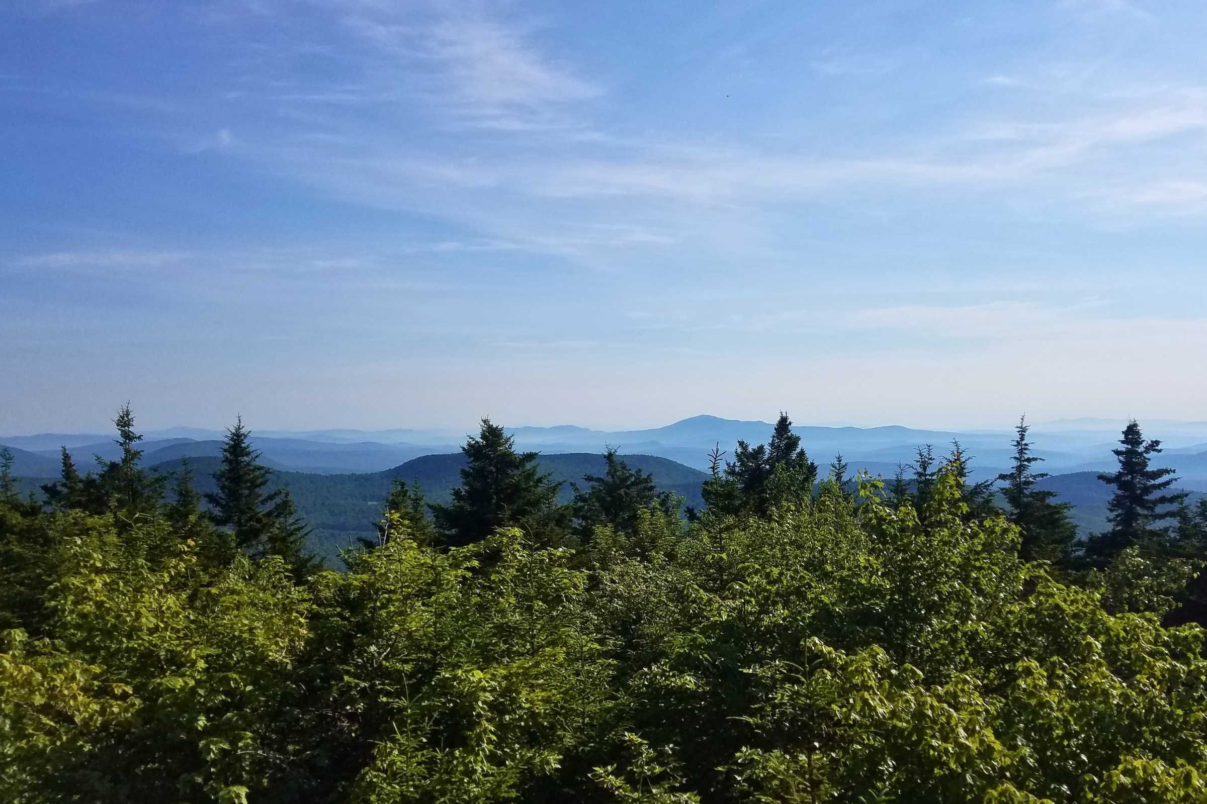
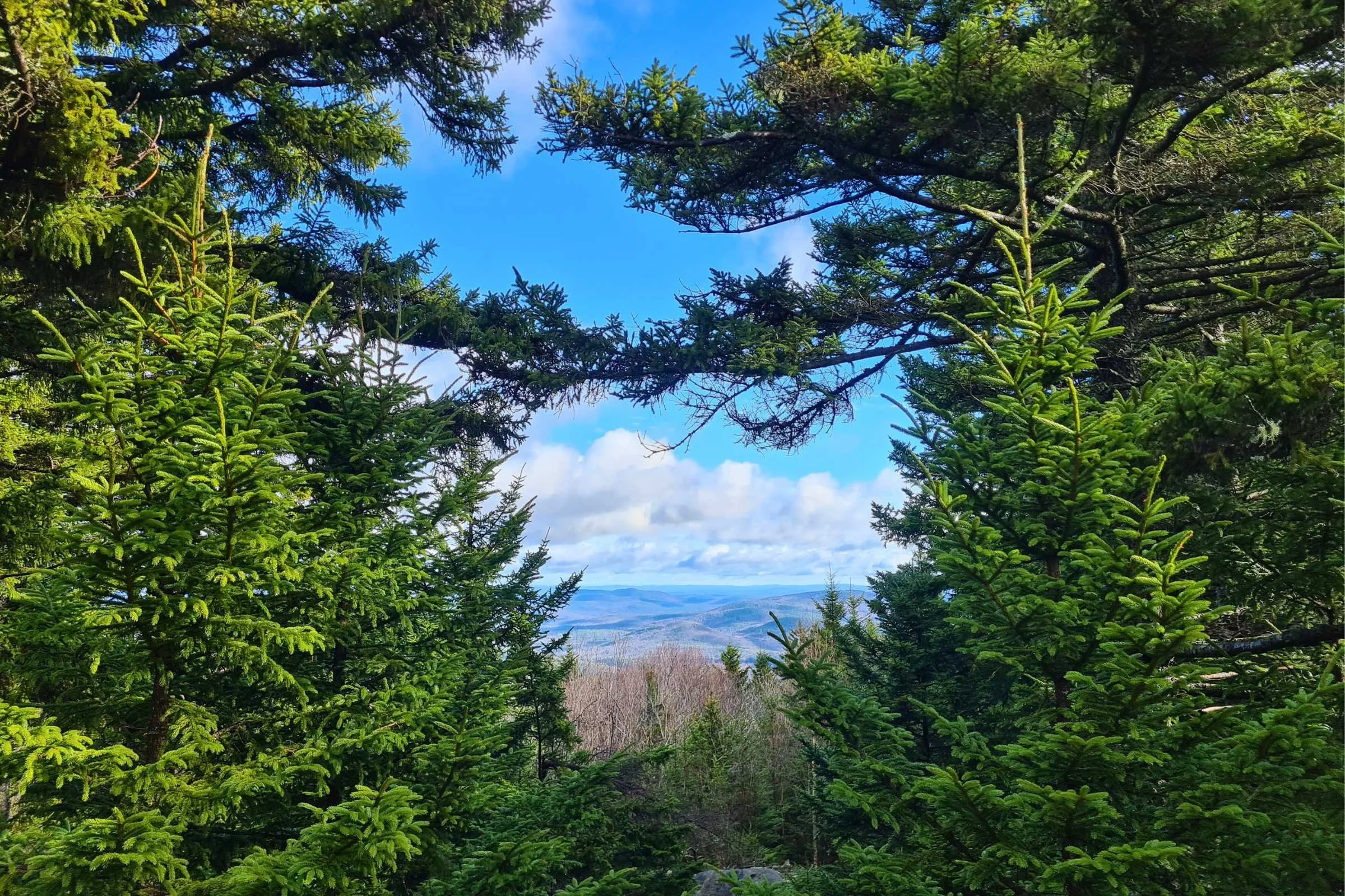
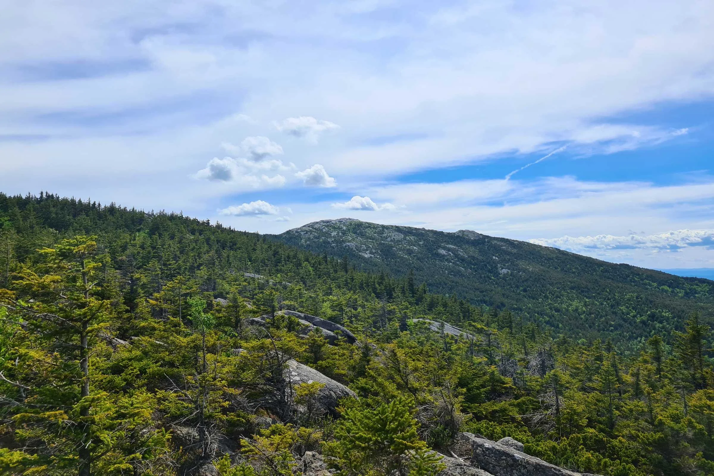
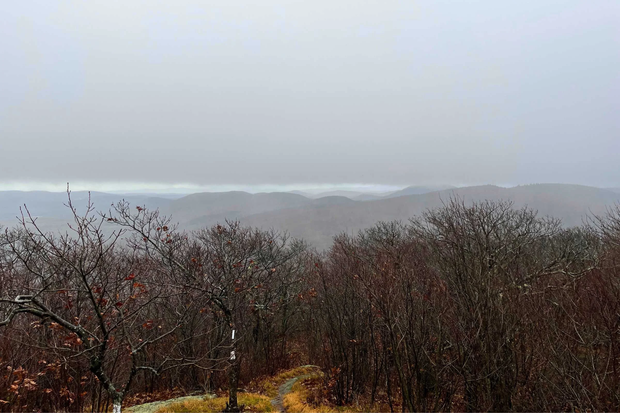
Gallery of photos


Highlights
Lower-elevation hiking with periodic vistas and summits
Six established overnight sites, with five shelters and one campsite
Walking directly through a town means resupply, charging, and deli sandwiches available right on trail
Relatively smooth, moderately technical trails
A halfway sign!
Frequent access to water for filtering
The trail’s hiking season spans more months than many Northeast trails thanks to its lower elevation
Summiting Mt. Monadnock and experiencing epic above-treeline views
Challenges
Mt. Monadnock can be a tough start or finish, with steep rock slabs and more exposure than anywhere else on this trail
Since this is a traverse, a car spot/shuttle is needed
The trail runs through a quiet rural area and it may be difficult to bail off-trail
Cell service is intermittent
There is some dirt road walking, which might be a welcome break or might be undesired
Since this trail involves more than 80 cooperative agreements with private landowners, overnight camping is allowed only at established campsites.
Gear List
Here is a quick list of the gear I used for running and backpacking the MSG. For a more thorough discussion about my gear choices, read below.
| MSG GEAR | OUR PICK(S) | MORE OPTIONS |
|---|---|---|
| Trail Running Gear | ||
| Running vest | Salomon ADV Skin 12 Hydration Vest Women's Men's |
Best Running Hydration Vests |
| Filter/ water bottle | Katadyn BeFree AC 1.0 L Water Filter Bottle | Best Running Water Bottles |
| Headlamp | Black Diamond Storm 450 Headlamp | Best Running Lights |
| Satellite communicator | Garmin inReach Mini | Best Satellite Messengers and Personal Locator Beacons |
Best Season
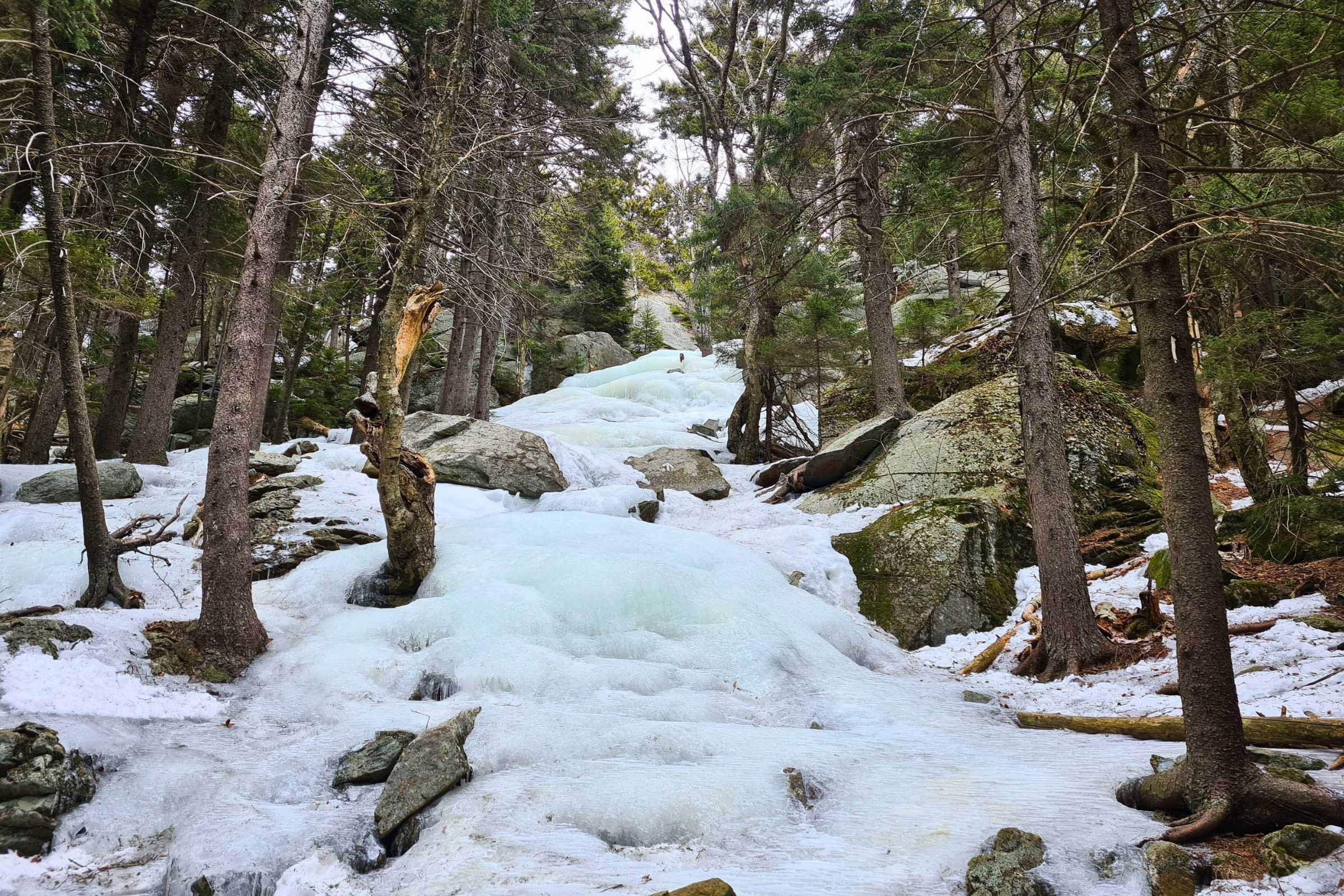
An ice-encrusted trail on Mt Monadnock in the spring. Photo by Aubri Drake.
The Greenway is best hiked between June and September. Hiking the Greenway in April, May, and October are also possible.
Depending on the snow year, there is often still snow on the higher elevations of Mt. Monadnock in April and May that can require traction, with muddy and wet trails otherwise.
For lower elevations, May is typically black fly season, with mosquito season spanning multiple months. October can be an option with crisp nights and cooler days, though it can be a wet month. Typically, August and September have less precipitation than June or July.
Difficulty and Skills

White blazes lead the way through the forest. Photo by Aubri Drake.
Navigation
The navigation for the Greenway is pretty straightforward, with 2” x 6” white blazes indicating the trail. The trail was well-blazed when I completed it. It’s not quite as well marked as the Appalachian Trail with its abundance of blazes, but it’s pretty close. There are a few intersections where the clarity of a GPS map is helpful, but overall, the trail is very easy to follow. Most intersections were clearly marked, with different color blazes used for side trails.
I only carried GaiaGPS and FarOut maps downloaded to my cell phone. If you’re looking for a waterproof map covering the Greenway, the Monadnock Sunapee Trail Club sells a map and guidebook. See Navigation Resources below for more details.
Rough Terrain/Scrambling/Rock Climbing
This route is mostly Class I/II terrain with a lot of rocks and roots (sometimes called “northeast technical”), with a few sections of Class II/III on Mt. Monadnock. In particular, there are open rock slabs on the White Cross/White Dot trails that have fall risk even when dry. The ascent and descent of Mt. Monadnock is by far the most technical section of the trail.
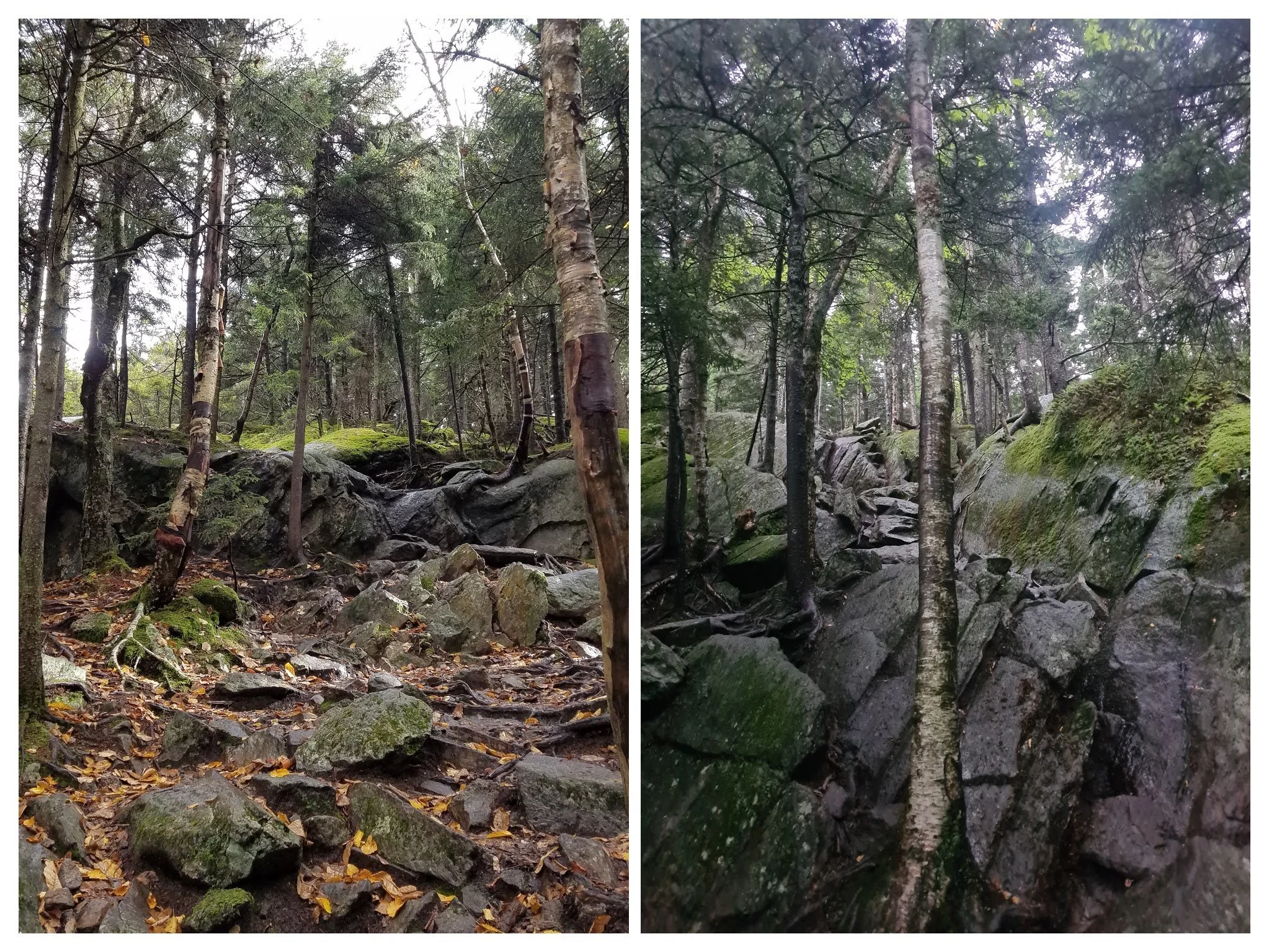
The ascent and descent of Mt Monadnock via the Greenway/ Dublin Trail is very rocky. Photos by Aubri Drake.
Elevation Gain/Elevation Loss
Over this route’s 52 miles, the trail gains 12,500’. Most of this is dispersed over the course of the trip, with the ascents/descents of Mt. Monadnock and Mt. Sunapee accounting for 1800’ and 1600’ gain/loss, respectively. Mt. Lovewell accounts for 1000’ gain/loss, and Pitcher Mountain (the halfway point) accounts for 800’ gain/loss. Trekking poles are a great help with climbing and dispelling the downhill force on the knees and legs during the descents.
Route Summary
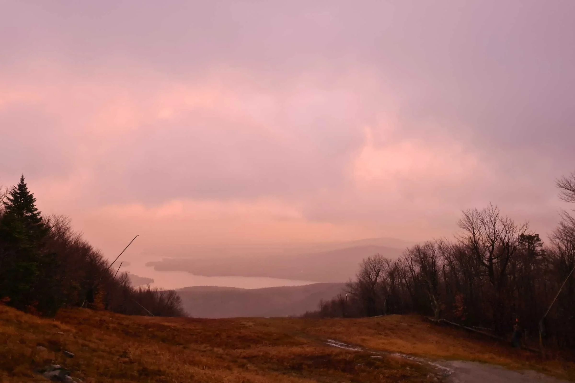
Sunrise view of Lake Sunapee from Mt Sunapee during a tropical storm. Photo by Aubri Drake.
The Greenway can be done in either direction. I’ve done this trail southbound both times, mainly due to parking logistics and the desire to end my hike with a summit of Mt. Monadnock. Done southbound, the trail starts at the Mt. Sunapee parking lot and ends at Monadnock State Park.
Technically, the trail is 47 miles long, running between the summit of Mt. Sunapee and the summit of Mt. Monadnock, but there are 5 miles of hiking to get to and from the summits, making it a total of 52 miles.
Starting from the Mt. Sunapee parking lot, Greenway hikers head uphill to the summit of Mt. Sunapee, following white blazes while keeping a sharp eye for downhill mountain bikers who enjoy this mountain in the summertime. At the summit of Sunapee, the trail officially begins. There’s a great view from the summit of nearby Lake Sunapee, but some of the views are limited by the ski area equipment and buildings. Soon after the summit, the trail passes by the tiny Lake Solitude.
The first ~15 miles of the Greenway are narrow single track with a lot of ups and downs, and I find it to be one of the more physically and mentally challenging sections of the trail. This is part of why I prefer to start here, rather than end here.
Around mile 7.25, there is the Steve Galpin shelter at Moose Lookout, in the shadow of Little Sunapee Mountain. I stayed here on the Friday night of my weekend thru-hike of the Greenway and enjoyed the peace and quiet.
Around mile 13.5, the trail climbs to the summit of Mt. Lovewell, within Pillsbury State Park, passing by Max Israel shelter around mile 12. After coming down from Lovewell, there’s a little bit of road walking to bring you into the small town of Washington, NH around mile 17.5. There’s a small general store that’s friendly to Greenway hikers. They have a deli counter and a fryer available and a wide variety of snacks and drinks. Within 0.3 mi of town, there is the George Washington shelter, if you’d like to stay close to town.
The view from Pitcher Mountain, with Mt Monadnock in the distance. Photo by Aubri Drake.
The Greenway going forward is a mix of singletrack, dirt roads, and woods roads as you head towards Oak Hill at mile 19 and Jackson Hill at mile 23.5. Around mile 24, there is the Fox Brook tentsite (the only overnight site without a shelter).
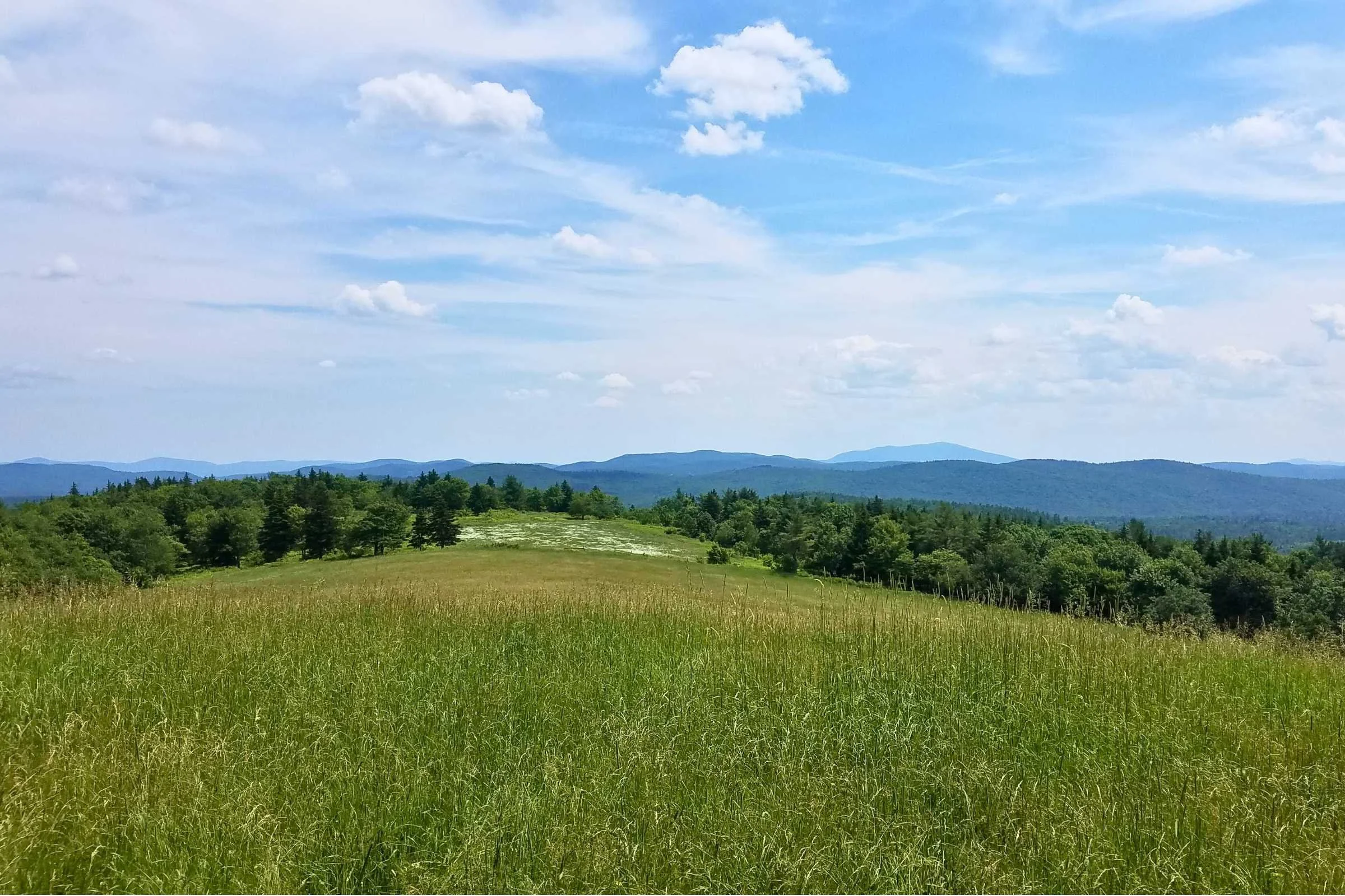
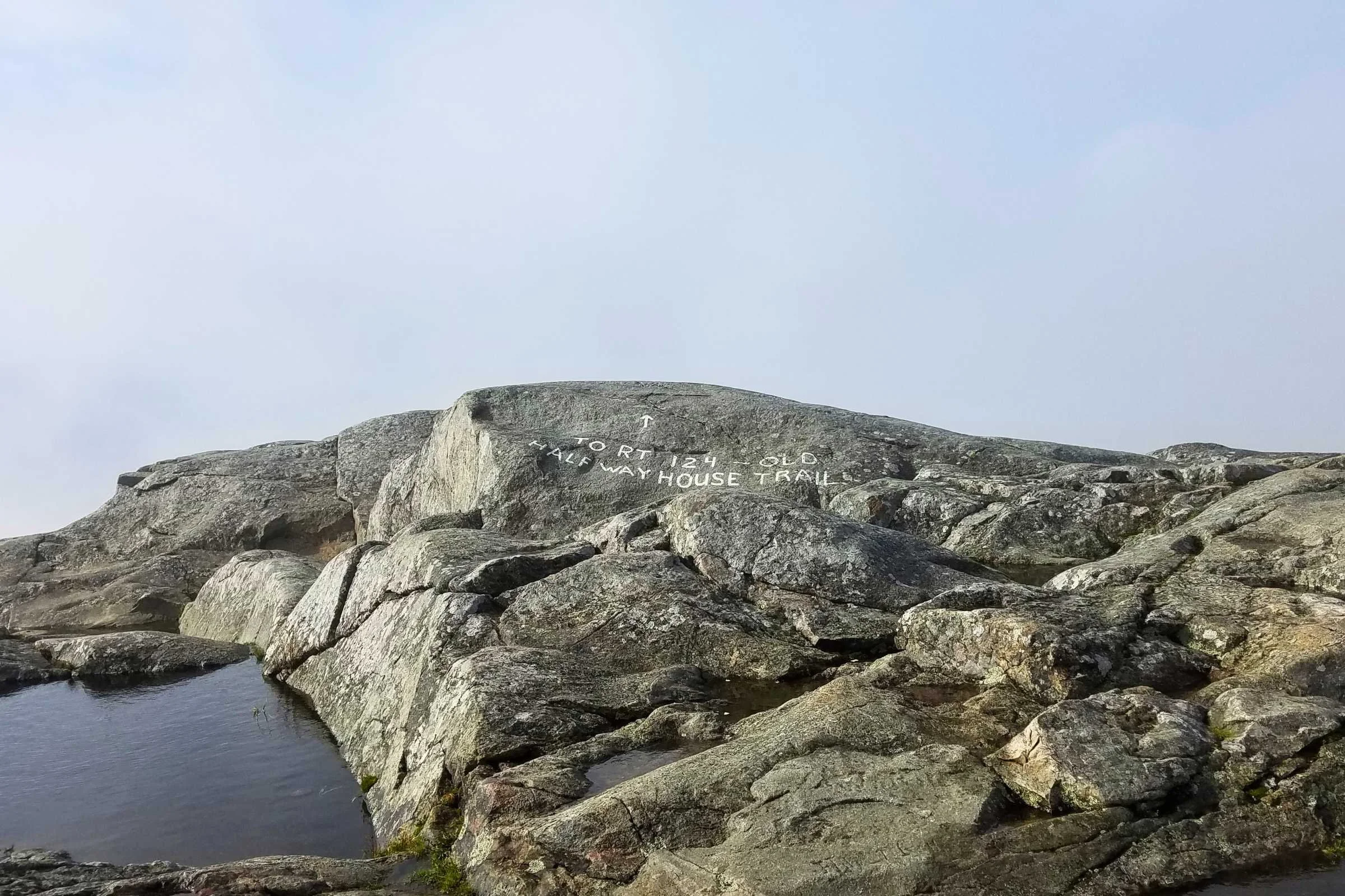
At mile 27, you arrive at the summit of Pitcher Mountain, where there is a delightful halfway sign to encourage hikers. From the top of Pitcher, you can see both the summit of Sunapee in the north and the summit of Monadnock in the south! It’s magnificent to get a clear view of what has been hiked already and what still awaits you.
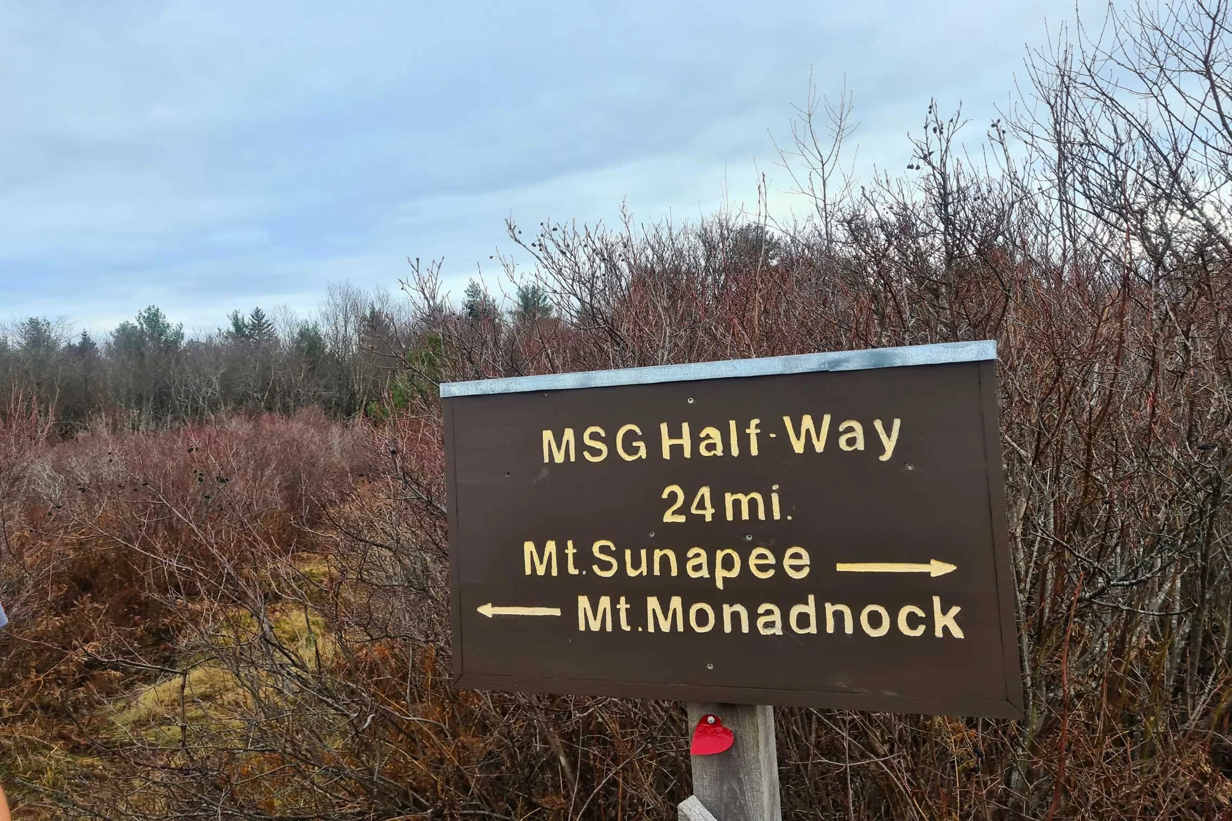
Halfway sign at the summit of Pitcher Mountain. Photo by Aubri Drake.
Around mile 30-31, the trail passes by Center Pond on a dirt road. The Crider Forest Shelter is at mile 31, down a 0.2 mi spur trail. It’s best to get water before heading to this shelter, since the pond is not readily accessible anywhere nearby the shelter.
I stayed here on the Saturday night of my thru-hike, which happened to be the Fourth of July. There were ATV and dirtbike trails nearby the shelter, and they were very busy in the evening and into the night with local users who were also shooting off fireworks. This shelter had a lot of mosquitos when I was there due to its proximity to the pond’s marshy areas.
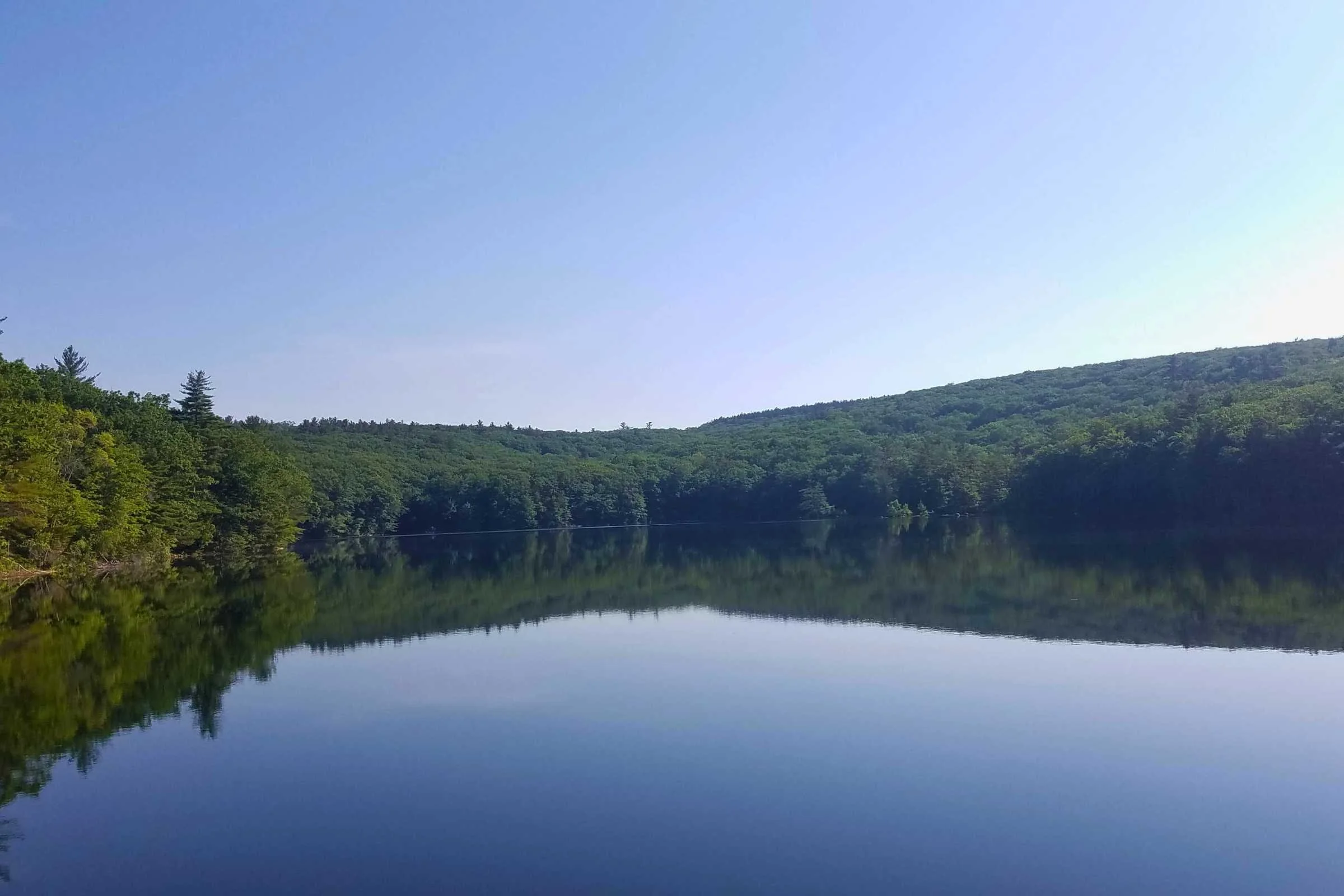
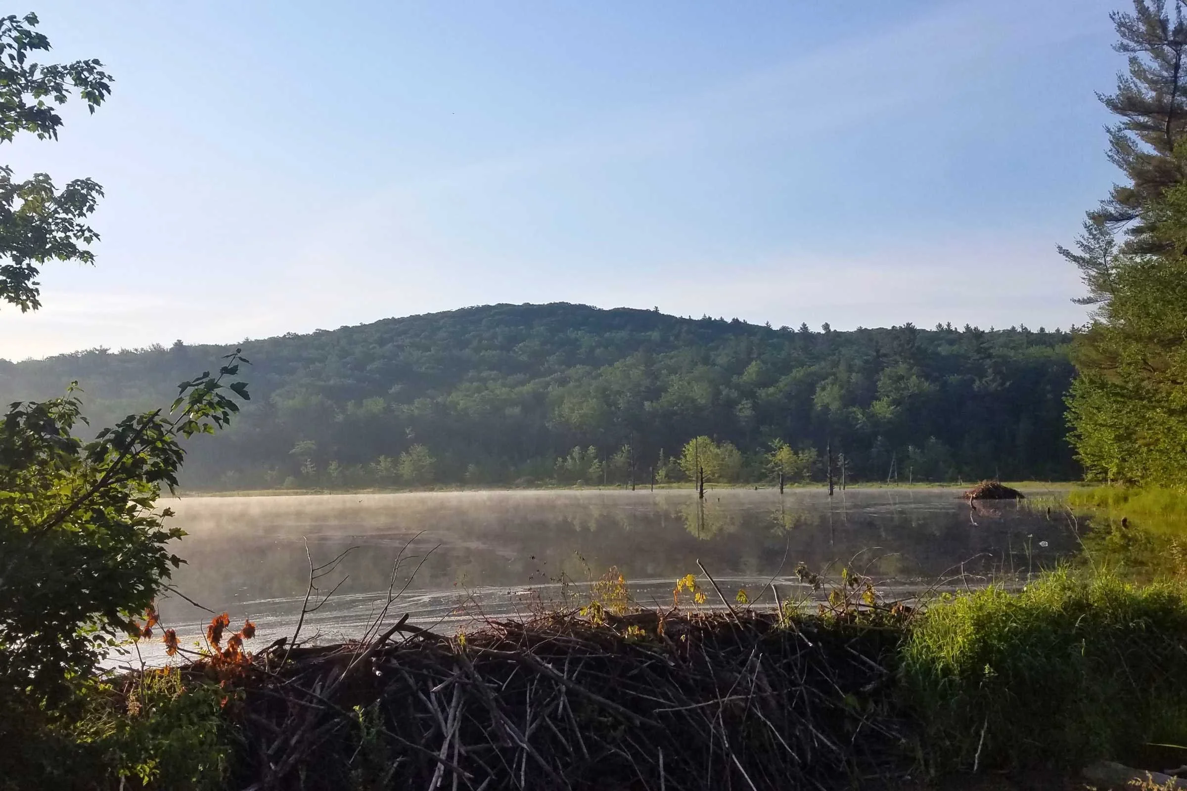
Seaver Reservoir in the morning light. Photo by Aubri Drake.
From here to the foot of Mt. Monadnock, the trail is smoother, often following dirt roads and woods roads, though I did encounter some overgrown sections of single track. Around mile 39, the trail goes past Childs Bog and Silver Lake. Soon after gathering and filtering water first thing in the morning, I encountered a mama bear and her cub, but was able to give them a wide birth as I passed by.
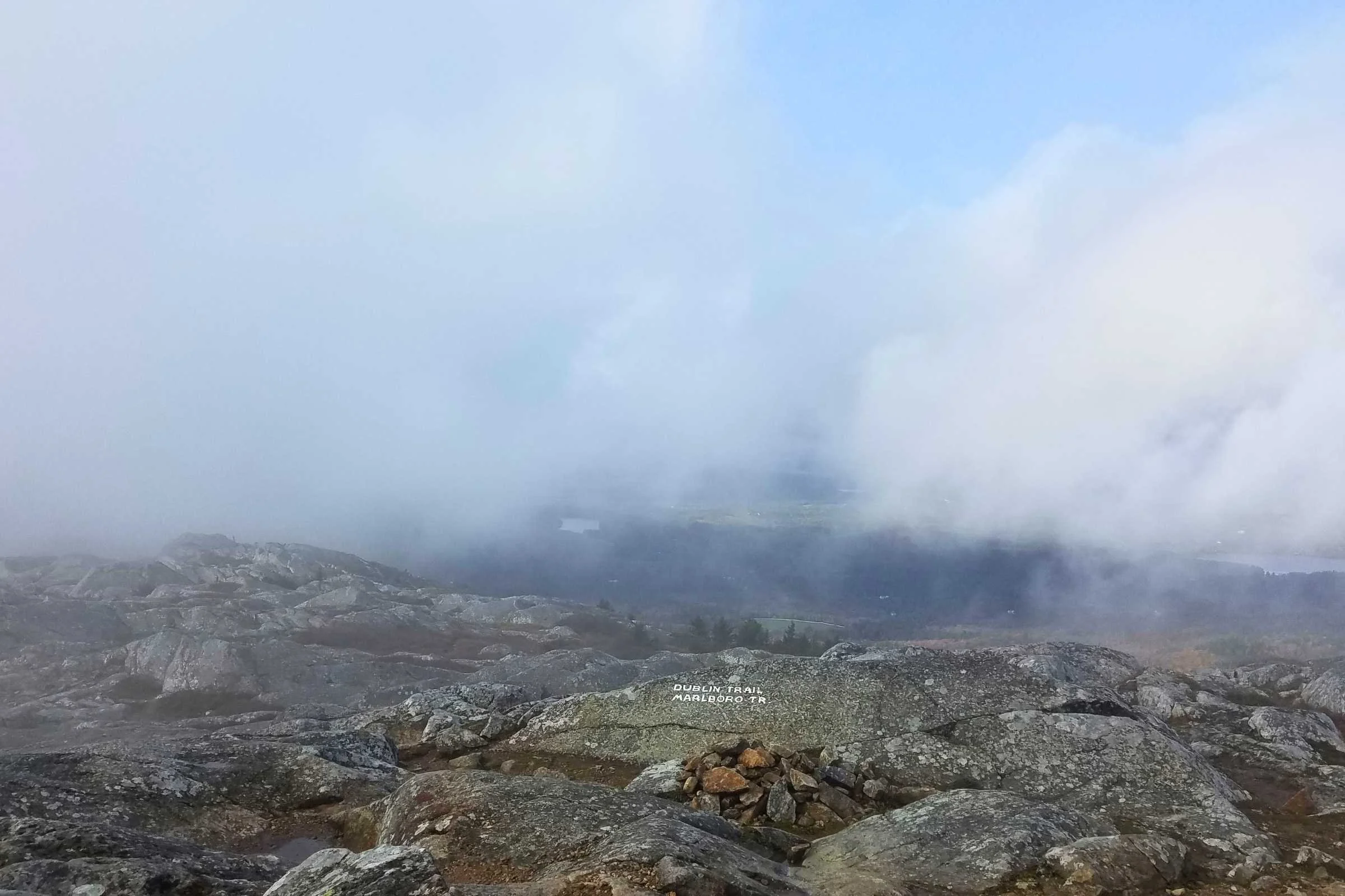
At mile 44, nearby Howe Reservoir, there is Spiltoir shelter, the most southern overnight site on the Greenway. At mile 47.5, the Greenway arrives at the Dublin trailhead, one of the five trailheads for Mt. Monadnock. There’s sometimes a porta potty in the parking lot, but not always.

Dublin Trailhead. Photo by Aubri Drake.
From here, it’s a methodical but brutal 2.5 miles to the summit of Mt. Monadnock. This approach is gentler than most others but none of them are easy. This section has a lot of wet rock slabs and slippery roots. The elevation gain is sharp, and if done southbound, your legs are tired.
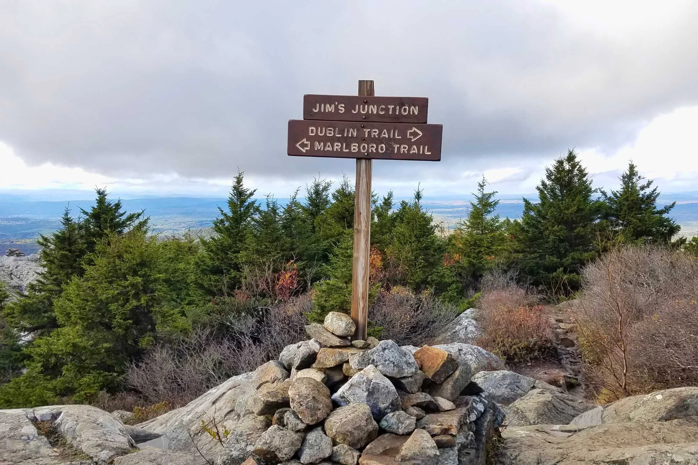
Jim’s Junction on Mt Monadnock. Photo by Aubri Drake.
At mile 49.5, the Greenway/Dublin trail arrives at Jim’s Junction, where the trail emerges fully above treeline for the last half of a mile. And at mile 50, you arrive at the summit of Mt. Monadnock, with a 360-degree view of three states: New Hampshire, Vermont, and Massachusetts. On days with good visibility, you can often see as far away as Boston! Once you’re at the summit, you’ve done it—you’ve finished the Monadnock Sunapee Greenway!
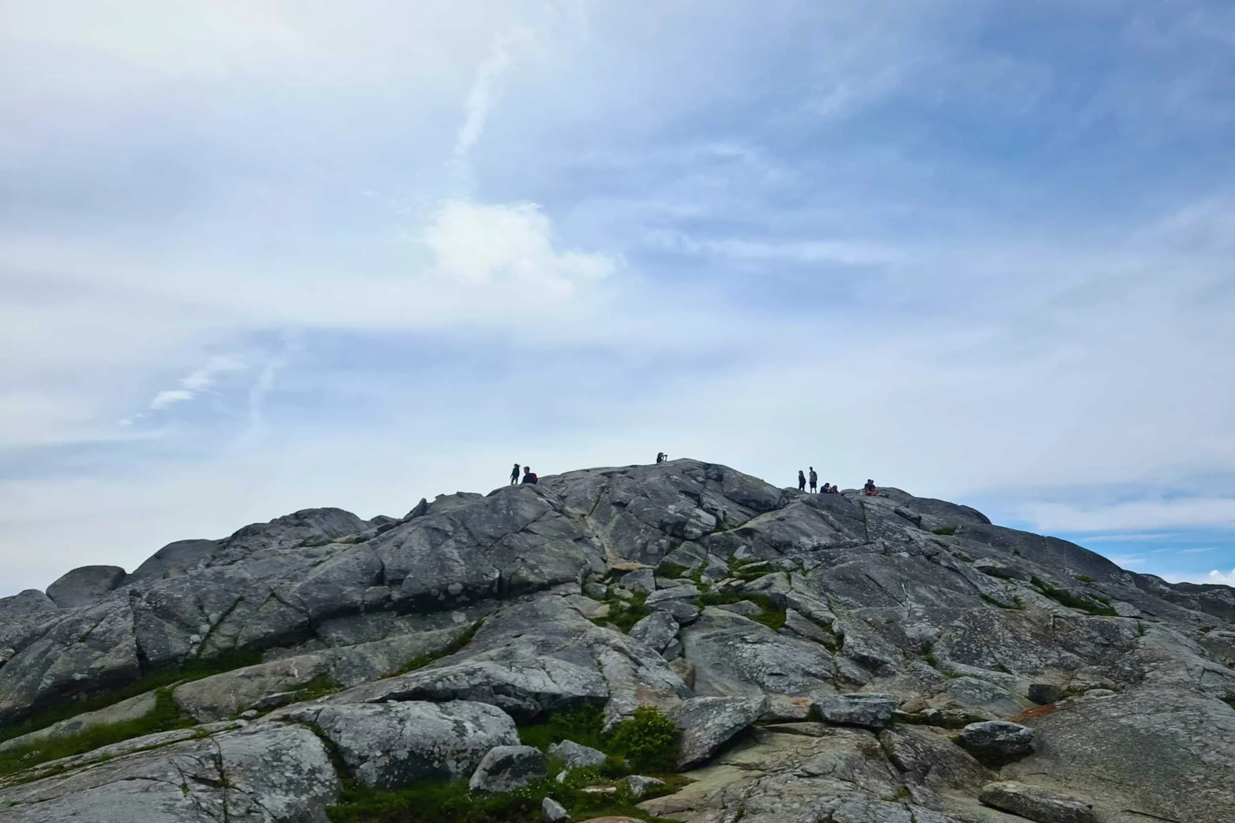
The summit of Mt Monadnock. Photo by Aubri Drake.
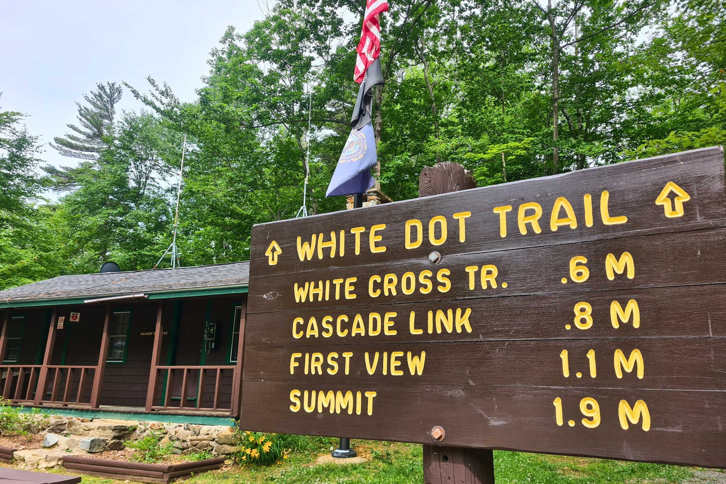
Once you’ve celebrated your official thru-hike of the Greenway, you’ll still need to hike another two miles down to a trailhead. Be very attentive when leaving the summit—it’s very easy to go down the wrong trail, since it’s above treeline and the few markings available are painted on the rocks.
Most commonly, hikers head down to Monadnock State Park via the White Dot/White Cross trails to the east. Both trails are steep and rocky, with many slick rock slabs to descend. If it’s wet, the descent can be quite difficult. This is the most technical section of the entire trail; plan to take your time. At the base of those trails are the state park facilities. There is a small visitor center and a campground at the base of the mountain within the state park.
The Monadnock State Park visitor center. Photo by Aubri Drake.
Navigation Resources
FarOut
FarOut offers the individual purchase of the Monadnock Sunapee Greenway within the app, as well as free access to guides for Monadnock State Park, Mt. Sunapee, and Pillsbury State Park.
Gaia
GaiaGPS is my preferred navigation app, and it functions very well on the Greenway. You will likely have service for the majority of summits and ridge walking but may lose service once you drop lower down, so be sure to download the route and maps before heading out of town.
Maps
If you’re looking for a waterproof map covering the Greenway, the Monadnock Sunapee Trail Club offers a map. However, it is only available for purchase at a dozen New Hampshire locations (including Monadnock State Park Office), and otherwise must be purchased via mail with a check.
Getting There
Shuttle
Since this is an end-to-end hike, you will need some method of returning to your start point. It is a ~70-minute drive over 54 miles to connect the start and end points of the Greenway.
It is highly advisable to arrange for a shuttle from your end point back to the start. This means you’re not rushing to make a pick-up time or potentially missing the shuttle you arranged due to weather or other challenges.
If you can manage it, convince a friend to help you spot your car. Or pay someone you know to help. Otherwise, Keene and Concord both have taxi services, but they’re the closest towns that do.
Keene is closer, at ~2.5 hours and 110 miles round trip for a taxi service to drive to both trailheads and then drive home. For Concord, it’s ~3 hours and 144 miles round trip. In Keene, there is Sunshine Taxi and Thomas Transportation Services. In Concord, there are Concord Taxi & Cab and Legacy Travel NH.
Rideshares are also possible to pick up in Keene or Concord areas, though it will likely be impossible to do so from trail.
By Plane
Fly into Boston Logan International Airport or Bradley International Airport (Hartford, CT) and then either rent a car or take a bus or train as close to the trailheads as possible. See below for car and bus details.
By Car
This is by far the easiest method. The Mt. Sunapee parking area is 15 minutes from I-89, 30 minutes from I-91, and 45 minutes away from Concord. Monadnock State Park is more remote, and is 70 minutes away from Concord, Manchester, and North Londonderry, and 30 minutes away from Keene.
Bus and Train Services
Concord Coachline offers bus service from Boston to Concord and North Londonderry. Greyhound offers bus service from New York City, Hartford, and Springfield to Keene and Bellows Falls, VT. The Amtrak Vermonter offers train service from New York City, Hartford, and Springfield to Brattleboro and Claremont.
To connect to the trail from here, a shuttle or taxi would be required. See above for more information.
Trailheads
The Greenway has two ends: Mt. Sunapee and Mt. Monadnock. The two closest parking lots are located at Mt Sunapee Ski Resort and Monadnock State Park.
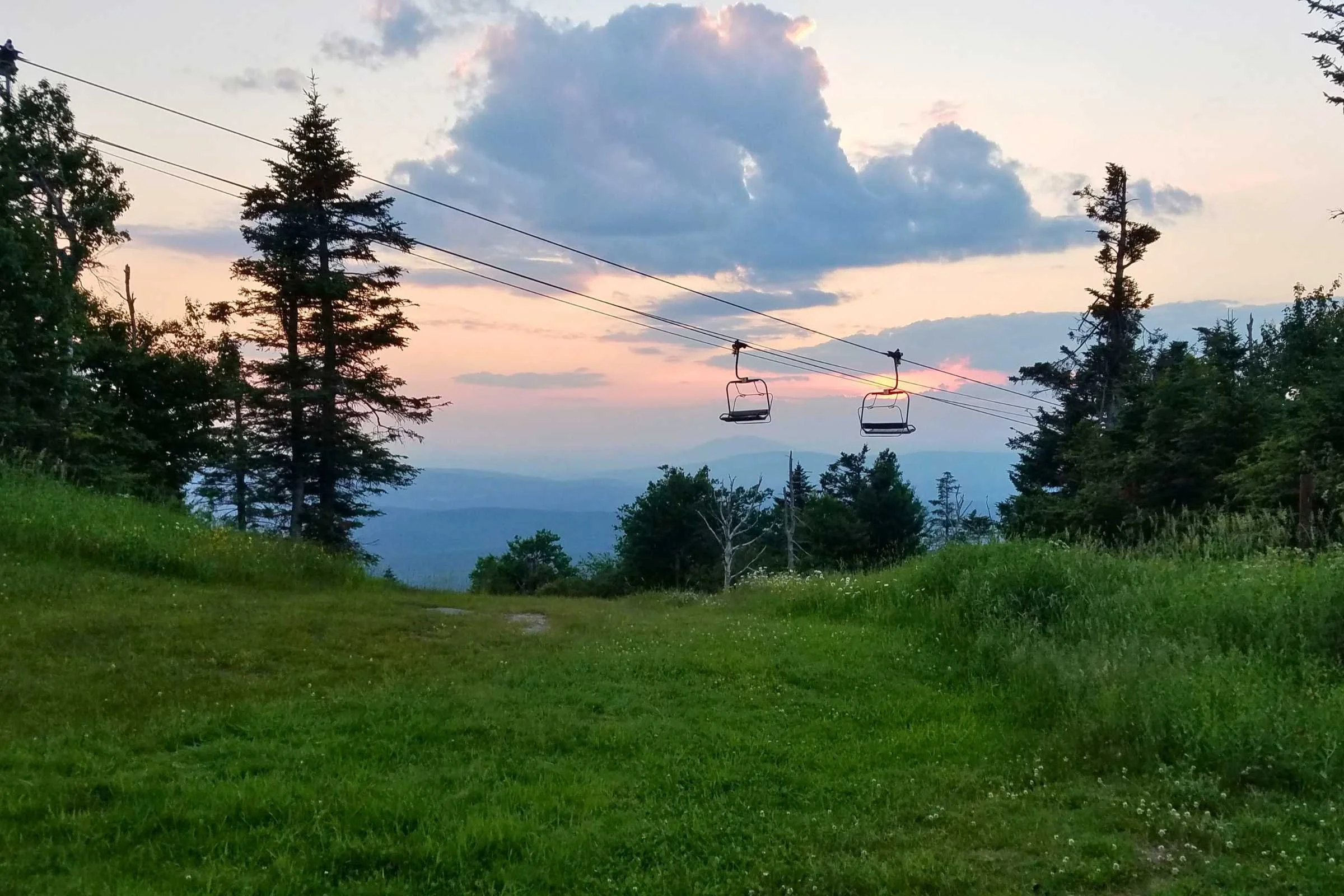
Sunset on Mt Sunapee. Photo by Aubri Drake.
Mount Sunapee Ski Resort
Overnight parking is allowed and freely available at Mount Sunapee Ski Resort. However, hikers leaving a car must confirm with the ski resort and provide them with some basic information (name, car make and model, hiking dates, emergency contact). The staff member will confirm which parking lot should be used (1, 2, or 3).
A staff member reported that their phones are typically staffed Tuesdays and Thursdays from 9am-1pm during the off season. You can call them on the phone to fill out this form or you can email them at Guest Services. Bathroom access is available during their business hours.
Monadnock State Park
While this information isn’t available online, I spoke with a ranger to confirm their process. To park overnight at Monadnock State Park, make a day use parking reservation for $16 online for the day you expect to start from the park.
It is possible to do this in-person, but if the lot fills up for the day, it’s possible they won’t be able to fit your car. Check in at the park office, let them know you’re a Greenway hiker and your expected return date. They’ll give you a tag and have you park in a particular place where they can keep an eye on your car until you return. There are newly renovated bathrooms near the parking area.
The summit of Mt Monadnock. Photo by Aubri Drake.
Post-Trip Favorite Restaurant/Bakery/Brewery/etc.
There aren’t a ton of options between or nearby Mt. Monadnock and Mt. Sunapee, but there are a few good places to grab a bite. Thai Bamboo in Troy, Mexica Mexican Restaurant in Fitzwilliam, and Sweet Beet Market & Cafe in Bradford are all excellent options! And in a pinch, there are a few Dunkin’ locations nearby.
Regulations
Follow Leave No Trace Ethics
Per New Hampshire State Park regulations, no dogs are allowed in Monadnock State Park, year-round. If you’re hiking with your dog, you’ll need to start or finish your hike at Dublin Trailhead, just shy of the park.
Camping is allowed only at established campsites to fulfill agreements with 80+ landowners and prevent loss of the trail corridor.
No fires are allowed at any time, per landowner agreements. Gas camping stoves are permitted.
Overnight sites are first come, first served. It is expected that hikers will share space with one another.
Group size is recommended to be 10 people or fewer.
Stay on the trail, particularly above treeline on Mt. Monadnock where there are fragile alpine plants that are easily damaged by careless footsteps. Please respect all “Revegetation area - stay out” signs.
Camping
The Greenway has six established overnight sites, five with shelters and one with a tent platform. Four of the five shelters were built in the last 25 years, with the oldest shelter (General Washington Shelter nearby town) being more than 40 years old. Each of these locations is free and first come, first serve.
All sites have a privy, and a water source within 0.2 miles.
Sunapee State Park has a car-camping campground, as does Monadnock State Park. These can be good camping options for the start or end of a Greenway thru-hike.
Water Planning
Water is regularly available along the Greenway, similar to the Appalachian Trail. The FarOut app marks available water sources for easy trip planning. While there are a few potable sources, the majority of water sources require chemical treatment or filtering.
Bears and Food Storage
If staying on trail overnight, it is recommended to do a bear hang when bear boxes are not available. No other precautions are required.
Variations
New England Trail
While not strictly a variation, the New England Trail stretches from Long Island Sound in Connecticut up to the summit of Mt. Monadnock. For southbound hikers seeking more miles, it's easy to continue heading south on the NET.
Gear Shops and Rentals
There are very few gear shops anywhere near the Greenway. There are two gear shops within 30 minutes of the trailheads, including Sam's Outdoor Outfitter in Keene and Huberts of New London in New London.
Other nearby options include Sierra, Dick's Sporting Goods, and Walmart, all in Keene. If gear beyond that is needed, you can find an REI an hour away from Monadnock State Park in Bedford, and REI typically offers gear rentals.
Gear Discussion
I have backpacked and run the Monadnock Sunapee Greenway twice, once in July and once in November.
For my ultramarathon run, I wore the Salomon ADV Skin 12 hydration vest, and carried a Katadyn BeFree 1L filter, a Black Diamond Storm 450 headlamp, a Garmin InReach Mini, an Outdoor Research Helium UL rain jacket, and an emergency bivy sack.
Tent
I used the Big Agnes Fly Creek UL2 (former Treeline winner for Best Roomy Tent for One Person) for this trip because the campsites available are either on rocky ground or on wooden tent platforms, which makes it difficult to pitch a non-freestanding tent, and the weather and humidity in the Northeast typically require a double-walled tent.
See our Best Backpacking Tents guide for more recommendations.
Backpack
I used my Gossamer Gear Mariposa, Treeline’s pick for Best Backpack for Thru-hiking, since it carries a heavy load well and has a light frame.
Sleeping Bag
I used my Katabatic Gear Alsek (a variation of Treeline’s Best Overall pick for Best Backpacking Quilts) for this trip since it’s my favorite 3-season quilt/bag hybrid, in the short and wide variety to comfortably accommodate my wide shoulders. The weather can shift quickly, and I always want a way to stay warm at night regardless of the temperatures.
See our Best Sleeping Bags story for more recommendations.
Sleeping Pad
I used my Therm-a-Rest XTherm wide pad for its excellent cushion and comfort and its warmth and high r-value. For sleeping in the shelters, I brought a 3-mil plastic dropcloth to place underneath my sleeping pad to protect it from punctures.
Learn more in our Best Backpacking Sleeping Pads guide.
Trekking Poles
I used my Black Diamond Trail Ergo Cork trekking poles for this trip (a previous version of Treeline’s best overall trekking poles pick), because they’re light, mold to my hands, and don’t grow slick when I sweat. The Northeast tends to be hard on trekking poles, and these aluminum poles are light but also hold up well despite everything I ask of them.
For more recommendations, see our Best Trekking poles story.
Cooking System
I used my MSR PocketRocket 2 stove on this trip because it’s simple, inexpensive, and hard to break, the GSI Pinnacle Soloist II cook set, and my beloved TOAKS titanium long handle spoon.
See our Best Backpacking Stoves story for more recommendations and our Best Cooking Pot guides for our recommendations.
Headlamp
I have carried either the BioLite Range 400 (our pick for Best Overall headlamp) or the Black Diamond Storm 450 for this trail because they’re both waterproof, comfortable, and bright.
Satellite Messenger
Cell reception is not always guaranteed on this trail. There is typically cell service on the summits and ridgeline but very little service below higher points. I carried a Garmin inReach Mini to be sure I could contact Search and Rescue if needed for myself or other hikers around me.
Learn more about the newest inReach Mini in our in-depth review of the Garmin inReach Mini 3. See our Best Personal Locator Beacon and Satellite Messenger guide for more of our top picks.
Water Filter
I carried a Sawyer Squeeze (the Best for Thru-hiking winner in our Best Water Filters guide) for both of my trips, and used it frequently.
Check out our guide to the Best Water Filters and Purifiers for Backpacking.
Potty trowel and toilet kit
There are some backcountry toilets available at the shelters and campsites along the way, but you’ll quite possibly need to dig a cathole on your trip, so please be sure to bring these items with you. It is recommended to pack out all toilet paper since it is difficult to dig a proper 6” hole on this trail given the ground’s rocks and roots. As an alternative, consider carrying a Backcountry Bidet to avoid the need for toilet paper.
What to wear
Shoes or Boots
I typically wear Saucony Peregrine trail running shoes (the Best Affordable winner in our Best Women’s Trail Running Shoes guide) on this route because they are available in 2E/men’s wide sizes and provide excellent traction.
If you’d feel more comfortable in boots, check out our Best Hiking Boots or Best Lightweight Hiking Boots guides.
A nice footwear compromise for this trip can be hiking shoes, which are designed to feel like a trail runner but have stability more like a boot. See our Best Hiking Shoes guide for footwear that has more durability and stability than trail runners.
Rain Jacket
I either bring the Outdoor Research Foray or the Outdoor Research Helium jacket, depending on the likelihood of rain. If it is very unlikely, I’ll bring the Helium. If there is a possibility of rain, I’ll bring my 3-layer Foray.
For more recommendations, see our Best Rain Jackets guide.
Rain Pants
If rain and colder temperatures are expected, I wear a base layer legging underneath my Patagonia Wind Shield Pants, which is our pick for Best Running Pants for Rain.
Fleece or Midlayer
I run warm so I used the Smartwool Merino 250 long sleeve shirt, our best base layer pick for extreme cold) as my midlayer. Find more options in our Best Midlayers and Best Fleece Jackets guides.
Hiking Pants
If it was cold enough for pants; I used the Zpacks Ultralight Trail Cool Joggers.
See our guides to the Best Women's Hiking Pants and Best Men's Hiking Pants for more recommendations.
Hiking Shorts
I used MIER 5” men’s running shorts, because they’re inexpensive, quick-dry, and do not have a liner.
For more recommendations, see our Best Men's Trail Running Shorts, Best Women's Trail Running Shorts, Best Men's Hiking Shorts, or Best Thru-hiking Shorts guides.
Gaiters
I used my Dirty Girl Gaiters, our Best Thru-hiking Gaiters pick, to keep rocks, grit, and dirt out of my shoes.
Base Layer
I used the Smartwool Classic All-Season base layer T-shirt because it fully covers my upper arms, dries quickly, doesn’t smell, and provides great temperature control.
Hiking Socks
I typically wear the Darn Tough Hiker Cushion socks because they dry quickly, provide good temperature control, and hold their shape. Learn more in our in-depth review of the Darn Tough Miker Micro Crew Midweight Hiking Socks.
Warm Hat
I used my Turtle Fur fleece hat because it’s light, comfortable, and covers my ears.
Gloves or Mittens
I typically used the Minus33 Merino Wool Glove Liner, paired with the lightweight waterproof and windproof Salomon Bonatti Mitten shells, since I most often only need a light pair of gloves for the morning chill until the day warms up, but cold rain can cause problems with my dexterity quickly.
For more recommendations on lightweight but warm gloves, see our Best Winter Gloves guide.
Miscellaneous Gear Items
First Aid Kit
Leukotape
Ibuprofen
Emergency bivy sack
Adhesive bandages
Hemostatic gauze
Safety pins
Gold Bond Friction Defense Stick
Sun Protection
Sunscreen isn’t needed for the majority of this below-treeline hike, though you’ll want sunscreen when climbing Mt. Monadnock since there will be some time spent above treeline without shade.
You can check out our Best Body Sunscreens and Best Face Sunscreens guides. You may also want to check out our Best Sun Shirts guide.
Why you should trust us / About the Author
The author hiking the Pemi Loop in the White Mountains. Photo by Eric Hansen.
Aubri ('Data') Drake (he/him) is a white queer and transgender hiker, backpacker, ultrarunner, and writer passionate about making the world a better place. He discovered long-distance backpacking in 2013 and has been running off to the woods ever since.
He’s always looking forward to his next big outdoor adventure, in between working full-time in research administration. He’s hiked the Appalachian Trail, Pacific Crest Trail, Arizona Trail, Colorado Trail, Vermont's Long Trail, Nüümü Poyo (twice), Europe’s Tour du Mont Blanc, Tahoe Rim Trail, New England Trail, and New Hampshire's Cohos Trail, and is 55% done with the Continental Divide Trail.
Because 75 MPH winds, waist-deep unbroken snow, and ice eyelashes have a strange appeal, Aubri has also completed numerous Northeast peakbagging lists in both winter and summer seasons, including the Northeast 111 4,000 Footers and the New England Hundred Highest, as well as the New Hampshire 48 4,000 Footers Grid (48 peaks x every month of the year = 576 peaks).
For reasons unknown, he’s also started running ultramarathon distances up to 100 miles, and set more than 20 Fastest Known Times. Aubri has logged more than 9,000 miles on his feet in the last three years, and in addition to this publication, his writing has been featured in Trail Runner Magazine, Long Trail News magazine, and five research journals.
Find more of Aubri Drake’s reviews on his Treeline Review author page.
Website: https://transcendingmountains.blog/
Instagram: @genderqueer_hiker